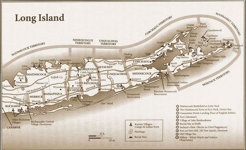
LIRR MONTAUK BRANCH - BABYLON TO PATCHOGUE - NATIVE AMERICAN NAMED LOCATIONS
The Indians called
Another example: Unkechaug (the word "Unkechaug"
has had varied historical spellings). The nation is also known as the Patchoag,
Patchogue or Patachogue.
The overall general consensus is that when
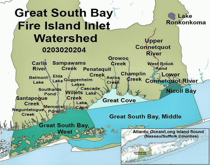
NY State DEC Watershed map 2016 - Great South Bay West Creek Names
The area we shall cover exists from Babylon Station to Patchogue Station, roughly
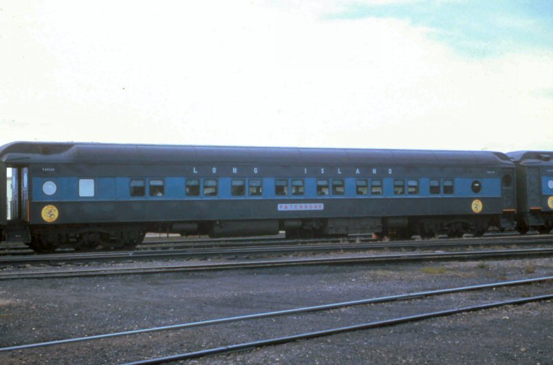
MP36 to MP54. The Scoot run. It's the Montauk Branch so let's ride in this parlor:
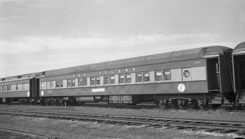
MONTAUK in the yard at Montauk, NY in 1963. W. J. Edwards photo, Dave Keller archive
MONTAUK: A name frequently bestowed on high or hilly land throughout New England, and denotes "a place of observation", "a place for seeing (or to be seen) far off"
Our parlor has the Dashing Dan logo on one end and the
Weekend Chief on the other as used on the older heavyweight parlors:
![]()
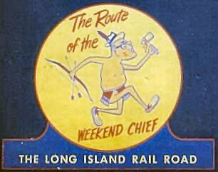
Parlor #2018 Close-up Logo Weekend Chief 5/26/68
All
Aboard! Let's have a snack, a drink, and play some cards as we travel:
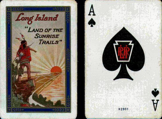 "Sunrise Special" Playing Cards c.1921
Here’s what we encounter, west to east:
Babylon:
Sampawams Creek, East of 231,
Orinoco Drive as it parallels, just north of the LIRR ROW, from
Brightwaters:
Nosreka
O-co-nee
Penataquit Creek
Awixa Creek
Islip:
Orowoc Creek
Winganhauppauge Creek, since renamed Champlin Creek
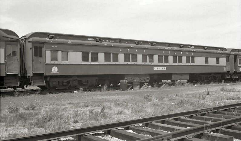
ISLIP in the yard at Montauk, NY on 7/28/1962 George E. Votava photo, Dave Keller archive
Note: I'm using a bit of poetic license here to include Islip, my hometown! The first people to settle in the area that is now
named West Islip were the Secatogue Indians, over one thousand years ago.
So, ISLIP has a more indirect "once removed" connection with Native Americans. Info Jack Deasy
Great
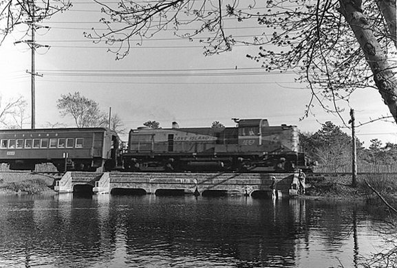
RS3 #1553 Patchogue - Babylon Scoot crossing Connetquot River westbound view S 1968
J. P. Krzenski photo, Dave Keller archive
Patchogue:
Patchogue
The Scoot is nearing the end of our journey The entrance Patchogue from
the west is over the 30' bridge spanning the Patchogue River. View N 2001 Photo:
Steven Lynch
PATCHOGUE in the yard at Montauk, NY on 5/15/1966. William Rugen photo, Dave Keller archive
PATCHOGUE:
A village in the western part of Brookhaven town. Pochoug Neck containing
some three hundred acres was number three, in the seven necks of land disposed of in Avery's
lottery in 1758. The name by some of the Long Island historians is said to have been derived
from a so-called Pochaug tribe of Indians. That an individual Indian has a similar cognomen and
lived in Brookhaven town is proven by a deed of 1703, where Paushag signs as one of the grantors.
The popular meaning, among the residents of the village is, "a place of many streams," but the
etymology of the word will not allow this interpretation. Variations are Pochoug, 1758;
Pochog, 1759; Patchague, 1825. Similar names of places occur in New England viz.: Pachaug River in
Voluntown and Griswold, Conn.; Pachaug Neck on Taunton River, Mass. Westbrook, Conn.,
was called Pochaug (on some maps Patchogue).
Trumbull gives: Pachaug = pdchau-auke, denoting a "turning-place", whence perhaps the river's
name; and says: " Patchogue in Brookhaven, L. I., is probably the same name." But Pochaug in
Westbrook, he derives from pohshdog (Eliot), "where they divide in two," from the fact that
two rivers came together there and were regarded by the Indians as one divided river (Indian
Names in Connecticut). NY PUBLIC LIBRARY The Indian Place-Names on Long Island and Islands Adjacent with their Probable Significations
by William Wallace Tooker 1911
What a delightful abundance of Indian names that survive into the present day! Let’s take a brief look at the derivation of several of these:
SUMPAWAMS, Sampawams : a name now applied to the creek that separates the towns of Babylon and Islip. It belonged originally to the neck, on which the principal part of the village of Babylon is built as follows:
A Neck of land that extended out into the bay was bounded by two streams that flowed down from the hills up north. These two streams ran straight with no meanders.
The neck became known for the chief of a small clan of people who called themselves the Sampawams which means walks- straight- as- an- arrow. Living on the neck, the two creeks
guided the people to hunting grounds. All they had to do was follow the water and they would never become lost because the stream led them back to their shelter.

How this came to pass began many centuries ago before the neck was bounded by streams. There were no streams to guide them. On scouting and hunting trips, they often became lost.
Even when they marked trees with a swing of an ax, they had trouble finding their way. They gathered in a circle and asked what could be done to solve this problem.
When the sun clouded over, they had trouble because there no shadows to guide them. Often, Sampawams, the chief would start out with a small party following a trail that soon petered out.

After having traveled six miles north to where Deer Park  is now located, they stopped. Bewildered, they pondered which way to go. Just then, they saw two deer scratching the soil in the bushes.
The party crept closer and the deer didn’t notice because of the skill of tracking left no noise, not a single fallen branch snapped to alert the deer. The chief slowly reached for an arrow and loaded his bow.
This kill would feed his family for many days. The others in the party stayed back to not startle the deer. The chief pulled back the string of his bow and sighted along the arrow.
Where the deer had been scratching the ground with their front legs, water began to seep out and form a pool. The deer drank. So much water poured out that it began to flow. It kept coming and coming.
The deer had found a spring.  The chief saw that the water flowed in the direction they had come from. He released his arrow and brought down one of the deer. They picked up the deer and started following the water.

It led them back to the familiar territory of the neck where they lived for the summer and fall months. The stream provided them with fresh, clean water, and a way for them to find the path to a place to live in the winter up in the hills.
The tribe never lost their way again. They followed the creek, trapped and fished and drank its water. The Chief became known as Sampawams which means flows-straight-as-an-arrow. Research: Tom Stock

PENATAQUIT: a former name of Bay Shore, Islip Town, taken from the creek at that place in the Indian deed for Aweeksa Neck to John Mowbray, May 30, 1701.

OROWOC:  A brook at Islip, sometimes called the "Paper Mill Brook." First recorded in 1692, when Gov. Ingoldsby granted a patent to Andrew Gibb:
"For a certain tract of vacant land on Long Island commonly called Wingatt happah Neck bounded on the west by Orawack River" (Munsell's Hist. S. C., Islip This part of Islip  town was the last settled.
The brook takes its name from the land in the vicinity, being as stated in Gibbs's patent in the vicinity, being as stated in Gibbs's patent, as "vacant land."
Note: here we have the 1692 early name of “Wingatt happah
Neck”, currently the village known as
NY PUBLIC LIBRARY The Indian Place-Names on Long Island and Islands Adjacent with their Probable Significations
By William Wallace Tooker 1911
“…The greater Town of
In the 1690’s, Nicoll’s colleague, attorney Andrew Gibb, had come to the
area and applied for a patent of his own, for “All that tract of vacant land
commonly called by the name of Winganhauppauge or Champlin’s Creek, and on the
west by the Orowoc Creek”. He was granted his patent on March 26, 1692, from
Governor Richard Ingoldsby in the name of William and Mary, sovereigns of
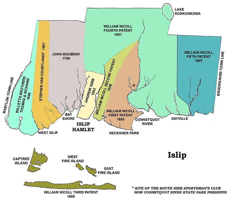
Geographic Note: The title “Between the Creeks” might be a bit misleading to residents today, for whom the reference to Champlin and Orowoc Creeks means the large bodies of water that appear to be located between the Great South Bay and Montauk highway/Main Street. The head waters for those creeks, however, are small streams that originate to the north in the area of the Southern State Parkway, the service road of which is Islip Hamlet’s northern border. (See the yellow-highlighted area of the above map labeled "ANDREW GIBB 1692"). Research: Islip Historical Society