SPRINGFIELD BRANCH
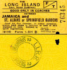
Form 1-BH
coach one way - GPA E. R. Comer
1943-46 |
1923
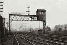
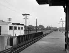
shot of SP interlocking tower, built on a signal bridge, controlling
Springfield Junction, the start of the Springfield branch just west of
Rosedale (Osborne-Keller)
|
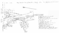
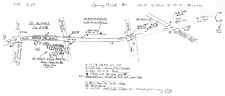
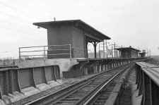
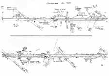
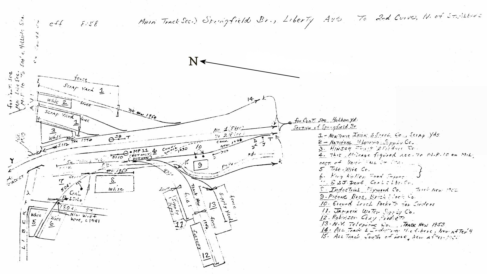
Emery map - MP11 Liberty Ave. to 2nd curve north of St. Albans 8/58
Location
#4 on map is signal S110
Emery
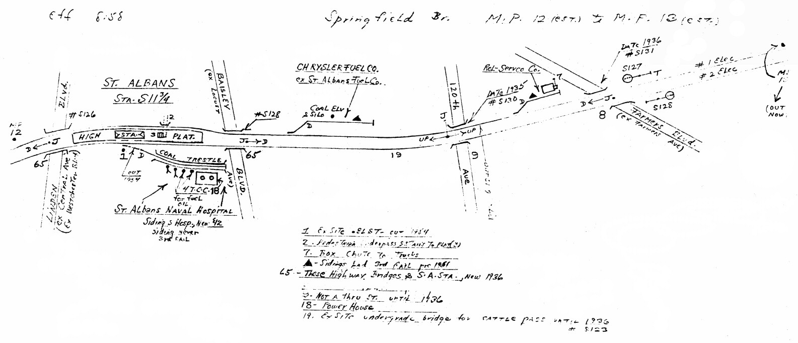
map - Springfield Branch MP12-13 8/58
|
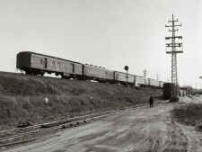
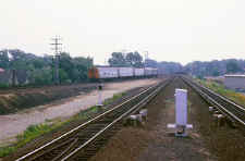
REA-RPO car #743 on rear of train passing Signal S110 02/12/57
(Faxon-Keller)
|
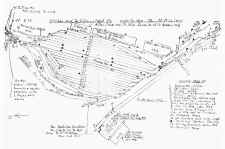
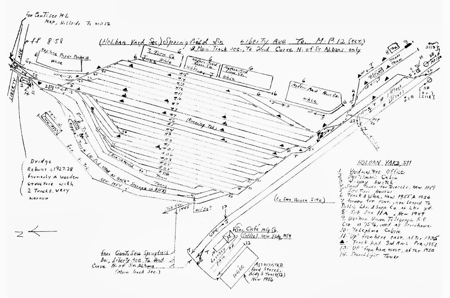
Emery map (East at top) - Springfield Branch 2nd curve north of St.
Albans to MP12
Holban
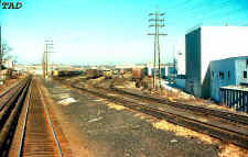
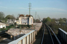
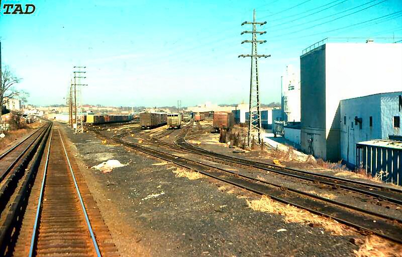
South Yard View NW 12/1976
Photo/Archive: Tim Darnell
|
|
ST.
ALBANS
|
|
St. AlbanS: OPENED: 7/1/1898, RAZED: 1935 WITH GRADE ELIMINATION ELEV. STRUCTURE IN SVC: 10/22-10/23/35. AGENCY STILL LISTED IN "L.I.R.R. TICKET OFFICES OPEN FOR SALE OF TICKETS" OF 9/12/55. AGENCY CLOSED: ?
Research: Dave Keller
|
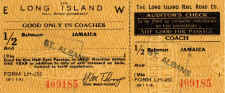
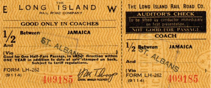
Ticket
St. Albans-Jamaica 6/10/1966
Archive: Brad Phillips
|
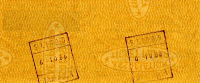
Ticket
St. Albans-Jamaica back 6/10/1966
Archive: Brad Phillips
|
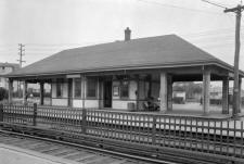
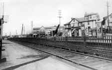
St. Albans Station - 1926 - eBay |
St. Albans Station at Linden Blvd prior to
elevation View SE 1935 Archive:
Steve Rothaug
Looking SE from Linden Blvd. we see the old wooden St. Alban's depot. To the left of the building there appears to be a crane shovel. This image is undated, however the grade crossing elimination project of 1935 resulted in the demolition of the little depot and elevation of the tracks, with Linden Blvd. being bridged. It's likely that the presence of the crane shovel is to begin the demolition of the depot, dating this image 1935. (Dave Keller data)
|
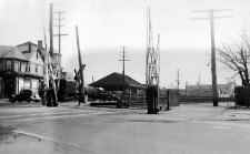
St.
Albans Station View W 1935
Archive: Steve Rothaug
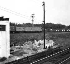
St.
Albans station having been just razed in anticipation of the upcoming
grade elimination project. The crane and rubble are still visible.
The view is looking towards the Linden Blvd. crossing. Info: Dave
Keller
|
Elevated
St. Albans station as it appeared nearly-new in early 1936. It was
placed in service at the end of October, 1935. Archive: Dave Keller
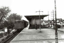
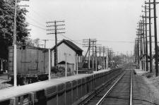
St. Albans Station
1954 with an MU RPO car pulling a train
(Edwards-Keller)
|
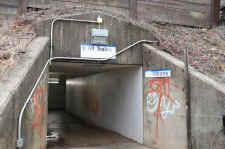
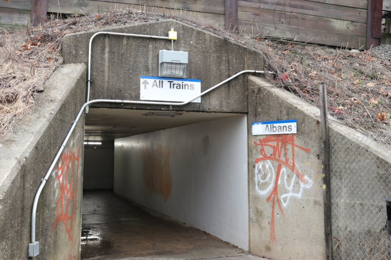
St.
Albans pedestrian underpass
|
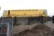
Plasser
PTS62 Dynamic Track Stabilizer
|
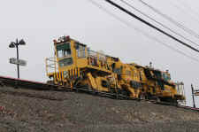
Plasser
PBR550 ballast regulating dressing machine
|

|
|
|
|
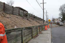
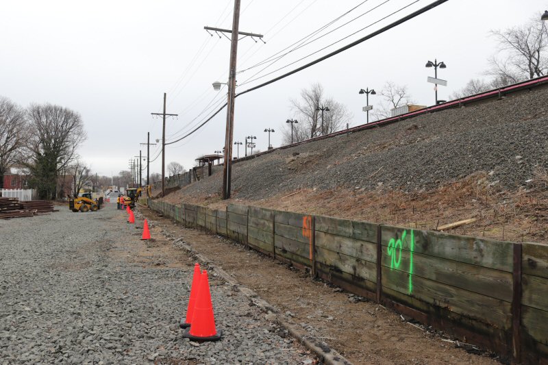
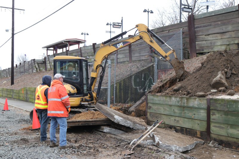
The
LIRR will be replacing three soldier pile timber lagging retaining walls
with a precast modular block system designed by
TITAN ENGINEERS PC.
2/07/2019 Photos/Archive/Info: Charles
H. Clackett
|
 |
 |
|
|
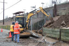
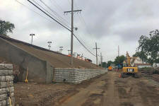
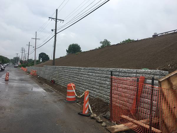
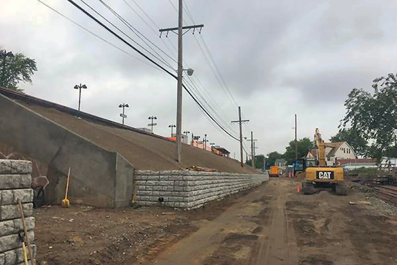
St. Albans Station segmental block retaining wall - 6/18/2019
Photos/Archive/Info: Charles
H. Clackett
|
|
SPRINGFIELD
- SPRINGFIELD GARDENS |
|
SPRINGFIELD: BUILT: 1889 AS
SPRINGFIELD. LISTED AS SPRINGFIELD GARDENS IN ETT OF 10/1927.
RAZED: 1935 WITH GRADE ELIMINATION.
TEMPORARY STRUCTURE IN SVC: 5/1/1935.
ELEV. STRUCTURE IN SVC: 7/24/1936. AGENCY OPEN PART TIME PER
"L.I.R.R. TICKET OFFICES OPEN FOR SALE OF TICKETS LISTING OF 9/12/1955".
TICKET OFFICE SET ON FIRE AND AGENCY CLOSED PRIOR TO THE ISSUING OF THE
"LIRR TICKET OFFICE HOURS LISTING" OF 6/03/1962 (Brad Phillips data).
DISCONTINUED AS STATION STOP: 10/30/1979 Research: Dave Keller |
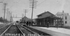
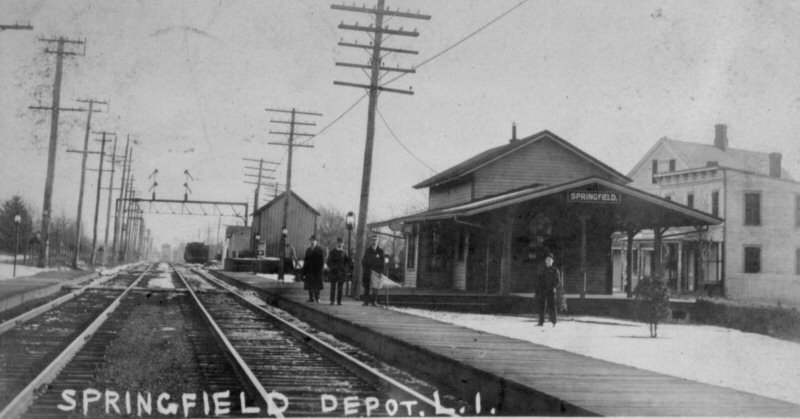
Springfield Gardens Station view E c.1910
Archive: Dave Keller |
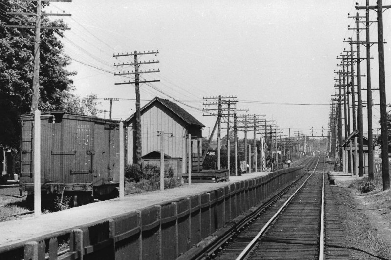
Springfield Gardens Freight Station and Team Track - View W 8/06/1934
(Weber-Boland)
|
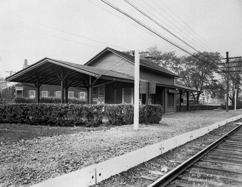
Springfield Gardens Station 9/04/1923
(LIRR Valuation-Dave Keller) |
|
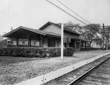
The
old, wooden Springfield station (above right) sits pretty among its landscaped grounds
and recently-constructed crushed cinder platform in this official LIRR
valuation photo taken on September 4, 1923, view west. Later changed to
Springfield Gardens 10/1027 this structure would be demolished in 1935 to make
way for the grade crossing elimination of the two LIRR stations along the
Springfield branch: Springfield Gardens and St. Albans, both of
which opened as new, elevated structures in 1936. (Dave Keller
archive and data)
|
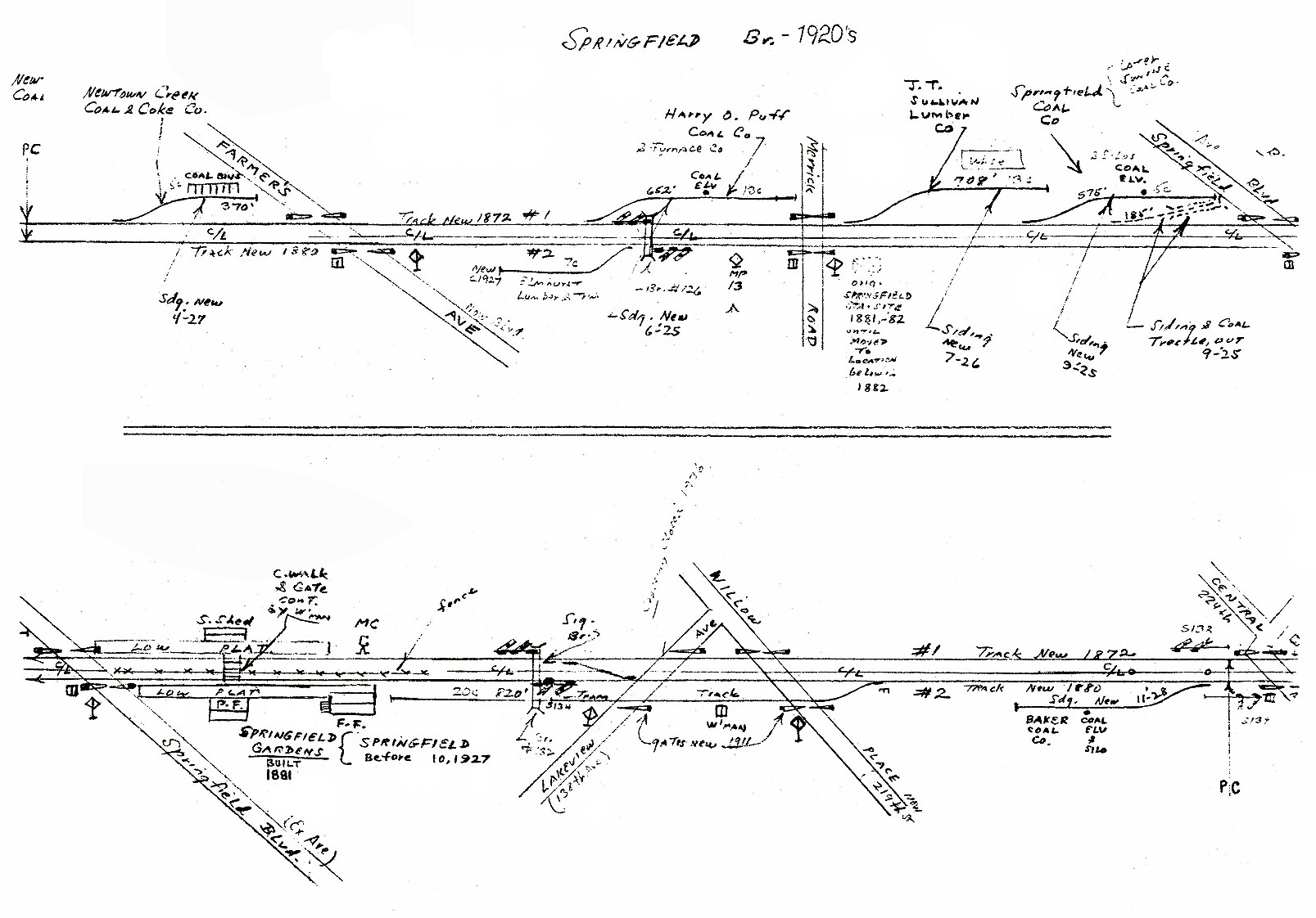
Emery
map Springfield Station 1920's
|
Springfield Gardens 4/1993 William Photo/Archive: Bill Mangahas |

Ticket Form B1-BH coach one way
Brooklyn (FBA) and Springfield Gardens 1969
Dir. Pass. Services: H. M. Throop |
|
|

|
|
|
Three
views showing an MU train eastbound on the Springfield Branch approaching
Springfield Jct., Laurelton 8/31/1957. Views northeast and east
from the Laurelton station platform.
(Will V. Faxon, Jr. photos, Dave Keller archive)
|
|
|
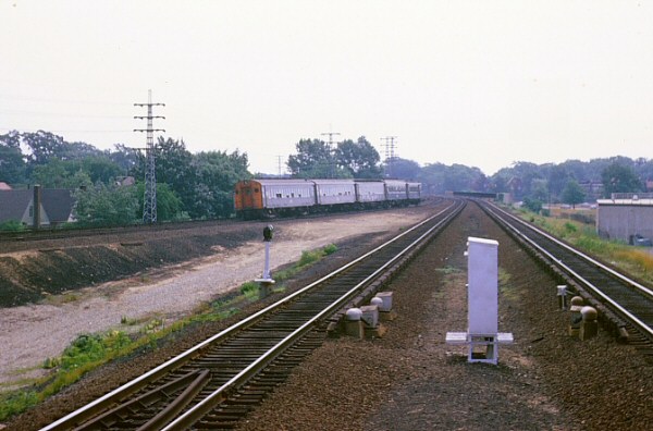
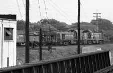
RS1
units are double-heading a freight eastbound on the Springfield branch
heading towards Springfield Junction where the branch meets the Atlantic
branch just west of Rosedale. This view, taken on August 31, 1957,
is looking northeast from the Atlantic branch station platform at
Laurelton. LIRR electric sub-station #10 is at the left. (Will V.
Faxon, Jr. photos, Dave Keller archive)
|
MU
electric train on the Springfield branch of the LIRR, crossing 225th
Street in Laurelton, looking north from the LIRR's Atlantic branch station
at Laurelton - 6/2/62 (Will V. Faxon, Jr. photos, Dave Keller archive)
|
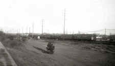
An MU electric train is heading eastbound over the Foster's Meadow Road
(later Brookville Blvd.) grade crossing west of Rosedale, NY in this
pre-grade-elimination view looking southeast c. 1948. The ROW at
this point consisted of four tracks at grade: two for the LIRR's
Atlantic branch and two for the LIRR's Montauk branch. The grade
elimination project through here began in the latter part of 1948.
The photo was taken from the approximate location where today the Belt
Parkway dips under the LIRR's ROW. (Will V. Faxon, Jr. photos, Dave Keller
archive)
|
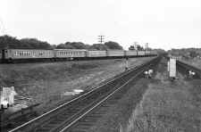
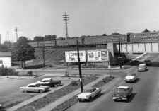
Laurelton view E
8/1966
Photo/Archive: Brad Phillips
|

.jpg)
.jpg)


.jpg)
.jpg)


.jpg)
.jpg)
.jpg)
.jpg)
%20ZOOM.jpg)
.jpg)
.jpg)