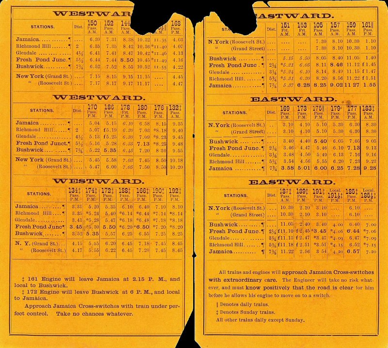
|
Emery Maps
1920s-1930s |
||||
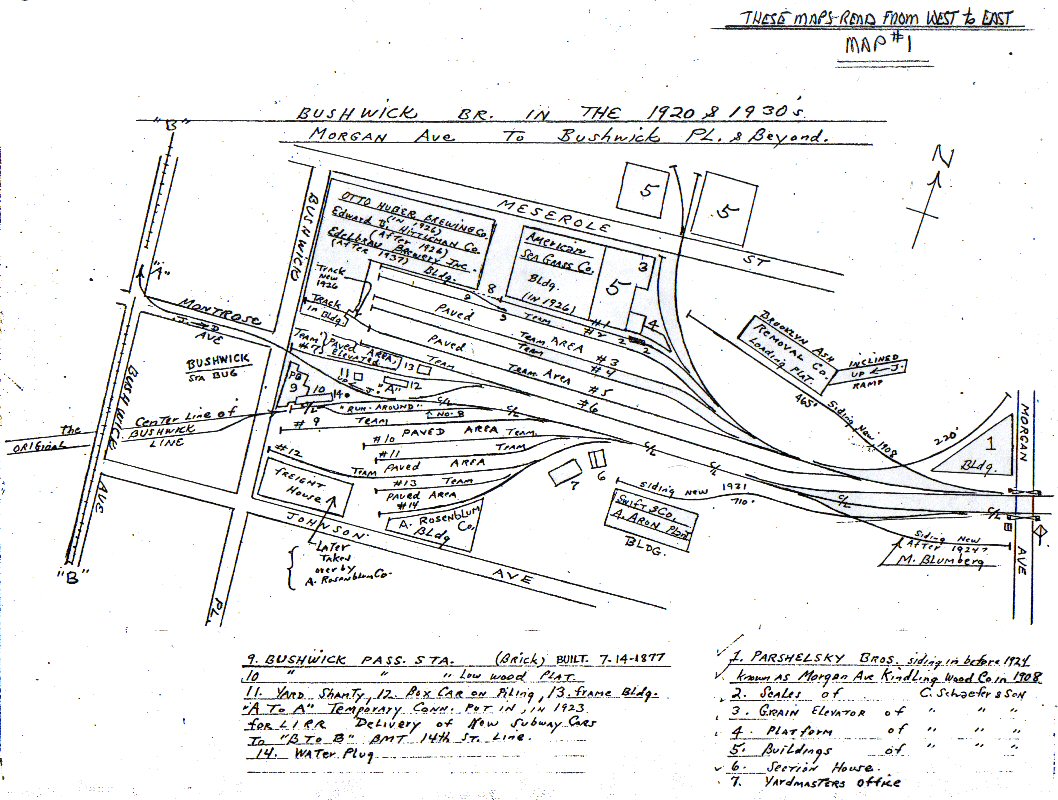 Bushwick Place to Morgan Ave |
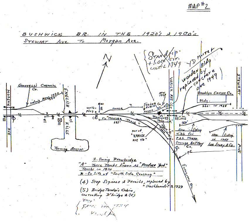 Morgan Ave to Stewart Ave |
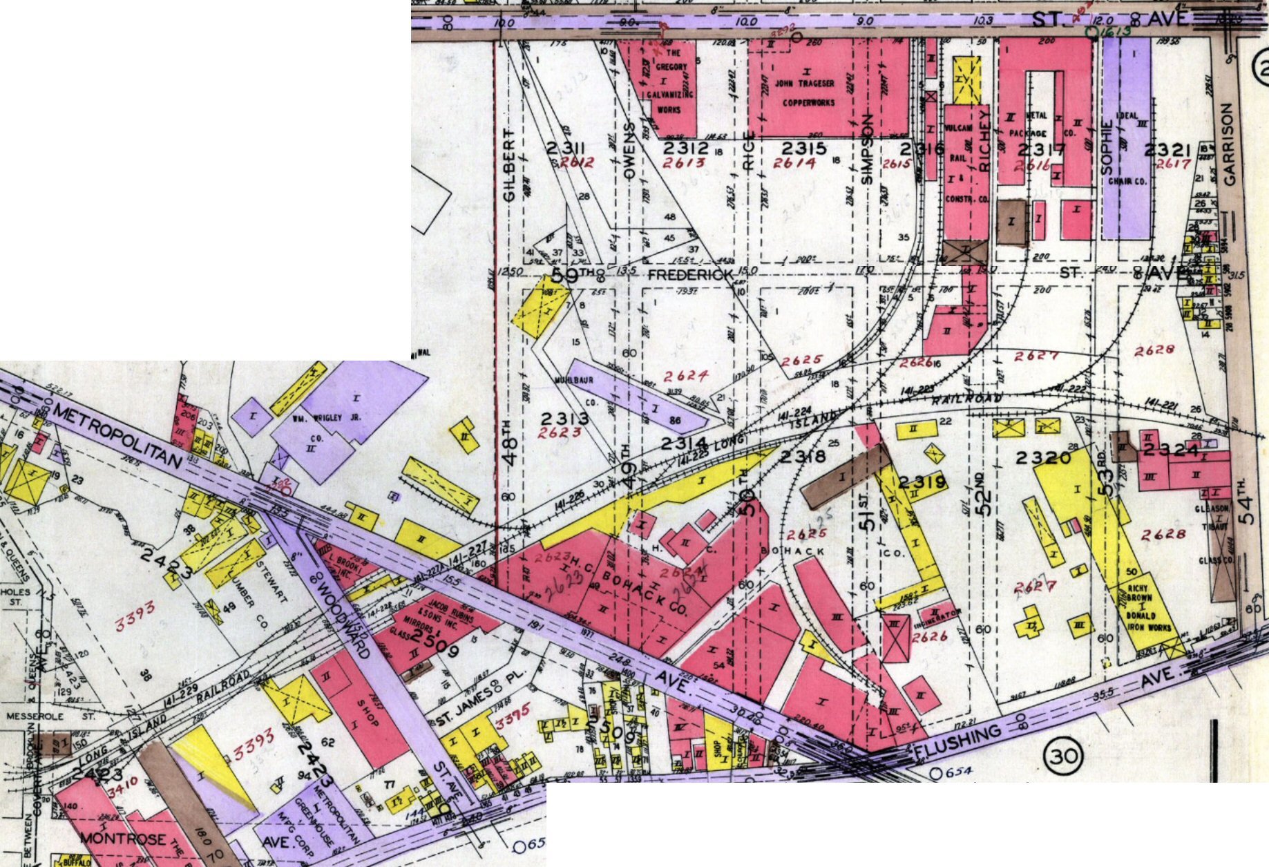
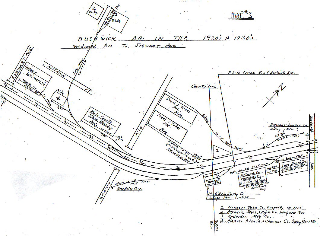 Stewart Ave to Woodward Ave |
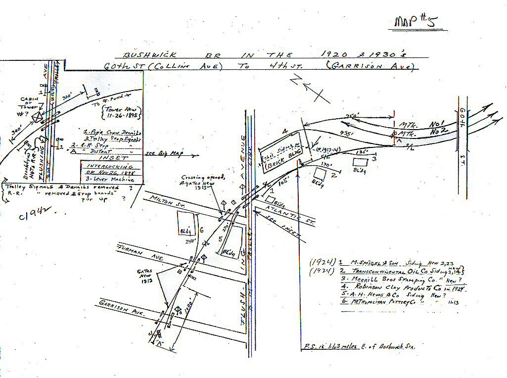
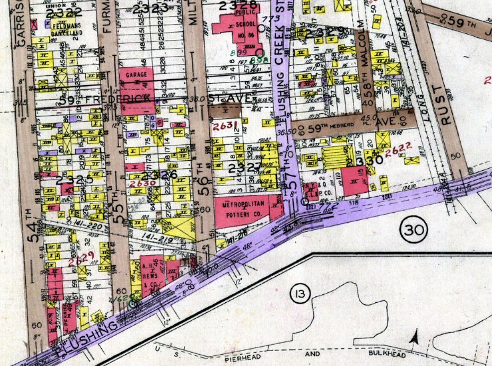
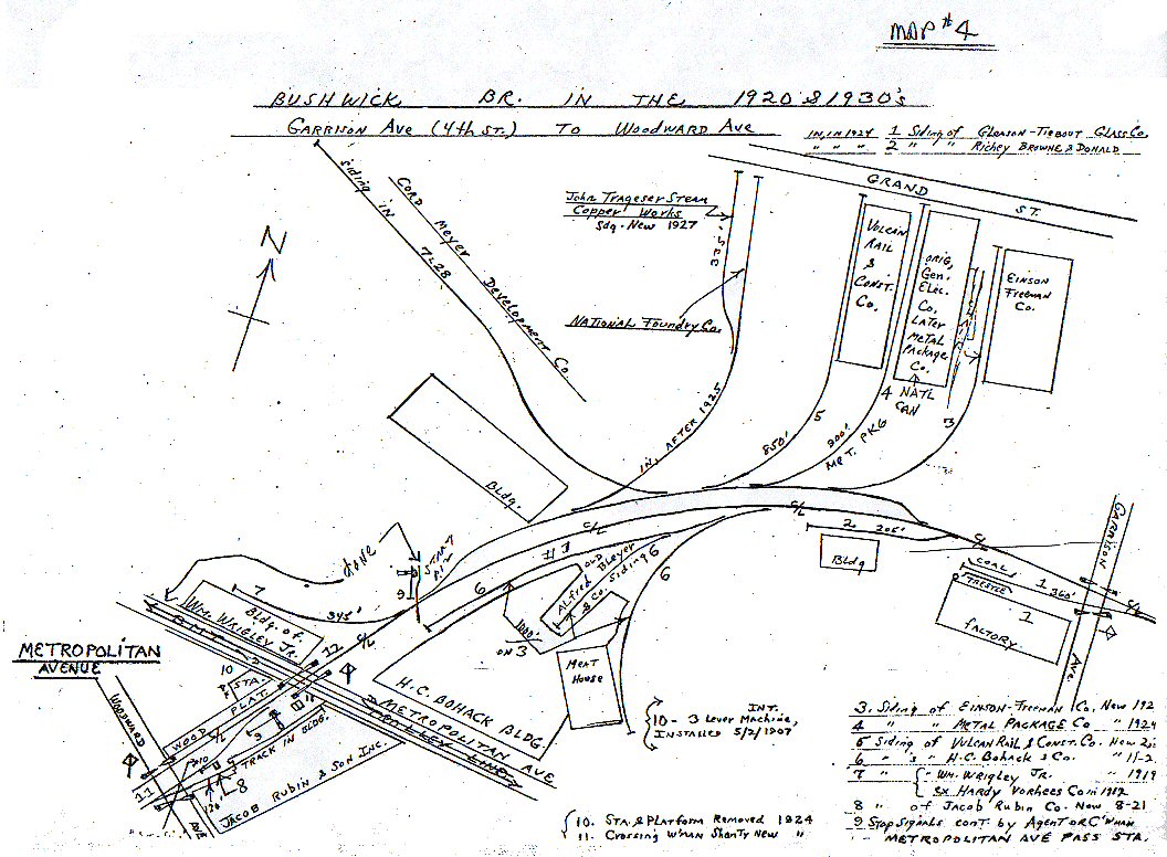 Woodward Ave to Garrison Ave (4th St) |
 4th to 60th St (Collins Ave) |
| Belcher Hyde Maps 1929 | ||||
 Bushwick Place to Morgan Ave |
 Morgan Ave to Stewart Ave
|
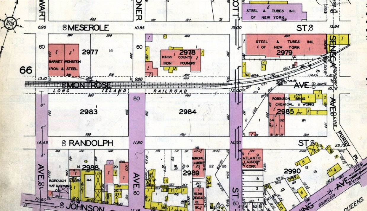 Stewart Ave to Seneca Ave |
 Seneca Ave to Garrison Ave |
 Garrison Ave (4th St) to Flushing Ave |
|
Composite
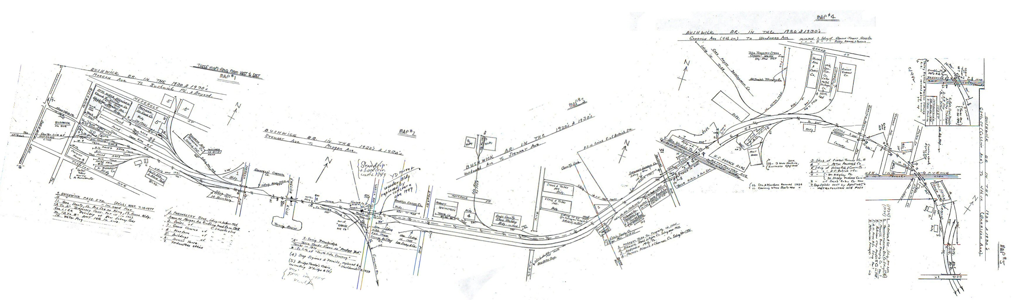
Emery Bushwick Branch 11-1958 east to west |
|||
|
Emery Maps
11-1958 |
|||
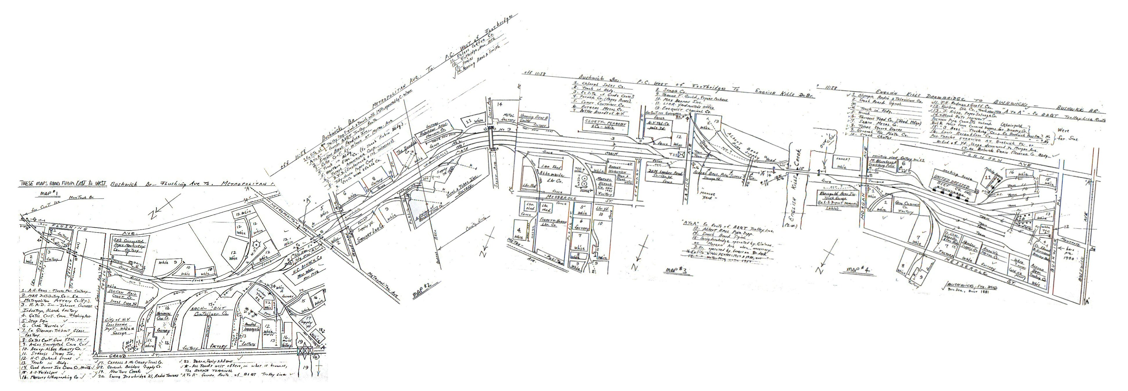
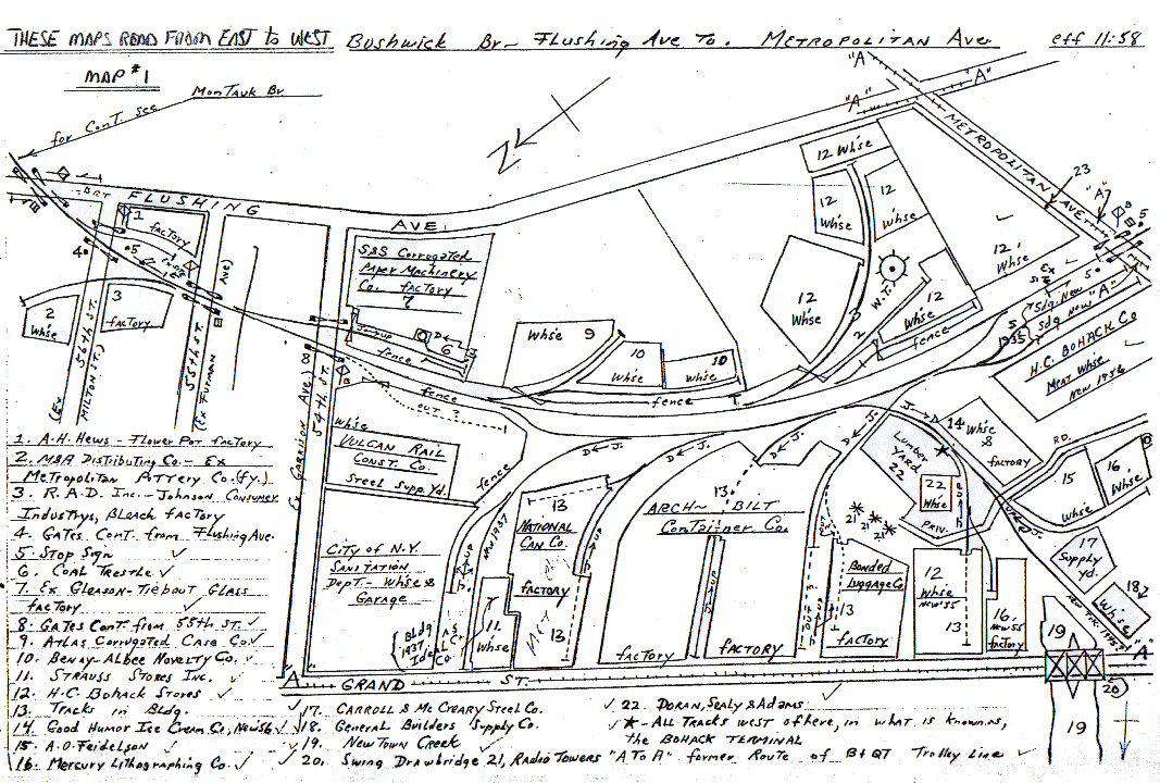 Flushing Ave to Metropolitan Ave Note: Continuation to Montauk Branch map |
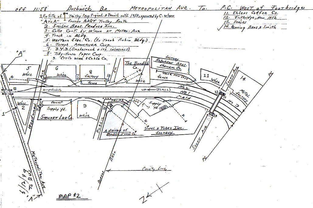 1. Metropolitan Ave to west of Scott Ave footbridge |
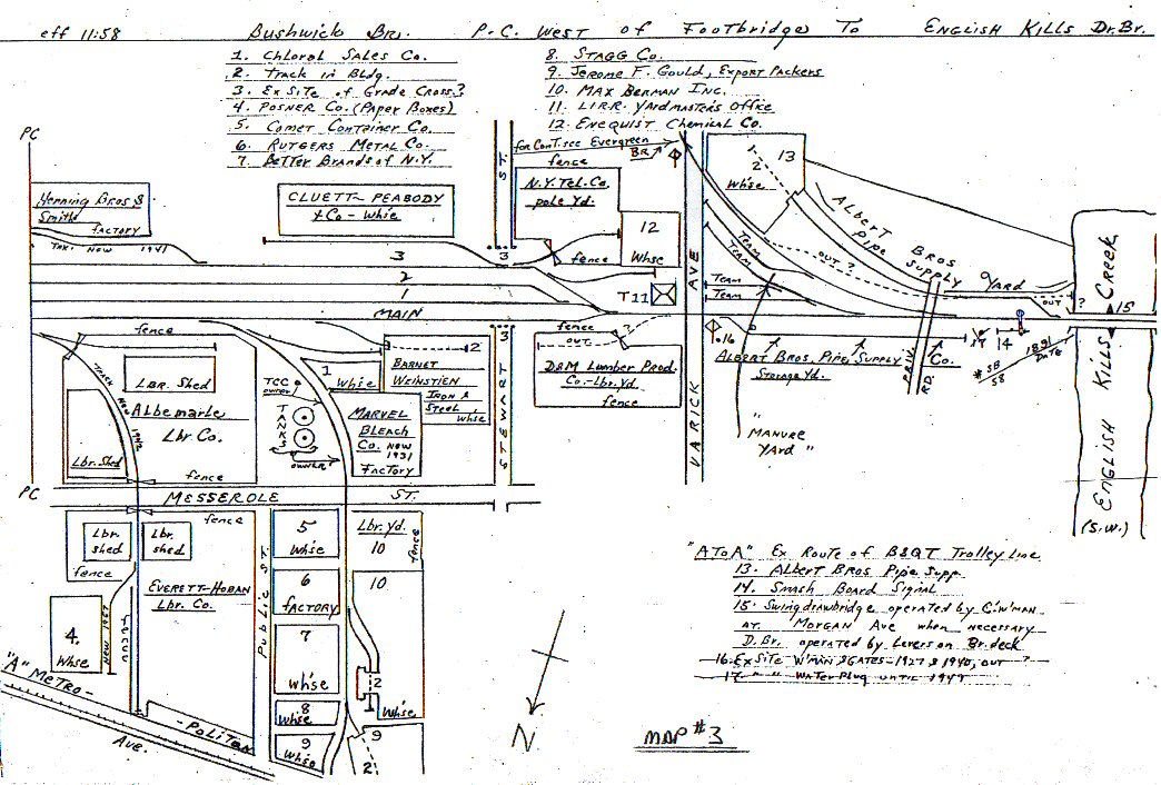 2. West of Scott Ave to English Kills Drawbridge |
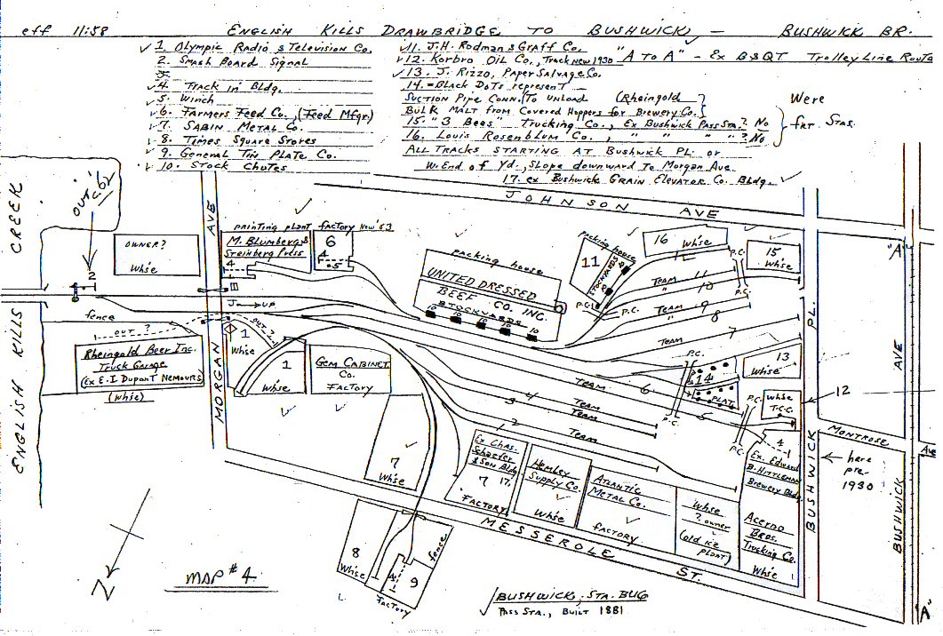 3. English Kills Drawbridge to Bushwick Ave |
|
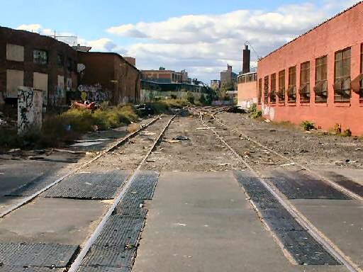
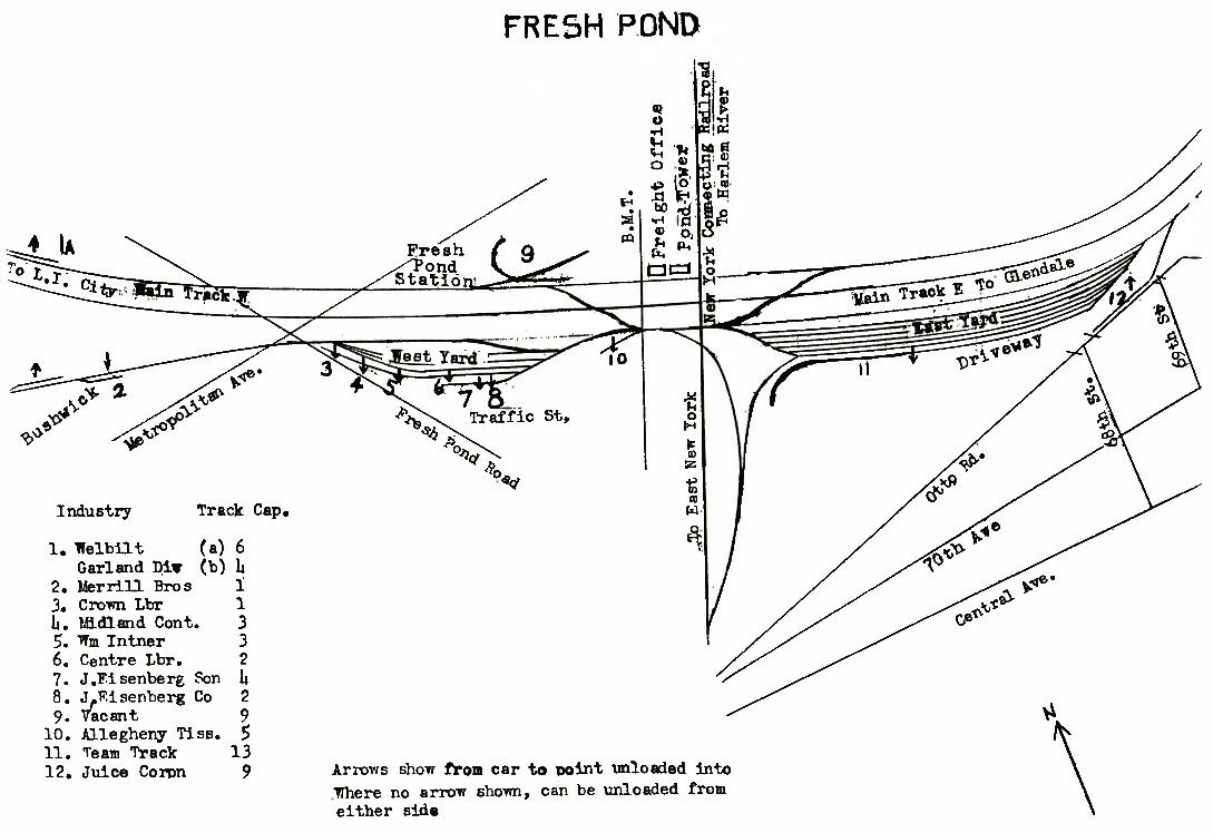
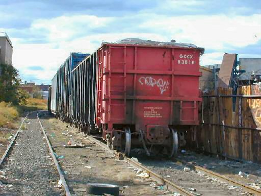
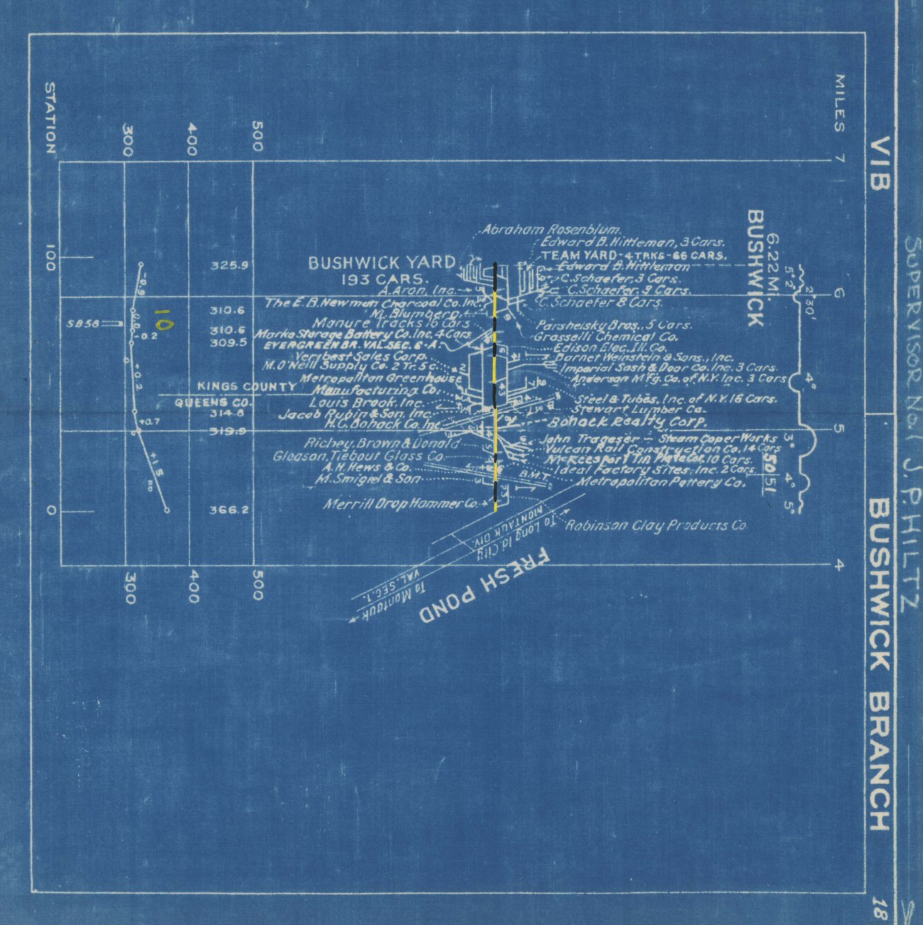
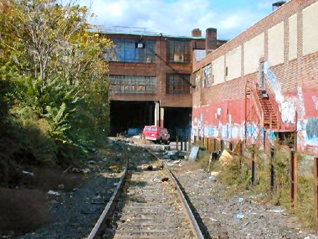
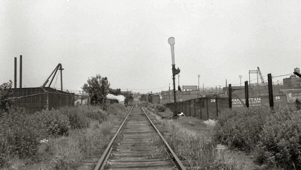
There were four yards in Bushwick: The "main yard" handled beef and beer plus team tracks. (#3) The actual freight house was on Varick Avenue on the Evergreen Branch and it was equipped with a crane. (#2) That yard closed in 1963 and the freight agent moved to the "main yard". The smallest "yard" was the manure yard just east of the yardmaster's office and the junction of the Evergreen Branch. (#2) When its use for manure cars ended, the one or two engines that served Bushwick were layed up there. This kept them under the watchful eyes of an LIPD patrolman who staffed the yardmaster's office on weekends. The last yard was the "icing yard" that handled the beef reefers. The icing yard (#1 )was distinguished by the Scott Avenue footbridge which was built to permit factory workers access across the right of way which was typically blocked by reefers. Info: Richard Makse |
|||
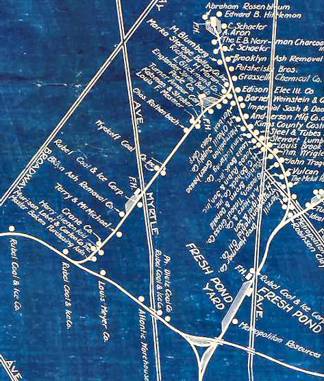
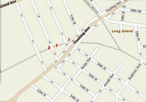 Bushwick Map Info: Steve Lynch 7/2007 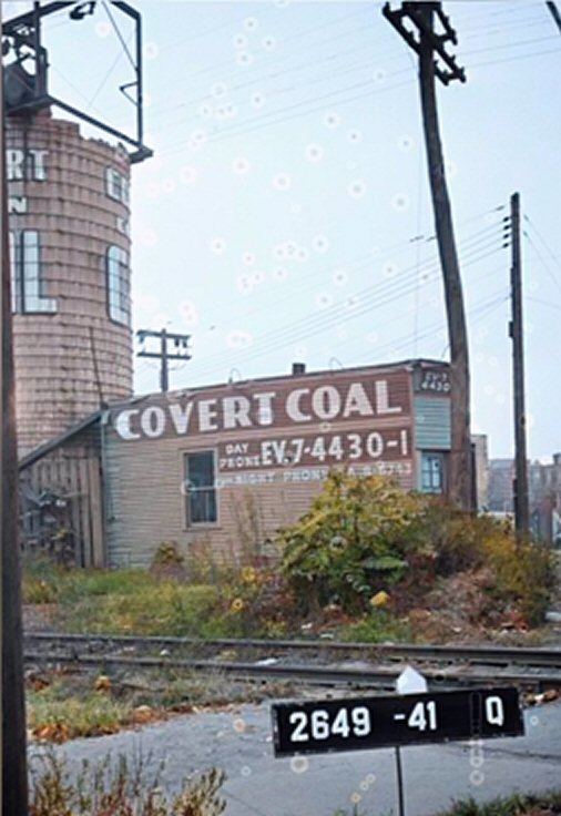 Covert Coal - Nurge Ave, Maspeth Bushwick Branch c.1940 Location 4 above
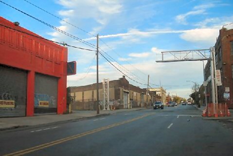
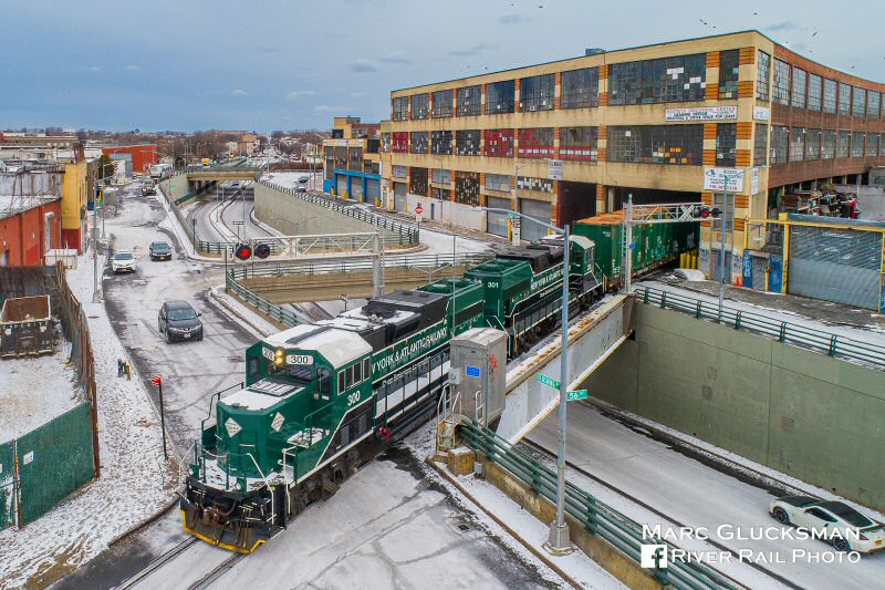
Up and over. New York & Atlantic Railway matched Progress Rail PR20Bs 300 and 301 lead local job RS-20 down the Long Island Railroad Bushwick Branch on the morning of Sunday, December 31, 2017. At this location in Maspeth, NY, it is both crossing and traveling over Flushing Avenue, approaching 56th Street. The train has just passed through the Globe Storage Building on its way to work Manhattan Beer and Waste Management. Sub-freezing temperatures have preserved the snowfall from several days prior.
|
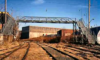
 Scott Ave Footbridge view west Photo: OldNYC.com
|
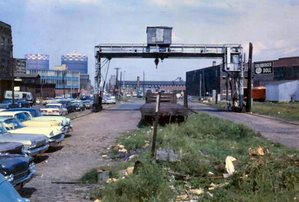
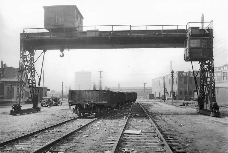 Varick Yard - 4/15/1925 (Ziel-Boland)
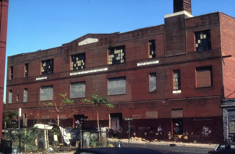
This yardmaster's office was built in 1949. The three tracks beyond, I believe, were referred to as the "icing yard" but the 1966 maps show them starting west of Varick Avenue. I think the 1966 drawings might be in error. This yard always had cars in it.
|
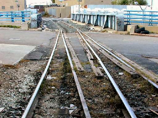
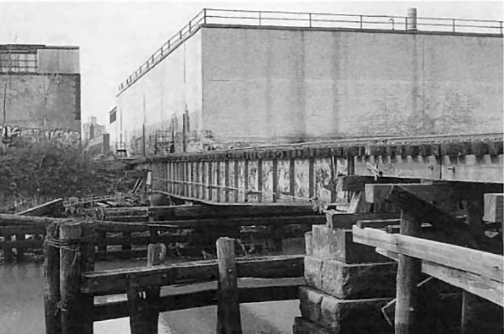
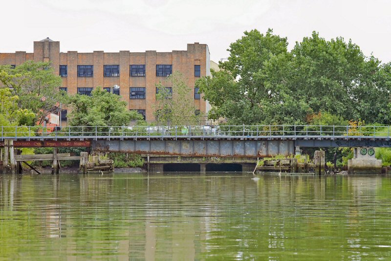
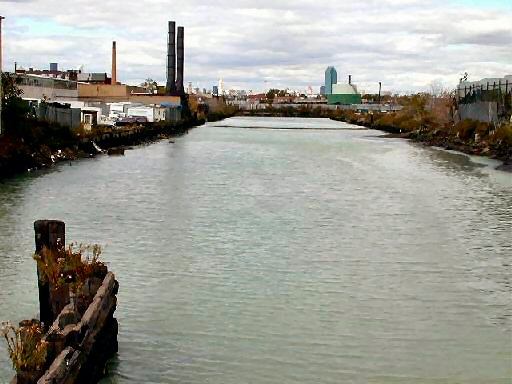
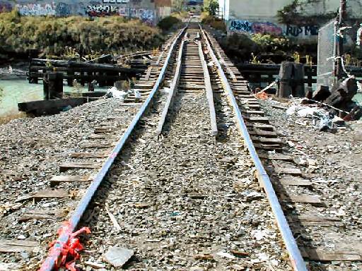 English Kills Creek Bridge, view west, was a Bobtail swing bridge. Photo: OldNYC.com The West portion where the inner counterweight is was removed, perhaps sinking, and replaced with I beams, so it is about 30 feet shorter. All the wood trestle was replaced with I beams, and the stone blocks were encapsulated with concrete. It has not opened since about 1955 when the basin was filled in. This is a fairly rare Bobtail swing bridge. Not many were ever built.
(If bridge was open, low signal was horizontal across tracks. Train failing to stop would “smash” into the board arm and alert the engineer.) Installed 03/1929
replacing Stop Signals and Derails. Removed c.1962
Info: R. Emery |
 View west into Bushwick Terminal - Morgan Ave Photo: OldNYC.com
|
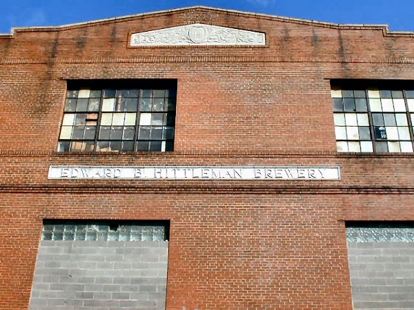
 1885 Hittleman Brewery Building, Bushwick Place View N 10/1984 Photo/Archive: Art Huneke Signage: BOTTLING EDWARD B. HITTLEMAN BREWERY DEPARTMENT |
 Former passenger terminal of located at corner of Bushwick Place and Montrose Avenue Photo: OldNYC.com |
|
| LIRR Map Bushwick Branch 1966 | |||
66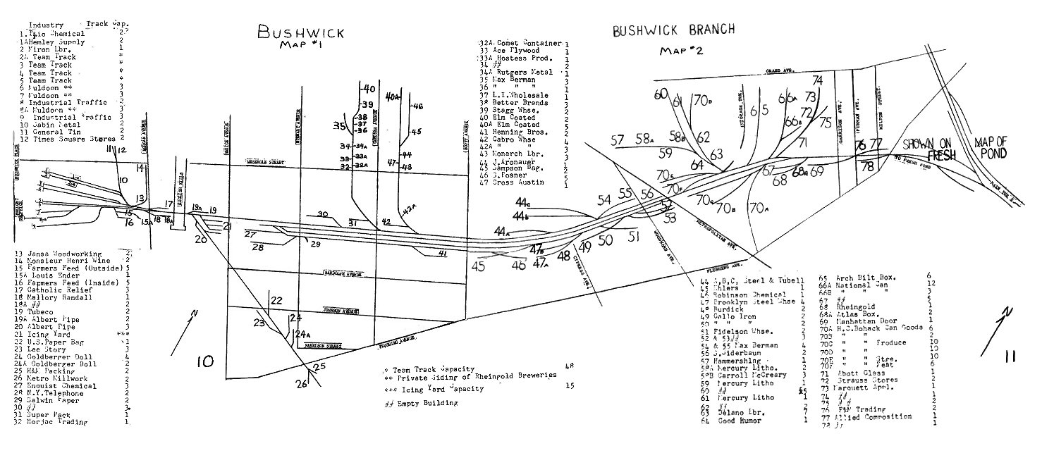 Composite Map: Steven Lynch 11/11/2009 |
|||
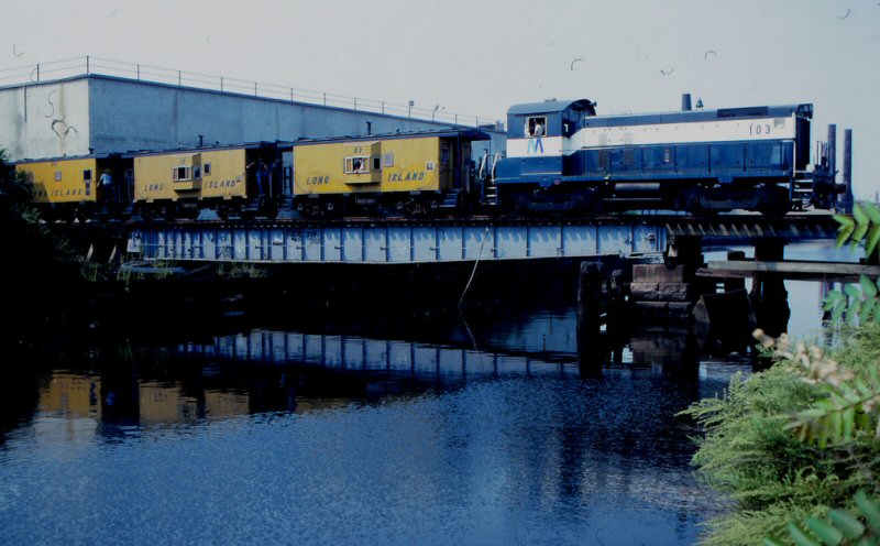
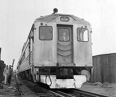
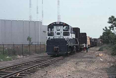
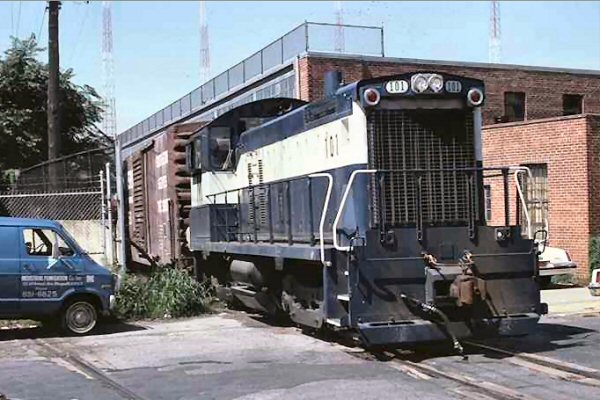 LIRR #101 Train YFD-301 56th St. 08-26-77 |
 LIRR #107 westbound east of Metropolitan Ave 05-25-77 |
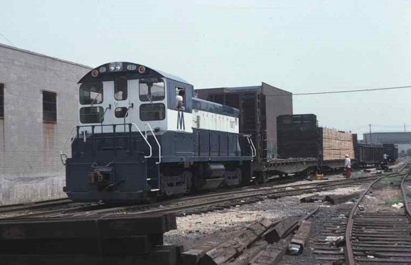
 LIRR #107 westbound Varick Ave 05-25-77
|
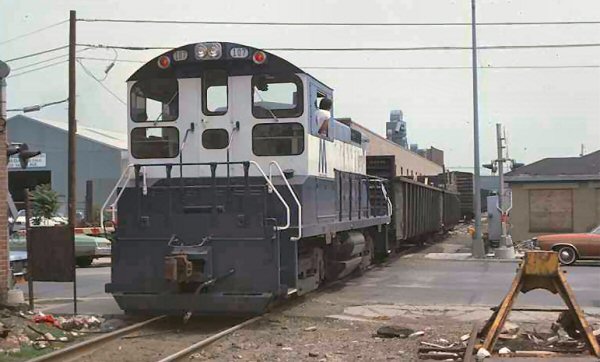
 Fresh Pond Junction 1966  LIRR #106 Train YFD-301 Morgan Ave 09-09-77 |
| LIRR Map Bushwick Branch 1978 | |||
 Composite Map: Steve Lynch 11/12/2009 |
|||
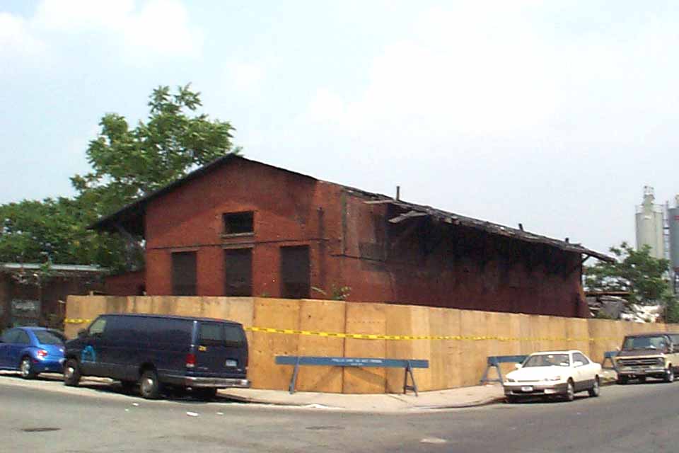
 South Side Rail Road Bushwick Freight House - Built 1870 10/1984 Photo/Archive Art Huneke
|
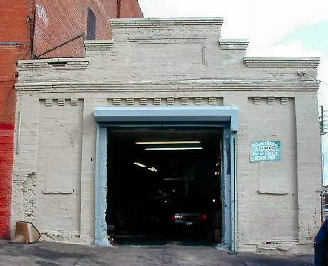
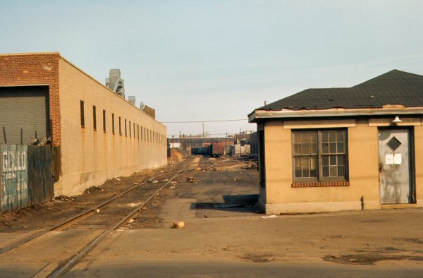
 Bushwick Freight Office 2003 Photo: Michael Pompili
|
 New signal installation Metropolitan Ave 11/10/09 Photo: R. McEnery |
|
|
Bushwick Freight Terminal |
|||
|
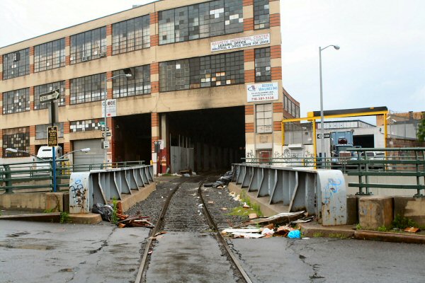
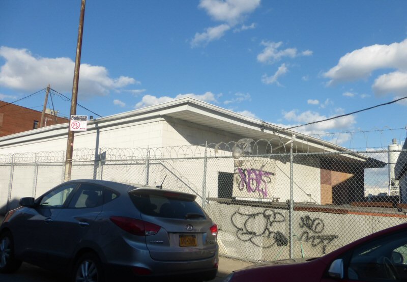
The Long Island Rail Road Bushwick freight terminal stood at the corner of Johnson Avenue and Bushwick Place in Brooklyn. It was abandoned by the LIRR decades ago and was leased out for other uses, including a meat packing facility and, most recently, to a manufacturer of styrofoam coolers as a warehouse for styrofoam pellets. The roof had collapsed following a fire set by the resident homeless in May, 2003. The building had been completely disused for about twenty years, but was still full of bags of styrofoam pellets at the time of demolition. The former LIRR freight office on Bushwick Place, pictured in the photo above left was demolished in 2003. The newer freight building now is owned by Kings Building Materials and was recently used as a hardware/home supply retail outlet. The remains of the passenger depot lasted until around 2005. |
|||
| Special thanks and links for more photos and information: Tom Scannello's www.OldNYC.com | |||
06/16/2026


.jpg)


