|
Far
Rockaway Branch |
|||||||||||
|
EARLY HISTORY |
|||||||||||
|
The
main section of the South Side Railroad was completed from Jamaica to
Babylon in 1867. However, the train did not make a formal stop at Valley
Stream. Waiting passengers had to flag down the train if they wanted to
get aboard. In 1868, Electus B. Litchfield, a financer from Babylon,
purchased the Brush farm, a large tract of land comprised of over 85
acres. He laid out what later became the Village of Valley Stream.
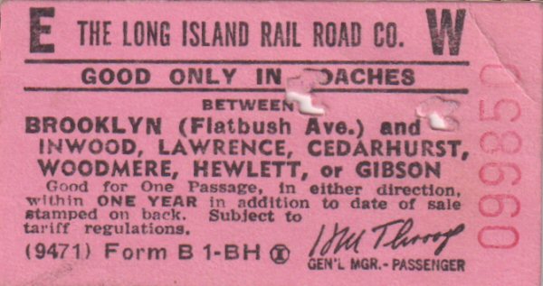
A train depot was built in 1869 on Rockaway Avenue at Third Street, located south of the tracks. Some prominent residents had offered to pay for half the cost of building it, but then reneged on their offer. The workmen rioted at the news, so the South Side Railroad paid for the station itself. The building was located between Third Street and Rockaway Avenue, south of the tracks. In 1876, the South Side Railroad ceased to exist and ownership passed to the Long Island Railroad. In 1889 the South Side Rail Road merged with Long Island Railroad. There were two trolleys in Valley Stream. The “Toonerville” trolley was owned and operated by the Long Island Traction Company and was in operation from 1903 to 1926. It ran from Jamaica to Freeport, and passed through Valley Stream along Jamaica Avenue. The other trolley was “The Dinkey,” a battery-driven trolley that ran north to south, from Mineola to Valley Stream. It broke down frequently. It, too, went out of business in 1926 when the Long Island Railroad electrified the line and established regular train service. “50th Anniversary Book of Valley Stream” (1975) – Howard Ruehl |
|||||||||||
|
TIMETABLE/STATIONS/EMERY NOTES |
|||||||||||
|
|
|
||||||||||
|
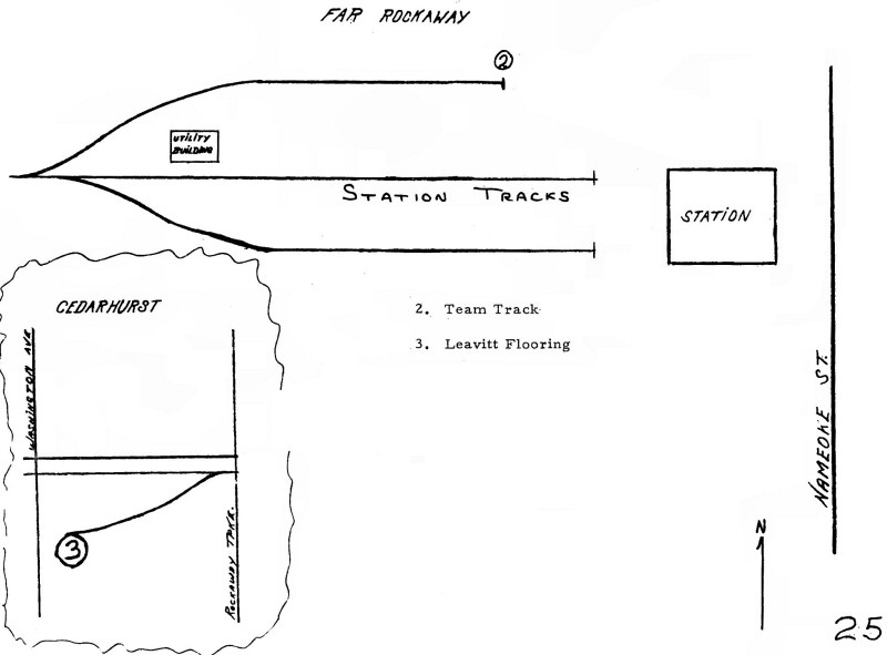
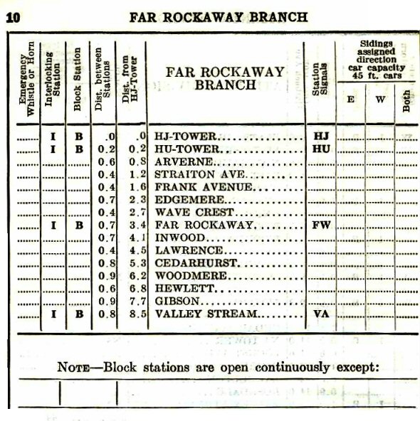
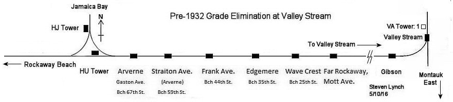
Mile posts changed after the Jamaica Bay trestle was taken out of service in
1950 and access to Far Rockaway was via Valley Stream only.
Mileage begins at "HJ" tower which is the former name of
"DRAW" tower prior to the 1937 name change. "HU"
tower was the tower at the east leg of the Hammel's wye, controlling
whether Far Rockaway trains went to and from the trestle over the bay or
traversed the base of the triangle on to Rockaway Park. It shows all 5 station stops between "HJ" tower and Far
Rockaway (Mott Ave.), with branch mileage ending at Valley Stream. Also
note that this is effective 6/16/1929 and Gibson opened 5/1929 of that year,
so this ETT reflects the new station stop at 7.7 miles from "HJ"
tower. |
|||||||||||
|
Emery Branch Notes: FAR ROCKAWAY BRANCH
Line “A” built by the Far Rockaway Branch Railroad Co. from Valley Stream to Far Rockaway: 1868 and placed in service: 1869 |
|||||||||||
|
|
|||||||||||
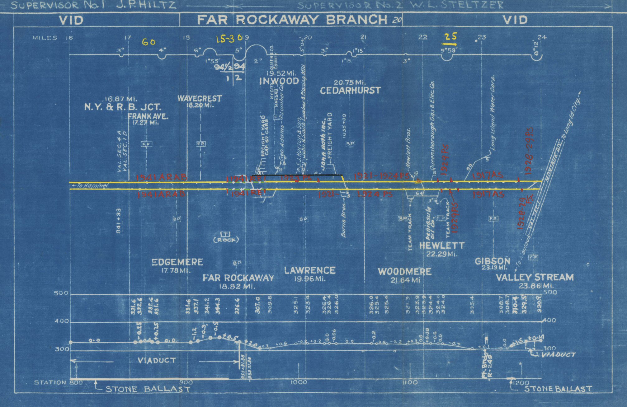 V1D Far Rockaway Branch blueprint - c.1943 Archive: Jeff Erlitz |
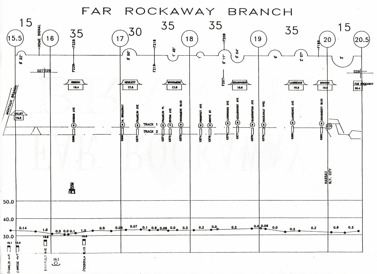 Far Rockaway Branch Track profile map 1994 |
||||||||||
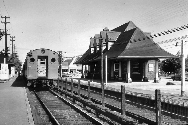
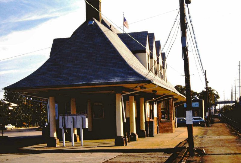
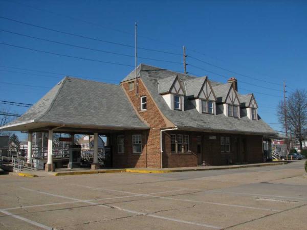
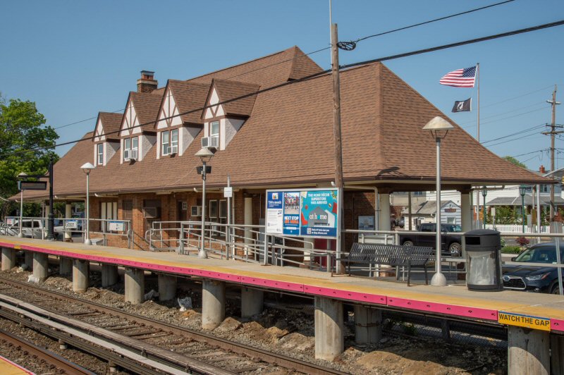
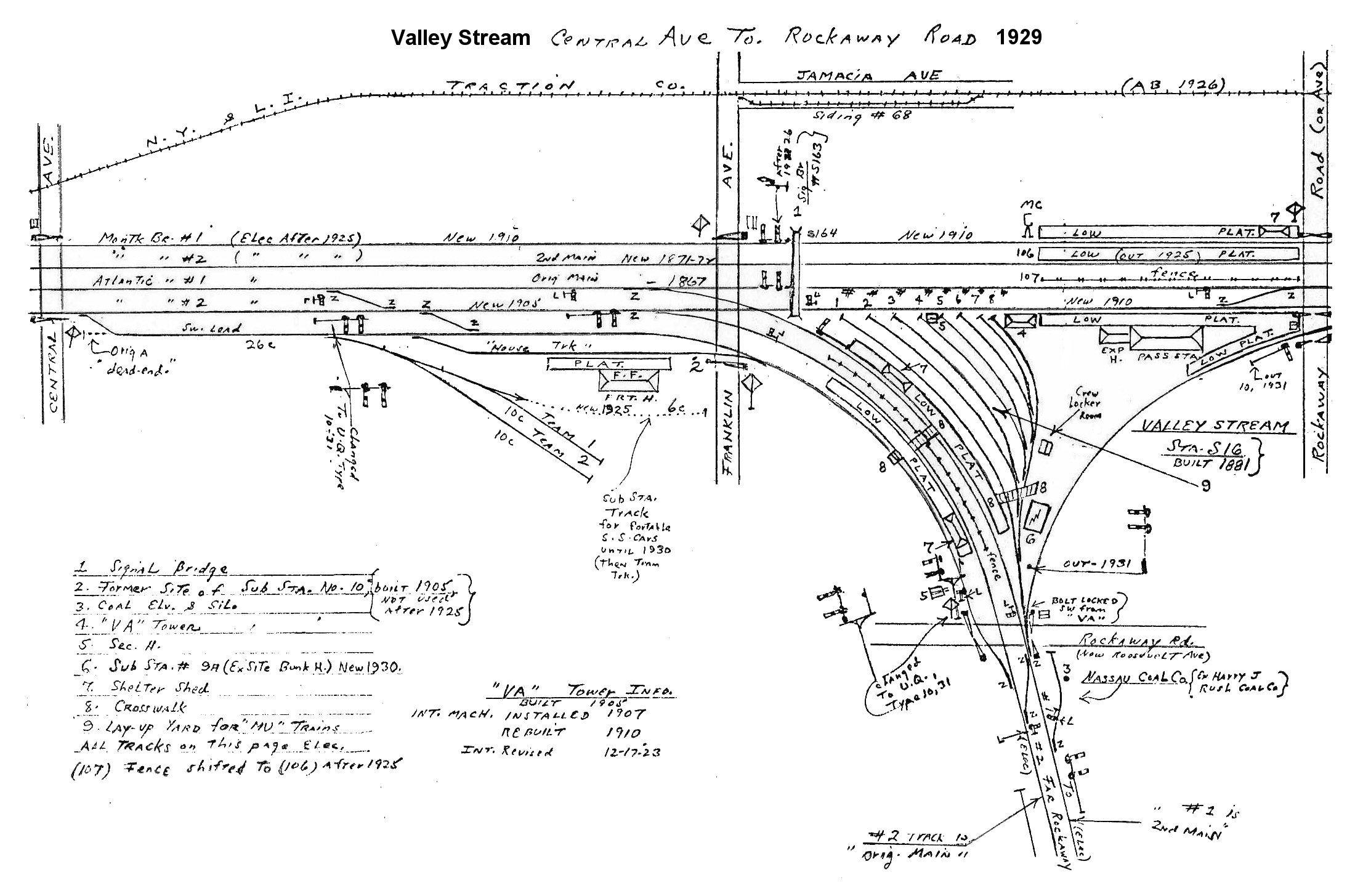
| VALLEY STREAM | |||||||||||
| SOUTH SIDE R. R.: SERVICE BEGAN 10/28/1867. DEPOT OPENED: 7/1869 WITH OPENING OF BRANCH TO FAR ROCKAWAY. BUILT INSIDE LEGS OF WYE. | |||||||||||
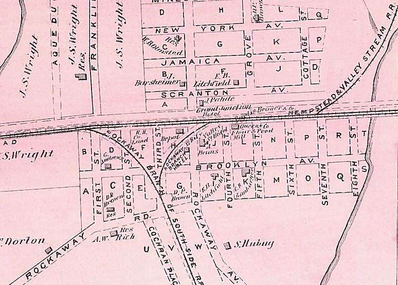 1873 Beers map - Valley Stream Queens Co. Flour & Feed Mill by 1876 the mill burned down. Archive: Art Huneke |
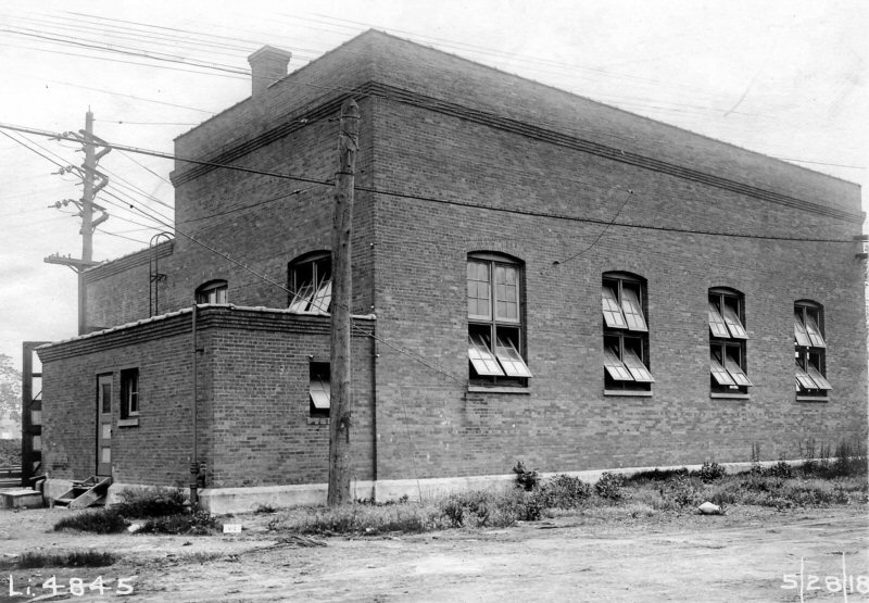
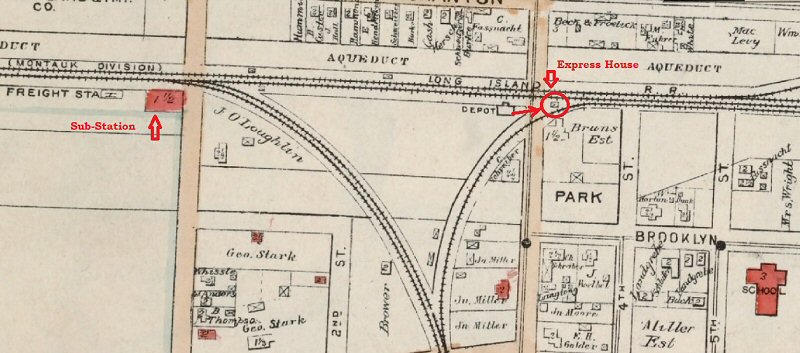
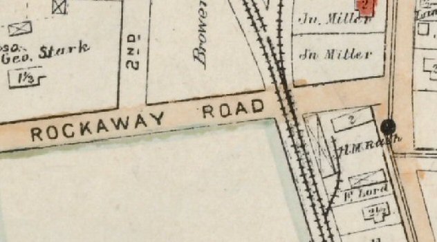
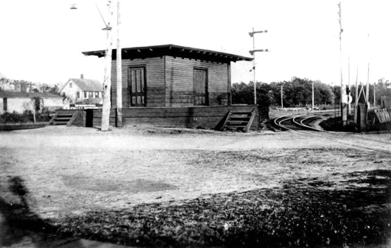 Freight/Express house - Valley Stream at Rockaway Ave. - View NE c.1902+
|
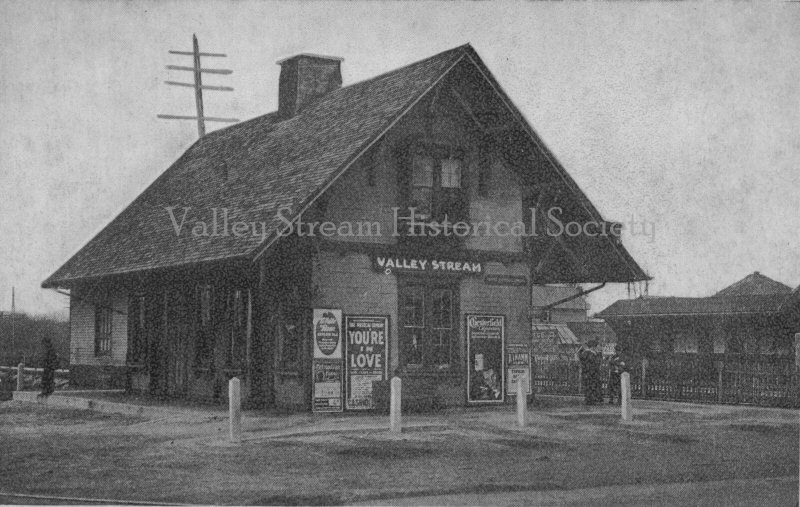
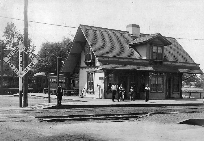
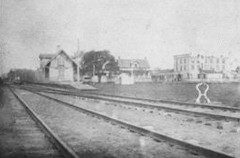 Valley Stream Station and Rockaway Branch Hotel, built 1873 View E 5/19/1878 - Photo: A. R. Young Archive: Brooklyn Historical Society
Materials courtesy of Archive: Valley Stream
Historical Society |
|||||||||
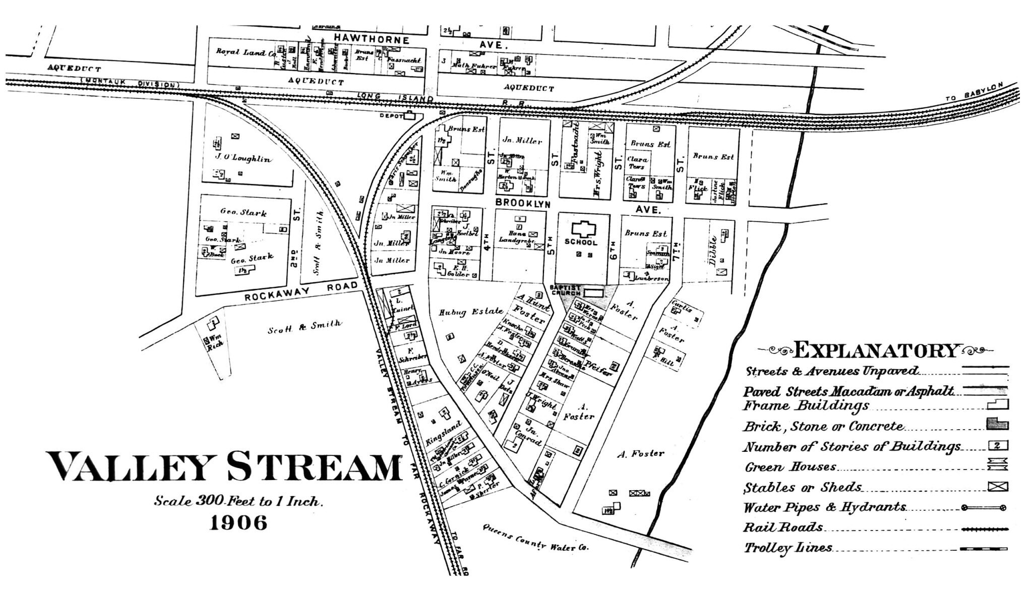 Valley Stream map - 1906 Archive: Valley Stream Historical Society |
 Valley Stream 1906 Belcher-Hyde map zoom Archive: Valley Stream Historical Society |

A detailed historical researched
Valley Stream spreadsheet: Railroad and related infrastructure, Far
Rockaway Branch, West Hempstead Branch, Railroad Map links, Postal
Offices-Postmasters, Water Works, and Hospitality & Restaurants.
Research: Amy Bentley |
|||||||||
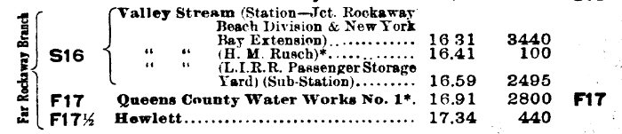 CR4 1913 Valley Stream Station junction Harry M. Rusch listed Archive: Dave Keller
1906 Hyde Map siding listed as L. Cuinet shed * Per The Brooklyn Daily Eagle H.
M. Rush, Sr., killed in coal elevator chain mechanism 1/16/1915 |
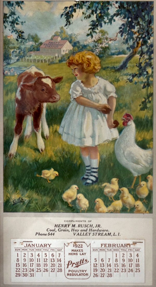 H. M. Rusch, Jr.- Coal, Grain, Hay & Hardware 1922 Calendar |
 Valley Stream substation 5/28/1918 LIRR valuation Archive: Dave Morrison
|
|||||||||
 Valley Stream - LIRR industry sidings - Map: Steven Lynch |
Valley Stream Coal Sidings
1. 1914-1922 - Henry M. Rusch, Sr./Jr. -
coal, grain, hay, hardware |
||||||||||
 Dickel Inc. Coal, Valley Stream 1969 Map location #3 above Archive: Valley Stream Historical Society |
 Moses R. Cornwell Coal - Scranton Ave. new 1933 undergrade bridge (maps location #2 above, #3 right) View SW - Archive: Art Huneke |
 Emery Scranton Ave to Merrick Rd., Valley Stream 1929 - Archive: Dave Keller |
|||||||||
 1910 Sanborn map - Dibble Lumber location #5 map above -Suburban Electric Light Co. location #3 Valley Stream |
 1918 Sanborn map - John T. Mohr Gas & Kerosene Station Location #6 map above, product delivered at siding location #7 |
Valley Stream
Oil and Lumber Sidings
5. 1910 Robert M. Dibble Construction Co.
6. 1918 John T. Mohr Gas & Kerosene location
#6, siding
#7
map 8. 1923 Gulf Refining Co. location #8 map 9. 1914-1944 John T. Loeffler
Lumber Yard location #9
map |
|||||||||
 1918 Sanborn map - Loeffler Lumber siding location #9 map Note: Emery 1929 map John T. Loeffler Lumber west of the siding, not Loeffler Lumber's brick and mortar location (above). |
 Merrick Rd view S early 1920's - Originally hay, seed and later HupCo Oils, Inc. at right. Map location #10 Loeffler Lumber at left. Archive: Art Huneke
|
 Laco Fuel Oil terminal - 150 E. Merrick Rd. postcard 1930's Archive: Valley Stream Historical Society |
|||||||||
|
|
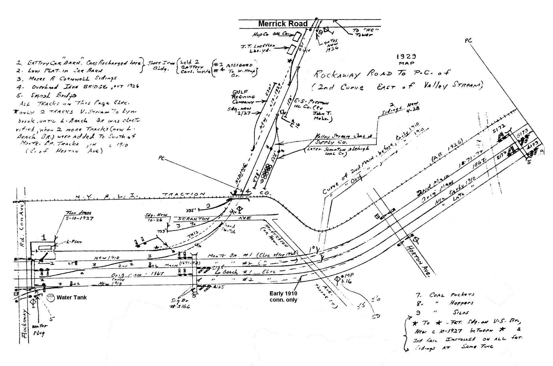 Emery map - Rockaway Rd., Valley Stream to east of MP16 1929 - Archive: Dave Keller |
 Emery map 1924 -Valley Stream to E. Merrick Road Archive: Dave Keller |
|||||||||
|
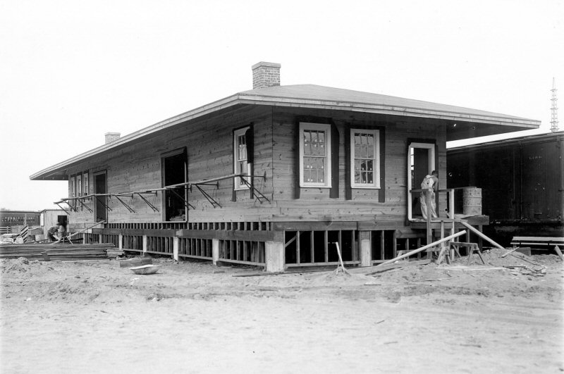
The replacement freight house
was constructed, also, south of the tracks, but inside the elevated wye
tracks as can be seen in the photos (below left).
You can see the freight house under construction in 7/1932 and its
future relationship to "VA" tower (renamed "VALLEY" tower in 1937) to
the right in this view looking southwest. Dave Keller |
|||||||||||
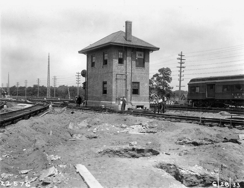
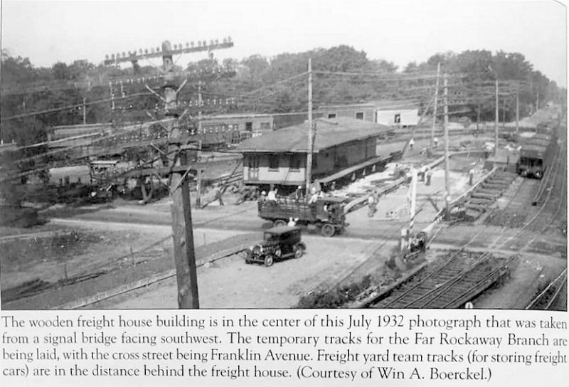 Valley Stream Freight House - View SW 7/1932 Archive: Win A. Boerckel-Dave Morrison |
 New Valley Stream Freight House under construction 6/28/1933 Photo: LIRR valuation Archive: Art Huneke |
 Valley Stream Freight House view SW post elevation 6/27/1933 Archive: Art Huneke  Valley Stream Freight House under construction view W 6/28/1933 Photo: LIRR valuation Archive: Art Huneke |
|||||||||
|
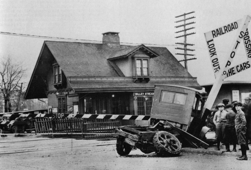
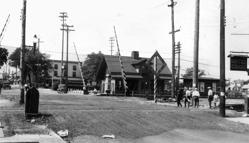
VALLEY STREAM: 2nd DEPOT BUILT AT SAME LOCATION OR ORIGINAL DEPOT REMODELED: c. 1881 OUT OF SVC: 8/10/32 ACCOUNT GRADE CROSSING ELIMINATION PROJECT. RAZED: 1933. TEMPORARY STATION RELOCATED ON SHOO-FLY NORTH OF FORMER LOCATION IN SVC: 8/10/32 TRACKS AND STATION PLATFORMS ON FAR ROCKAWAY BRANCH OUT OF SVC: 8/31/32. ELEVATED TEMPORARY TRACKS AND PLATFORMS ON FAR ROCKAWAY BRANCH IN SVC: 2/07/1933 3rd ELEVATED, CENTER-ISLAND STRUCTURE NORTH OF FORMER LOCATION IN SVC: 6/27/33. ELEVATED JCT. OF W. HEMPSTEAD BRANCH IN SVC: 9/10/33 |
|||||||||||
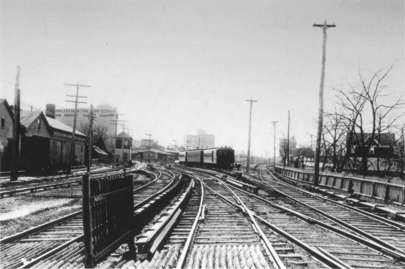
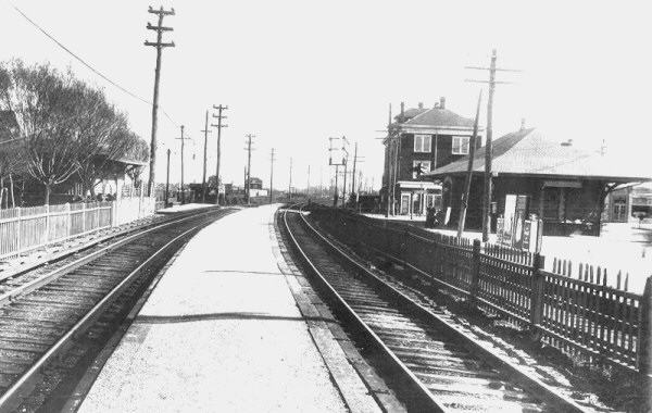
 Valley Stream Station view NW from Rockaway Ave c.1905 Archive: Amy Bentley-Valley Stream Historical Society
|
 Valley Stream Summer view SW c.1905 Note train on east leg of wye. Archive: Dave Keller
|
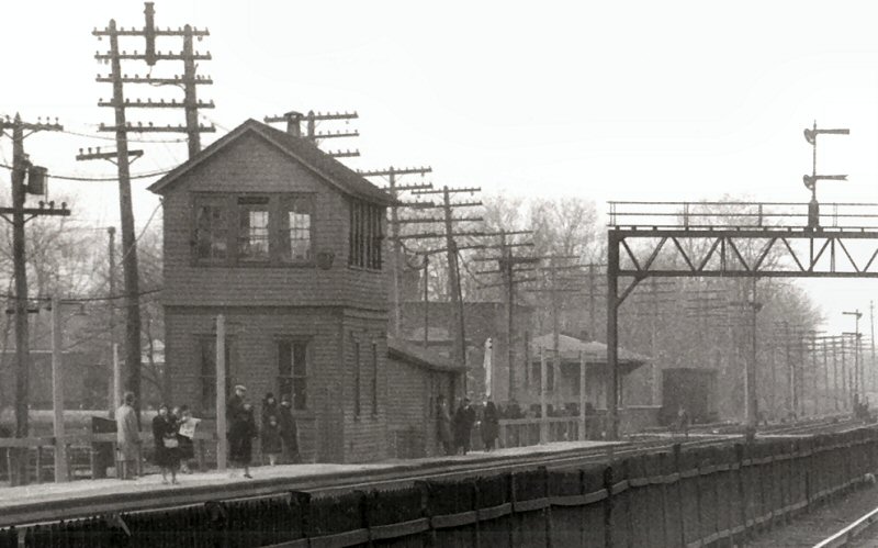
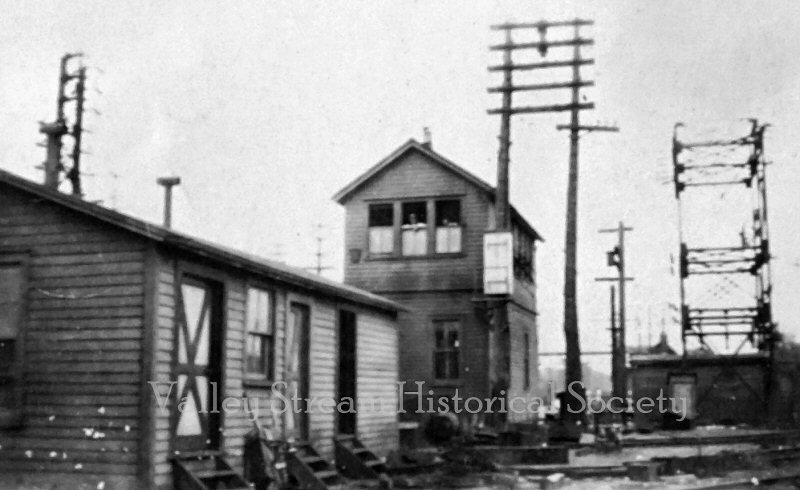 Valley Stream "VA" Tower view E from First St. c.1905 Archive: Amy Bentley-Valley Stream Historical Society
|
|||||||||
|
|
Note: Third rail was in service on
May 20, 1925 and the depot was gone by 8/10/1932 on account of the grade
crossing elimination. As there's an MU train in this image, it couldn't
have been prior to 5/20/1925.
Research: Dave Keller |
 Central Ave., Valley Stream view S toward Sunrise Highway 3/29/1938 Photo: Frederick J. Weber Archive: Queens Library Note: Elevated in 1956 per Emery map 9/1958 below. |
|||||||||
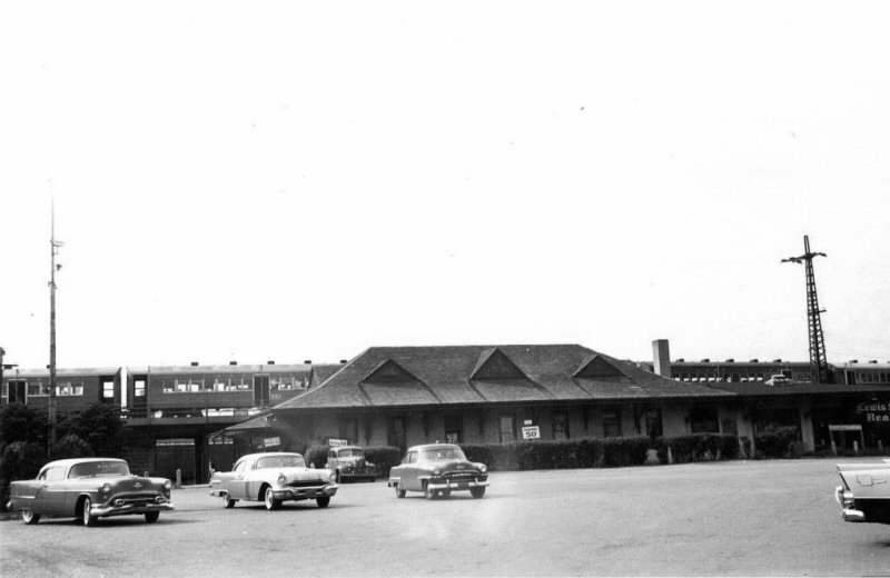
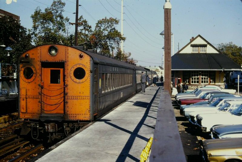
 LIRRer - Valley Stream 12/1955 Archive: Dave Morrison |
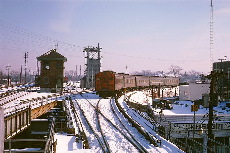
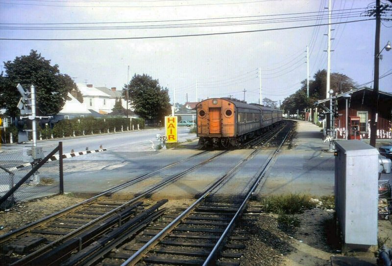
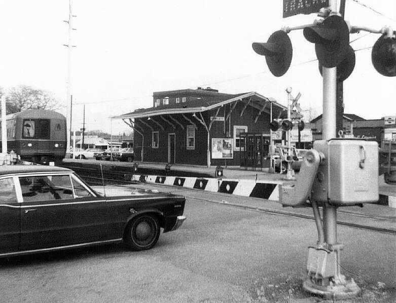
Valley Stream, AT GRADE, had both the station stop AND "VA" tower on the south side of the tracks and on the east side of the start of the Far Rockaway branch. The tower was at the west end of the station and the depot was alongside Rockaway Road. Valley Stream, ELEVATED, had the new "VA" (later "VALLEY") tower in a similar location, but moved to a point between the eastbound and westbound tracks, with it now being on the east side of the ELEVATED station, the STATION stop being relocated to the WEST side of the start of the Far Rock branch. Therefore, the 1955 L. I. Railroader photographer who took the "after" shot of Valley Stream from the east end of the station platform, above Franklin Ave. was in practically the same location as the at-grade image shot at the Franklin Ave. grade crossing. Info: Dave Keller
|
||||||||||
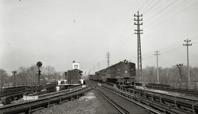 DD1 freight eastbound on Montauk Branch tracks at Valley Stream c. 1940 Archive: Dave Keller |
.jpg) MU Trains in the old Valley Stream yard View NW 9/14/1932 Archive: Dave Keller |
||||||||||
|
The curved platform at the left is the west leg of the wye. (Above left) That's the platform for passengers to and from Far Rockaway. The right leg of the wye and the depot building are to the right outside this image. Back in the day, this was a stop along the Montauk branch, hence the depot being located beyond the turn-off for Far Rockaway. Far Rockaway trains only stopped at this curved platform. Montauk trains (and possibly Long Beach trains) stopped in front of the depot. Note: Between the 2nd and 3rd MU trains is visible a small portion of the upper story of VA Tower: 1 |
|||||||||||
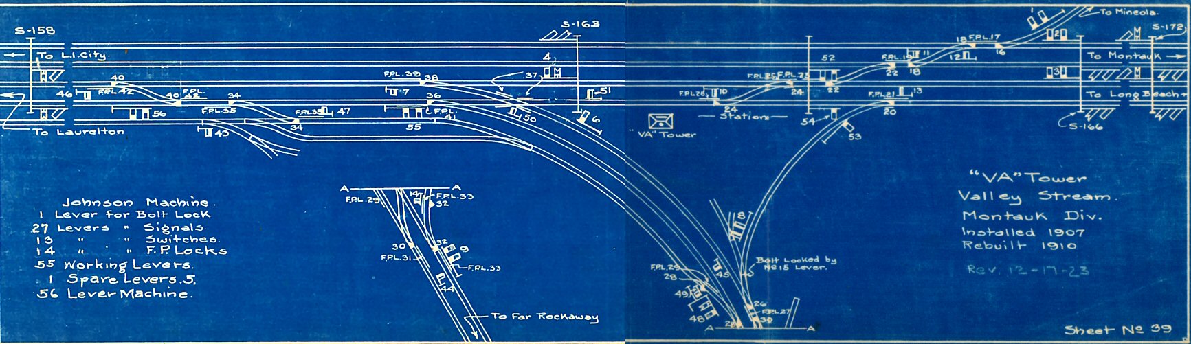 LIRR VA Interlocking Valley Stream blueprint 1923 Archive: Art Huneke |
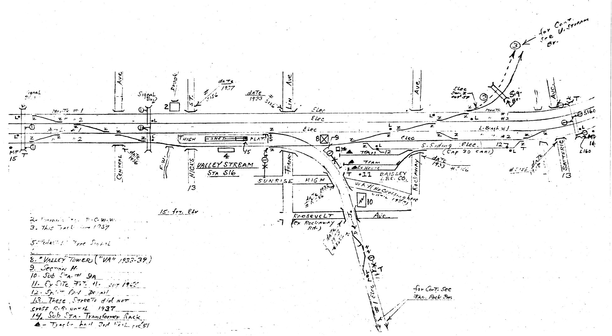 Emery map - Valley Stream MP15-16 - 9/1958 Archive: Dave Keller |
||||||||||
 |
 |
 |
|||||||||
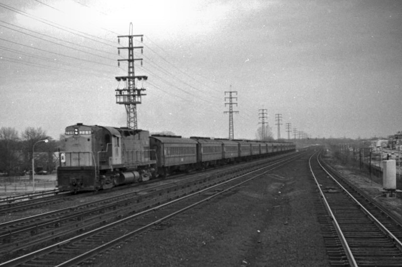
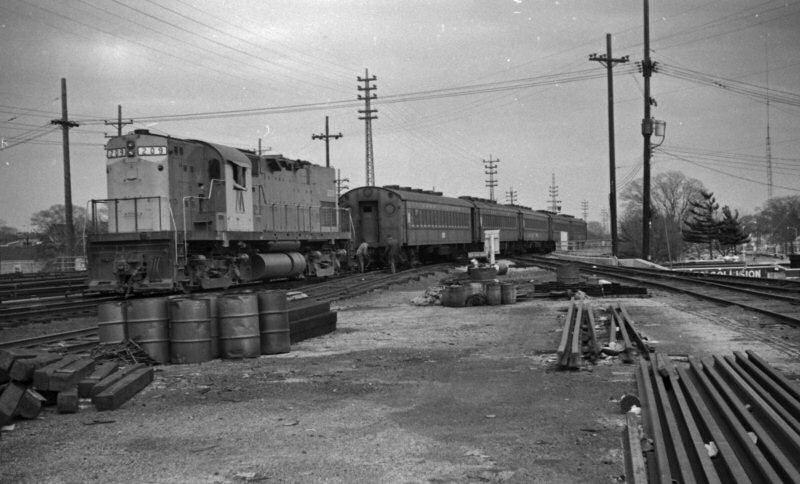
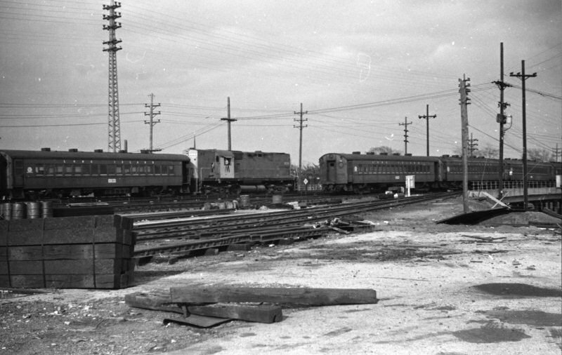
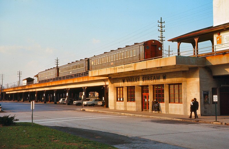
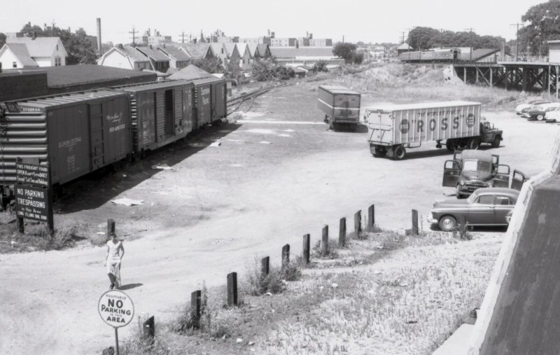
| LIRR #209 switching condemned MU cars at Valley Stream - 1970 Photos/Archive: Richard Glueck | |||||||||||
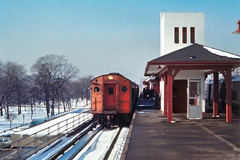
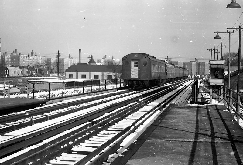
 Eastbound Far Rockaway train at Valley Stream Winter 1968 Archive: Brad Phillips |
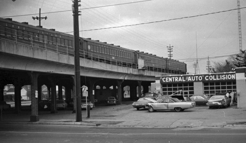 Condemned MU54 cars at Rockaway Ave., Valley Stream 1970 Photo/Archive: Richard Glueck |
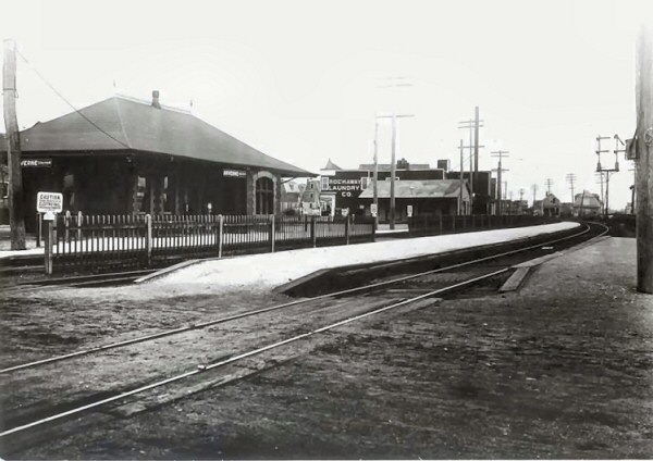
 Valley Stream Station - View N 1970 Photo/Archive: Richard Glueck |
|||||||||
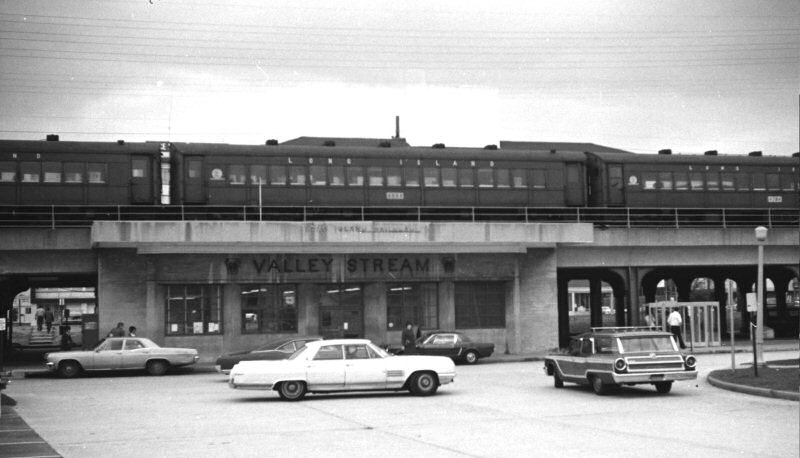
 Valley Stream Station - Trains for Far Rockaway #7024 and Long Beach #4830 1/02/1971 Photo/Archive: Richard Makse
|
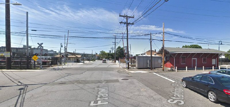
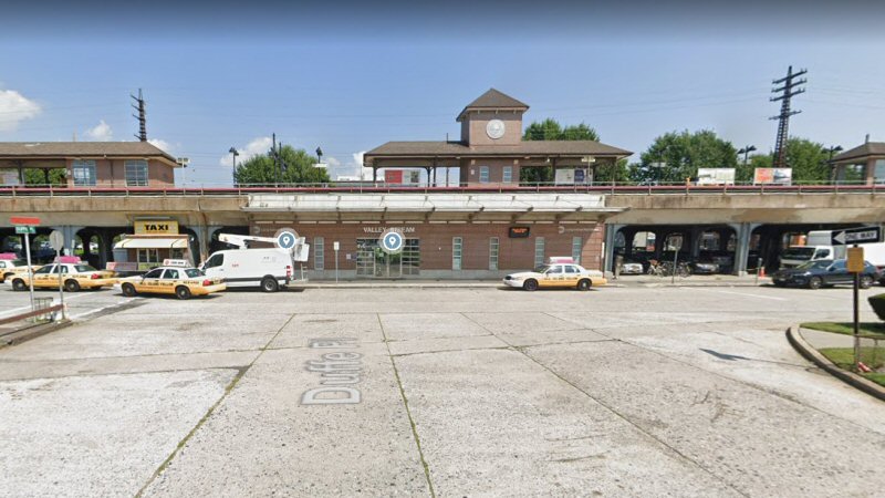 Valley Stream Station - View N 8/2018 Google maps
|
 LIRR Substation 9A -Valley Stream view S Photo/Archive: Amy Bentley-Valley Stream Historical Society |
|||||||||
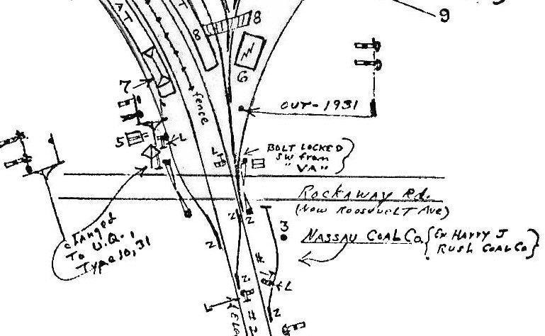
| “VA” TOWER | |||||||||||
 "VA" Tower: 1 - View SW c.1930 Archive: Art Huneke "VA" tower was rebuilt in 1910
because two more tracks were added that year and the interlocking had to
be rebuilt to accommodate these tracks and signaling thereof. There
are 3 tracks behind the mid-track fence and one at the right. The
mid-track fence was moved to this position after 1925. |
“VA”
TOWER: 1 VALLEY STREAM -
JCT. OF FAR ROCKAWAY AND WEST HEMPSTEAD “VA” TOWER: 2 JCT. OF FAR ROCKAWAY AND WEST HEMPSTEAD BRANCHES WITH MONTAUK BRANCH. BUILT EAST OF STATION AND JUNCTION. IN SVC: 6/27/33. RENAMED “VALLEY”: 4/30/37 See Emery map location #8 above right. |
 "VA" Tower: 2 - LIRR valuation photo: 6/28/33 view NW Archive: Art Huneke |
|||||||||
| “VALLEY” TOWER | |||||||||||
| "VALLEY" STREAM – JCT. OF FAR ROCKAWAY AND WEST HEMPSTEAD BRANCHES WITH MONTAUK BRANCH. (FORMERLY “VA”. US&S 35 LEVER MODEL 14 ELECTRO-PNEUMATIC MACHINE. RENAMED: 4/30/37. QUINDAR ELECTRONICS ALL-RELAY CONTROL PANEL CONTROLLING SIGNALS AND SWITCHES AT “ROCKY” AND “PORT” IN SVC: 4/30/83.) | |||||||||||
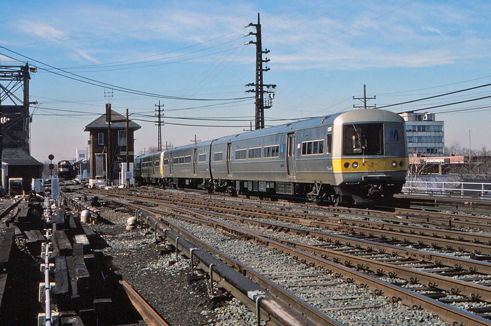
 Far Rockaway MU at VALLEY Tower 1/1971 Photo: Brad Phillips |
 Train #4152, with M1 #9408, heads east in VALLEY Interlocking in Valley Stream in March of 1986. It is crossing over on to the Montauk Branch after just having been sent via the Atlantic Branch at Jamaica. A RF-Extra freight, with an L-2 on the east end, is waiting in the station for the Babylon-bound train to clear. It will soon get its train orders at VALLEY to do its work on the West Hempstead Branch. Photo/Archive/Info: Jay Bendersky |
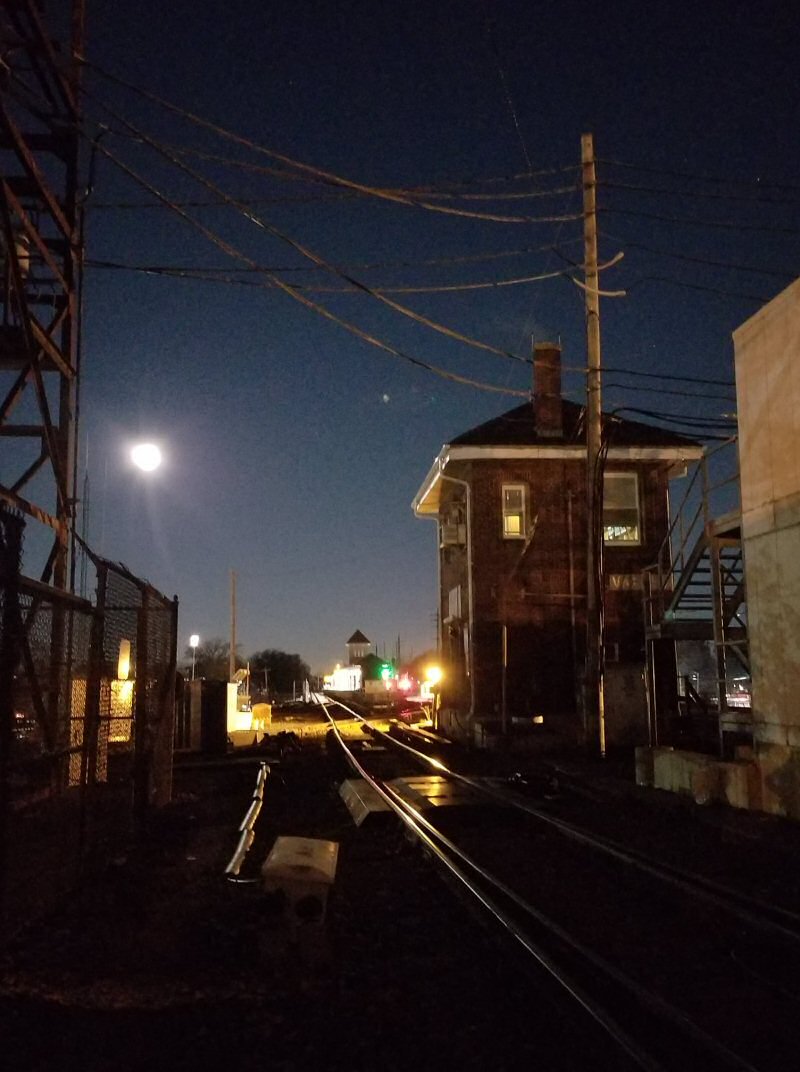 VALLEY Tower c.2021 Photo/Archive: Steve Torborg It's 5:45am and the train to Far Rockaway is approaching Valley Stream station as an almost full moon sets over the station. With the LIRR Mainline now fully controlled by JCC (Jamaica Central Control), time is also setting on the last classic PRR design tower still in service. Valley Tower is still fully staffed and controls movements on the Long Beach, Far Rockaway, West Hempstead and Babylon (Montauk) Branches. Steve Torborg |
|||||||||
|
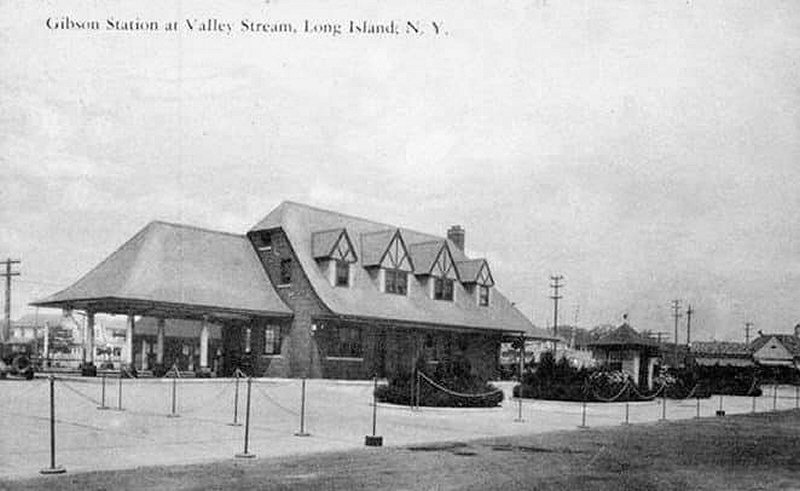
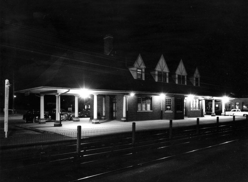
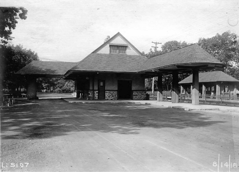
GIBSON BUILT: 5/29/1929. AGENCY CLOSED: ? |
|||||||||||
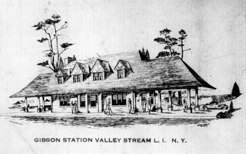 Gibson Station Ad drawing Post 5/29/1929 Archive: Dave Morrison |
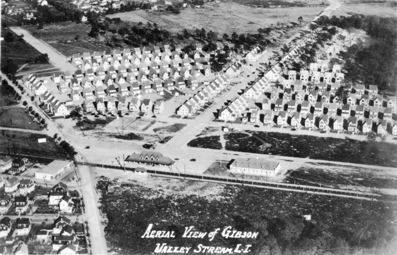 Gibson Station opened for the land development on 5/29/1929. Gibson aerial view E c.1929 |
 Gibson Station roped off rear for May 29, 1929 upcoming opening day celebration. Archive: Richard Kane |
|||||||||
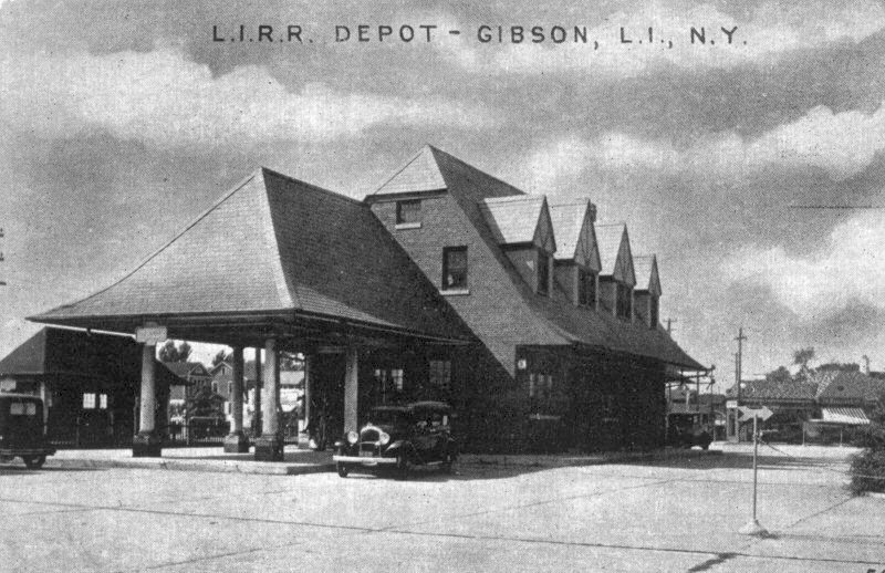 Gibson Station - View NW c.1936 Archive: Dave Morrison |
 Gibson Station View SE 1953 Archive: Dave Morrison
|
 Gibson Station view N c.1955 |
|||||||||
 Gibson Station - View S 1967 (Sturm-Fehn) |
 Gibson Station view W |
 Gibson Station - View NE 5/18/2023 Photo/Archive: Jeff Erlitz |
|||||||||
|
William R. Gibson came to Valley Stream in 1922 when he purchased land from the Norumbega Real Estate Company and the Queens County Water Company. On this land, Gibson designed and built homes for many white-collar city workers who were seeking a country-type environment along with convenience, naming the community after himself. The original land comprised 500 acres on Roosevelt Avenue and the adjacent side streets. The first homes built were on Avondale, Berkeley, Cambridge, Derby and Elmwood streets. More acreage was bought in 1927, along with rows of attached residences and mews on Cochran Place and Dartmouth Street. In 1929, the Long Island Railroad agreed to have morning and evening stops in Gibson, if Gibson erected his own train station. He did, at a cost of $50,000. A 16-hole miniature golf course was erected directly east of the station shortly after it was built. In 1932, an indoor tennis court was built across from the station as well. Almost
all of the families included at least one commuter. Realizing
that his community needed transportation, Mr. Gibson planned a
railroad station. After several years of legal negotiations, the
Long Island Railroad agreed to have trains stop morning and
night at Gibson, if the builder would erect his own station.
This was done at a cost of $55,000 and on May 29, 1929, the new
building was Gibson awarded prizes for the most-beautiful and best-kept
gardens and lawns. He started the custom of carol-singing around a
Christmas tree at the Gibson Station, provided the Santa Claus, and
bought candy for all the children who attended. ...In a whimsical
mood, he named some of the new streets after well-known liquors:
Haig Road, DuBonnet Road, Carstairs Road, Gordon Road and Wilson
Road." |
|||||||||||
|
HEWLETT The town was named after the Hewlett family, member of which was Richard Hewlett (1729-1789) who was an American loyalist during the American Revolution holding the rank of Lieutenant Colonel. He fought with DeLancey's Brigade as a loyalist in his 7-year military career. Info: Dave Keller
|
|||||||||||
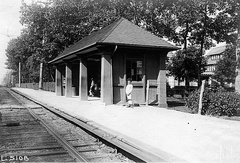
 Hewlett Station View NE c.1906 Archive: Dave Morrison |
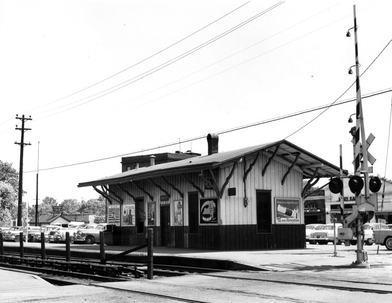
S. SIDE R.R. BEGAN SVC: 6/1869 AS "CEDAR GROVE." 7/1869 AS “HEWLETTS.” DEPOT BUILT: 1870. IN 1890s WAS KNOWN AS "FENHURST" AND THEREAFTER "HEWLETT." (per Vincent Seyfried’s LIRR history) ON S. SIDE OF TRACKS EAST OF FRANKLIN AVE. TRADITION SAYS CONSTRUCTION WAS PAID FOR BY THE
HEWLETT FAMILY. DEPOT TAKEN OUT OF SERVICE WHEN REPLACED BY NEW DEPOT: 7/28/2003 AND OLD DEPOT DONATED TO A LOCAL HISTORICAL SOCIETY.
(per David Morrison) |
 Archive: Brad Phillips |
|||||||||
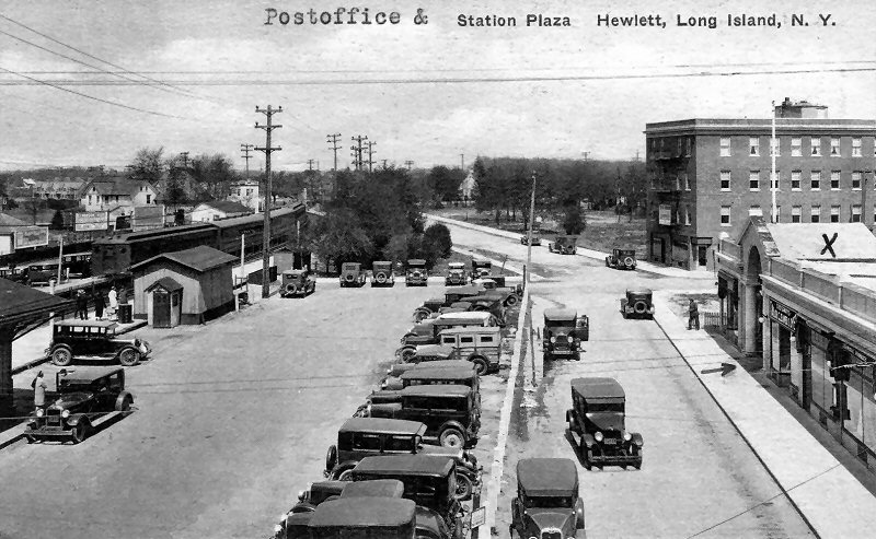 Hewlett Station Plaza View NW c.1928 Archive: Dave Morrison |
 Hewlett Station View NE 5/05/1953 Archive: Dave Morrison |
 Hewlett Station View NE c.1955 Archive: Dave Morrison |
|||||||||
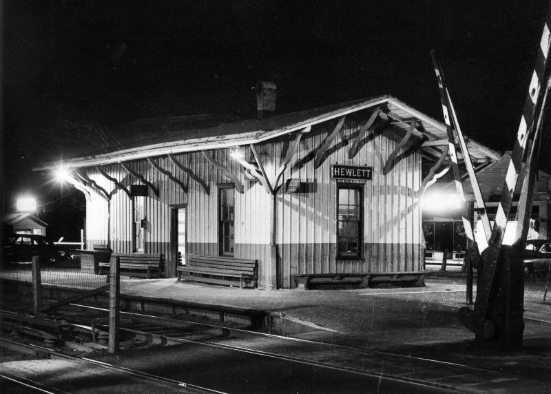
.jpg) Hewlett Station view N MU Train 7/1956 (Edwards-Keller) |
.jpg) Hewlett Station view NW 1968 (Keller-Keller) |

Hewlett Station view NE c. 1976 (Sturm-Fehn) |
|||||||||
 Hewlett Station view N MU Train 10/11/1970 Photo/Archive: William Gilligan
|
 Hewlett Station 1974 Photo/Archive: Tim Darnell  Hewlett Station Diagrams Archive: Dave Morrison
|
 Hewlett Station - View NW 2019 Google maps  2nd Hewlett Station - View W 2020 |
|||||||||
| Life-long Rider of the Far Rockaway Branch: Hewlett by Mike Boland | |||||||||||
|
Hewlett was a station on the branch I rode for about 40 years. Yes, the original building on the curve, built by the South Side Rail Road still exists. The LIRR, in a slick move, donated it to a local historical society. The LIRR built a new building diagonally across the street from it (the SSRR station building at Hewlett) that opened July 28th, 2003. |
|||||||||||
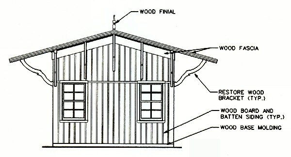
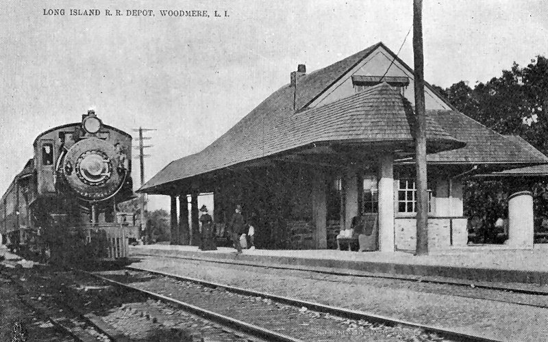
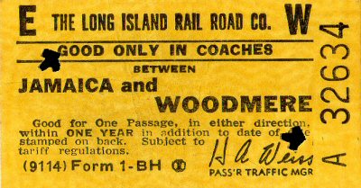
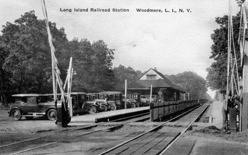
| WOODMERE | |||||||||||
|
WOODMERE: SOUTH SIDE R. R. SVC. BEGAN: 7/1869 ON TIMETABLE AS “WOODSBURGH” 2ND DEPOT BUILT: 1902 WITH PORTE COCHERE AT REAR. PORTE COCHERE REMOVED BY 1939. EAVES IN FRONT OF DEPOT CUT BACK AND COVERED PLATFORMS REMOVED WITH INSTALLATION OF HI-LEVEL PLATFORMS: c. 1968. AGENCY CLOSED: 8/19/2009. |
|
||||||||||
.jpg) MP41 Train at Woodmere Station c.1912 View S Archive: Dave Keller |
|||||||||||
|
|
|
|
|||||||||
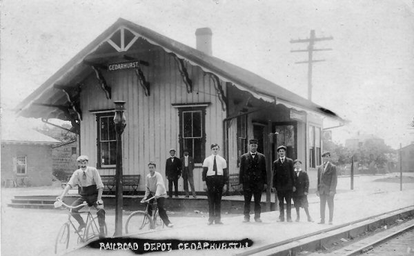
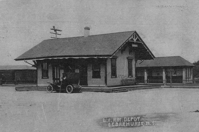
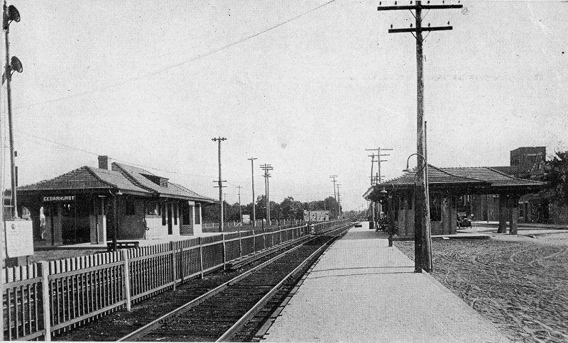
| CEDARHURST | |||||||||||
|
CEDARHURST: SOUTH
SIDE R. R. BEGAN SVC: 7/1869. DEPOT OPENED AS "OCEAN
POINT." RIVAL NY & ROCKAWAY RR. 2ND DEPOT BUILT: 1913 WITH SMALLER DEPOT BUILT ACROSS THE TRACKS. PORTE COCHERE AT REAR OF BOTH STRUCTURES. REMOVED FROM SMALLER STRUCTURE: 19 _?_. PRE-1957, TICKET OFFICE LOCATED IN DEPOT ON GEOGRAPHIC WEST SIDE OF TRACKS. POST-1957, TICKET OFFICE RELOCATED TO SMALLER DEPOT ON GEOGRAPHIC EAST SIDE OF TRACKS. AGENCY CLOSED: 8/19/2009. Research: Dave Keller |
|||||||||||
|
|
|
 Cedarhurst Station c.1910 view SW |
|||||||||
|
|
|
|
|||||||||
|
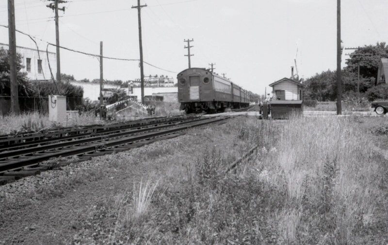
An MU train (above) is heading towards Far Rockaway as it crosses over the Rockaway Tpke (formerly Jamaica Tpke) crossing in Cedarhurst. The manually-operated gates and wooden crossing shanty are evident in this July 17, 1957 image viewed geographically west. (Dave Keller archive) |
|||||||||||
| CEDARHURST CUT-OFF | |||||||||||
|
On December 30, 1870 the New York & Rockaway Railroad Company was chartered to build from Rockaway Junction (later Hillside) to Far Rockaway. This line crossed the South Side Rail Road at Springfield Junction and ran directly to Ocean Point (Cedarhurst) where it curved and ran adjacent to the South Side Rail Road as far as Far Rockaway. It then crossed the S.S.R.R. and ran to its terminal at Lockwood's Grove. Springfield Junction was created in 1871 when the New York & Rockaway Railroad crossed the South Side Rail Road. The route between Springfield Junction and Cedarhurst was later known as the "Cedarhurst Cut Off". The line between Far Rockaway and Lockwood's Grove was later known as "The Grove Track". About July 1, 1871 the line was leased to the Long Island Rail Road. The New York & Rockaway Railroad opened May 14, 1872. Art Huneke |
|||||||||||
 NY&R Railroad - James Colton 1873 map Archive: Art Huneke |
 Springfield Station - 5/1889 Archive: Art Huneke Springfield was an original station of the NY&R Railroad. The second track was added in 1880, the automatic signals in 1906, and in 1925 the tracks were electrified. In employee timetable no. 107 of October 1927, the name changed to Springfield Gardens. Art Huneke
|
|
|||||||||
|
After the merger of the three competing companies the single Southern Railroad track and the single Long Island track, in 1876, were operated as a double track line. In 1880 or shortly thereafter the line between Laurelton and Cedarhurst was abandoned. In 1904-1905 the LIRR was planning to rebuild the Cedarhurst Cut Off and connect it with the Atlantic Division. Electrification and double track operation would have extended east of Laurelton, via the Cut Off, to Cedarhurst and the Rockaways. In March 1905 property in the southeast quadrant was purchased for connecting the Atlantic Branch with the Cedarhurst Cut Off. By 1919 the line was abandoned again. When the Cedarhurst Cut Off was rebuilt in 1927-1928 instead of a facing point switch at Laurelton there was a switchback. The line was double track with the connections with the main tracks single track. The line was petitioned 12/15/1934 to the PRR for abandonment in 1935. Art Huneke |
|||||||||||
| LAWRENCE | |||||||||||
|
SOUTH SIDE R. R. BEGAN SVC: 7/1869.
DEPOT BUILT: JUNE-JULY/1872 (Per Vincent f. Seyfried’s LIRR history. 3-year gap?)
MOVED TO PRIVATE LOCATION: 7/31/1906 |
|||||||||||
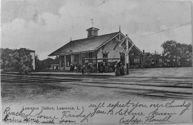 Lawrence Station - S.S.R.R. 1907 |
|
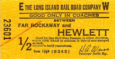
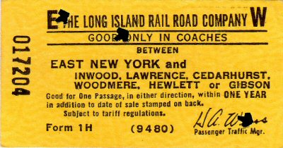
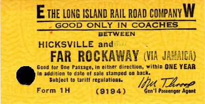
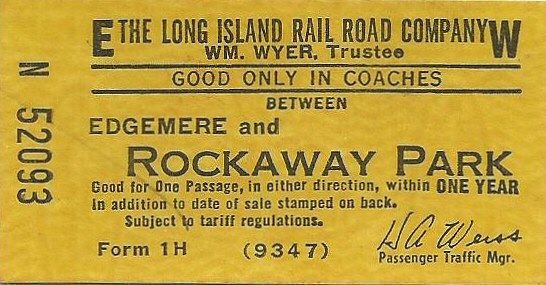
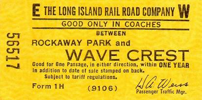
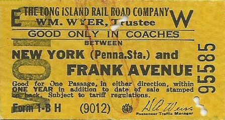
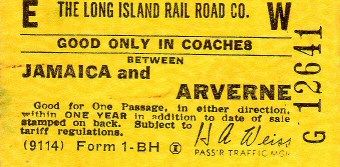
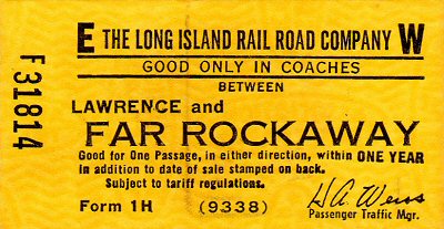 Form 1H one way coach Lawrence and Far Rockaway Passenger Traffic Mgr.: H. A. Weiss 1953-1964 Archive: Brad Phillips |
|||||||||
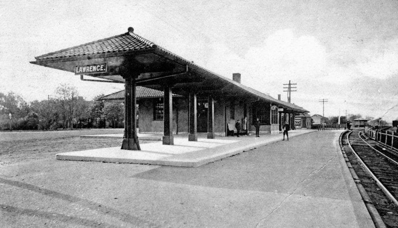 Lawrence Station - View S c.1908 Archive: Dave Morrison |
 Lawrence Station - View W c.1908 Archive: Dave Morrison |
 Lawrence Station view NE c.1968 Photo/Archive: Bill Mangahas The large Dashing Dan herald with no base from the late 1960's. |
|||||||||
|
The TAXI stand was near the end of the eastbound platform at the east end and was built on top of the old third track used by freights between Cedarhurst and Far Rockaway. Lawrence did have a slight curve in the platforms, which still can be seen. The low platforms had "temporary" high platforms with wood and asphalt built on top of them until the pre-fab concrete pilings and station platform slabs were installed some years later. The LILCO high-tension poles from the LILCO plant in Far Rockaway on the bay can be seen. There also was a pedestrian/commuter crossing complete with sliding gate, bell and blinking red light (like the ones on the LIRR crossing gates) by the station building that allowed you to walk across the tracks with a break in the third rail. It was closed, probably in anticipation of high platforms and probably deemed too unsafe as an eastbound train (LIRR direction) to Far Rockaway left Cedarhurst, commuters would slowly walk to the headend of the train so when it stopped at Lawrence, they could run down the platform to the street and cross around the dropped gates before the train started to move. This was very frustrating to the train's engineer and he would invariably give everyone a long blast on his whistle to let them know he was moving. Mike Boland |
|||||||||||
| INWOOD | |||||||||||
|
SHELTER SHED OPENED: 12/3/11, RAZED: 1956. REPLACED WITH METAL SHELTER SHED. Research: Dave Keller |
|||||||||||
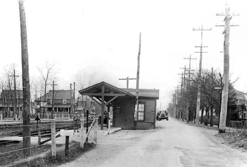 Inwood Station c.1928 |
 Inwood Station shelter shed |
 Archive: Brad Phillips |
|||||||||
|
An MU 3-car train is Jamaica-bound at the station at Inwood, NY in this geographically SW view from May 23rd, 1959. The tiny depot is gone by this time, but the old wooden shelter shed is in place along with a rough wooden slat platform and guardrail. An MU train is visible in the distance in the yard at Far Rockaway. (Dave Keller data and archive) |
|||||||||||
| FAR ROCKAWAY | |||||||||||
|
|
GROVE STREET (LOCKWOOD’S
GROVE):
BUILT: 1872. STATION STOP DISCONTINUED.
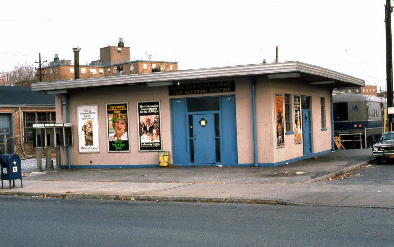
MOTT AVENUE: NAMEOKE AVENUE: IN SERVICE: 2/21/58. AGENCY
CLOSED: 11/07/1996
|
||||||||||
|
|
|||||||||||
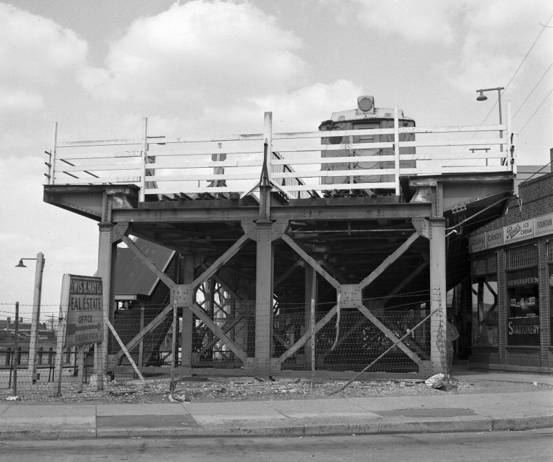
 FW Tower, Far Rockaway 6/06/1933 FW tower at end of station platform. Track in front of tower leads to the express house. Looking east – 1933 Note the single mast signal in the right background and a cantilever mast signal in the left background . . . both of which were set by the levers pulled in the tower.
|
FW Tower: FAR ROCKAWAY - SOUTH SIDE OF TRACKS AND EAST OF STATION. IN SERVICE: 6/18/1907. RENAMED “ROCK” 5/11/37. ROCK Tower: 1 FAR ROCKAWAY (PREVIOUSLY “FW” TOWER) SOUTH SIDE OF TRACKS AND EAST OF STATION. IN SVC: 1907. RENAMED: 5/11/37. OUT OF SVC: 7/8/41. ROCK
Tower: 2 FAR ROCKAWAY (LOCATED EAST OF |
 ROCK Tower: 2 View W c.1948 Archive: Mike Boland The track curving to the right in front of the camera is the yard lead. Tracks at the left head towards the old Far Rockaway station area. MP19 is visible between the tower and the cars. Nameoke Ave. crosses under the tracks just beyond the crossover in front of the tower. |
|||||||||
.JPG) ROCK Tower, Far Rockaway c.1939 Archive: Art Huneke |
|||||||||||
.jpg) Far Rockaway Station Mott Ave MU train View E 1920 |
 The building to the left of FW tower below, in front of the tall smokestack is the Far Rockaway venue of Sheffield Farms Dairy. Express house at right. Looking east – 1915 |
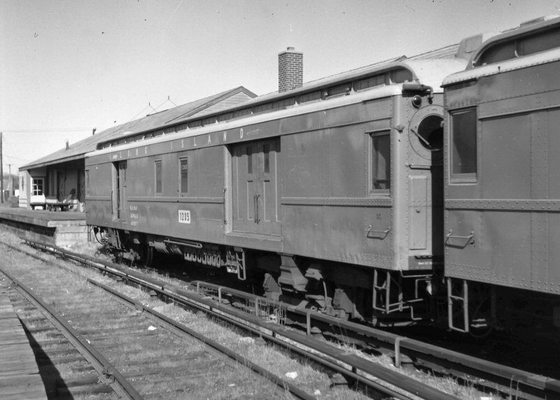 Far Rockaway Yard MU REA #1205 at Express House Mott Ave. View NW 8/09/1952 (Faxon-Keller) |
|||||||||
 Timetable Rockaway Branch 4/13/1885 Archive: Brad Phillips |
 Archive: Brad Phillips 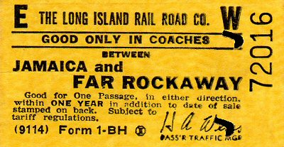
|
||||||||||
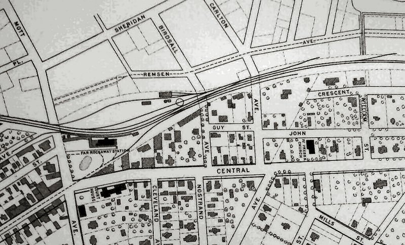
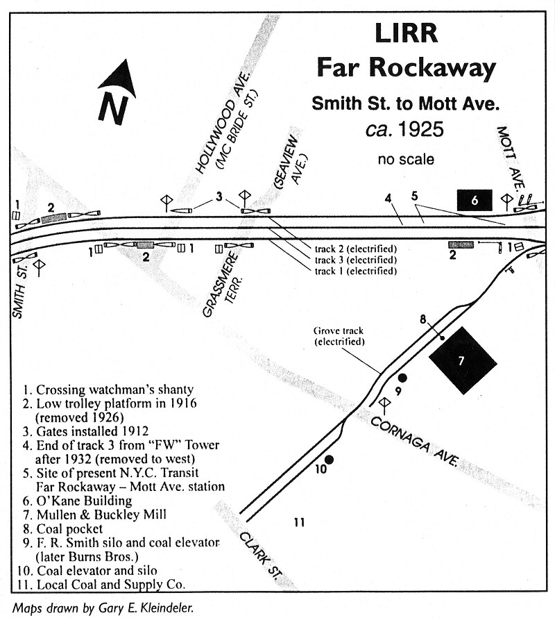 Far Rockaway Smith St. to Mott Ave. c.1925 Map: Gary Kleinedler - The Keystone Archive: Dave Keller
|
 Far Rockaway Branch Timetable 6/30/1915 Archive: Brad Phillips |
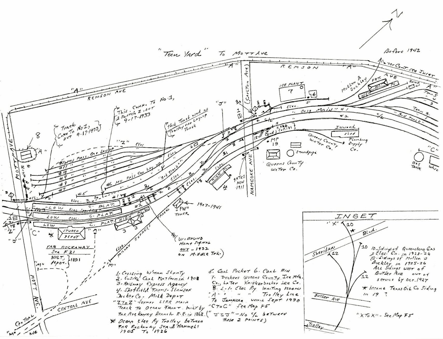
 Emery map Far Rockaway 1942-1957 Archive: Dave Keller
|
|||||||||
|
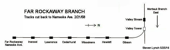
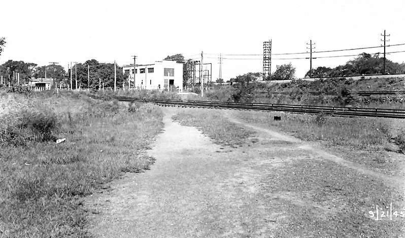
Looking geographically east at the remains of the
old Far Rockaway (Mott Avenue) freight yard we see three boxcars spotted
on the team track by the Express House (above right). In the right
background an MU train is passing the abandoned "ROCK" tower, roof of
which is visible behind the train, and it is about to enter the elevated
station facilities in this July 15, 1957 view. The site of the
distant tower became the site of the replacement station at Nameoke
Avenue when the old station facilities and tracks were taken out of
service on February 21, 1958 and service cut back to Nameoke Avenue.
Everything between Nameoke and Mott Avenues was demolished thereafter.
(Dave Keller archive) |
|||||||||||
 Sheffield Farms Dairy at the left, with rooftop “skeleton” sign. Looking west - 1915 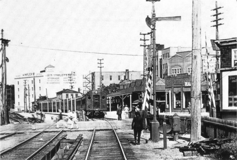 Mott Avenue crossing at grade. Depot at right of MU train. Express house towers above the lead car in the background. Looking east - 1915 |
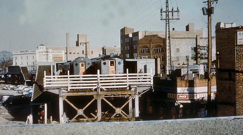
 Far Rockaway Station - 10/1955 - View NE Photo/Archive: Bernie Bierman
|
.jpg)
An MU train in dark gray and orange color scheme is making a station stop at the elevated Far Rockaway, Mott Ave. station in this view looking west in 1955. Note: This was AFTER Tichy and prior to Goodfellow/Dashing Dan scheme. By October of that year, through trains would no longer be running from here to and from Rockaway Park as the track rights and ROW would be turned over to the NY City Transit Authority. (W. J. Edwards photo, Dave Keller archive and data) |
|||||||||
 Old station with train on elevated viaduct. View N c. 1955 (W. J. Edwards photo, Dave Keller archive) |
,%20NY%20(View%20N)%20-%2006-02-62%20(Faxon,%20Jr.-Keller).jpg) Far Rockaway station at Nameoke Ave. View N 6/02/1962 (Faxon, Jr.-Keller) |
 Far Rockaway station at Nameoke Ave. after tracks were cut back from Mott Ave. View NE - 6/1964 Archive: Brad Phillips |
|||||||||
 LIRR Far Rockaway Track map 1966 page 25 |
 Far Rockaway station at Nameoke Ave. View N - 12/04/1976 (Madden-Keller) |
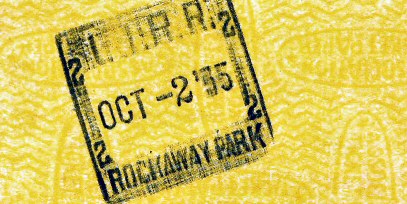
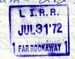 Far Rockaway, Nameoke Ave. Dater Die Stamp 7/31/1972 Usage/Collection: Dave Keller |
|||||||||
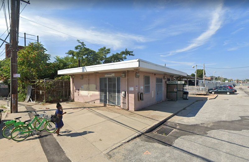 Far Rockaway station at Nameoke Ave. 8/2019 Google maps |
.jpg) Far Rockaway station at Nameoke Ave. 11/2020 Google maps |
||||||||||
|
|
|||||||||||
| Nameoke Avenue | |||||||||||
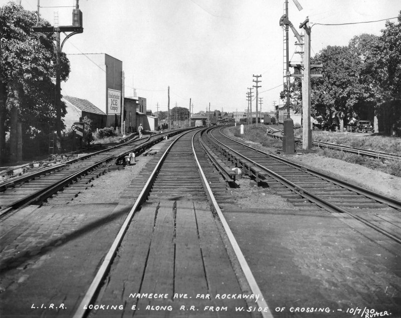 Nameoke Ave., Far Rockaway - View NE The first crossing east of the old Far Rockaway station. Mile Post 19 just beyond automatic block signal R181. |
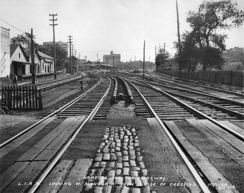 View southwest, with Far Rockaway station and FW Tower in the distance. You can also see the big Mullen & Buckley Manufacturing Co. On the left is one of Sheffield Farms’ many distribution sheds. |
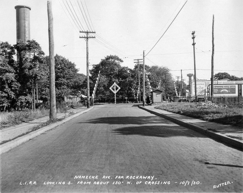 Looking south along Nameoke Avenue. The big pipe on the left is the water tank of the Queens County Water Company. |
|||||||||
| (Above left) Looking northeast, with Mile Post 19 just beyond automatic block signal R181. This is exactly the location of today’s Far Rockaway station. At some point in the 1930s, the automatic block signals were relettered from “R” to “F.” The Far Rockaway Branch was considered part of the Rockaway Beach Division way back when so perhaps that is why the original signals were lettered as such. Even though home signals didn’t have number plates (until recently) all of the original automatic signals had, in addition to the regular number plates, a separate plate with the letter “A,” for automatic. I think those “A” plates were also removed in the 1930s. Jeff Erlitz | |||||||||||
| Mott Avenue | |||||||||||
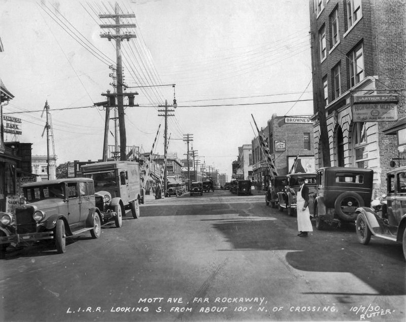
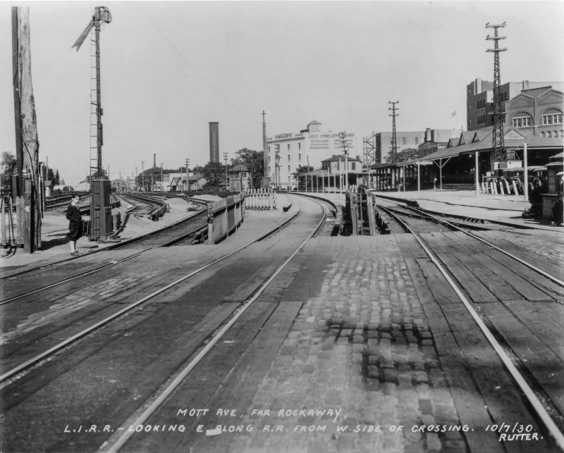 We now come to Mott Avenue, at the west end of Far Rockaway station with the station building on the right. To its left is the freight house. To its left is FW Tower (later Rock). |
 Looking south from the Mott Avenue grade crossing. This is the Grove Track, or Grove Siding. This was the original route of the New York & Rockaway RR. The boxcar is either at the Mullen & Buckley factory or a the Burns Bros. Coal facility. |
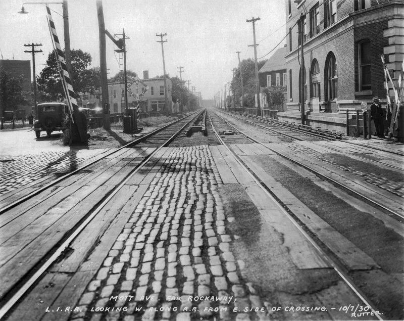 Looking southwest from Mott Avenue. On the right is the O’Kane Building, still with us today. On the left is home signal 28, controlled from FW Tower. |
|||||||||
|
|
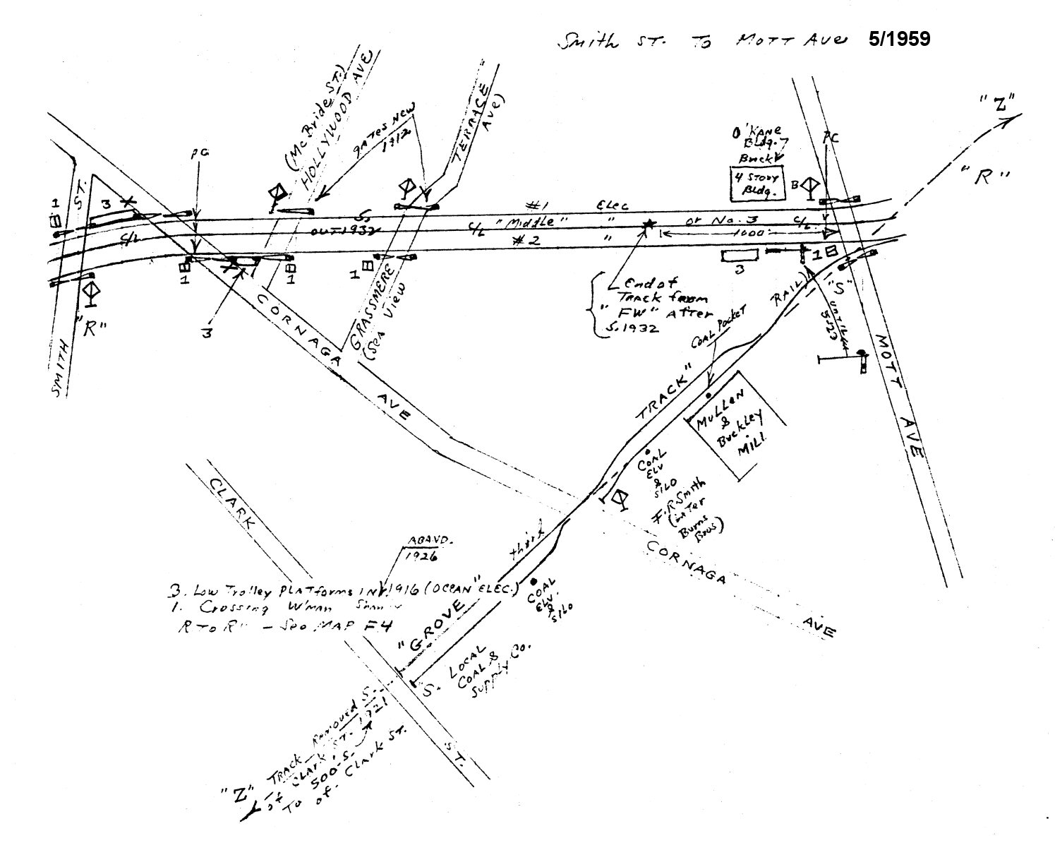 Emery map - Smith St. to Mott Ave., Far Rockaway 5/1959 Archive: Dave Keller |
 Looking SE along Mott Avenue, with the O’Kane Building on the right. On the left you can see the lower quadrant semaphores of automatic block signal R178. |
|||||||||
 Mott Ave. Station elevated structure as the tracks are blocked off 9/22/1956 - (Faxon, Jr.-Keller) |
Mott Ave. was at the west end of the Far Rockaway station prior to its relocation back to Nameoke Ave. At left, you can see the LIRR is in the process
of truncating the track connection as the NYCTA is taking over all the
tracks west of Mott Ave. At right, the tracks have been truncated.
|
 Mott Ave. Station - MU Train at the truncated track - View E 4/13/1957 - (Faxon, Jr.-Keller) |
|||||||||
| McBride Street | |||||||||||
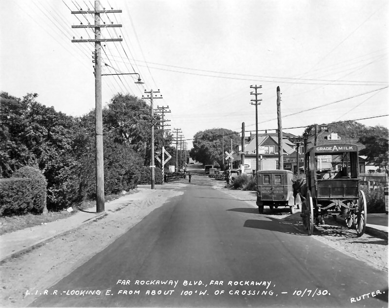
 We are now in Far Rockaway. Barely 150 feet east of Cornaga Avenue was the McBride Street crossing. This is looking southwest, towards McBride, Cornaga and Gipson. Wave Crest station is out of view in the distance beyond the curve, unfortunately. |
 Looking northeast along the north side of the railroad at the McBride Street crossing, which is just to the right. Rutter is standing on the construction of the new Beach Channel Drive. That next crossing, 200 feet further, is Grasmere Avenue. The tall building in the distance is the O’Kane Building, at 21-17 Mott Avenue, which still stands today. |
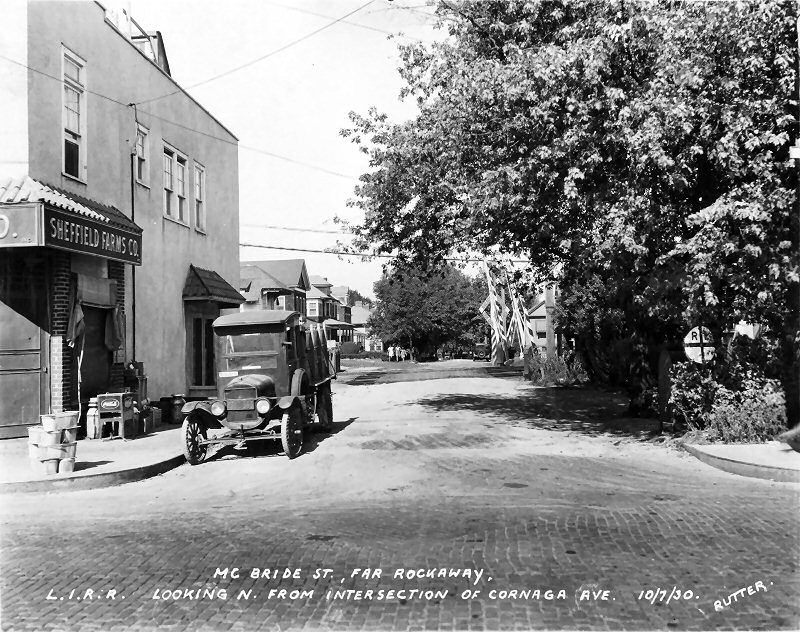 Looking north on McBride Street. This segment of the street, south of what will become Rockaway Freeway after the railroad is elevated, is no longer in existence. Note the cast iron crossing sign on the right! |
|||||||||
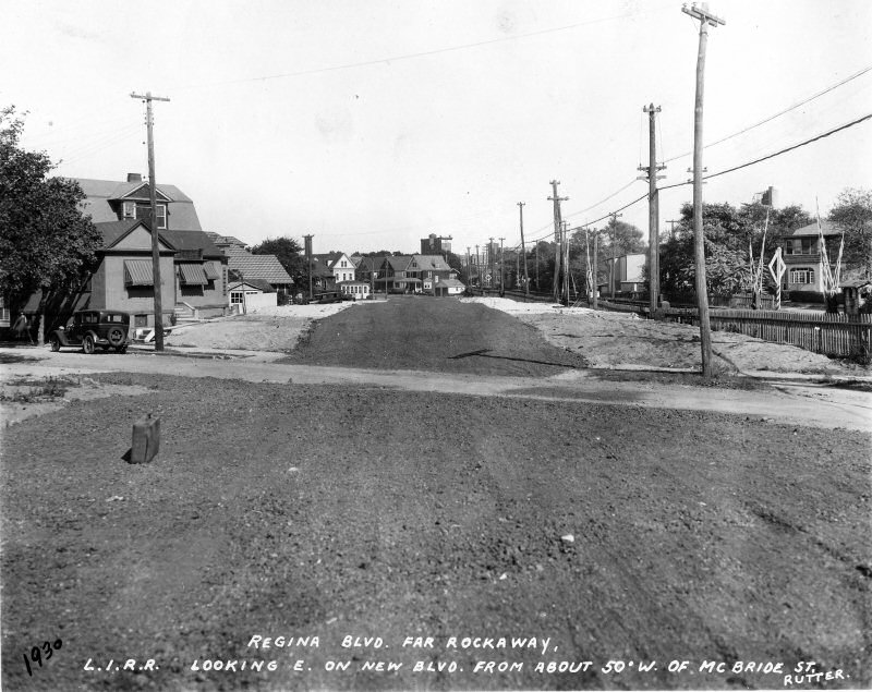
| Ocean Crest Boulevard | Gipson Street | ||||||||||
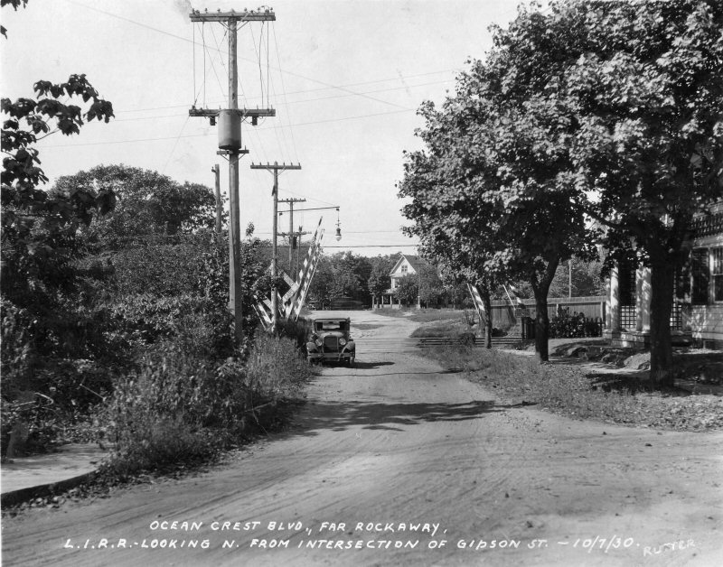 About a tenth of a mile to the east of Far Rockaway Blvd was the Ocean Crest Blvd crossing. This is View N. This dirt path is a boulevard? |
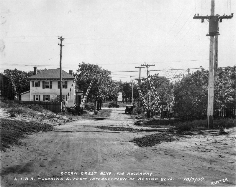 Ocean Crest Blvd crossing view S. These gates were controlled from the watchman at the next grade crossing, Gipson St, which was only about 175 feet to the east (left in this view). |
 Looking north up Gipson Street. |
|||||||||
| Cornaga Avenue | |||||||||||
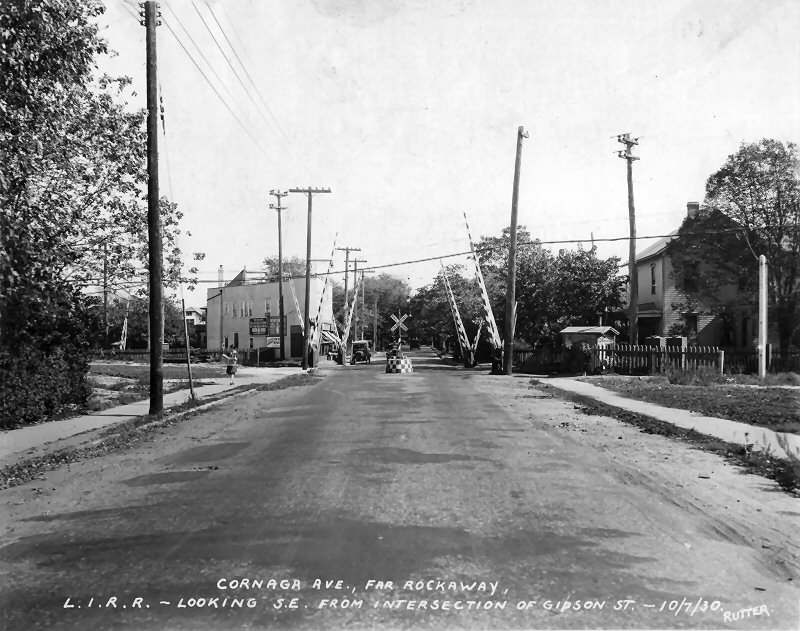 Roughly 200 feet further east was the Cornaga Avenue crossing. The Ocean Electric trolley had station platforms here, on the far sides of the crossing. |
Photos: Edgar E. Rutter Collection,
Queens Public Library |
||||||||||
|
|
|||||||||||
|
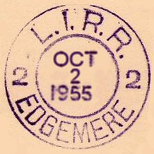
NOTE:
Ownership
of the trackage and station stops below, (Wave Crest to Arverne,
inclusive) were transferred to the NYCTA as of October 3, 1955, and the
tracks severed with the removal of the LIRR's overpass at Mott Ave. The
NYCTA built their own Far Rockaway station on the west side of Mott Ave.
and the LIRR maintained their Far Rockaway station on the east side. |
|||||||||||
| WAVE CREST (Beach 25th Street) | |||||||||||
 The next grade crossing to the east was Far Rockaway Blvd, at the east end of Wave Crest station. The date is now 10/7/1930 and we are looking almost due northeast. Wave Crest (today’s Beach 25th Street) station is almost oriented NNE/SSW! Also, Wave Crest was a late-comer as far as stations are considered, having been established in May of 1922. Photo: Edgar E. Rutter Collection, Queens Public Library
|
.jpg) This is the Far Rockaway Blvd. grade crossing at Wave Crest as photographed in 1934. Note the cantilevered signals mounted on the wooden power pole at the right! Missing are the semaphore blades from both sets of signals which governed the middle track which has since been removed. (Dave Keller data and archive)
|
.jpg) The old at-grade station at Wave Crest is seen in this photo taken on April 11, 1939. This station stop was soon to be elevated and placed atop the viaduct, eventually becoming a stop for the New York City Transit Authority when they took control of the tracks west of Far Rockaway, Mott Ave. in October, 1955. (Dave Keller data and archive)
|
|||||||||
| EDGEMERE (Beach 35th Street) | |||||||||||
 Edgemere Station view E 1915  Edgemere Station view W 11/05/1937 Photo: Fred Weber Archive: Ron Ziel Note the crossing shanty at the left atop the high level platform. Info: Dave Keller |
.jpg) Approaching Far Rockaway, Mott Ave. from Hammel's wye, we arrive at the Edgemere station. An MU electric train has made the station stop on April 6, 1934 when the station was still at grade. View W (Dave Keller data and archive) |
|
|||||||||
|
|
|||||||||||
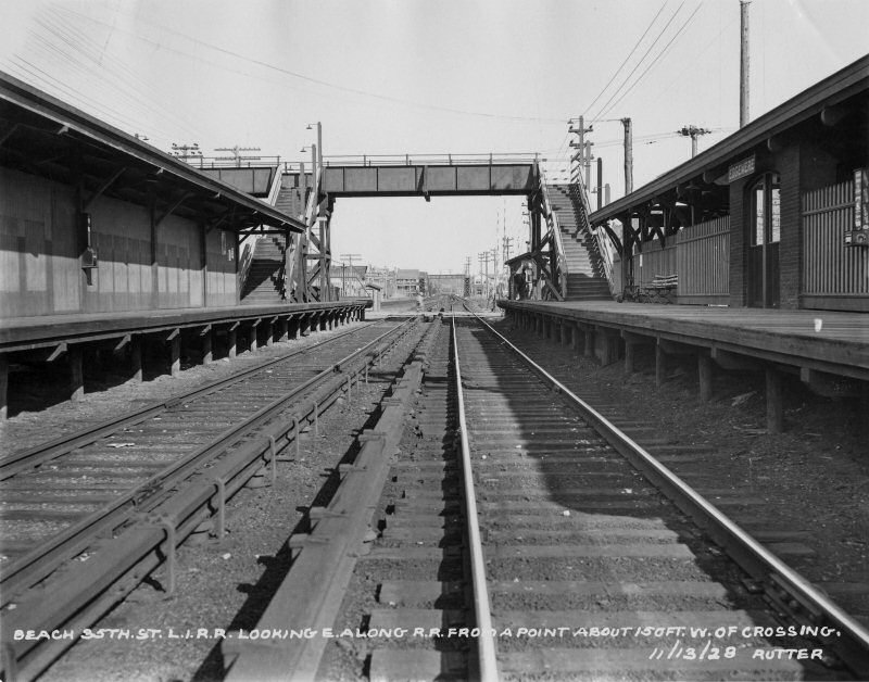
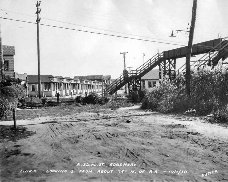
 Looking west towards the station from east of Beach 35th Street. Like Frank Avenue, Edgemere also had two pedestrian overpasses, the only two stations on the branch to have two. The west overpass also has automatic block signals R168 mounted on it. Those signals had been relocated from ground masts to the bridge in 1923. 11/13/1928 |
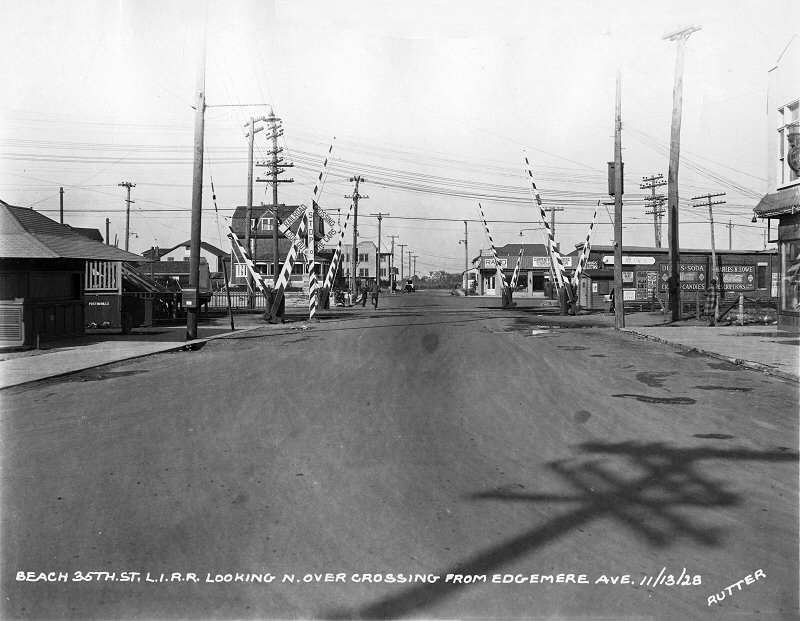 View north along Beach 35th Street.11/13/1928
|
 Moving further east, Rutter came to Edgemere station, at Beach 35th Street. This is looking east towards the grade crossing. In the distance is the pedestrian overpass at Beach 32nd Street. 11/13/1928 |
|||||||||
| FRANK AVE. (Beach 44th Street) | |||||||||||
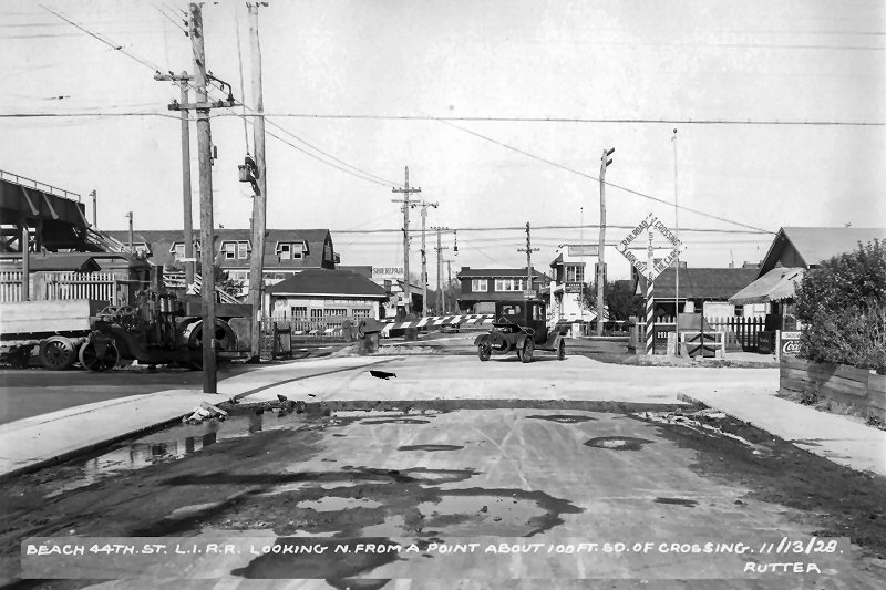
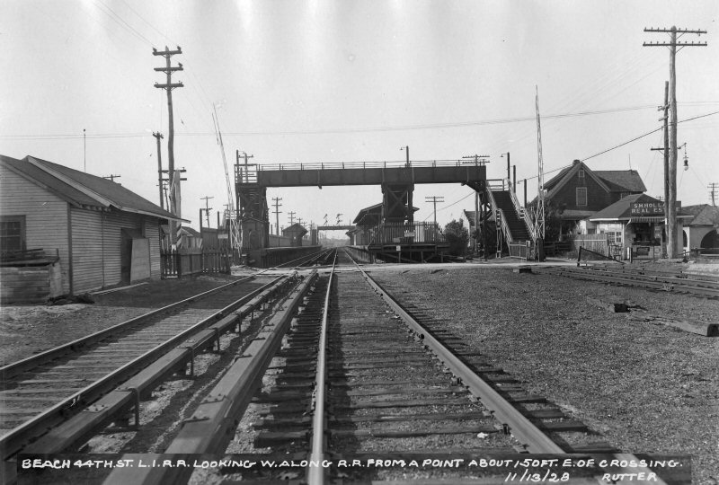 View west towards the station, across Beach 44th Street. In the distance, signal bridge R160 is part of the pedestrian overpass at the west end of the station. 11/13/1928
|
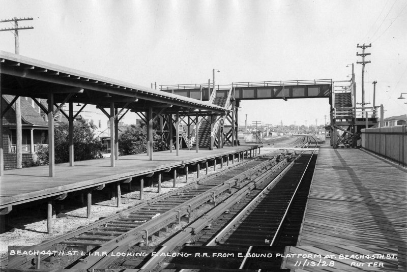 Frank Avenue station looking east towards Beach 44th Street. This was two years and three months before the middle track was abandoned. 11/13/1928
The Rockaway Peninsula, in Queens, was grade separated between 1940 and 1942
|
 Moving east of Frank Avenue station, Rutter came to the Beach 41st Street crossing. This is looking south, on the same day as above. Love the unpaved roads! 11/13/1928
|
|||||||||
| STRAITON AVE. (Beach 594th Street) | |||||||||||
 Straiton Ave. station 1955 Archive: Brad Phillips |
|
||||||||||
| ARVERNE (Beach 67th Street) | |||||||||||
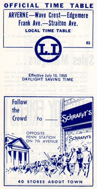 Timetable back Arverne 7-/18/1955 featuring the Schrafft's Ice Cream chain Archive: Brad Phillips |
 This view of the Arverne, Gaston Ave. station is looking west c. 1915. Note the cantilevered twin semaphore signals in the background. The island platform services two of the three tracks passing through this station. This center track was removed in the early 1930s. (Dave Keller data)
|
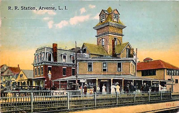
 The station building at Arverne, Gaston Ave. is shown here looking northeast c. 1915. Arverne got its name from the land developer there whose name was "R. Verne." Due to a dispute early on, a second "Arverne" station was opened at Straiton Ave. Note the ubiquitous warning sign on the mid-track fence advising of the active third rail. (Dave Keller data)
|
|||||||||


.jpg)
.jpg)


.jpg)


