 Fishing and the LIRR
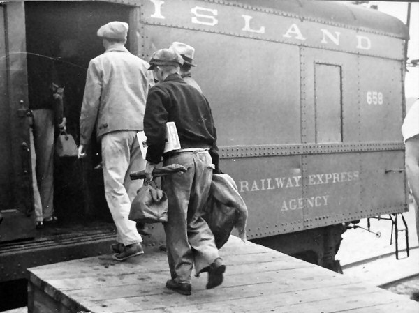
"These trains gained popularity early on because of the great idea of being able to go out all day on a fishing journey. A popular stop was Canoe Place on the east side of Shinnecock Canal. The Fisherman's Special left Pennsylvania Station in Manhattan and Jamaica in Queens early in the morning and, after making the Canoe Place stop, ran express to Montauk where fishermen would catch their boats and spend the rest of the day fishing. The LIRR offered a special accommodation on the return trip by icing the fishermen's catches in large containers in a designated Railway Express Agency car. The Fisherman's Specials were very popular and ran into the 1950s when they ceased operation." Info: Dave Keller
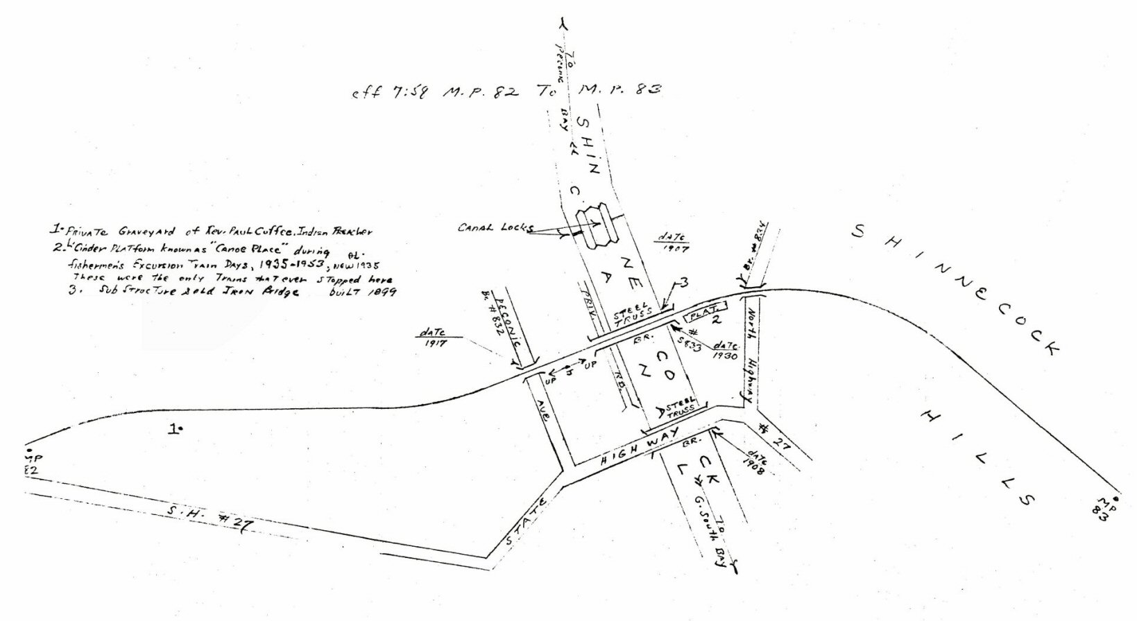
Emery map - Montauk Branch MP82-83 7/1959 Archive:
Dave Keller
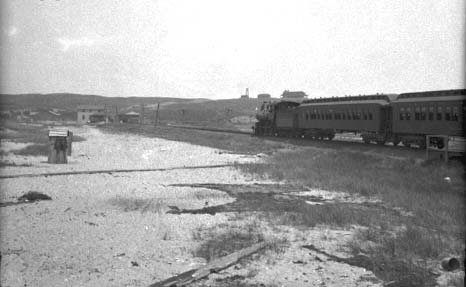
CANOE PLACE: Low cinder platform stop on southeast side of Shinnecock Canal. 1935-1953 for “Fisherman’s Special” trains.
While the station was located between Hampton Bays
and Suffolk Downs, to be more specific, it was located a short hop, skip and
jump east of the "K4 Bridge" over the Shinnecock Canal, south side of the
tracks, east of the bridge.
Research: Dave Keller
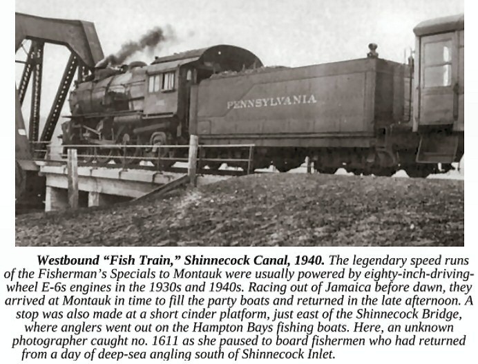
LIRR #1611 E-6s 4-4-2 "Fish Train" westbound at Shinnecock Canal 1940
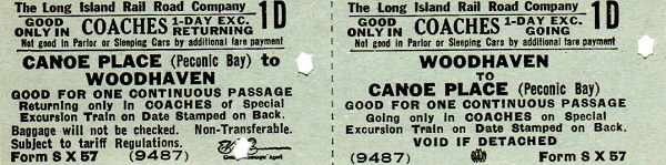
Canoe Place Excursion Ticket
 .
.
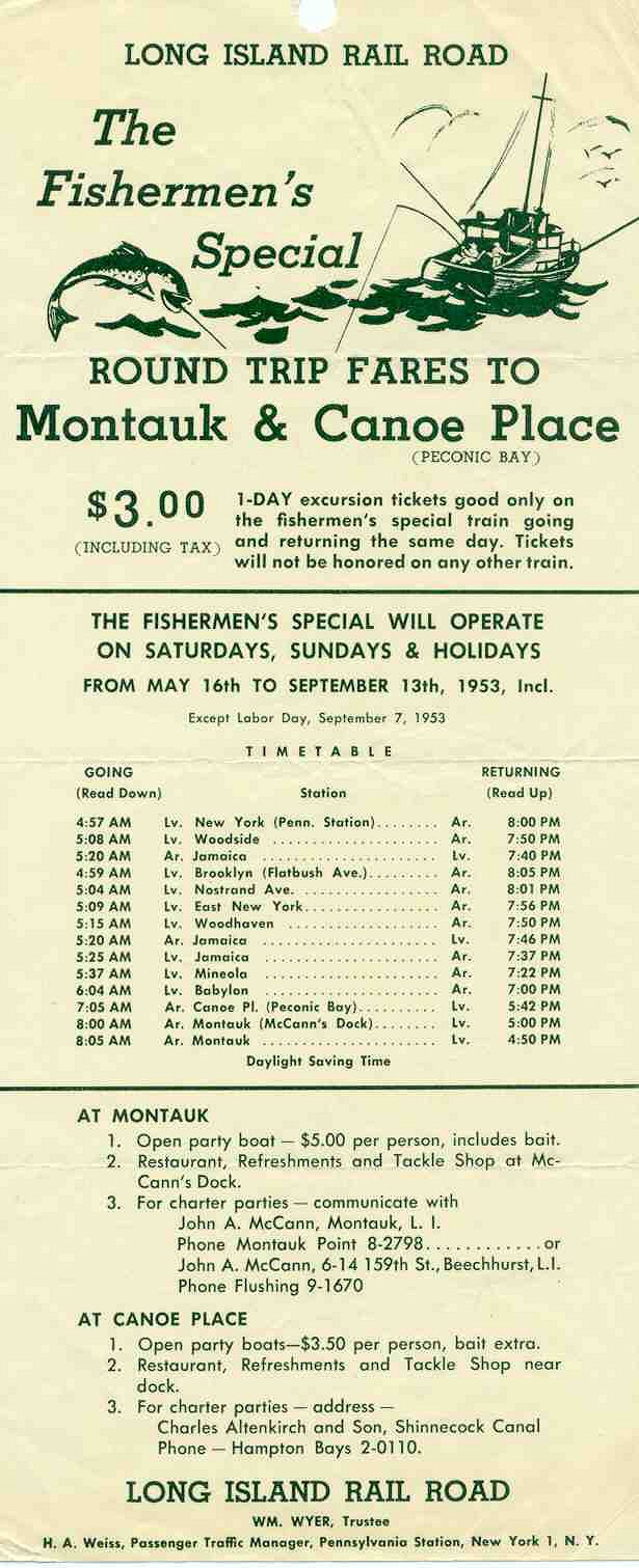
Fishermen's Special timetable 1953 Archive: Art Huneke
The
white flag special with wooden parlor cars headed into the old Montauk
station, with partial platform for the
fishing station stop visible
at the far right. This view is c. 1910. The old one-story depot
had an upstairs added in 1907.
Info: Dave Keller
Montauk return to Penn Station from fishing
excursion
c.1930s Photo: Rudolph Hoffman
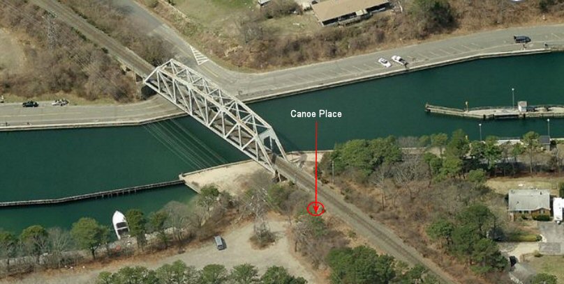
Previous approximate location of low cinder platform stop on southeast side of
Shinnecock Canal for 1935-1953
“Fisherman’s Special” trains. View is NW 2014
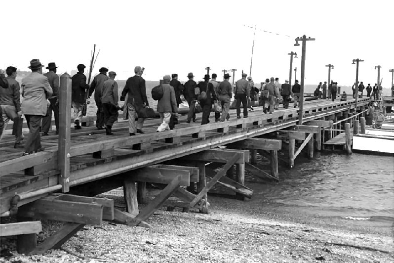
Montauk excursion fishing pier c.1930's
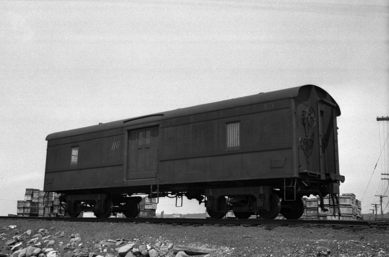
"Fish Car" baggage car #670 with ice bunkers at
Montauk 1935 Archive: Queens Public Library
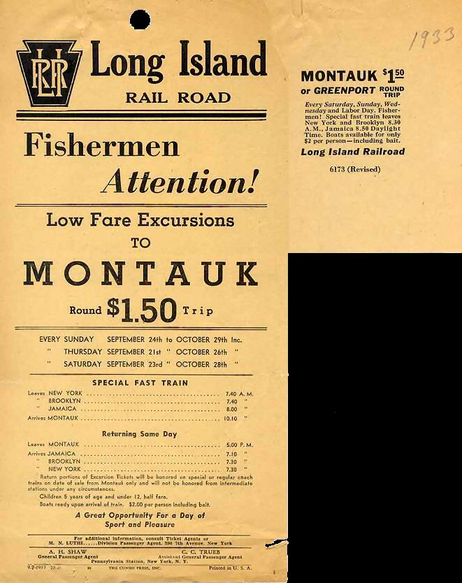
Fishermen's timetable to Montauk 1933
Archive: Art Huneke
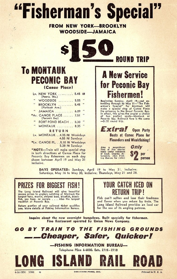
Fisherman timetable 1936 Archive: Art Huneke
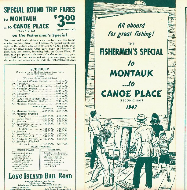
Fishermen's timetable 1947 Archive: Art Huneke
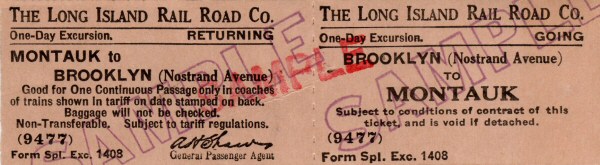
Montauk to Brooklyn Excursion sample ticket
Archive: Brad Phillips
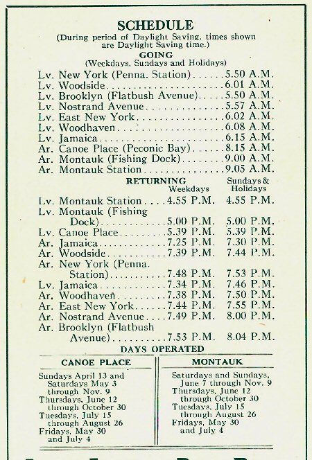
Fisherman Schedule 1947 Archive: Art Huneke
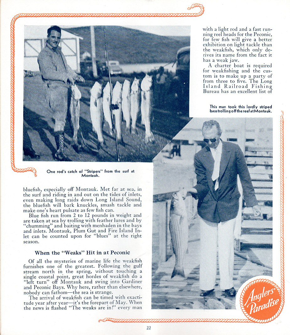
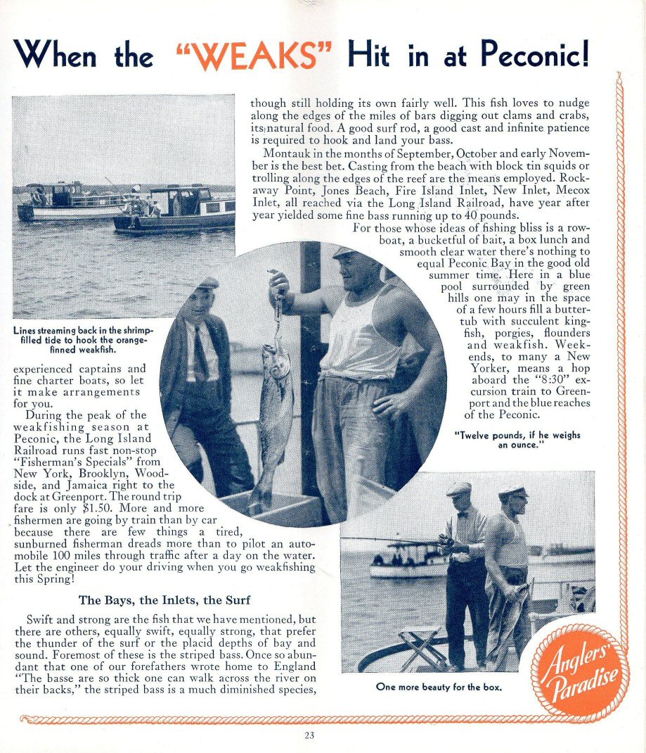
LIRR Peconic Fishing Story in LI Brochure page 1
Archive: Brad Phillips
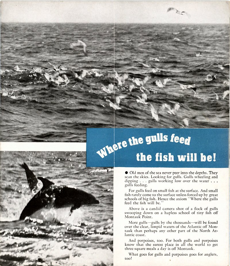
LIRR Peconic Fishing Story in LI Brochure page 2
Archive: Brad Phillips
Although the branch was extended from Bridgehampton to Montauk in 1895, Amagansett was the terminal with very few trains running the full route to Montauk. It wasn't until March 18, 1929 (34 years after opening the branch extension) that Amagansett was no officially longer considered a terminal and all trains went to Montauk. Info: Dave Keller
This 1898 excursion ticket from Amagansett to Montauk was perhaps an early fishing special. Archive/Info: Brad Phillips

Greenport/Montauk timetable -Salt Water Fishing 1934

Montauk timetable -Fishing at Montauk and Peconic Bay 1937
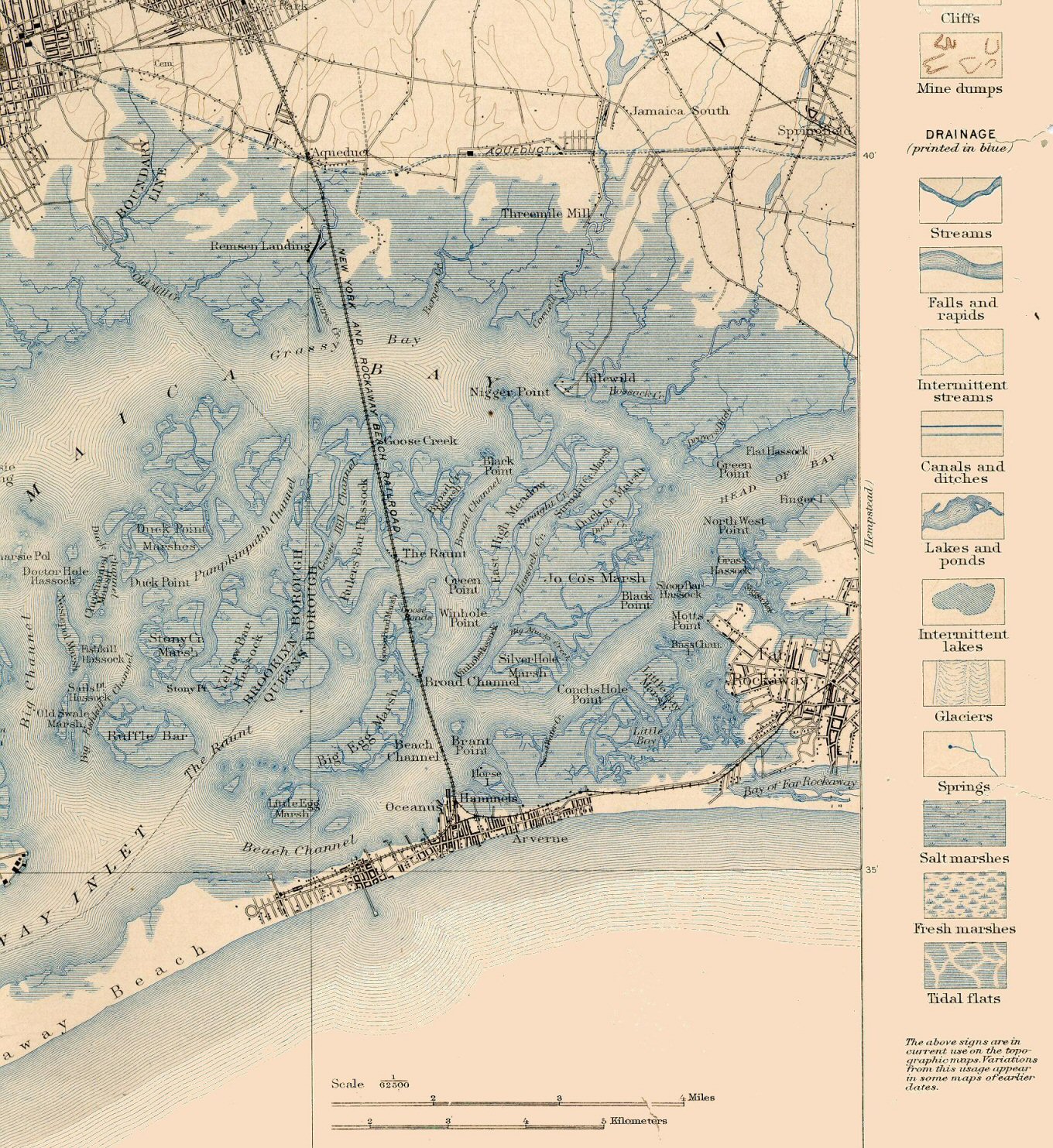
USGS 1898 Jamaica Bay map 1898
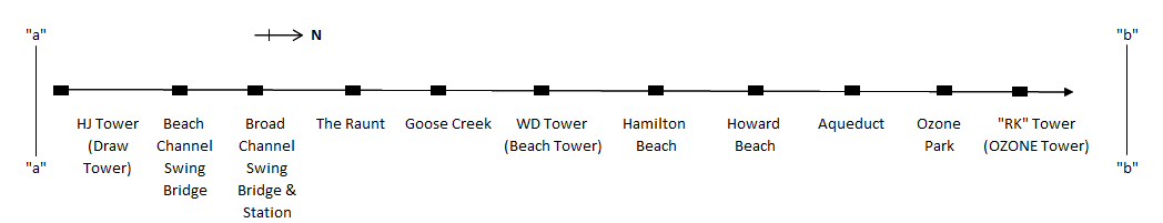
HJ Tower (Draw Tower) north across Jamaica Bay to RK
Tower (OZONE Tower) Design: Steven Lynch
I don't believe "Fishermen's Specials" were specific to station stops along the Rockaway Beach Branch. Just a scheduled MU train (with no express car to carry the fish on ice) stopping at the station and fishermen getting on/ off with his rod and reel and a bag to carry his catch.
GOOSE CREEK: Opened 1912 Closed: 9/1935
Excerpts from "The Other Islands of New York City" by Sharon Seitz & Stuart Miller
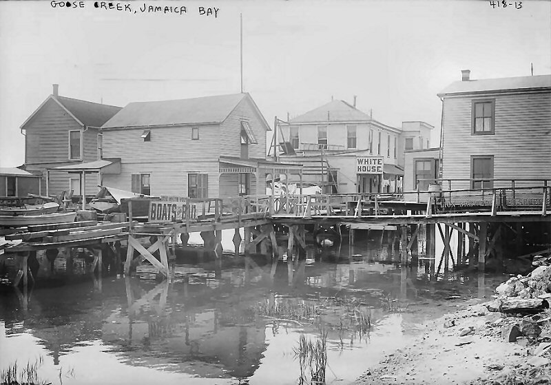 Goose Creek train stop and homes. Archive: Library of Congress
"The Bay's fishing tradition prospered after the Civil War, when ferries carried vacationers from Canarsie, Brooklyn to beaches on the nearby Rockaway Peninsula.
The bay islands remained sparsely populated until 1880, when the New York, Woodhaven, and Rockaway Railroad erected a 4.8-mile-long wooden trestle across Jamaica Bay. The line, which connected mainland Queens to Rockaway, made four stops: Goose Creek, The Raunt, Broad Channel, and Beach Channel, and accommodated far more passengers than the ferries. Within four years, as many as eighty-seven crowded trains chugged through the Jamaica Bay islands each summer day.
The route was sold in 1887 to the Long Island Railroad, and by 1895, the trains carried a million and a half passengers. In 1902, three and a half million fun-seekers rode the line. Rail transportation put Jamaica Bay on the map. Tiny fishing shacks, boathouses, fishing clubs, and small hotels-many built on stilts-rose near the railroad trestle.
In 1906, an estimated four hundred fifty thousand tons of oysters and clams, valued at $2 million, were harvested from the bay. The Jamaica Bay islands were a homesteader's paradise during the late nineteenth century. The town of Jamaica had jurisdiction, but did not exercise title or collect taxes, encouraging squatters to settle there."
Broad Channel is the largest island in the bay and the only one that remains inhabited. In the 1950's NY Parks commissioner Robert Moses razed the settlements on The Raunt and Goose Creek to create the Jamaica Bay Wildlife Refuge. Moses struck a deal with the NYC Transit Authority to replace the old wooden trestle that had been plagued by fires for decades with a new subway trestle and bridge. The dredging and landfill required to build the new track also created a single island with two fresh water ponds for the newly designated refuge.
THE RAUNT: Open: 1900 Out of service: 5/23/50 with abandonment of Jamaica Bay trestle after fire of 1950 G.O. #1728, Effective: 5/23/50: "The Raunt Station and station facilities, out of service." Info: Dave Keller
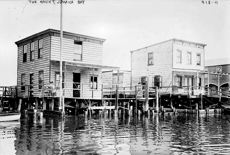 The Raunt at the turn of the century showing a shack
on stilts and some of the wooden walkways connecting the houses to the
railroad. Very easy to get off the train and fish off these walkways.
The Raunt at the turn of the century showing a shack
on stilts and some of the wooden walkways connecting the houses to the
railroad. Very easy to get off the train and fish off these walkways.
RAUNT HISTORY: from The Rockaway Museum by Emil Lucev, Curator Dedicated To The Memory Of Leon S. Locke
The Raunt bay colony takes it’s name from the Raunt Channel, which runs diagonally (southwest to northeast) through the marshes of Jamaica Bay. The Raunt Channel surrounds the Raunt community on three sides (north, east and south) and a narrow/shallow creek on the west side made the Raunt a marsh island in itself. There are a couple of other origins for the name of the Raunt Channel that are worth making note of.
Scandinavian fisherman fished the waters of our Jamaica Bay in the New York areas early years, as well as the Dutch, English and Native Americans. Many Bay Locale names can be traced to Scandinavian origins. The Danish word “rogen,” pronounced “raun” translates to fish roe, and this part of the bay was a spawning ground for lots of fish. But where did the “t” come from?
The Swedish word “rund” pronounced “runt” is the one that I favor. Webster’s Swedish Dictionary defines “rund” as around/in and around/here, there and everywhere. Before the landfill for the bird sanctuary by the “Pharoah” Robert Moses, one could get anywhere in the bay via Raunt Channel.
After the railroad over the bay opened, squatters put up fishing stations and boat rental floats on both sides of the trestle at the Raunt. The railroad didn’t seem to care as more riders meant revenue. Anglers getting off at the Raunt steadily increased during the first seven years. The LIRR, which now owned the bay railroad, decided to put up a station in 1888. A section of the right of way, 300’ x 48’, was leased to Christopher Murr or Muir and Elbert J. Kaltenbach, both of New York City, for ten years. The lease stipulated that these men would build a station and platform, and a large fishing station. This they did and the LIRR put the stop on its timetable. The first bona fide leases at the Raunt were issued to James S. Williamson and Michael Hahn or Hann. These gentlemen were neighbors at the Raunt at the southwest corner alongside the trestle. The Raunt Station was on the southwest side opposite Williamson and Hann.
In 1894 a listing for the Raunt told of the Patterson Fishing Club, Hann’s Liquors, Hann’s Boats and Phil Schappert’s Boats.
In 1900, Flynn’s establishment was pulled out by winter ice, and the Co-Operative Society/Bay Trolley schemers were issuing eviction notices for people on their right of way. They issued a few leases to William Gralz of New York and the Dolphin Club. In 1902 the society issued leases to Richard Shoemaker of New York, at Swift Creek (west of the station), next to Cooper and Colbert. Mary V. Meeteer took over the Hann operation at the station. At the same time about fourteen leases were said to have been issued by the City Docks Department, shortly thereafter the trolley project died and the city had full control over the bay. Two years later, a James Jordan built a home, and two years after that, a huge fire almost destroyed the Raunt.
Lost to the fire were Schwind’s Hotel, Vigilant Yacht Club, Liberty Island Rod and Gun Club, and part of the trestle.
Rebuilding started as soon as possible, and by 1907 there were 16 structures at the Raunt, and this soared to 88 and then 100 leases at the exclusive Raunt Colony.
Later in 1915, the Raunt Marsh was leased to Pierre Noel, and all residents had to now sign on with Noel’s Broad Channel Corporation.
When Crossbay Road opened in 1926, the Raunt lost exclusive status; the place could now be reached by a road from Crossbay and a footbridge.
The colony suffered a great loss by fire in 1931, and by 1938 only one hundred people were recorded on a census.
As the mid-1950’s approached, only fifteen structures were left, and the area was razed for the west pond of the Bird Sanctuary built in the area (R.I.P).
The Raunt view N 1933 Archive: Dave Keller
The Raunt view S Archive: Dave Keller
.jpg)
MU train nearing The Raunt view S 7/27/1947
Photo: Edward Hermanns Archive: Dave Keller
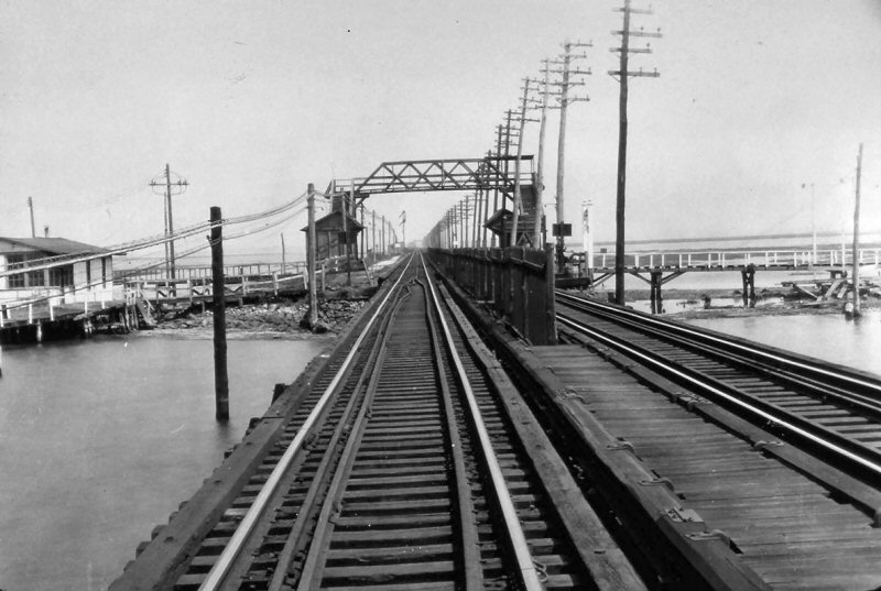
BROAD CHANNEL: Depot opened 1900, Wooden shelter sheds built: 1921, 1923. Out of service: 5/23/1950 per G.O. #1728 with abandonment of Jamaica Bay Trestle after fire of 1950
.jpg)
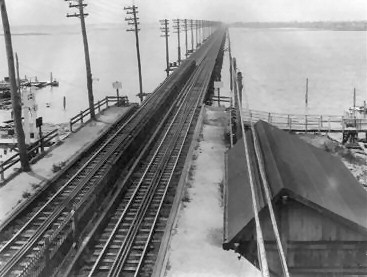
An MU train is northbound, approaching the Broad Channel station on July 27, 1947.
In this view south, we see quite a few fishermen on the wooden platform in the
right background. Photo: Edward Hermanns Archive/Info: Dave Keller
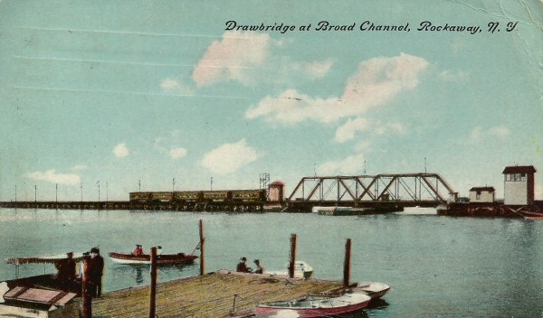
Drawbridge at Broad Channel postcard c.1905
Archive: Brad Phillips
.jpg)
D53 Camelbacks and trains passing on Broad Channel Swing Bridge c. 1900 Archive: Dave Keller
.jpg)
A rare and very old LIRR valuation photo of the Broad Channel station and station area looking south on August 3, 1914. The ticket office and waiting room appear to be housed in the first floor of the hotel at the left as evidenced by the bay window and scattered chairs. (LIRR valuation photo, Dave Keller archive and data)
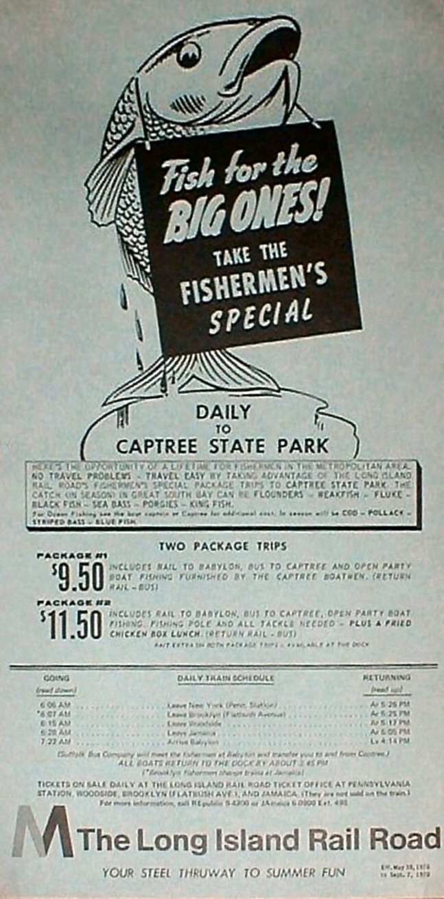
Fisherman's Special Fare Flyer - May 28th thru September 7th, 1970
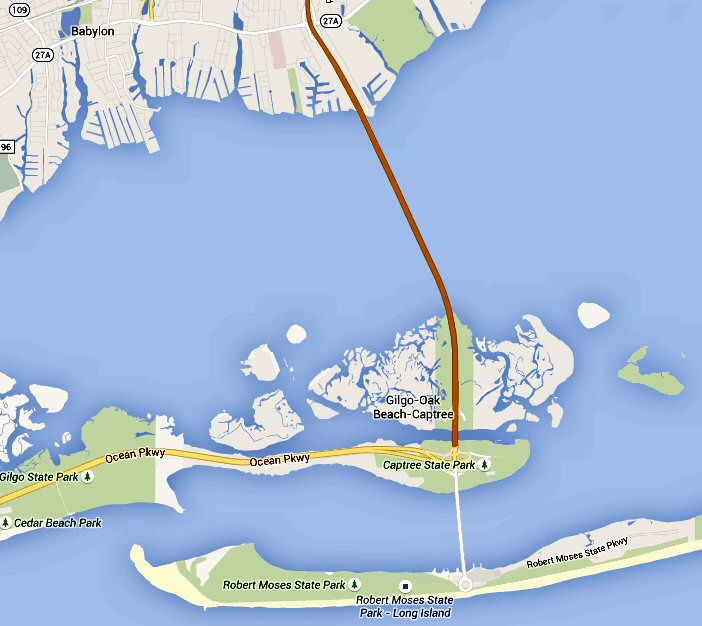
Home to the largest public fishing fleet on Long Island, Captree State Park is a fishing haven and a picnicker's delight, located on the eastern tip of Jones Island at the end of the Ocean Parkway. Open and charter boats are available for saltwater fishing. No license or equipment is necessary as the boat staff provides everything you'll need for a day on the Great South Bay or the Atlantic Ocean.
If you are unfamiliar with that Park,
its main function is to serve as one of the largest places on the Island
(save perhaps Montauk) to grab a "party" boat to go fish. Also a
great spot for crabbing and fishing off a dock. Just watch the tide, it just
whips through there except at slack water. The only way I could think of is
that the LIRR offered a package to go to Babylon and then a bus to Captree.
The Fish trains were once a big deal, a very early express train to go out
East to drop off fishermen. A box car loaded with ice was provided for the
trip home for the angler and his catch. Must have been a fun train for the
CAMs (Car Appearance Maintainer = Coach Cleaner) to clean back in Richmond Hill. I didn't know they also made a stop at
Canoe Place (seen from your page), that's great. Once a fantastic place for
fish such as Winter Flounder and Weakfish (Sea Trout), and a easier walk
than what you find at Montauk. I believe before the hurricane of 1938 (LI
Express), the bulk of the fleet docked near the older station in the area
called Navy Dock, so picking up the party boats was much easier then.
Unfortunately, the fishing is a pale shadow of what it once was, but at the
time it must have been great to have an express train take you out there and
then a short walk to the fleet. Still some interesting fishing out there,
including some great fresh water fishing a short walk away (don't mind the
blue-green algea). The fleet now lies in present day Montauk Harbor near
Gosman's and the main surf fishing is nearly 10 miles at the Point, so
taking the train now isn't as attractive as it used to be. Unless you're
sitting in the usual traffic on Rt. 27, which is almost enough at times to
brave the Hipster parade and unruly teens from the Boardy Barn found today. Submittal:
Anonymous
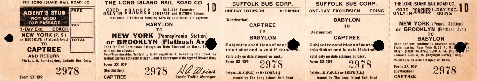
Fisherman's Ticket - New York to Babylon, Suffolk Bus Corp. to Captree and return. Form: SX 109 pre-1964 Archive: Brad Phillips
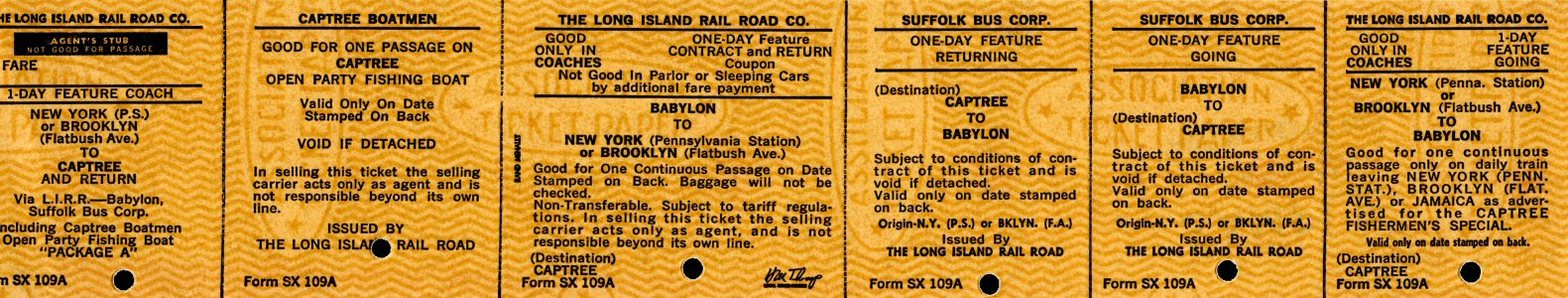
Fisherman's Ticket - NY Penn Station to Babylon, Suffolk Bus Corp. to Captree and return. "Open Party Fishing Boat" Form: SX 109A 1964+ Archive: Brad Phillips
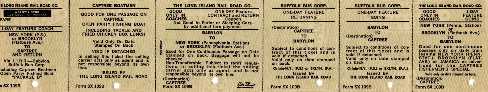
Fisherman's Ticket - NY Penn Station to Captree SX-109B 1964+ Archive: Brad Phillips
 Opened: Sometime after 1903 for employees of neighboring fish processing plants.
It appears as a signal stop in special instructions of ETT #27: 6/25/1903.
Appears with a station designation of "S110" in 1903, 1913 and 1924
CR4 books and listed in train schedule of ETT #49: 9/09/1908. (Art Huneke data).
Listed in train schedule of ETT of November, 1910. Shelter shed constructed: c. 1918 or earlier.
Appears on LIRR 1918 valuation map as "frame passenger" structure (R. Makse data).
Appears as flag stop in schedule pages of ETT #106: 5/1927. Robert Emery states
station razed: 12/5/27 and station stop discontinued, however ETT #107: 12/26/27 lists station stop in schedule pages, but no stops indicated. no
longer indicated in ETT #108: 5/23/28 (Art Huneke data)
Opened: Sometime after 1903 for employees of neighboring fish processing plants.
It appears as a signal stop in special instructions of ETT #27: 6/25/1903.
Appears with a station designation of "S110" in 1903, 1913 and 1924
CR4 books and listed in train schedule of ETT #49: 9/09/1908. (Art Huneke data).
Listed in train schedule of ETT of November, 1910. Shelter shed constructed: c. 1918 or earlier.
Appears on LIRR 1918 valuation map as "frame passenger" structure (R. Makse data).
Appears as flag stop in schedule pages of ETT #106: 5/1927. Robert Emery states
station razed: 12/5/27 and station stop discontinued, however ETT #107: 12/26/27 lists station stop in schedule pages, but no stops indicated. no
longer indicated in ETT #108: 5/23/28 (Art Huneke data)