|
|
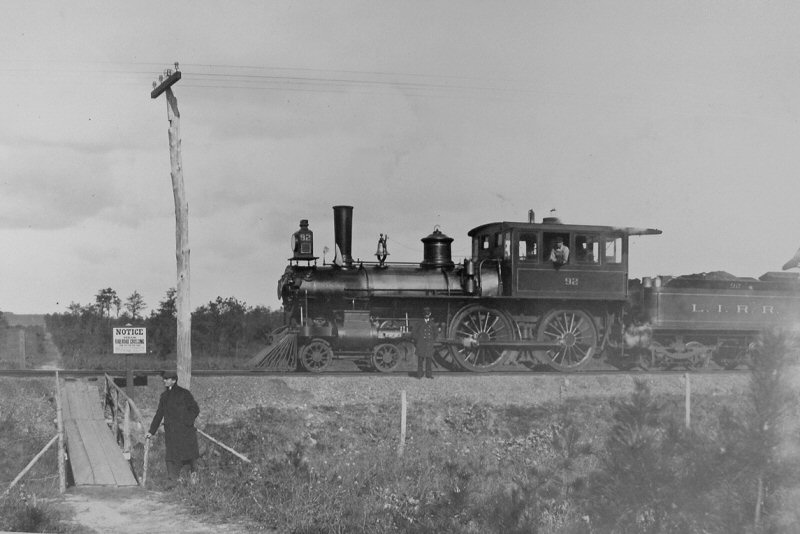
This 1897 view looking north shows a westbound Atlantic-type (4-4-0) locomotive #92 with oversized cab stopped at the north/south bicycle path crossing of the LIRR’s Main Line between Holtsville and Medford. The bike path ran from Patchogue on the south shore, around Bald Hill in the hamlet of Farmingville and on through Coram into Port Jefferson on Long Island’s north shore. (Harold Fullerton photo, Robert M. Emery collection courtesy of SUNY @ Stony Brook)
|
|
|
|
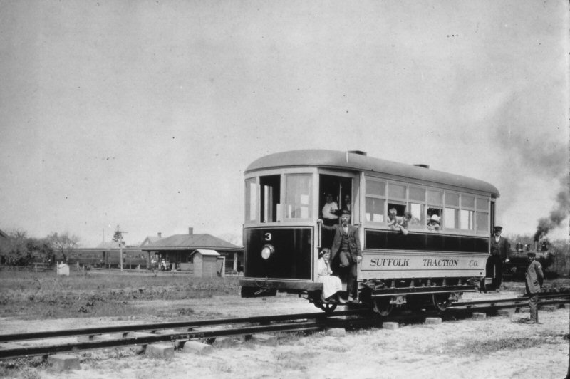
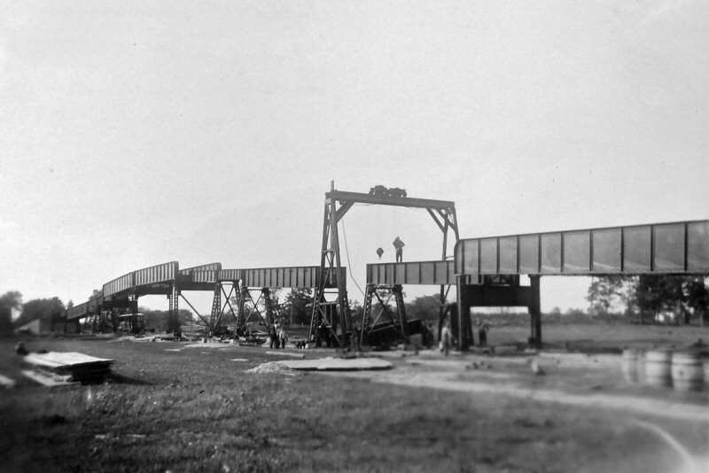
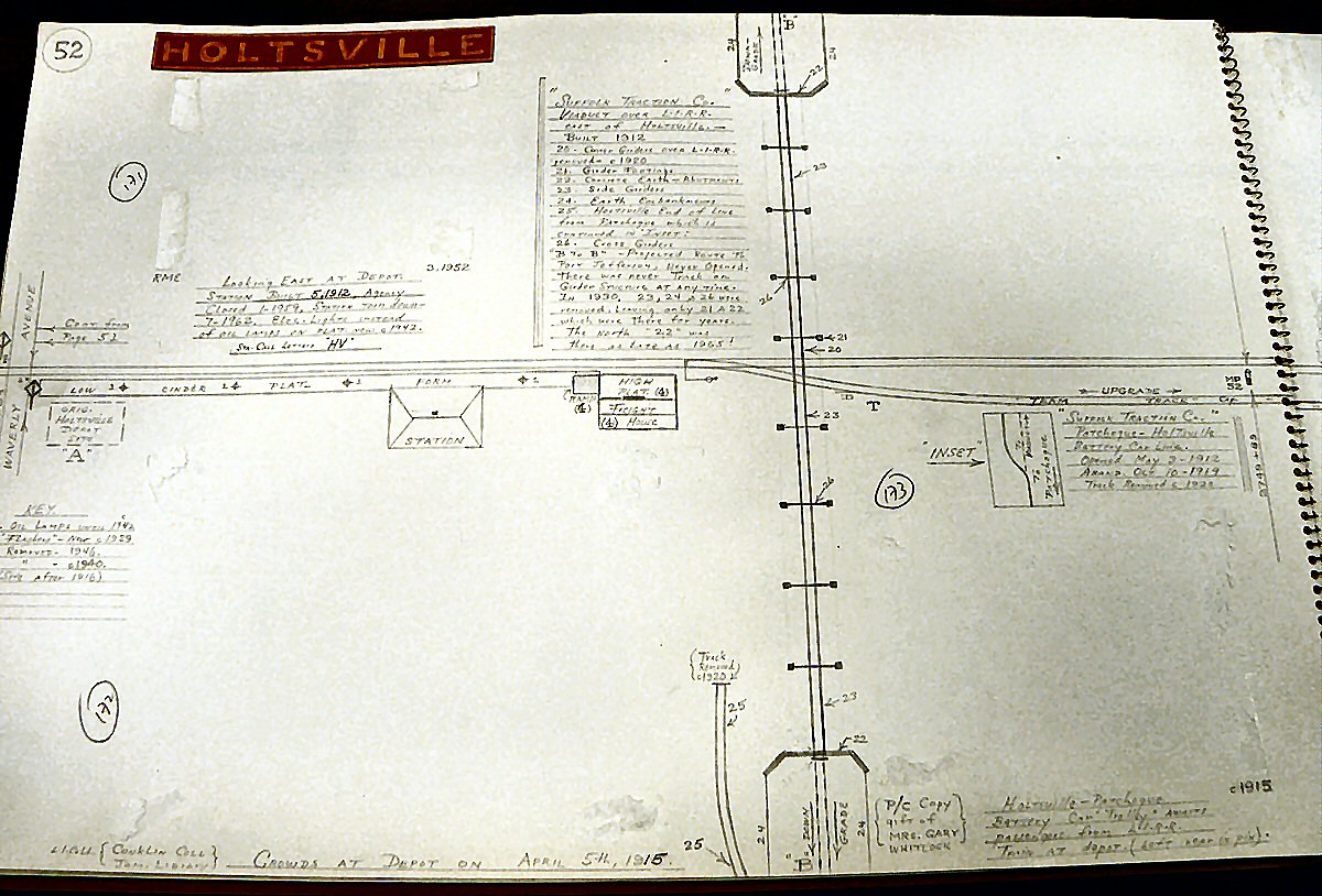
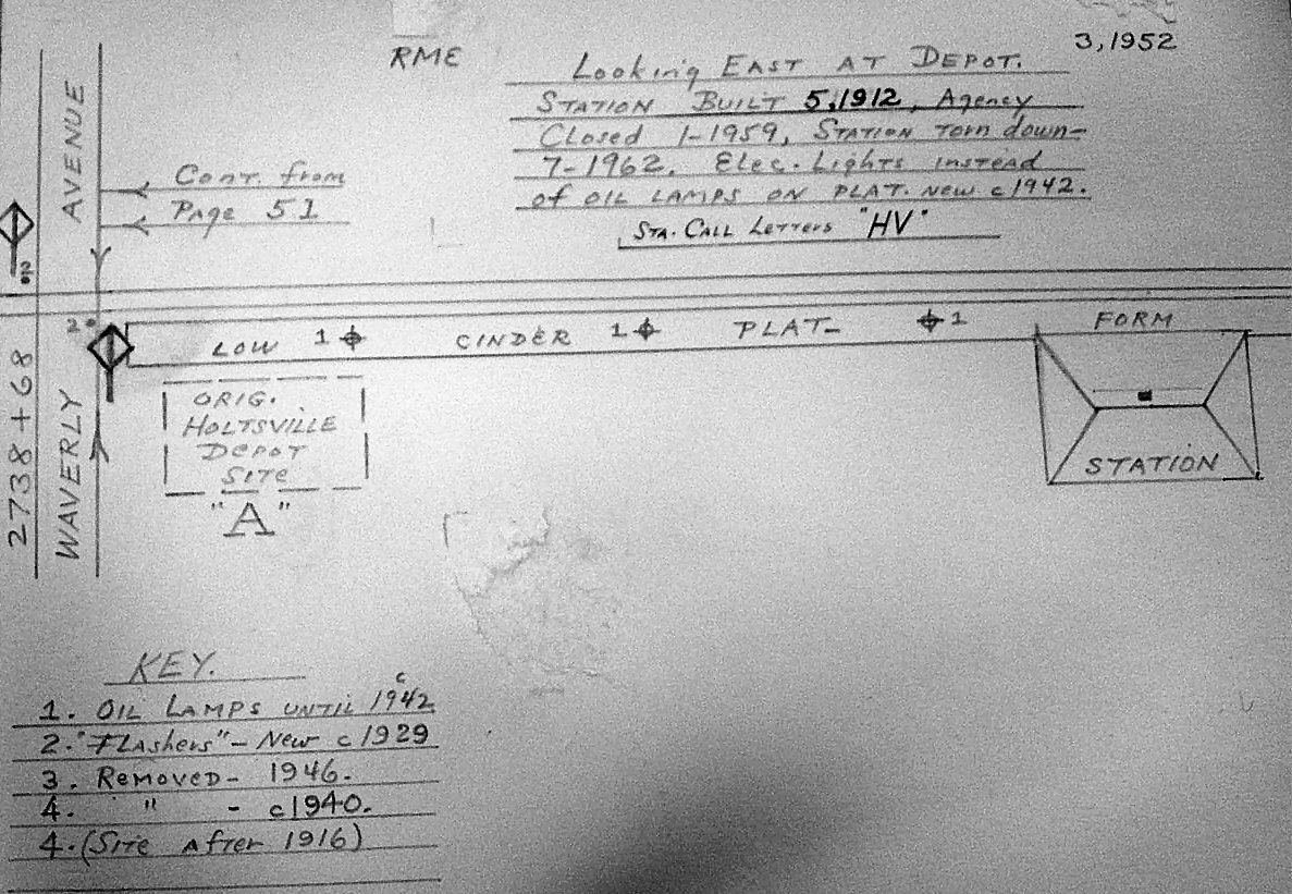
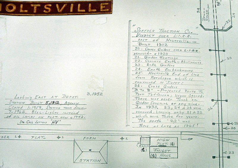
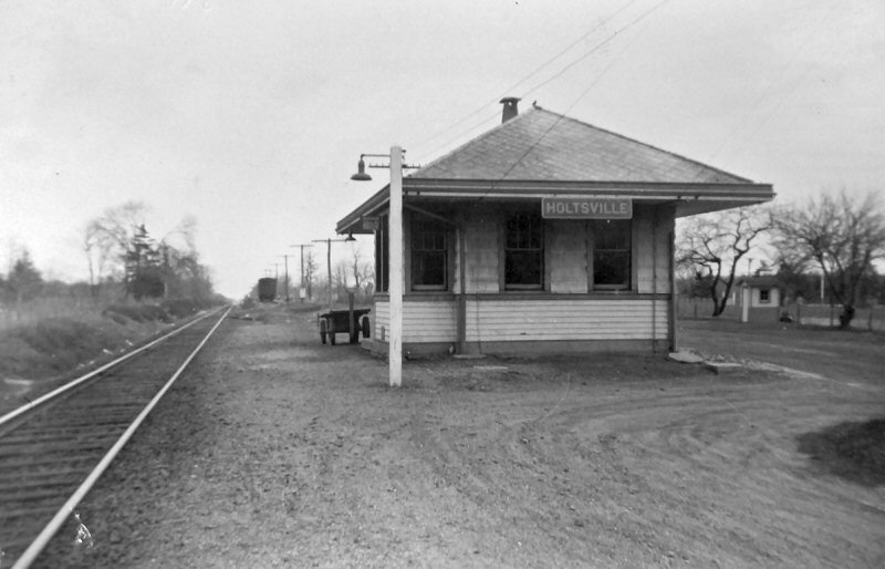
This 1912 view looking northeast shows the 1912 construction of the Suffolk Traction Company’s steel trestle over the LIRR’s Main Line just east of the depot at Holtsville. The lines four storage battery cars ran from the foot of Patchogue dock to Main Street, where the line branched west to Blue Point and north past Canaan Lake along Traction Blvd. until it entered the woods on a private right of way (PROW), heading in a northeasterly direction towards Holtsville station. The line was intended to extend over the trestle at Holtsville and on to Port Jefferson but, although the right of way was graded as far as north of Farm-to-Market Road, track was never laid and the trestle was never used. It remained in place in its entirety until the girders over the LIRR’s Main Line were removed c. 1920. The rest of the structure remained until 1930 when all but two stanchions, one concrete and one steel, were demolished. The steel stanchion disappeared over time, perhaps during the scrap metal drives of WWII, but the concrete stanchion just south of Long Island Avenue and opposite Woodland Avenue remained in place on private property as late as the late 1980s when your writer moved to sunny Florida. (Dave Keller archive) |
|
|
|
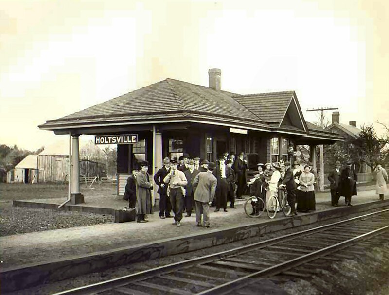
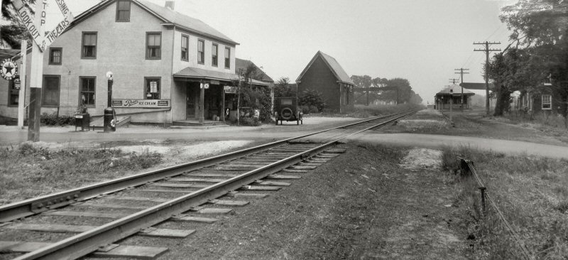
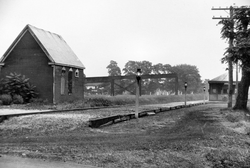
This c. 1925 view looking northeast from Waverly Avenue shows the old platforms and Dietz kerosene platform lamps in place. These lamps remained in use until c. 1942 when they were replaced by electric lights on poles. The traction company trestle is still visible in the center background with the depot in the right background. The structure at the left on the north side of the tracks was not a railroad structure. (Photo courtesy of the Robert M. Emery collection – SUNY @ Stony Brook)
|
|
|
|
|
|
|
|
|
 General Joseph Holt 18th Postmaster General 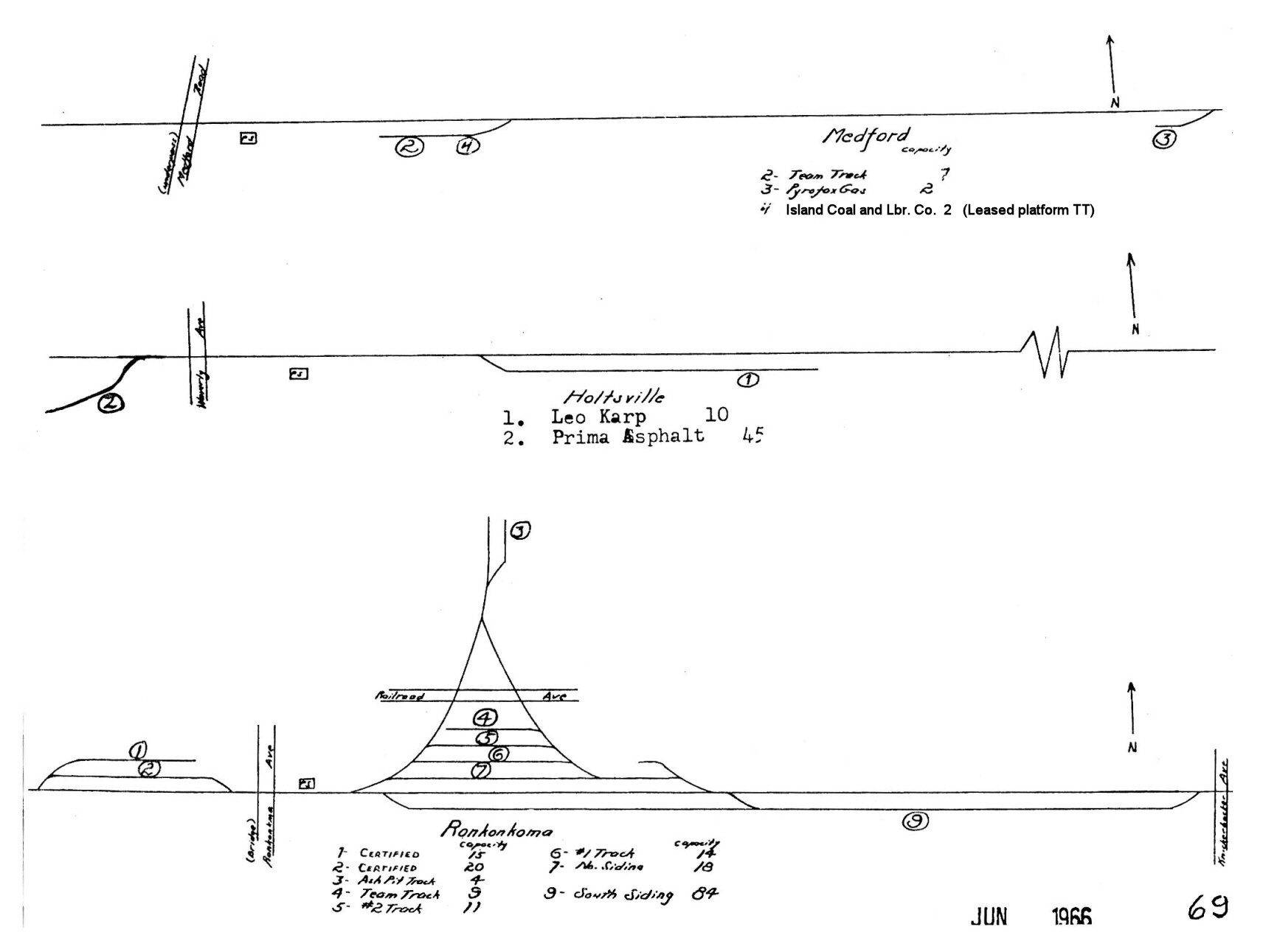 LIRR 1966 Holtsville track map - page 69 |
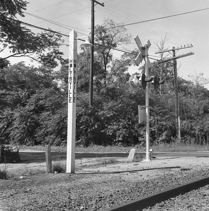 A view of one of the electric platform lights with “integrated” station sign for Holtsville. This view from August, 1971 is looking southwest and shows the crushed cinder platform, and the entrance to the station grounds. The crossing is Waverly Avenue. (Dave Keller photo and archive) |
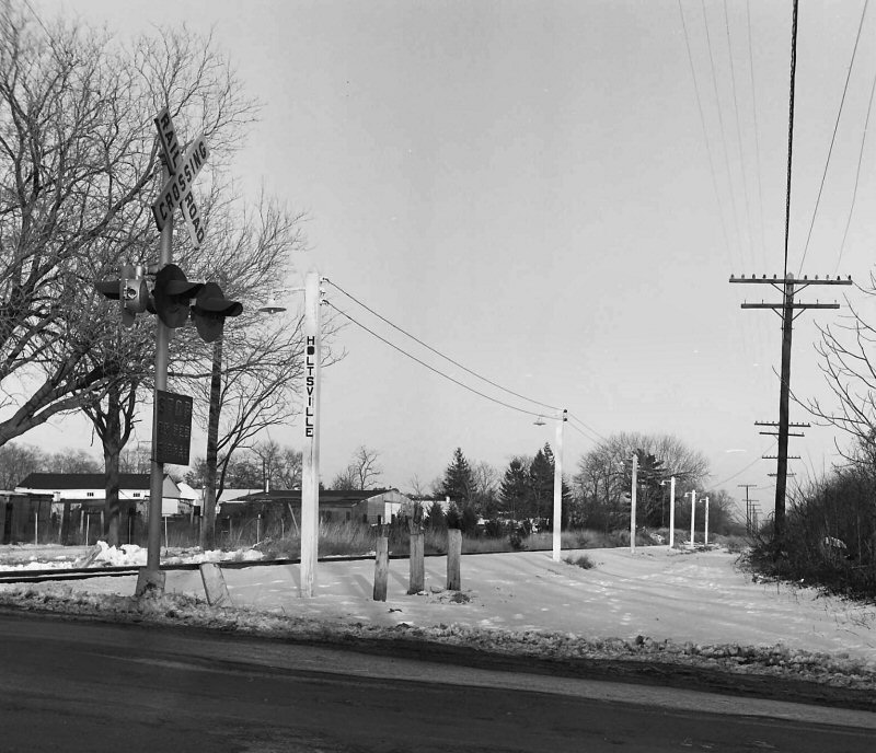 Holtsville station, February, 1972. View is looking northeast showing the station area and electric platform lights. A metal shelter shed had been erected after the depot building was razed but the shed was later removed. Waverly Avenue crossing is in the foreground. No tire tracks in the snow indicates the business of this little station stop, which use was discontinued on March 16, 1998 (Dave Keller photo and archive) |
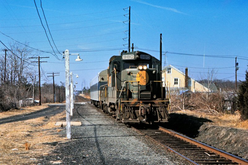 Train #204 with PNC #980 at Holtsville 3/10/1977 - Photo/Archive: Richard Makse |
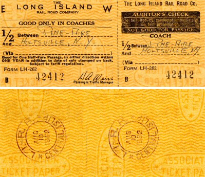 Ticket Pine Aire to Holtsville - Central Islip Dater Die 8/10/62 Archive: Brad Phillips |
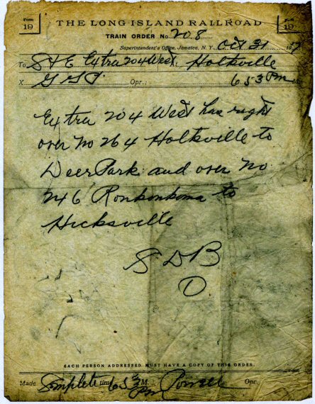 |
Form 19
train order #208 issued at “HV” block station on October 31, 1917.
Employee timetables list the block office as “HV” but at that
time, the block office name was spelled out in full, i.e.
“Holtsville.” This order was made complete by block operator
G. G. Powell at 6;53 pm, indicating that there were two tricks (shifts)
of block operators on duty at what actually was a very slow, country
station but for WWI underway at the time and Camp Upton further east on
the Main Line in service. Troop trains were coming and going at
this point in time, making Holtsville a busy place for the handling of
through trains. “Extra #204 west” referred to class D16b
(4-4-0) locomotive #204, while numbers 264 and 246 referred to scheduled
eastbound trains. |
 Holtsville map - Railpace March 2022 |
||
|
|
||
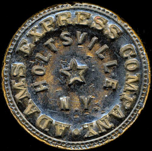
| HOLTSVILLE WAX SEALERS | ||
|
Cash remittances were made by the
railroad for ticket sales and express charges. Two wax sealers
were used at a ticket agency: one marked "Long Island Rail
Road" or "L.I.R.R." with the station identification
number on the sealer (the number matched the closest milepost marker to
the station) and another marked with the name of the express agency in
service at the time along with the station name. This wax sealer
was used at the Holtsville station along the LIRR's Main Line at a time
when the Adams Express Company was the firm contracted by the LIRR to
carry their express. The Adams Express Company became the American
Railway Express Company in 1918 and the ticket agency was closed at
Holtsville in January, 1959. REMITTANCES: |
|
| All captioning/data is per Dave Keller unless indicated | ||
05/08/2025
%20Agent%20M.%20E.%20Bloomer%20-%20View%20SE%20-c.%201880.jpg)
.jpg)
.jpg)