Meurer's Siding - Long Island City |
|||||||||||||||||||||||||||||||||||||||||||||||||||||||||
|
Switching Yard A for the LI City Area: The Degnon Construction Co. constructed warehouses along 47th Ave and created Degnon Terminal c.1919, with rail access to each. Additionally, other terminals in the area were built at this time (Kearny, Meurer, Harold Ave, Arch Street, etc.). As this would cause too much congestion in the North Shore Yard (Yard A), freights for east end destinations were sent to Jamaica to be re-classified. Yard A classified trains for numerous switch jobs in
the Long Island City area and freight bound for east of Jamaica.
Additional freight was
made up in Yard A and transferred to Fresh Pond for New Haven interchange
and local switching jobs in that area. This all began with barge
freight unloaded from float bridges in Long Island City which received
cars from many railroads in the area. In other words New York
Harbor, in itself, was like a huge classification yard. Info:
J. J. Earl |
|||||||||||||||||||||||||||||||||||||||||||||||||||||||||
|
Meurer Steel Barrel dates from likely the 1905-1910 era. It had facilities in Brooklyn and Newark, NJ with General Offices in New York City. The Meurer's track appears on a 1916 valuation map and was already an established track at that time. Richard Makse
|
 Emery maps Meurer's Siding 9/1958 Annotations: Steven Lynch |
||||||||||||||||||||||||||||||||||||||||||||||||||||||||
 Meurer's Siding area - Emery map 9/1958 Archive: Dave Keller |
 Meurer's Siding east end - Emery map inset 9/1958 Annotations: Steven Lynch |
Legend:
Meurer's Siding East End 1958 32. Metropolitan
Refining Co. |
|||||||||||||||||||||||||||||||||||||||||||||||||||||||
|
In an an unknown year, the track was extended to the
footbridge, (the actual footbridge in 1946; I mention it here
as a landmark west of Hunterspoint Avenue (HPA), and in 1939 to F
Tower creating a direct route from Wheelspur via LI City to Loop 1, one of
several ways the LIRR interchanged with the PRR in the past. The
car wash was added in 1940. I don't recall when the wash was closed, but it was
certainly active through the 1960's for LIRR trains only. Meurer's Siding labeled as the previous 3rd St. siding. Renumbering
to 51st Ave. occurred early in the 20th Century.
|
|||||||||||||||||||||||||||||||||||||||||||||||||||||||||
 Meurer's Siding area - Emery map 9/1958 Archive: Dave Keller |
 Meurer's Siding west end - Emery map inset 9/1958 Annotations: Steven Lynch |
Legend: Meurer's Siding
West End 1958 2 Crossing watchman
controlled gates at "A" |
|||||||||||||||||||||||||||||||||||||||||||||||||||||||
|
|
|||||||||||||||||||||||||||||||||||||||||||||||||||||||||
|
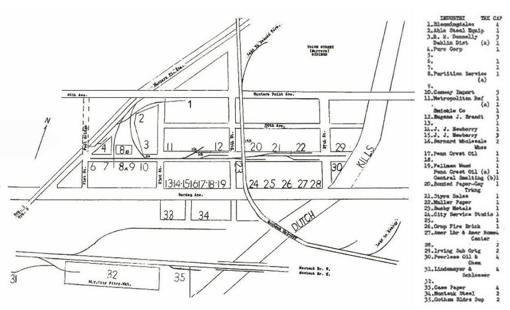
LIRR 1966 MAP - MEURER'S SIDING INDUSTRIES & TRACK CAPACITIES |
|||||||||||||||||||||||||||||||||||||||||||||||||||||||||
|
|||||||||||||||||||||||||||||||||||||||||||||||||||||||||
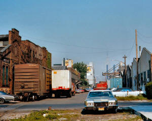
-6141974-RichardMakse_small.jpg) Conway Oil on Meurer's Siding. The view is west looking along 51st Avenue, ex-3rd Street, on June 14, 1974. The "billboard" advertising space has long been aimed at drivers destined for the Queens Midtown Tunnel on the LIE. Info/Photo/Archive: Richard Makse |
 Further east on Meurer's Siding is Penn Crest Oil on June 14, 1974. One can still see in the far western distance the Empire State Building. Info/Photo/Archive: Richard Makse |
 June 14, 1974 at Meurer's Siding. Unless you hung around LI City way back then, you didn't know those long sidetracks with multiple consignees. All now long gone. This is 51st Avenue at 25th Street looking east. Note the eastbound smashboard on the Montauk Cutoff above. Info/Photo/Archive: Richard Makse |
|||||||||||||||||||||||||||||||||||||||||||||||||||||||
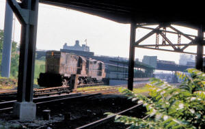
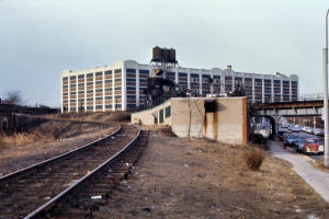
 Train #611 with BAR #219-#72 at Hunterspoint Avenue on June 14, 1976. The LIE is the overpass just west of Hunterspoint station. This photo faces in the east direction with the second overpass as 49th Ave in which is the access point downstairs to the Hunterspoint Station. The track in the foreground is the 3rd Street Siding. Note the wash buildings east of the Hunterspoint Avenue overgrade bridge. Info/Photo/Archive: Richard Makse |
 Bloomingdales Warehouse Cannonball C420 #203 and leased BAR GP7 #66 past Hunterspoint Station on August 24, 1973. View S. |
 Degnon Lead looking west. The bridge on the right side carries the Main Line Cutoff over Skillman Avenue. The turnouts for Degnon and the Main Line Cutoff were only a short distance apart off #2 Montauk Cutoff. The Degnon Terminal track paralleled Skillman for two blocks and then curved at Austell Place to run parallel to and on the south side of 47th.Avenue. 3/26/1974 Photo: Richard F. Makse |
|||||||||||||||||||||||||||||||||||||||||||||||||||||||
|
|
|||||||||||||||||||||||||||||||||||||||||||||||||||||||||
|
LIRR 1978 MAP - MEURER'S SIDING INDUSTRIES & TRACK CAPACITIES |
|||||||||||||||||||||||||||||||||||||||||||||||||||||||||
 |
|
||||||||||||||||||||||||||||||||||||||||||||||||||||||||
|
|
|||||||||||||||||||||||||||||||||||||||||||||||||||||||||
| LIRR 1986 MAP - MEURER'S SIDING INDUSTRIES & TRACK CAPACITIES | |||||||||||||||||||||||||||||||||||||||||||||||||||||||||
 |
|
||||||||||||||||||||||||||||||||||||||||||||||||||||||||


