|
|
|
|
|
||||||||||||||||||||||||||||
|
|
||||||||||||||||||||||||||||
|
|
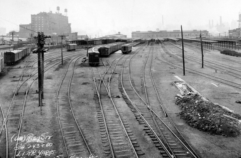
Business
began to drop off upon the opening of Penn Station and the East River
Tunnels in September of 1910. Passengers no longer needed to take
a ferry to access Manhattan, but could get to their destination without
the inconvenient change at Long Island City. As a result, the
importance of Long Island City as a terminal began to wane. Another blow
to the terminal was the opening of the new Jamaica station and LIRR
general offices in 1913. Both the general offices and the
dispatcher's office moved from the Long Island City terminal and were
relocated in the new Jamaica structure. Despite these blows, the
building remained in use for another 25 years. The
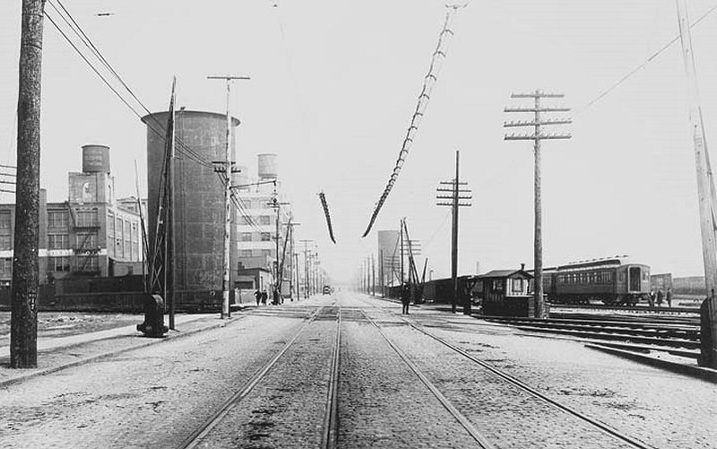
structure is already showing its age in the above image. The
wooden canopy overhang that ran the entire length of the building on the
track side to keep inclement weather away from the passengers is in a
dilapidated state and is showing disrepair. Some of the upstairs
windows appear to be broken, giving one the impression that the upstairs
portion was already abandoned, either completely or in part. At
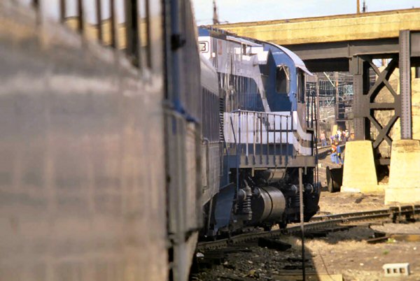
the far right are two Pullman parlor cars and in the background is the
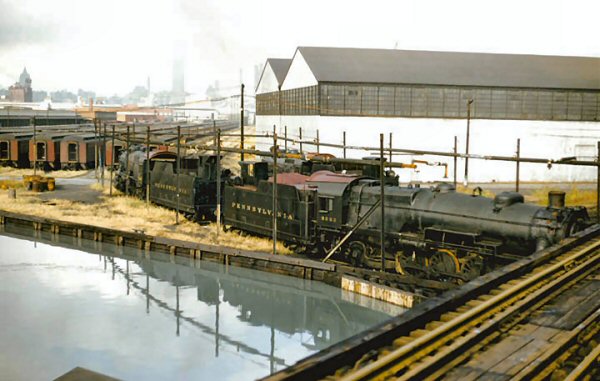
PRR's electric power plant. But the inevitable is on the horizon. The once-busy structure would be razed six years later during the construction of the Queens-Midtown tunnel. Photo: Percy Loomis Sperr Data/Archive: Dave Keller) |
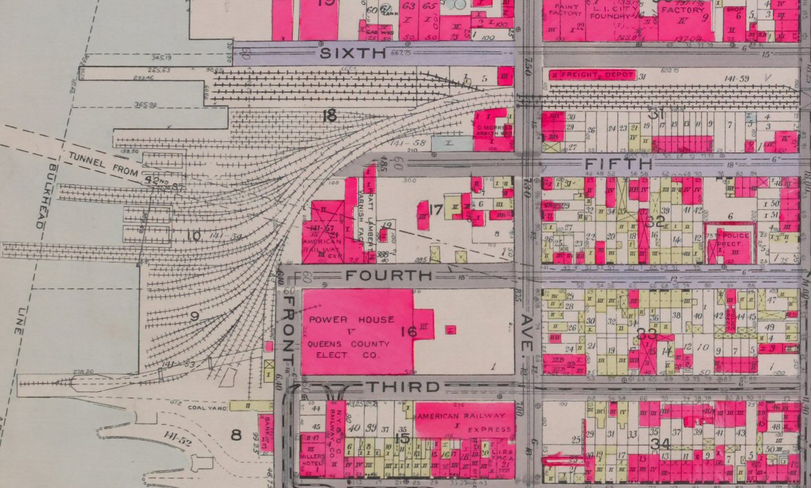
 PRR Power Station, at 51st Avenue, Hunters Point, NY
The Pennsylvania Railroad (PRR) Power Station at
51st Avenue in Hunters Point, NY, was built by the architectural firm
McKim, Mead, and White. Construction began in 1903 and was completed in
1909. Photo above 1910. 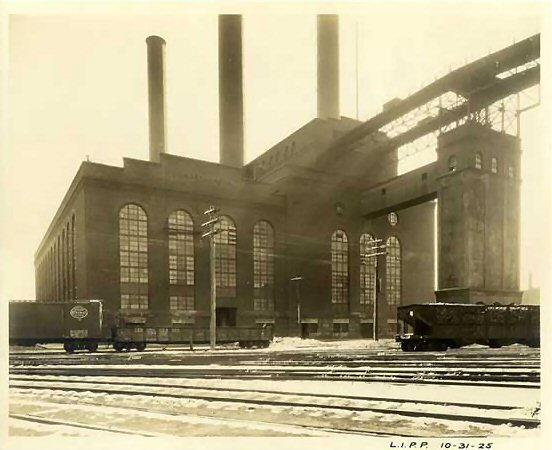 LI City PRR Power House 10/31/1925 view east from 2nd Ave Built
in 1905, as part of an enormous expansion and electrification project of
the Long Island Railroad and Pennsylvania Railroad, which culminated
with the completion |
||||||||||||||||||||||||||
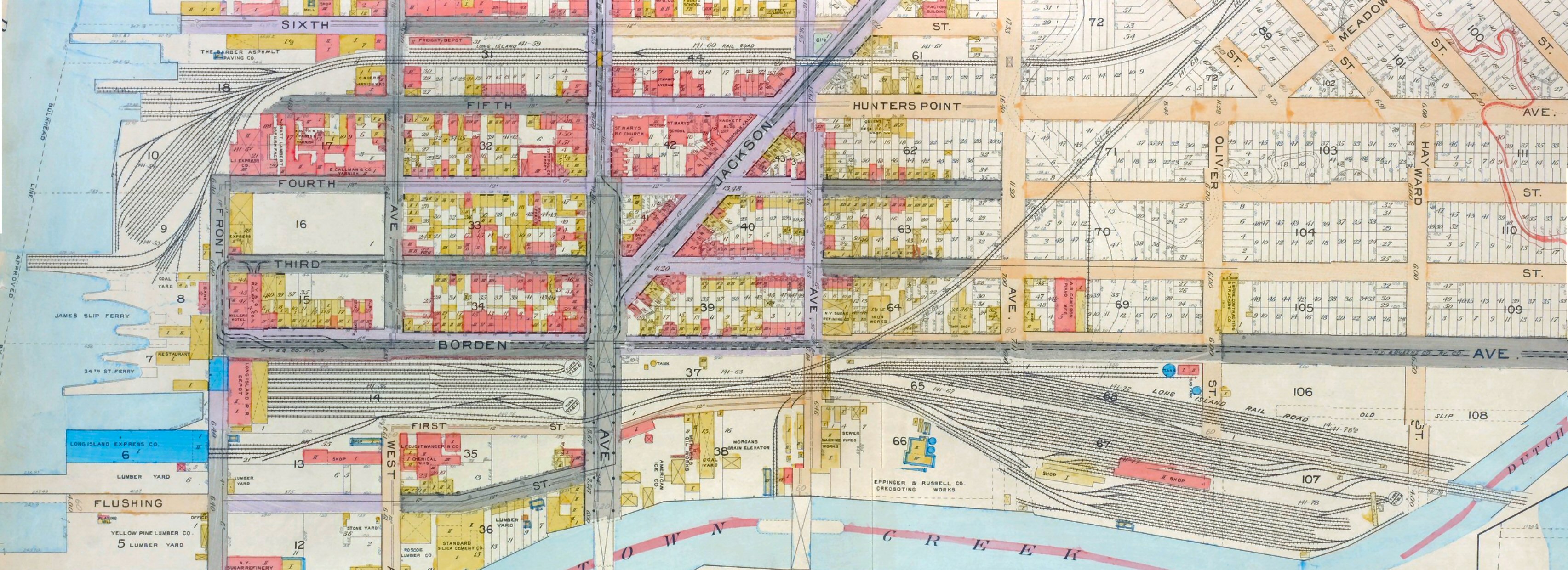
%20-%2011-03-30%20(Sperr-Keller).jpg) LIRR terminal building and former general offices- street-side view looking north at 54th Ave. along Front St. (2nd St.) towards Borden Ave. which is between the terminal building and the PRR powerhouse. The loop track is visible in the foreground - Long Island City, NY - 11/03/1930 (Percy Loomis Sperr photo, Dave Keller archive) |
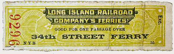
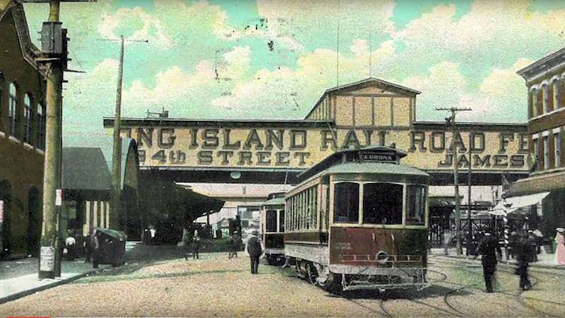 LI City Station view W c.1905 colorized postcard. Before 1910, there were no East River tunnels to Manhattan. LIRR commuters had to take a train to Long Island City and board a ferry for a half hour ride to 34th St. or James St. |
.jpg) Overall NW view of the LI City terminal building with PRR Railroad passenger cars in the yard just 2 years prior to demolition. 10/25/1936 (Percy Loomis Sperr photo/Dave Keller archive) |
||||||||||||||||||||||||||
 DD1 pinstriped in World's Fair 1939-40 - Long Island Expressway (LIE) Midtown Tunnel toll plaza construction 1939 - View NW - Source: eBay |
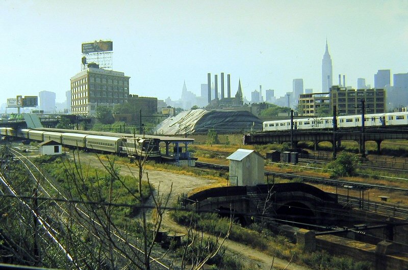
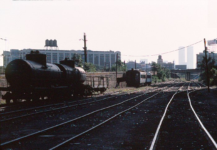
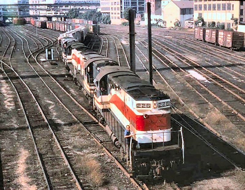
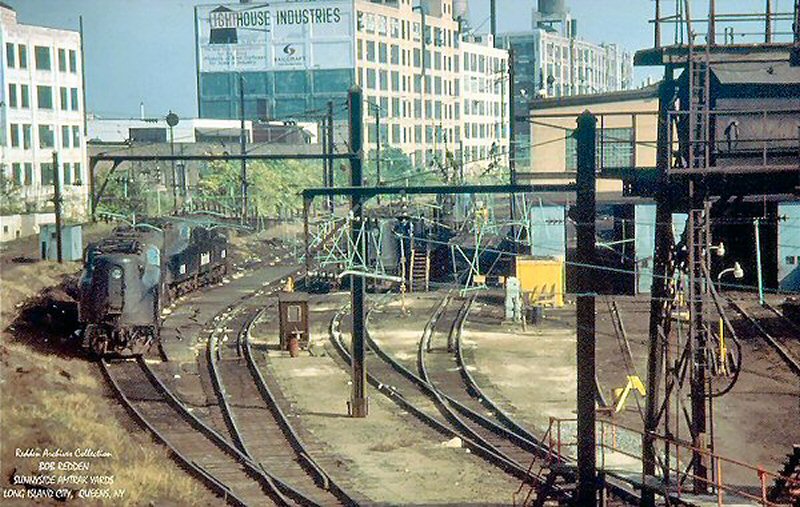
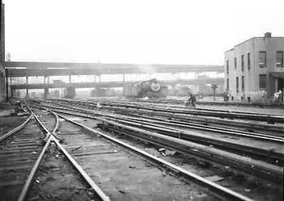
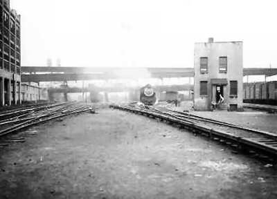
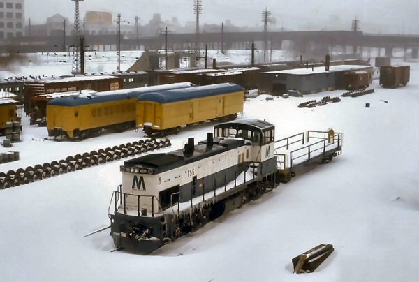
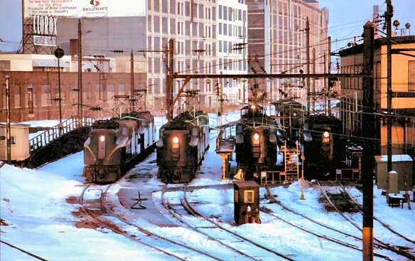
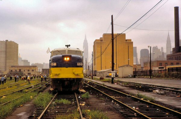
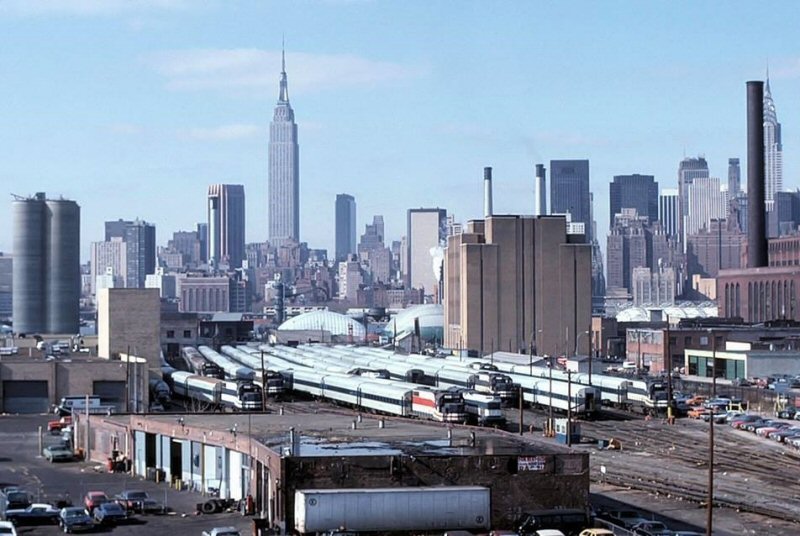
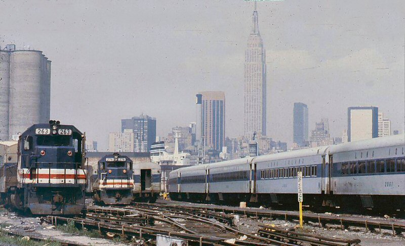
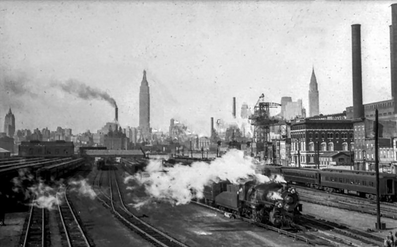 LI City Passenger Yard - View W c.1940 |
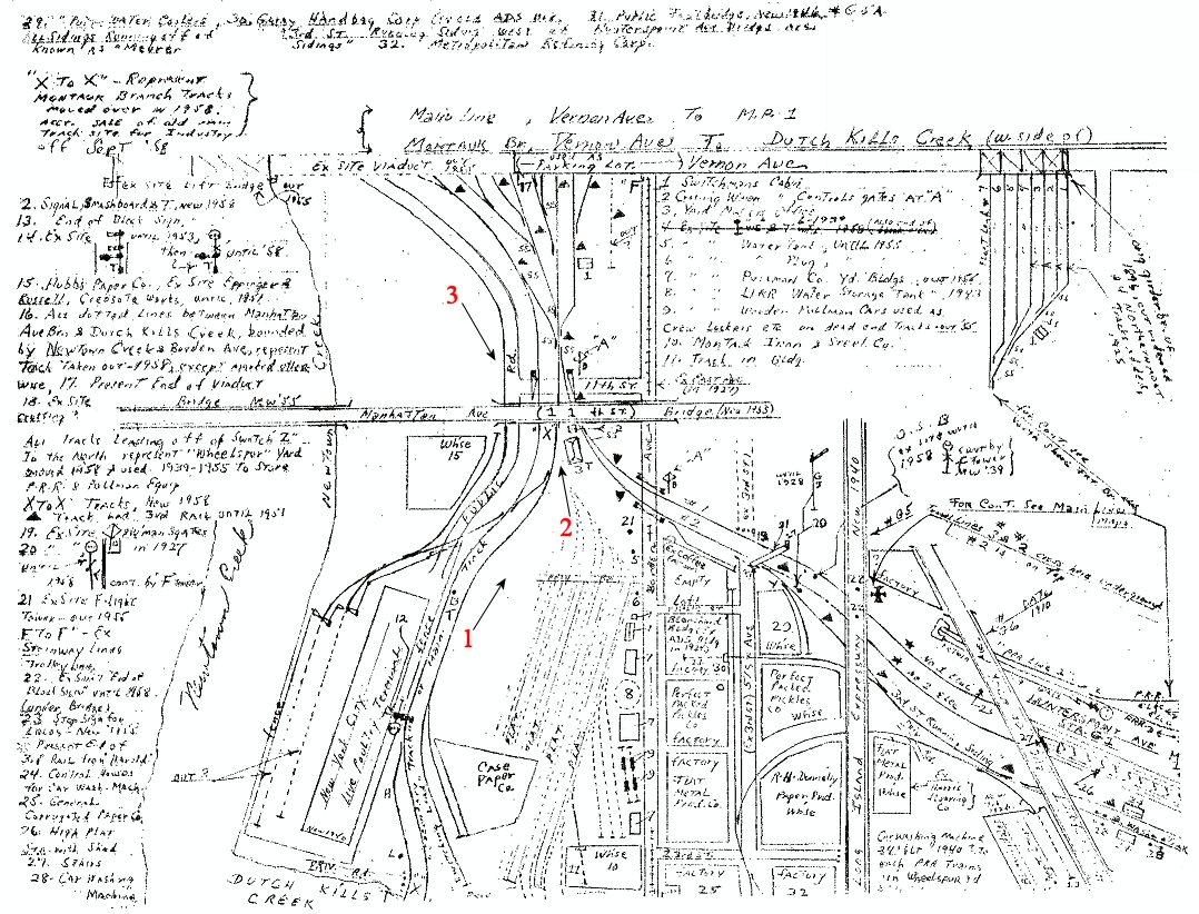
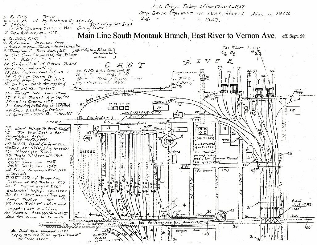 Emery map - LI City East River to Vernon Ave. 9/1958 Archive: Dave Keller |
||||||||||||||||||||||||||
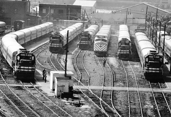
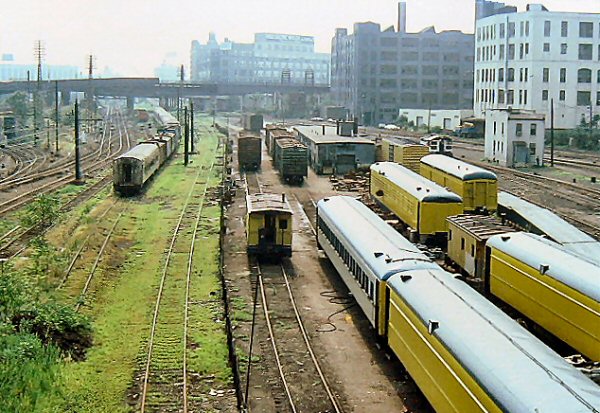
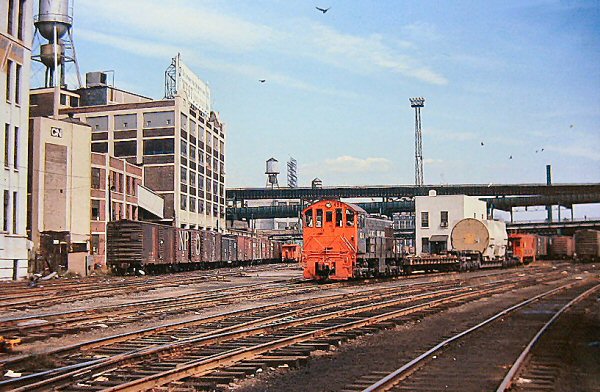
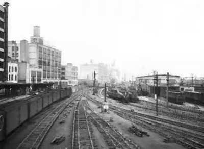
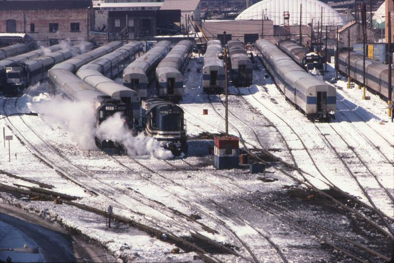
 LI City Passenger Yard - 1/29/1974 Photo/Archive: Richard Makse |
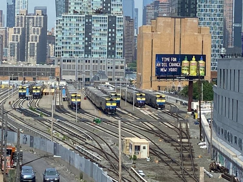
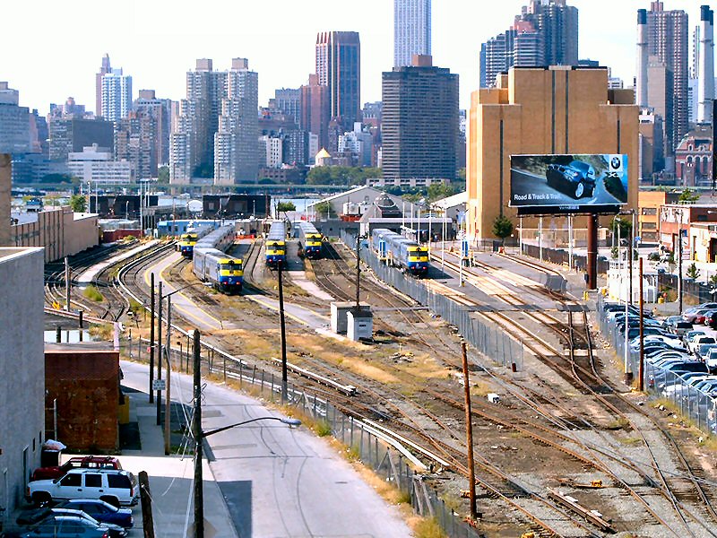
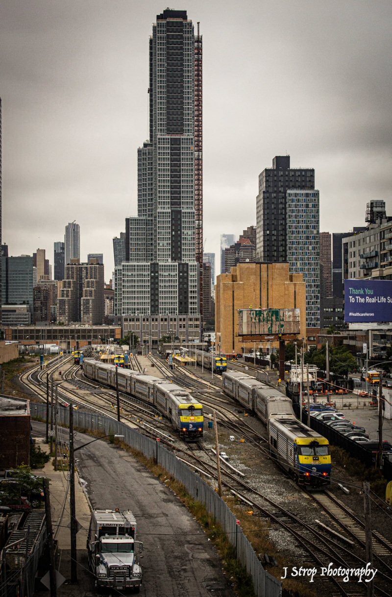
LI City View W from the Pulaski Bridge 1989 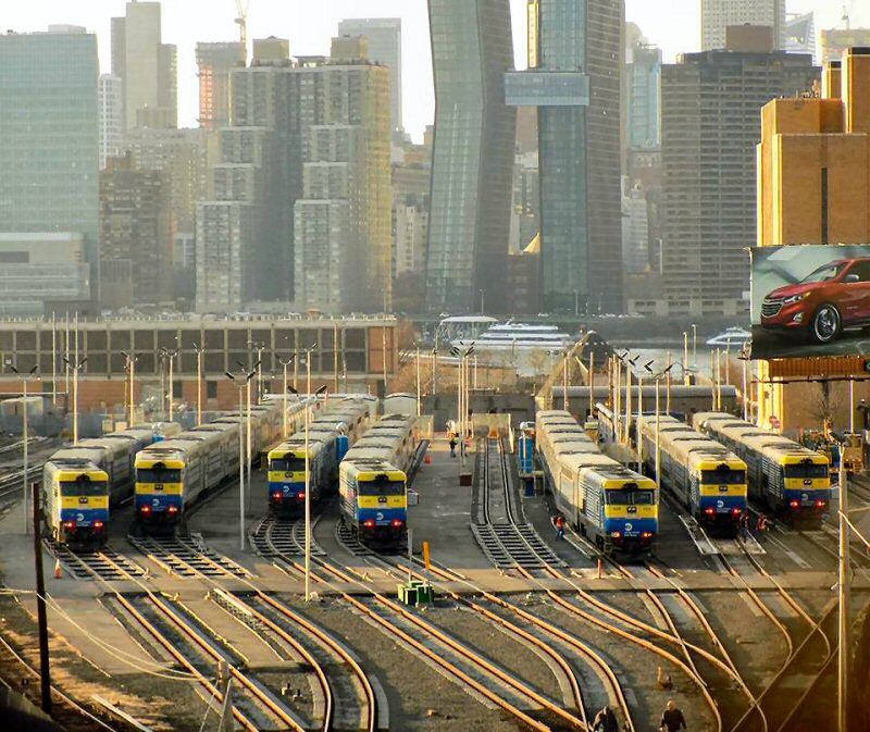 LI City Passenger Yard View W from the Pulaski Bridge 12/19/2017 - Photo: Angel Benitz |
|
||||||||||||||||||||||||||
|
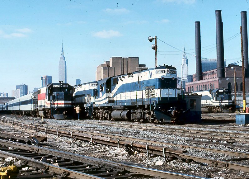
Still some steam heat coaches, which would not go away for another 13 months, the last being the 4:34 Hunterspoint to Port Jeff. Not all P72 had been converted to "electric heat" as stenciled near the doors, indicating their running heat off their diesel gen sets, and not all MP72 had yet been converted to push pull, hence some B&M coaches remained until March 1979. Joe Versaggi
|
|
|
||||||||||||||||||||||||||
 Hurricane Sandy Oct. 29, 2012 - LI City Rail Yard perimeter flood wall construction - 6/10/2026 View W - Photo/Archive: John McCluskey |
||||||||||||||||||||||||||||
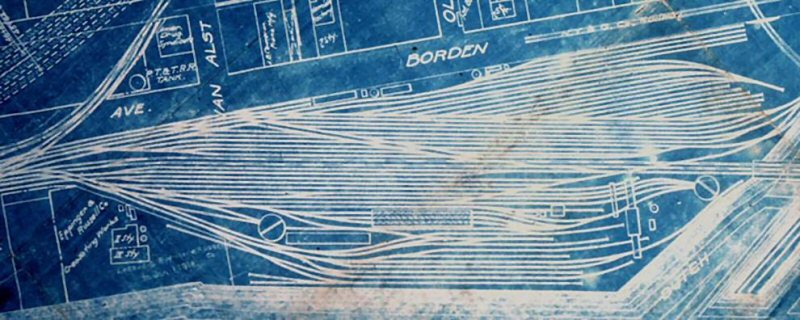
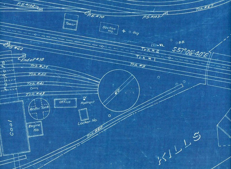
| LI City - Borden Ave | ||||||||||||||||||||||||||||
|
|
|
|||||||||||||||||||||||||||
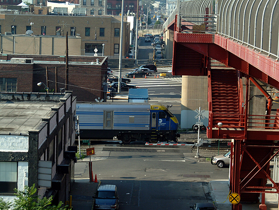
.jpg) FL9 #300 eastbound in LI City crossing 11th St. to duck under the Pulaski Bridge approach ramp. View N 11/1992 Archive: Dave Keller |
 Hunterspoint 53rd Ave at 11th St. - Queens Midtown Tunnel LI Expressway toll booths- View N 7/15/2003 Photo: Bernard Ente |
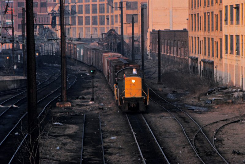
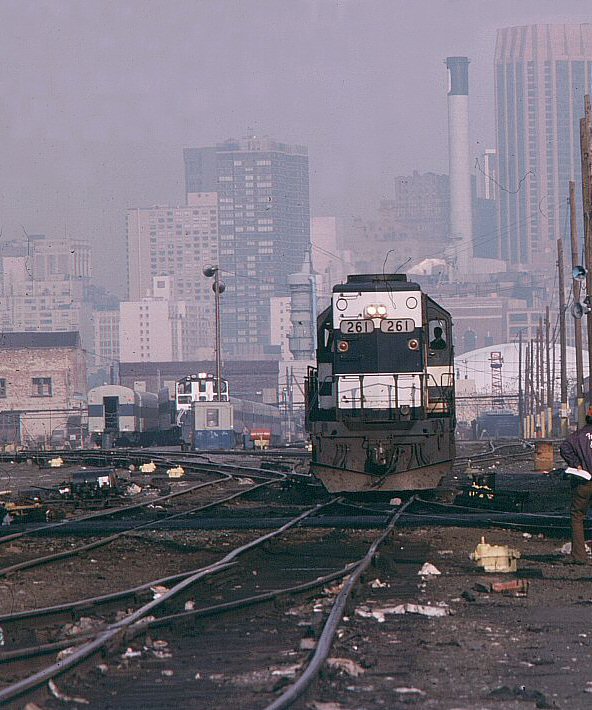
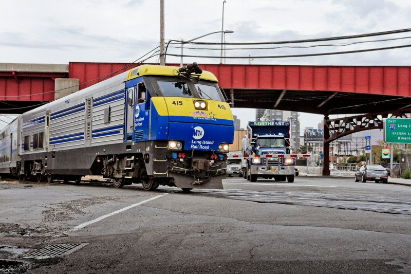 DE30AC #415 crossing Borden Avenue EB at grade 5/03/2026 - Photo/Archive: Mitch Waxman |
||||||||||||||||||||||||||
|
|
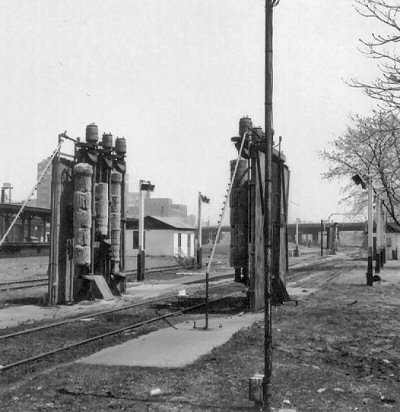
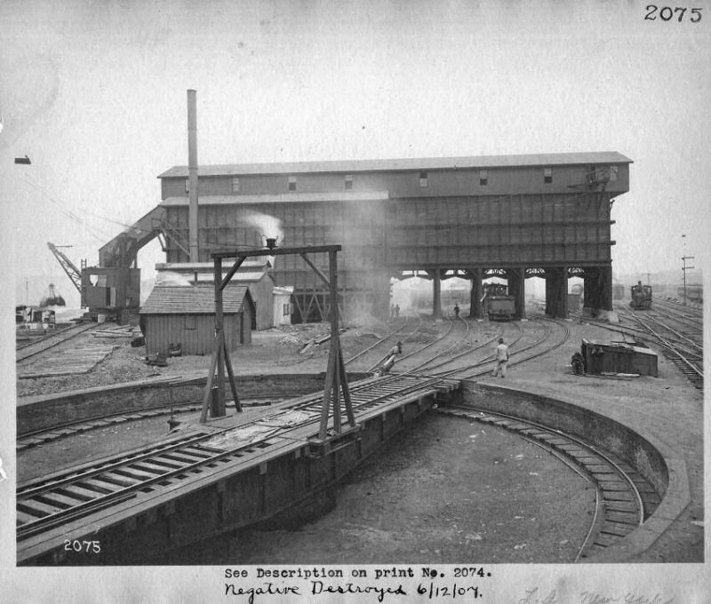
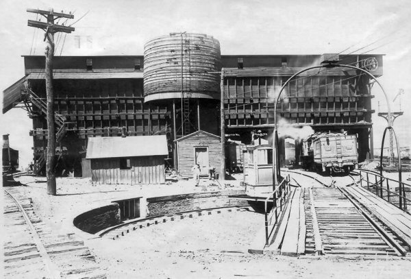
.jpg) Water Tank - LI City Borden Ave 1954 Archive: Dave Keller |
|
||||||||||||||||||||||||||
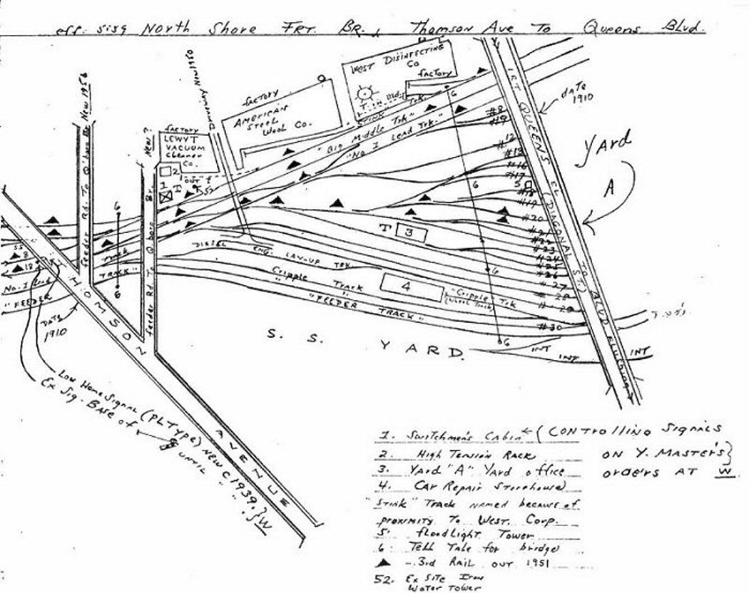
| The water tank is Emery map location #5; above. This was the Pullman Storage Yard 1939-1955 leading into Wheelspur Yard just to the east and photos from 1954 were prior to the removal of this storage area and water tank. | ||||||||||||||||||||||||||||
|
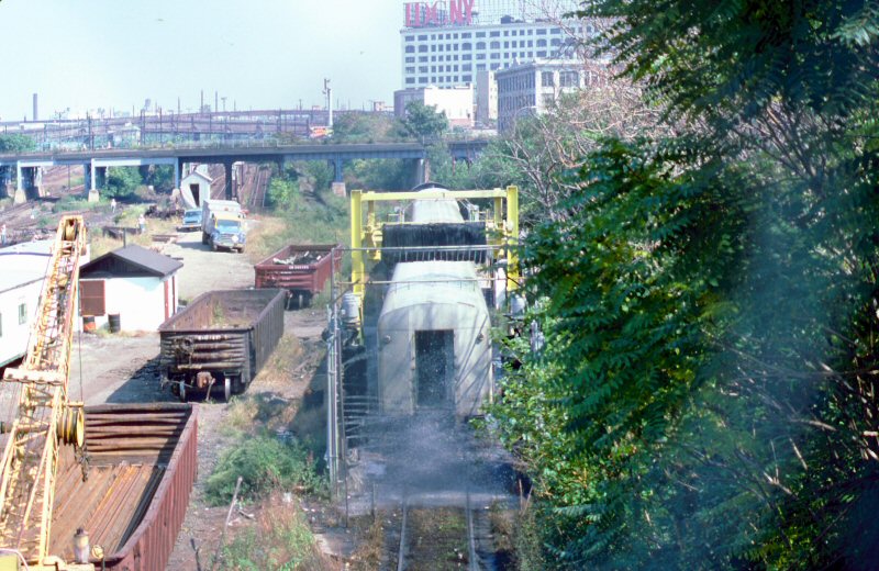
LI City Station Area - Hunterspoint Ave Wash Rack |
||||||||||||||||||||||||||||
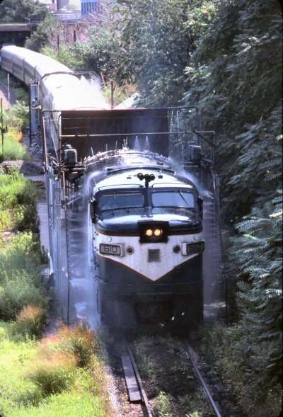
 Hunterspoint Ave Station - Car Wash Rack - View E The platform for Hunterspoint Ave. is at the far left. 1969 Photo/Archive: Dave Keller
|
 FA2 #610 at Hunterspoint Ave. wash rack - View E 8/10/1983 Archive: Dave Keller |
 Hunterspoint Ave. wash rack view E 9/29/1987 Photo/Archive: Edward Hand
|
||||||||||||||||||||||||||
|
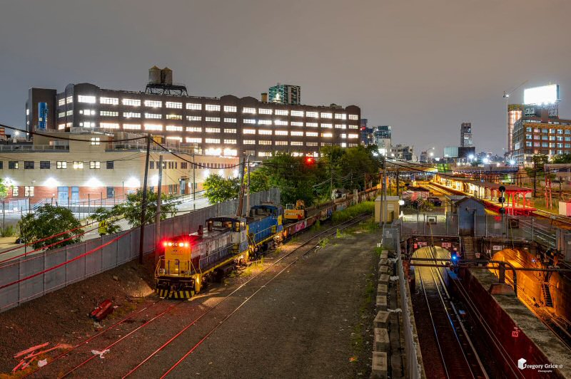
Info/Photo/Archive: Gregory Grice |
||||||||||||||||||||||||||||
|
LI City Station Area - Hunterspoint Ave Station |
||||||||||||||||||||||||||||
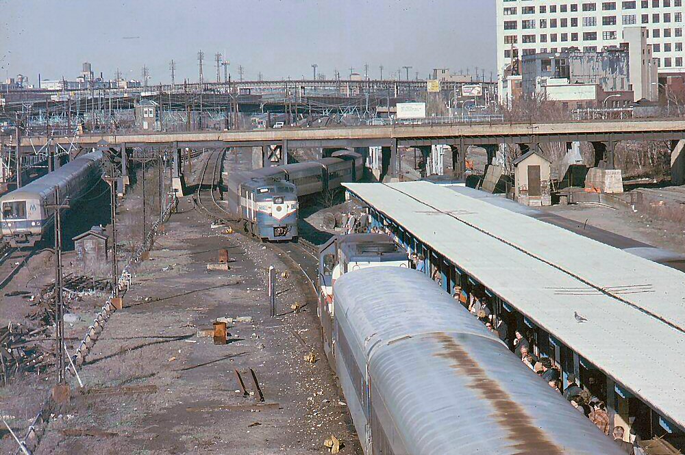
 LIRR GP38-2 #252 Hunterspoint Station view W 10/14/1982 |
||||||||||||||||||||||||||||
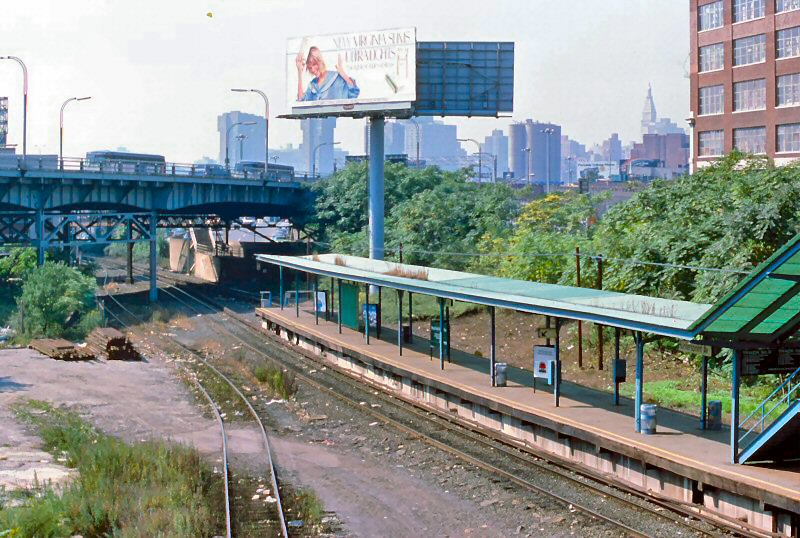
| The East River tunnels lines 1 and 3 are in the foreground . The tarp covers the salt mound for the NYC Sanitation Department at Arch Street Yard. Rock salt would be delivered by hoppers to Arch Street for pickup by DSNY (Dep't of Sanitation, NY) at least until the early 1990's. The Flushing Line, white livery World's Fair R36s, (note the clean white cars compared to Bronx IRT lines), are evident. The Plaxall Building, at upper right, is in early stages of being stripped and converted into the new Hunterspoint Plaza office building (completed in late 1986). The white control house for the car wash rack is located left center. Info: Dave Keller | ||||||||||||||||||||||||||||
|
|
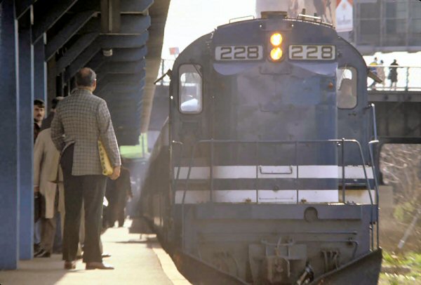
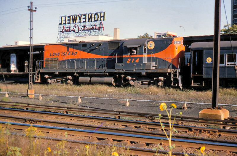 LIRR #214 eastbound at Hunterspoint Station - View SE c.1965 Silverman Slide Collection, Railroad Museum of Pennsylvania, PHMC
|
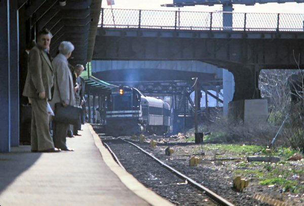
 FA #613westbound at Hunterspoint Ave. Station View E c.1972 (Hoskins-Lynch) Bridge above the M1 and push-pull train is the Montauk Cutoff. Ex-PRR's "F" tower in left background. The top of the East River tunnel portals "B" and "D" are to the right of the covered platform. The car wash rack control house stood atop the two portals where you see the little building with door. Info: Dave Keller
|
||||||||||||||||||||||||||
|
|
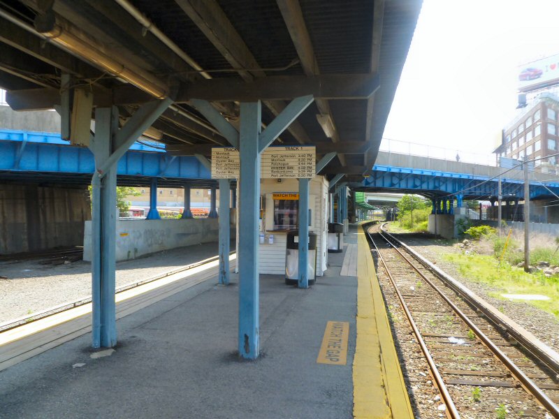 Hunterspoint Ave. Station 6/14/2012 Photo/Archive: Kevin Wong |
|||||||||||||||||||||||||||
|
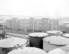
Dutch Kills - Texas Oil - Kearny Sidings Texas Oil: 2 track siding, PRR, Office of Chief Eng. 05/20/1946 |
||||||||||||||||||||||||||||
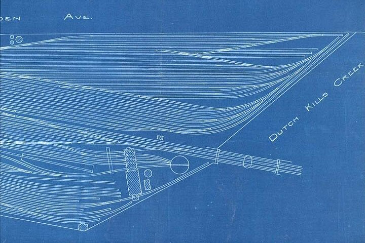
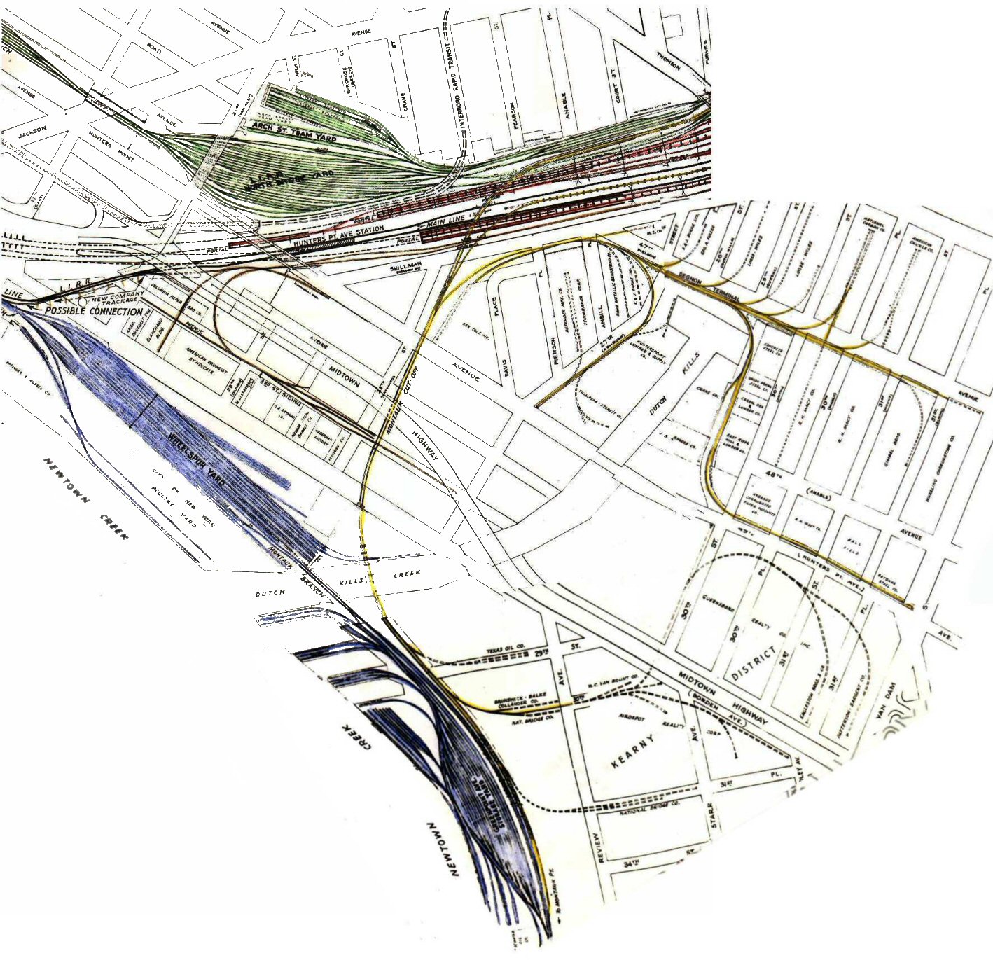 Dutch Kills Creek Area, c.1946 |
 Texas Oil Co. refinery located at Review Ave and 29th St. just east of Dutch Kills Creek |
|
||||||||||||||||||||||||||
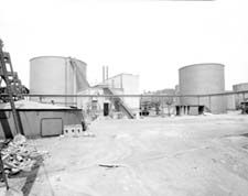
 Texas Oil Co. c.1952 |
 Texas Oil Co. View SW toward Greenpoint tanks. |
|
||||||||||||||||||||||||||
|
|
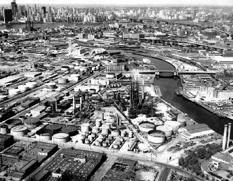
Newtown Creek in 1960, view west from Apollo
Street looking towards the East River. The site is a 3.8-mile
waterway between Brooklyn and Queens.
In the mid-1800s, the area adjacent to Newtown Creek was one of the busiest hubs of industrial activity in New York. More than 50 industrial facilities were located along its banks, including oil refineries, petrochemical plants, fertilizer and glue factories, sawmills, and lumber and coal yards. The creek was crowded with commercial vessels, including large boats bringing in raw materials and fuel and taking out oil, chemicals and metals. In addition to the industrial pollution that resulted from all of this activity, the city began dumping raw sewage directly into the water in 1856. Today, as a result of its industrial history,
including numerous spills, Newtown Creek is reported by US Environmental
Protection Agency to be one of the nation's most polluted waterways. |
|||||||||||||||||||||||||||
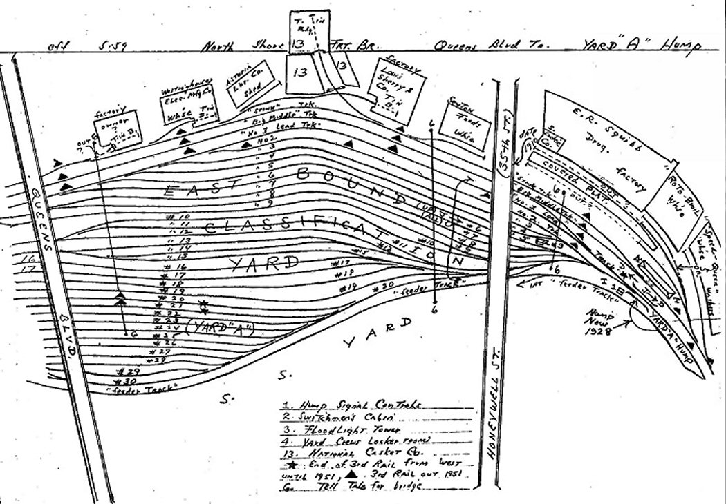
| Wheelspur Yard | ||||||||||||||||||||||||||||
 Wheelspur Yard - 1904 Collection: Art Huneke |
|
|
||||||||||||||||||||||||||
|
|
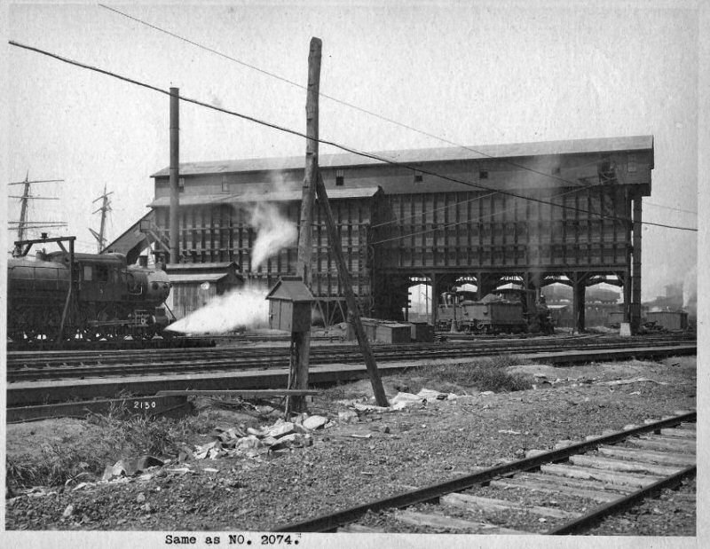 Coaling Tower LI City early 1900's - View SW |
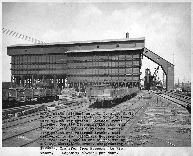 Coaling Tower LI City early 1900's - View E |
||||||||||||||||||||||||||
|
|
The extensive Wheelspur
Yard area was razed south of the Montauk Branch, as it crossed Dutch
Kills, later to become the NY Poultry Terminal as the engine yard
was no longer needed prior to the "...January 10, 1941
Construction of a live poultry market in Long Island City to handle all
the live poultry coming into the city was authorized yesterday by the
Board of Estimate, which voted an issue of $460,000 in serial bonds to
finance the new market..." The New York Times Archives |
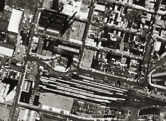
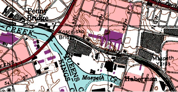
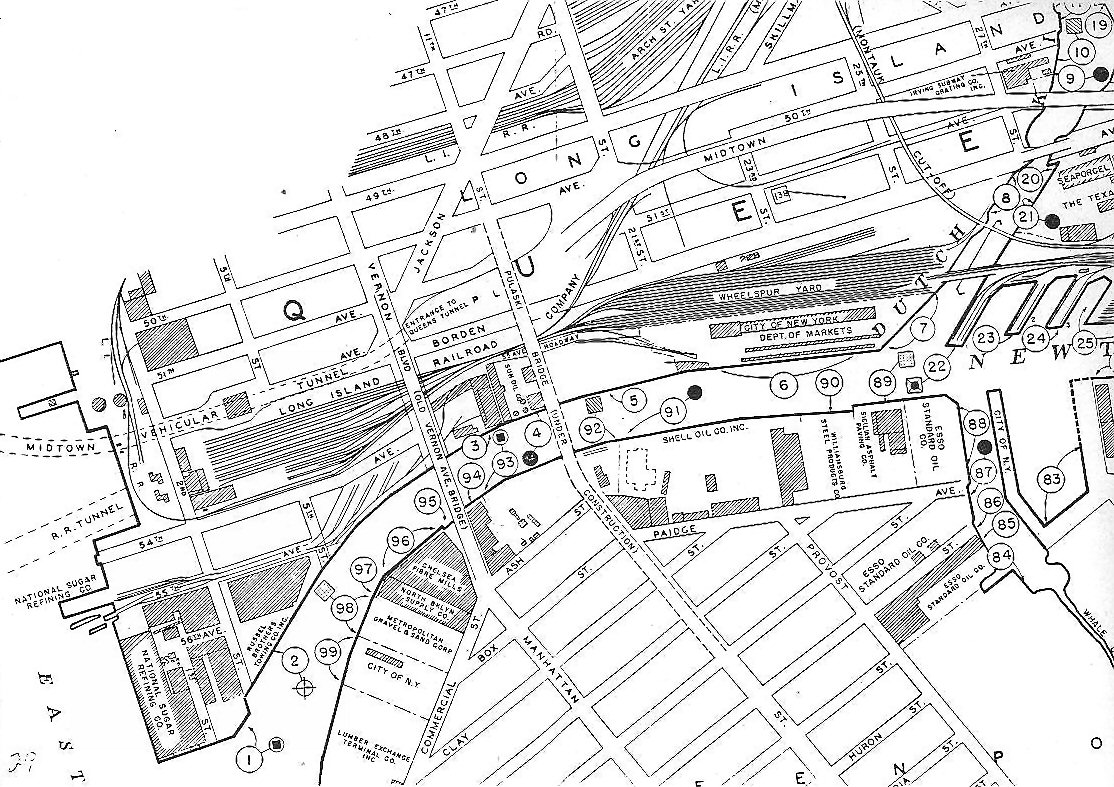 LI City detail of Hunterspoint and Newton Creek area. Circa 1946-1954 as the Pulaski Bridge is under construction on this map. |
||||||||||||||||||||||||||
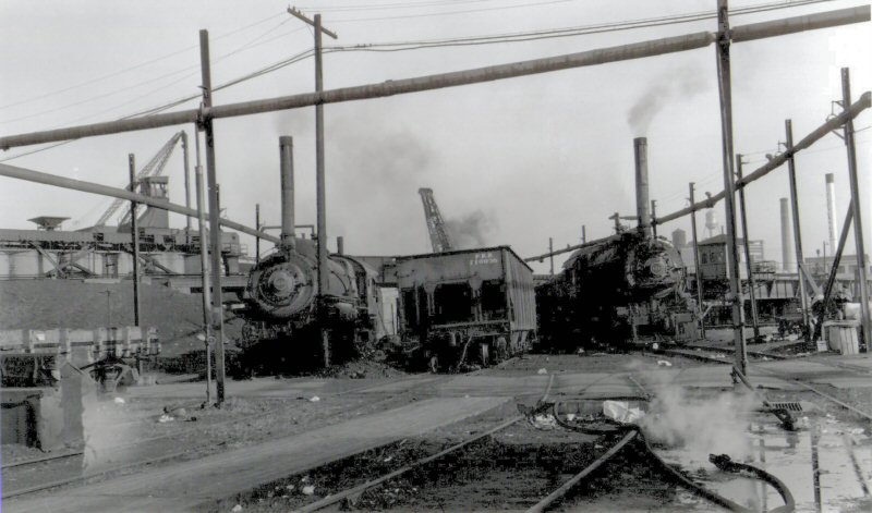
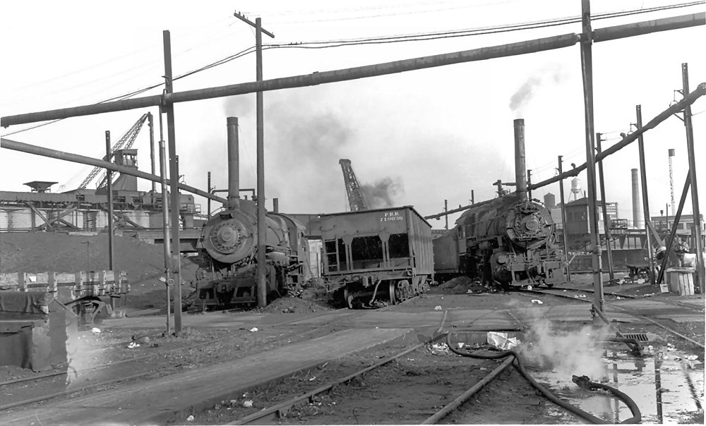 Wheelspur Yard - c.1948 Looking NE towards “M” cabin and drawbridge. (Cabin at right background, Dutch Kills at far right, not visible in this shot.) Two PRR H9s locomotives laying up (there were usually a total of 3, one is behind the engine at the right and not visible) to supply the yard with steam heat. Headlights have been removed. In the center of the view are the coaling gondola and derrick to feed the tenders. In 1950, the H9’s were replaced by three PRR L1s (2-8-2) locomotives, so this shot precedes 1950. The yard was torn up in 1959. Info: Dave Keller |
As a point of reference, the photographer of this Wheelspur photo (left) would have been standing approximately in front of the first or second string of passenger cars above. Info: Dave Keller |
|
||||||||||||||||||||||||||
|
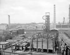
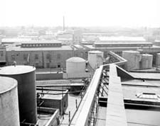
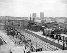
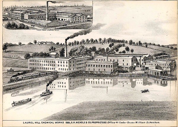
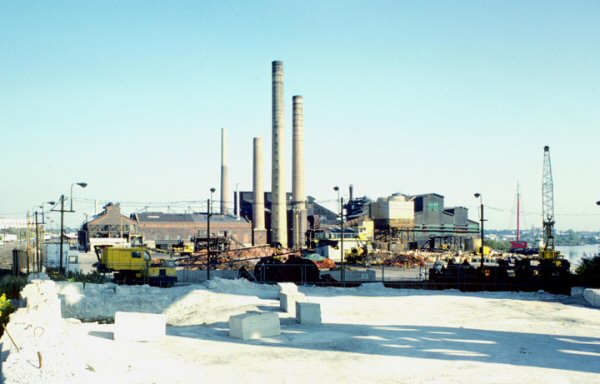
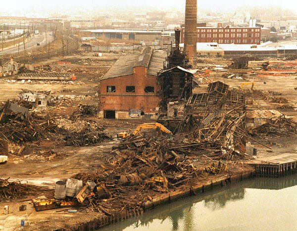
Phelps-Dodge Copper Refining and Chemical Production Plant 1920-1983
The Laurel Hill copper
refinery was built in 1905 by the Nichols Refining Company for
electrolytic refining of 'blister' copper. Most of the
copper was done for Phelps-Dodge Company, and came from it's smelters in
Arizona. In 1928, Nichols built another refinery near El Paso,
Texas. In 1930 Phelps-Dodge acquired both refineries. After
P-D acquisition, the Laurel Hill refinery processed scrap copper from
the eastern US, and blister copper from the southwest, and possibly some
from South America. P-D closed the Laurel Hill facility in 1984. |
||||||||||||||||||||||||||||
|
|
 View NE Laurel Hill Works at full build-out, circa 1933 (courtesy Allied Signal Archives)
|
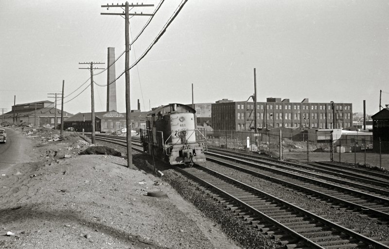
 "Dead Man's Curve", so named because of the many workers who were killed by oncoming trains while crossing the tracks to and from work at the "Laurel Hill Works" View west of 46th St./ Employees crossing
the tracks to get to work got hit by westbounds not making the station
stop or, after the station was discontinued, not preparing to make ANY
stop! |
||||||||||||||||||||||||||
| Nichols Copper Co. started out making sulfuric acid from the sulfur in copper ore. The acid-making side of the business later became Allied Chemical, now merged into Allied-Signal. | ||||||||||||||||||||||||||||
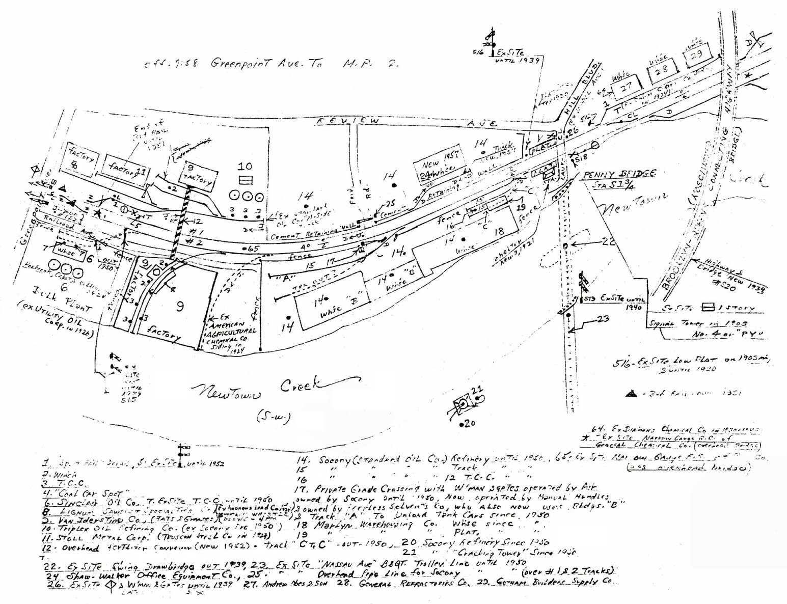 Emery map - Greenpoint Ave to MP2 9/1958 Archive: Dave Keller |
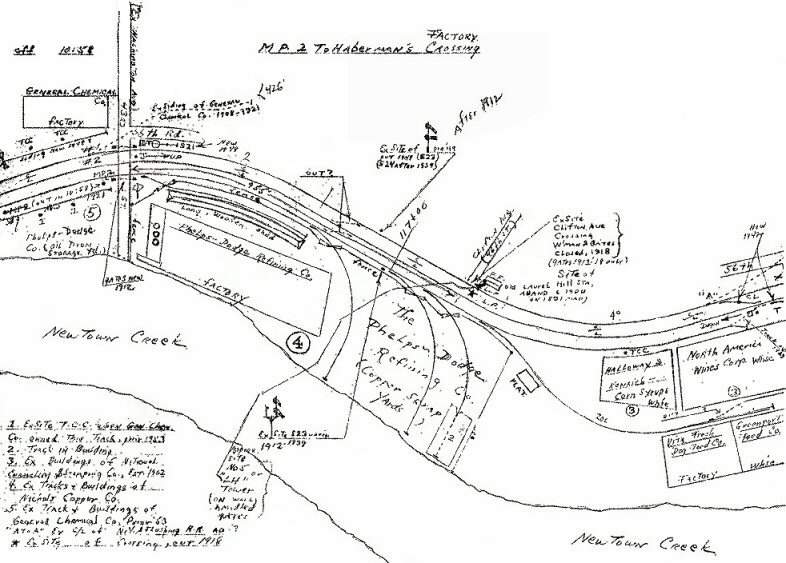 Emery map - MP2 to Haberman's Factory Crossing 10/1958 Archive: Dave Keller |
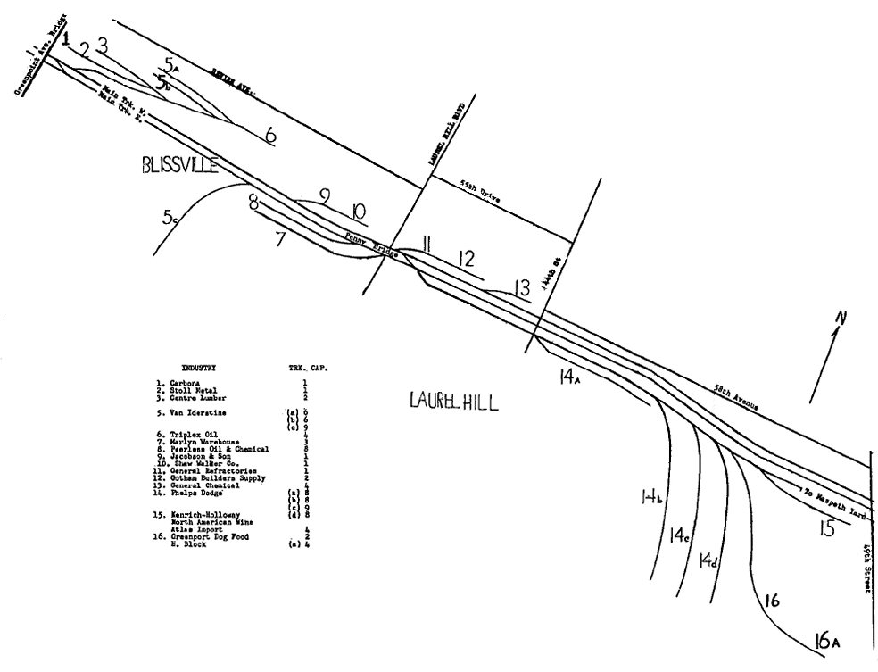 LIRR Map 1966 Laurel Hill-Bliss - Phelps-Dodge location |
||||||||||||||||||||||||||
|
Phelps-Dodge cars were stored in Bliss yard where the afternoon Bliss job would bring new cars in from Yard A and make up the afternoon train, following the drill order, for the Laurel Hill job.
"...Bliss was used by LIRR freight and
had an engine terminal so that steam engines did not have to run reverse
all the way to Morris Park. This was also gone by 1957. In my time, Bliss
yard was used to store cars for Phelps Dodge, Van Iderstine and other
customers between Greenpoint Ave and PD. Also cars for Murers sidings were
stored here. Crews reported at Yard A and brought cars to Bliss before
making up their trains for their respectful switching areas. Phelps Dodge had four tracks, all on a downgrade toward Newtown Creek and great care had to be taken that these heavy copper cars did not get away while shoving in. The usual drill called for about fifteen to twenty cars in and the same number out every night. Author: J.J. Earl |
||||||||||||||||||||||||||||
|
|
Phelps-Dodge, a company with ancient roots in NYC and a supply link to copper mines off the SP and the Tucson, Cornelia and Gila Bend in far away Arizona, signaled to the world why the ancient and fragrant colonial waterway of Newtown Creek represented the greatness of New York at the inland port of Maspeth. Info: Richard F. Makse |
|||||||||||||||||||||||||||
|
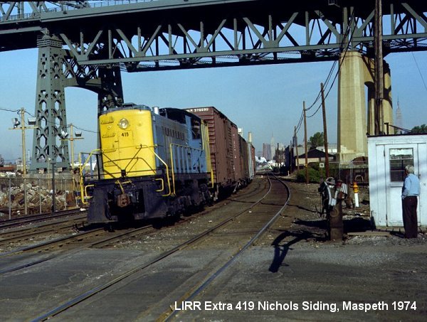
On Berlin curve (just west of Haberman), the site of an 1893 wreck, #461 runs light to Yard A. The 3rd track is Nichols Siding, the long lead track that served a number of sidetracks into the Phelps-Dodge plant. Phelps-Dodge, the LIRR's busiest customer, had its own LIRR freight agent reporting under the station name Laurel Hill. You can barely make out the lettering on the building in front of the chimney. It reads Rasson's Holloway. These buildings were part of Haberman's enameling works (later National Enameling). Both of these companies coated pots and pans. Lalance and Grosjean (their clock tower still stands near Woodhaven station) was in the same business. Agateware and other trade names were used in turn of the century Queens. My maternal grandmother used Agateware--very common in Queens households when I was growing up in Winfield. Interesting that Bob Emery's map (above MP2) shows the building with the stack as Holloway and Kenrich. But they didn't make corn syrup but rather sucro-chemicals used in the manufacture of resins. The building to the left of the stack was Haberman's original factory. BTW, Nichol's Siding, originally a double-ended freight siding, ended at the Haberman factory. Information: Richard F. Makse |
||||||||||||||||||||||||||||
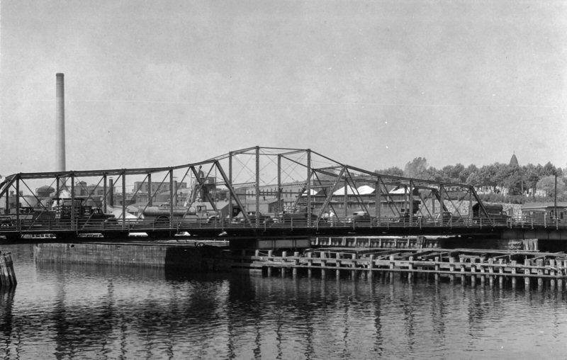
| Penny Bridge | ||||||||||||||||||||||||||||
| PENNY BRIDGE: MONTAUK SHELTER SHED BUILT: 1902 2ND SHELTER SHED BUILT: 3/1921. NO AGENCY ESTABLISHED. DISCONTINUED AS STATION STOP: 3/16/1998 Research: Dave Keller | ||||||||||||||||||||||||||||
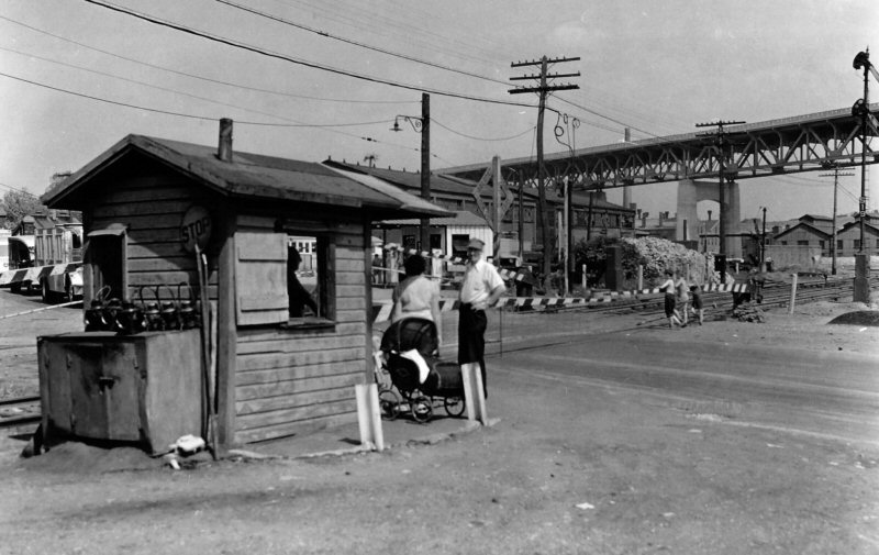 Penny Bridge View NE 1939 Kosciuszko Bridge newly opened Archive: New York Public Library |
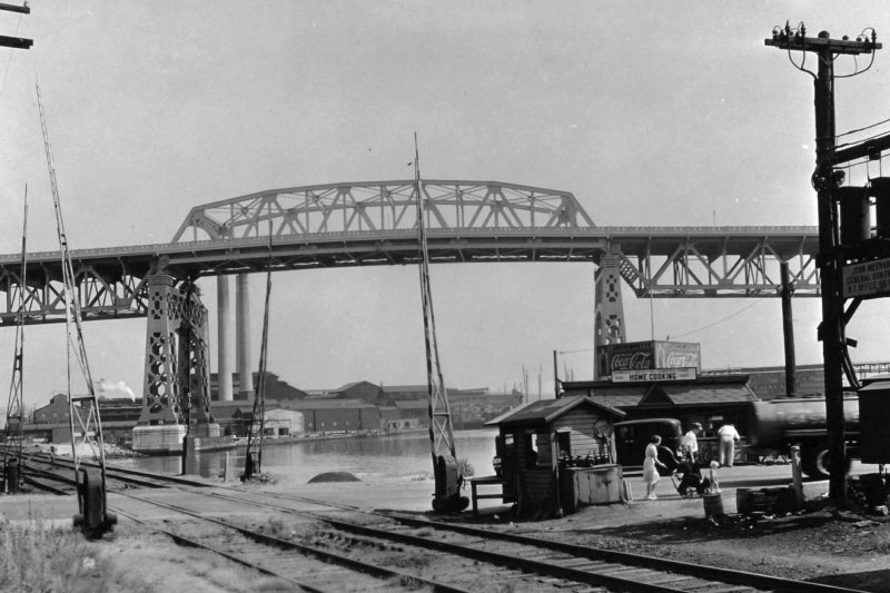 Penny Bridge View SE 1939 Kosciuszko Bridge newly opened Archive: New York Public Library 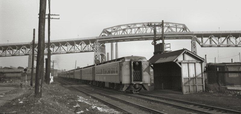 Penny Bridge Station - Eastbound Montauk Train - View E 1954 Photo: Walter J. Edwards Archive: Dave Keller |
|
||||||||||||||||||||||||||
 The second crew rider from Jamaica to Long Island City, train #1833, passes through Penny Bridge on April 17, 1972. Info/Photo/Archive: Richard F. Makse
|
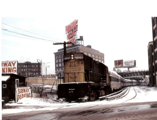
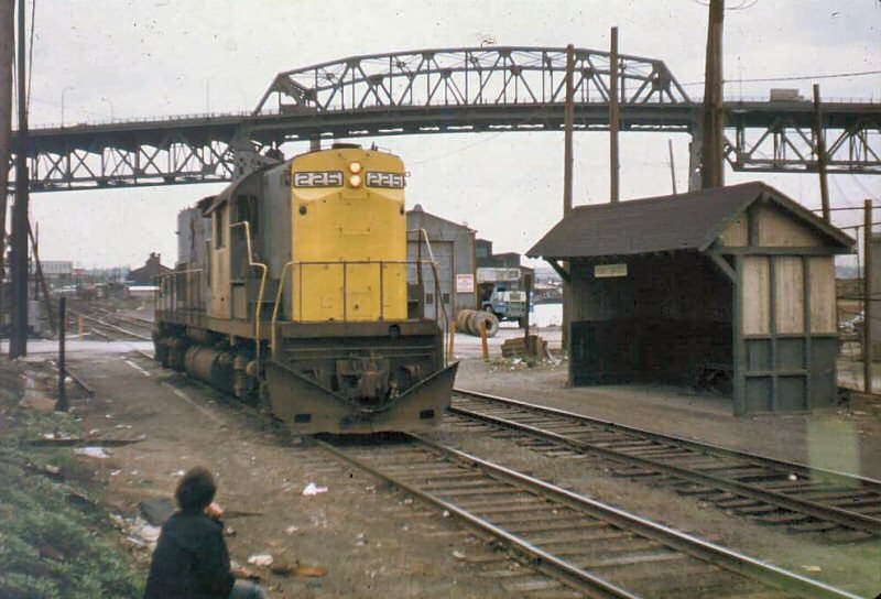
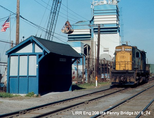 It's about 10:30 AM on May 2, 1974 and LIRR #208 extra running light back to Morris Park for midday servicing after bringing a morning train into Long Island City. Penny Bridge was one of the last extant pure PRR standard shelters and this classic design was the architectural inspiration for the first modern era shelters that started appearing along the South Shore in the 90's. Info/Photo/Archive: Richard F. Makse |
|
||||||||||||||||||||||||||
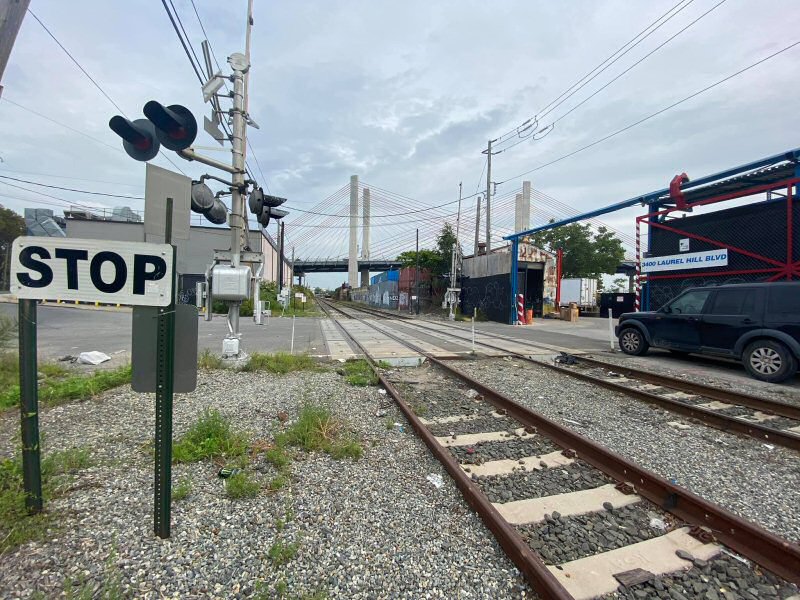 Penny Bridge - View E 2020 Photo/Archive: Andrew Sorrentino |
 Penny Bridge Station Closing Sign - MTA/LIRR 3/16/1998 |
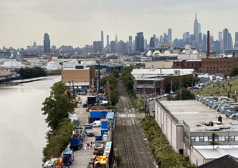 Penny Bridge - Aerial view W 2020 Photo/Archive: Andrew Sorrentino |
||||||||||||||||||||||||||
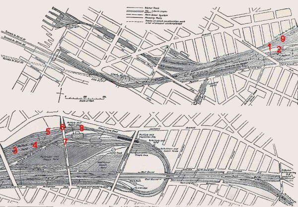
| LI City LIRR Manhole Cover | LI City to Jamaica Map 1952 | |||||||||||||||||||||||||||

|

|
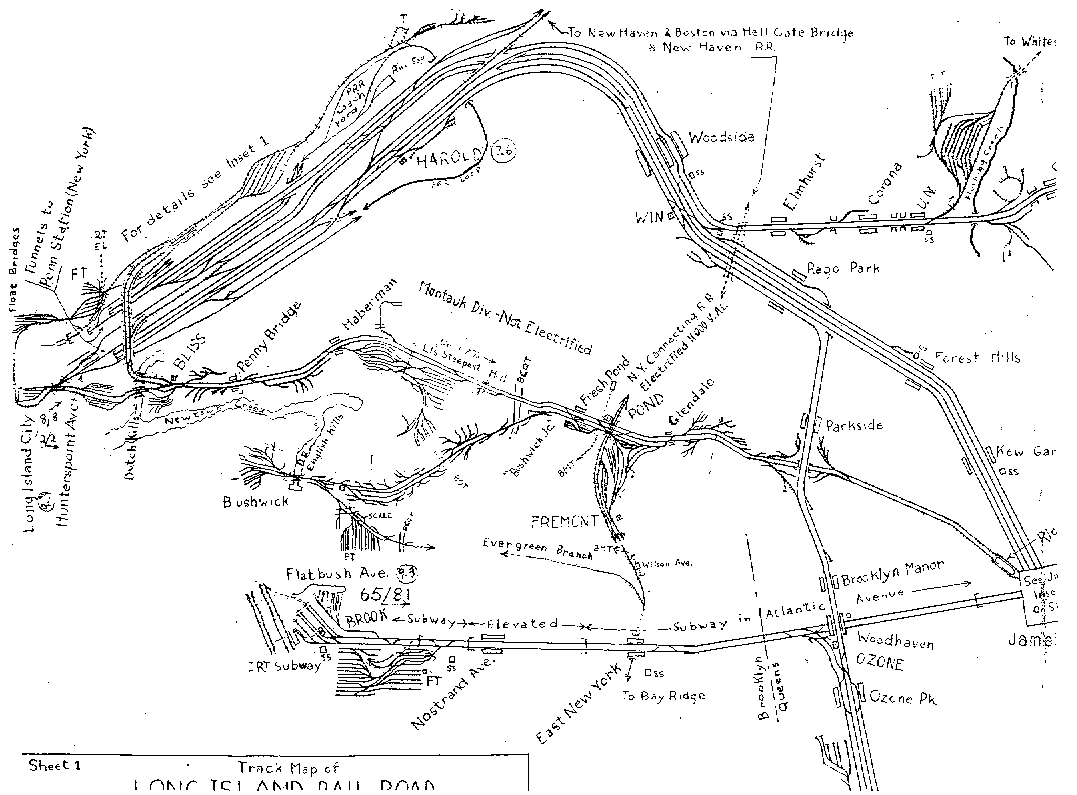 Click on map to enlarge |
||||||||||||||||||||||||||
|
Manhole cover near the old power plant 2nd St. and 50th Ave. LI City 11/27/15 Photo: Joseph Anastasio |
||||||||||||||||||||||||||||
| LI City Page 1 | ||||||||||||||||||||||||||||
06/15/2026
 LONG ISLAND CITY


.jpg)


%20-%2006-24-1932%20(Sperr-Keller).jpg)


.jpg)
.jpg)
.jpg)

 |
|