 LIRR Track Maps
 |
|
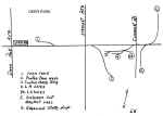
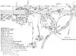
Emery Map Symbols:
|
|
A.G.
Automatic Gates
B or BB
Bell on one or both sides of diamond crossing sign
BLS
Block Limit Signal
 BLS with unattended block station signal lower down on the mast
_ C
(ex. 10 C: 10 car capacity of siding)
CL
Center Locked Crossover
C/L
Center Line of R.O.W.
 Diamond Crossing Sign
D.S. & S.I Distant Switch &
Signal Indicator
D.S.I.
Distant Switch Indicator
 Electrified tracks
 Gates across tracks (private sidings)
H.
sec
Section House
J
Marking point indicating upgrade or downgrade
L
Low (dwarf) signal
MC
Mail Crane
ML
Main Line
MP
Milepost
|
OSB
Old Signal Base
PC
Point of Curvature (of track)
PCC
Point of Concentric Curvature
PL 0r PLS Position Light Signal
SB
Section Break (Signals to keep MU trains from energizing rail where
current has been turned off. Steam/Diesels could pass these signals.)
SD
Section Divide (section gang maintenance zone)
SS
Spring Switch
T Telephone Box
T.C.C.
Tank Car Connection
T.T. Team Track
UG Undergrade Crossing (Tracks over a road)
VS
Valuation Section - From LIRR 1916 maps
W.P. Water Plug
 Wig-wag Signal
YL Yard
Limit
Z
Interlocked Switches/Turnouts
0xxx
Bridge numbers (4 digits with zero being the first) |
|
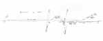
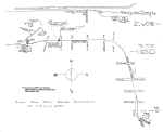
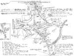
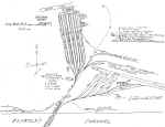
Robert Emery sketched maps, probably
out in the field, and used LIRR official valuation maps accessible to him to
help create the ruled lined maps. Perhaps in addition, physical
characteristics, landmarks, etc. were added while working on the LIRR.
Next, the rule lined notebook versions c.1957-59 were drawn. Later the
finalized finished-copy versions were designed, currently at the Long Island
Room, SUNY-Stony Brook. |

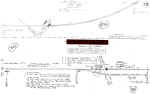
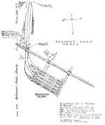
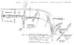
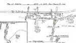
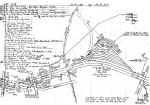
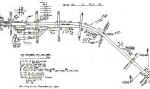
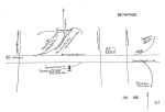
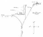
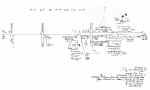
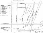
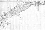
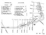
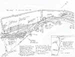
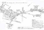
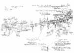
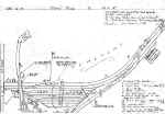
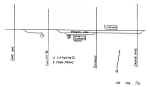
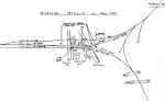
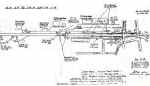
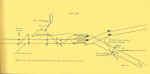
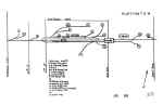
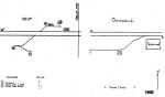
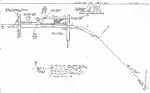
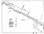
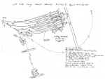
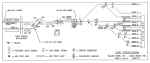
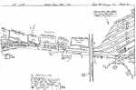
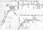
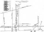
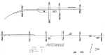
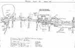
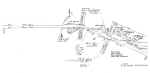
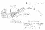
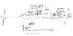
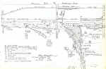
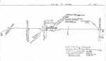
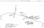
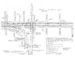
Bushwick Branch - West of Scott Ave to English Kills
Drawbridge*
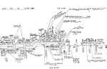
Robert Emery's original loose-leaf pencil sketch from 1958 - Archive:
Richard Makse |

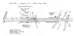
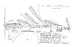
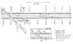
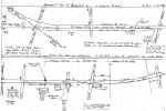
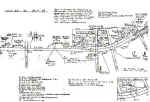
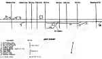
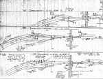
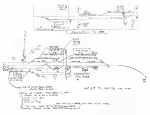
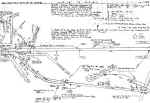
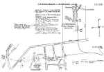
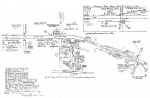
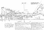
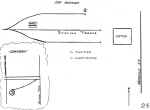
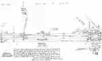
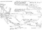
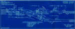
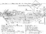
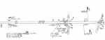
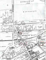
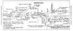
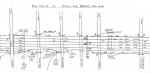
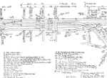
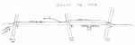
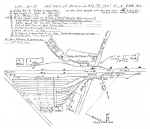
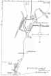
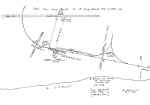
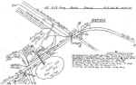
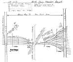
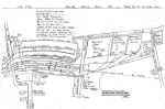
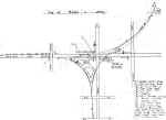
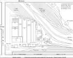
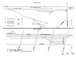
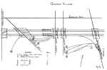
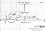
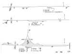
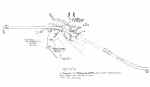
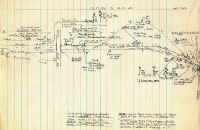
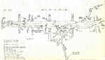
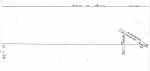
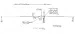
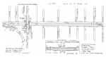
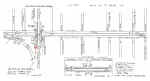
Bushwick Branch - West of Scott Ave to English Kills Drawbridge
Removal of the loose-leaf page lines and photocopy defects.
Archive: Dave Keller Map Restoration: Steven Lynch |
|
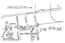
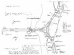
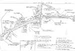
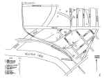
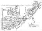
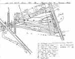
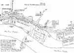
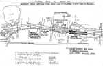
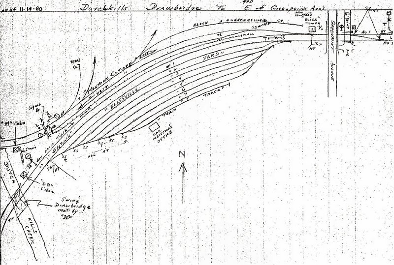
*The English Kills drawbridge:
For those not familiar with early NY Dutch nomenclature, a kill is a creek
or a stream. For reasons unknown, it's English Kills in Bushwick and Dutch
Kills in LI City. Note the he small "yard", the manure yard,
just east of the yardmaster's office and the junction of the Evergreen
Branch. When its use for manure cars ended, the one or two engines
that served Bushwick were layed up there. This kept them under the
watchful eyes of an LIPD patrolman who staffed the yardmaster's office on
weekends. Richard Makse |

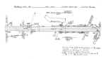
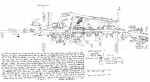
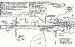
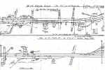
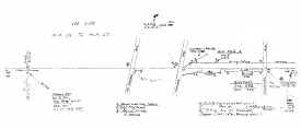
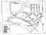
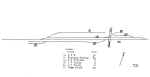
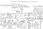
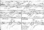
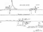
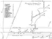
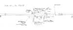
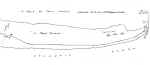
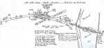
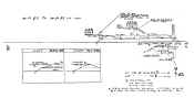
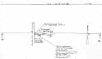
Emery's final version Track map collection is housed at SUNY-Stony Brook,
NY.
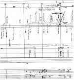
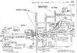
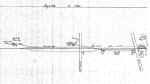
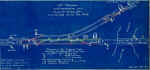
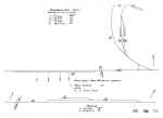
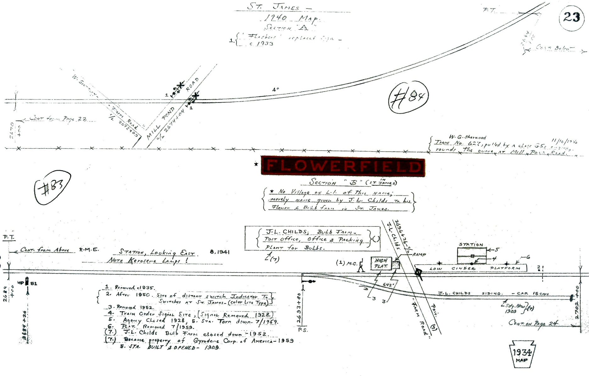
Flowerfield Map 1934 photo example |
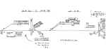
Emery's final version map Flowerfield Map 1934
Archive: SUNY-Stony Brook, NY. Map Restoration: Steven Lynch |
|
| EMERY
TRACK MAPS - RACE TRACKS |
Aqueduct pre-1940
Aqueduct -post-1940 |
Belmont Park pre-1957 |
Locust Manor-Jamaica Racetrack
pre-1937
Locust Manor-Jamaica Racetrack
post-1937 |
Locust Manor pre-1959 |
|
Meadowbrook - Roosevelt Raceway 6/1958 |
Union Course pre-1942 |
|
|
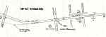
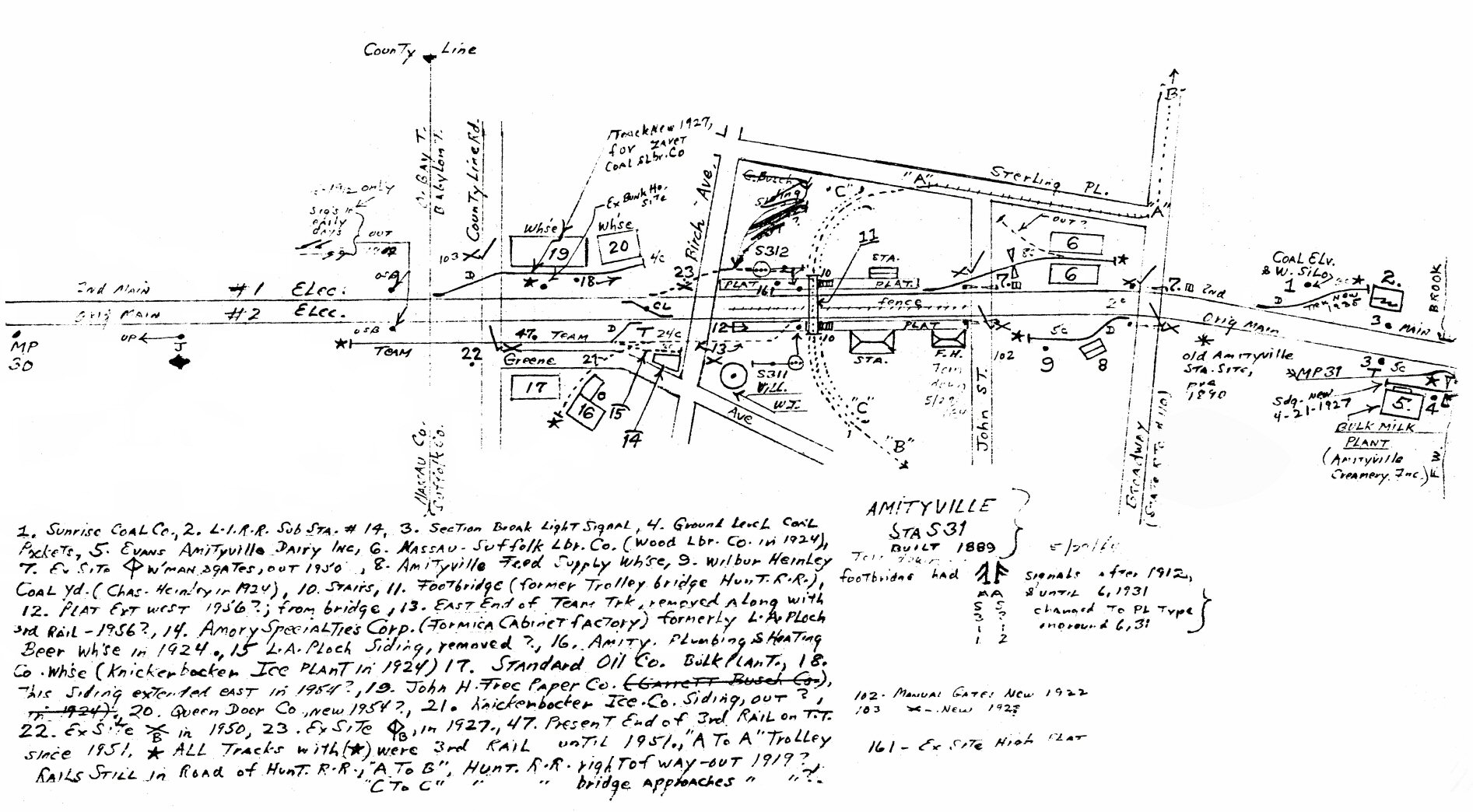
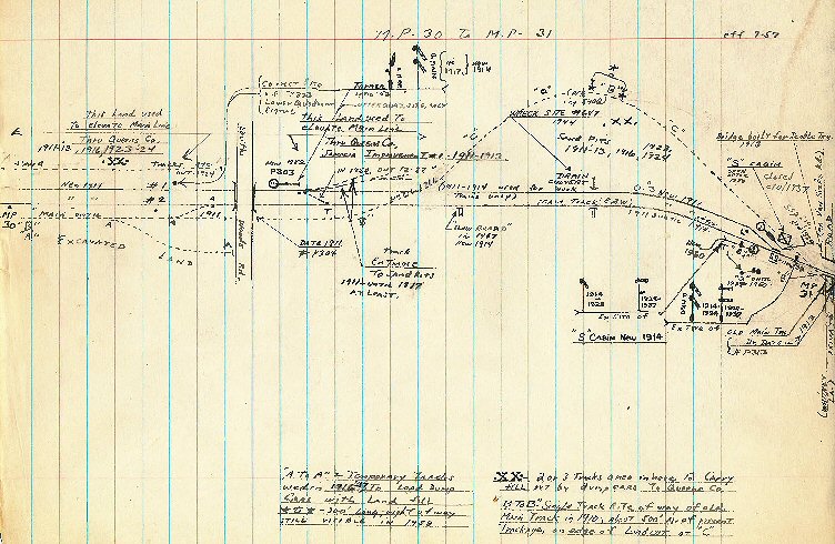
Amityville MP30-31 08/1958 |
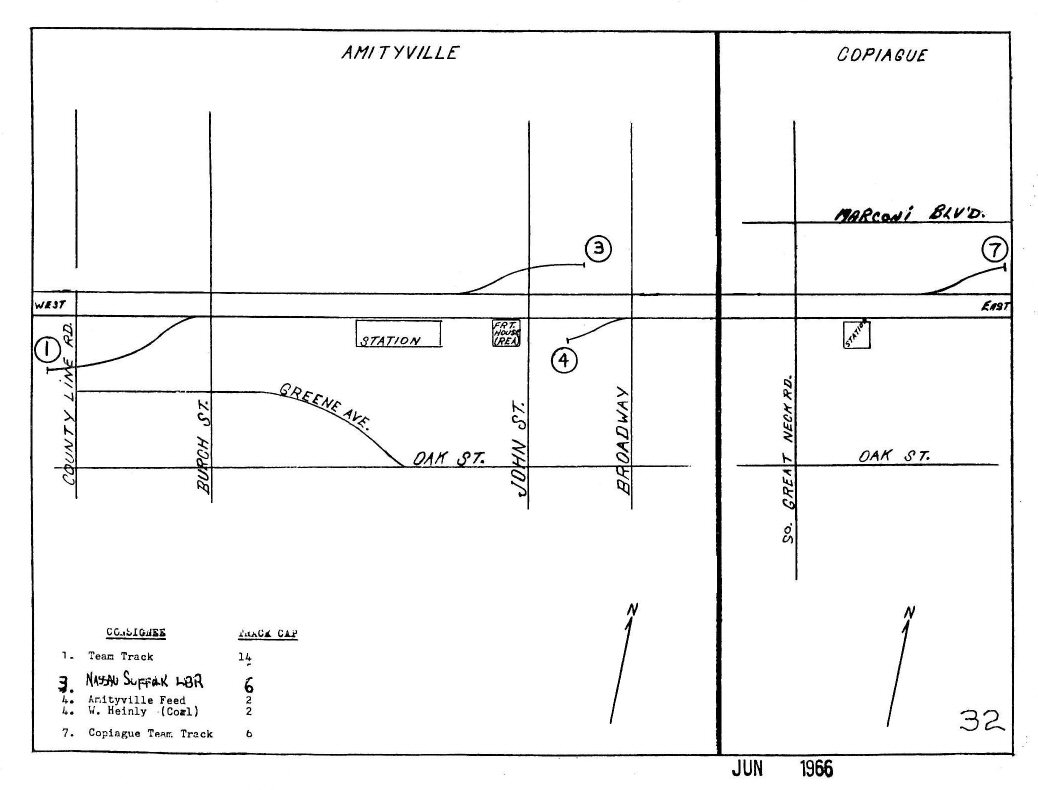
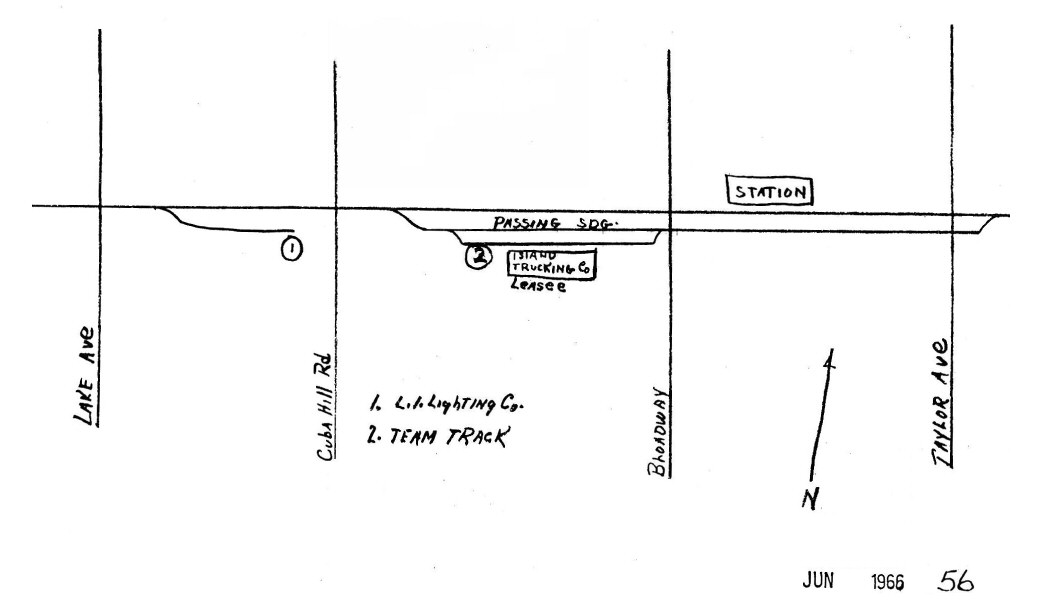
Amityville - Copiague 1966 |
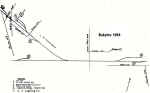
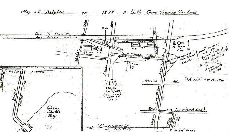
Babylon 1888 |
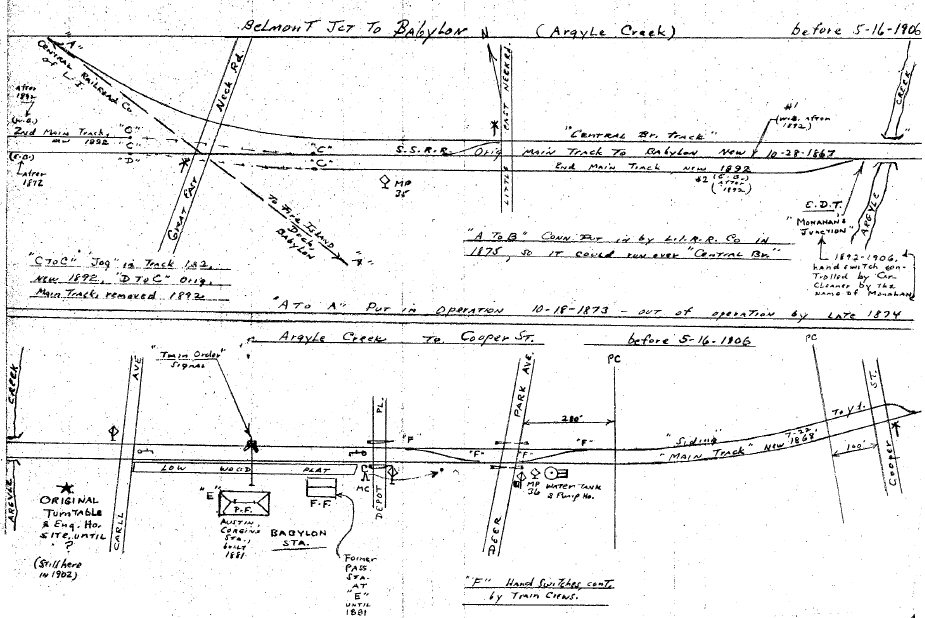
Babylon 05/16/1906 |

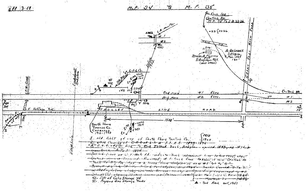
Babylon MP34-35 07/1958 |
 \ \
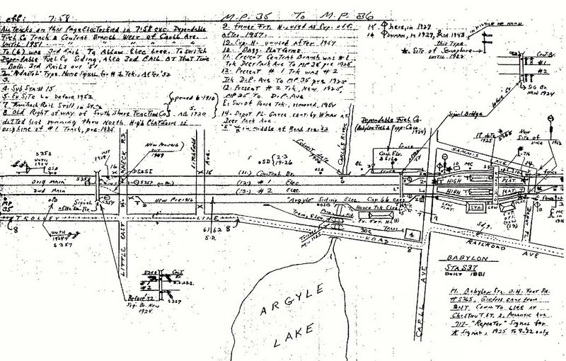
Babylon MP35-36 07/1958 |
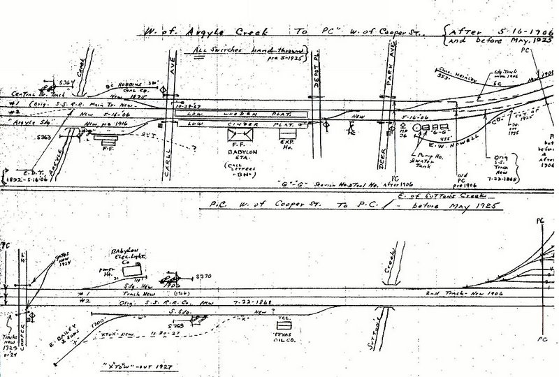
Babylon MP36-37 1925 |
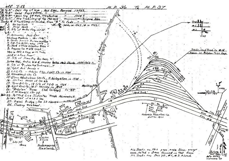
Babylon MP36-37 07/1958 |
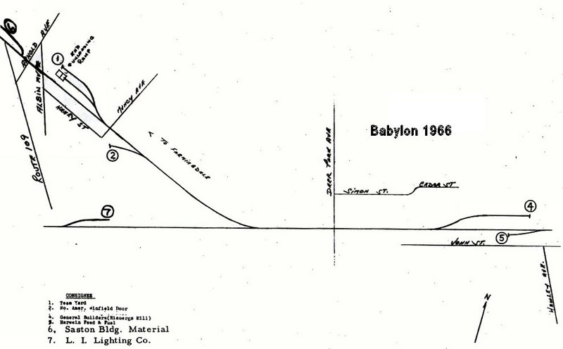
Babylon 1966 |
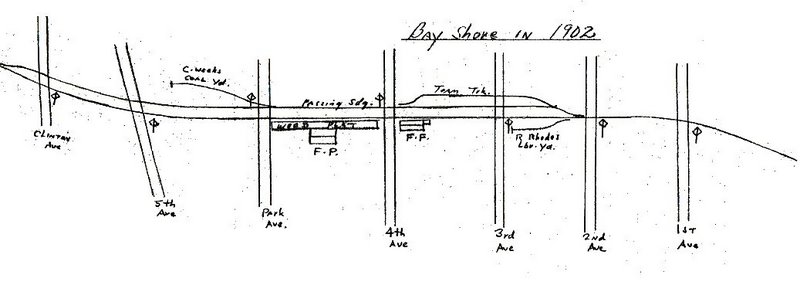
Bay Shore 1902 |
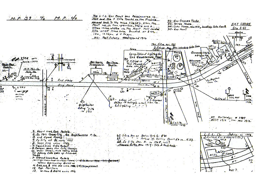
Bay Shore MP39-40 1958 |
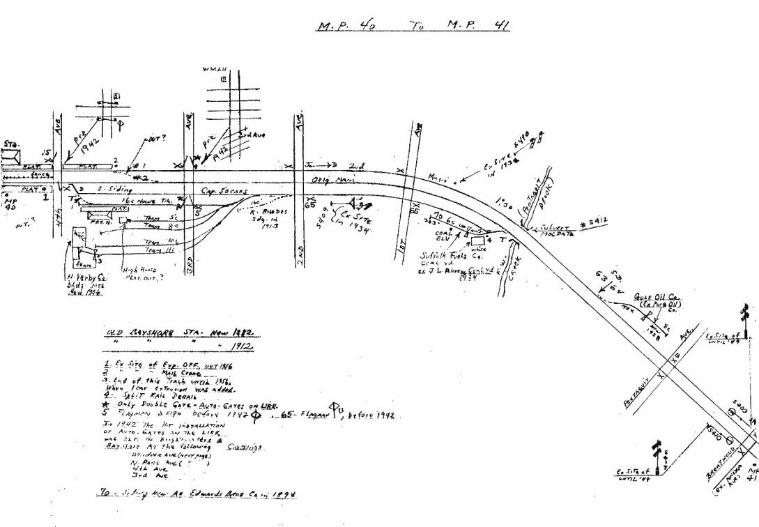
Bay Shore MP40-41 1958 |
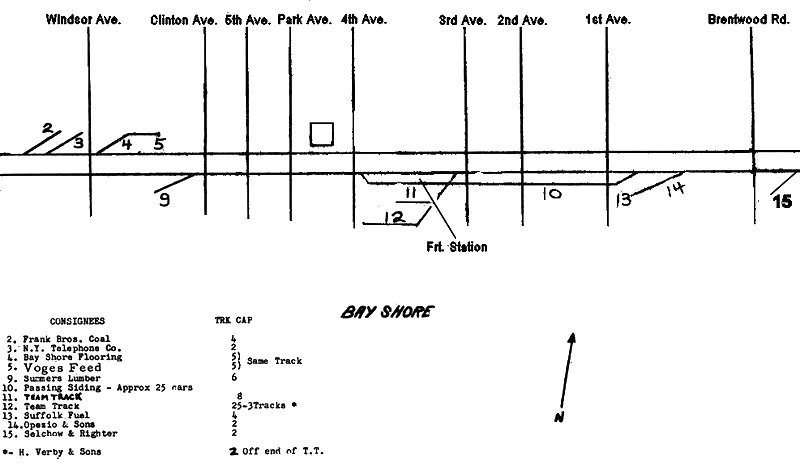
Bay Shore 1966 |
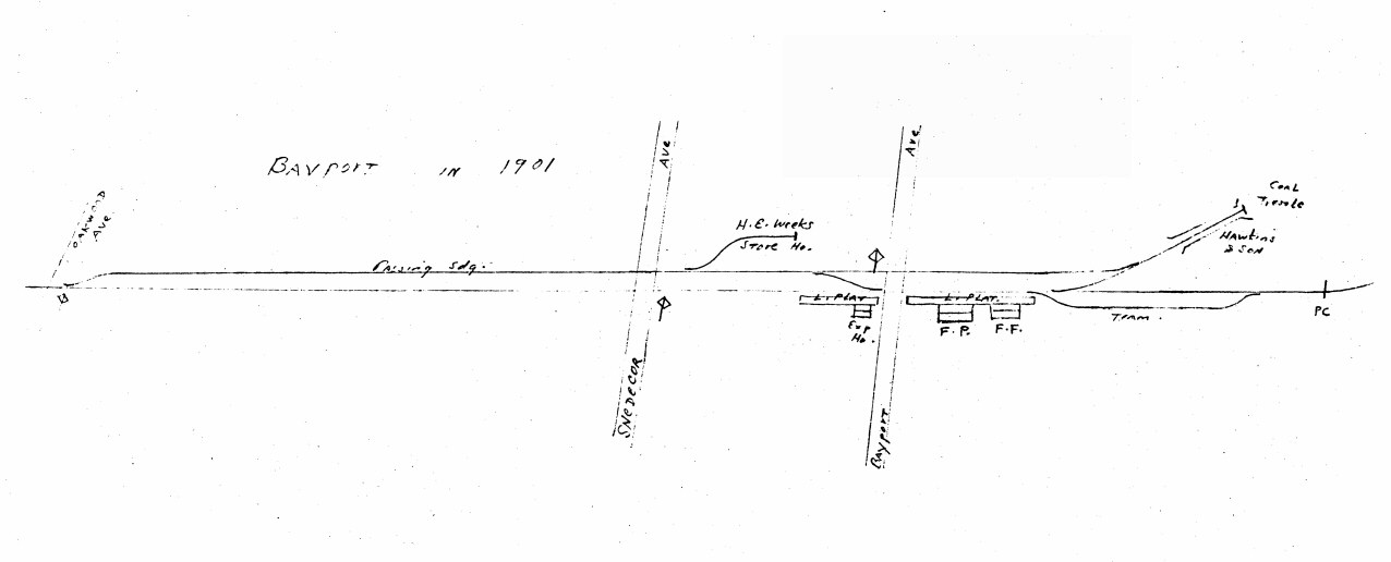
Bayport 1901 |
Bayport MP50-51 1958 |
Bethpage 1966 |
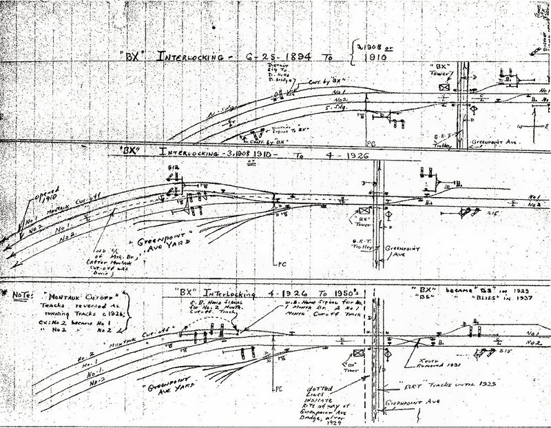
BX Interlocking 1894-1950
Blissville, LI City |
Bliss 1966 |
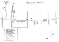
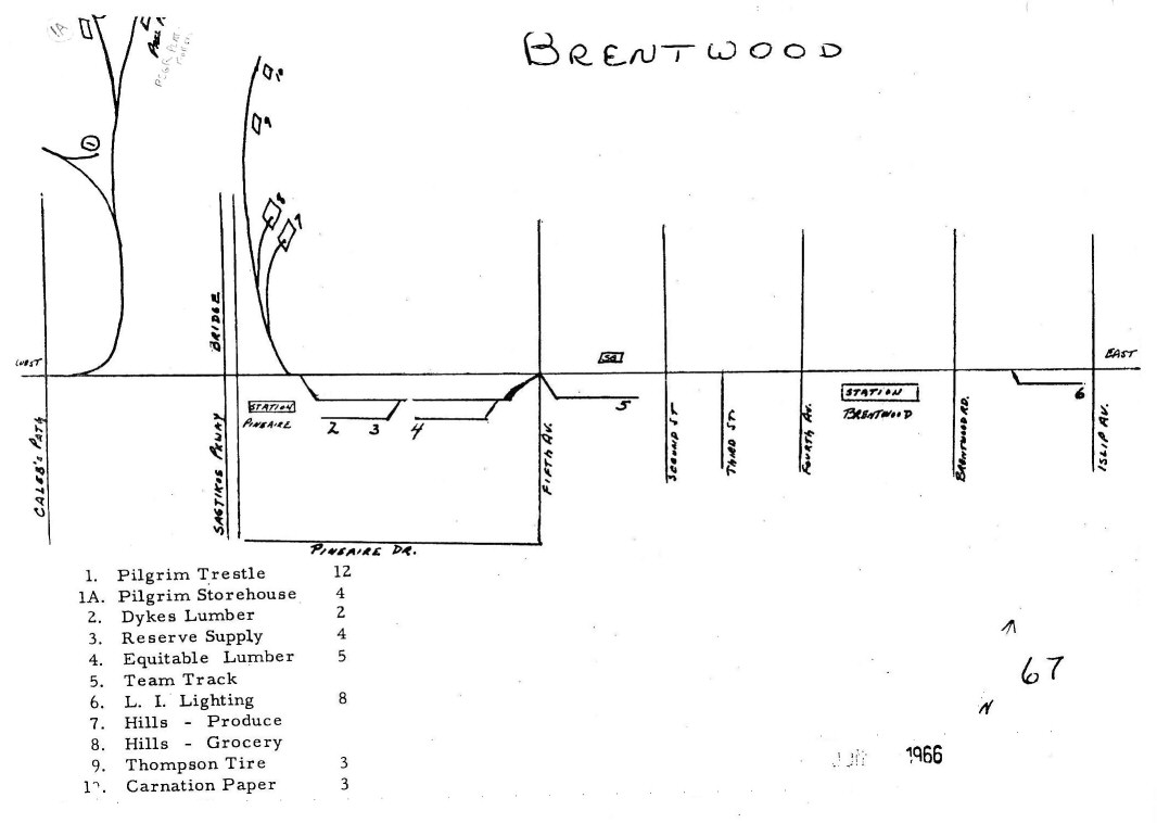
Brentwood - Pilgrim State
Hospital 1966 |
Brentwood - Pilgrim State
Hospital Spur 5/1958 |
Calverton MP69-70 Pre-1924 and 10/1957 |
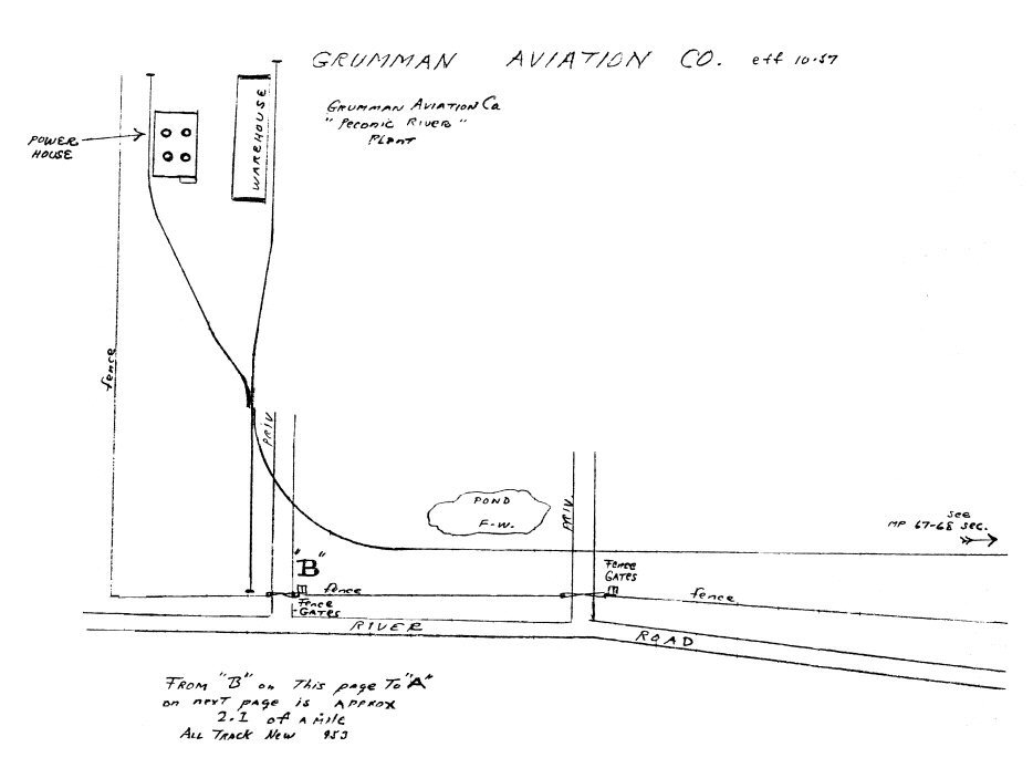
Calverton "Grumman Aviation Co." 10/1957 |
Calverton 1966 |
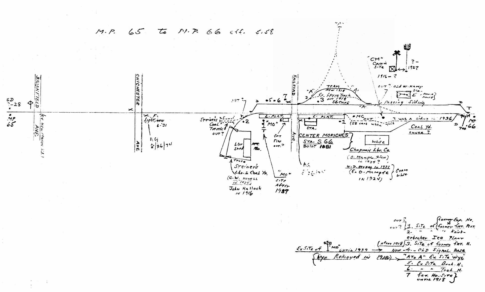
Center Moriches MP65-66 05/1958 |
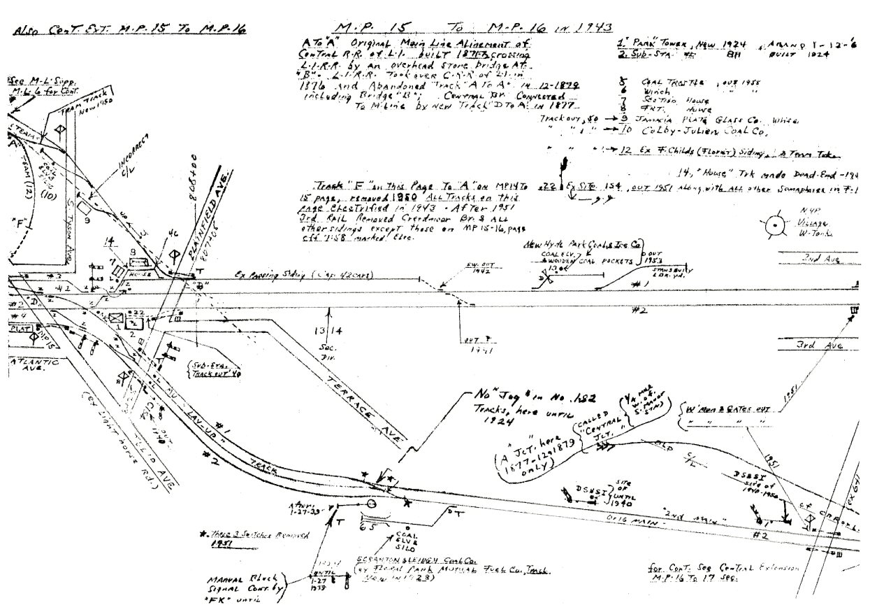
Central Branch MP15-16 1943 |
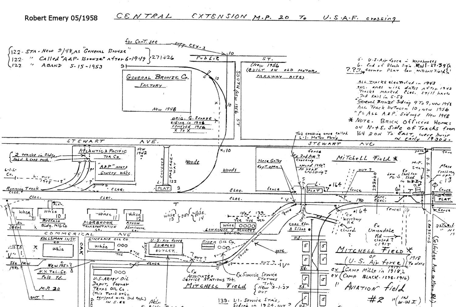
Central Branch MP20 Mitchel Field USAF 05/1958 |
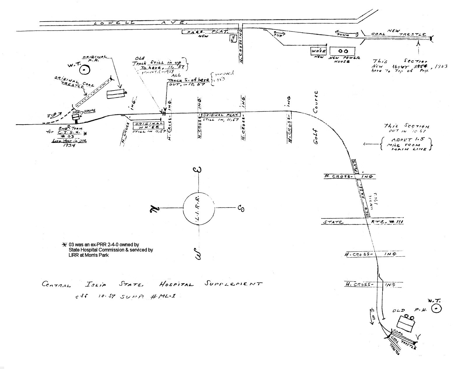
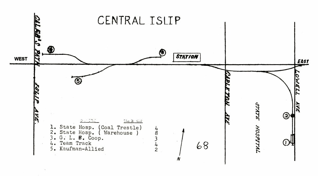
Central Islip State Hospital
10/1957 |
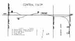
Central Islip 1966 |
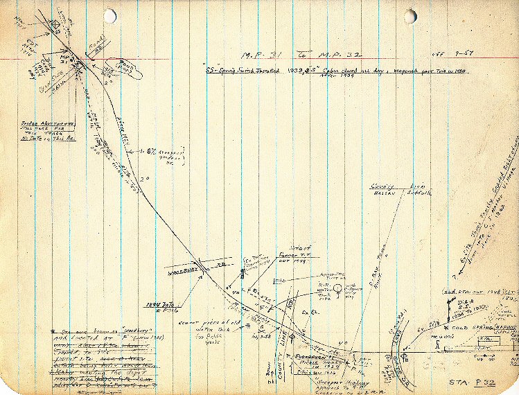
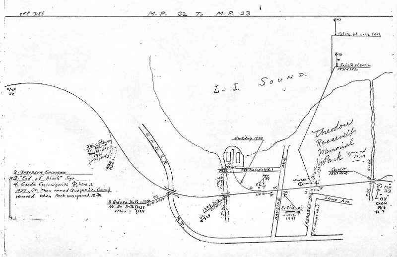
Cold Spring MP31-32 9/1957 |
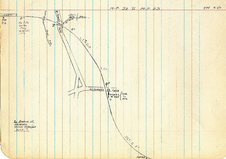
Cold Spring MP32-33 9/1957 |
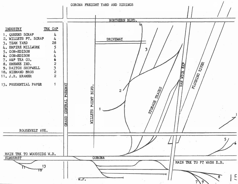
Corona MP6-7 |
Corona Yard 1966 page 15 |

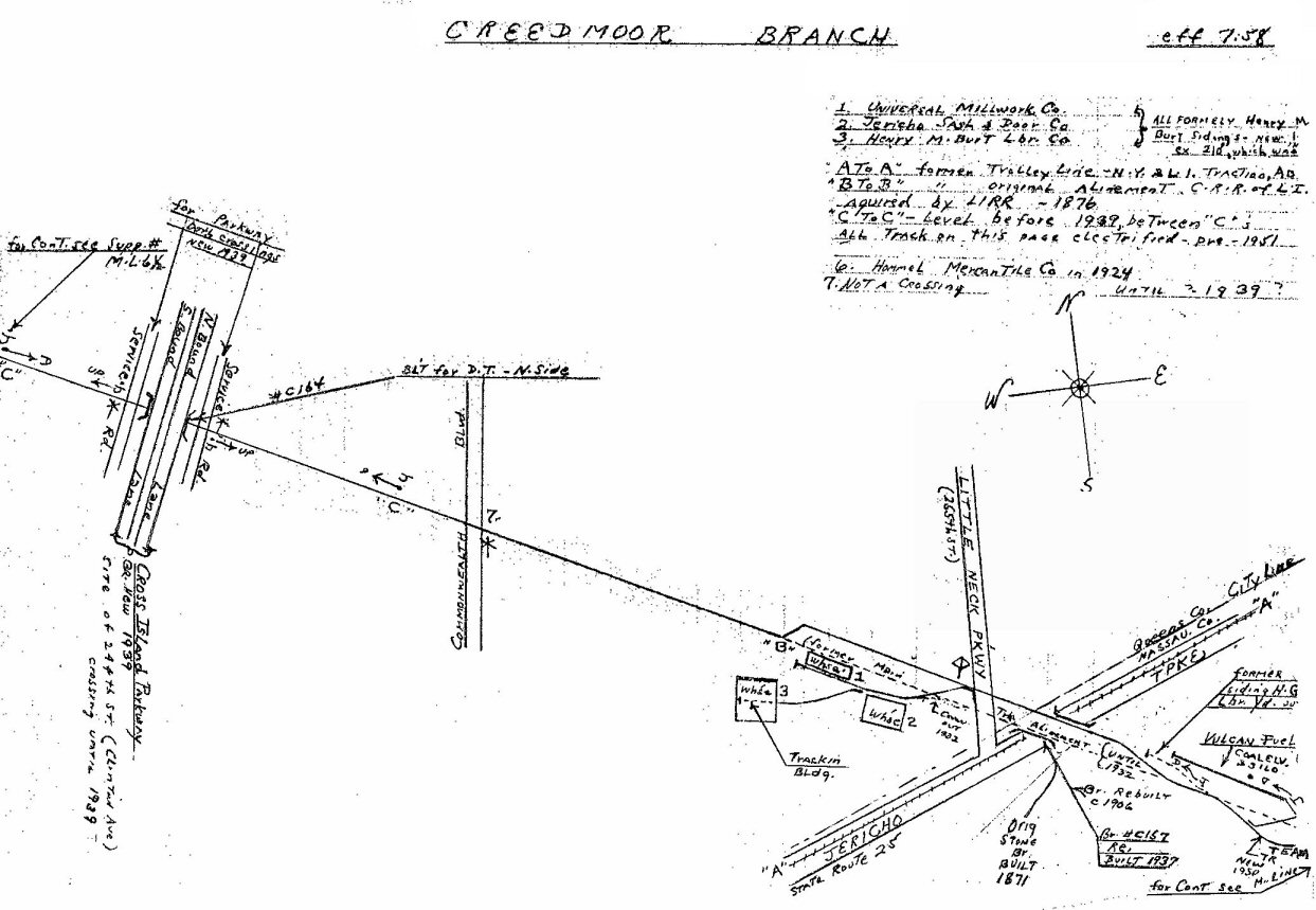
Creedmoor 07/1958 |
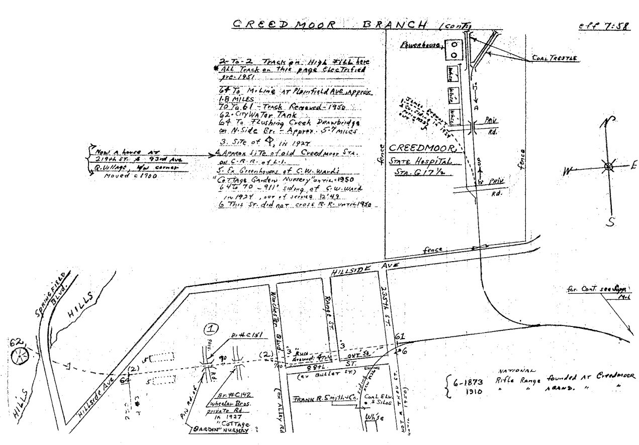
Creedmoor 07/1958 |
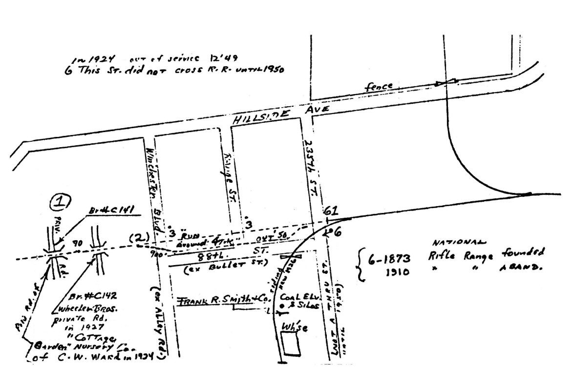
Creedmoor 07/1958 Frank Smith
Coal Inset
|
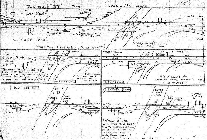
DB Tower 1906-1959
Dutch Kills Draw Bridge, LI City |
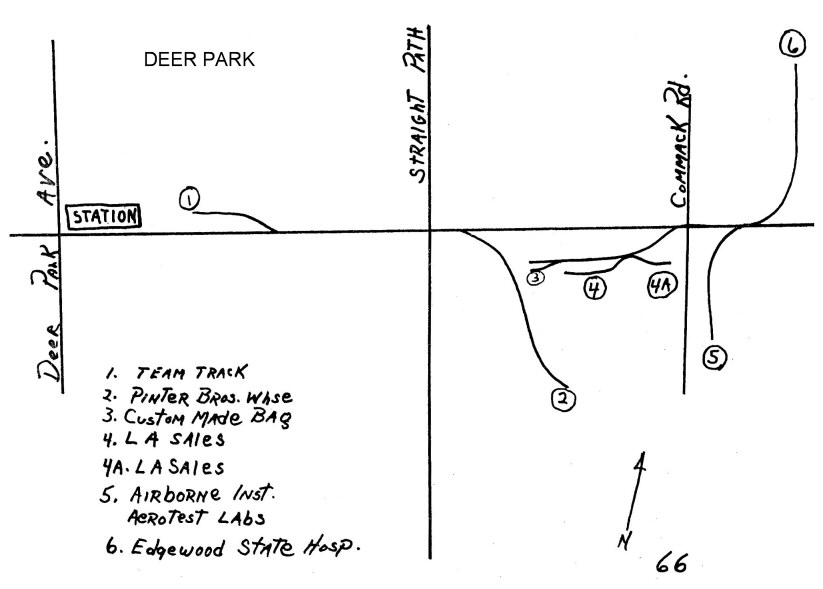
Deer Park 1966 |
Drawbridge Greenpoint Ave
11/14/60 |

Dutch Kills 1966 |
|
|
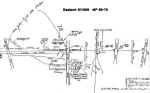
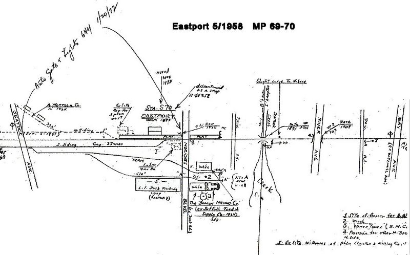
Eastport MP69-70 06/1958 |
Eastport - Speonk 1966 |
East New York -
Vanderveer Park 1966 |
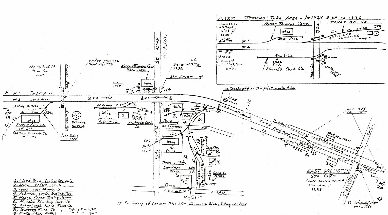
East Williston MP19-20 5/1958 |
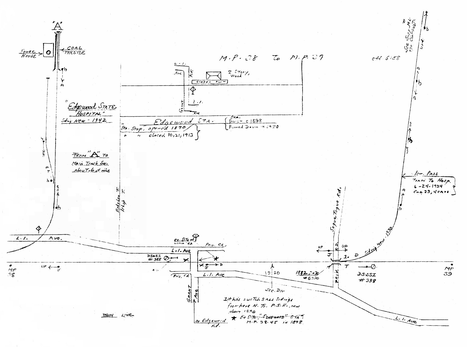
Edgewood MP38-39 5/1958 |
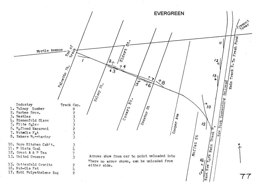
Evergreen Branch 1966 |
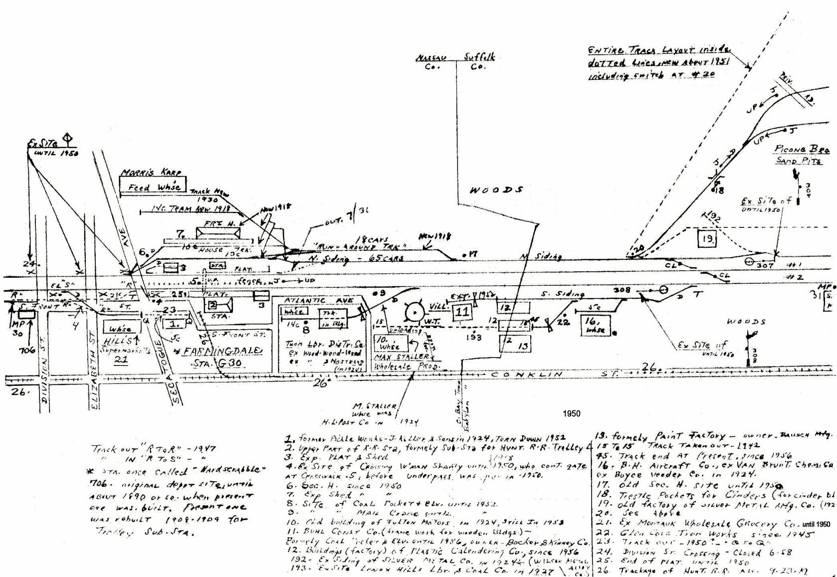
Farmingdale MP30-31 06/1958
|
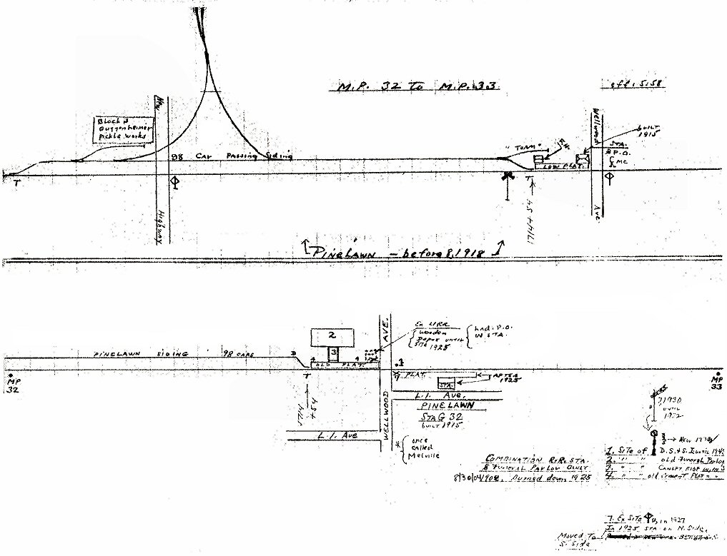
Farmingdale/Pinelawn MP32-33 06/1958 |
Republic Rte: 110 Farmingdale MP31-32 06/1958 |
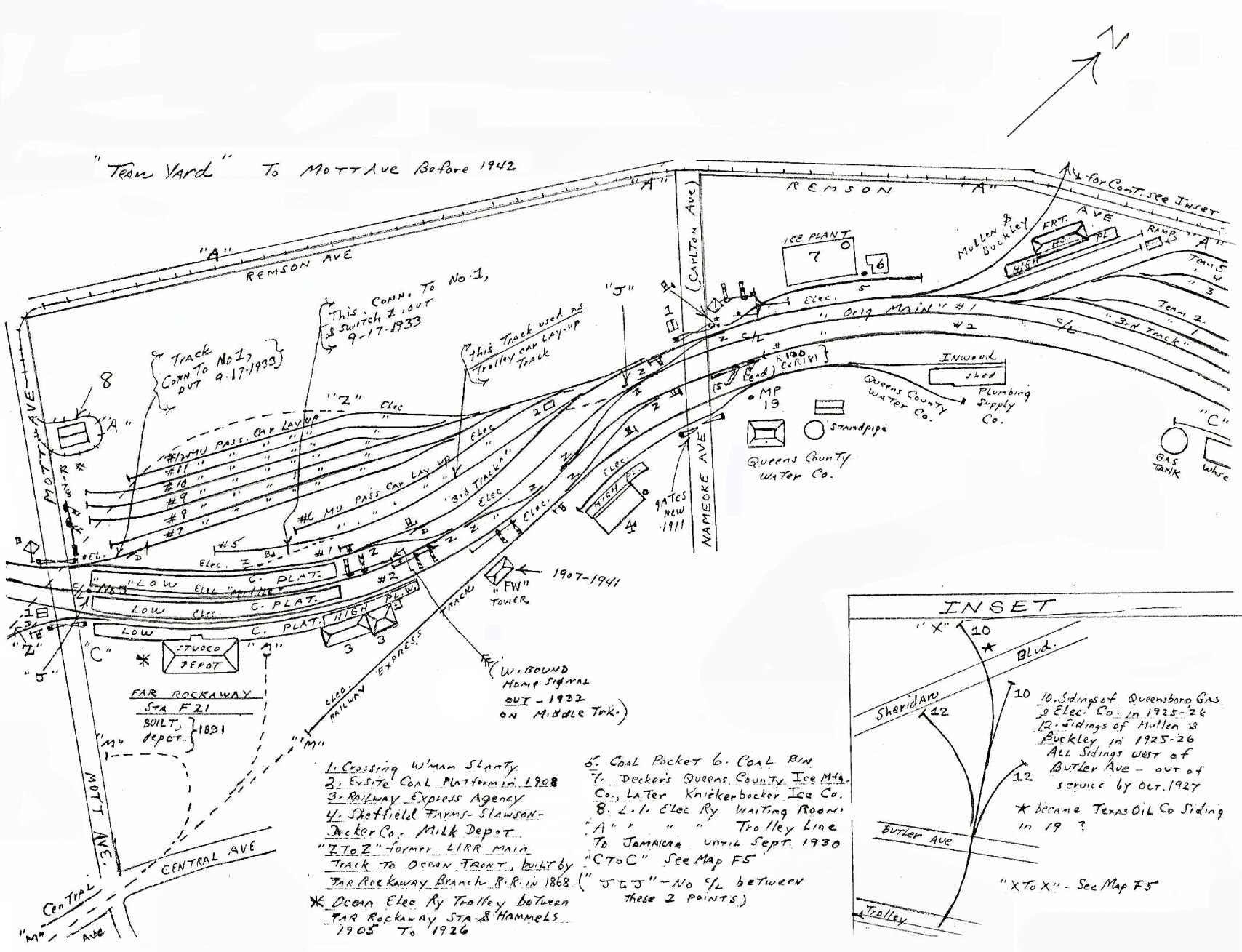
Far Rockaway <1942 |
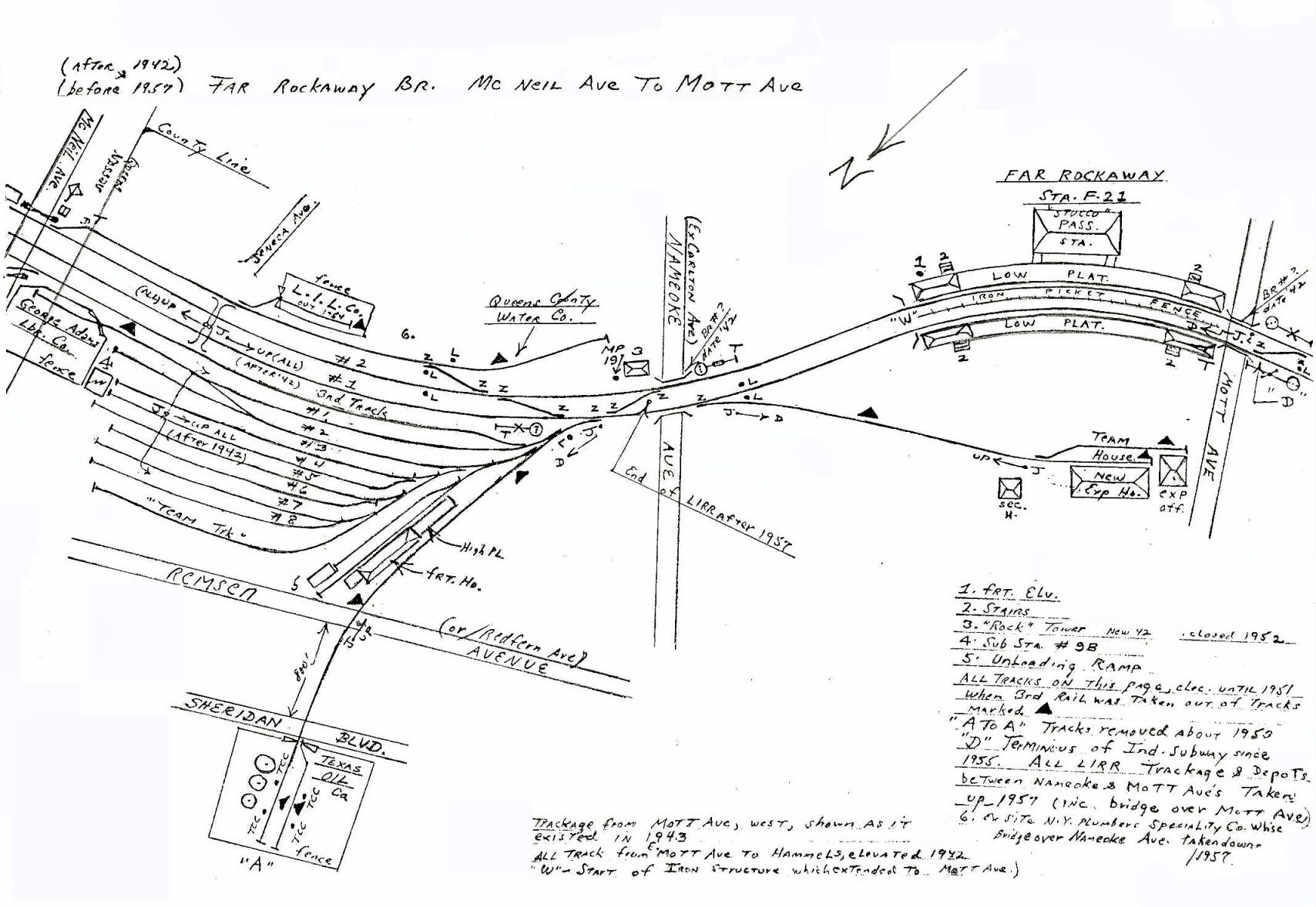
Far Rockaway 1957 |
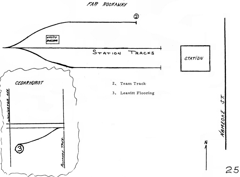
Far Rockaway 1966 |
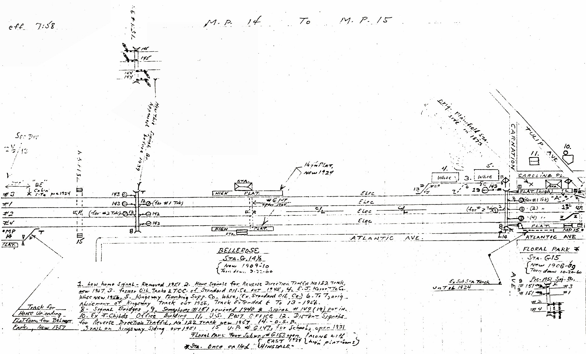
Floral Park MP14-MP15 07/1958 |
Floral Park MP15-MP16 07/1958 |
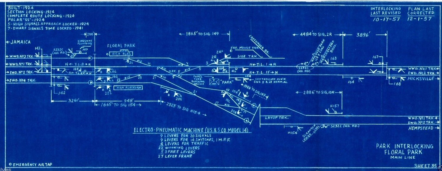
Floral Park PARK Tower
1957 blueprint Sheet #35 Archive: Art Huneke |
Flowerfield 1934 SUNY-Stony
Brook |
|
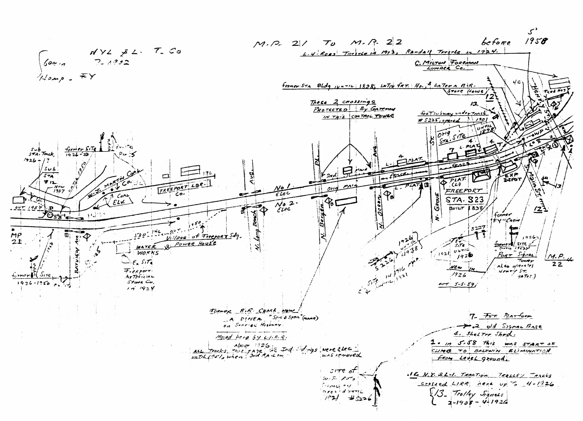
Freeport MP21-22 5/1958 |

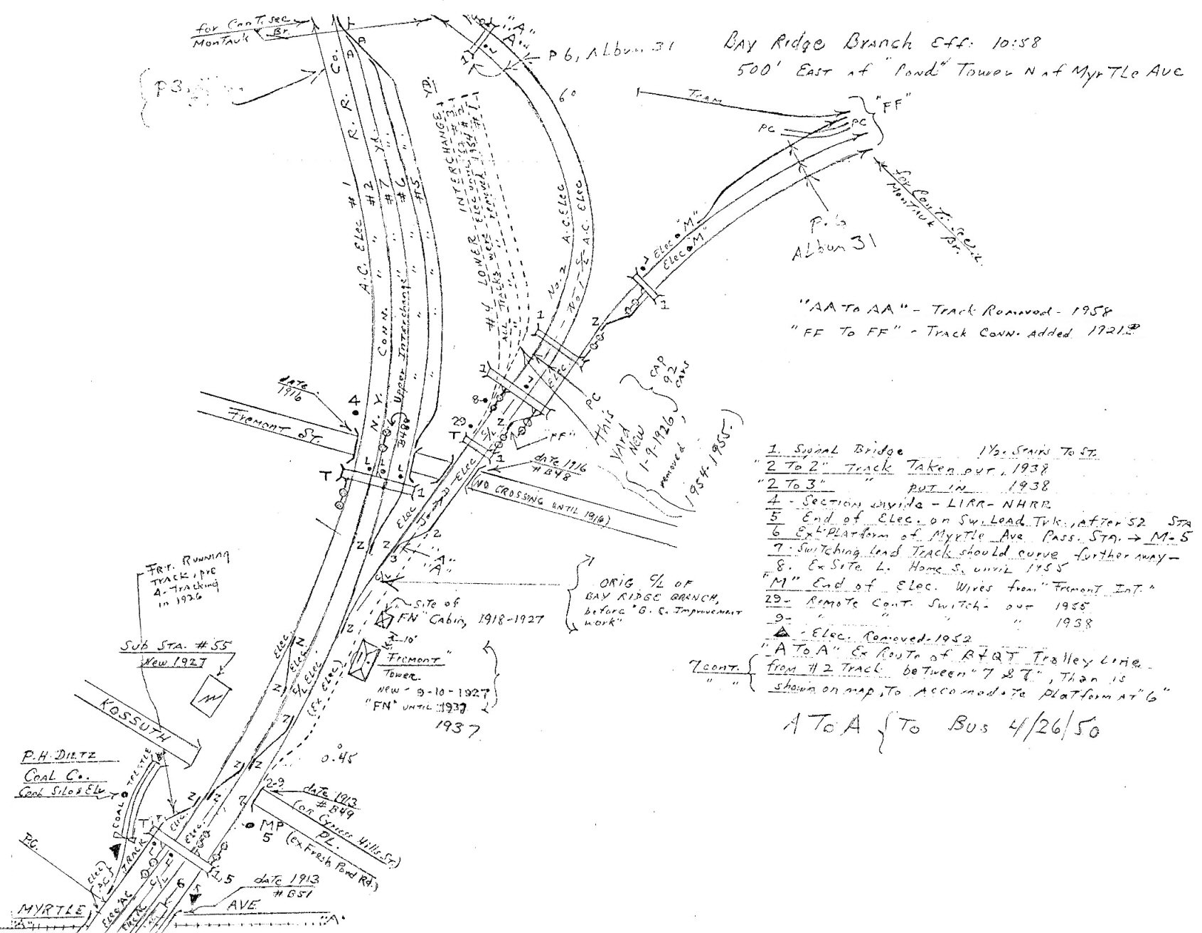
Fremont Tower - Bay Ridge Branch 10/1958 |
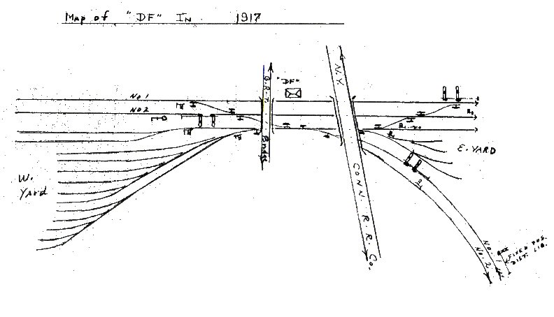
Fresh Pond 1917
|
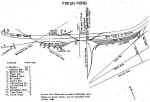
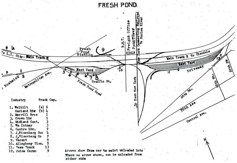
Fresh Pond 1966 |
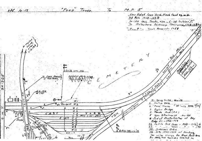
Pond Tower to MP5 10/1958
|
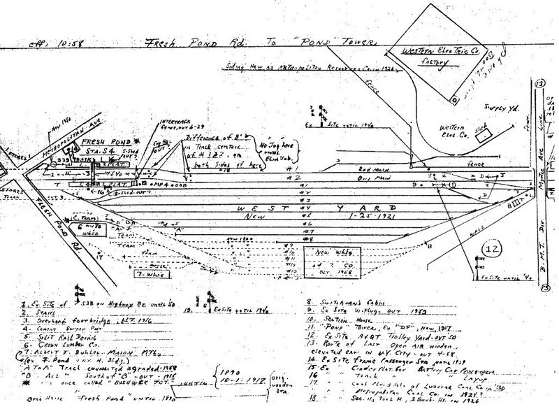
Fresh Pond 10/1958 |
|
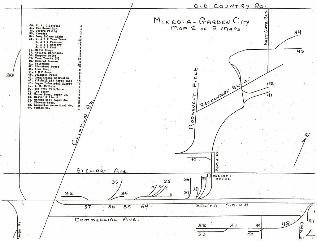
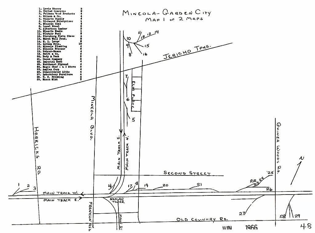
Garden City Secondary 1966 |
Glendale Jct. 11/1958 |
Glen Head - Seacliff - Glen
Cove- Locust Valley 1966 |
|
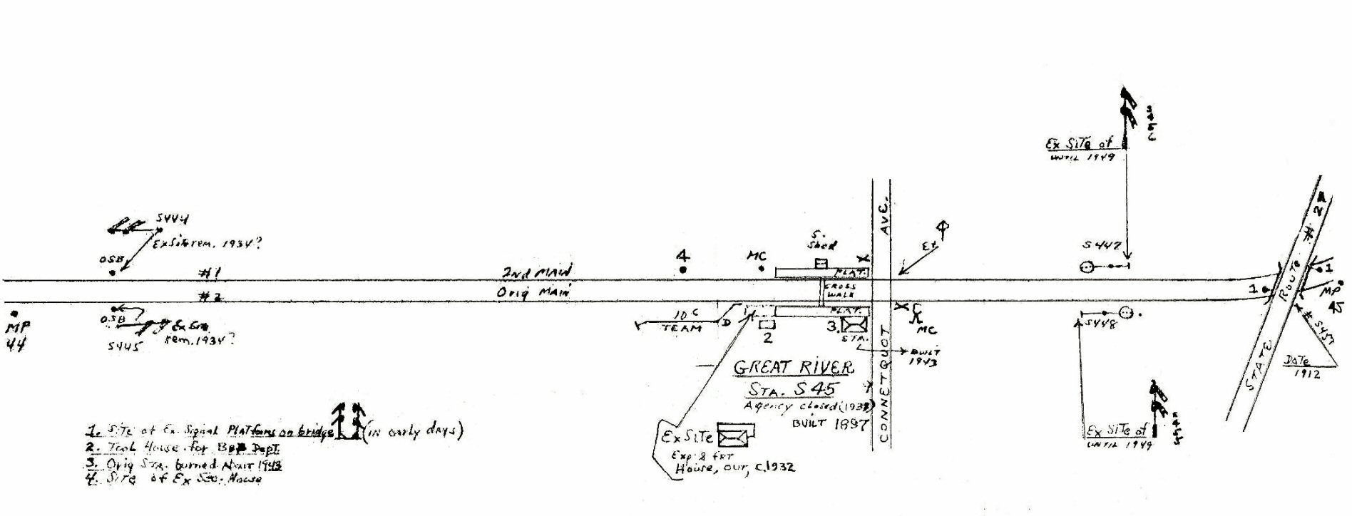
Great River 5/58 |
Greenlawn 1966 |
|
Hammels Wye Post-1942 |
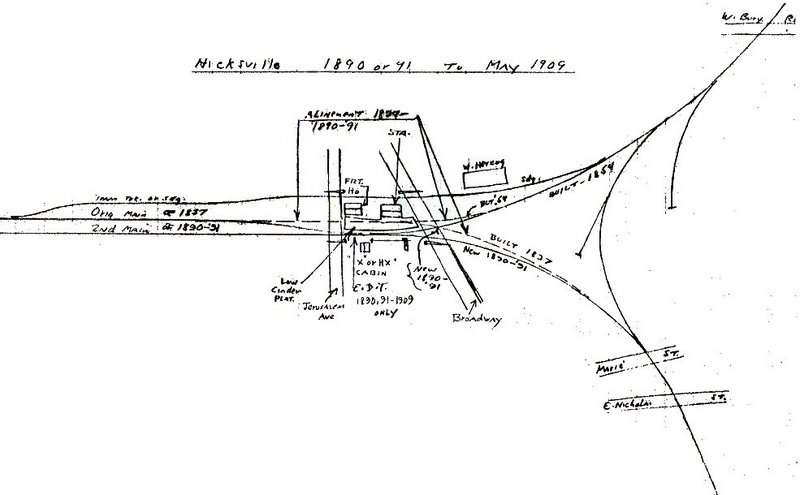
Hicksville 1891 |
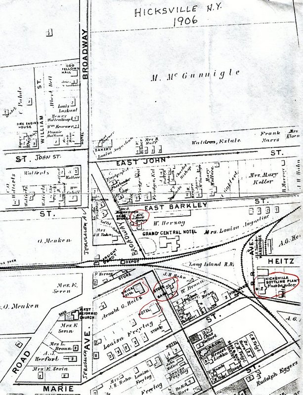
Hicksville 1906 |
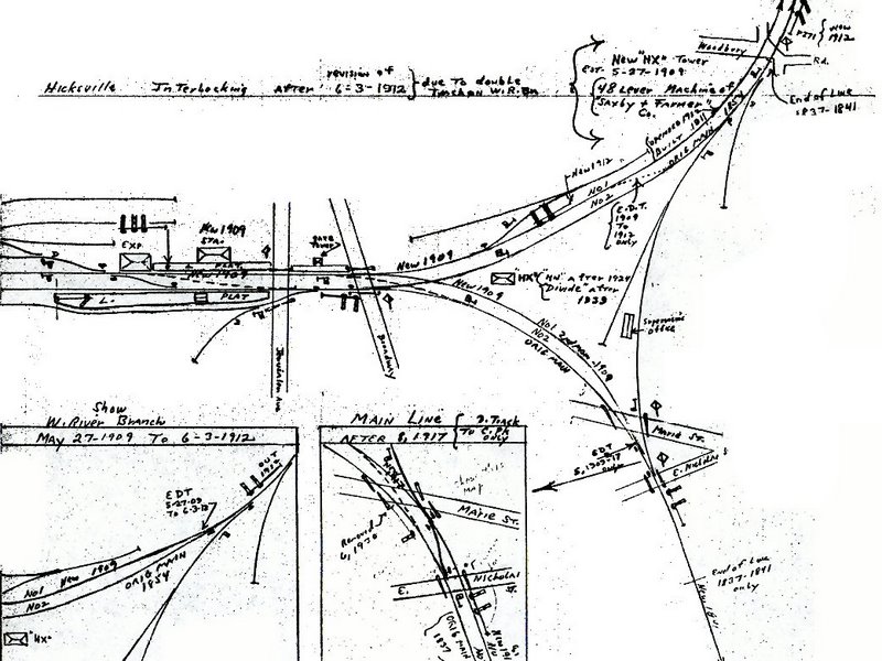
Hicksville 1912 |
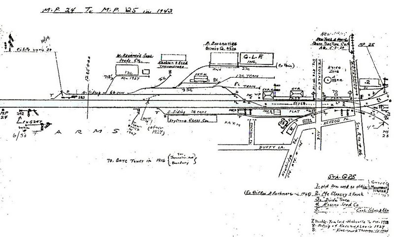
Hicksville 1943 |
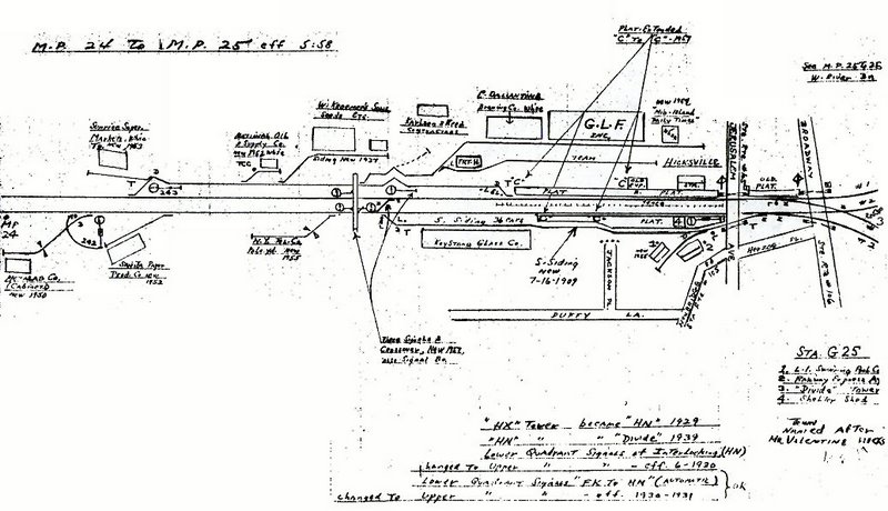
Hicksville 05/1958 |
G.O. Hicksville Elevated
Interlocking 9/19/64 |
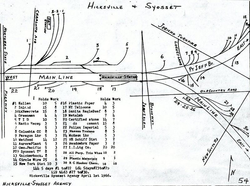
Hicksville 1966
|
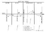
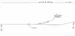
Hicksville Track Profile 1982 |
Hicksville 3/1983
LIRR map
|
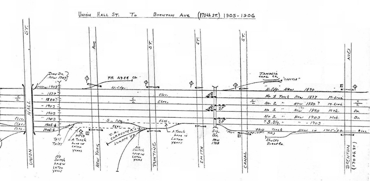
Hillside 1905-06 |
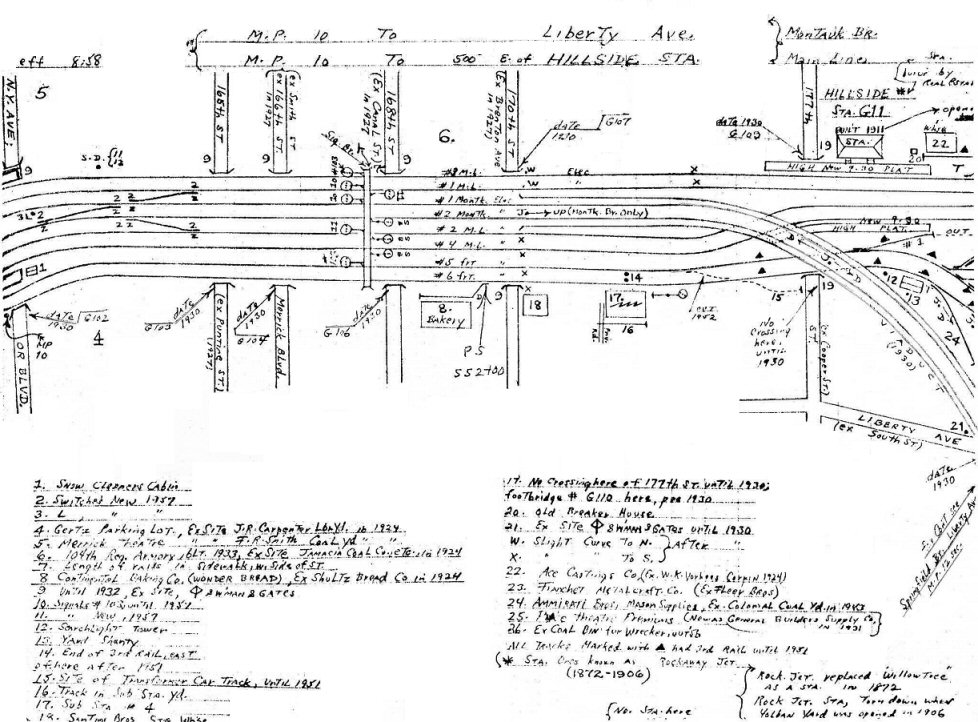
Hillside 8/1958 |
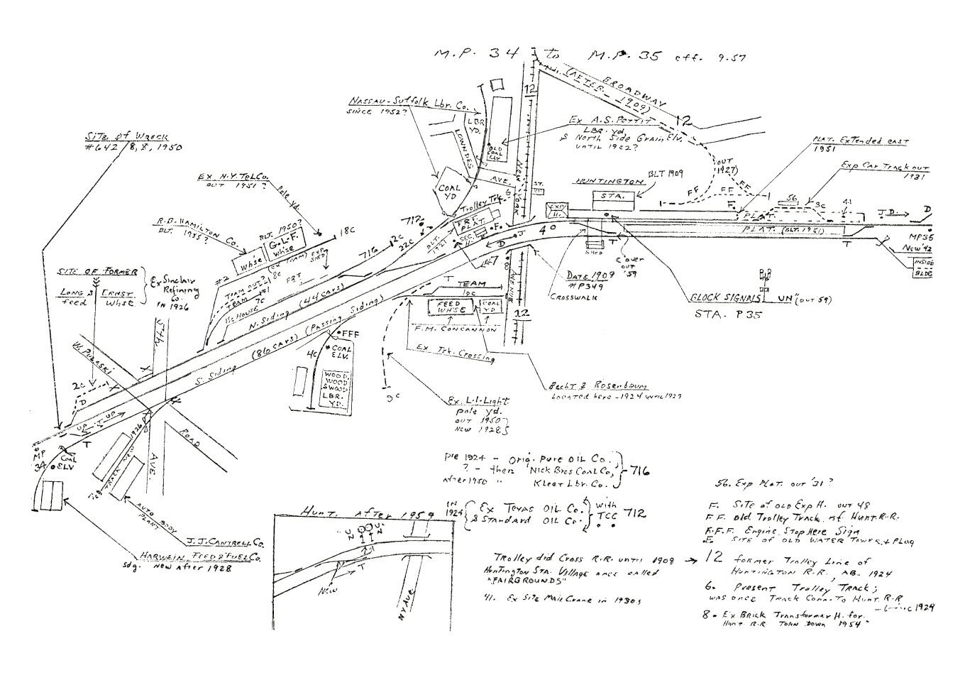
Huntington MP34-35 09/1957 |
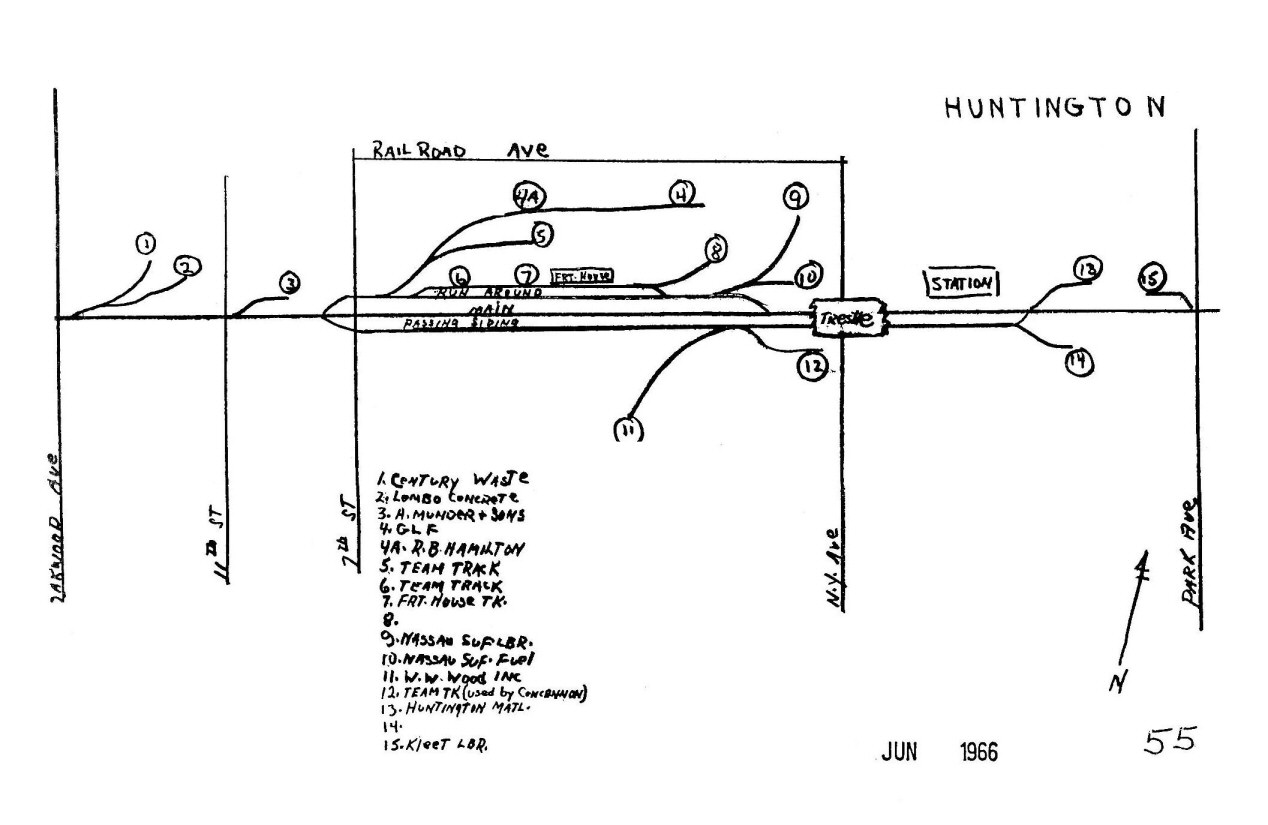
Huntington 1966 |
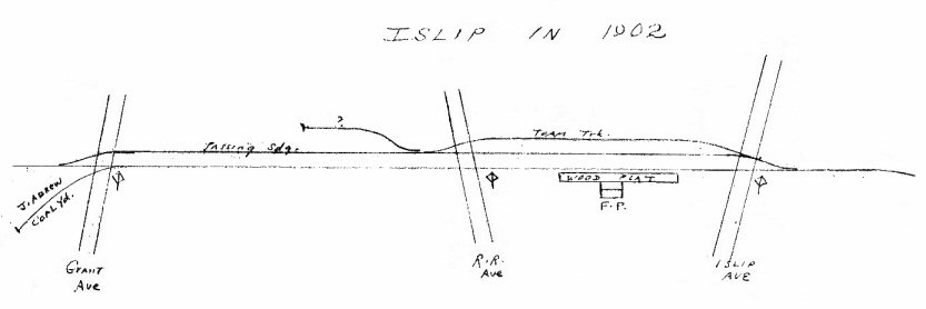
Islip 1902 |
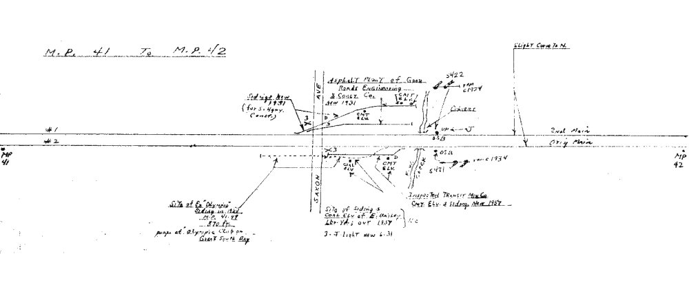
Islip MP41-42 1958 |
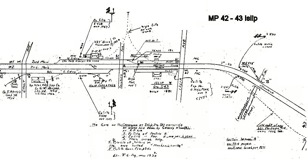
Islip MP42-43 1958 |
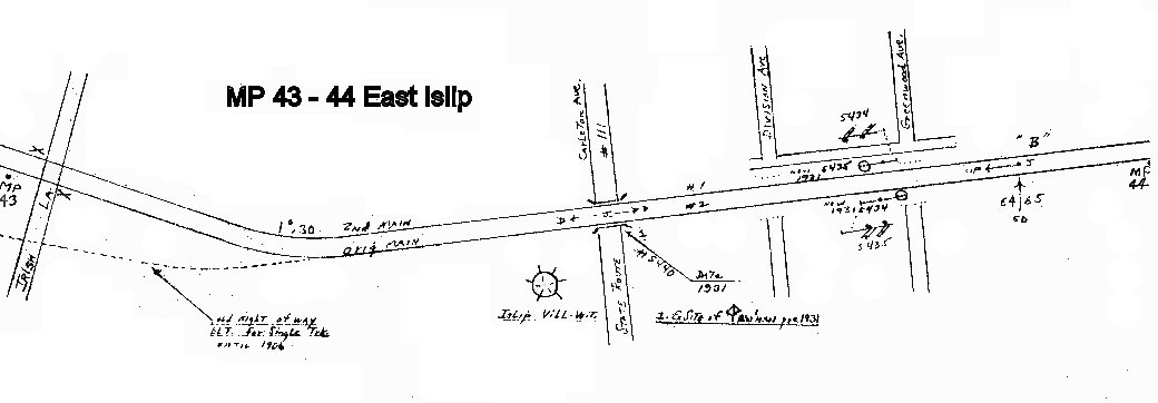
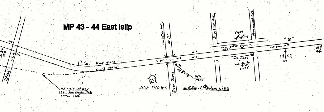
Islip/East Islip MP43-44 1958 |
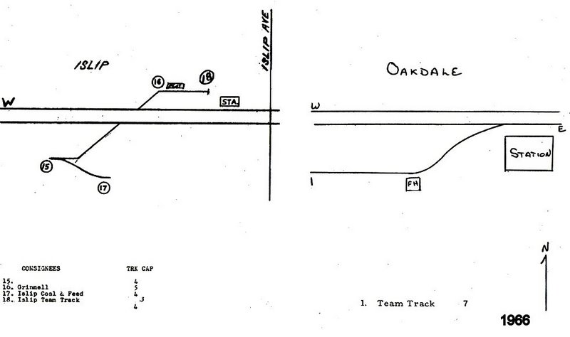
Islip 1966 |
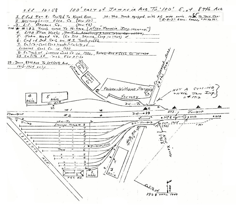
Jamaica Ave. to 89th Ave. 10/1958 |
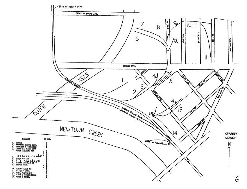
Kearny Sidings 1966 LIRR maps
page 6 |
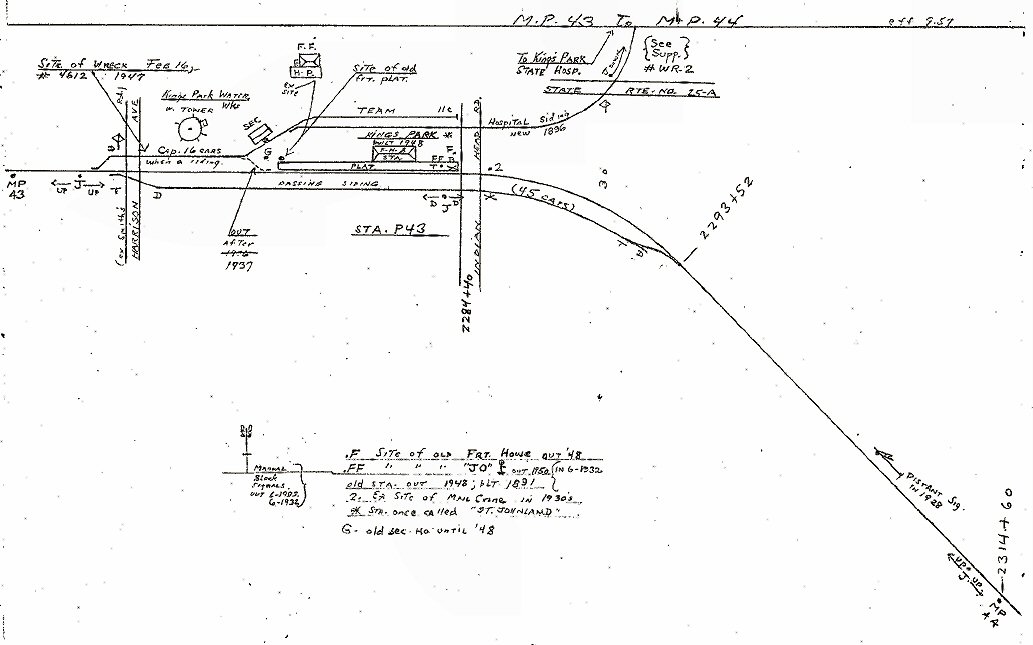
Kings Park MP43-44
09/1957 |
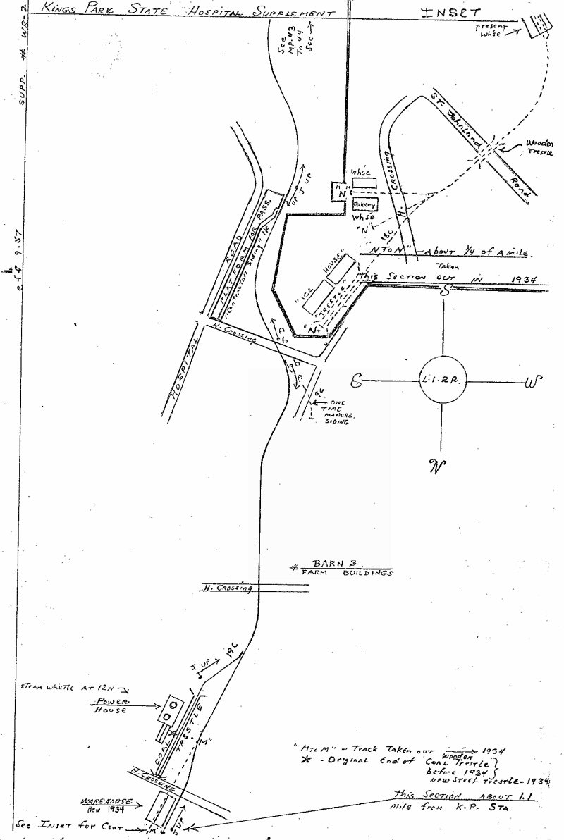
Kings Park Hospital Detail MP43-44
09/1957 |
Kings Park 1966 |
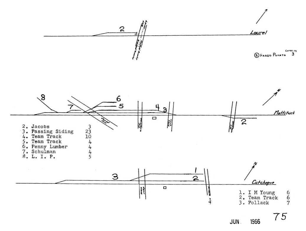
Laurel - Mattituck - Cutchogue 1966 |
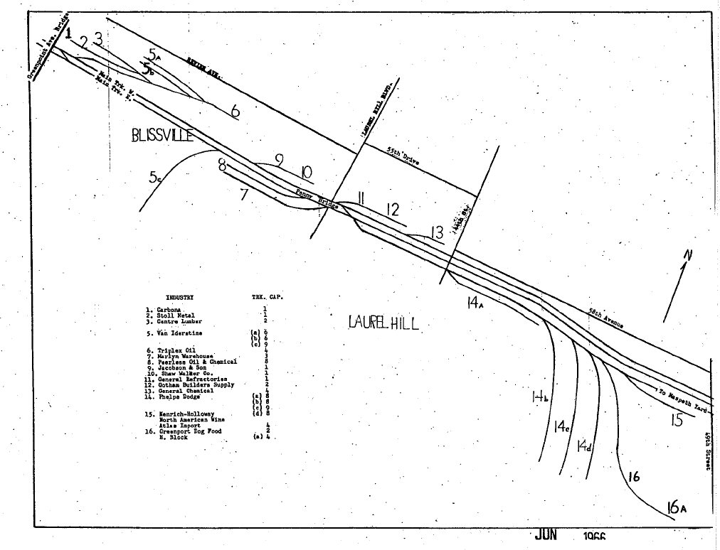
Laurel Hill 1966 |
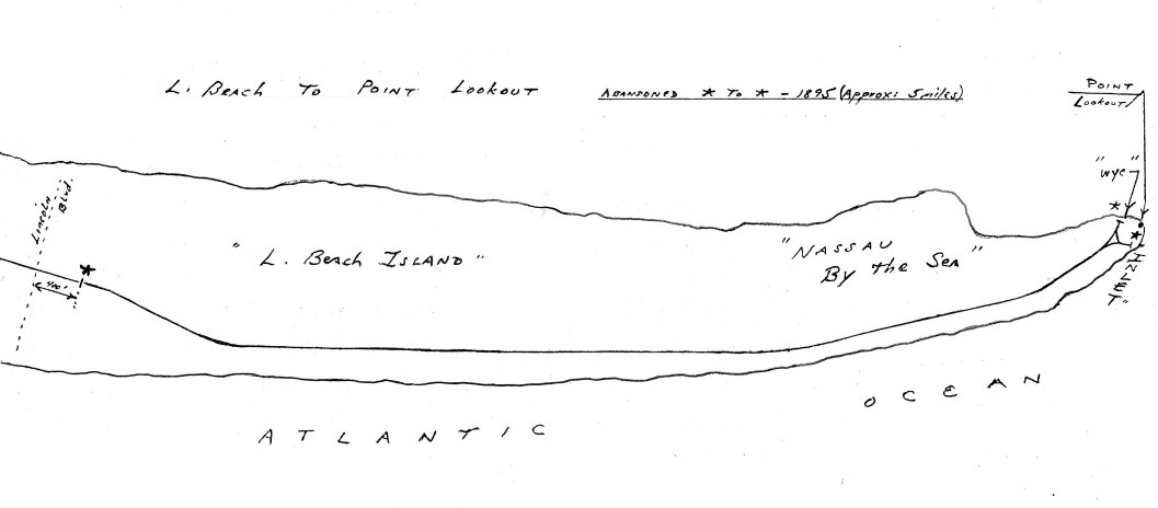
Long Beach to Pt. Lookout c.1892 |
Long Beach 1908 |
Long Beach 1920
|
Long Beach 1958
|
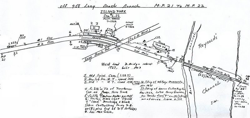
Long Beach MP20-21 09/1958 |
Long Beach MP21-22 09/1958 |
|
|
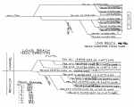
Long Beach Track Capacities
pre/post 1962
|

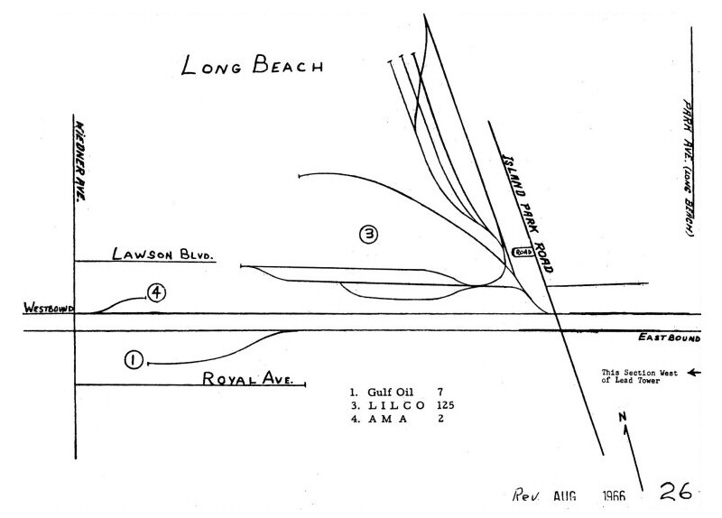
Long Beach 1966
|
G.O. LEAD Interlocking - Long
Beach 4/15/04 |
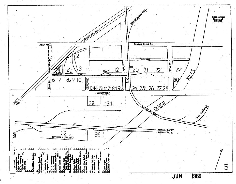
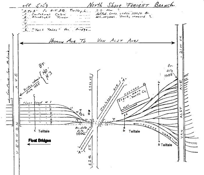
LI City 05/1959
Float Lead Yard |
LI City 05/1959
Arch Street Transfer
Westbound Classification (8th Street) Yard |
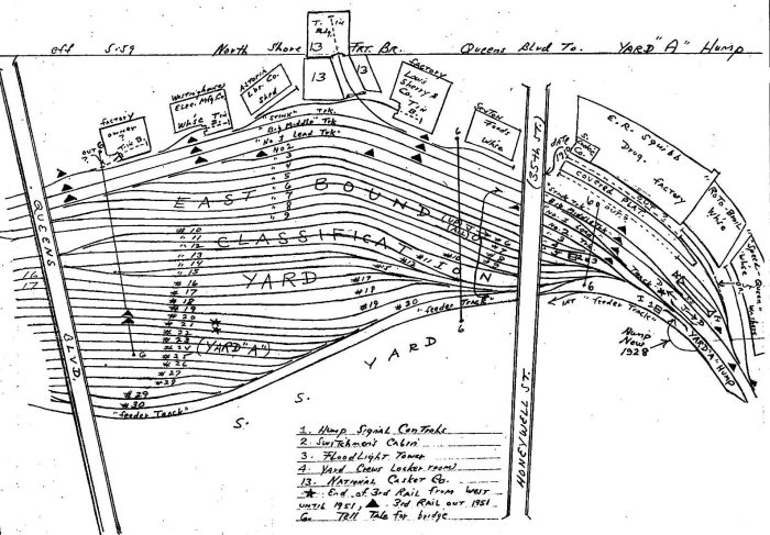
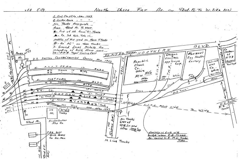
LI City 05/1959
Thomson St to Queens Blvd.
Yard A
|

LI City 05/1959
Yard A Hump - Eastbound Classification Yard |
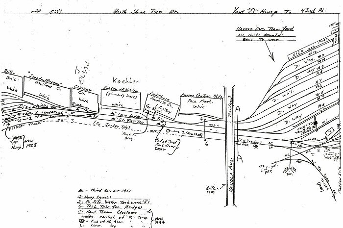
LI City 05/1959
Yard A Hump to Harold Ave Yard |
LI City 05/1959
Gosman Yard - US Postal Center |
|
|
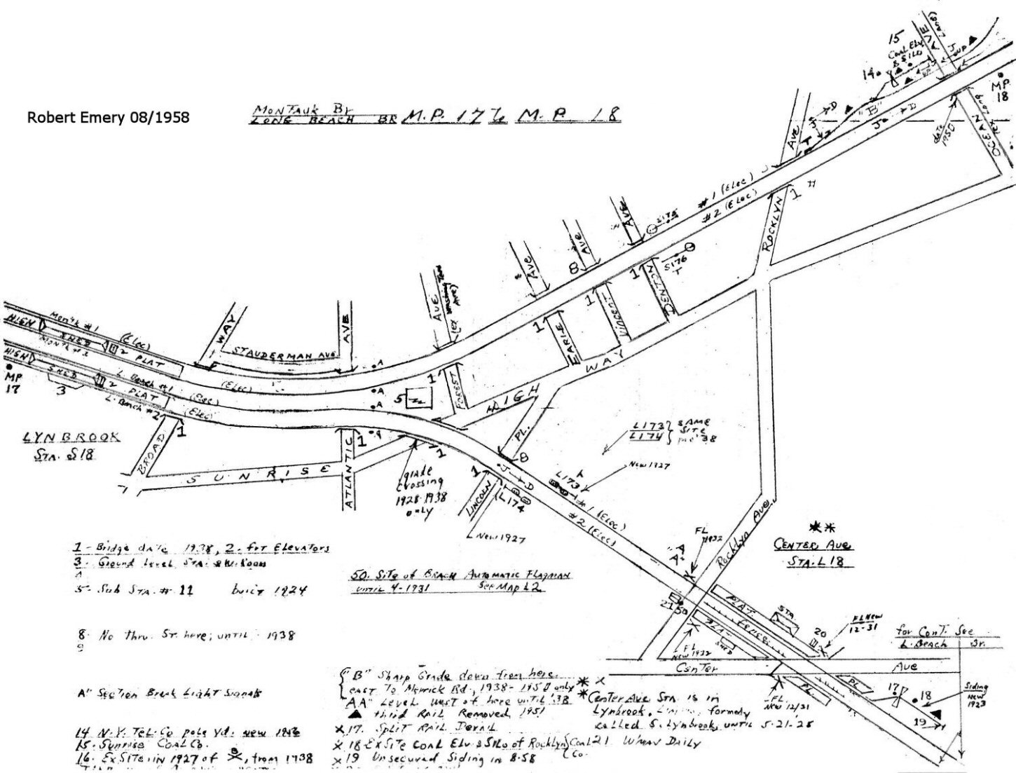
Lynbrook MP17-MP18 08/1958 |
Manorville - Grumman Siding 1966 |

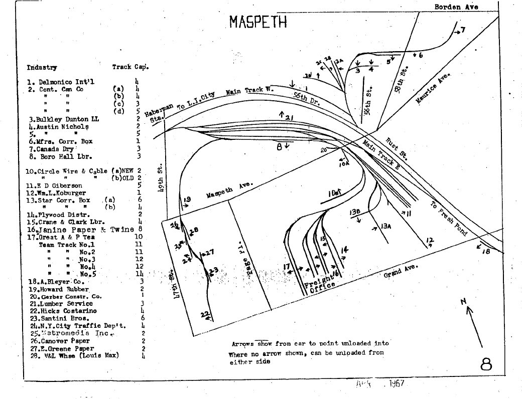
Maspeth 1967 page 8 |
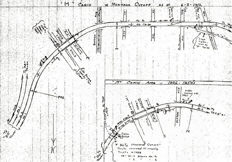
M Cabin 1912 Freight Drawbridge
(lift bridge) over Dutch Kills |
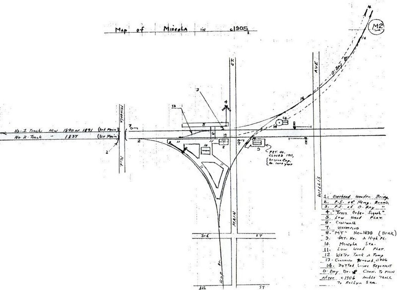
Mineola 1905 |
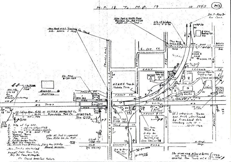
Mineola 1943 |
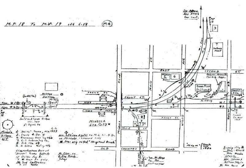
Mineola 1958 |
Mineola 1966 |

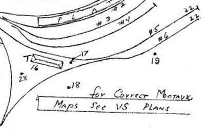
Montauk 1942+ zoom -VS Plans LIRR 1916
Valuation Section/Plans map several feet long, 1 mile of the
railroad standard nationwide Info Richard Makse |
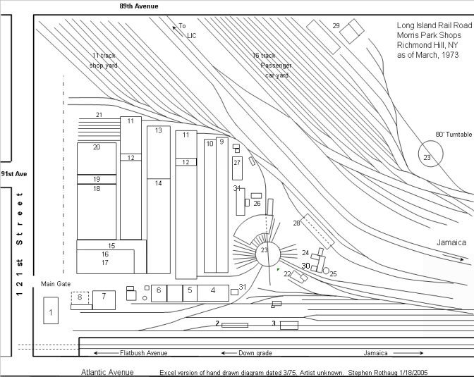
Morris Park Shops 1973 |
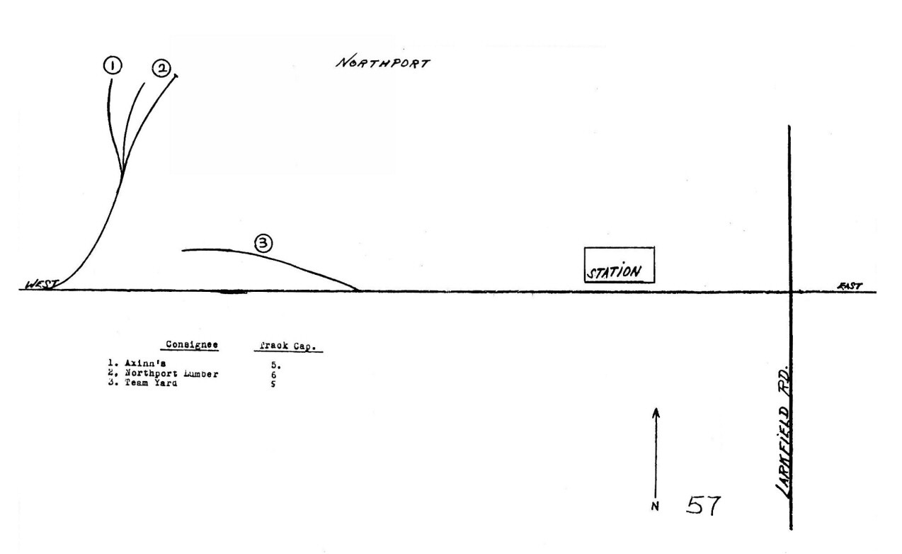
Northport 1966 |

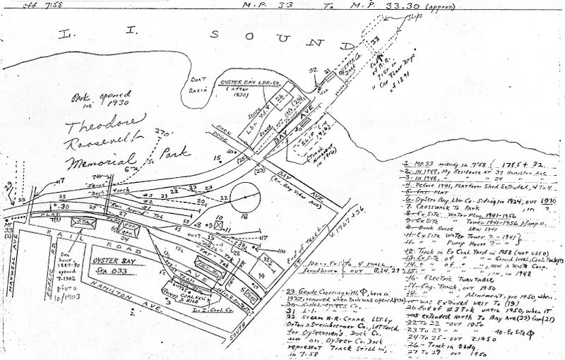
Oyster Bay MP32-33 07/1958 |

Oyster Bay MP33-34 07/1958 |
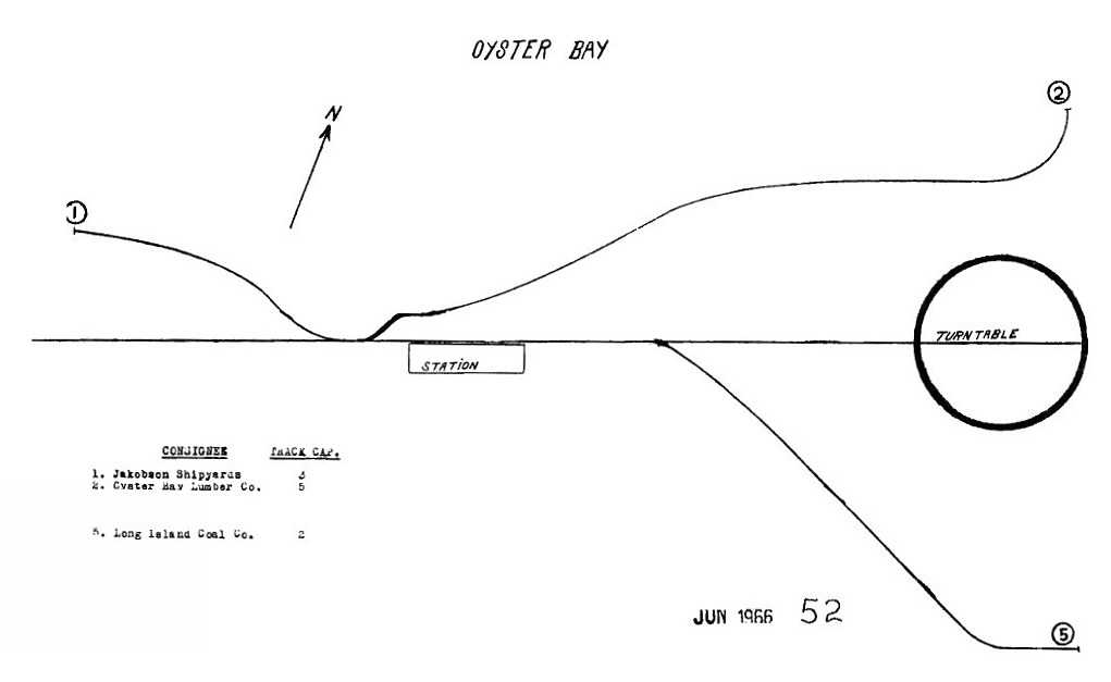
Oyster Bay 1966
|
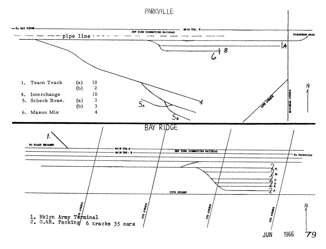
Parkville - Bay Ridge 1966
|
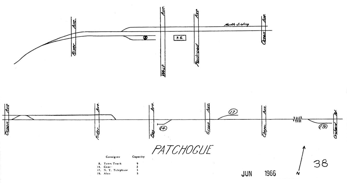
Patchogue 1966 |
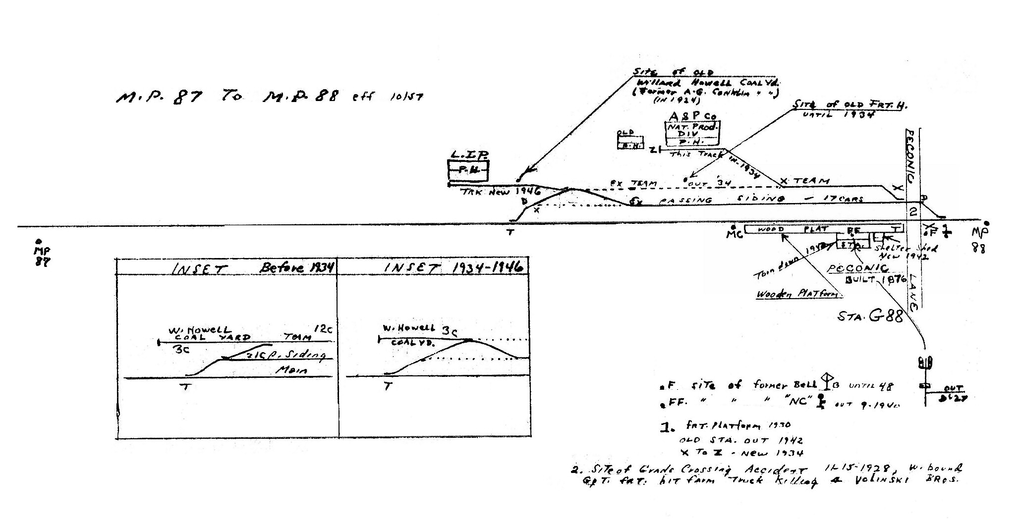
Peconic MP87-88 10/1957
|

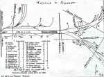
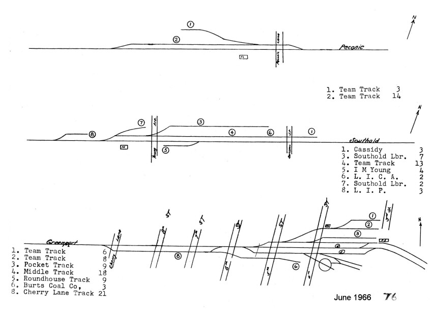
Peconic - Southold - Greenport
1966 |
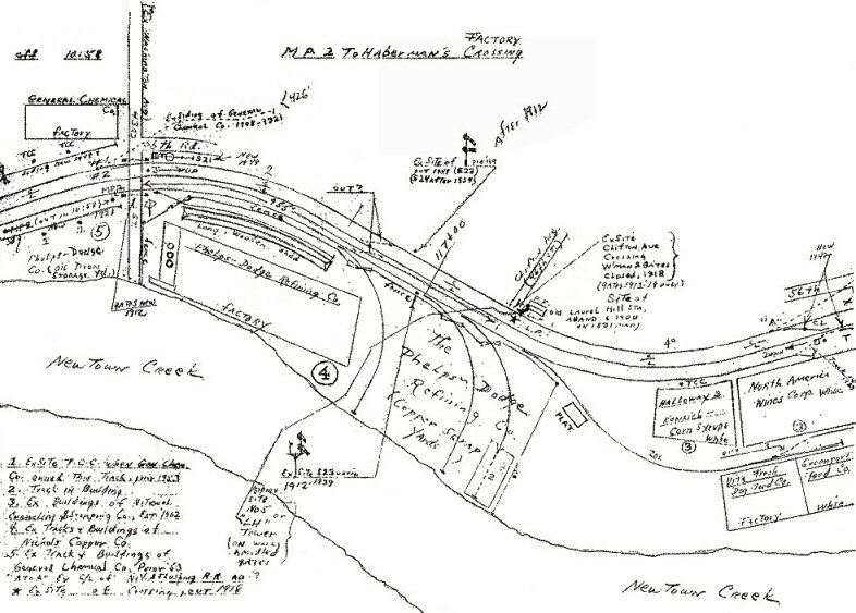
Phelps Dodge MP2 1958
Montauk Branch |
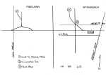
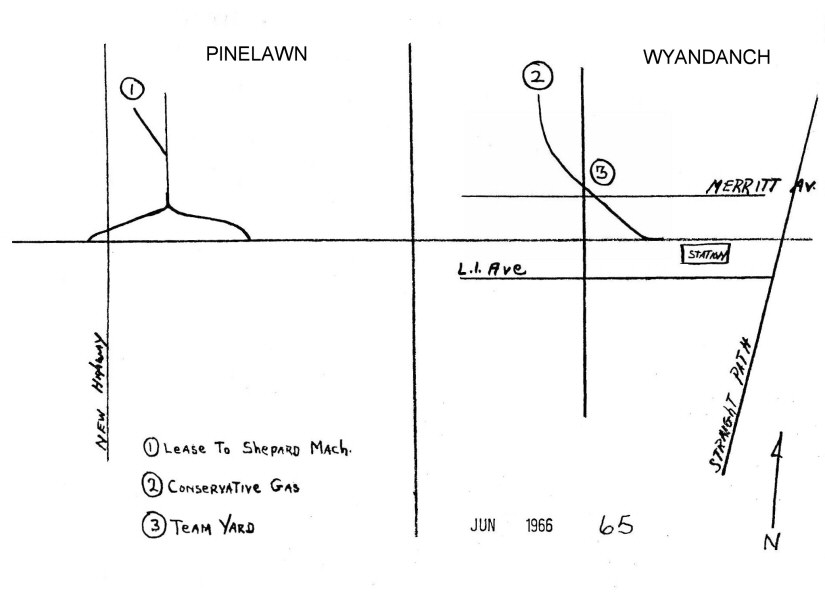
Pinelawn - Wyandanch 1966 |
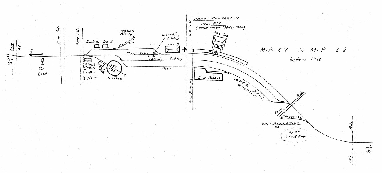
Port Jefferson MP57-58 pre1920 |

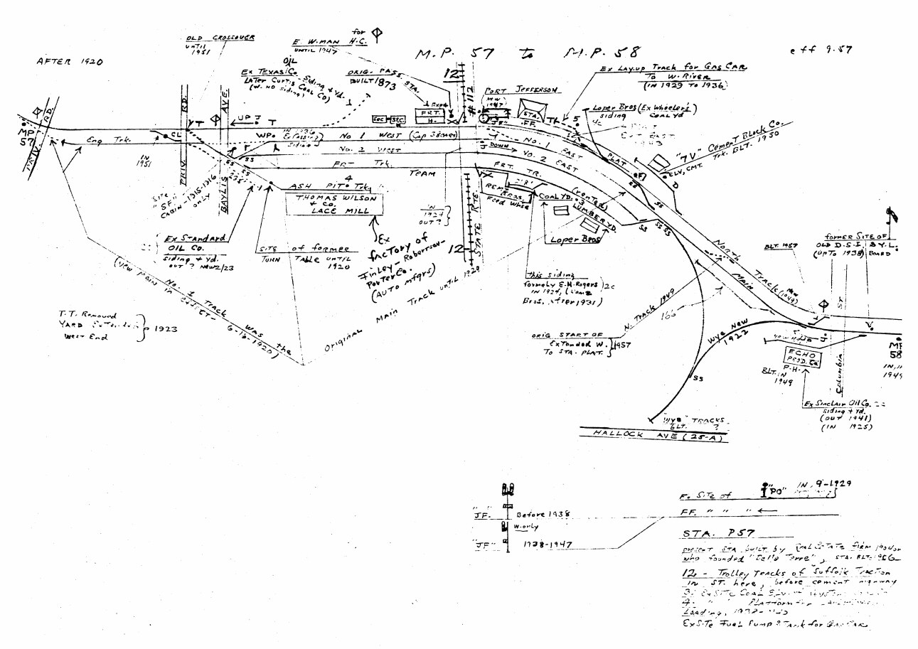
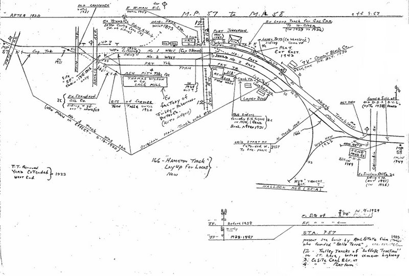
Port Jefferson MP57-58
post1920 09/1957 |
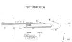
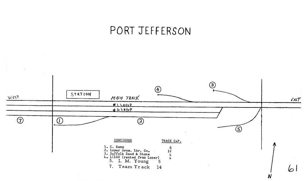
Port Jefferson 1966 |
Queens Village - Belmont Park
Jct. MP13-14 |
Queens Village 1966 |

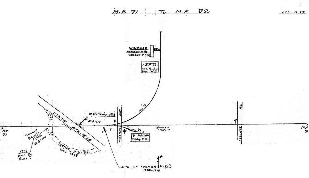
Riverhead MP71-72 10/1957 |
Riverhead MP72-73 10/1957 |
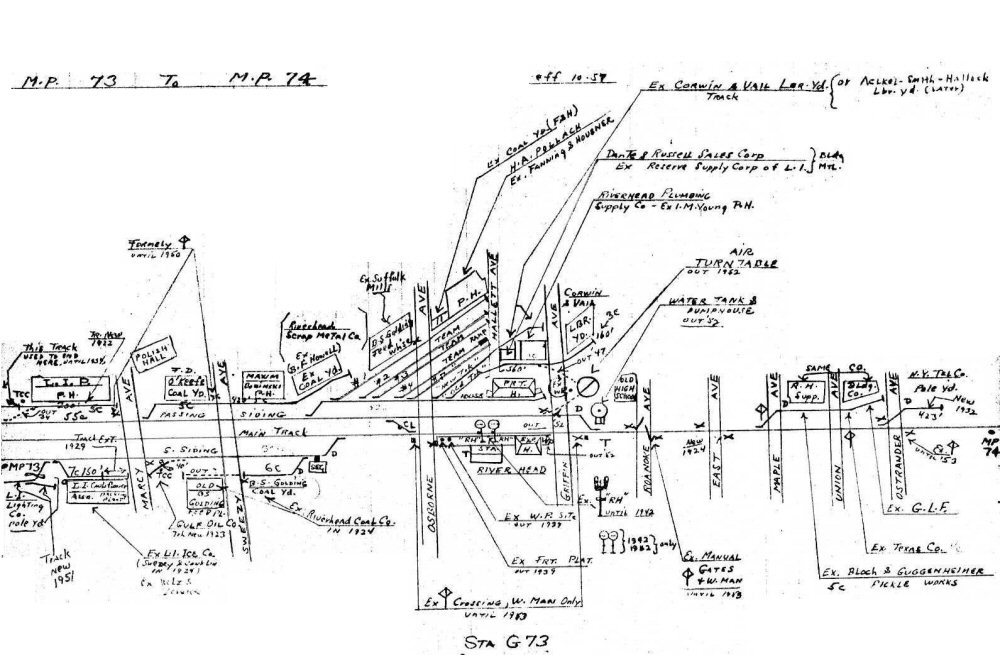
Riverhead MP73-74 10/1957 |
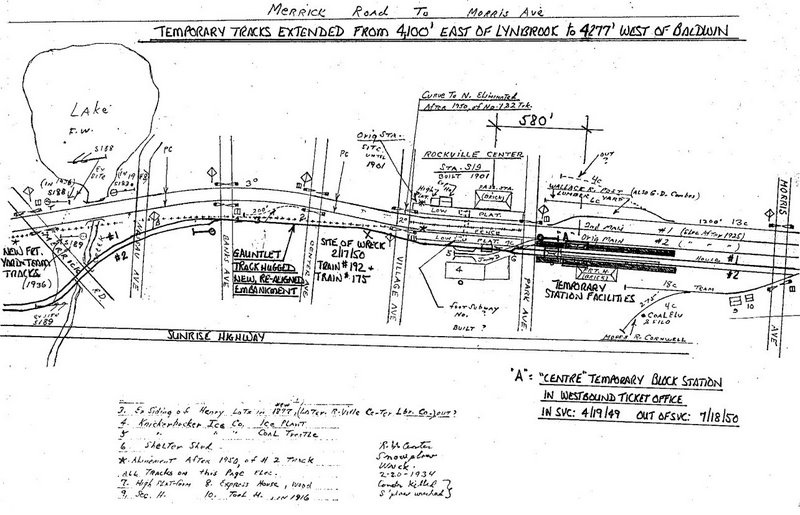
Rockville Centre
Merrick Rd. to Morris Ave.
Gauntlet Track and other temp tracks were laid in 1949 |
Rockville Centre
Merrick Rd. to Morris Ave. |
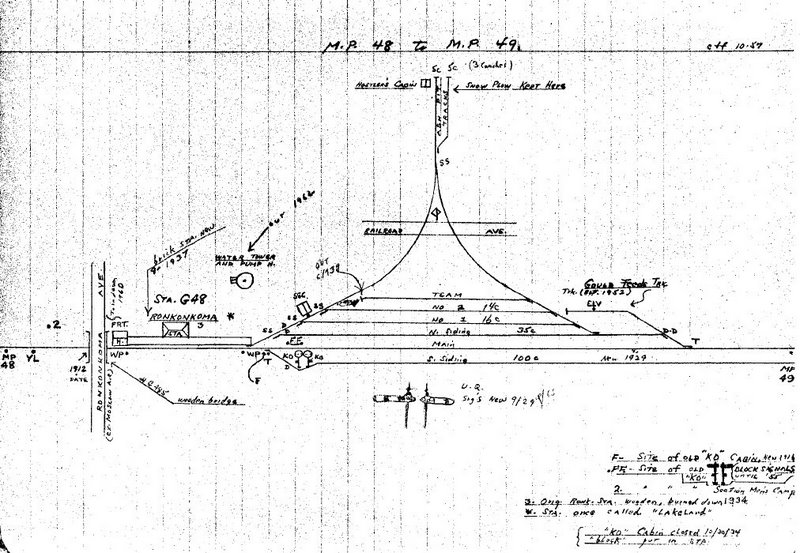
Ronkonkoma MP48-49 10/1957 |

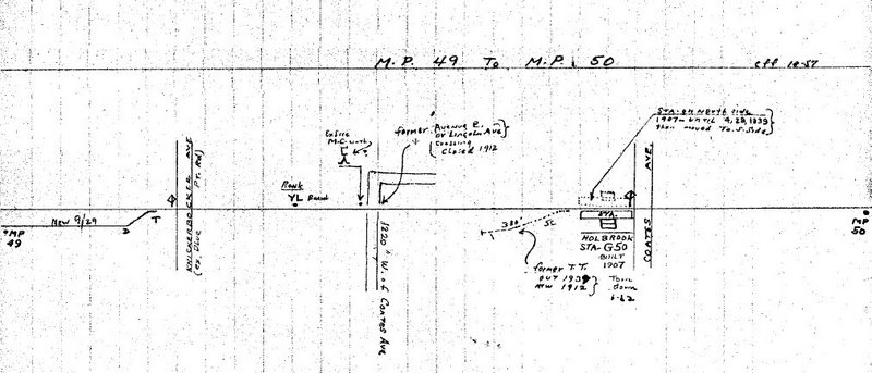
Ronkonkoma MP49-50 10/1957 |
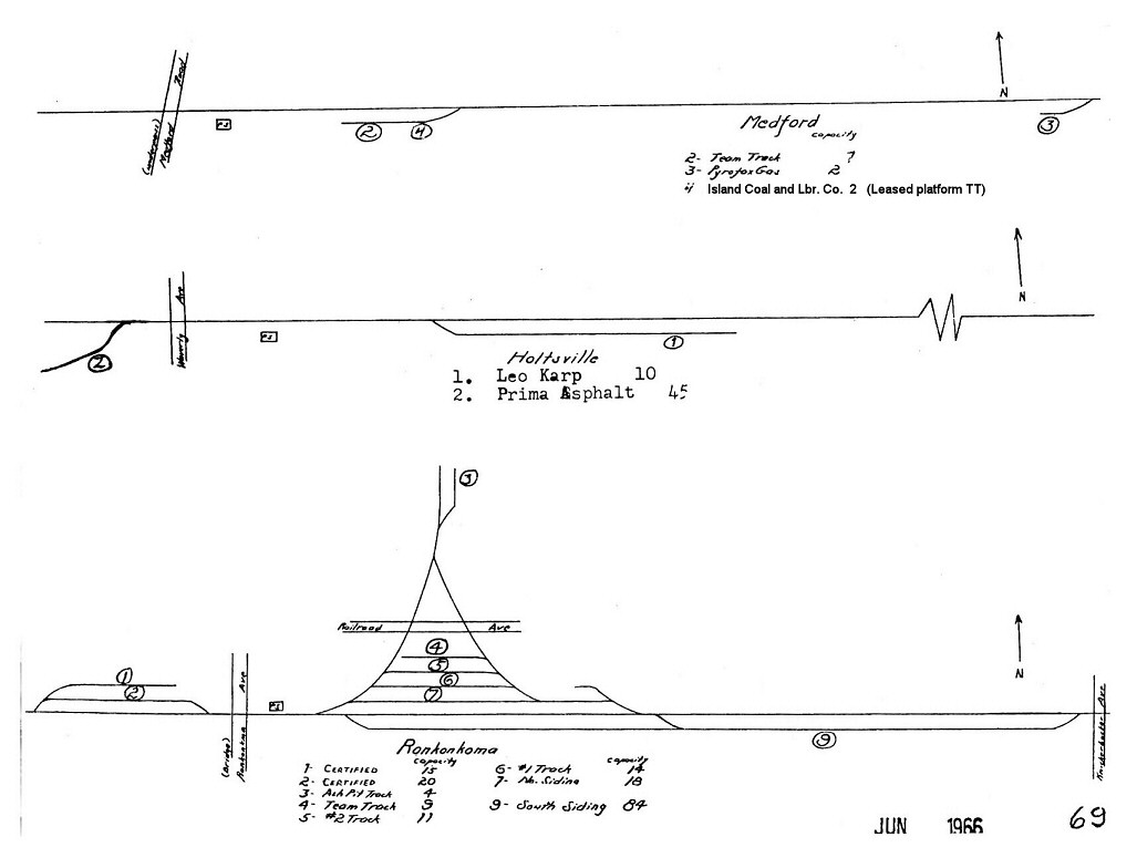
Ronkonkoma - Holtsville -
Medford 1966 |
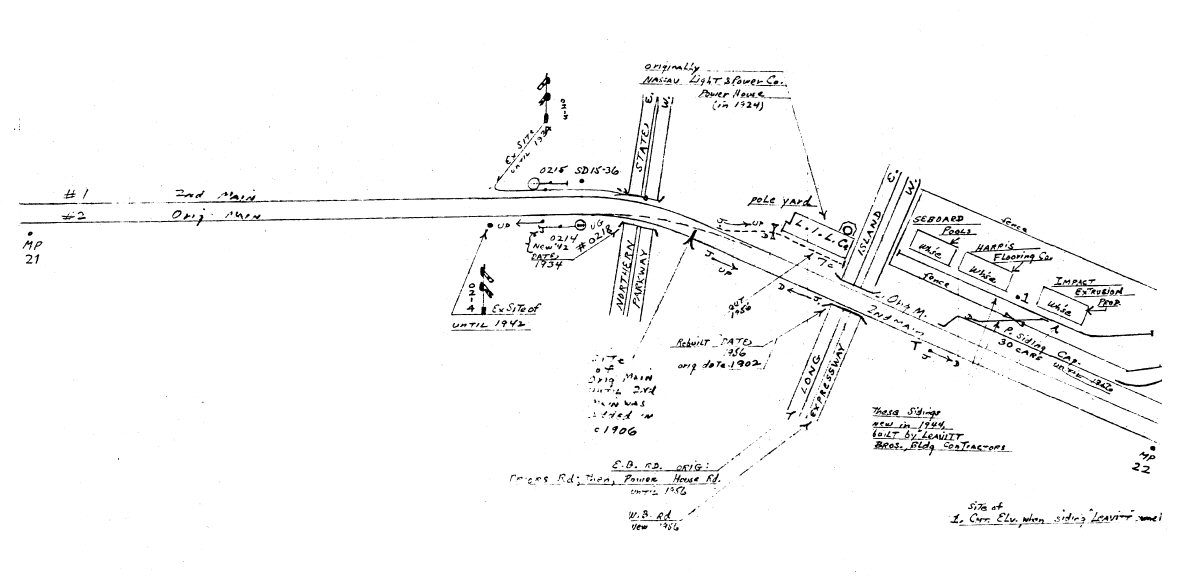
Roslyn MP21-22 5/1958 |
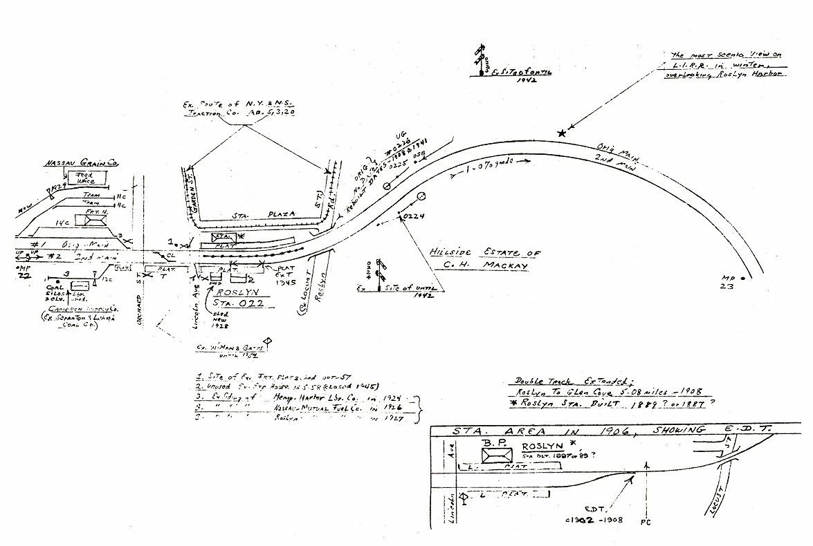
Roslyn MP22-23 5/1958 |
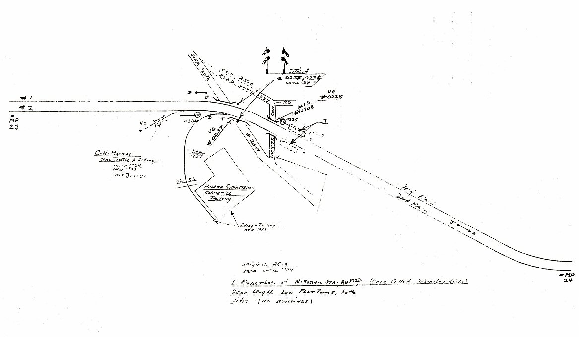
Roslyn MP23-24 5/1958 |
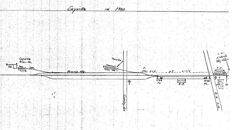
Sayville 1900 |
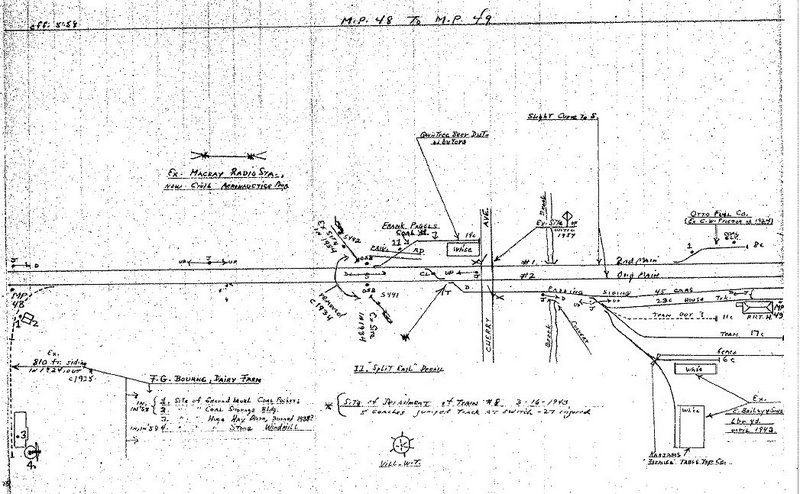
Sayville MP48-49 05/1958 |

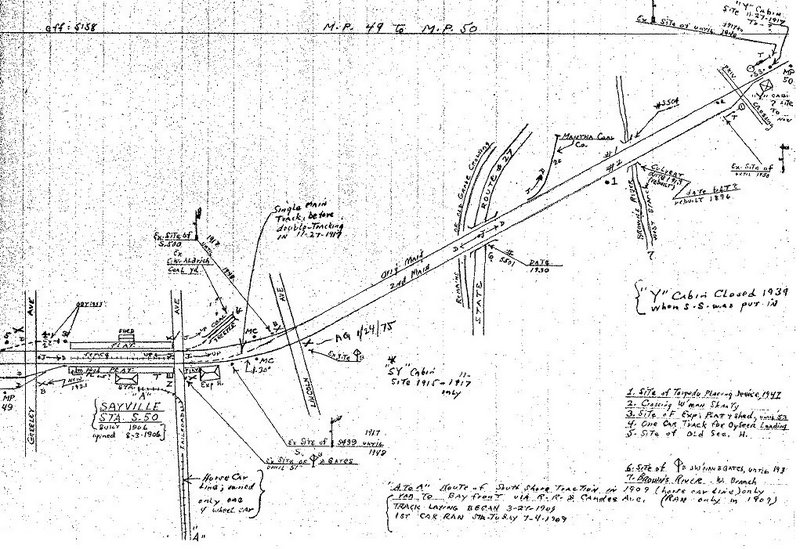
Sayville MP49-50 05/1958 |
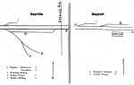
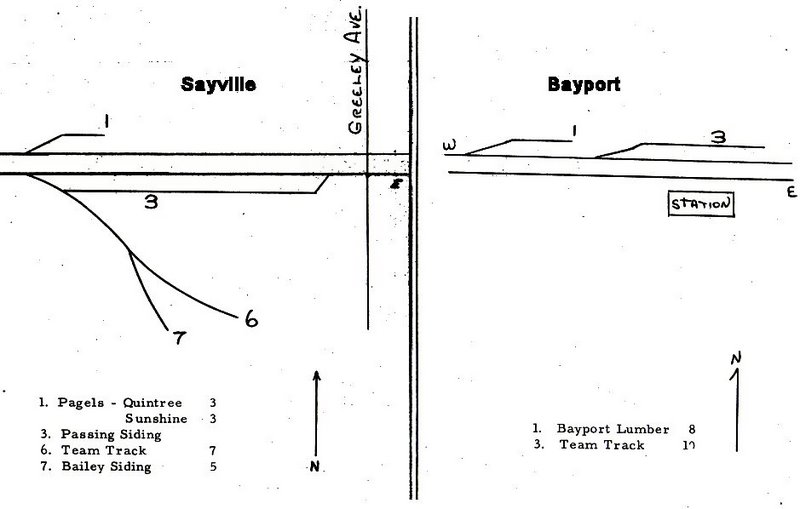
Sayville 1966 |
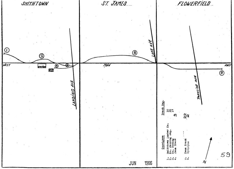
Smithtown - St. James -
Flowerfield 1966
|
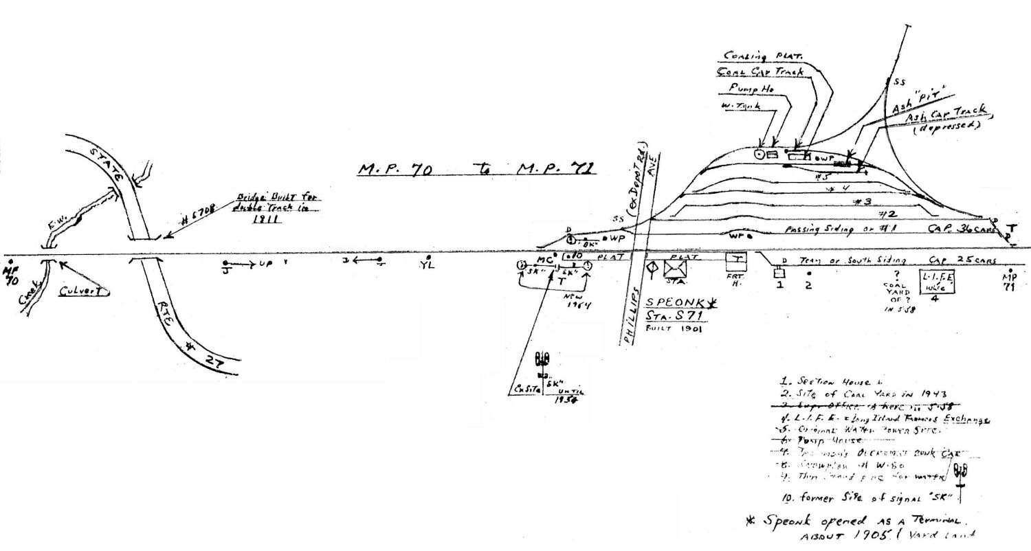
Speonk MP70-71
|
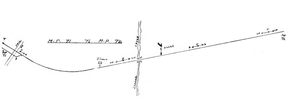
Speonk MP71-72 Yard Limit |
|
St. James MP49-50 1958 |
St. James 1966 |
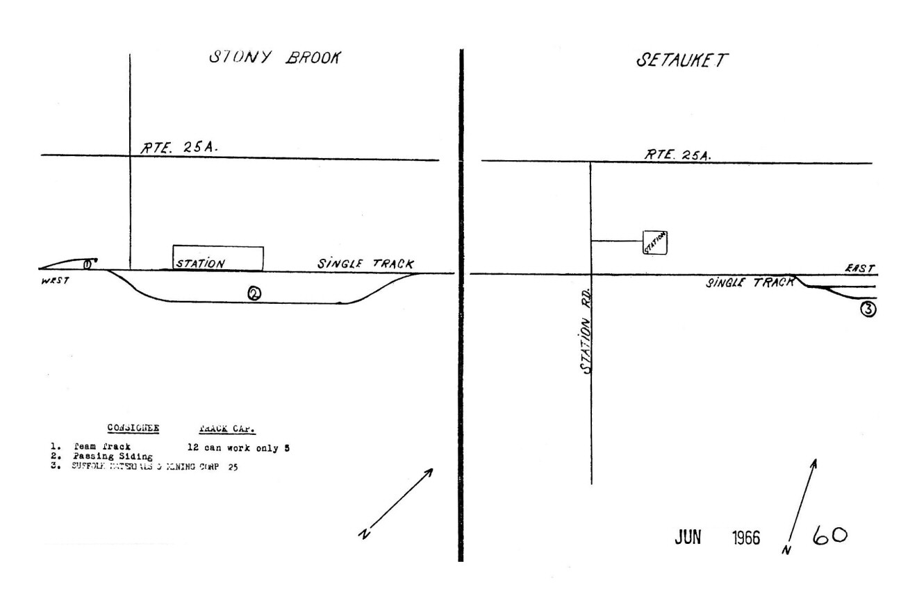
Stony Brook - Setauket 1966 |
Syosset MP30-31 7/57
Original Emery |
Valley Stream 1930-32 |
Valley Stream MP15-16 08/1958 |
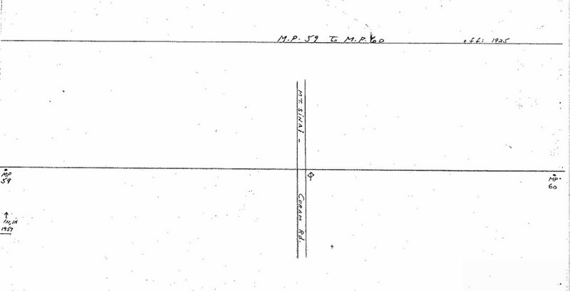
Wading River MP58-59 1925 |
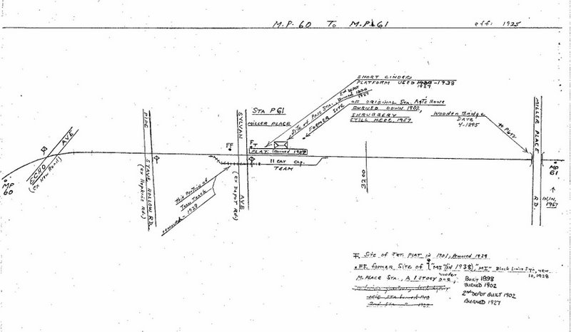
Wading River MP59-60 1925 |
Wading River MP60-61 1925 |
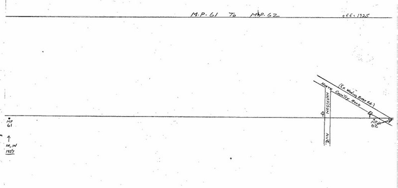
Wading River MP61-62 1925
|
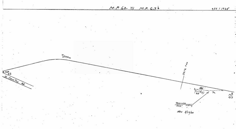
Wading River MP62-63 1925 |

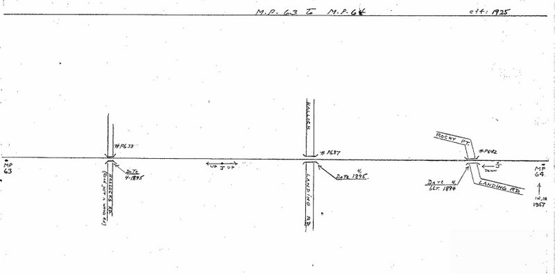
Wading River MP63-64 1925 |
Wading River MP64-65 1925 |
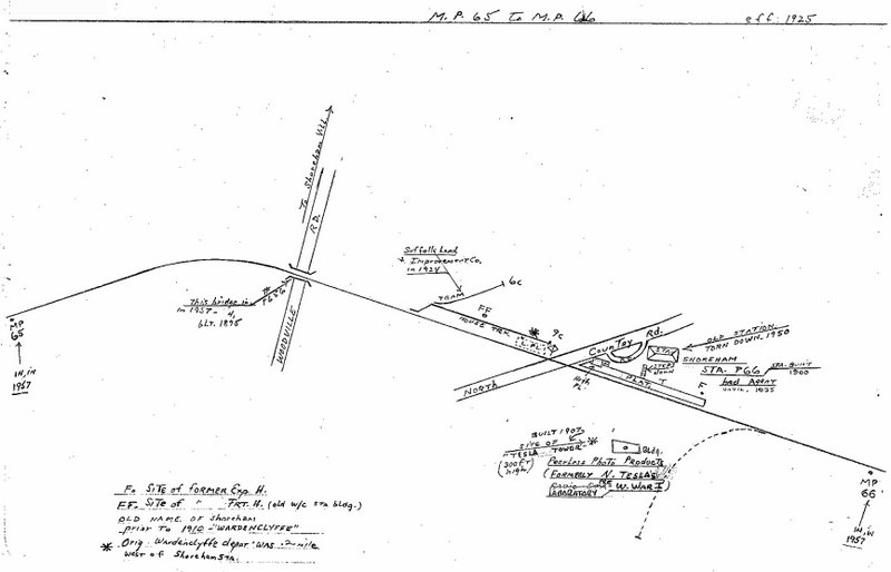
Wading River MP65-66 1925 |
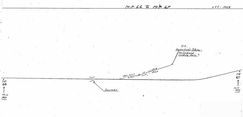
Wading River MP66-67 1925 |
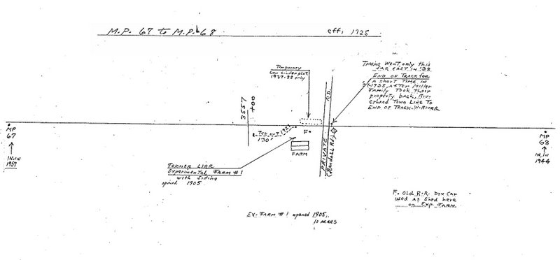
Wading River MP67-68 1925 |

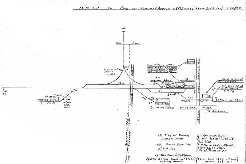
Wading River MP68 1925 |
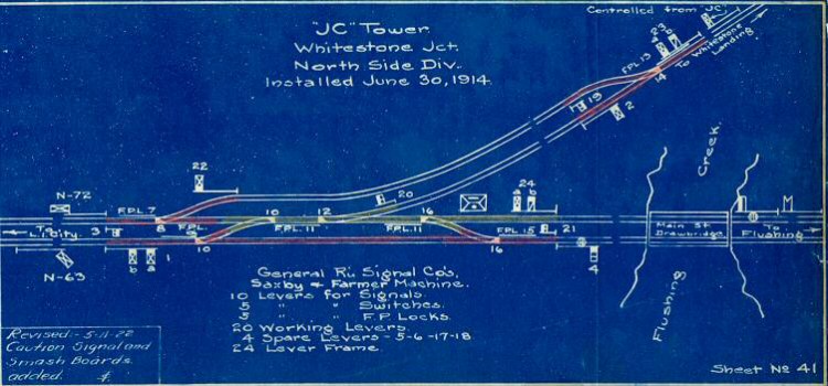
Whitestone Jct., JC Tower
1922
Archive: Art Huneke |
|
|
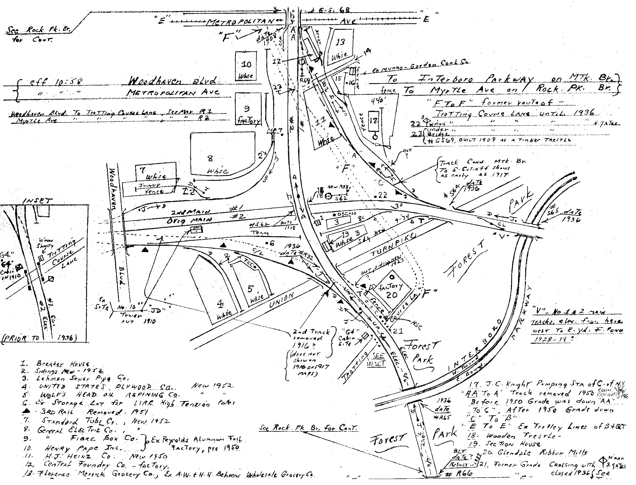
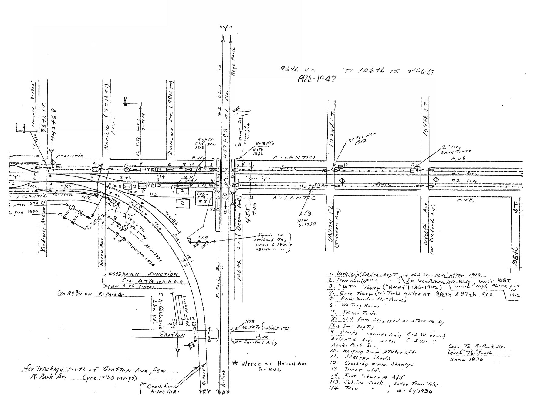
Woodhaven Jct. pre-1942 |
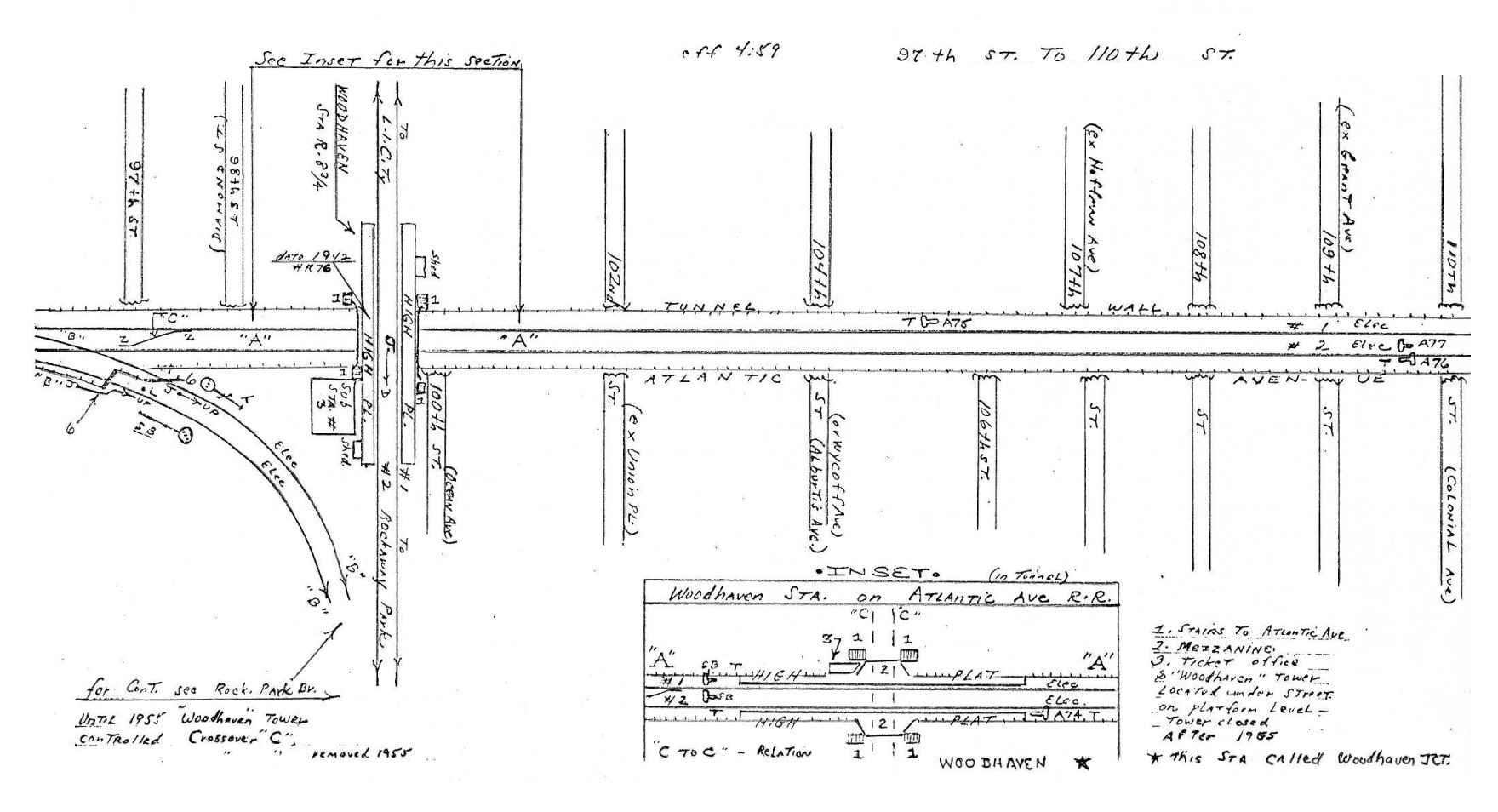
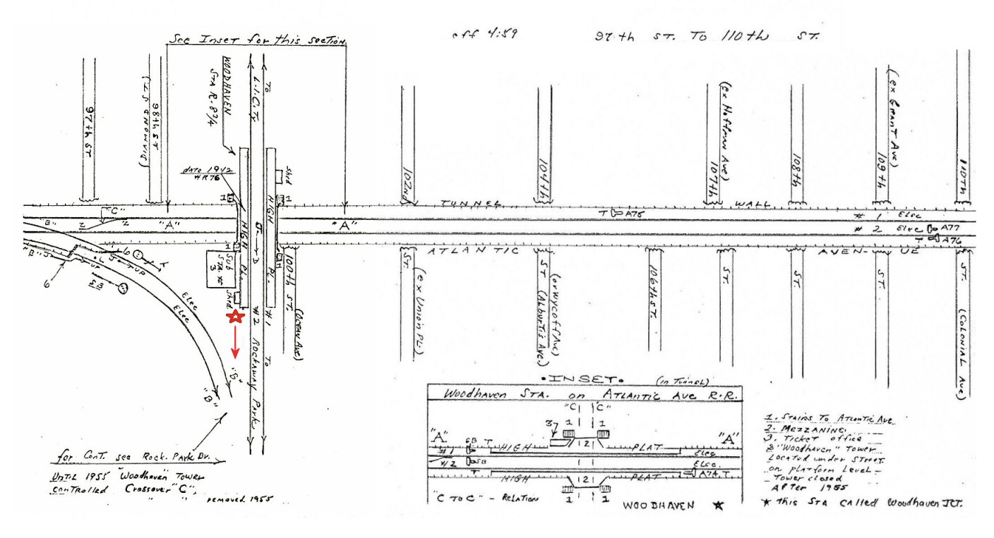
Woodhaven Jct. Post-1942
Ozone Tower added, Dave Keller
research |
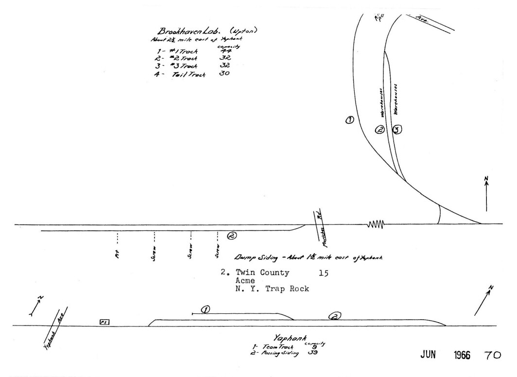
Yaphank - Brookhaven Lab 1966 |
|
|
Maps
Research/Source/Design: Robert Emery, LIRR - Collection: Dave Keller
- Map Restorations: Steven Lynch
|


.jpg)
.jpg)
.jpg)
.jpg)
.jpg)
.jpg)
.jpg)
.jpg)


.jpg)
.jpg)


.jpg)
.jpg)
.jpg)

.jpg)
.jpg)


.jpg)


