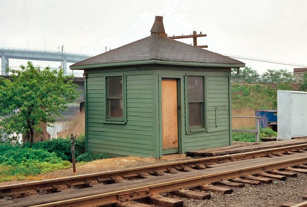
 Montauk Cutoff
|
|||||
|
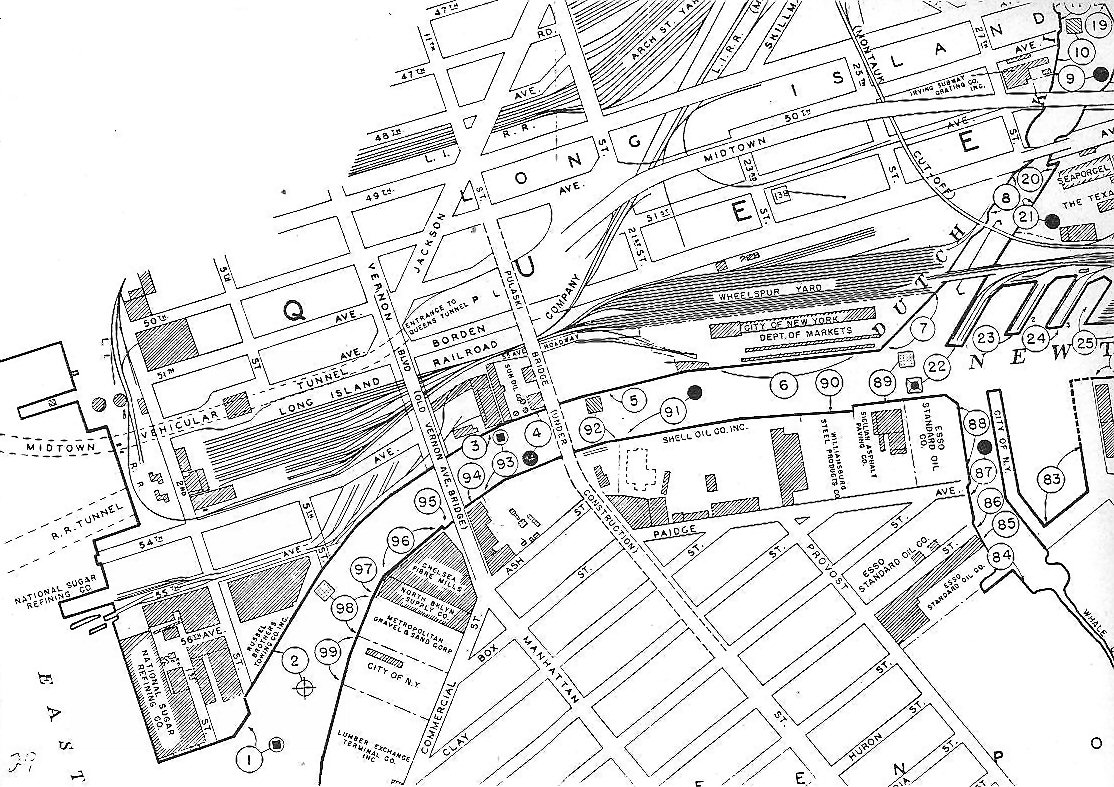
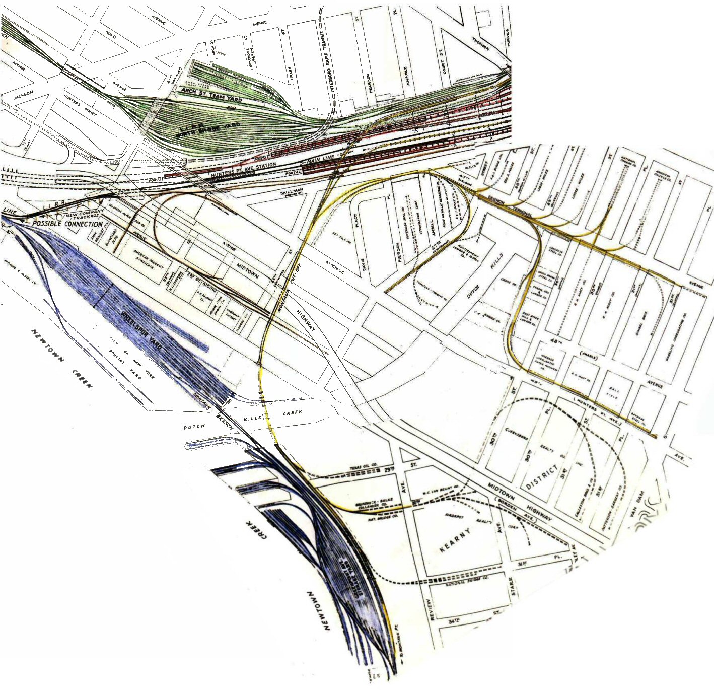
Montauk Branch Cut-Off The Montauk Freight Cut-Off was opened in 1910. From the time of the leasing of the old South Side Railroad in 1876 by the Long Island Railroad, most of the traffic from the Island of Manhattan and Long Island City was carried in steam trains over the Montauk Division through Richmond Hill. But in 1910, with the opening of the East River tunnels, practically all the passenger traffic from Manhattan was carried in electric trains over the Main Line. This made it impossible to route freight trains from the old North Side yards over the Main Line, as had been formerly done, as it would interfere with passenger train operation. Accordingly, this elevated freight connection, known as the Montauk Freight Cut-Off, was built from the North Side yards to a connection with the Montauk Division at Dutch Kills Creek, a distance of over two miles. Felix E. Reifschneider's 1925 Long Island Rail Road History |
|||||
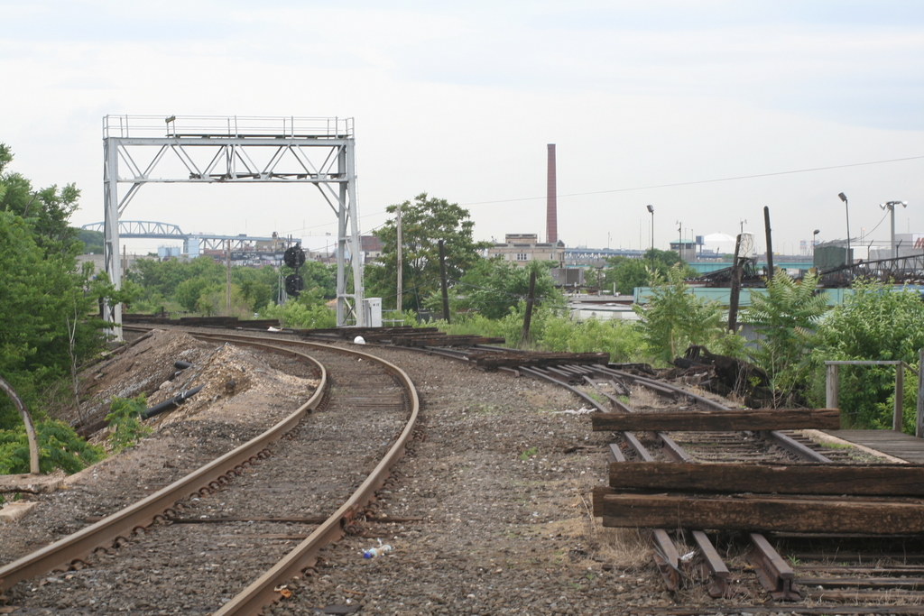
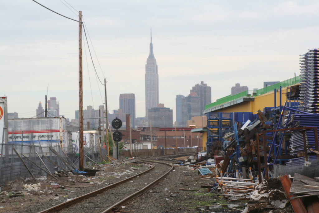
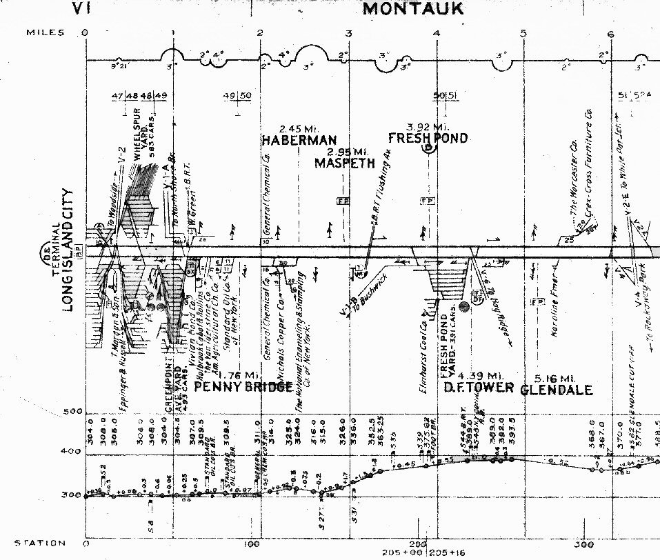 Montauk Branch track profile map LI City 0-6 miles Collection: John Fusto |
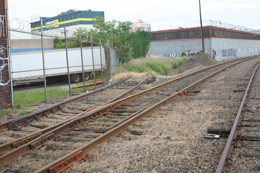
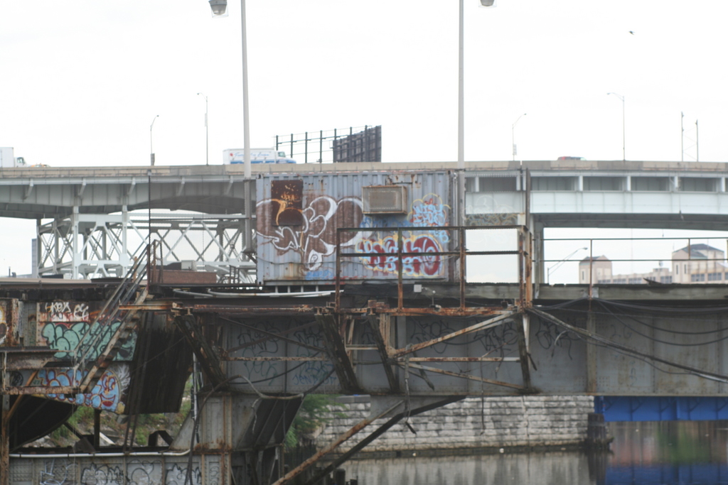
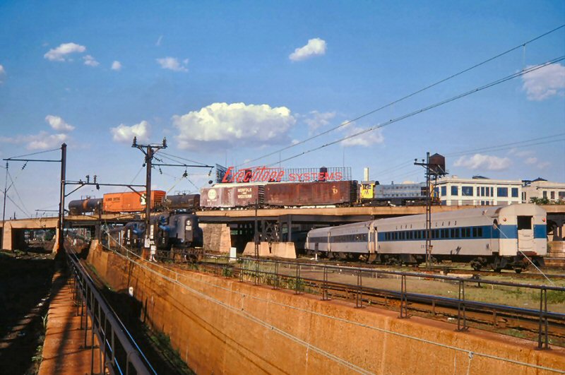
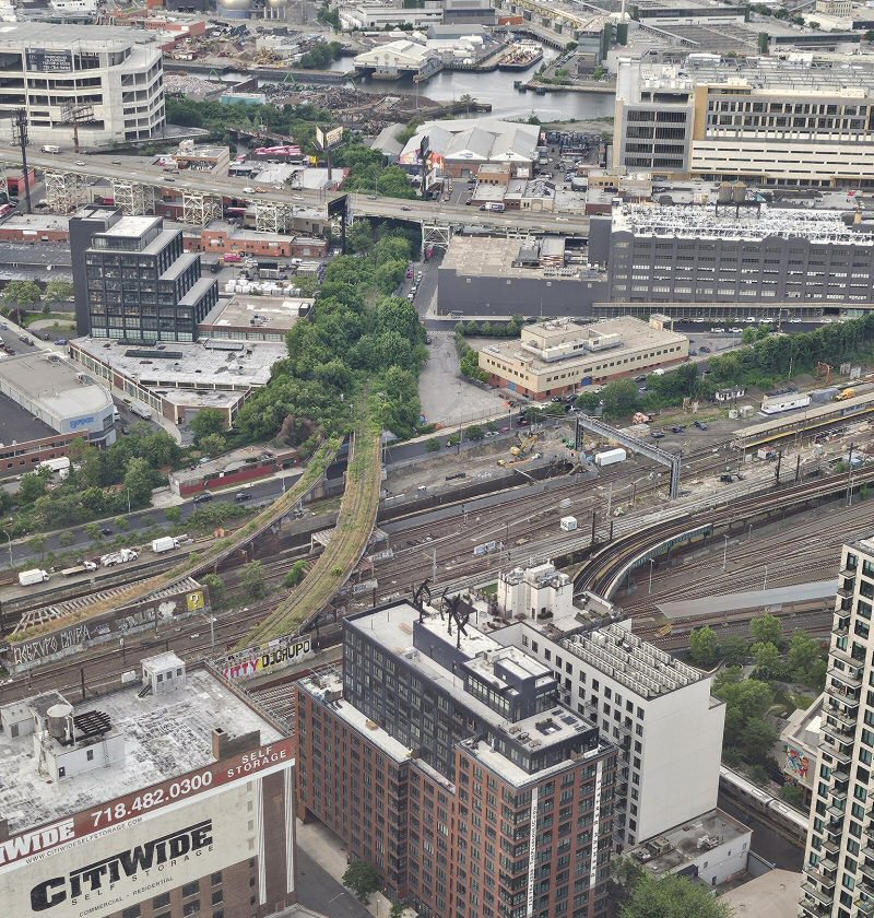
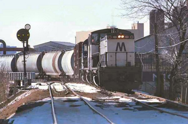
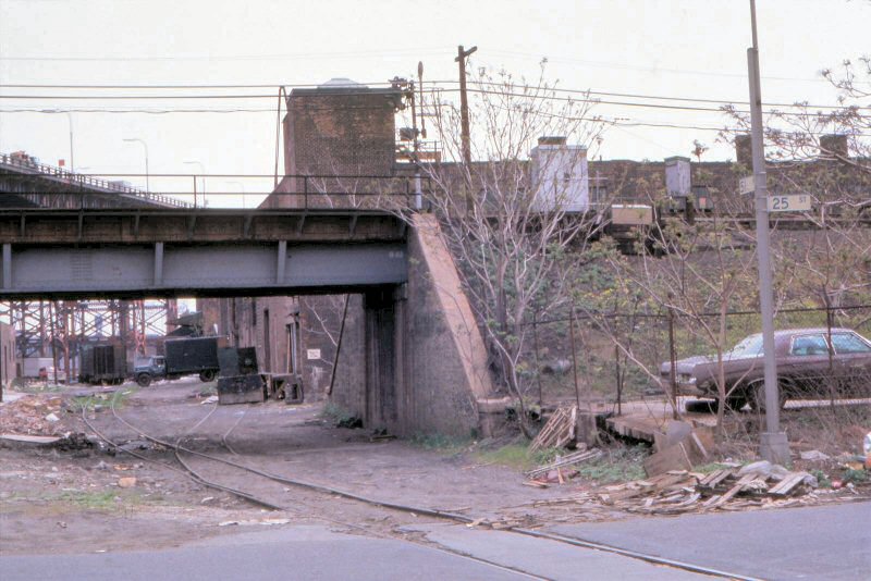
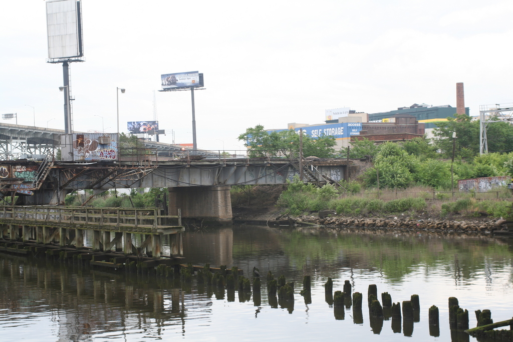
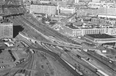 Looking East-NE: Sunnyside passenger yard upper left, freight team track platforms lower left, Montauk Cutoff tracks center view, and Executone Telephone Systems (ex-Sunshine Biscuits bakery 1956) upper center. Photo: Nick Kalis Collection |
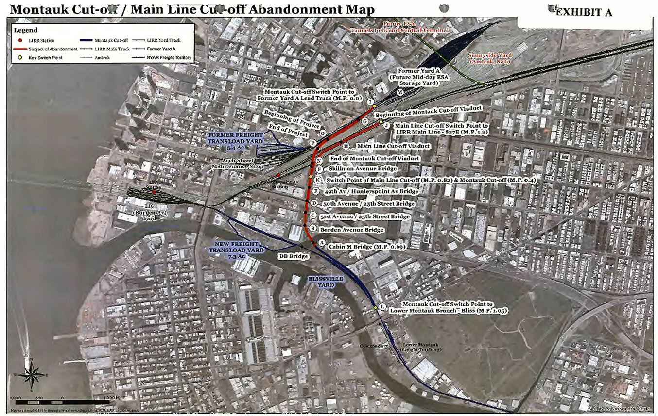 Montauk Cutoff Abandonment petition map 10/13/2015 |
|||
 An interesting shot of freight and Passenger action at the West End of the railroad in Long Island City. A Freight pulled by an Alco switcher on the Montauk Cutoff passes above an MU train led by as MP-54C as it rushes westbound into one of the tunnels leading to Pennsylvania Station. View E 5/1961. Photo: Gene Collora Archive: Eugene Powell
Note: The MU train is entering Line 4 at
left. The track alongside leads to Line 2 behind...Out of the photo to
the left is the #7 Flushing Line tunnel entrance/beginning of elevated
structure and to the right is the Hunterspoint Avenue LIRR Station. |
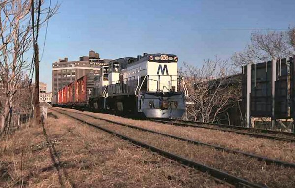
 Long Island City, NY 7/12/1974 Photo: Vincent J. Benkovitz, Archive: Mike Woodruff Locomotives: PC 4875 (GG1), LIRR MTA Alco S1 (Info: Paul Strubeck) Three trains moving in this shot; on the right, a LIRR commuter train has departed Hunterspoint Avenue station headed east, on the left a pair of GG1s bring an equipment move from Sunnyside Yard into Penn Station, while up above a LIRR Alco S1 hauls a short cut of cars out of Yard A on the Montauk Cut Off toward Bliss tower. Author: Vincent J. Benkovitz View east from the mouth of the East River tunnel portals towards the Montauk Cutoff curving overhead with an eastbound LIRR freight consist. The tracks to Penn Station and the tunnel are to the right and left of the abutment and low railing, visible in the shadows and are beginning to angle downwards. Info: Dave Keller |
||||
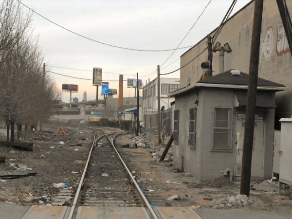
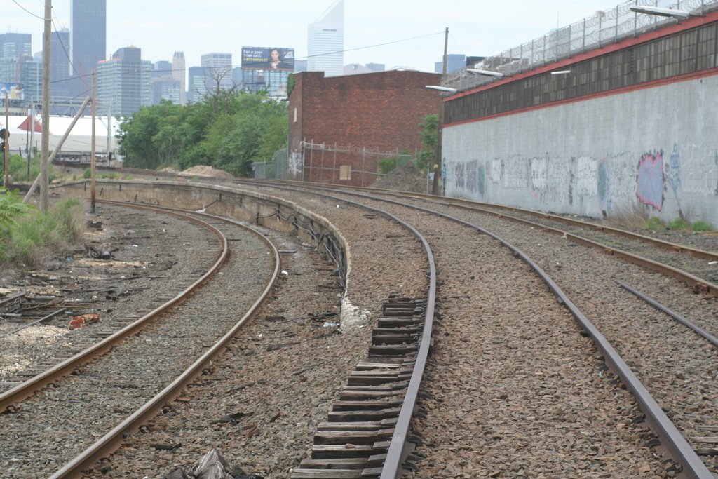
 Montauk Cutoff west leg into Yard A from Bliss cab view Going from Bliss to yard A is considered west. 3/2005 Photo/Archive: Bob Anderson |
 Montauk Cutoff view from Citywide Storage Bldg Photo/Archive: Kevin Katta 11/2007 |
 Montauk Cutoff - 5/2026 Photo/Archive: Faizal Satar |
|||
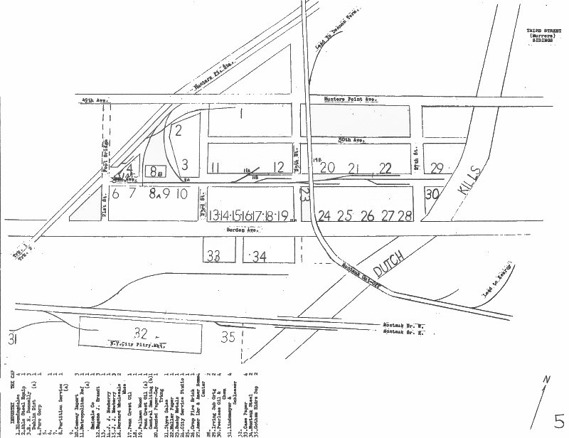
 Office of Chief Engineer, Pennsylvania Railroad, May 20, 1946 |
 LIRR #155,156 eastbound to Bliss from LI City Yard A 12/08/1977 - Archive: Henry Wagner |
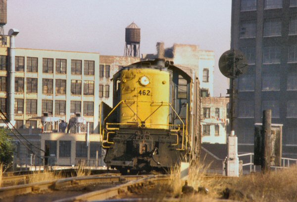
LIRR RS-1 #462 Montauk Cutoff 10/1974 Photo: A. Joseph Daly
|
|||
 LIRR #159, 154, 224 westbound Bliss to Yard A on secondary track Train RF-15 02/11/1979 Archive: Henry Wagner |
 LIRR S-1 climbing out from North Shore/Yard A, on Montauk cut-off. 10/1974 Photo/Archive: A. Joseph Daly |
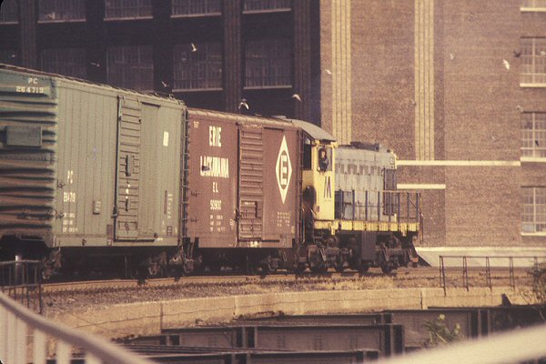
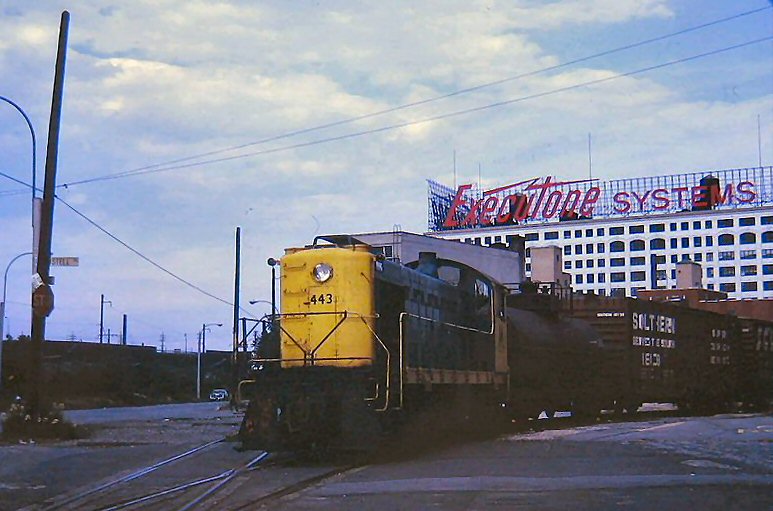 LIRR #443 1971 at Degnon Terminal Info: Henry Wagner |
|||
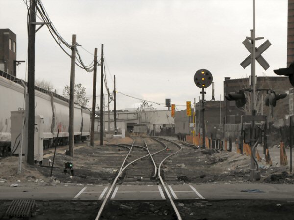
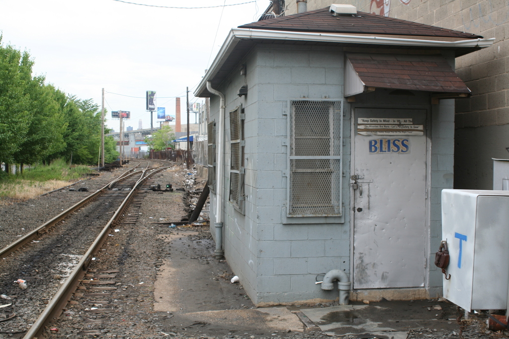
 Bliss Cabin 03/2005 view E. Aligning the switch after entering, this is going west, taken from the rear of the train. On the eastbound trip back, it's a spring switch. |
 Montauk Cut-off - Removed GN 3-22 8/19/17 |
||||
 Bliss Cabin, facing west. 11/24/08 Photo: Bob Anderson
|
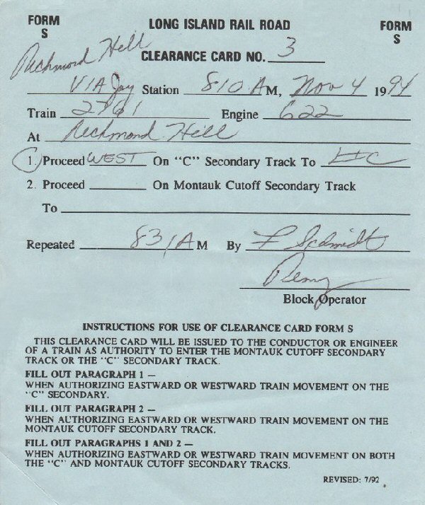 S Form Clearance Card: 11/04/94 Proceed west from Richmond Hill to LI City via the C secondary Archive: Neil Feldman |
Going from Yard A to Bliss is
considered going east. |
|||
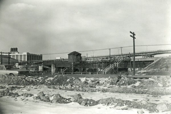
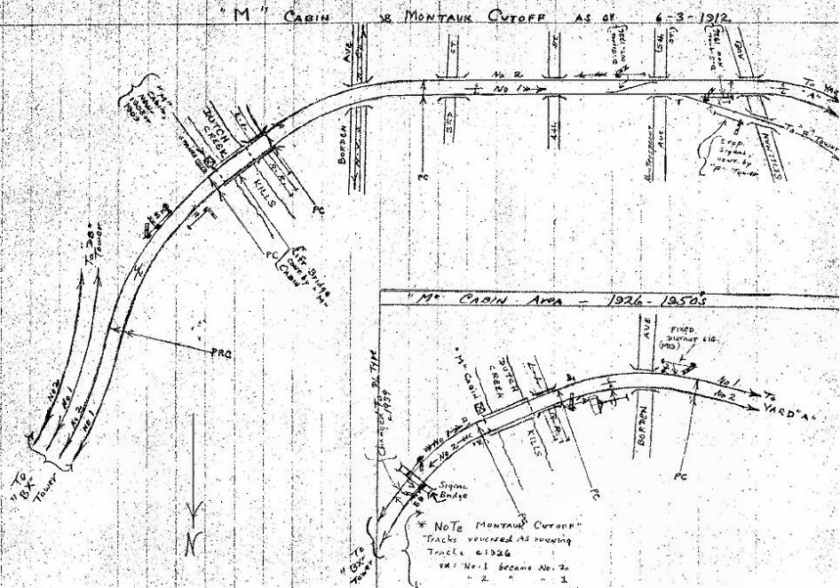 Emery Map: M Cabin 1912-1950s Archive: Dave Keller 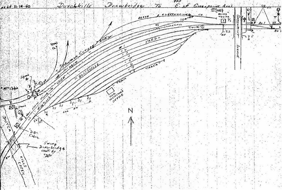 Emery Map: Bliss Yard 11/1960 Archive: Dave Keller |
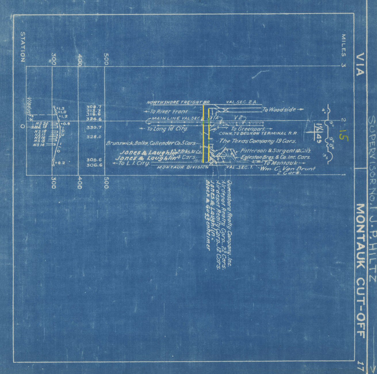 V1A Montauk Cutoff blueprint - c.1943 Archive: Jeff Erlitz |
|
 Emery Map: Dutch Kills to Greenpoint Ave 1958 Archive: Dave Keller |
||
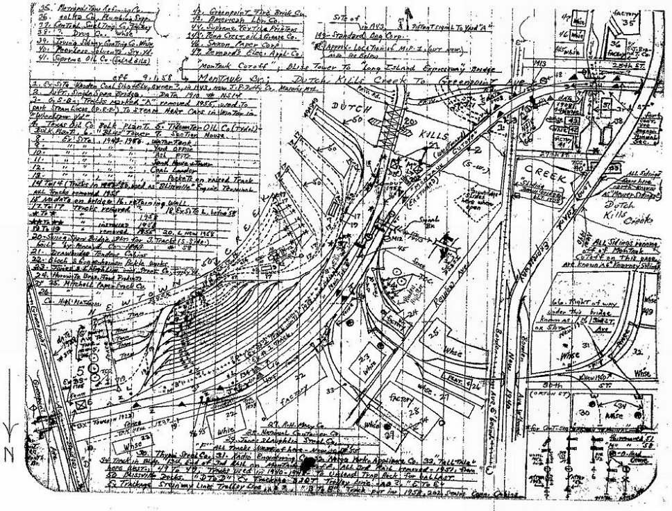
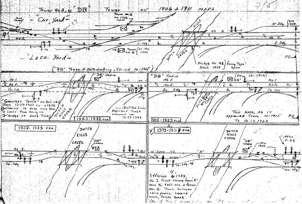 Emery Map: DB Tower 1906-1958 Archive: Dave Keller |
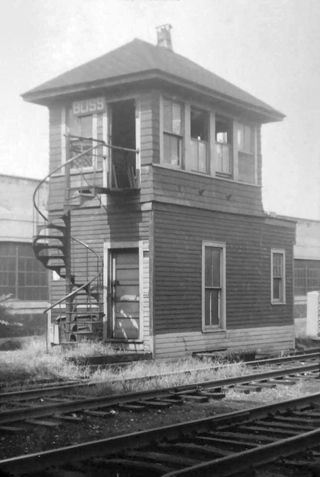
"BS" Bliss Tower on 8/12/1959, a little over a year before it was replaced with a cinder block cabin on the other side of the tracks. This Bliss Tower (formerly BS) had a Saxby & Farmer 24-lever mechanical interlocking machine. Archive: Jeff Erlitz |
||||
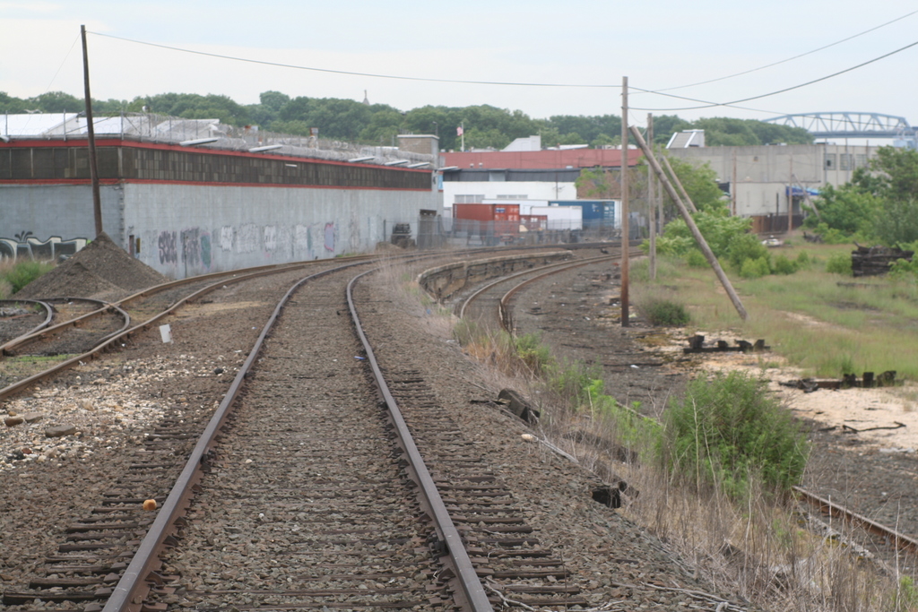
 Bliss Cabin, facing west. Greenpoint Ave and the rest of the Montauk is at my back.
|
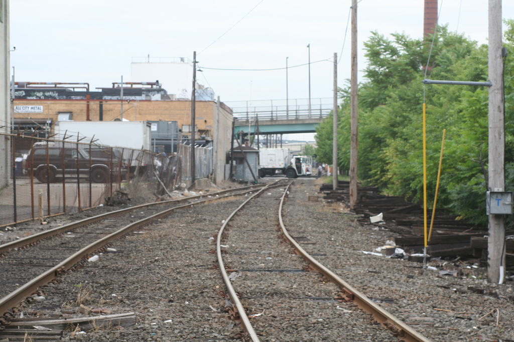
 On my left you have the C-secondary, which links the Lower Montauk with LI City yard, the right is the active track of the Montauk Cutoff, that's what were headed down looking west
|
|
|||
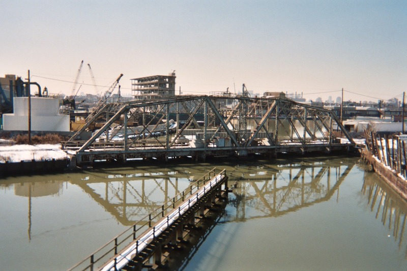
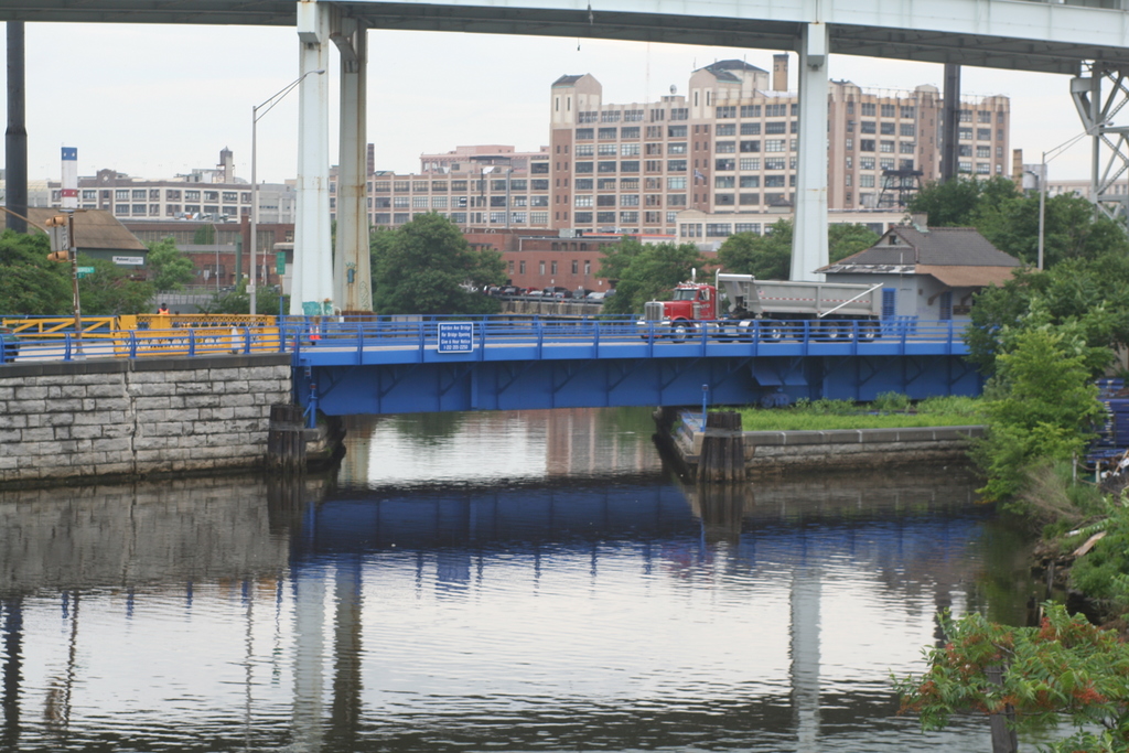
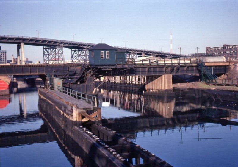
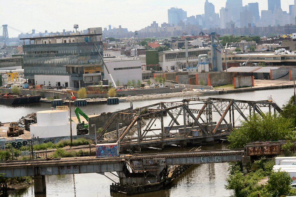 Dutch Kills view south. Both LIRR bridges in sight. Foreground bridge: Montauk Cutoff to Sunnyside Yard Background Bridge: Swing Bridge at DB Tower  Montauk Cutoff - M Cabin, Dutch Kills - Right bank view NW Mid-1960's - Archive: Richard Ryan |
 Montauk Cutoff - View E 6/14/1974 Photo/Archive: Richard Makse Note: Above the bridge abutment, you can see the home signal for M Cabin, complete with smash board. The Montauk Cutoff was left-handed (English) running based on the design of Yard A. The westbound cutoff, closest to the camera, only had a low home (dwarf) signal protecting eastbound moves. Richard Makse Note
2: The location above is
Meurer's siding; named after the
|
"M"
Cabin : 
|
|||
 M Cabin lift bridge - View NE 1967 Archive: Dave Keller |
 "The Bridge" is the Lift bridge on the Montauk Cutoff, it's where M Cabin is perched on top of. Photo: S. Goldstein |
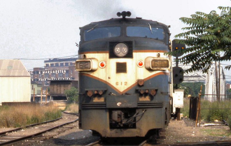
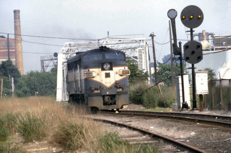 LIRR #612 crossing Dutch Kills drawbridge (swing bridge) eastbound over Dutch Kills 6/1981 Photo: S. Goldstein |
|||
|
Dutch Kills Swing Bridge: 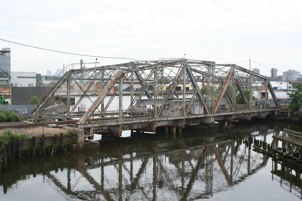 Dutch kills swing bridge
|
Dutch Kills Swing Bridge: 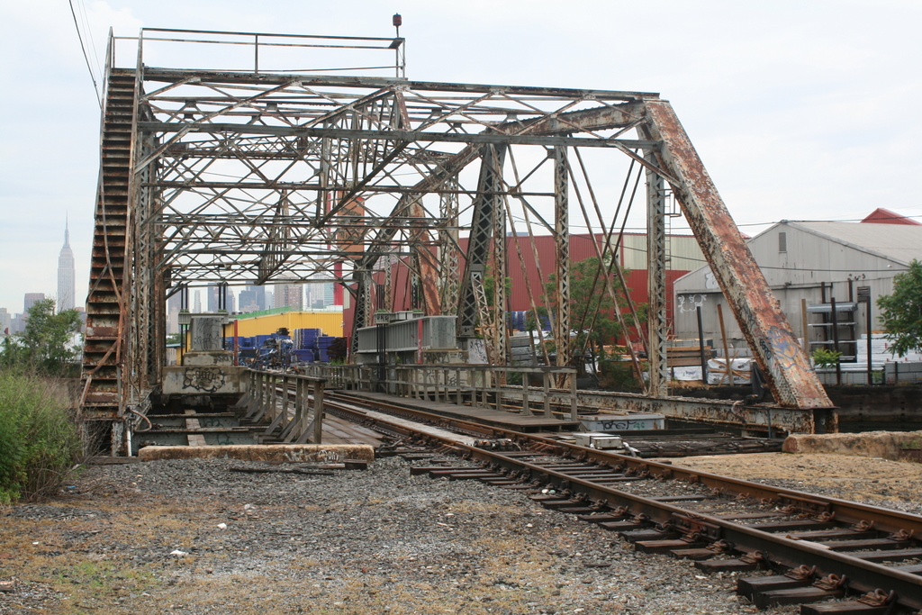 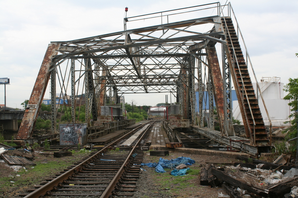
|
Wheelspur Yard:
|
 Back towards Bliss. The shot facing up towards the old signal bridge is also on the C-secondary.
Borden Ave |
||
 Haberman Station - Montauk Branch 3/19/1976 Archive: Henry Wagner |
 LIRR #216 east of Haberman 3/05/1976 Archive: Henry Wagner |
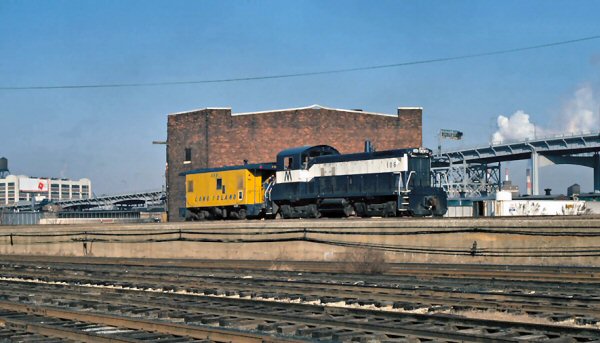 Blissville looking at the Montauk Cutoff LIRR #1106, caboose #56 heading east Archive: Henry Wagner |
|||
| Photos and Commentary: Joseph Gregory 6/20/2007 unless otherwise noted. | |||||