|
Port Washington
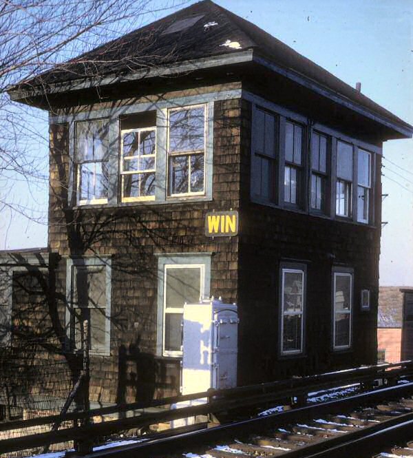
Branch |
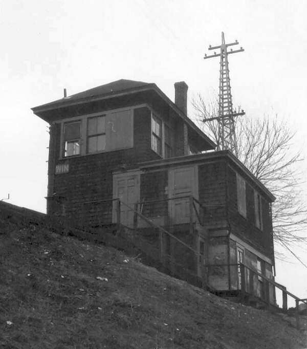
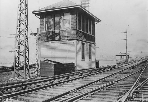
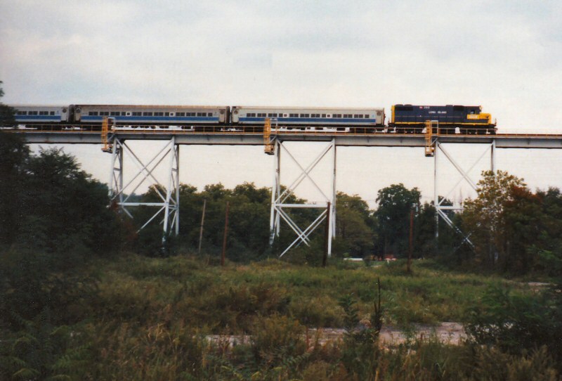
WIN Tower Winfield Junction 1967 Photo/Collection: Dave Keller |
||||||||||||||||||||||
| The History of the Port Washington Long Island Rail Road presented by David Morrison March 3, 2020 | |||||||||||||||||||||||
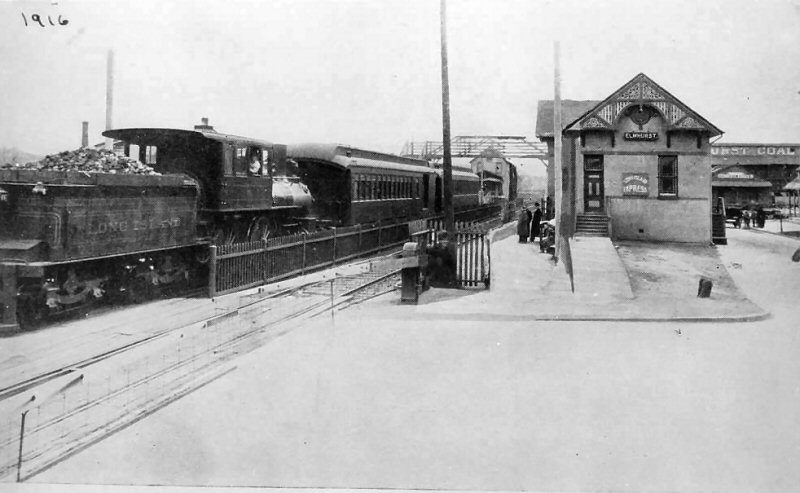
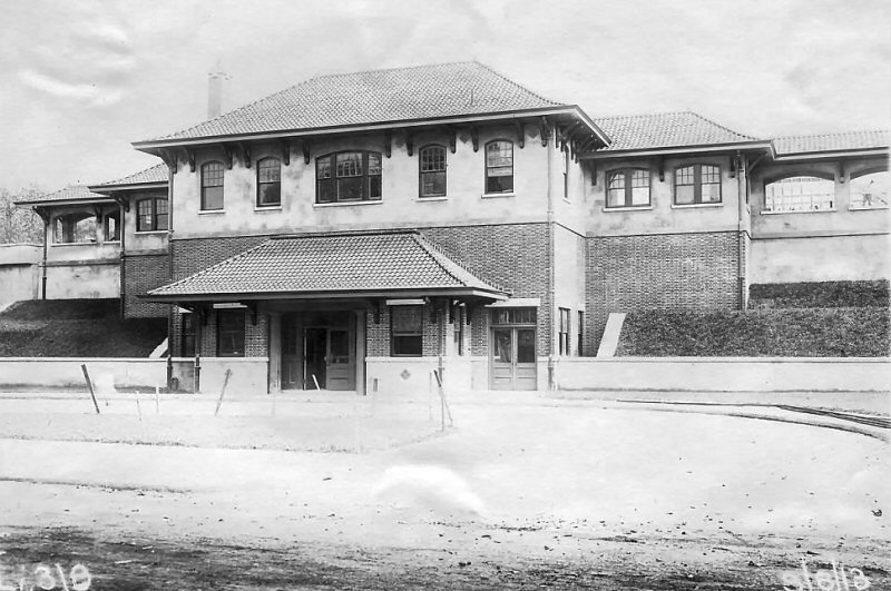
 Port Washington Branch 1916 |
|||||||||||||||||||||||
| LIRR NORTH SIDE DIVISION | |||||||||||||||||||||||
|
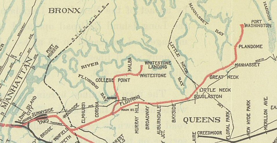
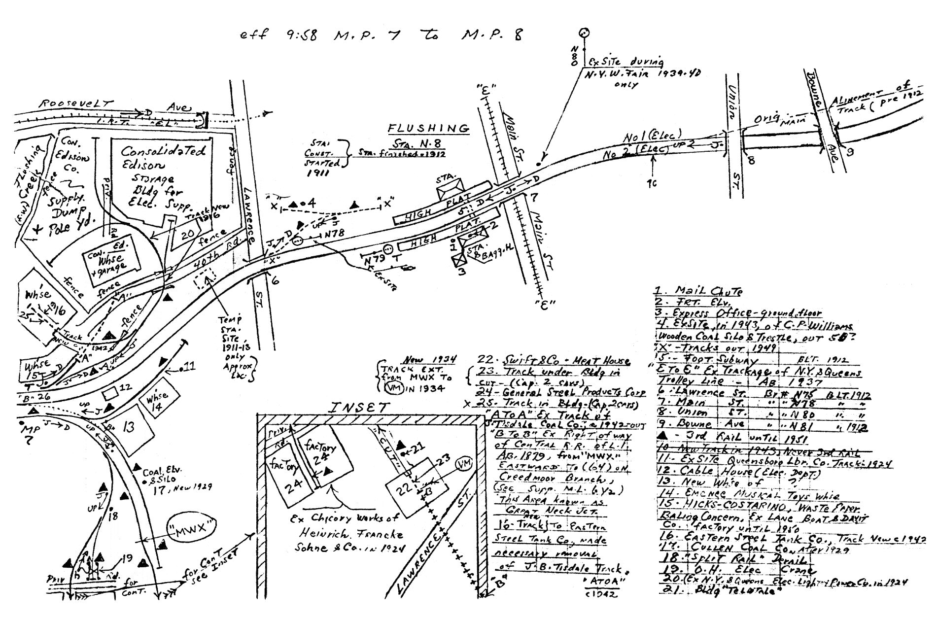
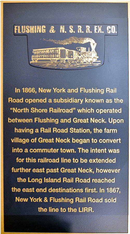
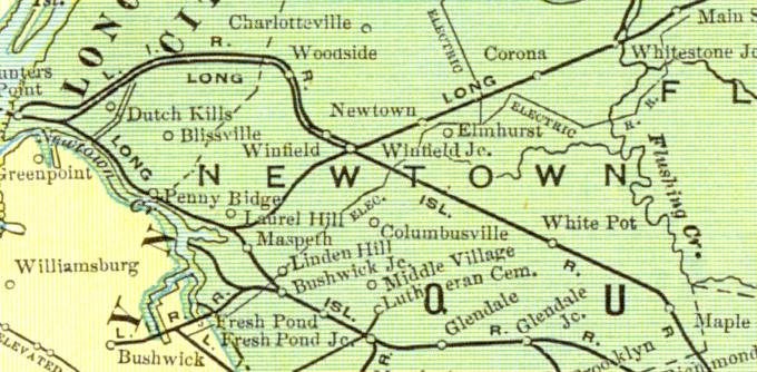
The "North Side Division" is the original
name of the Port Washington branch. The branch started east of
Woodside at Winfield Jct. It continued on and stopped at Great Neck
until 1898 when it was extended to Port Washington. The Whitestone branch started east of Corona
station, on the west side of the Flushing River (Creek).
In 1887, Malba wasn't yet a station stop on the Whitestone branch. The lines on the timetable between Corona and
Flushing, Main Street designate the Whitestone branch.
This was common on timetables that had other branches leading off the
timetable's main branch. Research: Dave Keller |
|||||||||||||||||||||||
|
|
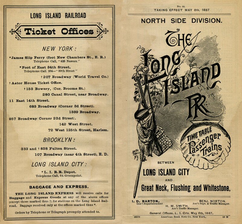
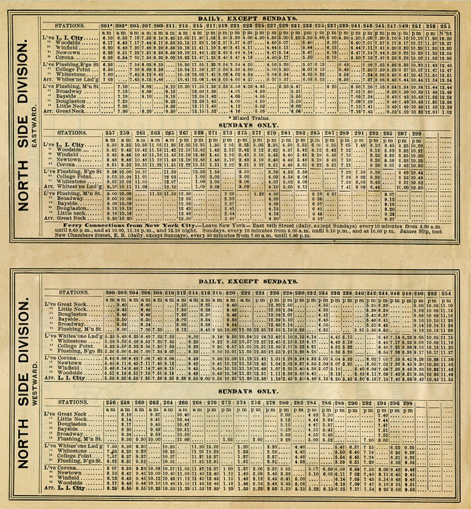
Timetable - North Side Division - 5/08/1887
|
 |
|||||||||||||||||||||
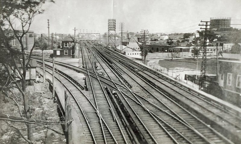
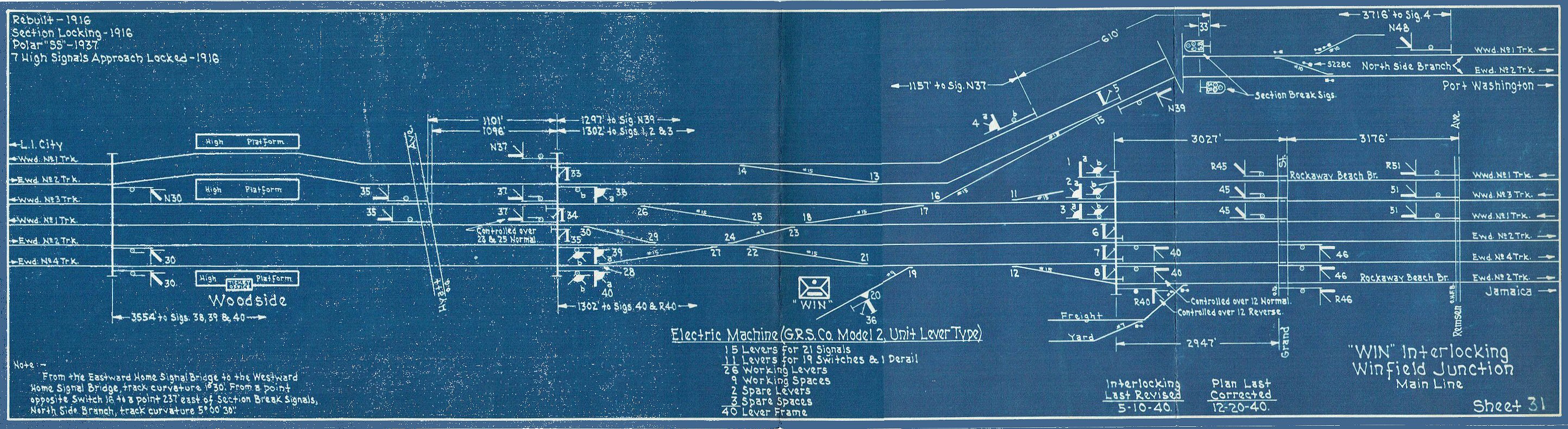
| WINFIELD JUNCTION | |||||||||||||||||||||||
|
“WJ”
TOWER: WINFIELD
JUNCTION., QUEENS - JCT. OF MAIN
LINE AND PORT WASHINGTON BRANCH (NORTH SIDE DIVISION). NORTH
SIDE OF PORT WASHINGTON BRANCH TRACKS, EAST
OF JUNCTION. FORMERLY TOWER #35. S&F MECHANICAL MACHINE
IN SVC: 1884. REBUILT: 3/1/1898 [?] MOVED:
12/1915, SOUTH SIDE
OF TRACKS,
.7 MILES EAST OF WOODSIDE.
40-LEVER GRS MODEL 2 UNIT LEVER TYPE ELECTRO-MECHANICAL MACHINE IN
SVC: 1908. |
|||||||||||||||||||||||
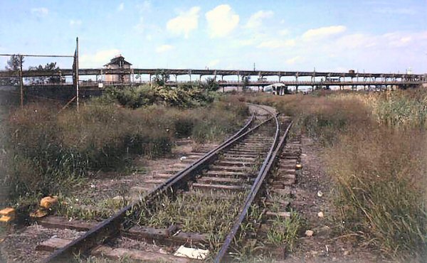
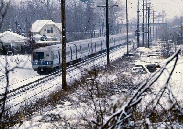
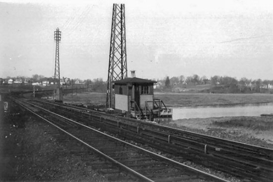
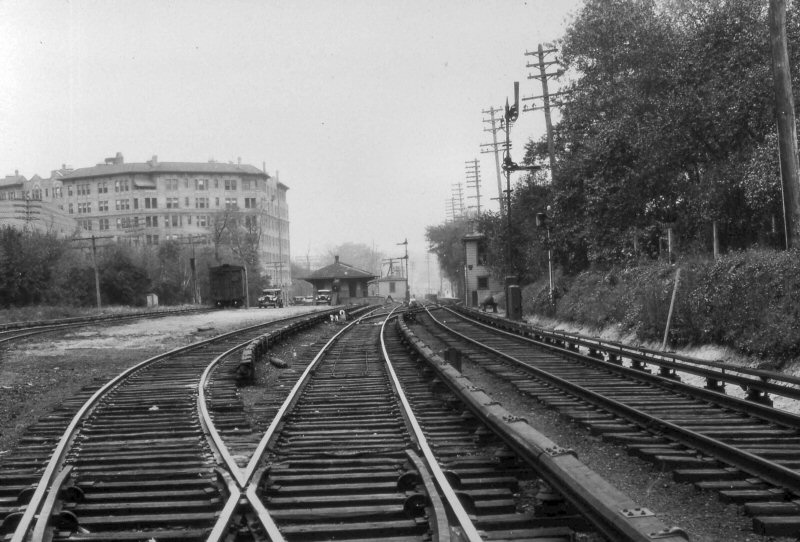
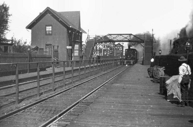 Winfield Tower No. 4 c. 1894 Archive: Dave Keller |
 WJ Tower - Winfield Jct. east of Woodside View E c.1910 previously Tower #35 Archive: Dave Keller |
|
WJ Tower-Winfield Jct. c.1910 view SW Archive: Dave Morrison |
||||||||||||||||||||
|
|
|
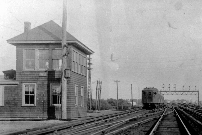
 WIN Tower - "The Cannonball" 10 car Train #22 6/02/1972 Photo/Archive: Richard F. Makse
|
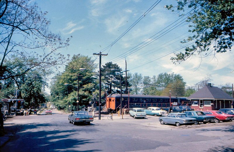
 WIN Tower - View NW 1968 Photo/Archive: Art Huneke |
||||||||||||||||||||
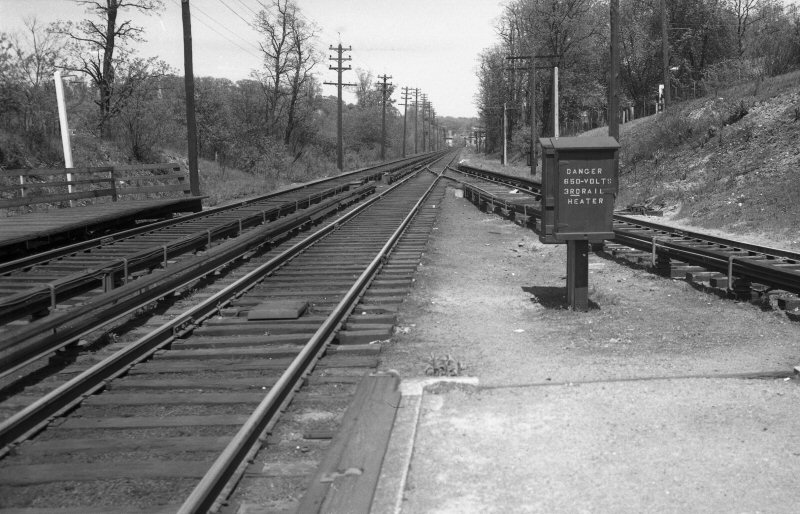
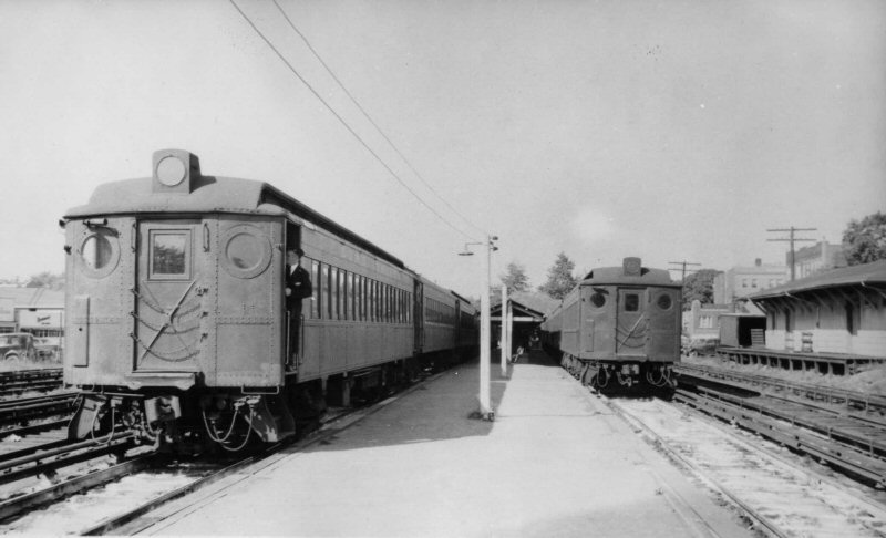
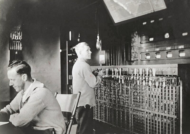
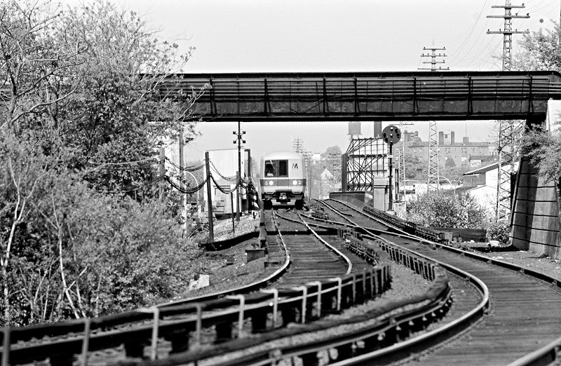
| Just a tad west of the Queens Boulevard undergrade bridge, Train #461 approaches 13 crossover (above), installed during World's Fair days to handle World's Fair Jamaica trains that changed ends at WIN. That's 4 signal at the engineer's cab and N39 is the eastbound automatic. (13 crossover had originally been a trailing point westbound crossover located opposite WIN but was rarely used and the new 1964 crossover picked up its old number). Richard F. Makse | |||||||||||||||||||||||
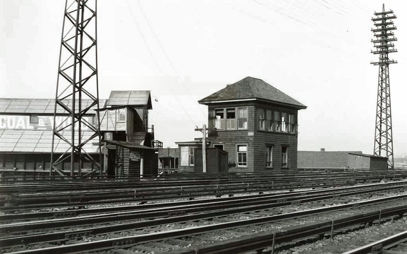
 WIN Tower - Port Washington Branch local eastbound at Winfield Junction. 8/24/1972 Photo/Archive: Richard F. Makse |
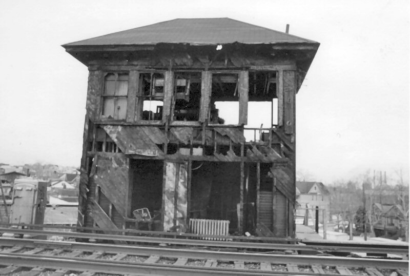 WIN Tower shortly after the fire of 8/24/1972 Photo: Winfield S. Boerckel Archive: Dave Morrison |
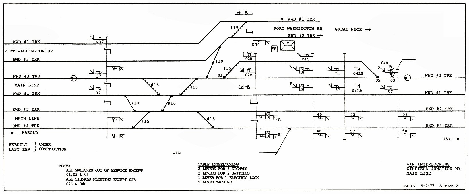 WIN Interlocking map 5/22/1977 The normal-direction home signals were modified to automatically fleet, as automatic block signals. Plans were drawn up effective 05/02/77 to rebuild the interlocking and move the table-top machine into the old sub-station building, but this was never accomplished. Archive/Info: Jeff Erlitz |
|||||||||||||||||||||
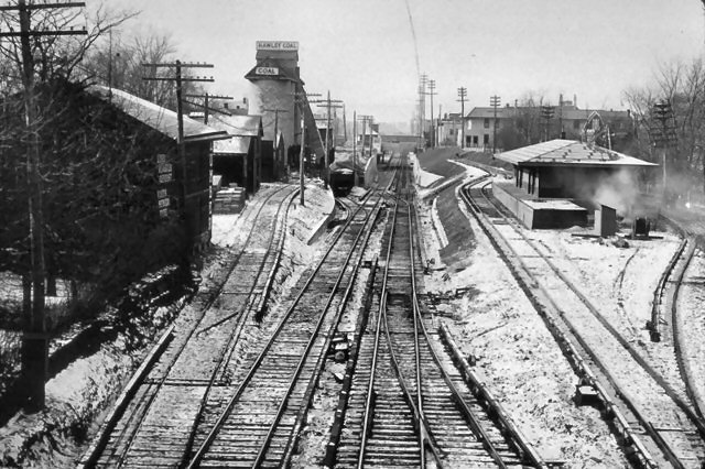
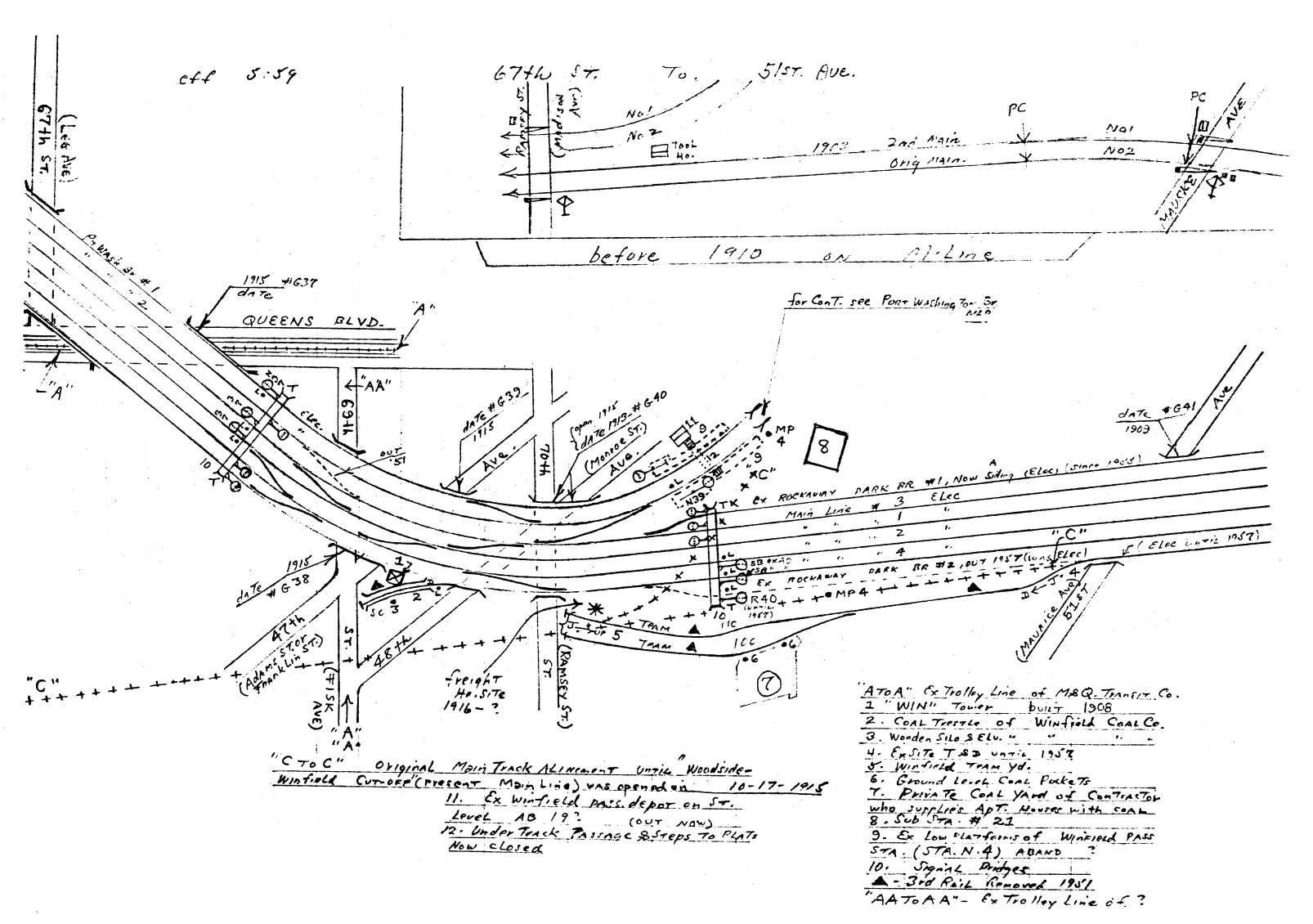 Emery map Winfield Jct. 9/1959 Archive: Dave Keller |
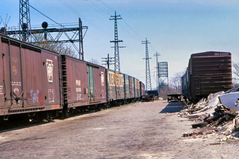 Winfield Team Yard - 5/1973 Photo/Archive: Richard F. Makse |
May, 1973. Winfield team yard.
The yard was quite full that day and all the cars were consigned to
Supro Building Products. The Supro building now belongs to
Advance Building Products which uses the former team yard for storage.
During the intense postwar home construction in Winfield and Woodside
during the 50's and 60's, most cars at Winfield brought in bagged
cement in L&NE boxcars. |
|||||||||||||||||||||
| WINFIELD | |||||||||||||||||||||||
|
WINFIELD: BUILT: JULY/1854, MOVED TO WINFIELD JCT: 8/1876 2nd DEPOT BUILT: ?, RAZED: 1915 3RD DEPOT BUILT: 1915, DISCONTINUED AS STATION STOP AND RAZED: 1929 Research: Dave Keller |
|||||||||||||||||||||||
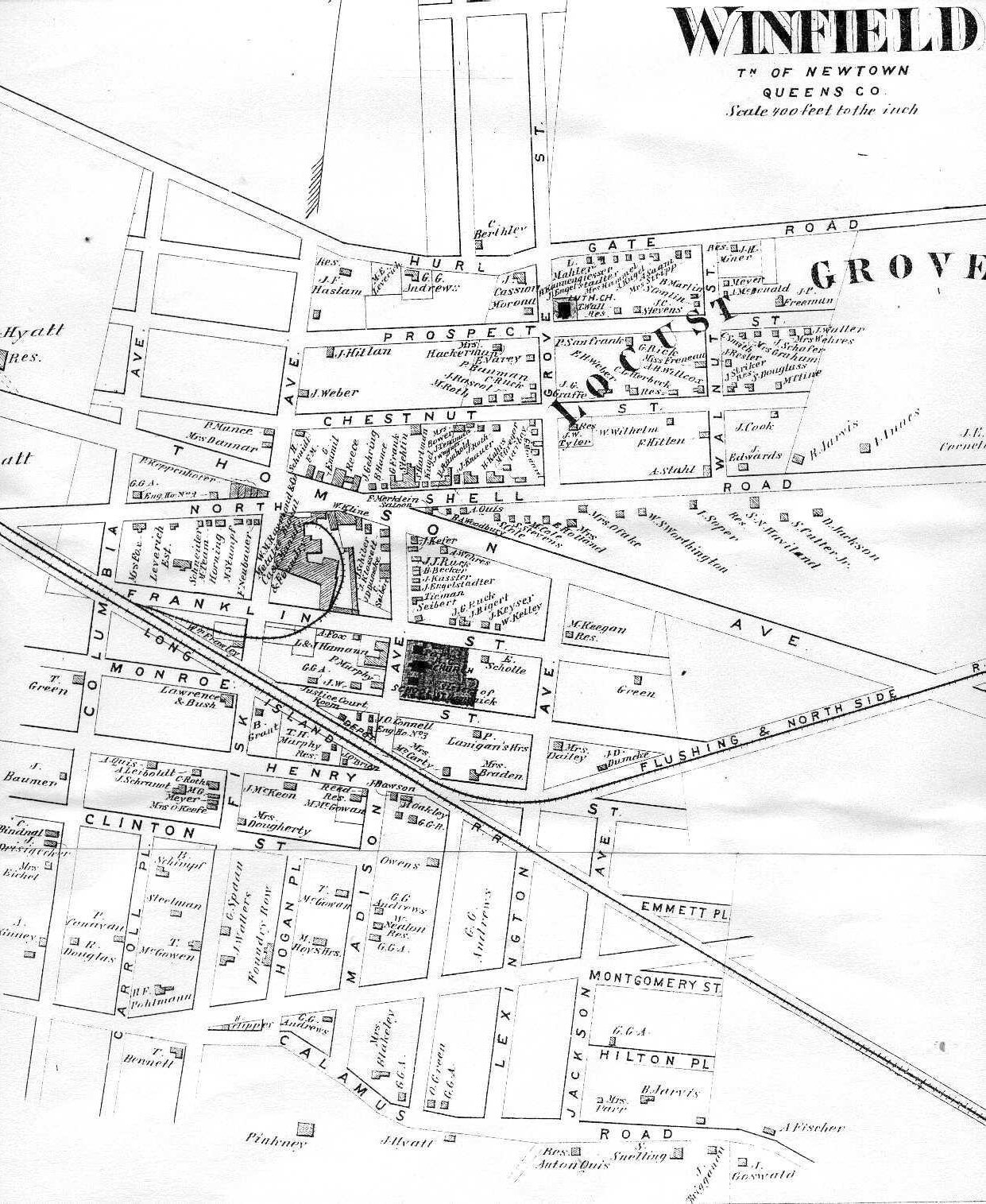 Winfield map - 1873 |
.jpg) Winfield Station c.1910 Archive: Art Huneke
|
.jpg) Winfield Station c.1918 Source: eBay
|
|||||||||||||||||||||
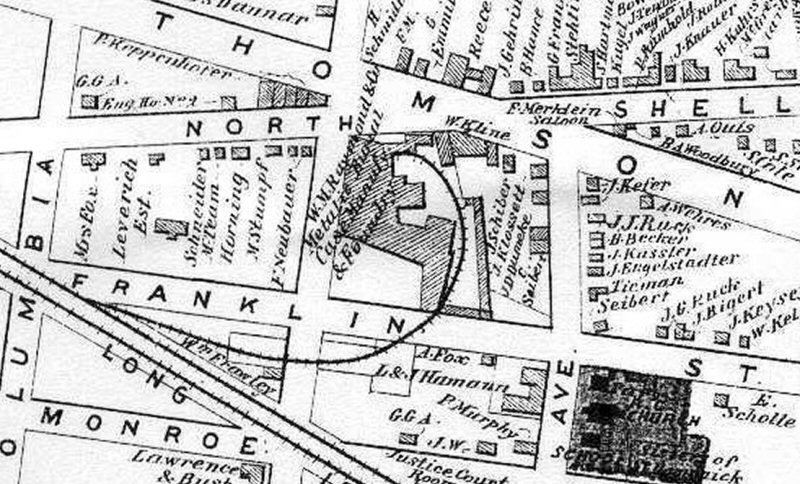
|
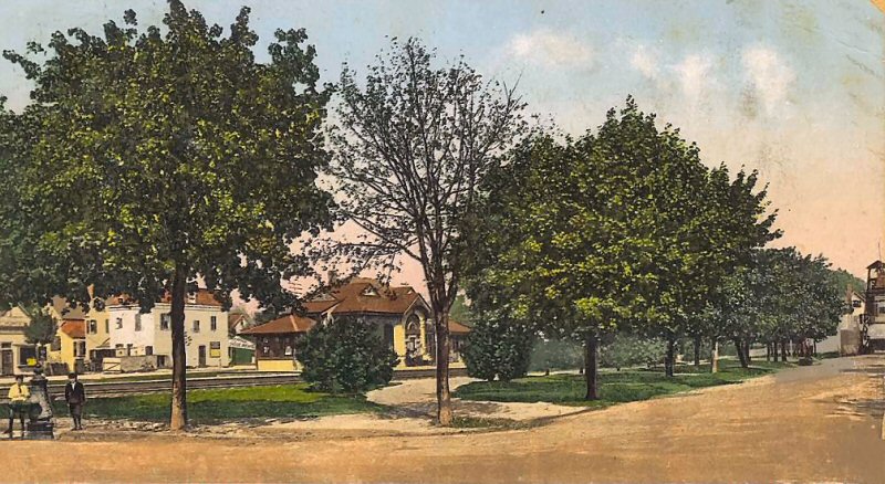
Winfield was situated roughly in
the area within the following borders: Hurl Gate Road (Woodside
Avenue) to the north, Mount Zion Cemetery, Calamus Road (Avenue,
today) and Maurice Avenue to the south, the New York Connecting
Railroad to the east, and New Calvary Cemetery to the west. Its major
intersection was where North Shell Road (45th Avenue), Thomson Avenue
(Queens Blvd) and Fisk Avenue (69th Street) converged. This was an
excellent place for a settlement, as it was located in close proximity
to Newtown, and along the road that connected Long Island City and
Jamaica. The adjacent town of Woodside was called so because the area
sat beside what was then the Winfield Woods – a.k.a. “Suicide’s
Paradise” – where, legend has it, despondent early colonists went to
commit suicide. |
|||||||||||||||||||||||
| ELMHURST | |||||||||||||||||||||||
|
Originally
NEWTOWN OPENED: 1855, RAZED: 1888 2ND DEPOT OPENED: DEC/1888, HIGH PLATFORMS
CONSTRUCTED: 1912, RAZED: 1927 |
|||||||||||||||||||||||
|
|
 Elmhurst Station 1916 Archive: Dave Morrison |
.jpg) Elmhurst Station 3/1923 (Osborne-Keller) |
.jpg) Elmhurst Station View E on Whitney Ave from Broadway 1929 Archive: Dave Keller |
||||||||||||||||||||
|
Note: A shelter is evident atop the stairs at the right, but what appears in the distant center to be a "shelter" on the north side of the tracks seems rather substantial to be just a shelter. (above right) I wonder if there was a ticket agency there in the first several years of its existence. In its last years as a station stop, the only thing remaining was the high-level concrete platforms. Dave Keller |
|||||||||||||||||||||||
.jpg) Elmhurst Station View E 2/07/1977 (Madden-Keller) |
 Elmhurst Station 12/1984 - M1 eastbound prior to next month's raze Photo: Matthew Kowal
|
 1941 Hagstrom map Elmhurst Station area Corona-Flushing - Archive: Kevin Wong |
 Elmhurst Train #755 passing former Grand Street station location 8/21/1970 Photo/Archive: Richard Makse |
||||||||||||||||||||
| CORONA | |||||||||||||||||||||||
|
ORIGINALLY:
FASHION RACE COURSE BUILT:
3/1853 AS FASHION RACE COURSE, RENAMED WEST FLUSHING,
RENAMED |
|||||||||||||||||||||||
 Emery map - Corona MP5-6 10/1958 Archive: Dave Keller |
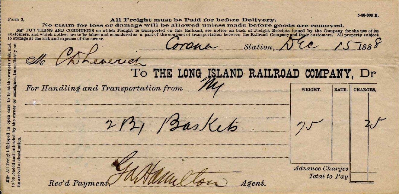 Corona Station freight bill for 2 boxes of baskets 25¢ ($6.92 in 2018) Form 3 - 12/15/1888 Archive: Dave Keller .jpg) Corona Fuel & Supply Co view NW Zoom 12/1930 (LIRR Valuation-Keller) See note 9 on map at left for location. |
||||||||||||||||||||||
.jpg) Corona Station - Tiffany Factory View W c. 1910 Archive: Dave Keller |
 Corona Station -View E c.1913 Archive: Dave Keller |
 Corona Station c.1910 Archive: Dave Morrison |
|||||||||||||||||||||
.jpg) Corona Station view E 10/05/27 In preparation of the grade crossing elimination project. Archive: Dave Keller |
%20-%2011-24-30%20(LIRR-Keller).jpg) Corona Station view E 1/24/30 Newly elevated 111th St. (LIRR valuation-Keller) |
.jpg) Station Corona view E 4/27/30 Archive: Dave Keller |
|||||||||||||||||||||
|
A Long Island Rail Road valuation image (above center) from November 24, 1930 showing the newly-elevated ROW and tracks at 111th St. east of Corona Station. The view is looking east towards Flushing Creek with the Brooklyn Ash Removal Company's Corona Ash Dump at the right which, 4 years later, would be ordered cleared by Robert Moses to be leveled out and become the site of the 1939-40 N. Y. World's Fair. The tracks dip down in the distance, cross over the Creek then rise again on the other side of the waterway. Yes, folks . . . It's hard to imagine, but Queens DID once look like this! (Dave Keller info and archive) |
|||||||||||||||||||||||
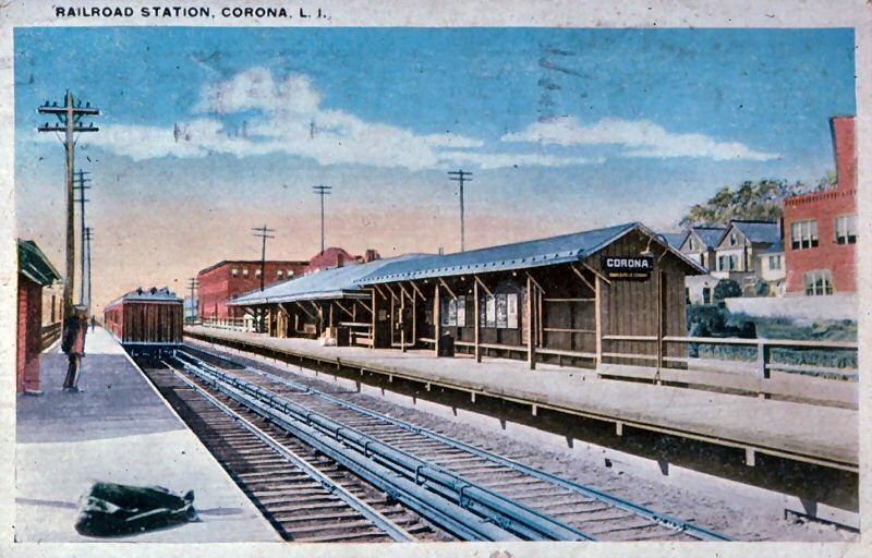 Corona Station colorized post card View NW c.1913 |
|
%20-%2012-1930%20(LIRR%20Valuation-%20(Keller).jpg) Recently opened elevated station at Corona - platform shelter View NW - 12/1930 LIRR valuation photo/Dave Keller archive |
 Emery map - Corona Station - Archive: RMLI |
||||||||||||||||||||
|
This station opened in 10/13/1930. Note how white the concrete stanchions are under the platform, and it appears some construction debris is still on the platform. Research: Dave Keller |
|||||||||||||||||||||||
%20Flushing%20Mdws,%20NY%20(View%20N)%20-%2009-30-35%20(Sperr-Keller).jpg) It's September 30, 1935 and photographer Percy Loomis Sperr has focused his camera on Flushing Meadows, with a view north towards the LIRR's newly-constructed overpass over the projected route of the new Grand Central Parkway which is under construction. Beyond the LIRR can be seen the IRT's Flushing Line at Roosevelt Avenue with an EL train passing the signal tower on the upper level and an EL train entering or leaving the storage yard at the lower level. (Dave Keller archive) |
|||||||||||||||||||||||
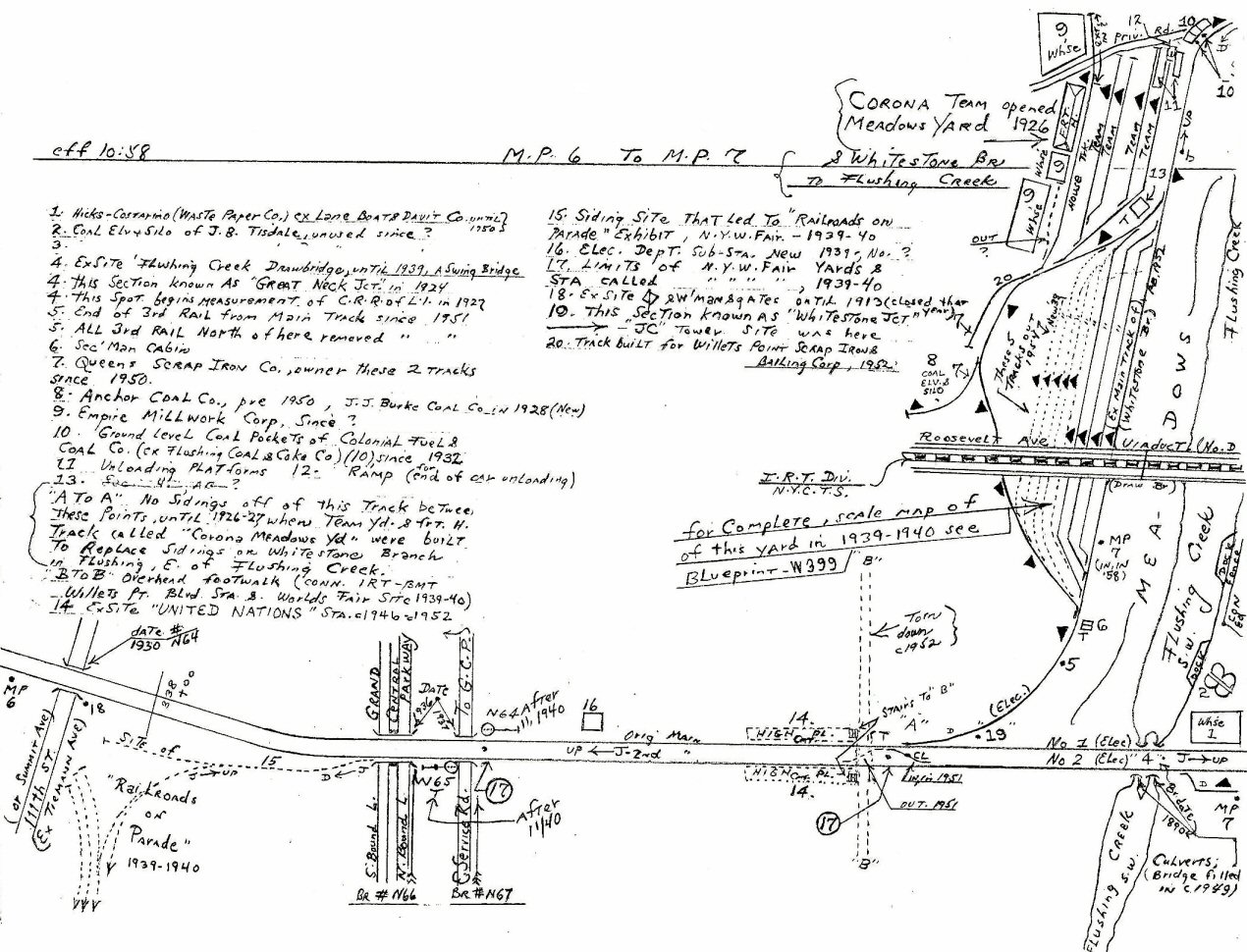
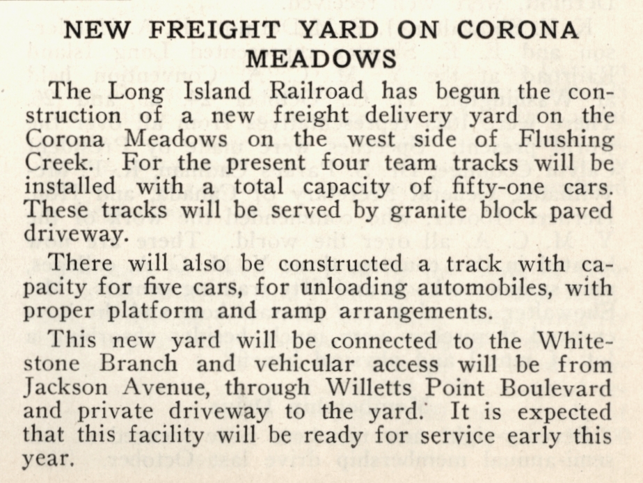
| CORONA MEADOWS TEAM YARD | |||||||||||||||||||||||
%20-%2010-18-36%20(Sperr-Keller).jpg) Corona Meadows Team Yard - View NE 10/18/1936 (Sperr-Keller)
|
|
After that date, the yard was considered part of the Port Washington branch as it was accessed via the former tracks of the Whitestone branch running parallel to the Flushing River and connecting with the Port Washington branch at the former location of "JC" tower at Whitestone Jct. The short stretch of track between the Port Washington branch and the west bank of the Flushing River at the out-of-service swing bridge was all that remained in service of the former Whitestone branch. In 1929, the LIRR stated that this stretch of track would remain in service to access the yard and the freight sidings should the branch be abandoned (plans for which were already in the works at that time). Info: Dave Keller |
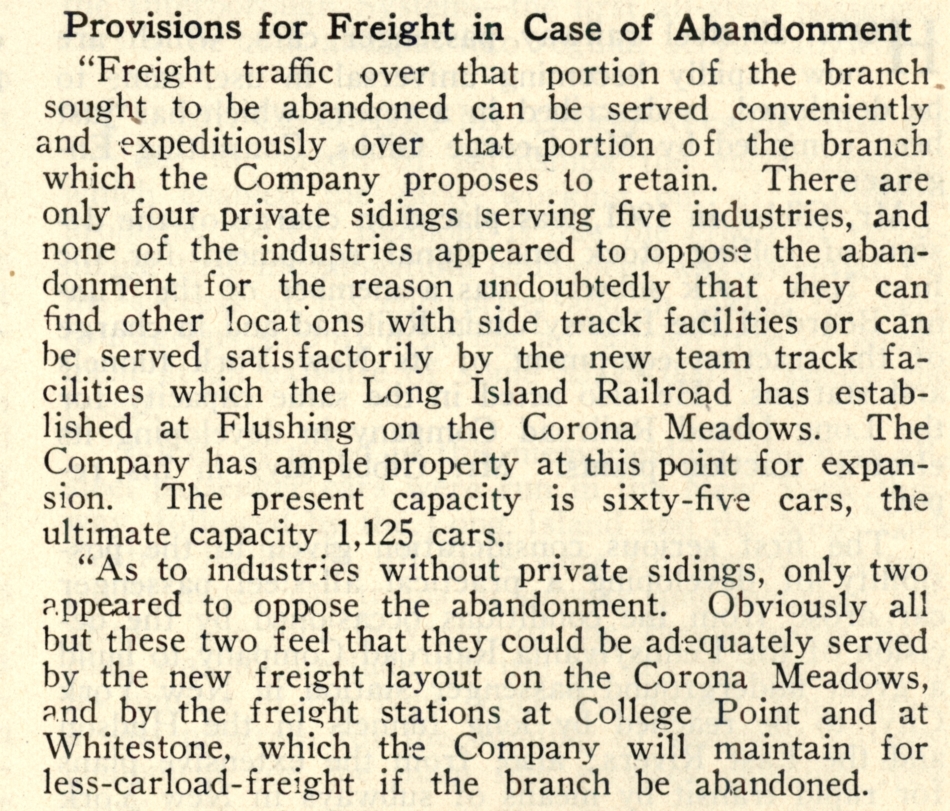 Corona Freight Yard abandonment + LIRR Information Bulletin 9/1929 Archive: Art Huneke Of course, this last part never happened. On February 19, 1932, the branch was abandoned, no LCL freight provisions were made at the two named stations and the short stretch of track alongside the Flushing River was left in service. Info: Dave Keller
|
||||||||||||||||||||
|
|
 Anchor Coal Co. Corona 5/1994 Photo/Archive: James Mardiguian |
%20-%20c.%201949%20(Faxon,%20Jr.-Keller).jpg) DD1 freight at Corona Yard Lead - Flushing Meadows (View NE) - c.1949 (Faxon, Jr.- Keller) This is a close-up view of the Corona Meadows team yard. The former Whitestone branch track at the far right curves in the distance, where it once went across the Flushing River over a swing bridge. |
|||||||||||||||||||||
|
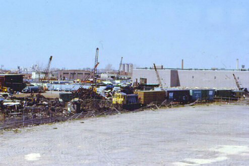
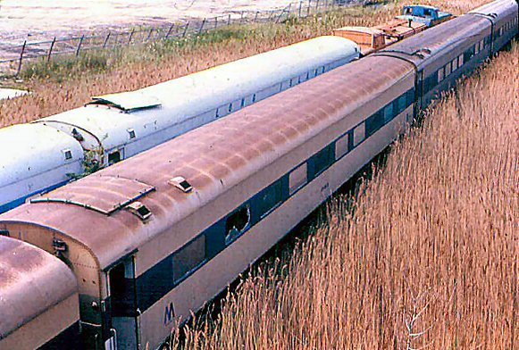
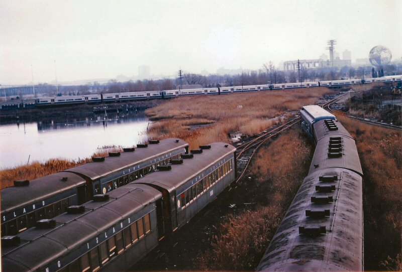
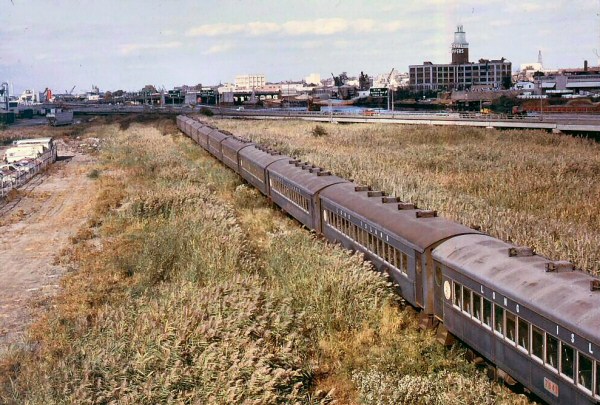
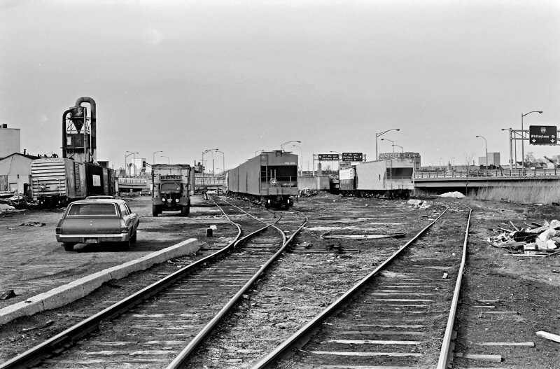
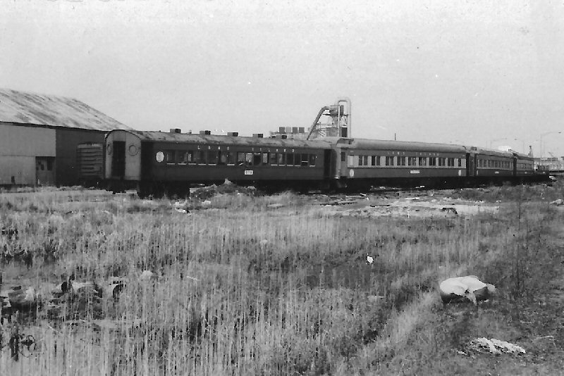
Corona Yard, and what is left of the Whitestone Branch, once went to Whitestone Landing in Queens. Incidentally, the LIRR offered the Whitestone Branch to the City of New York for sale and maybe even for free, but the city turned it down; they hoped the city would incorporate into their Flushing IRT branch. There are various classes of cars that are being scrapped, while a train of new M1's is in the background on the Port Washington Branch. Many cars of the MP54 fleet and others were scrapped here; they were dropped off, cut up and carted off. (above right). The Corona Yard is no more; all of this within the shadows of Shea Stadium and now CitiField. It was once a very active yard but business slowly dried up and it became the last stop for many cars replaced by the new M1 fleet. Info: Mike Boland |
|||||||||||||||||||||||
.jpg) Corona Meadow Team Yard - View S 10/25/1947 (Weber-Morrison)
|
 Shea Stadium is to the left, just across the street. To the right is where the scrap cars were kept. I've heard they cut up cars here, and shipped the pieces in gondolas to Naporano. 5/1976 Photo/Archive: Tim Darnell
|
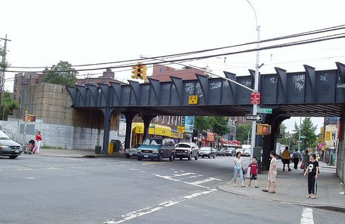
 Roosevelt Ave bridge under the #7 line, facing S-SW Photo: Tim Darnell
|
|||||||||||||||||||||
 The branch came off the Pt. Wash line, just east of Shea Stadium station. Info: Tim Darnell Looking
north from just north of the Port Wash Branch. Shea Stadium to your
left, Roosevelt Ave and IRT ahead. Taken I believe in 1978. |
 LIRR 2181 in the scrap line at Corona. Prior EL 1310 previously DL&W 310. 3 cabooses C-94, C-52, and C1. Photo: Tim Darnell c. 1976-77 |
 Roosevelt Ave bridge under the #7 line, facing southwest. The track in the foreground is the remains of the old Whitestone branch, looking towards the old 1964 World's Fair site. Photo: Tim Darnell The cut-up car is in the lower end of Corona Yard, where a LOT of scrapping went on: regular passenger cars, parlors and diesels. This track accessed the yard. The work train is eastbound on the Port Washington branch. Info: Dave .Keller |
|||||||||||||||||||||
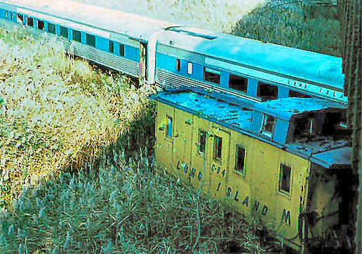 C94 from IC built 1941 acquired 1/72 Photo: Tim Darnell c. 1976-77 |
 P74B #7523 Pullman Std. Built 1926 Photo: Tim Darnell c. 1976-77 |
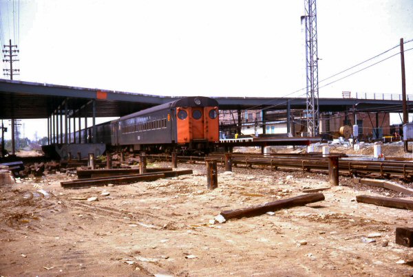
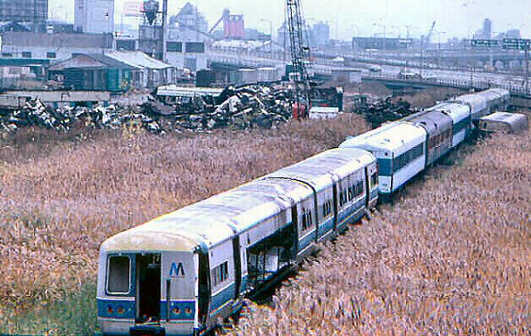
 Corona Yard - View S toward the site of the old 1964-1965 New York World's Fair. 1/22/1972 Photo: Frank Zahn Archive: Mike Boland |
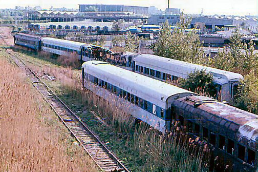
 Corona Yard lead track - P54 coaches awaiting the Scrapper's torch c.1973, view NE Photo: Steve Hoskins .Archive: Steven Lynch Note: Serval Zippers factory in background |
||||||||||||||||||||
 LIRR map 1966 Corona page 15 |
 LIRR map 1978 Corona page 14 Archive: Jeff Erlitz |
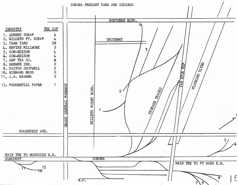
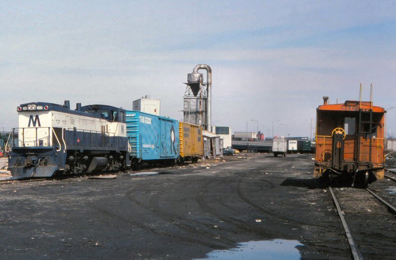 LIRR #169 - C58 at right. Latham Lumber delivery Corona Team Yard location #3 1978 map (left) View N 3/13/1978 Photo/Archive: Jeff Erlitz |
 LIRR map 1986 Corona page 17 Archive: Jeff Erlitz |
||||||||||||||||||||
|
1930-40
WORLD'S FAIR / UNITED NATIONS / 1964-65 WORLD'S
FAIR / SHEA STADIUM / METS - WILLETS POINT |
|||||||||||||||||||||||
|
1930-40 WORLD'S FAIR:
TEMPORARY STATION IN SERVICE
PER ETT #9, EFF. 6/19/38 DURING CONSTRUCTION OF MAIN STATION AND
FAIR COMPLEX. |
|||||||||||||||||||||||
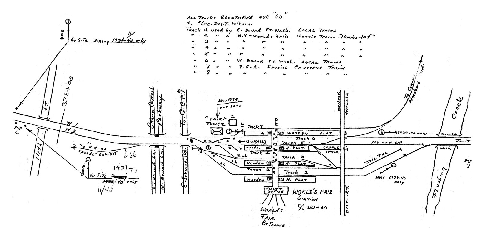 Emery World's Fair temporary only MP6-MP7 1937-1940 Archive: Dave Keller
|
 NY World's Fair Station 2/1939 View SE Archive: Dave Keller 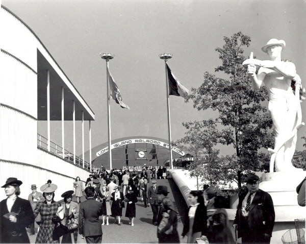 NY Worlds Fair Station - Fairgrounds 1939 |
.jpg) MP41 #1056 NY World's Fair Station 1939 (Votava-Keller) .jpg) MU train at NY World's Fair Station-1939 (Votava-Keller) |
|||||||||||||||||||||
|
UNITED NATIONS: EAST OF CORONA STATION. IN SVC: 9/15/46, OUT OF SVC: c. 1952 (FLUSHING MEADOWS - SITE OF 1939 WORLD’S FAIR STATION) |
|||||||||||||||||||||||
.jpg) MU Trains DD1 Electrics at NY World's Fair Station 10/06/1940 Archive: Dave Keller |
 Cabin FAIR - NY World's Fair 5/1940 View E Archive: Dave Keller |
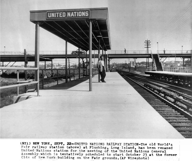 United Nations Station - Flushing Meadows 1946 Archive: Art Huneke |
|||||||||||||||||||||
 Tower JC - Whitestone Jct. Flushing LIRR valuation photo 4/04/21 Archive: Dave Keller |
 MP6-7 Corona Emery Map 1958 Collection: Dave Keller |
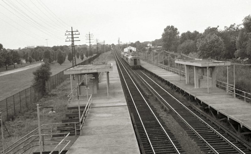 United Nations Station with MU - Flushing Meadows 1952 (Votava-Keller) |
|||||||||||||||||||||
|
WORLD'S FAIR:
4TH STATION FACILITIES RELOCATED
1,570’ EAST OF FORMER LOCATION AND CONVERTED FROM OUTSIDE, LOW LEVEL
PLATFORM TO SINGLE ISLAND HIGH LEVEL PLATFORM PER G.O. #1004 EFF:
07/10/63 IN PREPARATION FOR OPENING OF FAIR. AGENCY OPENED _?_.
LAST DAY OF AGENCY FOR 1964: 10/18/64. AGENCY RE-OPENED AGAIN
FOR FAIR SERVICE IN 1965. LAST DAY OF AGENCY: 10/17/65 (Brad Phillips
data) AT CLOSING OF FAIR. STATION RENAMED “SHEA STADIUM”: 4/15/66.
(SEE "SHEA STADIUM.") |
|||||||||||||||||||||||
.jpg) MU Train at NY World's Fair temporary station 1962 (Edwards-Keller) |
 MU eastbound World's Fair Station under construction Flushing Meadows 5/30/1963 |
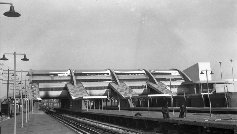
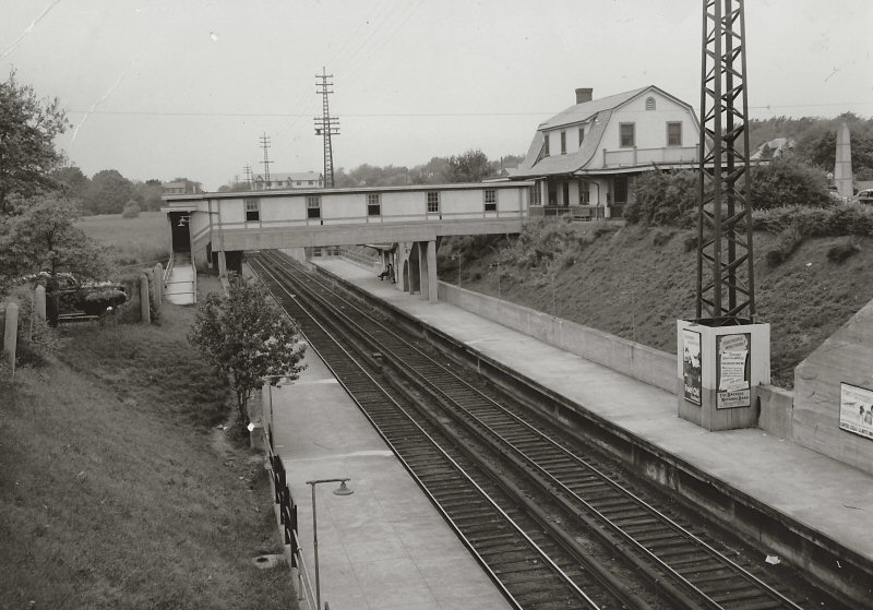
 World's Fair Station 9/1964 Photo/Archive: Roger Puta MORE: World's Fair |
|||||||||||||||||||||
 World's Fair Station 8/1964 Photo/Archive: Jim Gillin |
.jpg) FAIR Interlocking Cabin - NY World's Fair 5/16/1965 (Makse-Keller) |
.jpg) MU Trains at NY World's Fair Station 9/25/1965 (Votava-Keller) |
|||||||||||||||||||||
|
SHEA STADIUM: PREVIOUSLY “WORLD’S FAIR” STATION OF 1964-65 NY WORLD’S FAIR - FLUSHING MEADOWS - 1964. RENAMED “SHEA STADIUM”: 4/15/1966. NO FULL-TIME AGENCY. AGENCY ONLY OPEN DURING EVENTS PER LIRR "TICKET OFFICE HOURS" LISTING OF 5/31/66 (Brad Phillips data). FLASHING YELLOW LIGHT MOUNTED ON SIGNAL MASTS TO INDICATE STOP TO BE MADE, IN SVC: 3/21/88. OUT OF SERVICE: END OF BASEBALL SEASON: 9/29/2008. SHEA STADIUM TORN DOWN AND REPLACED WITH NEW “CITI FIELD” STADIUM AND STATION STOP RENAMED “METS-WILLETS POINT.” IN SERVICE: TIMETABLE EFFECTIVE 4/3/2009. Research: Dave Keller |
|||||||||||||||||||||||
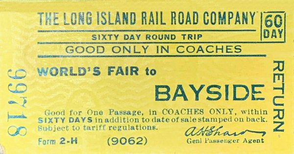
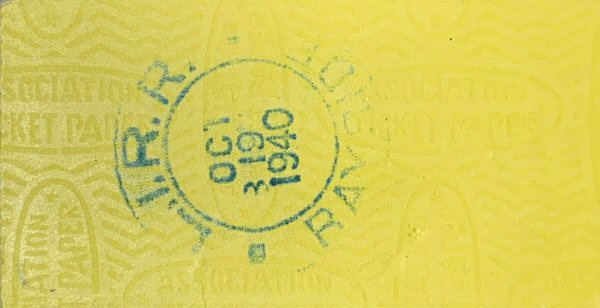
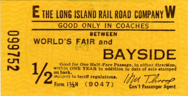
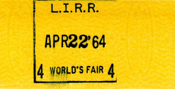
 Ticket between NY Penn and Shea Stadium Form 1-B H - Archive: Brad Phillips |
.jpg) M1 Railfan Extra at Shea Stadium Station 4/20/1969 (Edwards-Keller)
|
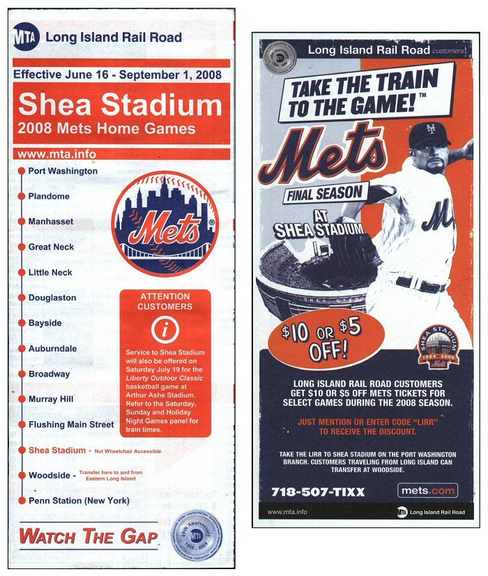 "Take the Train to the Game" Shea Stadium Port Washington Branch timetable 6/16/2008 |
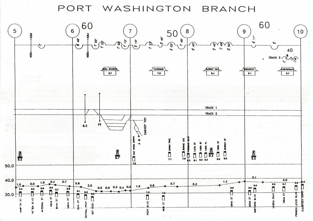 Port Washington Branch - Shea Stadium to Auburndale Track profile map 1994 |
||||||||||||||||||||
| WILLETS POINT: FORMERLY SHEA STADIUM STATION. RENAMED WITH CONSTRUCTION AND OPENING OF NEW “CITI FIELD” STADIUM. IN SERVICE: TIMETABLE EFFECTIVE 4/03/2009 | |||||||||||||||||||||||
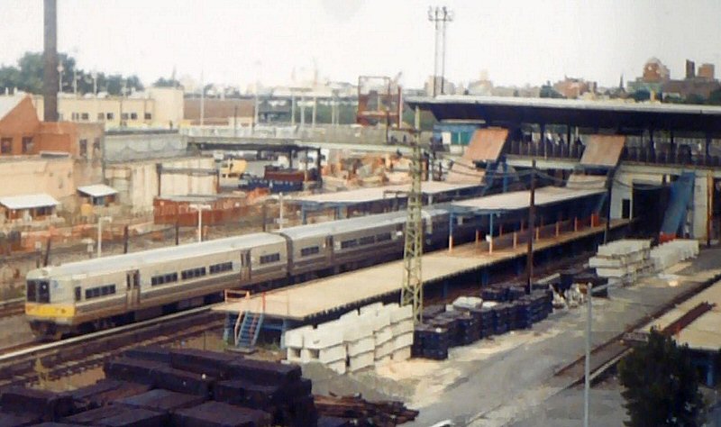 M1s passing Willets Point Station under construction 9/02/2004 Photo/Archive: Kevin Wong |
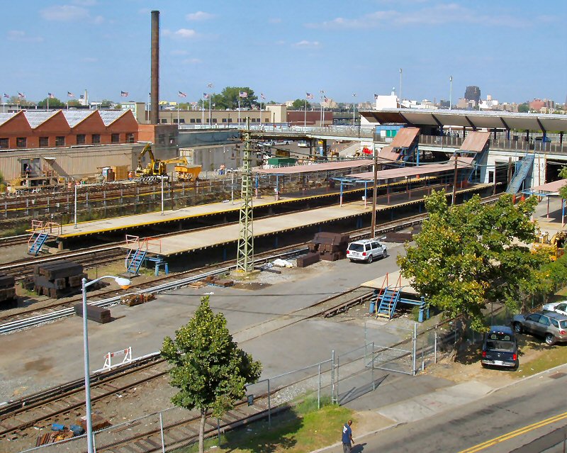 Willets Point Station under construction 9/01/2005 Photo/Archive: Kevin Wong |
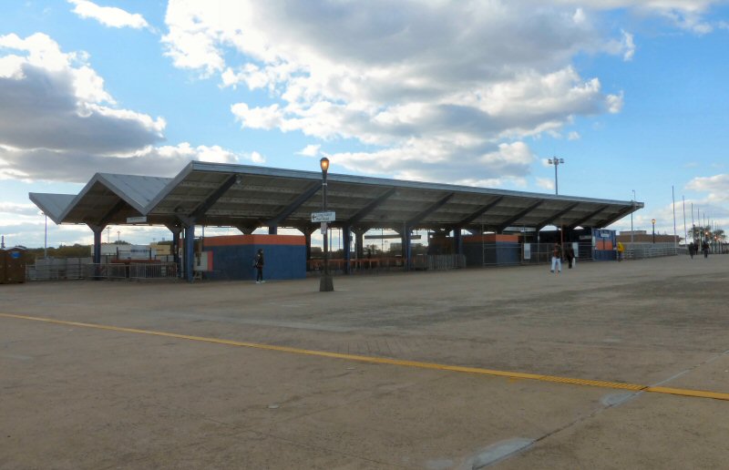 Willets Point Station 10/17/2015 Photo/Archive: Kevin Wong |
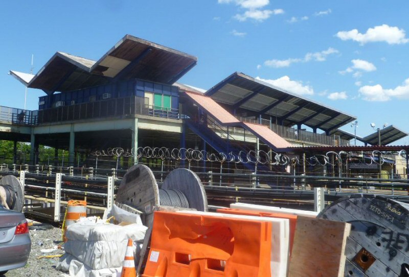 Willets Point Station 6/07/2014 Photo/Archive: Kevin Wong |
||||||||||||||||||||
| SHEA CAR SHOP | |||||||||||||||||||||||
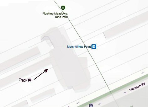 Tracks 3-4 are where they currently do the Extensive Interior Cleaning of the MUs. Tracks 5-6 are the pit tracks, which have been filled in with dirt. The MofE trailers are on this platform. (photo right) |
 Shea Car Shop track 4 location. |
 Shea Car Shop 7/1981 Photo/Archive: Bill Mangahas |
 Metro North M-3A 4/1983 Photo/Archive: Bill Mangahas |
||||||||||||||||||||
|
FLUSHING RIVER DRAW (SWING) BRIDGE |
|||||||||||||||||||||||
 North Side Div. Draw Bridge N72 - Flushing River sketch B 7/21/1924 |
%20-%2009-30-35%20(Sperr-Keller).jpg) The Flushing River swing bridge and bridge tender's cabin can be seen across marshland looking South from the Roosevelt Avenue bridge on September 30, 1935, The building in the left background with "Flushing" indicated on its roof is reminiscent of what early airports used as identification for pilots to see from the air and act as an aid to identify where they were. This facility appears to be a construction company with a number of crane booms visible. (Percy Loomis Sperr photo, Dave Keller archive) |
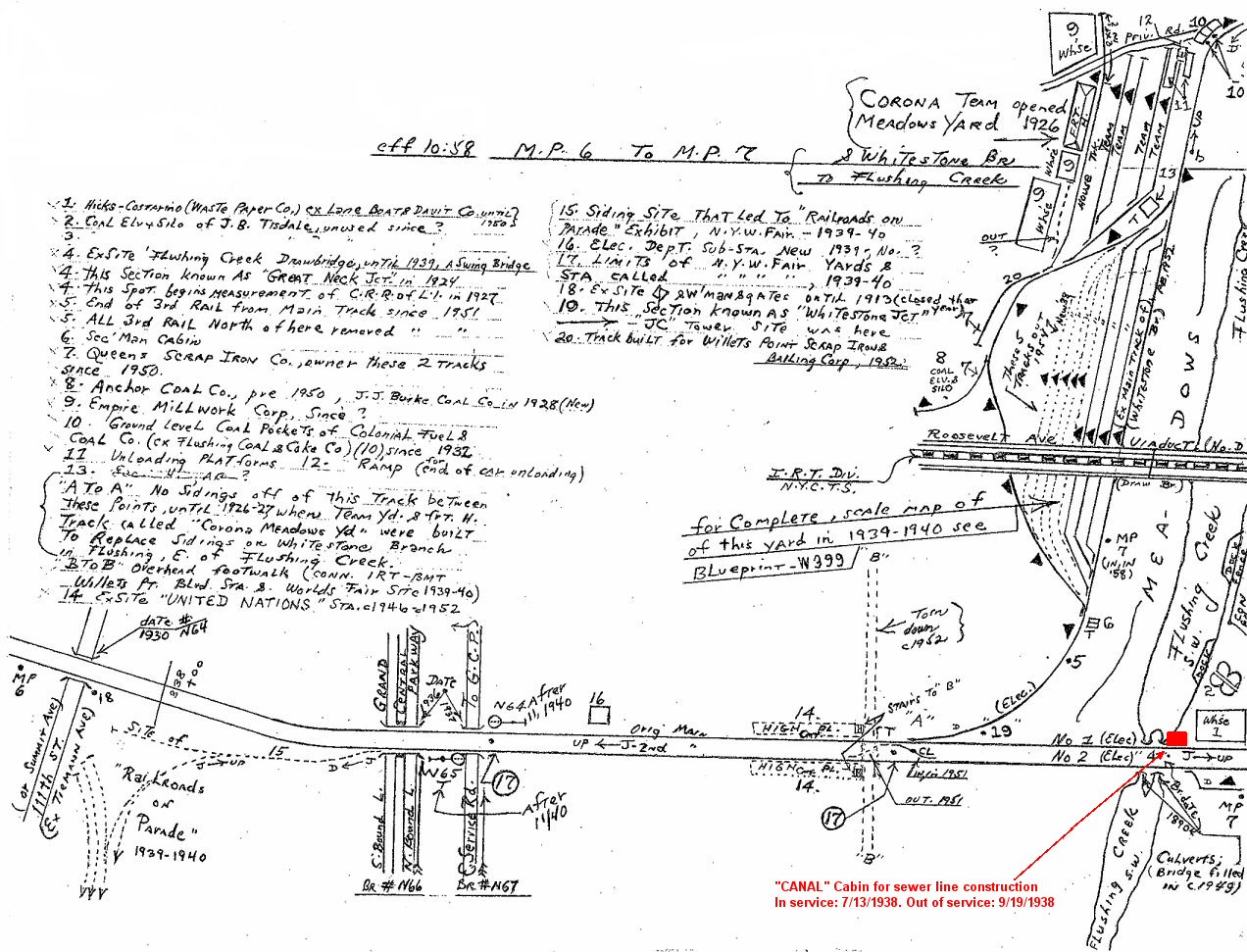
%20-%2009-30-35%20(Sperr-Keller)%20(Zoom).jpg) This is a zoomed-in view of the swing bridge which was originally controlled by the operator at "JC" tower (Whitestone Jct./ Corona Jct.). When the Whitestone branch was abandoned in early 1932, the tower was taken out of service and a bridge tender's cabin installed at the east end of the bridge and it was called "Flushing Drawbridge" despite the fact this was a swing bridge. During the construction of the sewer line for the N. Y. World's Fair, the bridge tender's cabin was turned into a temporary block office with a 6-lever Model TC table machine and given the call letters "CANAL." The block operator on duty handled the block as well as operated the swing bridge. See the segment on "CANAL" cabin for additional info. (Dave Keller data)
|
|||||||||||||||||||||
| "CANAL" CABIN | |||||||||||||||||||||||
|
Located on the north side of the tracks and the east end of the Flushing River swing bridge (see map notation below), east of Flushing Meadows/Corona during the N. Y. World's Fair sewer line construction adjacent to the Flushing River. US&S 6-lever style TC table machine in service: 7/13/38. Out of service 9/19/38. Note the effort to construct the PRR-style keystone call letters sign, rather than just a square of wood with the name "CANAL" painted on it, which you'd expect for a temporary structure! Also note the screens on all the windows: lots of mosquitoes! |
|||||||||||||||||||||||
%20-%2007-17-38%20(W.S.%20Boerckel-Morrison).jpg) CANAL Cabin -View NE |
%20-%2007-17-38%20(W.S.%20Boerckel-Morrison).jpg) CANAL Cabin -View NW |
%20-%2007-17-38%20(W.S.%20Boerckel-Morrison).jpg) CANAL Cabin - LIRR C51sa #268 eastbound over the Flushing River - View W |
%20-%2007-17-38%20(W.S.%20Boerckel-Morrison).jpg) CANAL Cabin -Operator Win Boerckel - View NE |
||||||||||||||||||||
| 7/17/1938 Photos: Win S. Boerckel Archive: Dave Morrison | |||||||||||||||||||||||
 Flushing MP7 Cullen Coal - Hicks Costarino Waste Paper (left) View E-1938 (William J. Rugen-Queens Public Library) |
 Emery map - Flushing MP7-8 - 9/1958 Archive: Dave Keller |
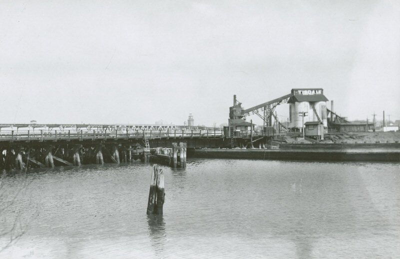 Flushing Creek Drawbridge - J. B. Tisdale Coal View NE-1938 (William J. Rugen-Queens Public Library) |
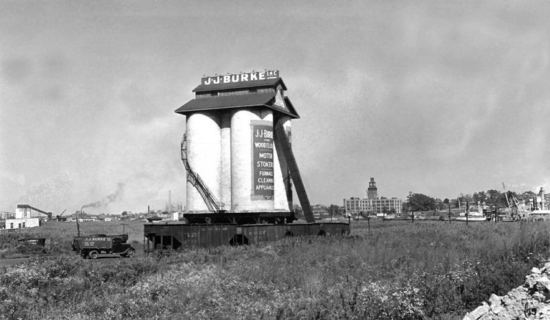
 Flushing Creek Drawbridge - J. J. Burke Coal (left) View N-1938 (William J. Rugen-Queens Public Library) |
||||||||||||||||||||
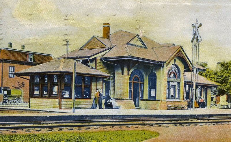
| FLUSHING - MAIN STREET | |||||||||||||||||||||||
|
BUILT: 12/1853. BURNED: 10/13/1864 |
|||||||||||||||||||||||
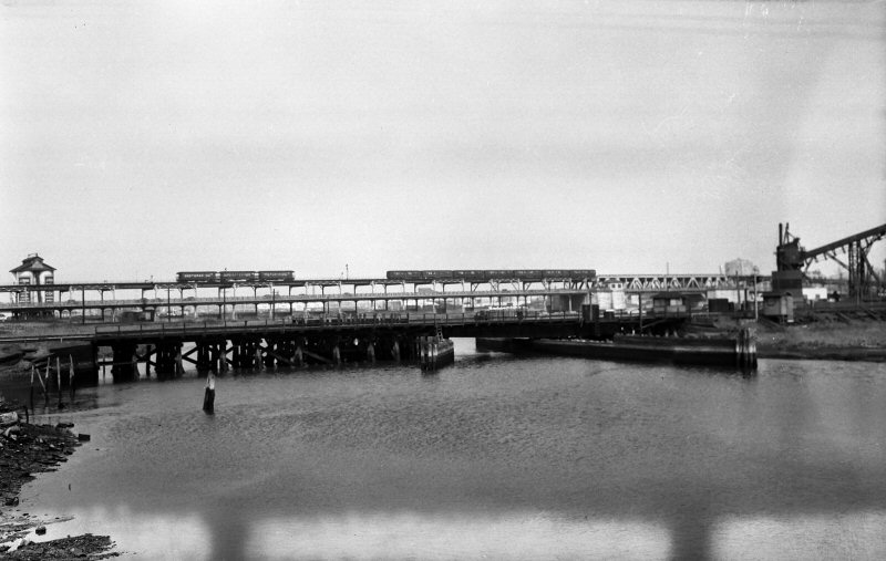
.jpg) Flushing Station Water Tower View E 9/05/1910 Archive: Dave Keller |
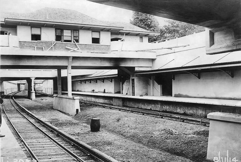
.jpg) ROW view W from portal east of Main Street, Flushing 10/25/1911 - (LIRR valuation-Keller) |
.jpg) ROW view from east portal of tunnel towards Union Street, Flushing 10/25/1911 (LIRR valuation-Keller) |
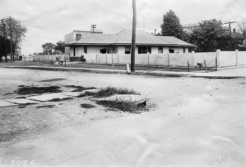
 Main St. Station, Flushing demolition - West side of Main St. - 1912 Archive: Pinterest |
||||||||||||||||||||
|
The depot (above right) is in the process of being demolished for the grade crossing elimination. It appears the lumber is being removed a bit at a time rather than a wrecking ball type of demo. Probably due to the lack of space due to the very tight quarters at the depot with the narrow water tank and as the tracks enter the tunnel on the west side of Main St. Info: Dave Keller |
|||||||||||||||||||||||
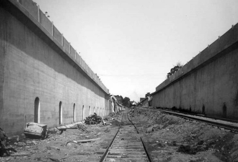 Flushing Grade Elimination as a temporary track has been laid and finish grading hasn't yet begun. 1913 Archive: Kevin Wong |
 LIRR valuation Union St. construction complete and third rail is being readied to install. View W 9/10/1913 Archive: Kevin Wong |
 Flushing LIRR bridge crossing Main Street 1924 postcard - Archive: Kevin Wong |
 Flushing Main St. Station (westbound side) - 9/08/1918 (LIRR valuation photo, Dave Morrison archive) 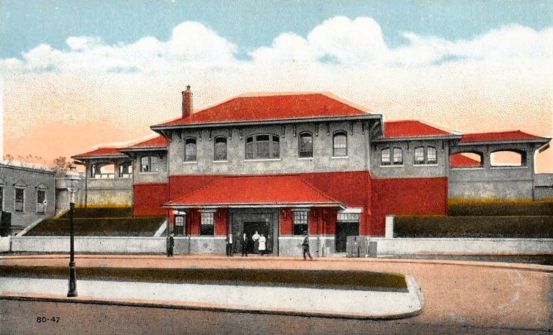 Flushing Station - Main St. colorized post card c.1920 |
||||||||||||||||||||
 Flushing Main St., express house with elevated station (eastbound side) - 4/04/1921 (LIRR valuation photo, Dave Morrison archive) |
 Flushing Arrestor House 4/04/1921 (LIRR valuation-Morrison) |
.jpg) Flushing Station - Main Street 7/1960 View S Archive: Dave Keller |
 MU train eastbound at Flushing Main St. Station View W 5/06/1962 (Smith-Keller) |
||||||||||||||||||||
|
|
|||||||||||||||||||||||
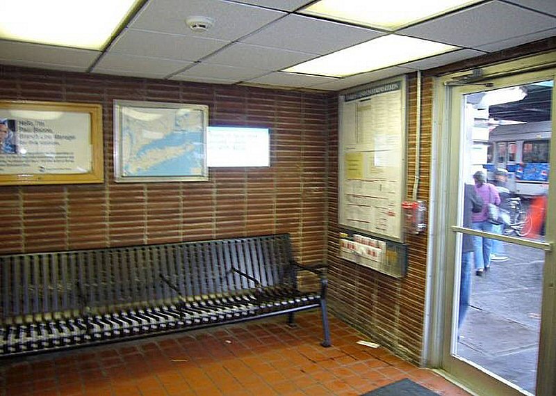 Flushing Main St. Station - Interior |
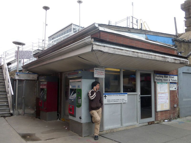
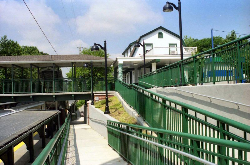
 Flushing Main Street Station 41st Ave-Main St. 4/04/2007 Photo/Archive: Kevin Wong |
 Flushing Main Street Station 4/08/2016 Photo/Archive: Kevin Wong |
|||||||||||||||||||||
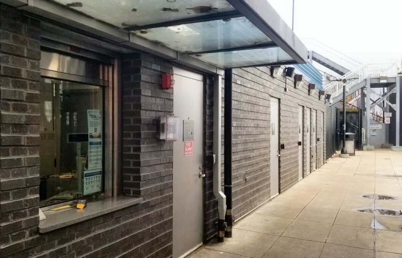 Flushing Main Street ticket office 1/27/2023 Photo/Archive: Kevin Wong |
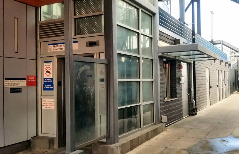 Flushing Main Street new station house 1/27/2023 Photo/Archive: Kevin Wong |
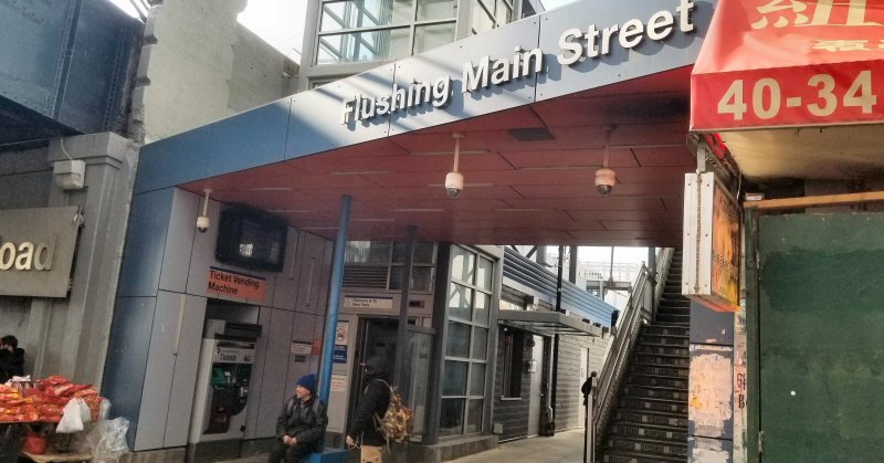 Flushing Main Street 1/27/2023 Photo/Archive: Kevin Wong |
|||||||||||||||||||||
|
Flushing Main Street 1/27/2023 – New fully
accessible ADA station built 2017-2018, completed August 2018, in
service 8/31/2018. Dedication by local officials 10/18/2018, per
MTA. New station house is on the |
|||||||||||||||||||||||
|
BUILT: 1889-90, RAZED: 10/1912 2ND ELEVATED DEPOT OPENED: 7/1914 (STATION BLDG. SPANNED DEPRESSED TRACKS). AGENCY STILL LISTED IN "L.I.R.R. TICKET OFFICES OPEN FOR
|
|
 Murray Hill Station colorized photo view NE c.1910 Archive: Dave Morrison |
|||||||||||||||||||||
.jpg) Murray Hill Station view W from Boerum Ave. 12/18/1911 (LIRR valuation-Keller) |
 Murray Hill Station view W 8/11/2014 (LIRR valuation-Morrison) |
 Murray Hill Station 8/11/2014 (LIRR valuation-Dave Morrison) |
|||||||||||||||||||||
.jpg) MU train under 149th Pl. leaving Murray Hill Station View E 1950 (Edwards-Keller) |
 Murray Hill Station colorized photo view NE c.1910 Archive: Dave Morrison |

Murray Hill MI Cabin 1925 view W Photo: James V. Osborne Archive: Dave Keller |
|||||||||||||||||||||
|
|
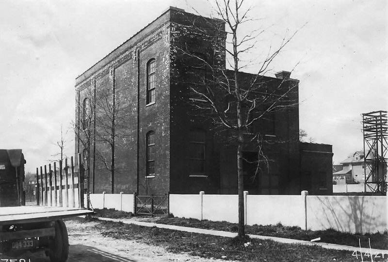 Murray Hill Substation LIRR 4/04/21 (LIRR valuation-Morrison) |
 Murray Hill Station - 8/29/2024 Photo/Archive: Kevin Wong |
|||||||||||||||||||||
| FLUSHING - BROADWAY | |||||||||||||||||||||||
|
OPENED: 10/27/1866 AS " |
|||||||||||||||||||||||
 Broadway Station - Flushing colorized photo c.1920 |
 Broadway Station Flushing LIRR valuation photo 1914 |
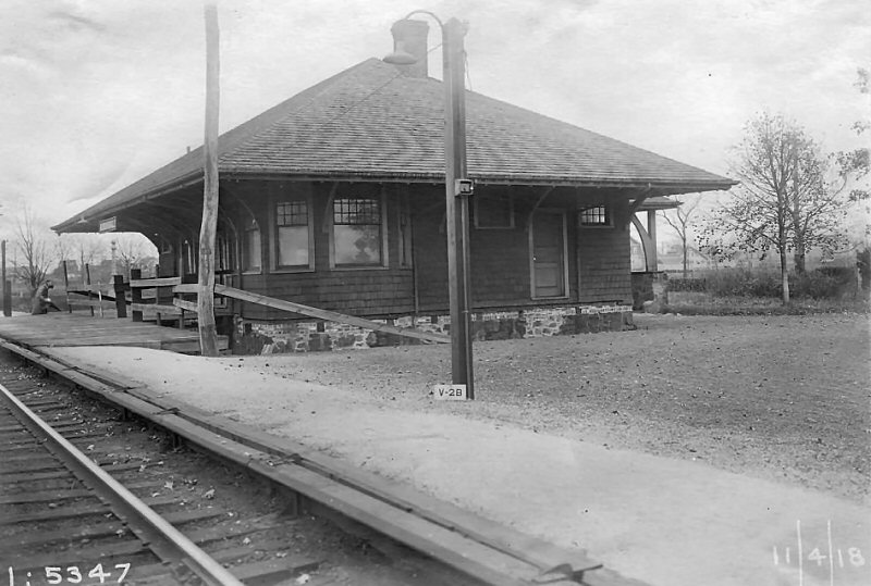
 Freight station Broadway Flushing 11/04/18 Archive: Dave Keller |
|||||||||||||||||||||
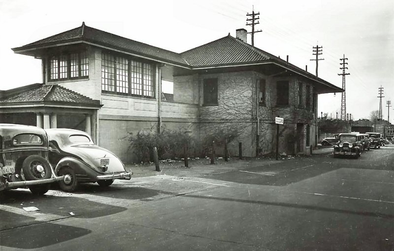
.jpg) Broadway-Flushing Station view NW 1967 Photo/Archive: Dave Keller |
 Broadway Station 1937 Archive: Dave Morrison |
 Broadway Station 4/04/2021 view NE (LIRR valuation-Morrison) |
|||||||||||||||||||||
 Broadway Station 8/29/2024 view NE Photo/Archive: Kevin Wong |
|||||||||||||||||||||||
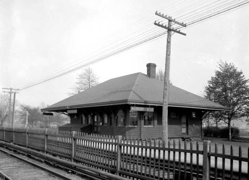
| AUBURNDALE | |||||||||||||||||||||||
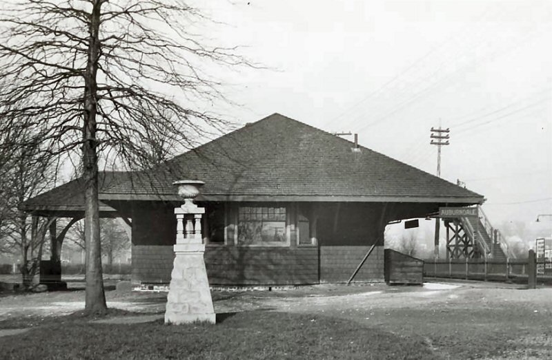
|
BUILT: 5/1901, CLOSED: 1929
ACCOUNT GRADE CROSSING ELIMINATION, SOLD AND MOVED TO PRIVATE
LOCATION FOR USE AS A CHURCH: 1930. (CHURCH CLOSED:1973.) TEMPORARY
TRACKS RELOCATED ON SHOO-FLY 42’ NORTH OF ORIGINAL LOCATION:
6/18/29 DUE TO GRADE CROSSING ELIMINATION. HIGH LEVEL PLATFORM IN
SVC: 12/5/29 AND WESTBOUND STATION FACILITIES |
|||||||||||||||||||||||
.jpg) Auburndale Station grade elimination temporary tracks View E 5/18/1929 (LIRR valuation-Keller) |
 Auburndale Station 1923 Photo: James V. Osborne Archive: Dave Morrison |
.jpg) Auburndale Station grade elimination temporary tracks View W 5/18/1929 (LIRR valuation-Keller) |
.jpg) Auburndale Team Yard view E view E from Utopia Parkway - 6/17/1929 (LIRR valuation-Keller) |
||||||||||||||||||||
.jpg) Auburndale Station grade elimination temporary tracks View E 7/15/1929 (LIRR valuation-Keller) |
.jpg) ROW view E from Utopia Parkway overpass - Elevated Auburndale Station in the distance 12/12/1929 (LIRR valuation-Keller) |
 Emery maps Auburndale MP9-10 - 1904, 1928, 9/1958 Archive: Dave Keller |
|||||||||||||||||||||
 Auburndale Station 11/04/1918 (LIRR valuation-Morrison) |
 Auburndale Station - 1926 - eBay Note: Wooden platform and make-shift wooden slat fence removal. |
 Scranton & Lehigh Coal Co - View E 12/12/1929 Photo: LIRR Valuation Archive: Dave Keller Note: Auburndale Feed Co. lower right |
|||||||||||||||||||||
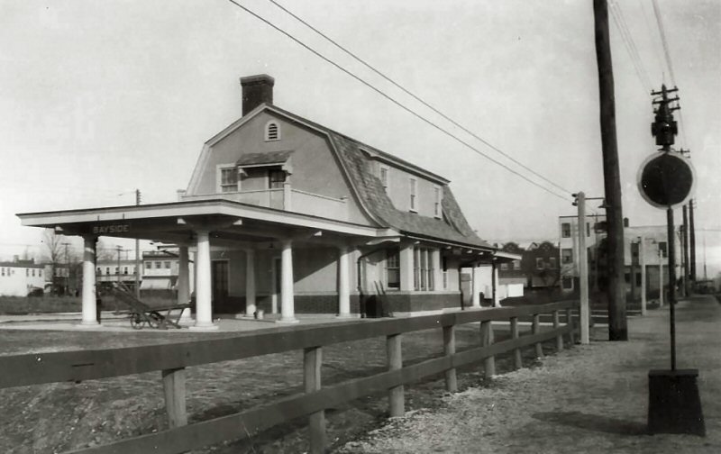
| BAYSIDE | |||||||||||||||||||||||
|
"BAY SIDE": (Originally) BUILT: c.1866 WITH OPENING OF STATION STOP ON 10/27/1866 2ND DEPOT BUILT: 1886, RAZED: 1924
3RD DEPOT BUILT: 1924. TEMPORARY TRACKS RELOCATED |
|||||||||||||||||||||||
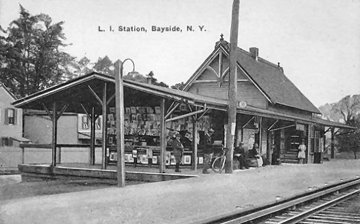 Bayside Station c.1917
|
 Bayside Station 1924 Photo: James V. Osborne Archive: Dave Morrison |
.jpg) Bayside Team Yard under construction view E from footbridge 6/17/1929 (LIRR valuation-Keller) |
|||||||||||||||||||||
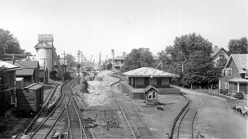 Bayside freight house View W 8/17/1929 (LIRR Valuation-Huneke) The electrified siding going into the coal yard provided DD1 electric locomotives to pull freight in third rail territory, freeing up locomotives to operate in steam territory. The "run around" to the right of freight house removed 1938. |
.jpg) Bayside freight house, track workers and the temporary block cabin B2 that controlled the temporary single track in place during the grade elimination project from June 18 to December 5, 1929 when it was placed out of service during the grade elimination - Fall, 1929 Archive: Dave Keller |
LIRR valuation photo shot after the grade elimination was completed at Bayside. You can see the concrete retaining walls as the two tracks dip into the cut, and all the embankments finished off. |
|||||||||||||||||||||
|
“B2” Cabin: A temporary block station 1,500’ east of Bayside Station on east side of freight house, north side of tracks on account of grade crossing elimination at Auburndale and Bayside. US&S 4 lever style TC table machine in service: 6/18/29 Out of service: 12/5/29 |
|||||||||||||||||||||||
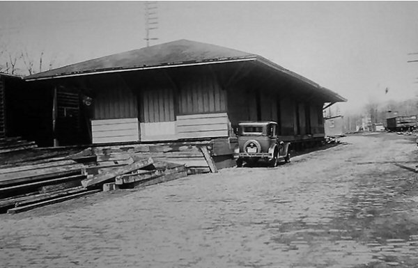 Bayside Freight House 4/14/34 Archive: Dave Keller
|
|
|
.jpg) Bayside Freight House -View W
4/12/1978 (Madden-Keller)
|
||||||||||||||||||||
 Bayside Station - View NW 1958 Archive: Kevin Wong |
 View W towards 216th St. overpass and Bayside Station 1975 Photo: A. Joseph Daly |
.jpg) Bayside Station SB Block Signal view E 1/22/1979 (Erlitz-Keller) |
|||||||||||||||||||||
 Bayside Station view W 7/05/2001 Photo/Archive: Dave Keller |
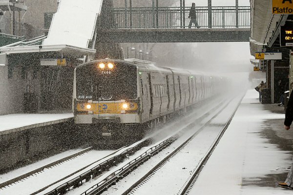 M7 7196 eastbound eases its train into Bayside Station on a snowy Saturday January 22, 2005. Photo: A. Joseph Daly |
 Bayside Station - 1961 Archive: Tommy Byrne |
|||||||||||||||||||||
|
BAY BLOCK STATION |
|||||||||||||||||||||||
|
LOCATED EAST OF BAYSIDE - TEMPORARY BLOCK STATION FOR SINGLE TRACKING DURING TRACK REHABILITATION BETWEEN BAYSIDE AND SHEA STADIUM AND BAYSIDE AND GREAT NECK, BOUNCING BACK AND FORTH BETWEEN THE 1ST AND 2ND CROSSOVER SWITCHES EAST OF BAYSIDE. SEE SERVICE HISTORY INDICATED BELOW. Info: Dave Keller |
|||||||||||||||||||||||
|
IN
SVC: 4/05/78 O.O.S: 5/07/78 |
.JPG) "BAY" temporary block station east of Bayside. This view is looking E on 04/12/1978 with a westbound M1 train abreast of the cabin. The call letters have been posted on the telephone pole. (Jeff Erlitz - Dave Keller) |
|
|||||||||||||||||||||
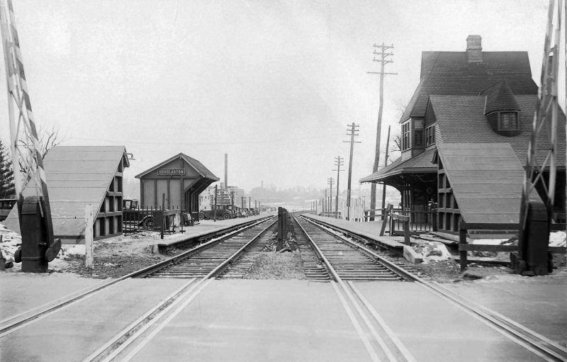
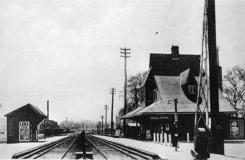
| DOUGLASTON | |||||||||||||||||||||||
|
BUILT: APR-MAY/1867, MOVED TO
PRIVATE LOCATION: ?
2ND DEPOT BUILT: 6/1887, REBUILT: 1898, RAZED: 3/1962 |
|||||||||||||||||||||||
|
|
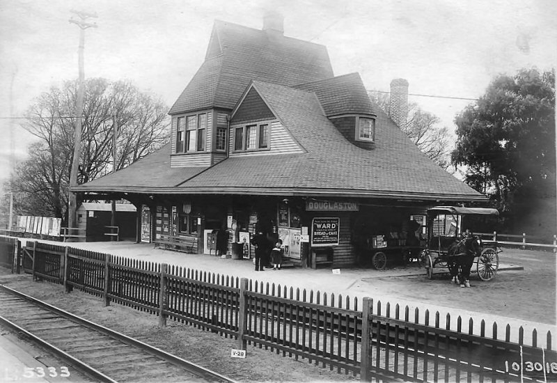 Douglaston Station - view NW 10/30/1918 (LIRR valuation-Morrison) |
 Douglaston Station - View W from the 235th St. crossing. 1930 Archive: Jeff Erlitz |
 Douglaston Station view E 1937 Archive: Dave Morrison |
||||||||||||||||||||
| The addition of the below-track pedestrian tunnel accesses were constructed in 1930. Info: Dave Keller | |||||||||||||||||||||||
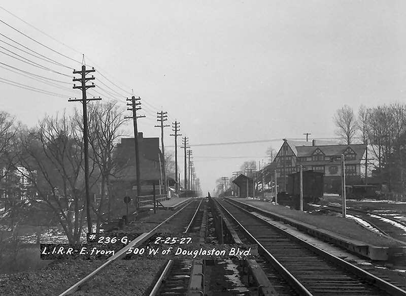
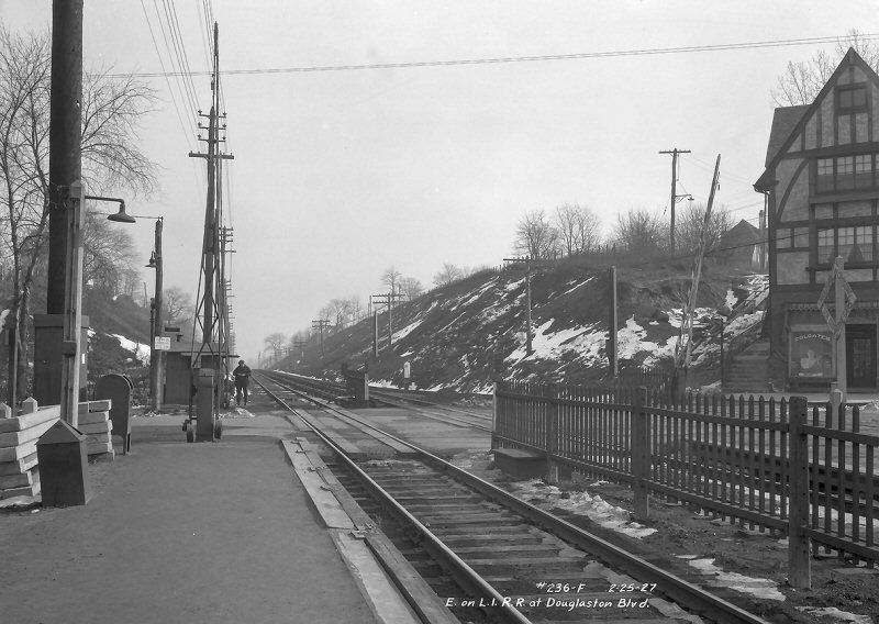 Douglaston Blvd. view E - MP12 2/24/1927 - Archive: NYC Municipal Library |
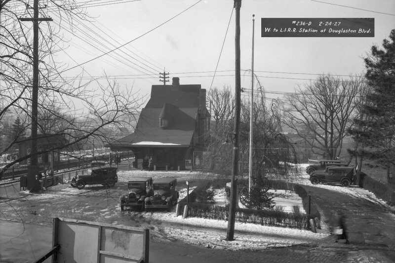 Douglaston Blvd.- Station view SW 2/24/1927 Archive: NYC Municipal Library |
 Douglaston Blvd crossing view SE The closer track here is eastbound Track 2 and the further one is the team track. 2/24/1927 - Archive: NYC Municipal Library |
 Douglaston Station with team track at right - view E 2/24/1927 - Archive: NYC Municipal Library |
||||||||||||||||||||
| This group of photos from the NYC Municipal Library and Archives and were originally photographed by the Queens Borough President Topographical Bureau. Jeff Erlitz | |||||||||||||||||||||||
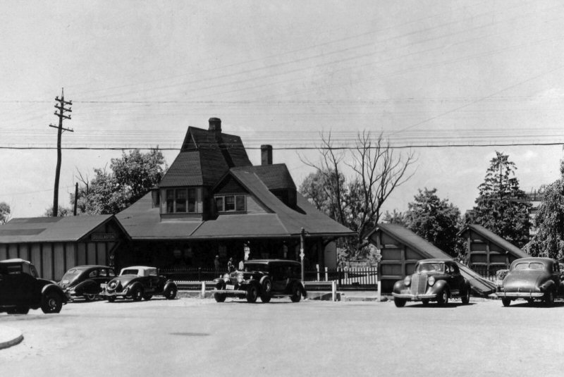
 Douglaston Station 1939 View W Archive: New York Public Library |
 Douglaston Station 1939 View N Archive: New York Public Library |
||||||||||||||||||||||
.jpg) MU Double Deck Train westbound at Douglaston Station - View NE 3/1962 Archive: Dave Keller |
.jpg) Douglaston Station temporary ticket office in background View NE 1962 Archive: Dave Keller |
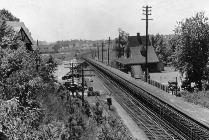
 Douglaston Station - View SE Photo: forgotten-ny.com
|
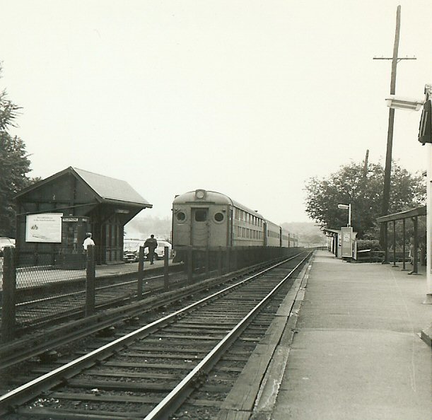
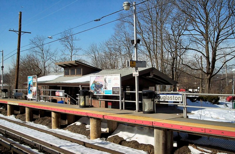 Douglaston Station - View NW c.2020 Photo: Google The photographer is standing on the former site of the 235th St. crossing, looking NW. Info: Dave Keller |
||||||||||||||||||||
|
Also, visible in the 1930 image, but not in
the earlier 1918 photo, is the crossing of 235th St. At some later
date, the crossing was eliminated in an early grade crossing
elimination project and the road truncated at either side of the
tracks |
The former site of the 235th St. crossing (above), looking SE towards the Douglaston Parkway overpass. Note the replacement stair shelters for the below-grade pedestrian crossing. These were constructed along with the replacement depot in 1962. Info: Dave Keller |
||||||||||||||||||||||
 View east from that 216th St. pedestrian overpass. The structure in the background is across Little Neck Bay, in Douglaston. Today, Bay Interlocking is here. A set of crossovers, controlled from Harold. I can't pin exact date, it is c.1975. A. Joseph Daly |
.jpg) LIRR #167 216th St. 1978 Photo: A. Joseph Daly |

LIRR #167 216th St. 1978 Photo: A. Joseph Daly |
 M-1 about to crest the grade up from Douglaston/Little Neck Bay. About to pass under 216th St. pedestrian overpass, and descend into Bayside Station. Westbound 10/1974 Info/Photos: A. Joseph Daly |
||||||||||||||||||||
 LIRR M7 7233 is crossing over at Bay Interlocking, due to track work ahead. March 15, 2004 train is westbound, going on to a normally eastbound track. Photo: A. Joseph Daly |
 Shot from 221st overpass, looking east. Apt. buildings in background are in Douglaston. Train is over the Cross Island Pkwy, coming upgrade to Bayside. |
 Under the watch of PRR style position light signals, LIRR MU (M1 or M3?) has climbed the grade from Little Neck Bay, and is westbound, dropping in to Bayside Station on Saturday, January 22, 2005. Signals are the west end of Bay Interlocking, I believe controlled by Harold Tower. Photo: A. Joseph Daly |
 M-1 at Alley Creek west of Douglaston Station traversing Little Neck Bay c.1975 Photo: A. Joseph Daly |
||||||||||||||||||||
 Eastbound arriving Douglaston 09/09/1965 Archive: Douglaston Historical Society |
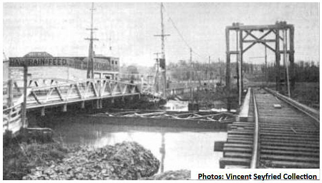 Alley Creek NY&NS Trolley bridge, Route 25A bridge (left) Van R. Swezy Hay Grain Feed & Coal Co. in background as a barged industry. View NE c.1910 Archive: Vincent Seyfried |
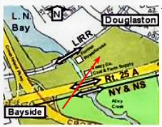 Alley Creek map |
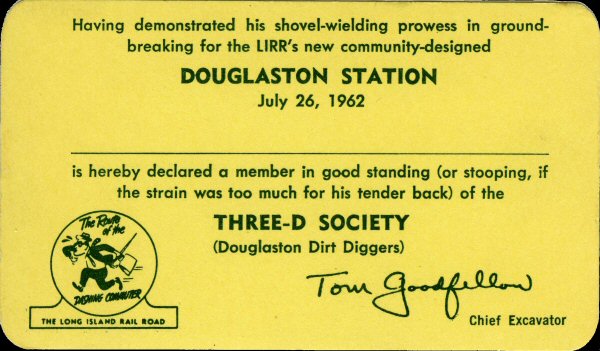 Douglaston Station groundbreaking Three-D Society 7/26/1962 Archive: Dave Morrison |
||||||||||||||||||||
 Douglaston bridge was a swing bridge originally allowing ships into Alley Creek to access the mill. It was rebuilt in 1990's to help revive tidal flow into Alley Creek. View N |
 Douglaston bridge view N c. 1964 Collection: nycsubway.org |
.jpg) M1 train heading across Alley Creek in Douglaston 10/07/77 View W (Wm. Madden photo, Dave Keller archive) |
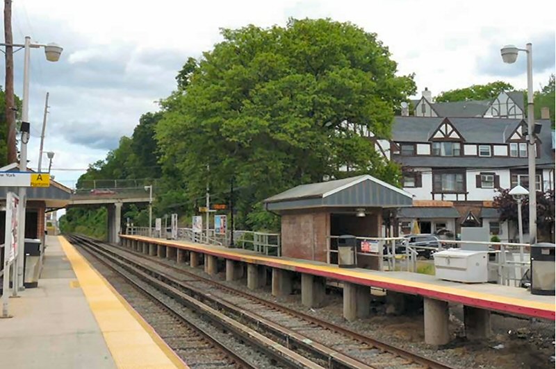
 Douglaston Station 8/29/2024 Photo/Archive: Kevin Wong |
||||||||||||||||||||
 |
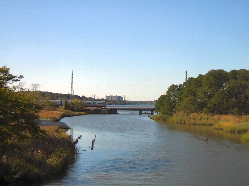
“TC-82 Over Alley Creek” - On the morning of April 22, 2025, Long Island Rail Road’s "TC-82" Track Geometry Vehicle crosses Alley Creek, a tributary of Little Neck Bay, as it approaches Douglaston, NY on the Port Washington Branch. In the background, the Towers at Water’s Edge and the towers of the Throgs Neck Bridge rise above the treeline. Built by Plasser American Corporation, TC-82 is used to perform track inspections across the LIRR system. Photo/Archive: Greg Grice |
||||||||||||||||||||||
D Cabin - Douglaston 1925 Photo: James V. Osborne Archive: Dave Keller |
“D” CABIN: 1. DOUGLASTON DRAWBRIDGE (SWING BRIDGE),
S. SIDE OF TRACKS BUILT ON RECLAIMED W. EDGE OF ALLEY CREEK. IN SERVICE: 9/1911 –
1924 |
||||||||||||||||||||||
| LITTLE NECK | |||||||||||||||||||||||
|
APPEARS ON TIMETABLE OF 1866. DEPOT OPENED: JULY/1870 2ND DEPOT OPENED: 12/1890. AGENCY CLOSED: 8/19/2009 Research: Dave Keller |
|||||||||||||||||||||||
|
|
.jpg) Little Neck Station view E 4/26/1932 Archive: Dave Keller |
 Little Neck Shelter Shed - Station - REA Express House View E 5/10/1946 (Weber-Morrison) |
 Little Neck REA Express House - View W 5/10/1946 (Weber-Morrison) |
||||||||||||||||||||
 Little Neck - End of REA platform View E 5/10/1946 (Weber-Morrison) |
.jpg) MU Train at Little Neck Station view W 9/18/1951 (Faxon, Jr.-Keller) |
.jpg) Little Neck Shelter Shed - REA Express House View E - 9/18/1951 (Faxon, Jr.-Keller) |
.jpg) Little Neck Express House View SE 9/18/1951 (Faxon, Jr.-Keller) |
||||||||||||||||||||
 Little Neck Parkway, Queens crossing View N 1975 - Archive: Richard Eikov |
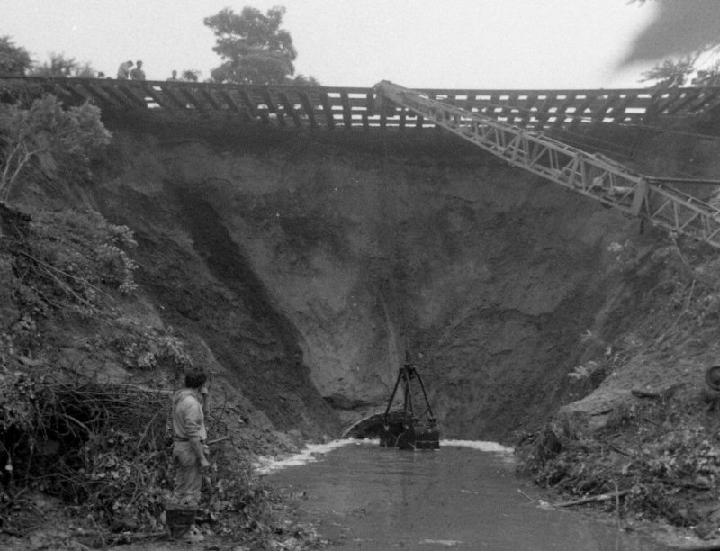 Little Neck washout 6/30/1984 Photo/Archive: John Krattinger |
|
 Little Neck Station - View NW 1927 Archive: NY Public Library |
||||||||||||||||||||
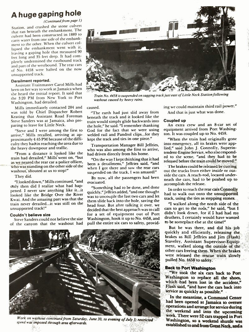
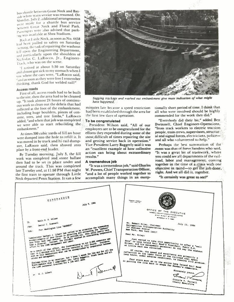
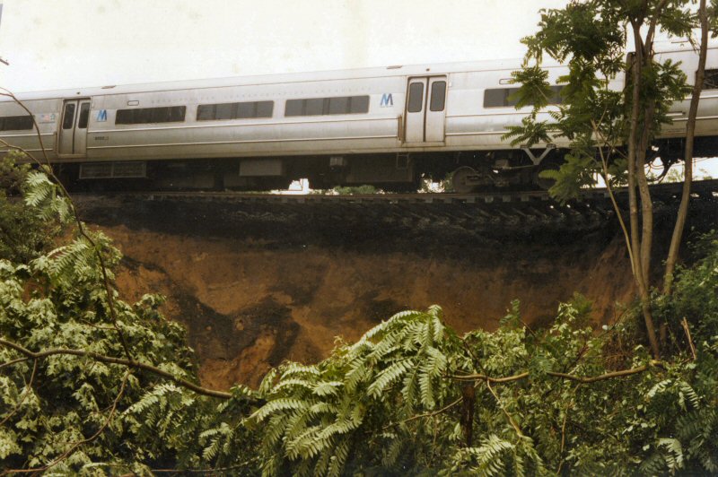 On June 30, 1984, an eastbound MU passenger train departed Little Neck Station and encountered a portion of the right-of-way that had just been washed out by water from a major rainstorm. The engineer could not stop in time, which allowed most of the train to cross over the washed out area. The rear car hung in midair on the totally unsupported track, as seen in this photo taken by Win A. Boerckel. Information/Archive: Dave Morrison
|
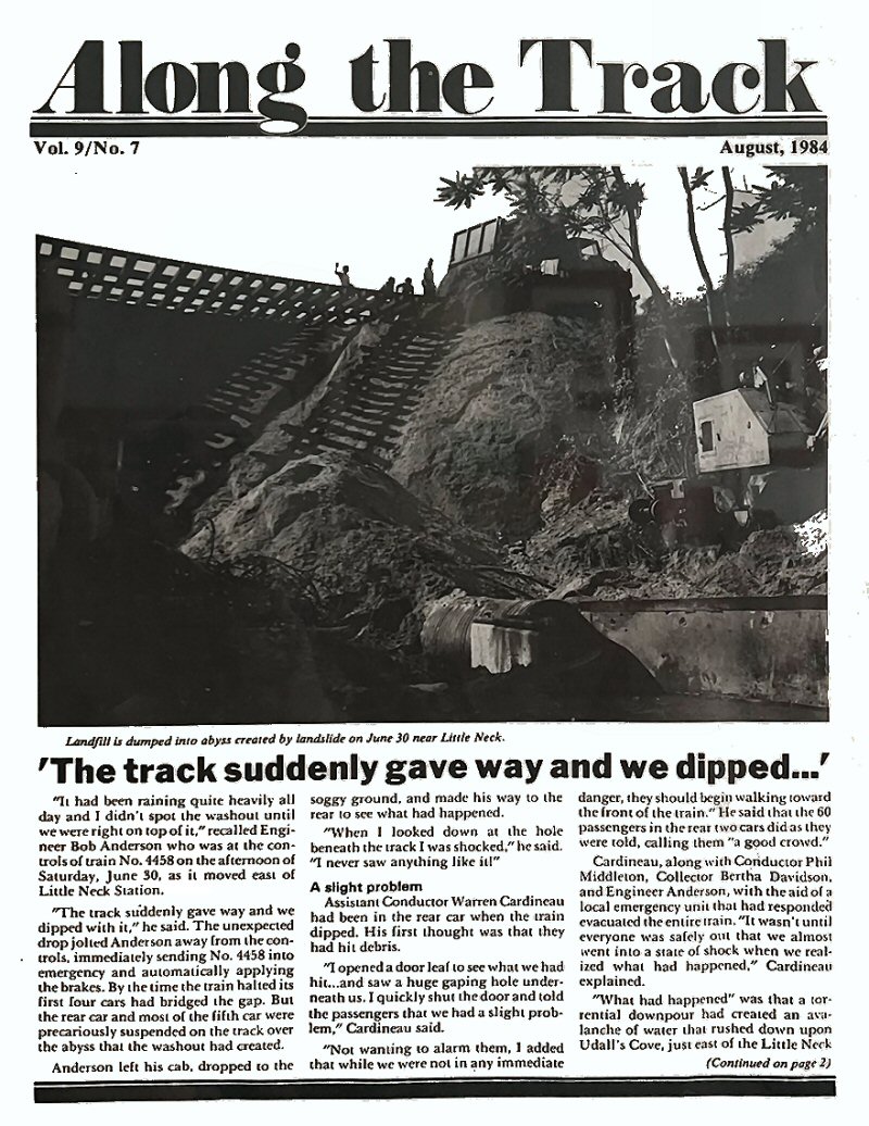 |
 LIRR Along the Track August, 1984 Archive: RMLI Library |
 |
 Little Neck Station - View NW c.1968 |
|||||||||||||||||||
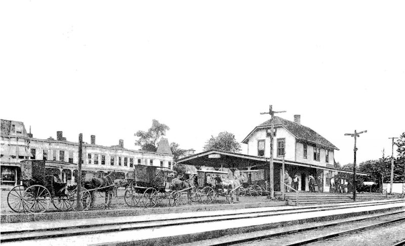
| GREAT NECK | |||||||||||||||||||||||
|
BUILT: 1866. ON NY & FLUSHING
TIMETABLE 12/31/1866 AS "GREAT NECK" AND ON FLUSHING & NORTH SIDE
TIMETABLE OF 05/06/1872 AS "BROOKDALE" RAZED: 1883 |
|||||||||||||||||||||||
|
|
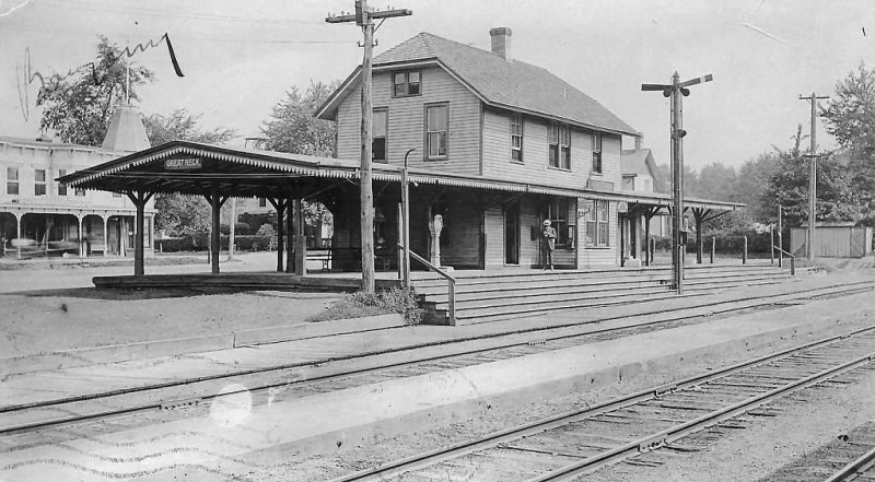 Great Neck Station c.1905 Archive: Dave Morrison
|
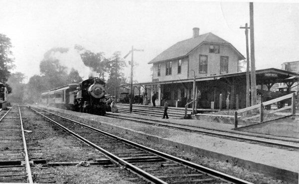 Great Neck Station Camelback #2 view W c.1912 Archive: Dave Keller
|
|
||||||||||||||||||||
| The camelback locomotive and
trains are eastbound on the westbound track. The depot (as with the
present-day depot) was on the N side of the tracks. In the middle of
the eastbound and westbound tracks is a center island platform. The
third track, the one in the foreground, is a passing siding. Double track was in place to Great Neck in 1912-13 and just beyond the station the double track became single track and extended as such to Port Wash. Electrification was in effect as of 10/25/1913. As there is no third rail (1913) evident in theses images, but double track is (1912-1913), the images would have to have been photographed in 1912. Dave Keller |
|||||||||||||||||||||||
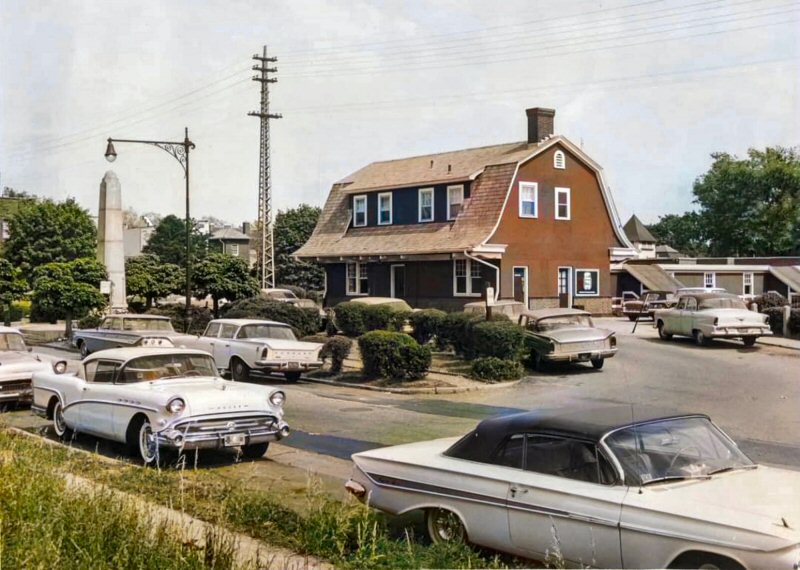
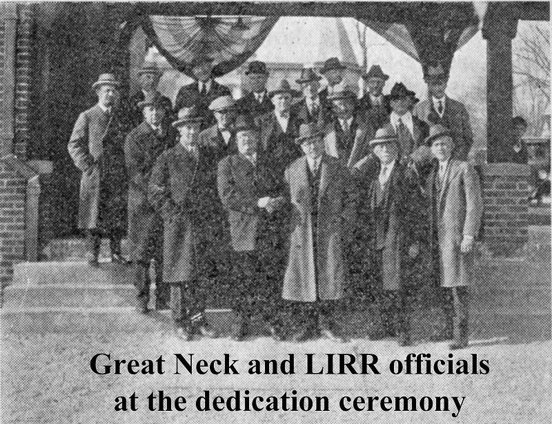
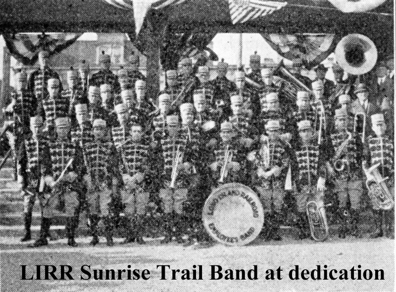
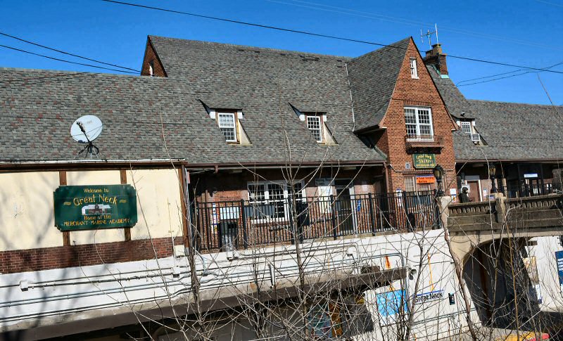
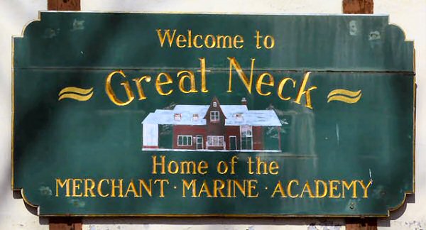
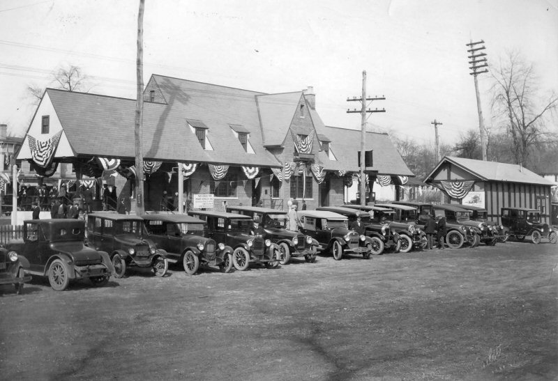 Celebrating the opening of the new station on March 7, 1925, built by Ernest L. Smith "in the English style" at a cost of $50,000. Photo: Alexander Culet Archive: Great Neck Library |
 |
 |
 |
||||||||||||||||||||
| Long Island Railroad Information Bulletin - June 3, 1925 Archive: Dave Morrison | |||||||||||||||||||||||
.jpg) MU Train Eastbound - Colonial Rd Iron Bridge east of Great Neck View W c.1940 Archive: Dave Keller |
.jpg) Ping Pong Loco Train B Grace Ave Iron Bridge E. of Great Neck View E c.1905 Archive: Dave Keller |
.jpg) Colonial Rd. Iron Bridge E of Great Neck View W Google Maps 2015 |
|||||||||||||||||||||
|
Two more, kind of "before and after" shots only from opposite directions: 1.
Ping-Pong locomotive pulling train westbound under the Grace Ave. iron
bridge E. of Great Neck - c. 1905 (View East: Third rail not yet
installed) |
|||||||||||||||||||||||
 Great Neck freight station and "G" interlocking tower and semaphore block signal - looking west at - 10/28/1931. All sidings, including the team track with box car at far left are electrified. Archive: Dave Keller |
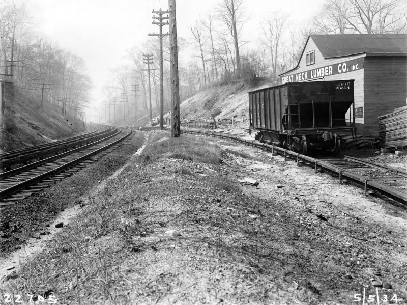
 North Shore Mason LIRR valuation photo View E 5/05/34 Note: Great Neck Lumber then Gregory Coal in background. |
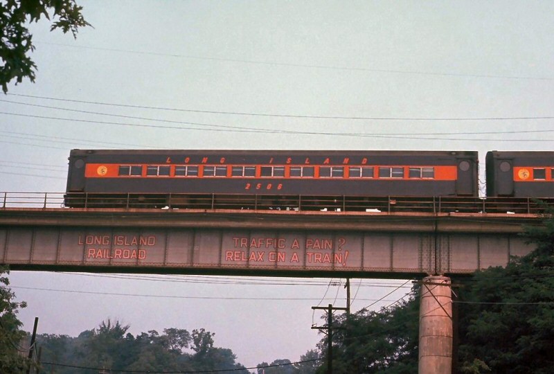 MU #2506 East Shore Rd., Great Neck view N 9-/01/1969 "Traffic a Pain? Relax on a Train!" bridge slogan |
|||||||||||||||||||||
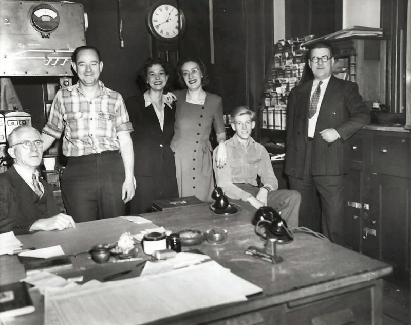 Great Neck station and "G" block office employees - Agent J. Ellenberger is at the left, seated at the desk, an unidentified block operator is standing in front of the model board, with the office ticket clerks to the right. The ticket clerk with the eyeglasses is Tina Wieckhorst (Dave Morrison archive) Note the
timetable rack in the background, as well as the counter at the
right upon which the man is leaning his arm. Also
note the dater die (white top) and the bars of the ticket window at
the far right. "G"
tower was taken out of service on June 8, 1934, due to the pending
grade elimination and the block office relocated inside the Great Neck
ticket office effective January 19, 1935 with a table machine (seen
behind the agent's head) to operate the block signals. Between the
OOS date of 6/8/34 and the IS date of 1/19/35, "G" cabin
temporary block office was in operation. Research: Dave Keller |
 G Tower Great Neck View E c.1931 Archive: Dave Morrison
|
 Great Neck Lumber LIRR valuation photo View W 5/05/1934
|
 Great Neck Section House 1934 view E Archive: Dave Morrison 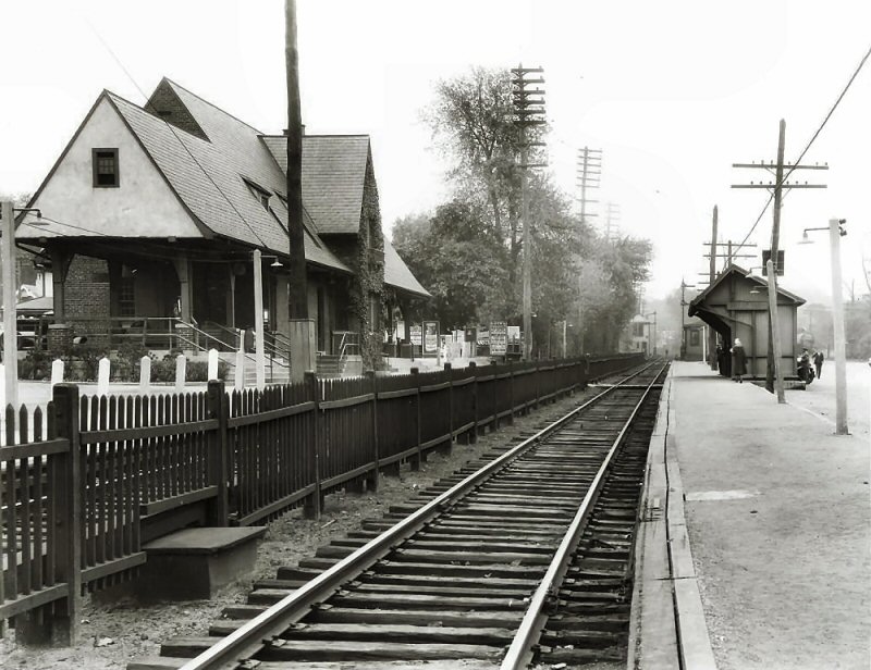 Great Neck Station 1933 Archive: Dave Morrison  Great Neck Express House - REA truck View E c.1935 Archive: Dave Morrison |
||||||||||||||||||||
| In 1933 the Long Island Rail Road (LIRR) was planning to eliminate the congested, some would say dangerous ground level crossing on Middle Neck Road by constructing an overpass. The LIRR insisted that lowering, or "depressing" the tracks, which Great Neck residents wanted, was too expensive. A solution was only arrived at when William and Florence Barstow donated $32,000 to cover the additional cost of lowering the tracks. Seventh Avenue, which joined North and South Station Plaza was renamed in their honor - Barstow Road. Lowering the LIRR tracks through Great Neck was quite a large and complicated job for a small town, involving much planning, surveying, earth moving and old fashioned manpower. Many would argue that track depression is the way most other Long Island communities should have gone, considering the number of ground level crossing accidents and fatalities they've had, and how few incidents Great Neck has had. Still, by 1935, residents had another concern: a sizable fare increase. The cost of the 60-trip ticket rose from $9.46 to $11.40. Info: Great Neck Library | |||||||||||||||||||||||
 Emery map Great Neck MP13-MP14 8/31/1958 Archive: Dave Keller |
.jpg) M1 Train #459 Great Neck Interlocking 1/19/1972 Photo: Richard Makse Archive: Dave Keller |
||||||||||||||||||||||
 Great Neck Station c.1940 Archive: Great Neck Library Postcards Collection
|
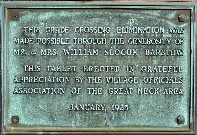 Great Neck Station plaque - Grade Crossing Elimination 1935 2/19/2020 Photo/Archive: Dave Morrison
|
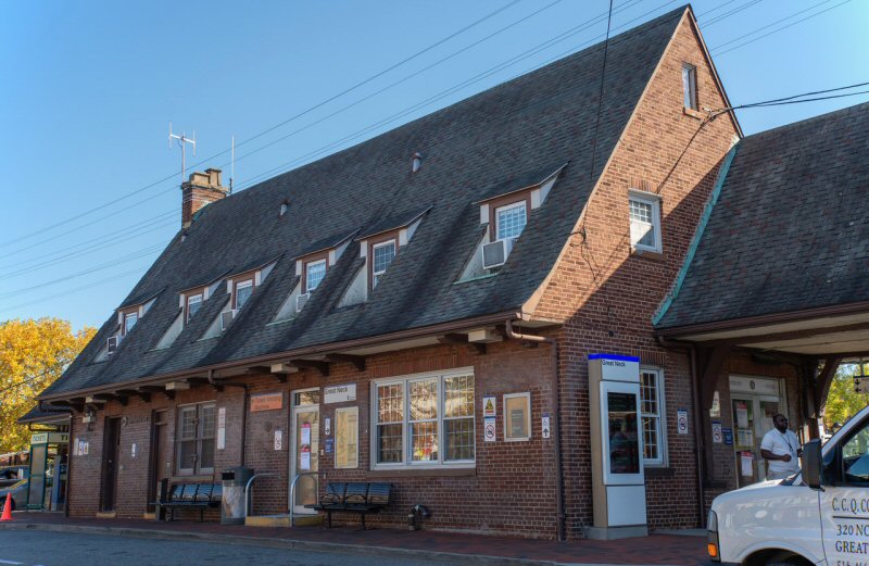 Great Neck Station 11/02/2022 Photo/Archive: Jeff Erlitz
|
 Great Neck Station - Waiting room plaque 2/19/2020 Photo/Archive: Dave Morrison |
||||||||||||||||||||
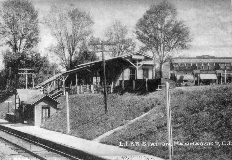
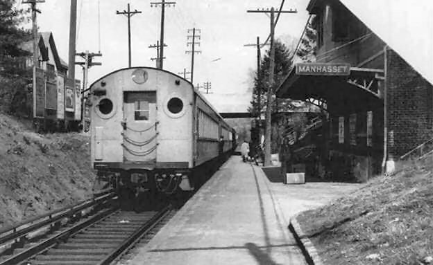
| MANHASSET | |||||||||||||||||||||||
|
BUILT: 1899. PARTIALLY RAZED:
LATE 1924. MAIN DEPOT PORTION MOVED ADJACENT TO TOWN HALL FOR USE AS BICYCLE
SHOP. |
|||||||||||||||||||||||
|
|
 Manhasset Trestle Construction
|
Photos Archive: Probably 1897,
as the railroad opened at Port Washington in June 1898. |
|
||||||||||||||||||||
 Manhasset Trestle colorized photo c.1905 Archive: Dave Morrison |
 Manhasset Trestle LIRR #261 1/02/1978 Photo/Archive: Paul De Luca |
 Manhasset Trestle over Cow Bay c.1907 |
|||||||||||||||||||||
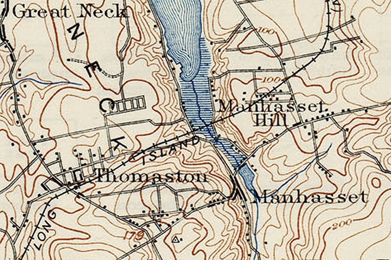
|
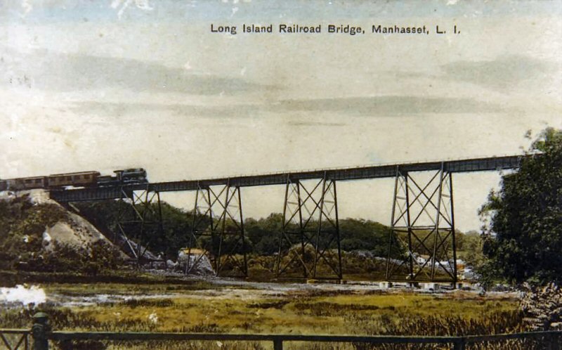
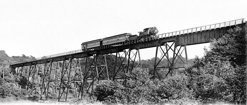
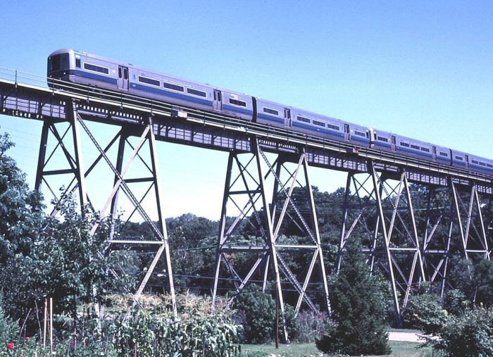
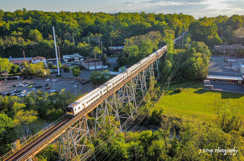
Soon after the end of the Civil War and the assassination of President Lincoln, the LIRR reached Great Neck, on the North Shore of Long Island. It would be more than 30 years before the Long Island Railroad could secure the political will and economic backing to extend the line further to its logical terminus, in scenic Port Washington. One million, one hundred and eighty five thousand dollars had been expended to purchase the right of way from local landowners between Great Neck and Port Washington. A bridge over the Manhasset Valley was constructed at an additional cost of $60,000, built by Kings Bridge Iron Company, a subsidiary of Carnegie Steel. At 678 feet long and 81 feet high, the bridge was to remain the highest bridge that the Long Island Railroad would ever construct. The line was fully electrified by October 21st, 1913. Research: the Cow Neck Peninsula Historical Society |
|||||||||||||||||||||||
.jpg) Manhasset Viaduct at track level c. 6/1934+ Archive: Dave Keller |

|
Cow Bay was the former name of Manhasset Bay, which is the body of water seen in the map. Due to the presence of cattle raising, it came to be called Cow Bay, and the local neck, to the northeast, "Cow Neck". It finally became Manhasset Bay in 1907. Source: Wikipedia P.F. Collier & Son - Map of New York City in The New Encyclopedic Atlas and Gazetteer of the World. New York: P.F. Collier & Son, 1917 |
|||||||||||||||||||||
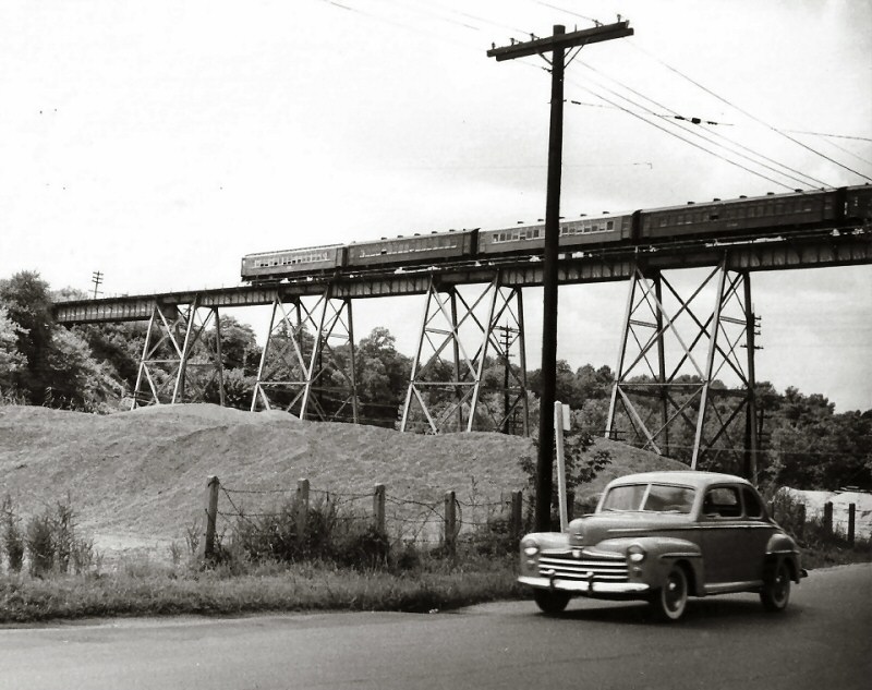 Manhasset trestle 6/01/950 Photo: Bill Slade Archive: Art Huneke
|
 Manhasset Station view E c.1900 Archive: Dave Morrison
|
 Manhasset Station c.1900 Archive: Dave Morrison
|
|||||||||||||||||||||
 Manhasset Station view E 1931 Archive: Dave Morrison Note: Warning telltale for Plandome Rd. |
 Manhasset Station view W 1931 Archive: Dave Morrison Note: Warning telltale for Manhasset Ave. |
 Manhasset Station view W 1946 Archive: Dave Morrison |
|||||||||||||||||||||
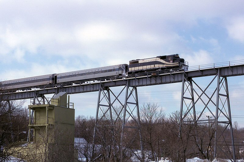
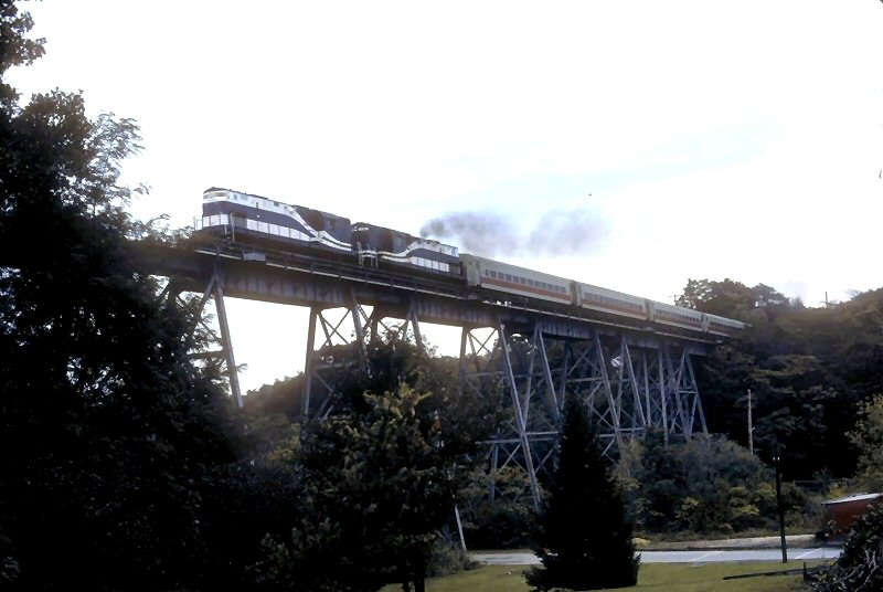 C420s #222, #226 Passenger Extra westbound Manhasset Viaduct 10/1987 Photo: Art Huneke
|
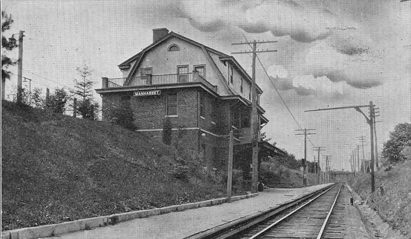
.jpg) Manhasset Station view SW 1967 Photo/Archive: Dave Keller |
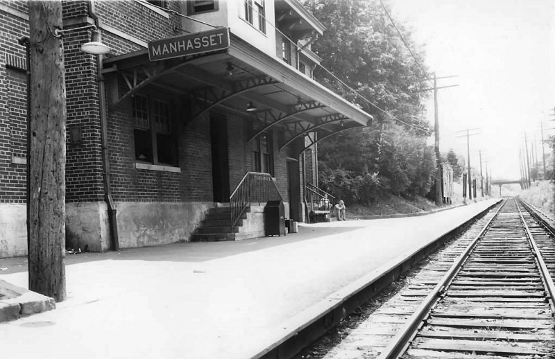
.jpg) Manhasset Station view NW 12/11/1976 (Madden-Keller) |
|||||||||||||||||||||
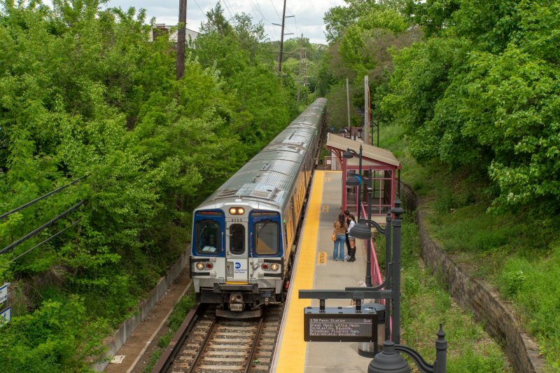 Manhasset Station - M9 #9069 Train #449 Port Washington to Penn Station 5/17/2022 Photo/Archive: Jeff Erlitz |
 Manhasset Station - M7 #7628 Train #432 Penn Station to Port Washington 5/17/2022 Photo/Archive: Jeff Erlitz |
 Manhasset Station view NW 8/29/2024 Photo/Archive: Kevin Wong |
 Manhasset Station Waiting Room - Ticket Office 8/29/2004 - Photo/Archive: Kevin Wong  |
||||||||||||||||||||
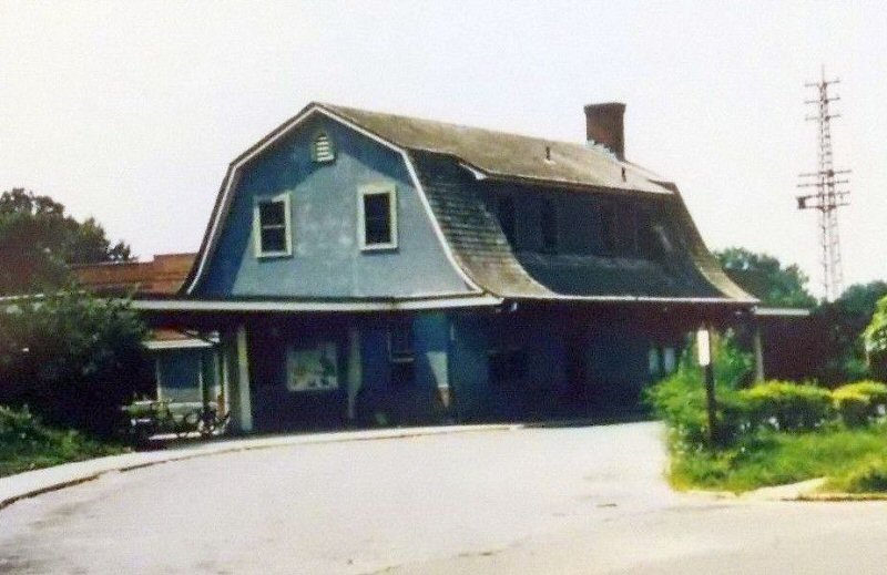
| PLANDOME | |||||||||||||||||||||||
|
BUILT: 1909, BURNED: 1987 2ND
DEPOT BUILT: 1987. AGENCY
CLOSED: ?
|
.jpg) Plandome Station newly opened 6/30/1909 View E Photo: William Rugen Archive: Dave Keller |
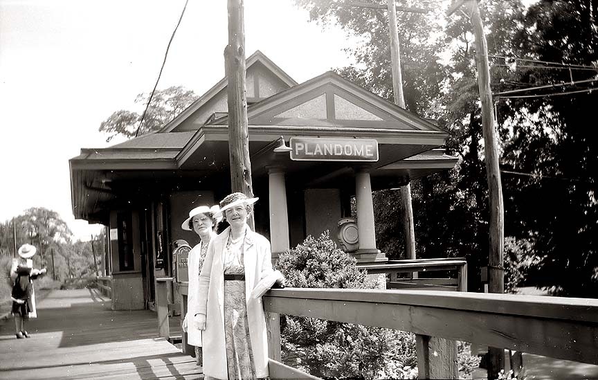 Plandome Station - Ladies waiting for the train c.1930 - Archive: Dave Keller |
 Plandome Station view W 1939 Archive: Dave Morrison |
||||||||||||||||||||
|
Plandome was elevated from the get-go and a bridge over the main road thru there on the west side of the station parking lot has been in place since 1898 when the tracks were extended to Port Washington. Plandome station itself was opened in 1909 at the elevated tracks which were laid atop a dirt embankment. You can see the tracks descending from the embankment as it curves to head towards Port Washington. Also visible is the station in an elevated position with the parking area at ground level to the right of the depot building. The 1909 Plandome depot was burned by vandals and replaced by a station that was very reminiscent of the original structure. What was sad was that the female station agent had antique LIRR memorabilia hanging on display in the ticket office to bring a little history into the venue. Info: Dave Keller |
|||||||||||||||||||||||
.jpg) Plandome Station MU Train 9/15/48 Archive: Dave Keller |
 Plandome Station MU Train 8/17/62 Archive: Dave Keller |
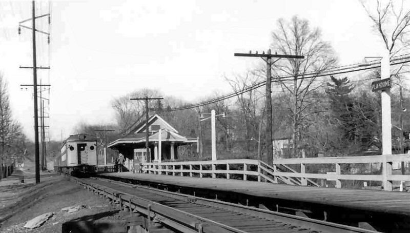
 Plandome Station 12/11/76 Archive: Dave Keller |
|||||||||||||||||||||
.jpg) Plandome Station view NE 12/11/76 (Madden-Keller) |
.jpg) Plandome Station close-up USPS sign 12/11/76 (Madden- Keller) |
 Plandome Station 12/13/2021 Photo/Archive: Joe Stroppel |
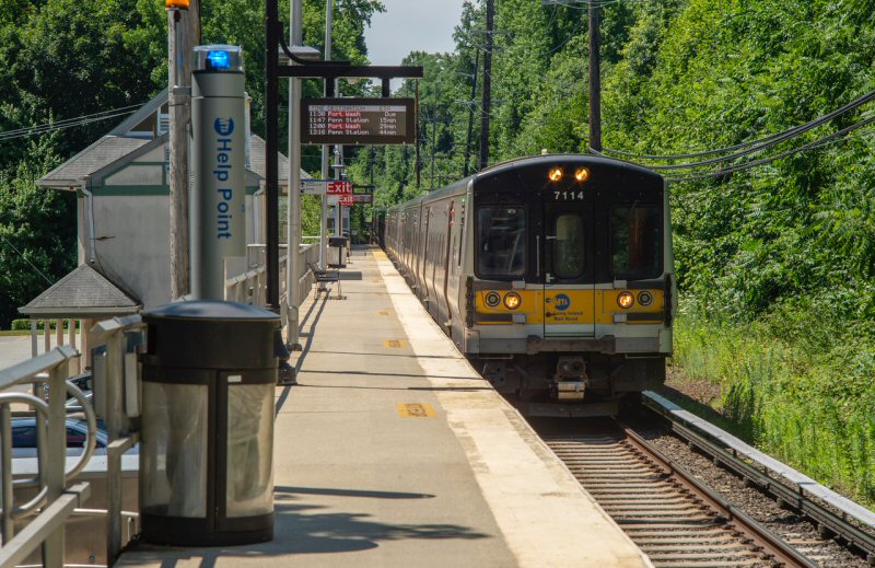 M7 #7114 Train #6424 (Penn-Port Washington) Plandome Station - View S 7/10/2022 Photo/Archive: Jeff Erlitz |
||||||||||||||||||||
|
PORT
WASHINGTON |
|||||||||||||||||||||||
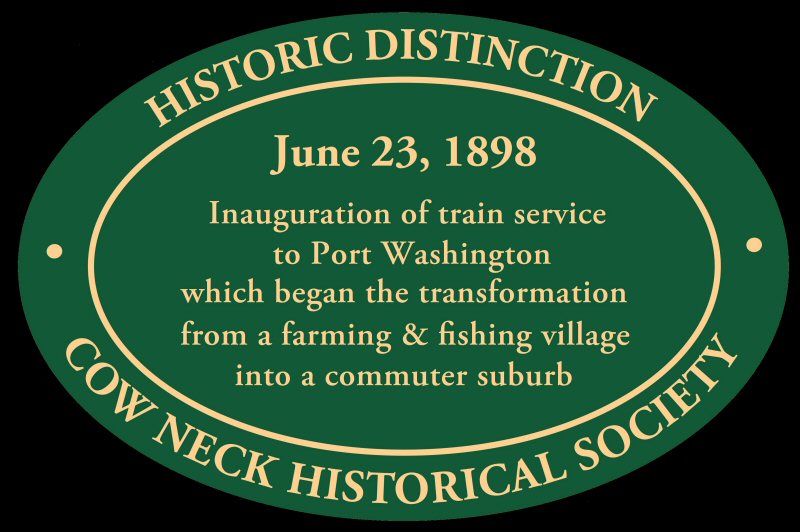 Inauguration of June 23, 1898 Port Washington train service plaque. 6/2/2021 by Cow Neck Historical Society Pres. Chris Bain
|
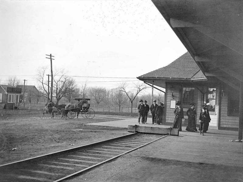
Port Washington Station – opening day – June 23, 1898 with Superintendent W. S. Potter’s business car #200. Check out the wooden building and wooden low-level platform around the depot. This is the SAME depot there today. Over the years they bricked the structure and added covered platforms and then covered hi-level platforms. Info: Dave Keller
|
 View NE of westbound track c.1900 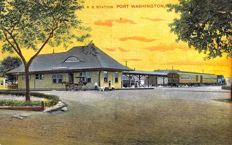 View SE colorized photo c.1905  First train on Port Washington Branch 6/23/1898  Port Washington Station Opening Day Parade 6/23/1898 Archive: Queens Public Library |
|||||||||||||||||||||
 View W colorized photo c.1905 Archive: Dave Morrison |
 Port Washington Station platform, view NE, with track bumper and canopy 3/1903. Photo: John Witmer Archive: Port Washington News |
 Port Washington Station platform, view W, with the canopy added 3/1903. The water tank on the far right is approximately where the footbridge crosses over to Haven Avenue. Photo: John Witmer Archive: Cow Neck Peninsula Historical Society |
|||||||||||||||||||||
|
|
 Morning Express D53a Camelback -Port Washington c.1905 Cow Neck Peninsula Historical Society |
||||||||||||||||||||||
 Port Washington Station tracks view W c.1940's Archive: Dave Morrison |
 MUs at Port Washington 1944 Freight/express house at right. Photo: W. J. Edwards Archive: Dave Keller |
.jpg) REA #1211 at Port Washington View W 08/31/56 (Faxon-Keller) |
|||||||||||||||||||||
 Port Washington Substation LIRR valuation 10/25/1918 Archive: Dave Morrison |
.jpg) Port Washington Station passenger yard View N 8/1962 Archive: Dave Keller |
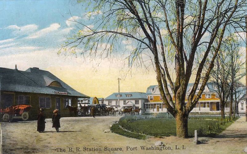
 Port Washington Station 8/30/1908 view S Main Street Photo: Kevin Wong |
|||||||||||||||||||||
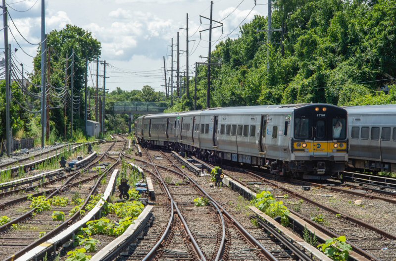 M7 #7750 Train #6426 (Penn-Port Washington) west of Port Washington - View S 7/10/2022 Photo/Archive: Jeff Erlitz |
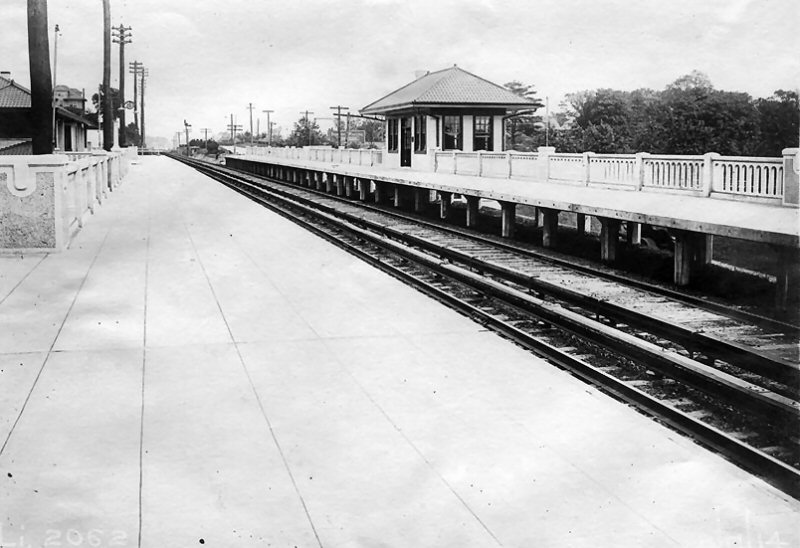
The yard switch indicators were installed maybe 20 years ago. This yard has US&S/Ansaldo/Hitachi YM-2000 switch machines, but they are not the trailable type. The Section A dispatcher in Jamaica controls these yard switches, as well as the rest of the branch. Jeff Erlitz |
||||||||||||||||||||||
| PORT WASHINGTON BRANCH - FREIGHT LOCATIONS | |||||||||||||||||||||||
|
LIRR 1919 CR4: |
1958 Emery maps: Research: Dave Keller |
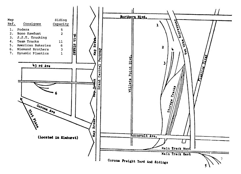
LIRR Maps -1966: Corona: Bayside: Great Neck: North Shore Mason Supply Port Washington: Donald D. Wyeing Inc. (Bldg Materials) Port Washington Lumber Co. Research: Steven Lynch
|
LIRR Maps -1986: Corona: Great
Neck: Research: Steven Lynch |
||||||||||||||||||||


.jpg)
%20-%20View%20NW-c.%201930%20(Keller).jpg)
%20-%2009-30-35%20(Sperr-Keller).jpg)
%20-%2009-30-35%20(Sperr-Keller)%20(Zoom).jpg)

.jpg)
%20-Murray%20Hill%20-%20View%20E%20-%2012-29-11%20(LIRR%20Val-Keller).jpg)
.jpg)
.jpg)
%20(Zoom).jpg)


.jpg)

.jpg)

.jpg)
.JPG)