|
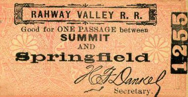
Rahway Valley Railroad
- Springfield, NJ
|

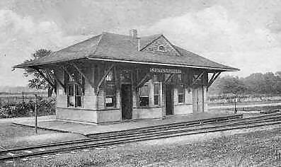
RVRR Springfield, NJ Station c.1906 |
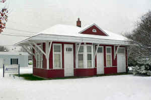
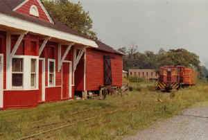
Springfield Station 12/04/2005
Archive: Jason Clifford |
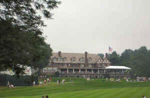
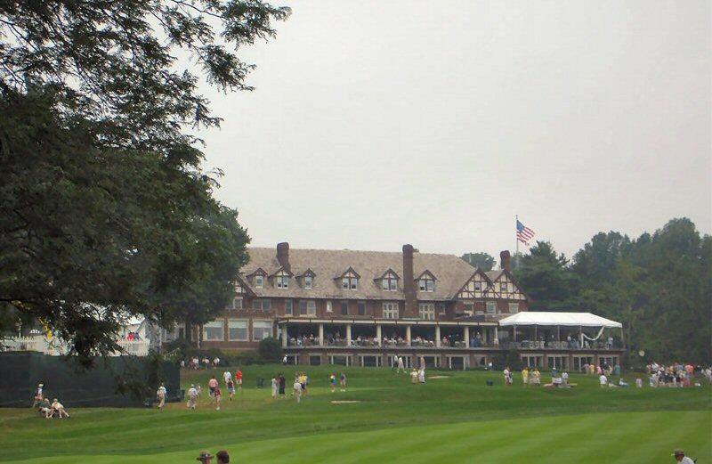
Baltusrol Golf Club site of PGA US Open Golf
June 12-15, 1980 Championship |
Otsego Lake Observation special car move of United County Trust
Co. (UCTC) for US Open Golf June 12-15, 1980 at Baltusrol, NJ (Jack
Nicholas -8 winner) 6/12/2015 View SW at Mountain Ave. |
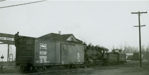
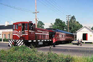
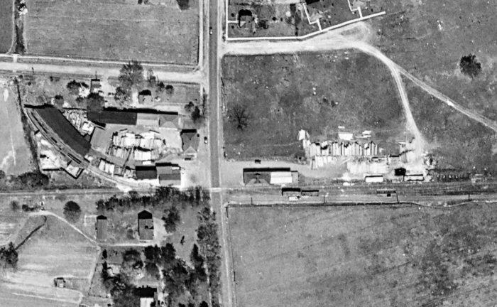
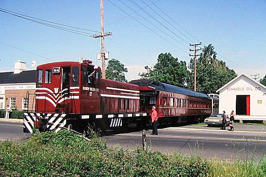
RVRR #15, Caboose #102, SLSF boxcar with brakeman on the runaround track
as the switch stand is off to the left.
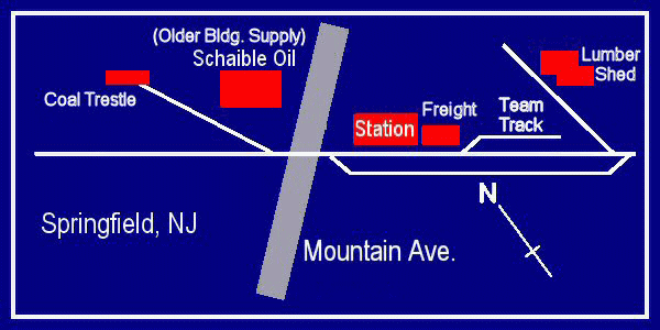
(See article/map below.) Builders Supplies located behind the
station at far left. At far right, cars spotted in
background on team track with lumber shed beyond. Springfield
station view NE 1/06/1951 |
|
Springfield, NJ Maps |
|
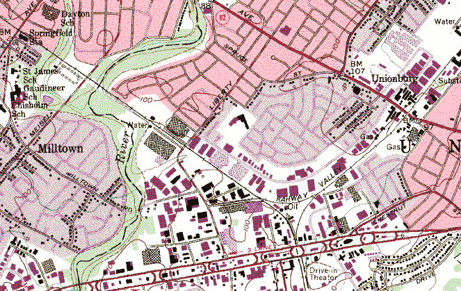
USGS topographic map - Roselle, NJ 24K Quad cropped.
1955 and photo revised in 1981
|
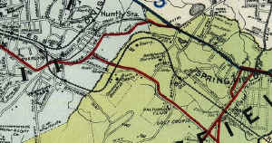
Summit to Springfield 1923
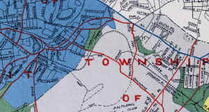
Summit to Springfield 1951 |
|
RVRR - Springfield, NJ
|
Springfield Passenger/Freight Stations on the right (east) of Mountain
Ave, Builder's Supply shed and coal trestle on the west side. 1921 Archive:
Rich Palmatier |
| RVRR
RUNAWAYS |
|
There were a few runaways on the RVRR. One occurred in the passenger days
that came down the grade from Summit and collided into a train sitting in Springfield (probably
in the station). A good friend of mine, who grew up in Union in the 60s-70s-80s and hung around the RVRR trestle remembers a runaway boxcar rolling down from Springfield,
 across Van Winkle Bridge, across Meisel Ave., across the Rahway River trestle and they finally got it to a halt before Liberty Ave. He remembers the
brakeman - flagman yelling for traffic to stop on Meisel Ave. Luckily there was no incidents.
Research: Richard King across Van Winkle Bridge, across Meisel Ave., across the Rahway River trestle and they finally got it to a halt before Liberty Ave. He remembers the
brakeman - flagman yelling for traffic to stop on Meisel Ave. Luckily there was no incidents.
Research: Richard King
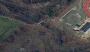
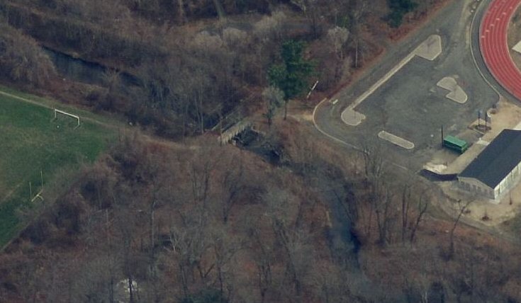
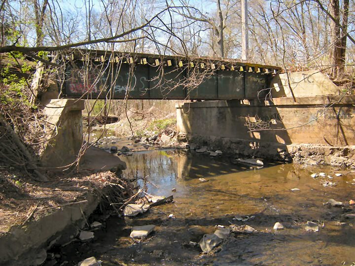
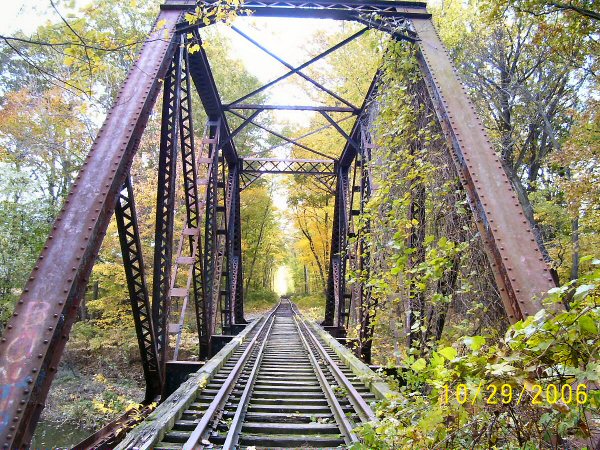
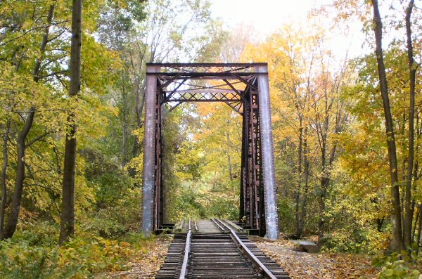
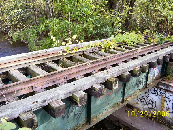
Van Winkle Creek view SW
|
|
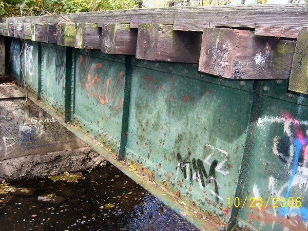
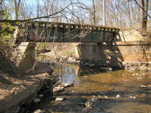 Van Winkle Creek
Bridge view S Photo: Craig Kasmin Van Winkle Creek
Bridge view S Photo: Craig Kasmin
|
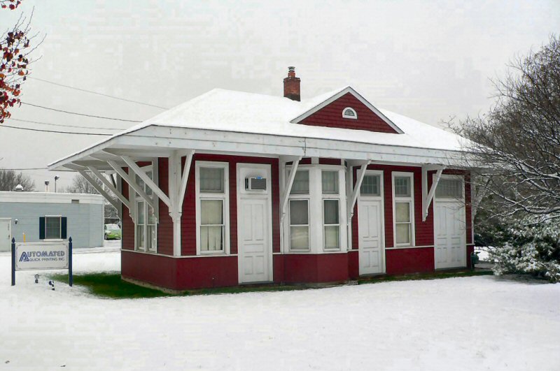
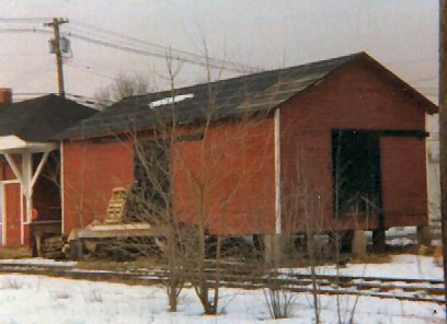
Springfield Station/Freight Station - View E 1972 |

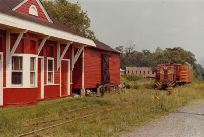
Springfield Freight Station 1978 -
Photo: Steven Lynch |

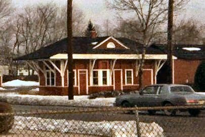
Springfield Station, Mountain Ave, view N 1978
Photo: Steven Lynch |
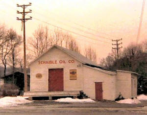
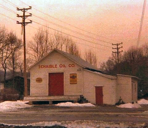
Schaible Oil Co. ex-Builders' Supplyview W 1978 -
Photo: Steven Lynch |
| Modeling
Springfield |
|
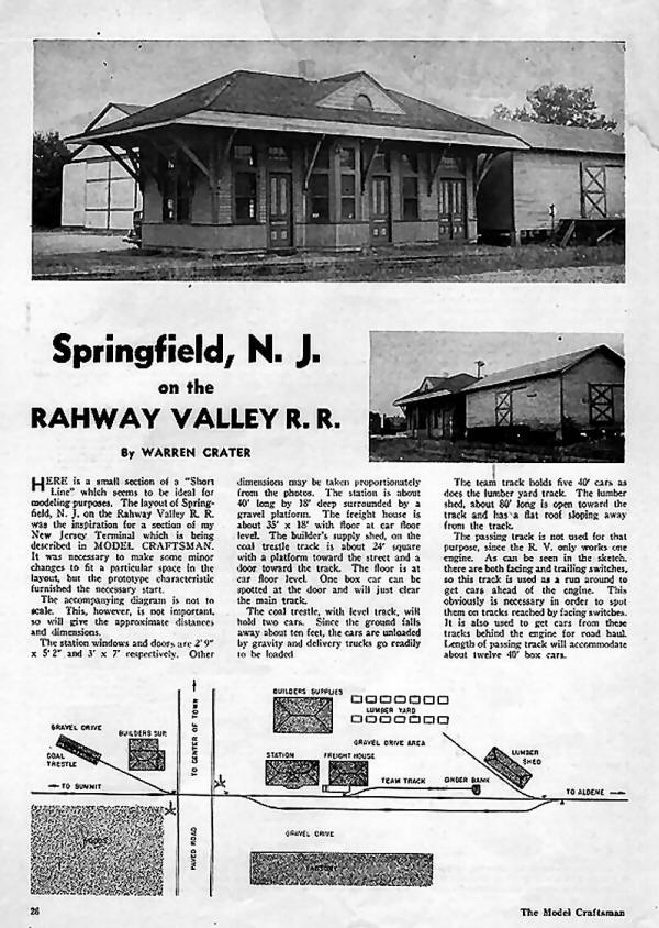
"The Model Craftsman" magazine December, 1947 Warren Carter
|
This is a
LDE
(Layout Design Element) for the Springfield Station area. It provides a basis to
model an area and incorporate the main features of interest. These can be
standalone or connected to other LDEs as space, time and cost dictate. Each shelf element would be approx. 30" deep by 96" in length.
Design: Steve Lynch - 2006 |
|
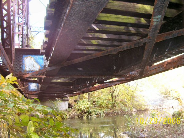
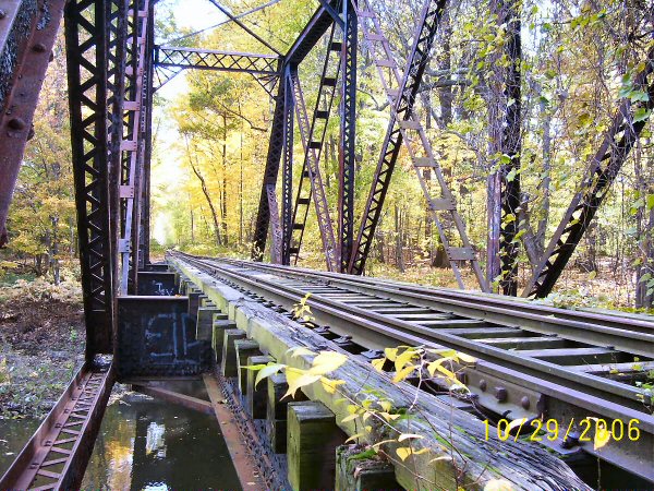
RVRR trestle bridge over the Rahway River
|
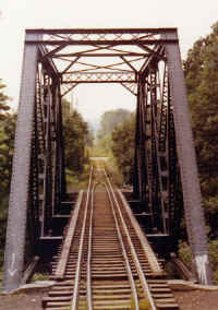
RVRR trestle bridge over the Rahway River east of
Springfield view from Cab 1972
|
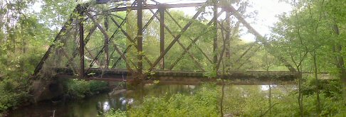
May 2010 cell phone "quick shot" photo: Rich Palmatier
|


