|
|||||
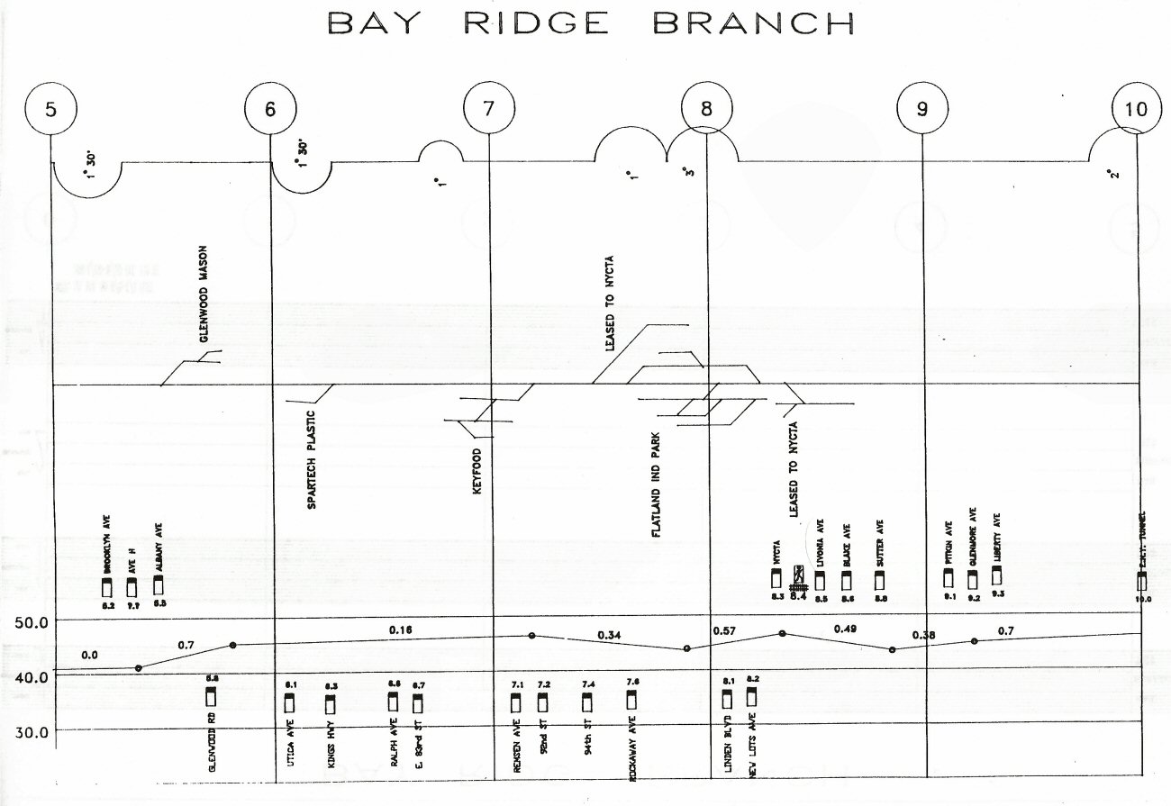
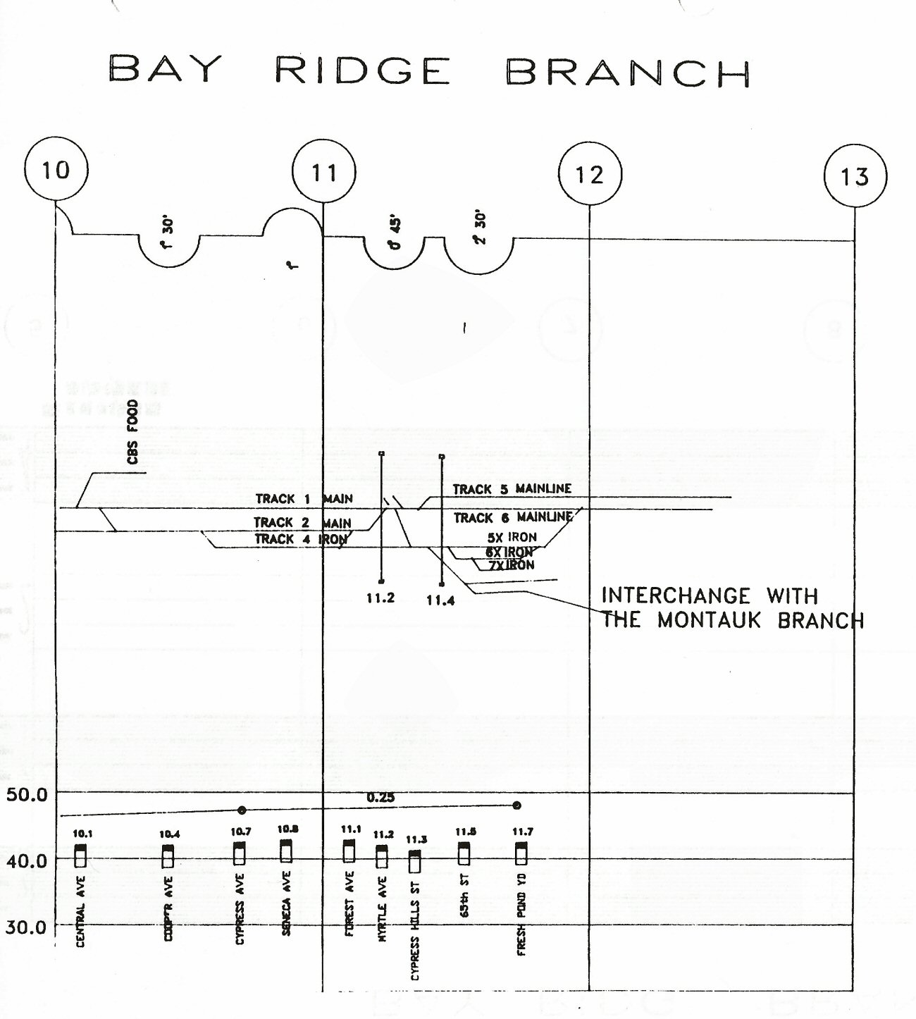
 Bay Ridge MP5-14 map dates from between 4/04/1966 and 4/15/1970
“BAY”
BLOCK STATION (R.C.) NEW UTRECHT AVE., BAY RIDGE, BKLYN.
(PREVIOUSLY “NU” BLOCK STATION. |
|||||
 Bay Ridge NYCTA Connection 1994 Track Profile Map |
 Bay Ridge Branch connection at Fresh Pond 1994 Track Profile Map |
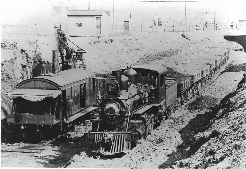 LIRR #117 3/20/1907 Bay Ridge Excavation (Ziel-Boland) “Bay Ridge
Improvement”: 1905-1918 |
|||
|
Bay Ridge Branch - Robert Emery Maps |
|||||
|
Mileage from 1913 ETT Manhattan Beach branch and a 1938 ETT Bay Ridge branch. Mileage is indicated from L. I. City on BOTH timetables:
Fresh
Pond Jct. ("POND" tower) 4.4
The
very few stations west of Manhattan Beach junction on the Bay Ridge branch
(i.e. Parkville, etc.) were gone between 1897 and 1904. Bay Ridge depot
was closed in 1904 with the end of passenger service to that terminal. By
the ETT of 1938, the Bay Ridge branch only indicated POND, FREMONT,
BEDFORD and NU towers with an end-of-line mileage at Bay Ridge of 16.3
Research: Dave Keller |
|||||
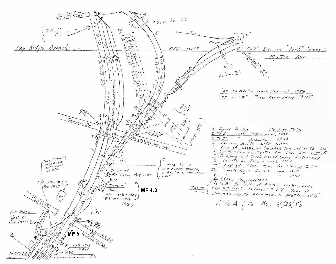 Montauk Branch east of POND Tower at MP4.4 to Myrtle Ave. MP5 NYCRR FREMONT Tower at MP4.8 Archive: Dave Keller
|
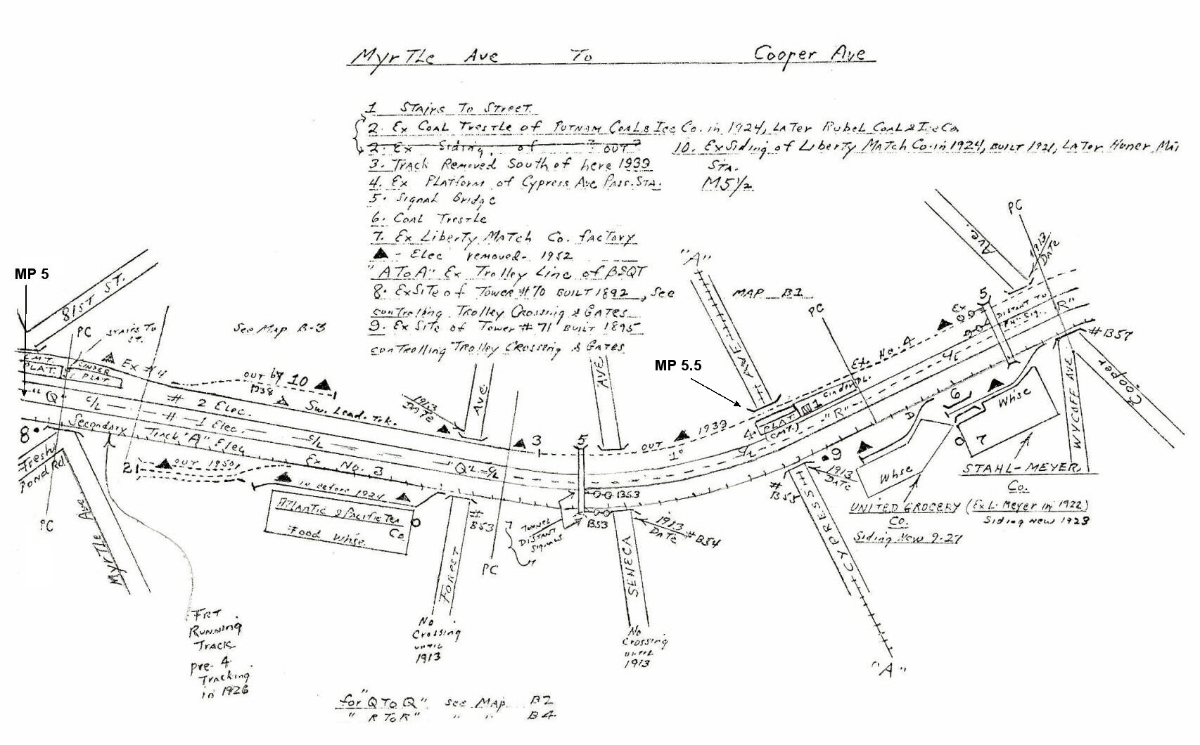 Myrtle Ave. MP5 to Cooper Ave. - Cypress Ave Station at MP5.5 Archive: Dave Keller |
 Cooper Ave. to East NY Tunnel portal Evergreen Branch connection at MP6 BMT Canarsie line running parallel Archive: Dave Keller |
|||
|
|
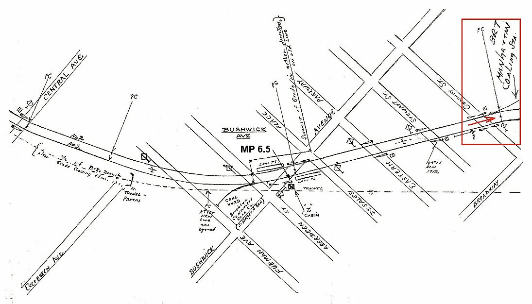 Central Ave to Conway St. - Bushwick Station at MP 6.5 1904 Archive: Dave Keller |
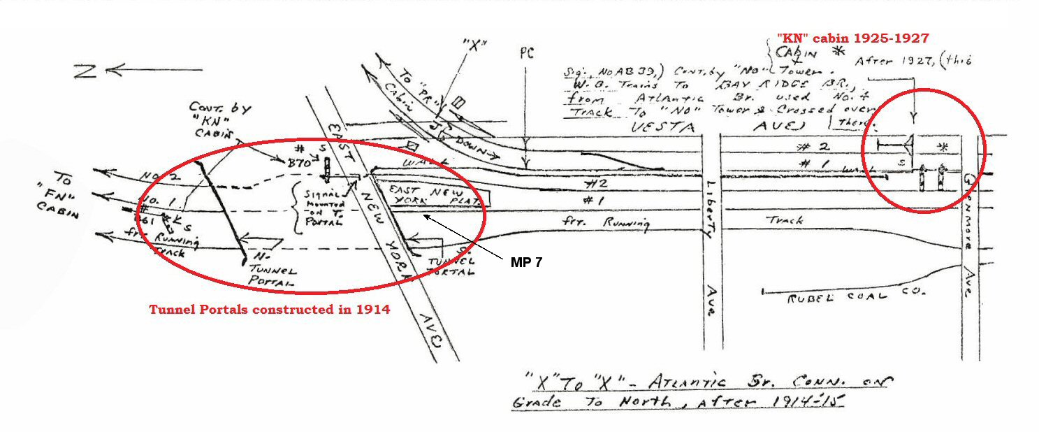 Original "KN" cabin location in service north of Glenmore Ave. from 1918-1925. East NY Station at MP 7
|
|||
|
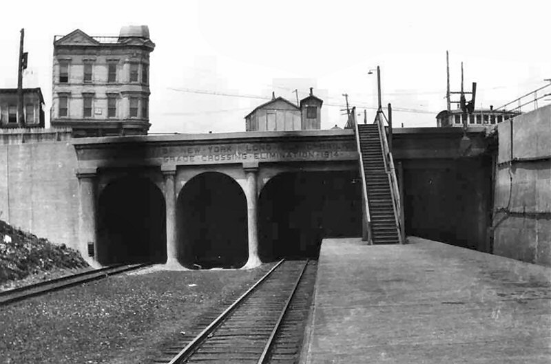
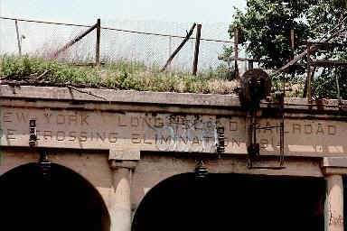
East New York tunnel portals on the Bay Ridge/Manhattan Beach branch were opened in 1914 with the Atlantic Ave Grade Crossing Elimination. |
|||||
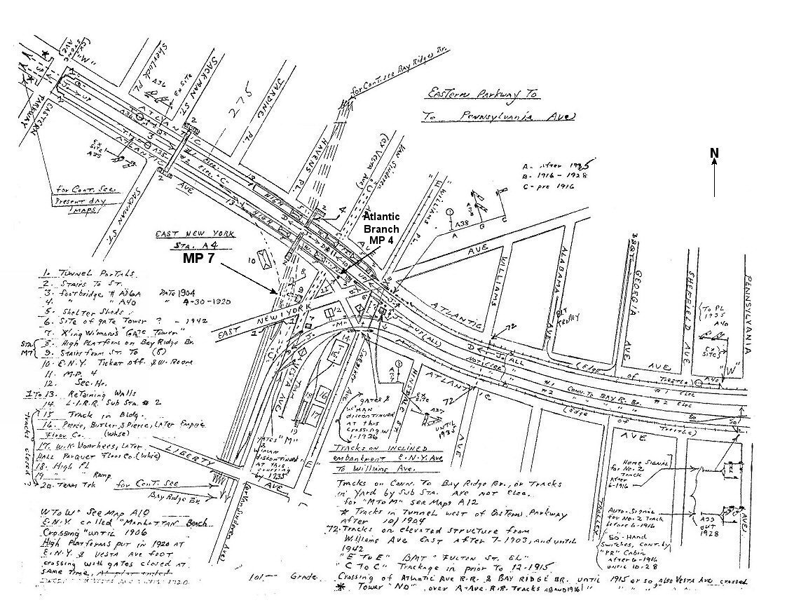
 East NY Tunnel portal to Liberty Ave. Abandoned East NY passenger station at MP 7. 3/10/1958 LIRR Atlantic Ave. line crossing. Info/Archive: Dave Keller Note: There is no fence at the top of the stairs to keep people from accessing the station platform (which went partway under the tunnel). Therefore, the photo is prior to the station closing (last passenger train from Bay Ridge to Manhattan Beach: 5/13/24). Info: Dave Keller |
Although, East NY Tunnel to Liberty Ave. Emery map is dated 3/10/1958, it shows the earlier configuration of tracks inside the tunnel. Info: Dave Keller Ex-Track No.4 removed and tunnel sealed 1939
(eastern tunnel portal, far right in photo above) Note 1: The stairs from the street to the high-level station platform were removed “c. 1924” according to the map. No “circa” about it . . . . they WERE removed in 1924 (see below). Therefore, the station was no longer in use as of that date. No pedestrian access to the platform meant station out of service. AND . . . when in use,
the station stop was called “ 1924 would be the proper
closure date, because passenger service was to Manhattan Beach only (not
Bay Ridge), utilizing what we know as the Bay Ridge branch to Manhattan
Beach Junction (joint branch at the time) and “MJ” tower then heading
south on its own trackage (Manhattan Beach branch ONLY) to Sheepshead Bay
and Manhattan Beach. Passenger service to Man. Bch. ended in 1924, although the tracks remained in for some years afterward for freight moves. Therefore, the high-level station at Fulton Street (ENY) would have been abandoned at that time. Notes/Research: Dave Keller
|
||||
|
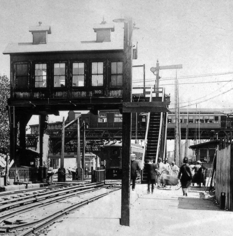
NO Tower: 1 East New York on the Atlantic Branch controlling the at-grade crossing of the LIRR by the NY & Manhattan Beach Railway. Tracks (later the LIRR's Manhattan Beach/Bay Ridge Branch). Built on a signal bridge on the west side of the crossing. Formerly Tower 63. Renamed in 1907 and out of service: 2/1916 with removal of the at-grade track crossing, and replaced by tunnels under the Atlantic Branch tracks. Research: Dave Keller |
|||||
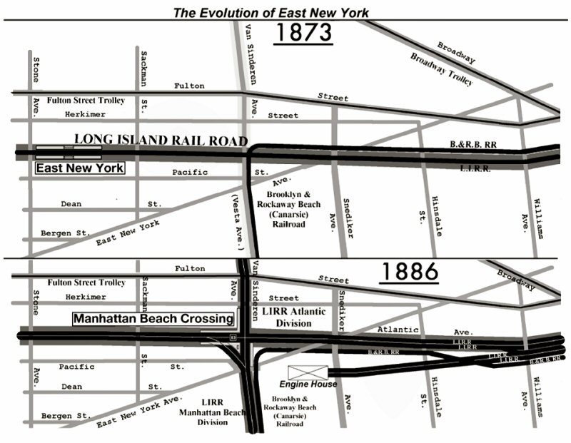 East New York 1873-1886 map |
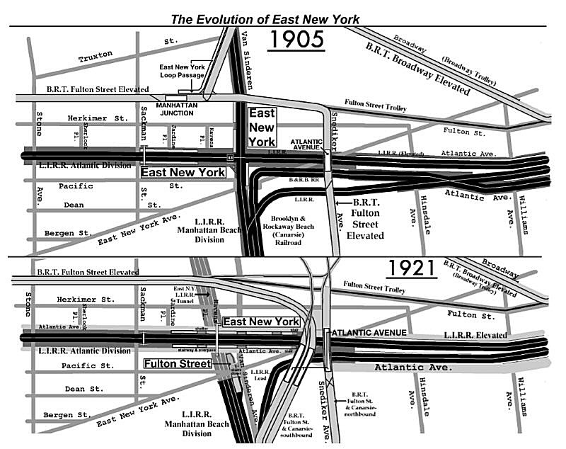 East New York 1905-1921 map |
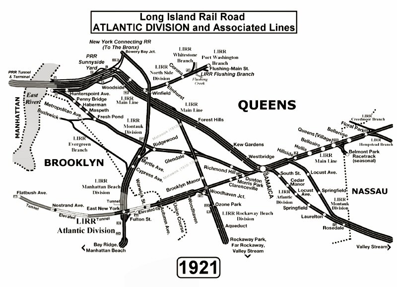 Brooklyn-Queens Atlantic Division map 1921 |
|||
| ERA "The Bulletin" Vol. 62 No. 12 12/ 2019 Author: George Chiasson | |||||
|
|
 East New York Tower #63 1903, later renamed "NO" Tower, in 1907. View west along Atlantic Branch. Cross tracks are: Bay Ridge/ Manhattan Beach branch Archive: Art Huneke Info: Dave Keller |
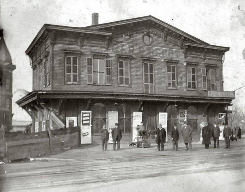
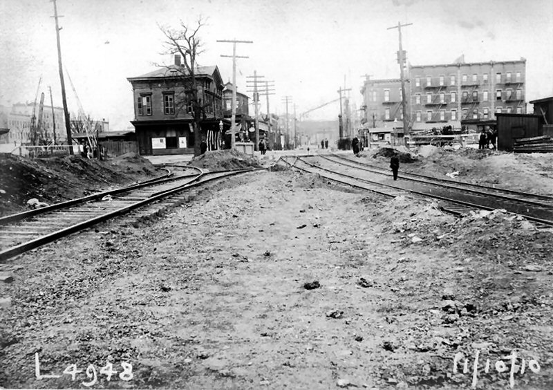 East New York NY&MB depot valuation photo view N 11/10/1910 at Atlantic Ave/Van Sinderen Ave |
|||
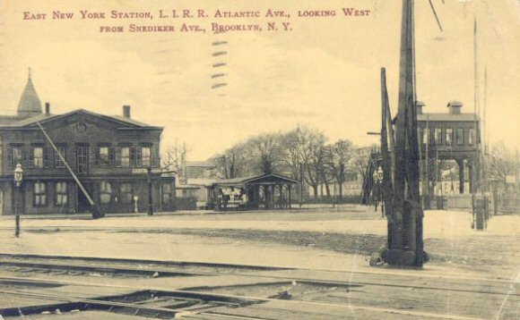
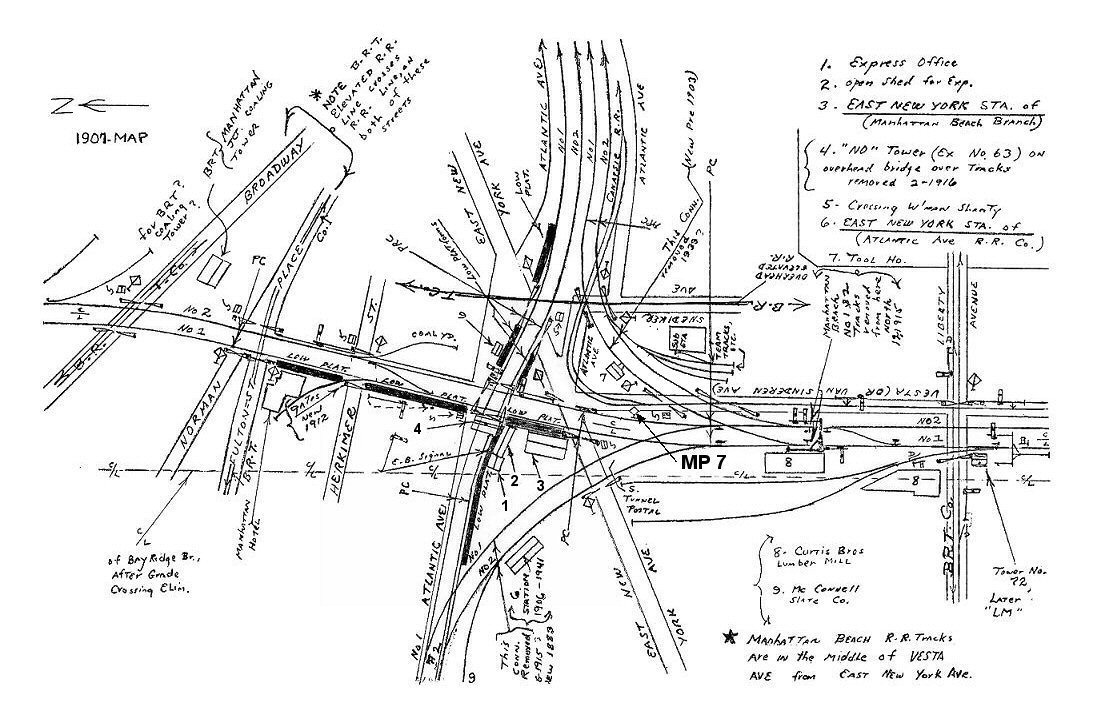 East New York Station 1907 Archive: Dave Keller The old NY&MB station photo above was at location #3 on the Emery map above. The station was actually on the Manhattan Beach branch. Atlantic branch trains initially stopped at Howard House for the East New York stop. When the LIRR acquired the NY&MB, the stop at Howard House was no longer made. The old 2-story wooden framed depot/hotel was used as the East New York station stop for both branches until the grade elimination, placing the Manhattan Beach/Bay Ridge Branch in tunnels below grade at East New York.
|
|
Although no longer used by the LIRR and demolished in November, 1915 due to the Bay Ridge grade elimination project, a small replacement depot/ticket office was constructed in 1906 alongside the Atlantic branch tracks and set back to clear the curved access tracks and later the eastbound segment of Atlantic Avenue (see photo below). Some years later, the depot had an addition making it a much longer structure.
|
|||
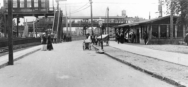
 Atlantic Ave Grade Crossing Elimination c.1915 Archive: Bob Diamond Atlantic Ave Project and in the last days of new construction. Photo sometime between 1914, when the portals were poured and the lettering "engraved" and 4/21/1916 when Urquhart took his photo for the BRT's insurance department of the newly-installed EL structure The platform has not yet been extended beyond the portals and access stairs not yet installed. The tracks ramping up and curving to the right connected the Manhattan Beach/Bay Ridge branch with the Atlantic branch on the east side of the station. NO Tower in place, center rear, but was gone by 4/21/1916. Research: Dave Keller
|
.jpg) Express House - East New York view SW from Fulton EL 4/21/1916 (Urquhart-Keller) "NO" tower being placed out of service in February, 1916 per East New York 1907 Emery's map note (above left). An official BRT photo shot of the BRT's newly-erected EL structure by their insurance photographer Urquhart showing the tower gone in an April 21, 1916. "NO Tower's purpose was to control the NY&MB tracks (and later LIRR Manhattan Beach branch tracks) crossing the LIRR's Atlantic branch tracks when at grade. Once in the tunnels, the tower no longer had any purpose and was removed. This is the first EL structure at the left, hence an official BRT photo. The later, 2nd EL structure was constructed between this structure and the Express House. Research: Dave Keller
|
|
|||
|
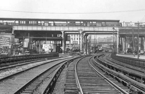
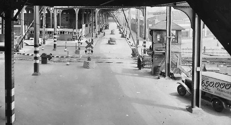
The Atlantic Ave. grade elimination project began on November 1, 1939, with the closing, per General Order, of all the LIRR's rapid transit stations along the Atlantic branch. Closing of stations and demolition probably began in November, 1939. As additional demolition, temporary tracking and actual construction of the project ran between 1940-41. All the arched steel framing is in place over the tracks to support Atlantic Avenue and East New York Avenue is being graded/trenched with concrete side walls constructed to cross under the LIRR tracks. Research: Dave Keller |
|||||
 East New York aerial 1924
|
The map shows the LIRR tracks at the station and across East New York Ave. as being at grade. Also, the old station platforms are indicated as well as the old ticket office (#10) and the pedestrian crossover (#2, #3). Atlantic Avenue is split on the north and south side of the tracks. This arrangement all changed with the 1939 grade crossing elimination project. After 1939, Atlantic Ave. ran ATOP the tracks and station. The station was built partly below grade under the superstructure carrying Atlantic Avenue.
|
 East New York Station c.1938 view SW Archive: Dave Keller
|
|||
|
 East New York Station - View E from just east of Sackman St. 1941 Archive: Riccardo Gomes |
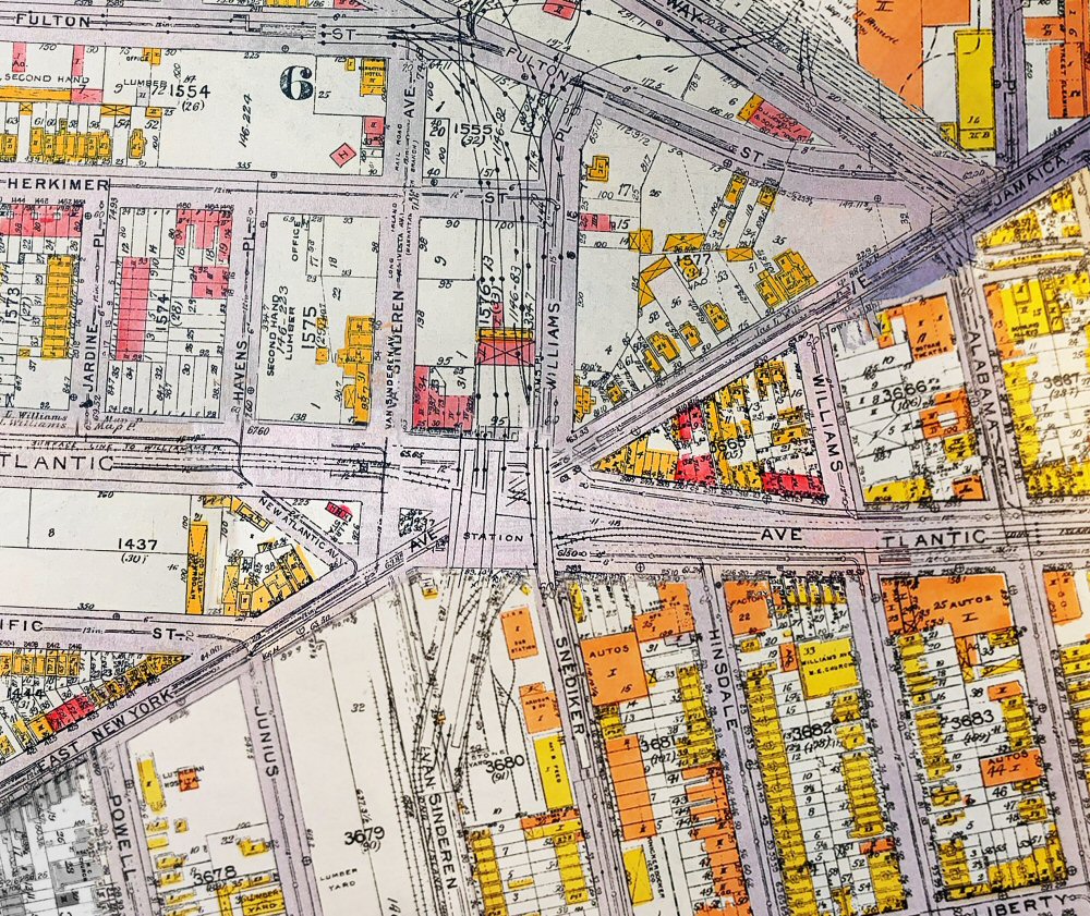
 East New York - Snediker Ave-Williams Place East New York Ave. crossing Fulton-Canarsie ELs - View NE c.1938 (Dave Keller archive)
|
 East New York 1941
|
|||
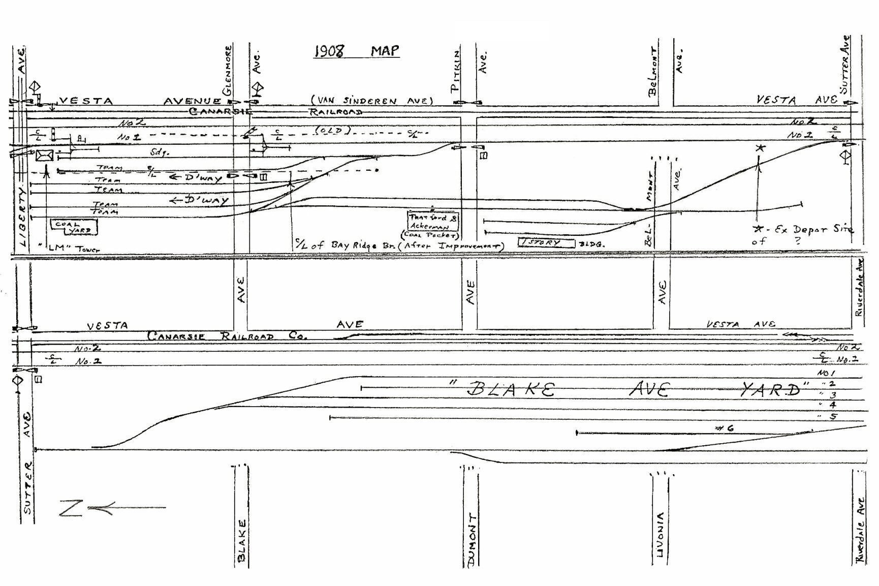 Liberty Ave. to Riverdale Ave. 5/1908 Archive: Dave Keller |
|
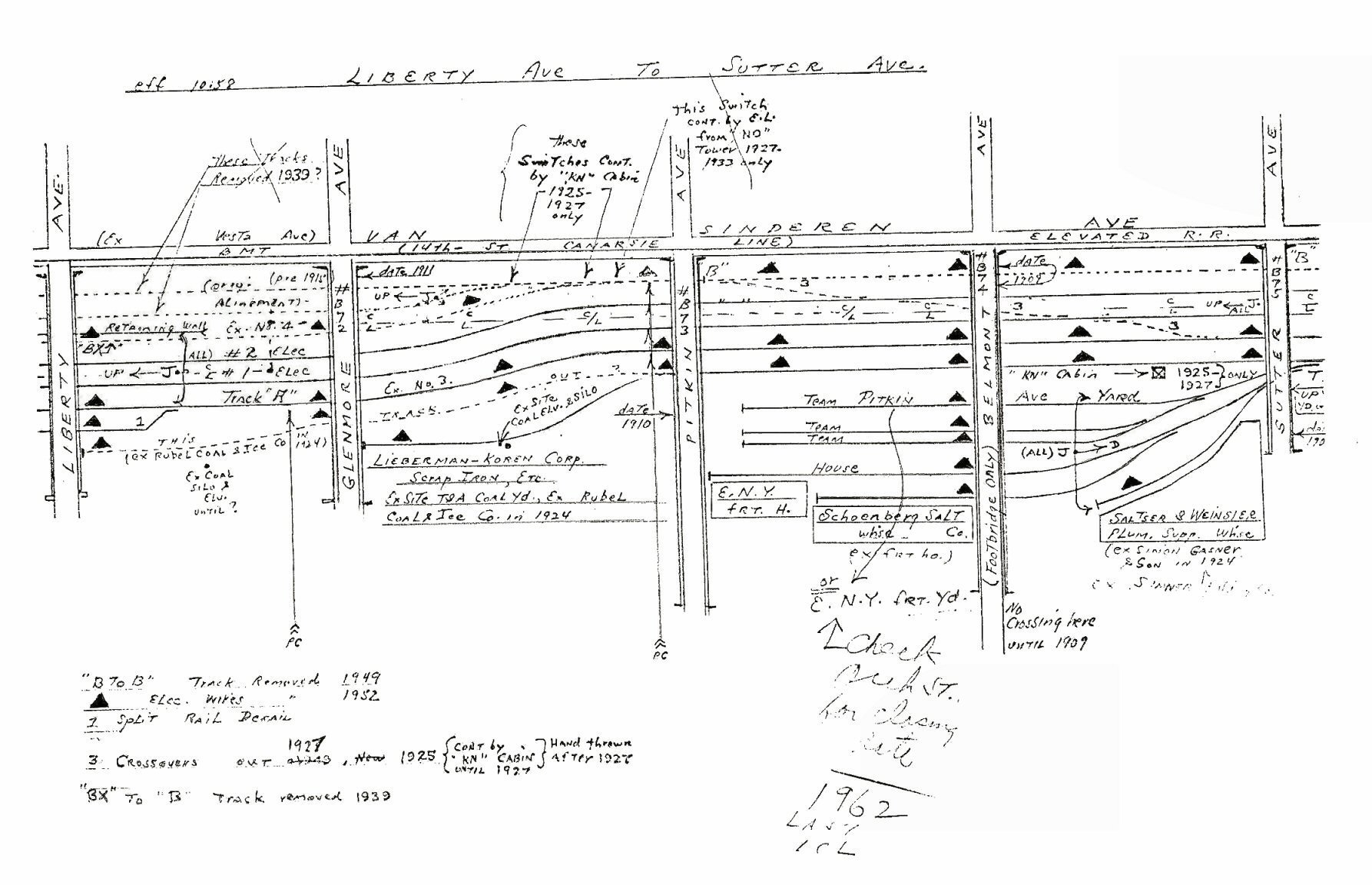 Liberty Ave. to Sutter Ave. 10/1958 Archive: Dave Keller |
|||
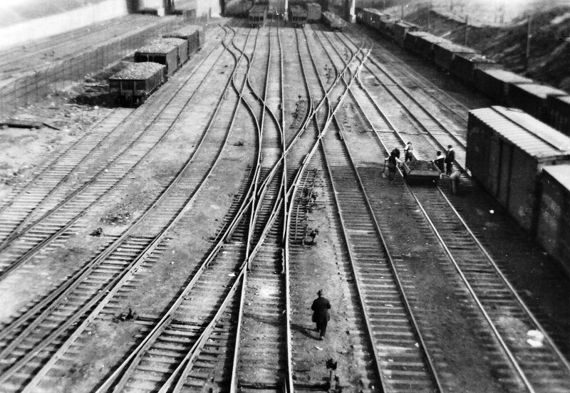
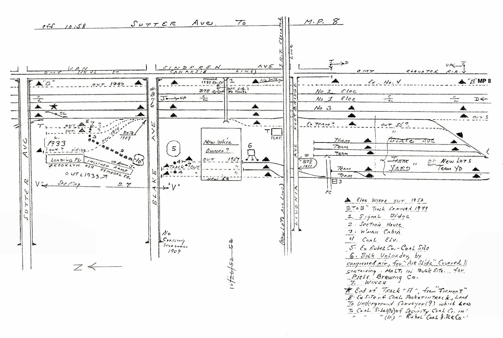 Sutter Ave. to MP 8 10/1958 Archive: Dave Keller |
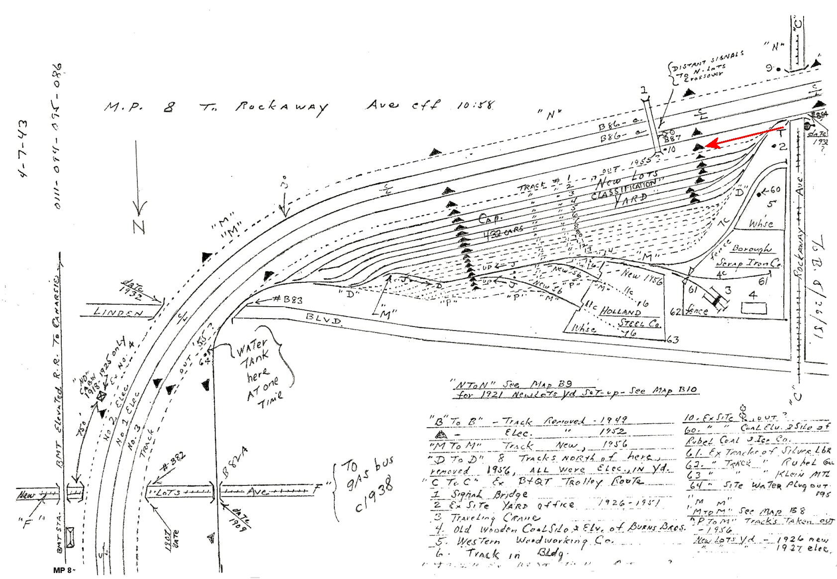
 MP 8 to Rockaway Ave. 10/1958 Archive: Dave Keller |
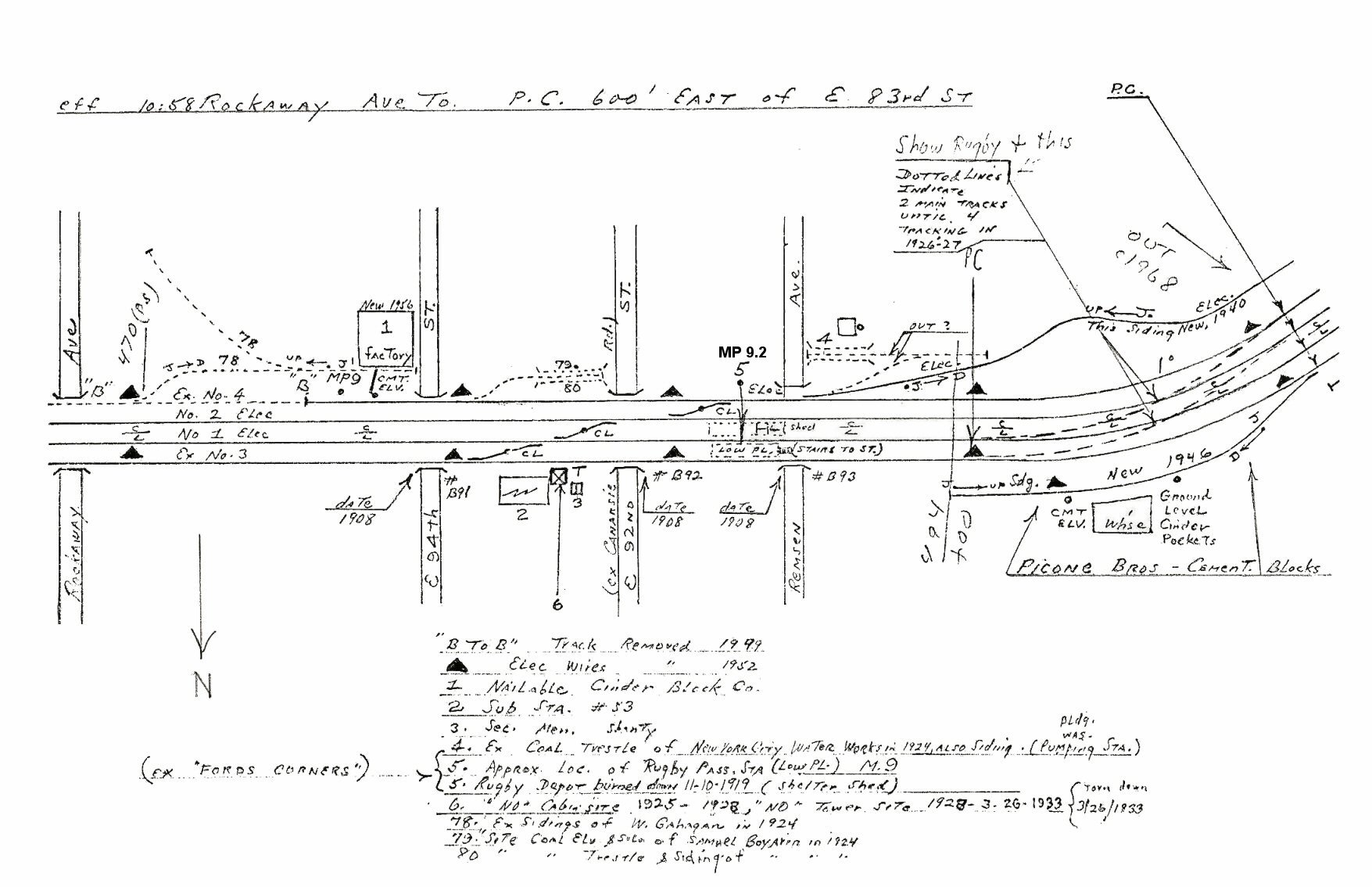 Rockaway Ave. to E. 83rd St. - Former Fords Corners (later Rugby) at MP 9.2 passenger station. Archive: Dave Keller |
|||
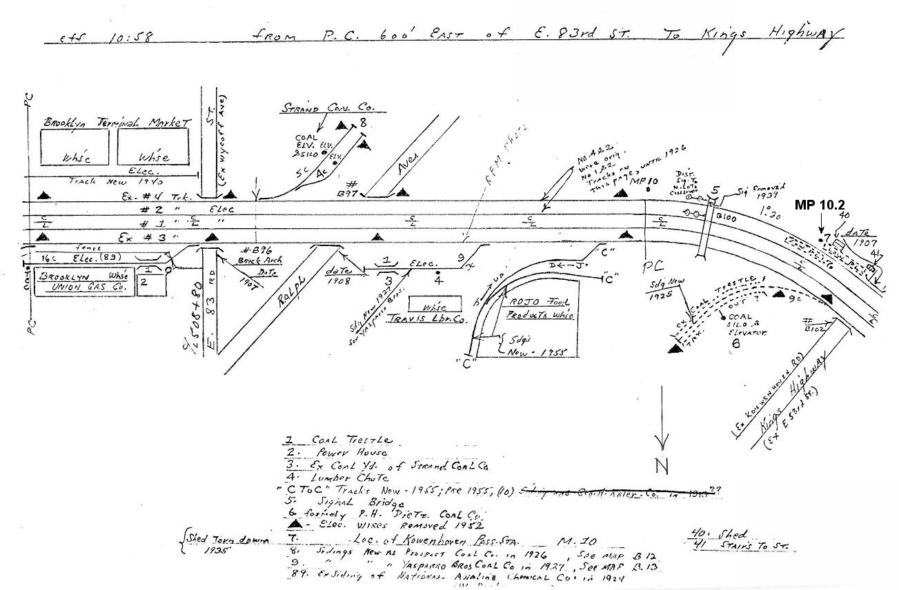 E. 83rd St. to Kings Highway - Former Kouwenhoven passenger station at MP 10.2 10/1958 Archive: Dave Keller |
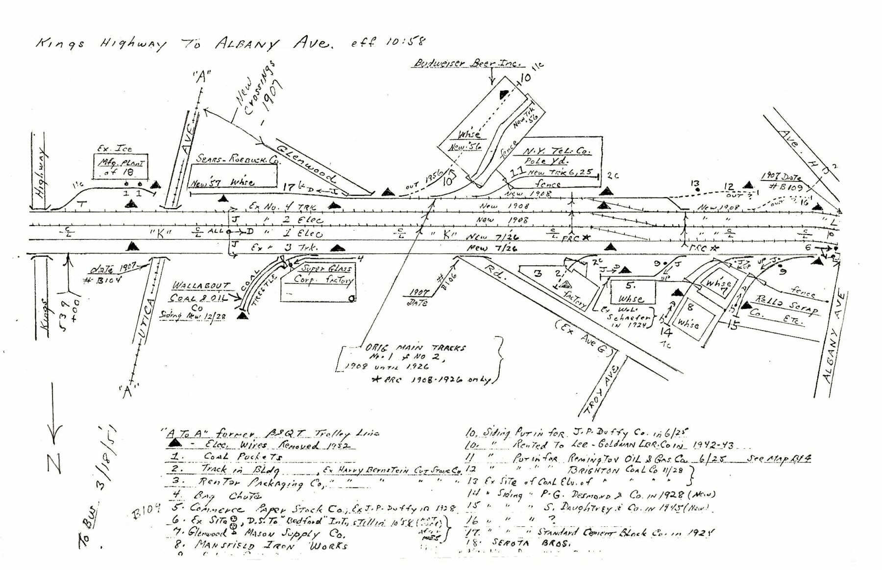 Kings Highway to Albany Ave 10/1958 Archive: Dave Keller |
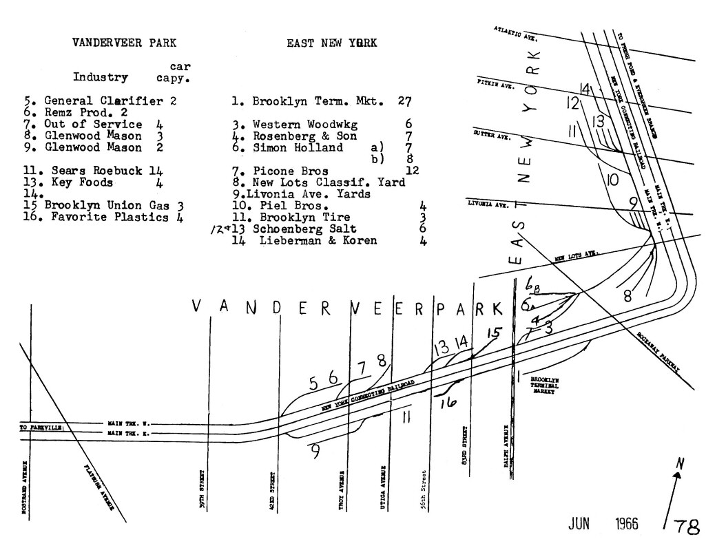
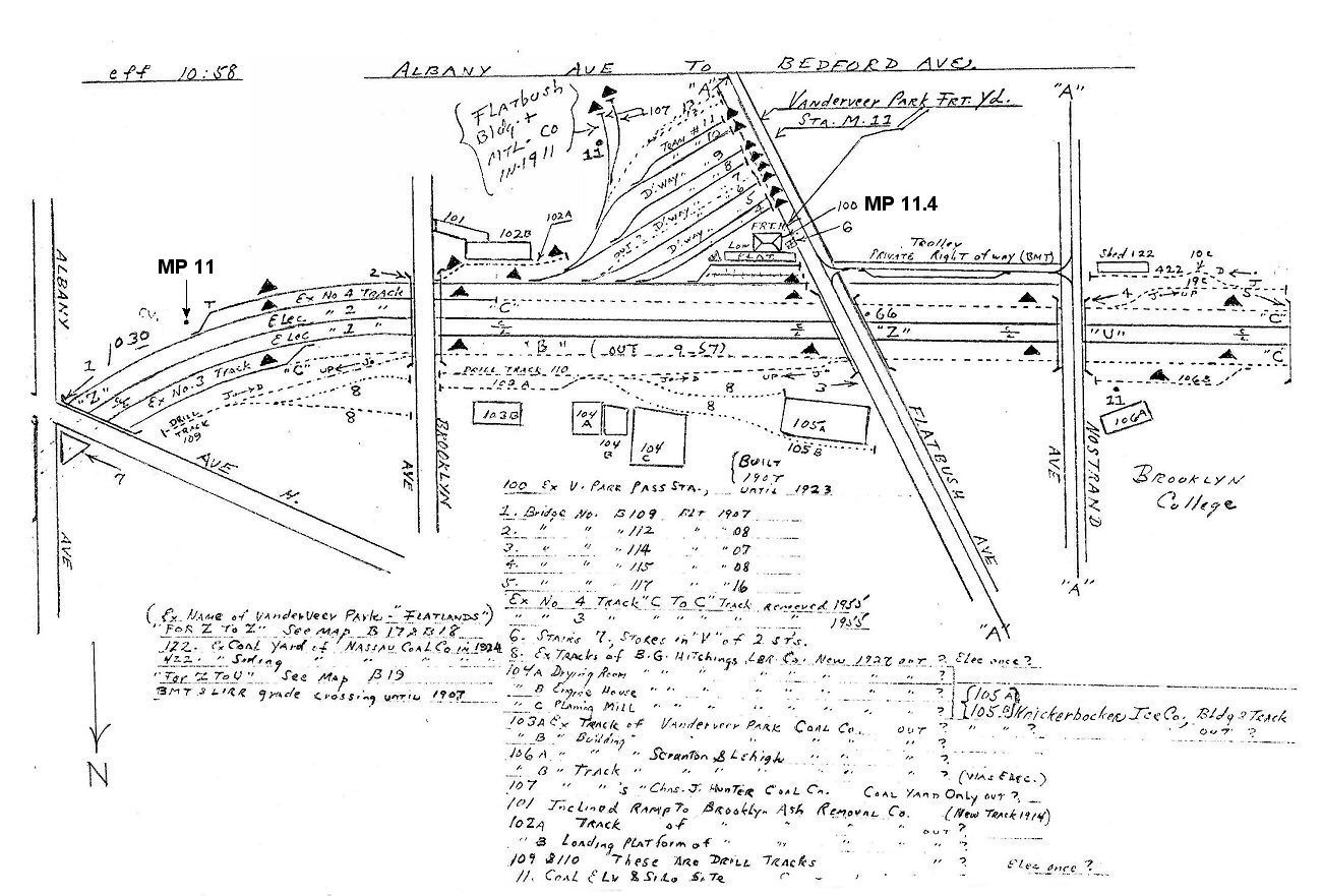 Albany Ave. to Bedford Ave. - Vanderveer Park Station at MP11.4 10/1958 Archive: Dave Keller
|
|||
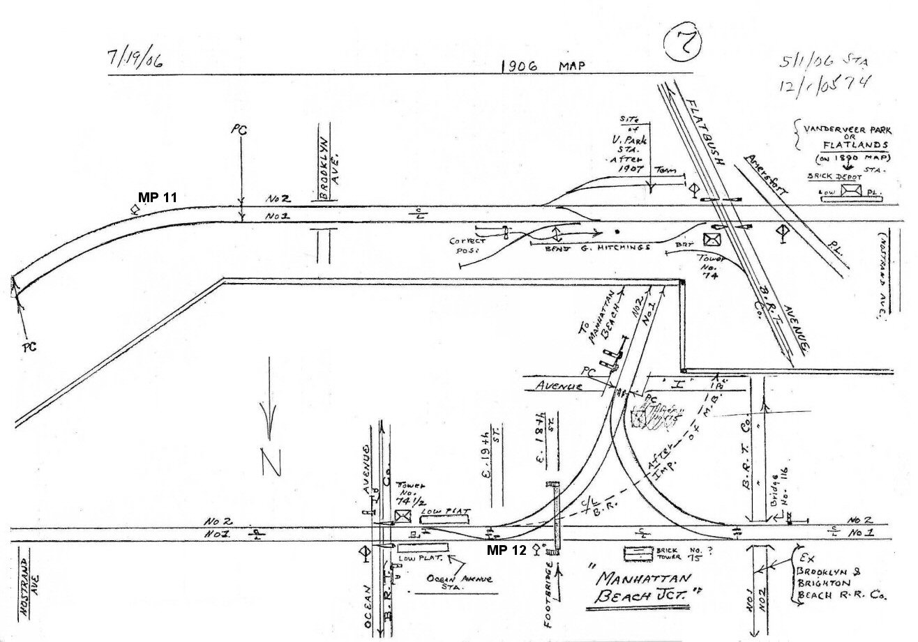 MP11 to Manhattan Beach Jct. MP12 7/19/1906 Archive: Dave Keller |
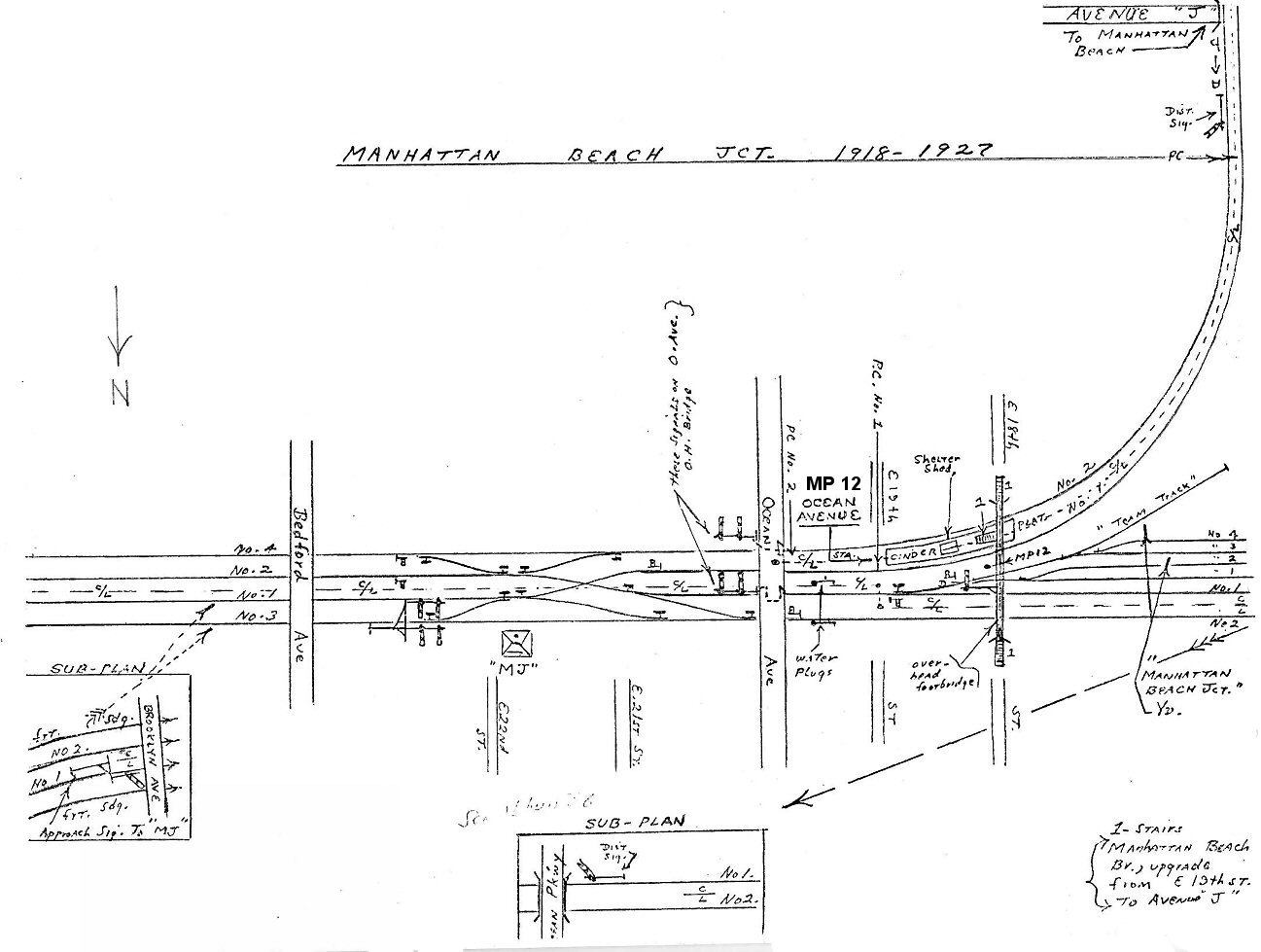 Bedford Ave to East 15th St. Footbridge Manhattan Beach Junction at MP12 - 1918-1927 Archive: Dave Keller |
 Vanderveer Park Station- Flatbush Ave and East 32nd St. 10/12/1916 Archive: Simon Borenstein |
|||
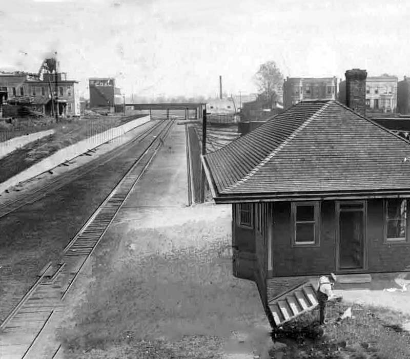
 Bedford Ave to East 15th St. Footbridge - BEDFORD Tower (ex-MJ) at MP11.9 Manhattan Beach Junction at MP12 - 12/31/1949 Archive: Dave Keller |
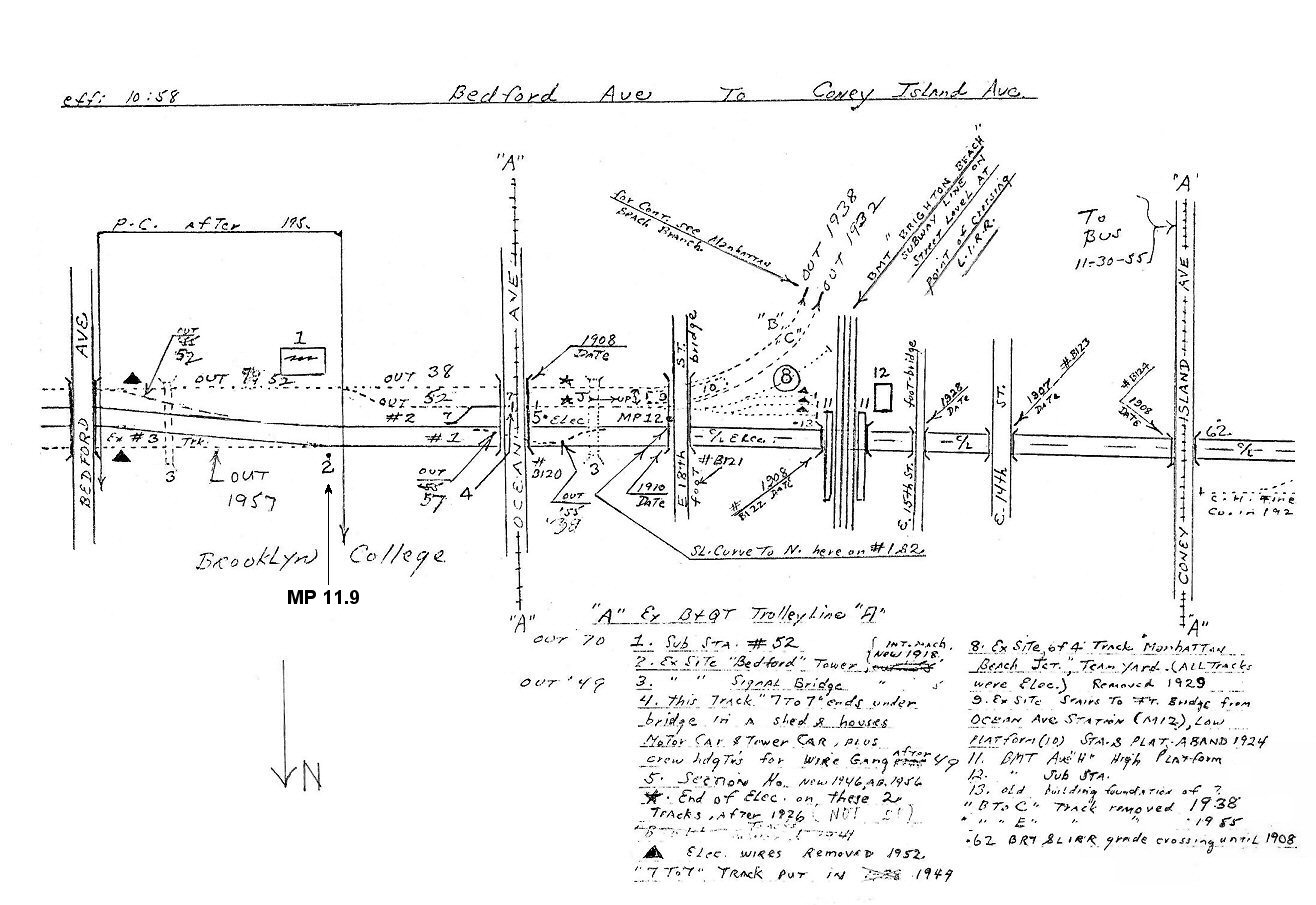 Bedford Ave to Coney Island Ave. - ex-site (12/29/1949) BEDFORD Tower at MP11.9 - 10/1958 Archive: Dave Keller
|
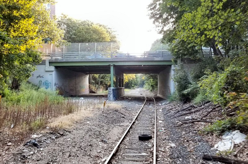 Ocean Ave Brooklyn - c.2018 Photo/Archive: Gregory Grice |
|||
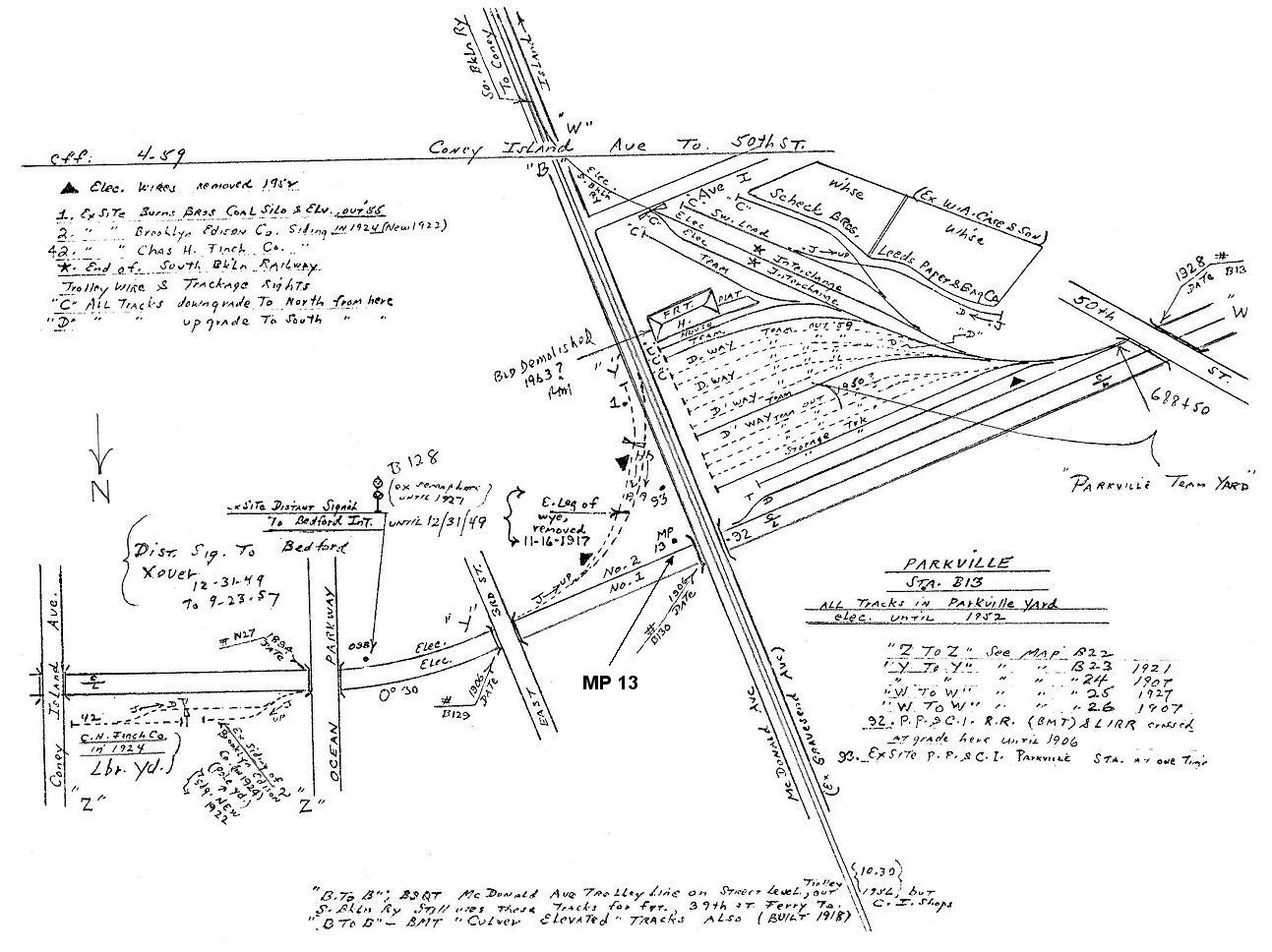
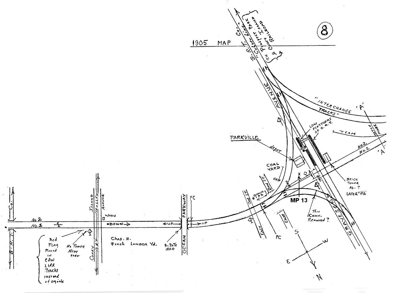 Coney Island Ave. to Parkville Station MP13 at Gravesend Ave. 1905 Archive: Dave Keller
|
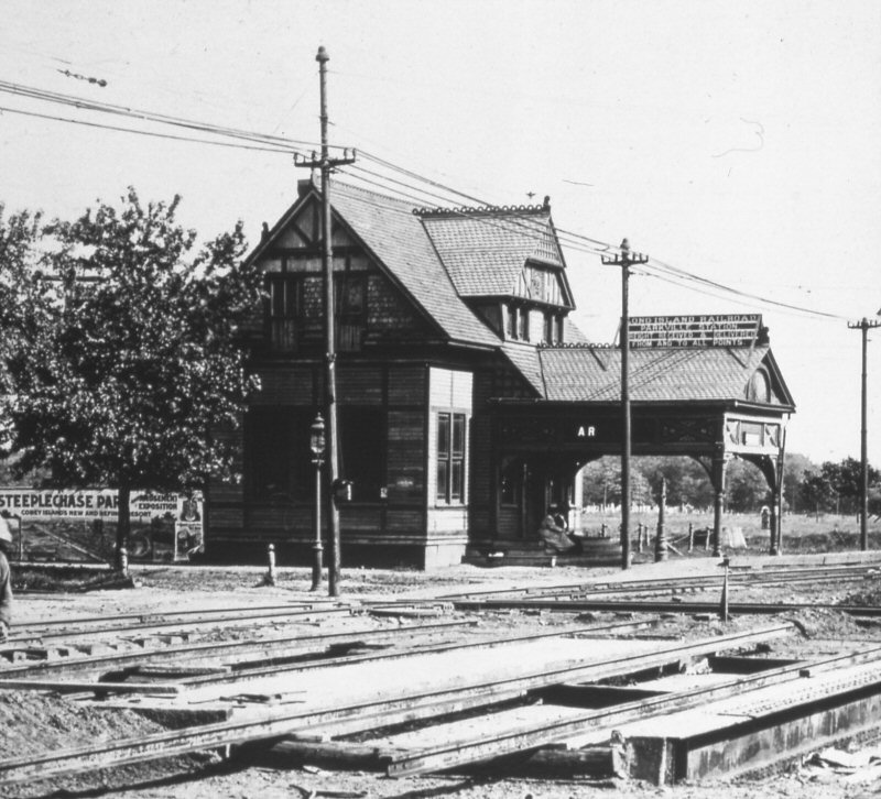 Parkville Station, Brooklyn - View SE 1906 Archive: Dave Keller
|
|
|||
|
The BRT tracks crossed the LIRR tracks at grade at that time. The tracks in the foreground were the BRT's with the LIRR tracks crossing the BRT's. View is SE. The spur or "interchange" tracks from the LIRR to the BRT curved behind the depot which was located at the SE quadrant of the crossing. Dave Keller |
|||||
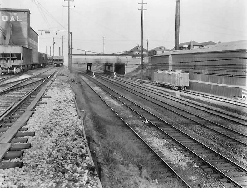
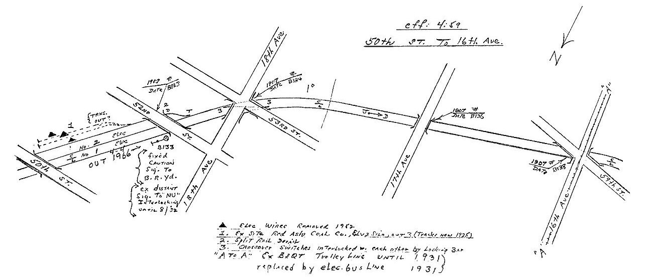 50th St. to 16th Ave. 4/1959 Archive: Dave Keller
|
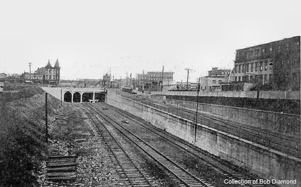
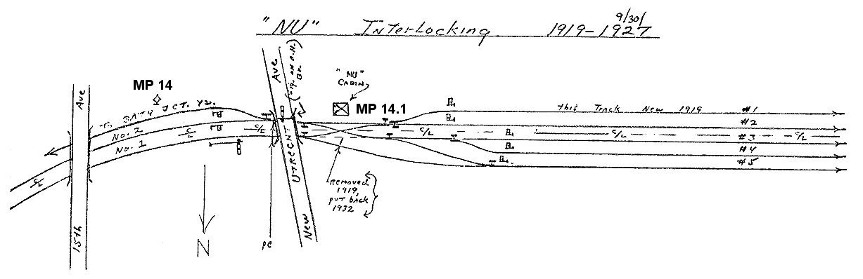
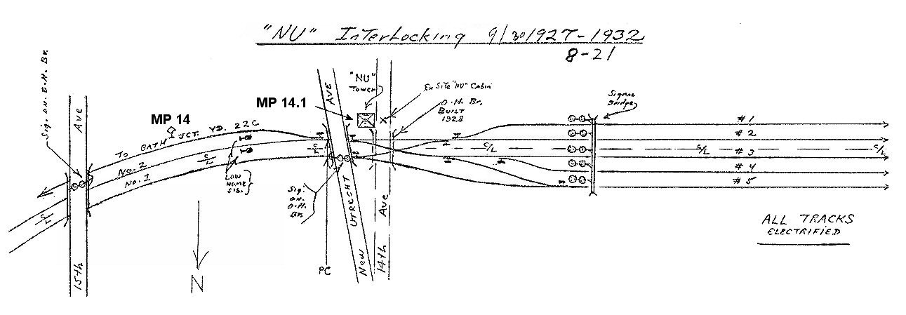
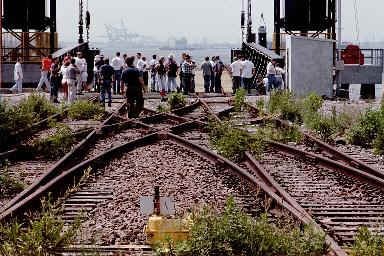
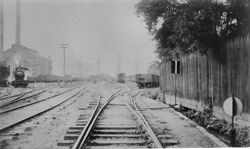
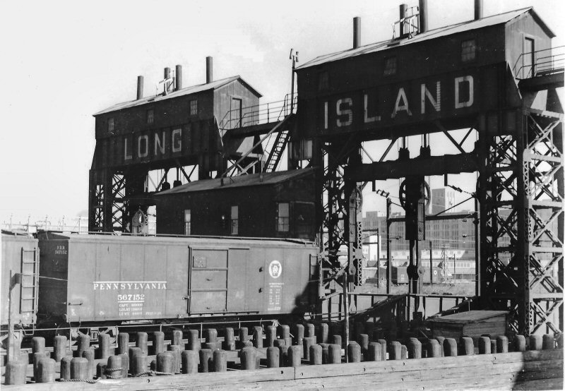
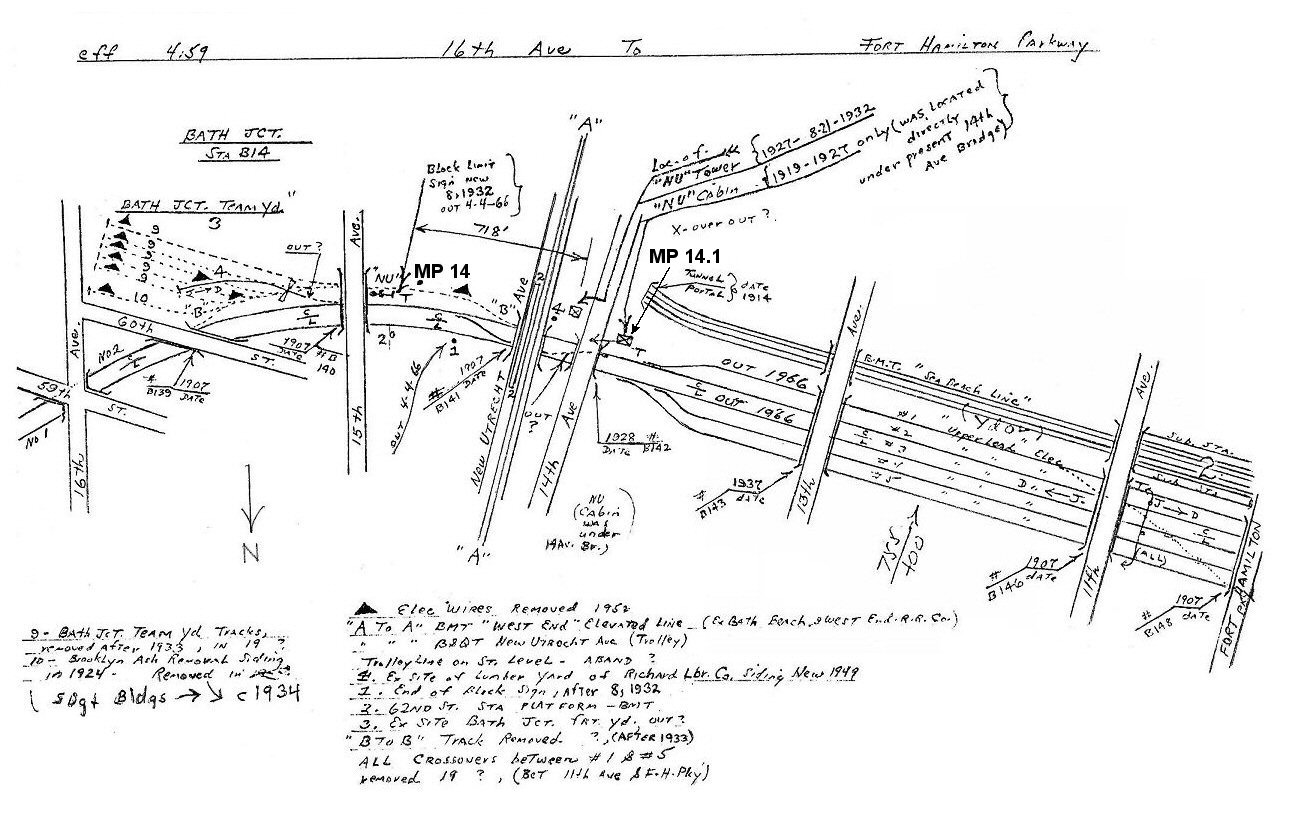 16th Ave to Fort Hamilton Parkway - ex-NU Tower at MP14.1 4/1959 Archive: Dave Keller |
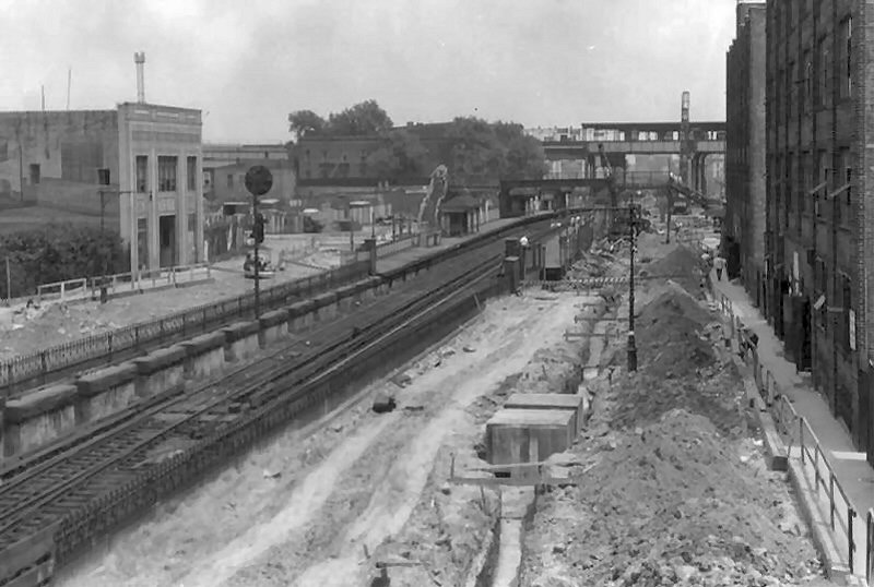
 Bay Ridge Branch view E near New Utrecht Ave. 4/28/1931 (Ziel-Boland) |
|||
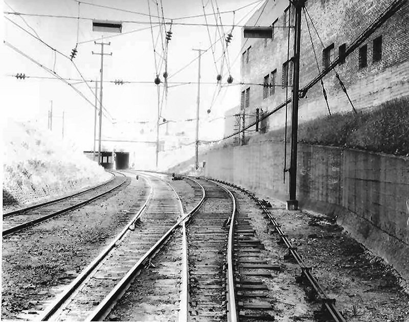
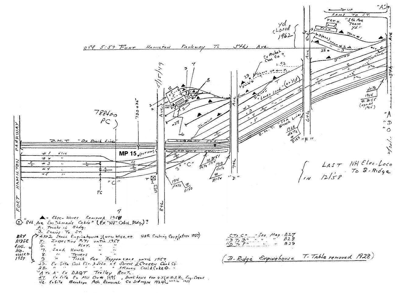 Fort Hamilton Parkway to 5th Ave. 5/1959 Archive: Dave Keller |
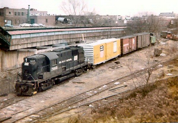
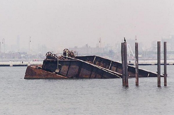
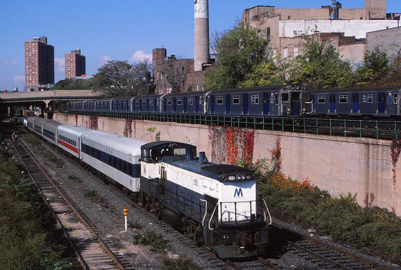 MP15AC #150 ERA Excursion Bay Ridge Branch Sixth Avenue, Bay Ridge 10/18/1986 Photo/Archive: Jeff Erlitz |
||||
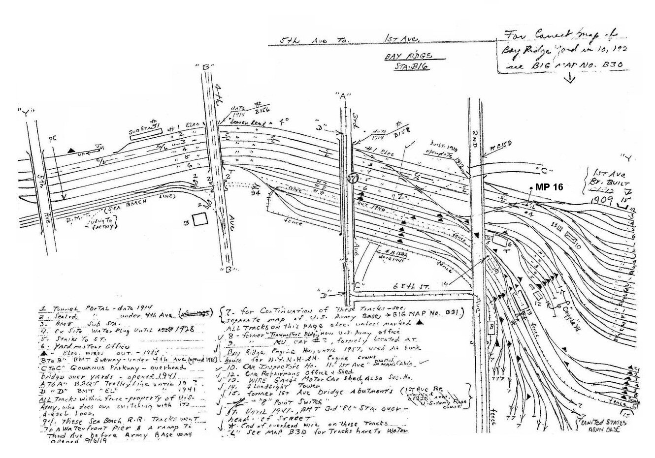 5th Ave. to 1st Ave. at MP 16 - 1959 Archive: Dave Keller |
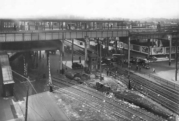
 LIRR 4-4-2 passing under the BMT 3rd Ave EL 65th Street Station |
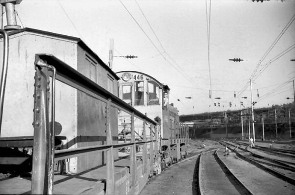
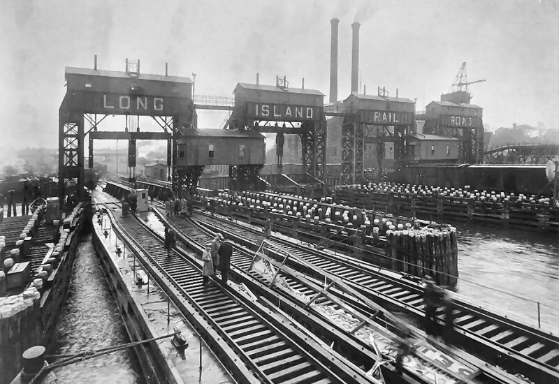
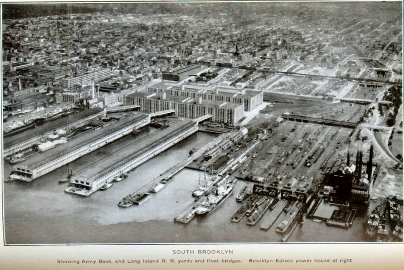
 1st Ave. to Waterfront - MP 16.3 - 1959 Archive: Dave Keller |
|||
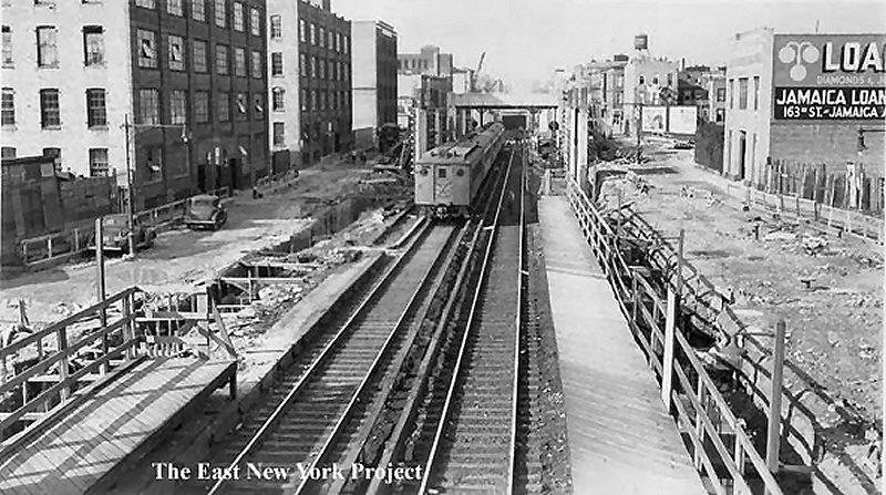
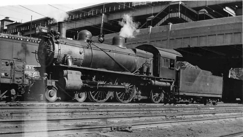
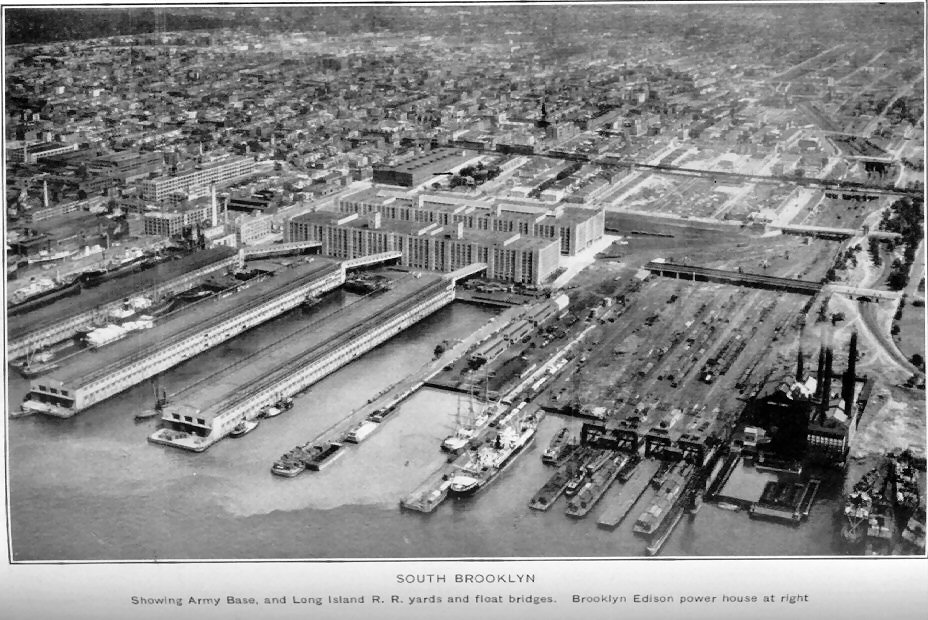
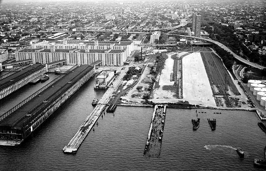
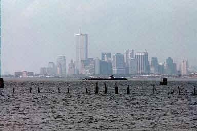
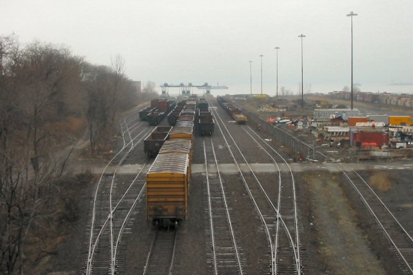
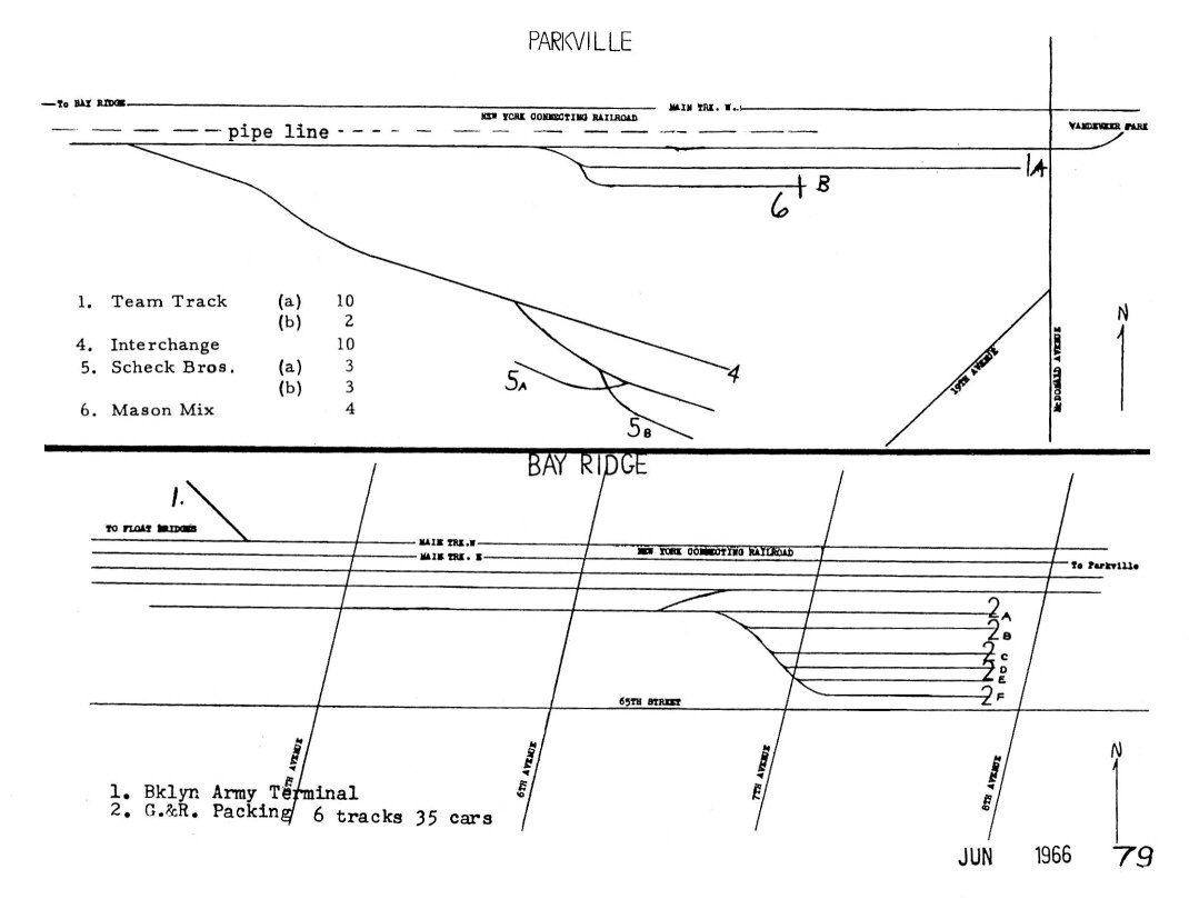
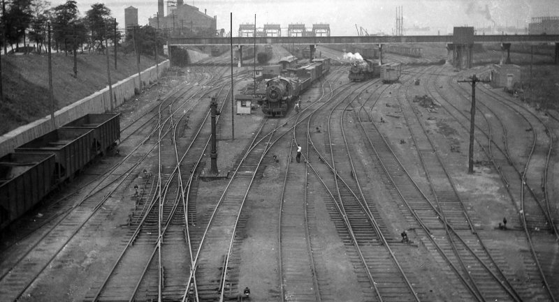
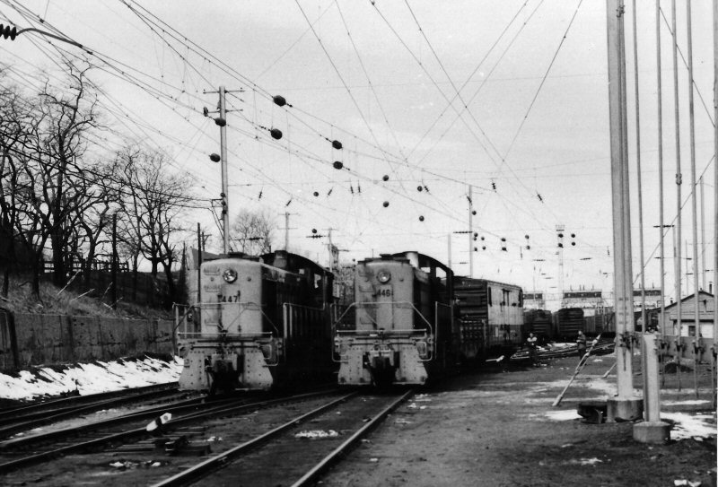
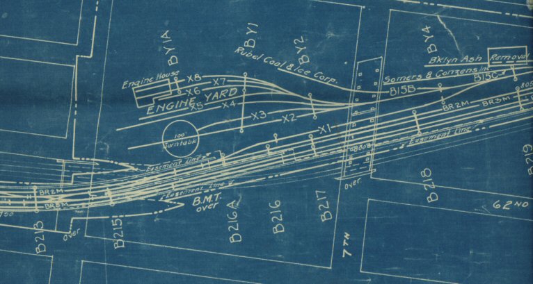 The 7th -8th Ave engine yard area 0 5/14/1932. (Future site of G&R Packing) Note the catenary bridge numbers on the print. This print was dated only 10 weeks before NU Tower would be closed forever. Info: Richard F. Makse |
|||||
|
|
|||||
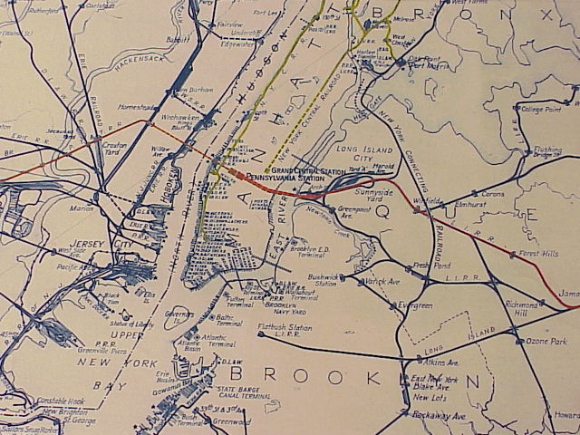
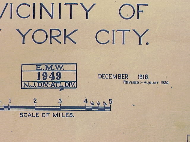
| LIRR Tri-State Map - 12/1918 revised 08/1920 | |||||
|
 Pennsylvania Tunnel and Terminal Railroad, P.T.&T.R.R. was an important part of the PRR system, comprising the tunnels and approaches from NJ, Long Island , into NY Penn Station. The company was formed on June 26, 1907 as a consolidation of the Pennsylvania, New Jersey and New York Railroad and the Pennsylvania, New York and Long Island Railroad, which were the New Jersey and New York parts, respectively. The PNJ&NY was incorporated February 13, 1902, and the PNY&LI was incorporated April 21, 1902. The New Jersey side was opened on November 27, 1910, though it hadn't been completed yet. The Long Island side was opened several weeks earlier. It was always operated by the PRR. |
||||


|
|||||||||||||||||||||||||||||||||||||||||||||||||||||||||||||||||||||||||||||||||||||||||||||||
.jpg)


