
Crossing Predictor, west of Cherry Ave, Sayville 12/31/2007
Photo: Mike McDermet
View west of Cherry
Ave
Photo: Mike McDermet 01/13/08
View west Greeley Ave. , Cherry
Ave
in background
Photo: Mike McDermet 12/31/2007
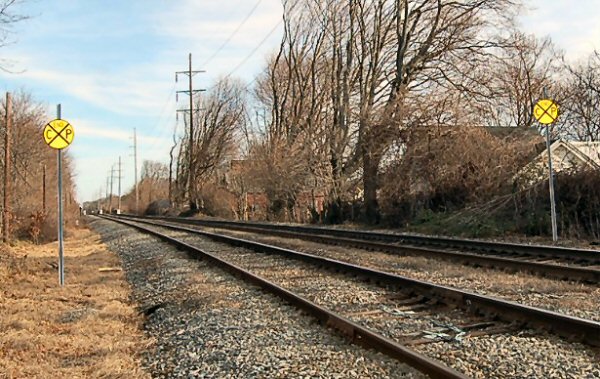
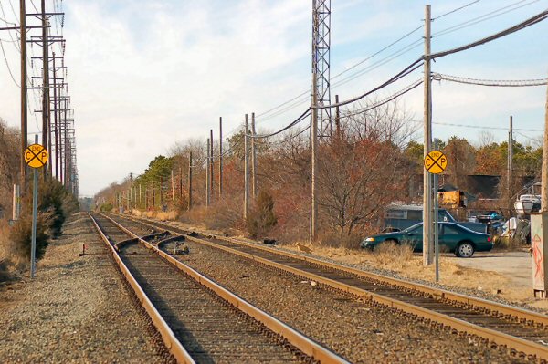
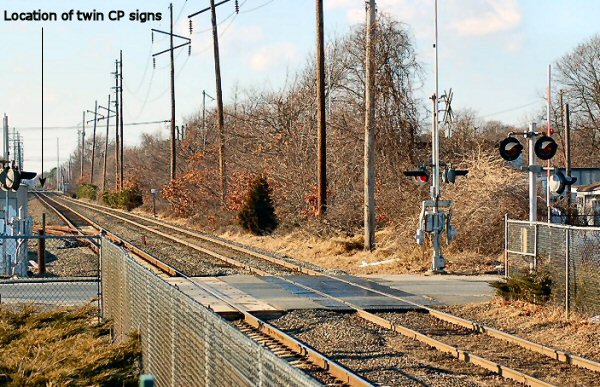
RR signs on the right-of-way with "END CP" at Sayville, NY. CP for crossing predictor, a different signal system being used at Sayville to help manage the length of time the gates are down. This simply alerts the engineer to the limits of this system in operation; in both directions. These signs are after the second grade crossing going east from the station (Lincoln Ave.) about 200' and another westbound of Sayville after Cherry Ave.
This device provides consistent warning times for crossings under the
conditions of varying train speeds. These were installed at several crossing in the Sayville area in the 90's.
That was one of those locations that if the train was travelling at a slower than MAS speed, the gates would not come down until the train was much closer to the crossing than at the other crossings on the Branch..
When they had low platforms, the platform extended right up to the
crossing when you pulled in, if you stopped half way in the station, the gates would come
up when you started from the station, about 3/4 of the way through, you would trip the gate circuit and the gates would come down.
|
|
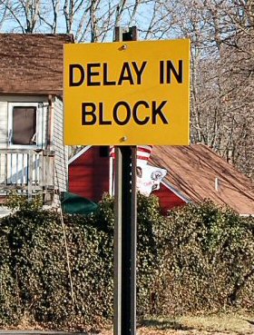
Delay In Block, just east of Sayville station 12/31/2007 Photo: Mike McDermet
"Delay in Block" is to remind an engineer, that had a clear signal when arriving at the station,
that after the dwell time at the station the next signal may, during the delay, have changed to
a more restricting aspect so the engineer should proceed accordingly.
Placed at locations where a train will come to a stop in non-cab signaled locations
between a distant signal and a home signal to an interlocking. The sign is a reminder that
NORAC Rule 504 is in effect. Passenger trains must be prepared to stop at the next signal,
not exceeding 40mph, if the train makes a station stop in between signals and the next signal
is at an interlocking, and until the aspect of the home signal can be clearly seen.
Trains with operative cab signals (ASC in LIRR terminology) in cab signal territory are exempt from complying with this rule. It is used in manual block and automatic block territory where there is no
ASC. In this case in
question, Sayville is automatic block territory. Info: Jay Eichler
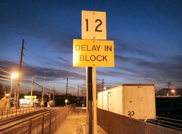 Delay In Block, just west of Bay
Shore station Platform A, facing east 01/07/08 Photo: Mike McDermet
Delay In Block, just west of Bay
Shore station Platform A, facing east 01/07/08 Photo: Mike McDermet
Yes, that is a 12 car marker; so an Engineer with 12 cars would know where to stop at Bay Shore (which, ironically enough, is a 12 car platform).
That could sound like a silly answer, but keep in mind as other stations got done over (high level, etc.) Bay Shore was left alone since it had been raised years ago.
Islip, Great River and Oakdale are 4 car platforms, while Sayville and Patchogue are 6 car platforms.
Keep in mind that emergency situations do develop from time to time, and that in summer, the Cannonball literally has 12 cars and two engines at times...suppose they had to make a stop at Bay Shore loaded with customers...where would they stop??? Why, at the 12 car marker of course!
At Westhampton, which holds 8 cars, they NOW make double stops...same at South (8), Bridge (6) and East (6) and Montauk (6).
The Delay in Block sign is "relatively" new...it is used in areas that are Manual Block or Non-speed controlled territory...for example, if someone sent you a current shot of Westwood, you would see a Delay in Block sign.
There was a crash in Maryland that killed several people...a train crew took an "Approach" on a distant signal, which means to proceed approaching next signal prepared to stop...had a change of crews and one Engineer forgot to tell the other Engineer about the Approach aspect...the new crew takes off doing MAS, came around a bend and saw a beautiful red light burning brightly on a signal mast.
Couldn't stop in time, and plowed into the passenger train sitting in the station ahead of them at great speed...bingo, the FRA said that anytime a train stops, even for a stop at a passenger station, they must approach the next signal prepared to stop.
For the Cannonball, Westhampton is still the first stop after Jamaica...Westhampton, Southampton, Bridgehampton, East Hampton and Montauk only every time.
No, they never make a Bay Shore stop...I was simply trying to draw a parallel between Bay Shore having 12 cars for capacity and the Cannonball on its heaviest days having 12 cars.
No, in an emergency, they would use one car if necessary...my point was simply that if needed, and an evacuation was imminent and they happened to be at Bay Shore, then hey, there was a 12 car platform available to let off 12 cars off at once.
You are correct...they never run 12 car trains, but since Bay Shore was already up and running, why change it???
The old diesel equipment had 12 cars on some trains, and I believe the Cannonball was up to 16-17 cars at one point, parlors and all...the Port Jeff branch had 11-12 car diesel trains that ran to HPA and LIC from Port Jeff.
Info courtesy of a LIRR Engineer,
Archive: Dave Keller
Why was the platform built for 12 cars?
The railroad seriously considered, for a short time in the mid 80's,
extending electrification from Higbie Lane to Bay Shore. Reason? The
Babylon-NY super express (old train 109) had a large number of Bay Shore
passengers and there was a mad scramble every morning for those
people--and others off of the Patchogue scoot--to get seats on 109. So the
plan, ultimately scrapped because the power off the Babylon substation
could not reach Bay Shore, owing to the load from Babylon yard. But before
the plan was ultimately dumped, Bay Shore got a 12 car platform to handle
that one train that never materialized. Richard F. Makse
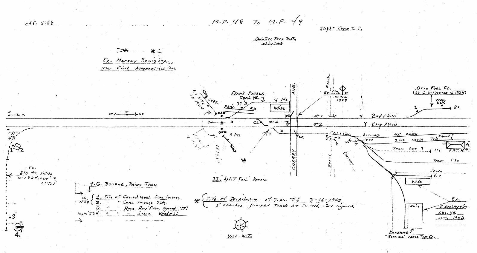
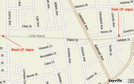
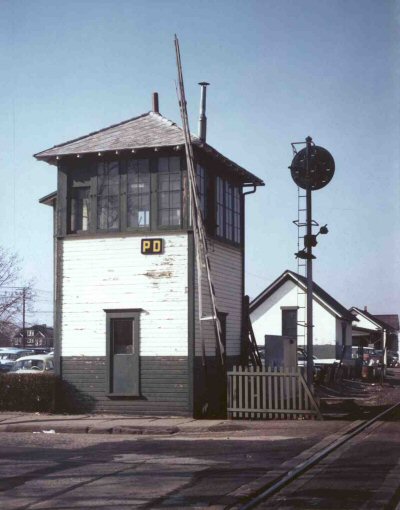
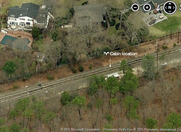
Emery Map 1958 MP 48-49 Sayville
Westbound CP west of Cherry Ave.
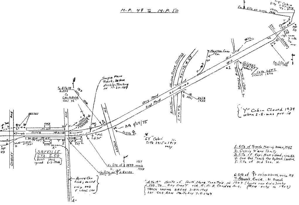
Emery Map 1958 MP 49-50 Sayville
Eastbound CP east of Railroad Ave.

Cherry Ave Gate Malfunction Sign 01/04/08
LIRR has "CHERRY ST" in error
Photo: Mike McDermet
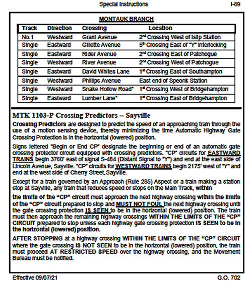
G.O. 702 page I-89 Special Instructions Crossing Predictors Sayville 9/07/2021
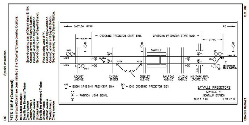
G.O. 702 page I-90 Special Instructions Crossing Predictors Sayville 9/07/2021