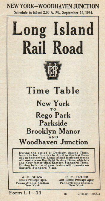
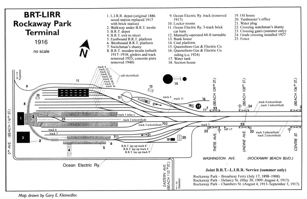
|
Rockaway Beach Branch Data/Research:
Dave Keller, unless otherwise noted |
|
|
Rockaway Beach Branch Data/Research:
Dave Keller, unless otherwise noted |
|
| NEW YORK & ROCKAWAY BEACH RAILWAY - 1886 to 1898 | |||||||
|
|
||||||
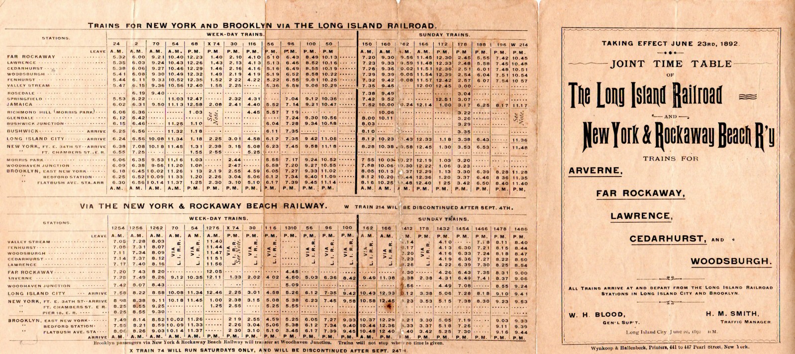
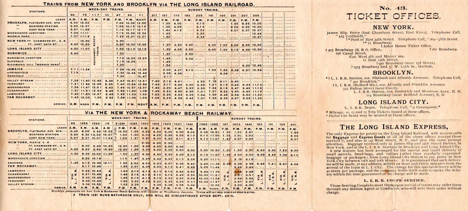
| New York & Rockaway Beach Railway and LIRR joint timetable 6/20/1892 Archive: Brad Phillips | |||||||
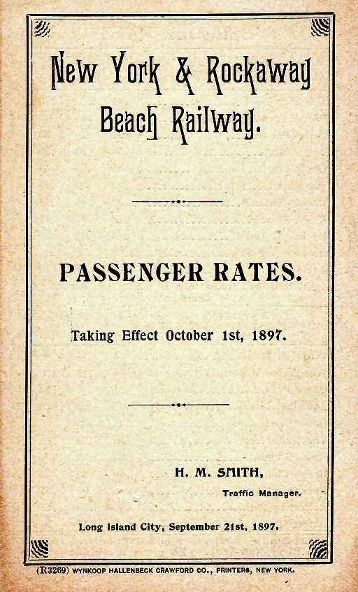 NY & RB Railway 10/01/1897 Fare Booklet front Archive: Brad Phillips  NY & RB 4-4-0 #310 (Fagerberg-Boland) |
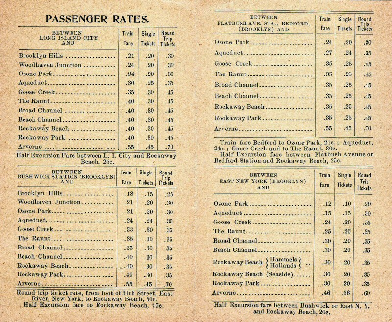 NY & RB Railway 10/01/1897 Fare Booklet inside Archive: Brad Phillips
|
 NY & RB Railway 10/01/1897 Fare Booklet back Archive: Brad Phillips
|
|||||
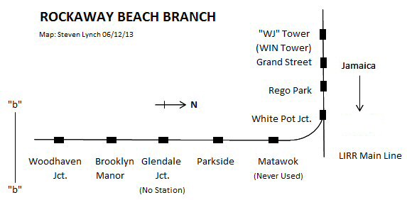
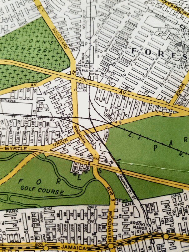
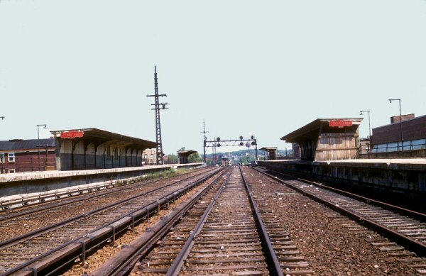
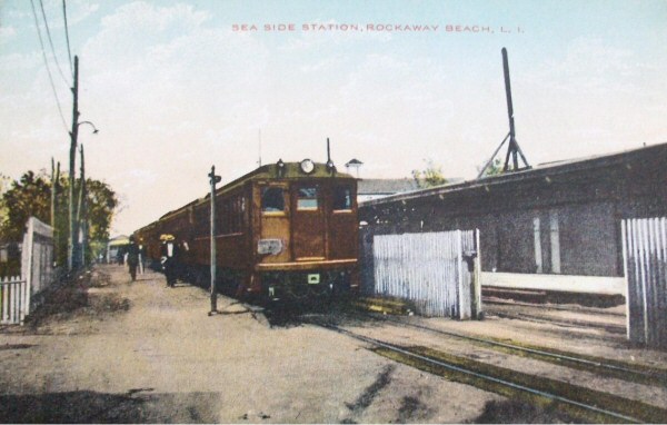
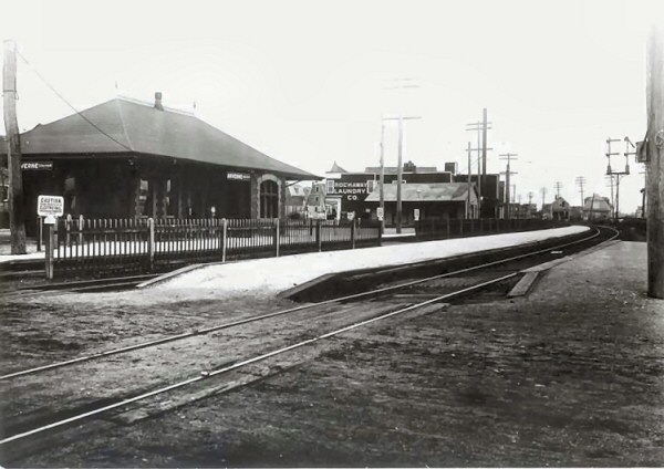
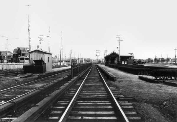
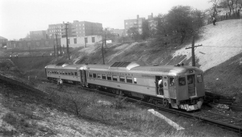
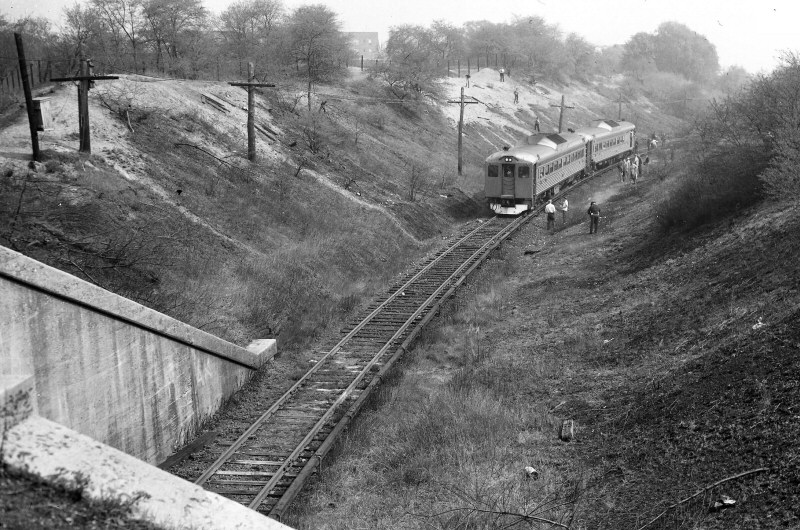
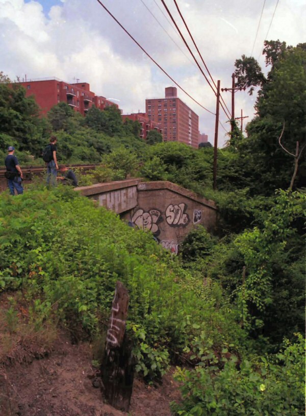
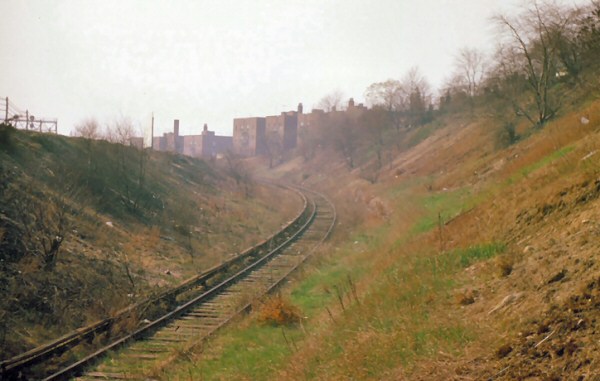
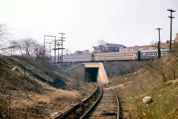
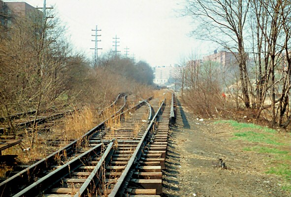
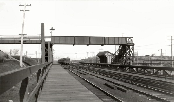
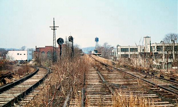
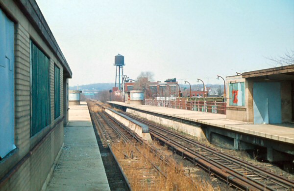
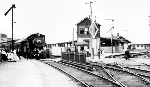
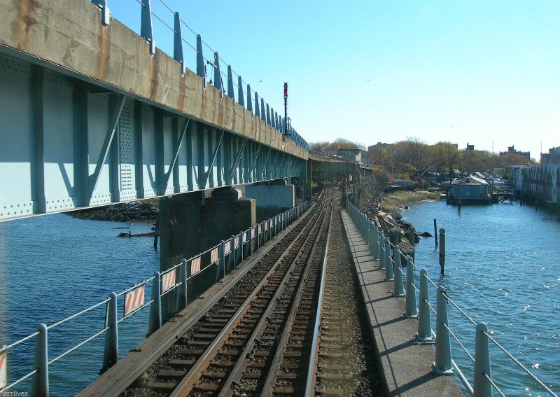
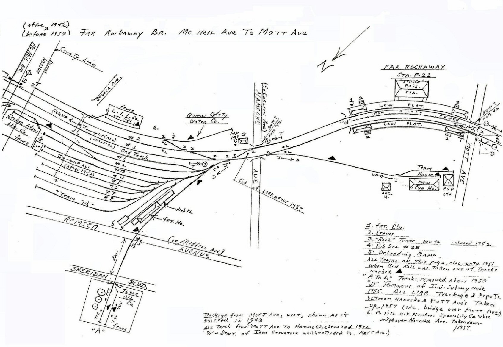
| The Rockaway Beach branch started on the Main Line just east of WJ (later WIN) tower (Winfield Jct.) east of Woodside, leaving the Main at White Pot Jct. (after the 1910 branch extension from Glendale Jct), originally making a first stop at the short-lived Matawok station. In subsequent years, Grand Street (short-lived) and Rego Park (along the Main Line) and Parkside (south of the Main Line) were added as station stops. The tracks then crossed the Montauk branch at Glendale Jct. (after 1910) and continued on to Brooklyn Manor (at Jamaica Ave.), Woodhaven Jct. (at Atlantic Ave.), Ozone Park (just north of Liberty Ave.), Aqueduct, Howard Beach, Hamilton Beach then across the bay making the remainder of the stops, branching off the Hammel's wye and, heading west, terminating at Rockaway Park (Beach 116th St.) and heading east, terminating at Far Rockaway, Mott Ave. | |||||||
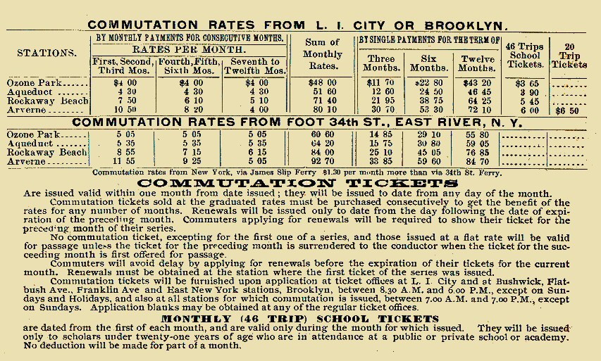
| TIMETABLES | |||||||
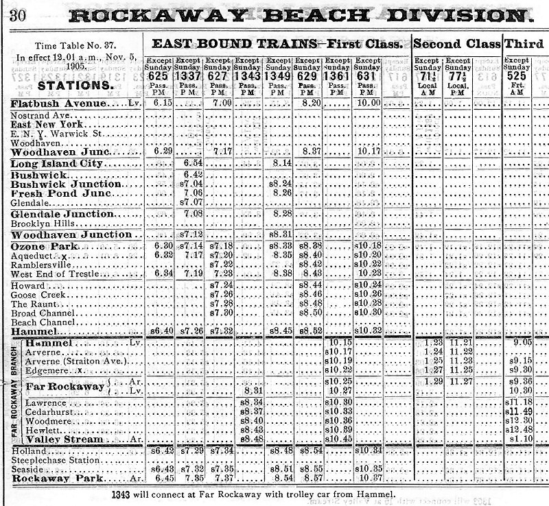 Rockaway Beach ETT #37 11/05/1905 Archive: Art Huneke
|
 Rockaway Beach ETT #110 6/16/1929 station listings Archive: Dave Keller |
 Rockaway Beach ETT #9 6/03/1962 just prior to abandonment June 9, 1962 |
|||||
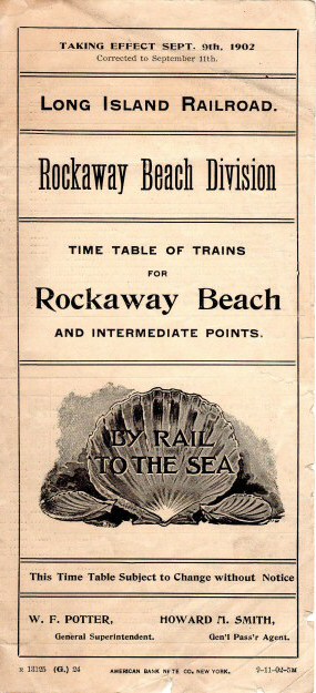 Rockaway Beach Division Timetable 9/09/1902 Archive: Brad Phillips |
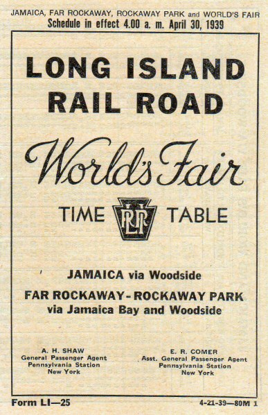 World's Fair - Rockaway's Timetable 4/30/1939 Archive: Brad Phillips |
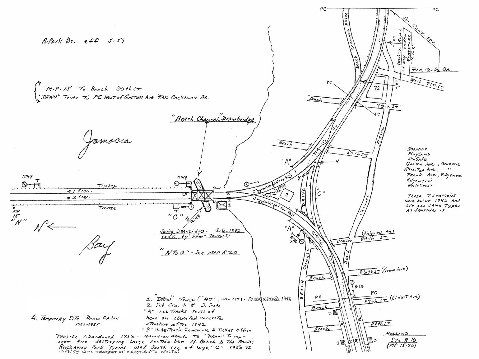
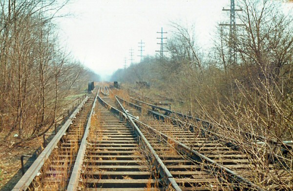
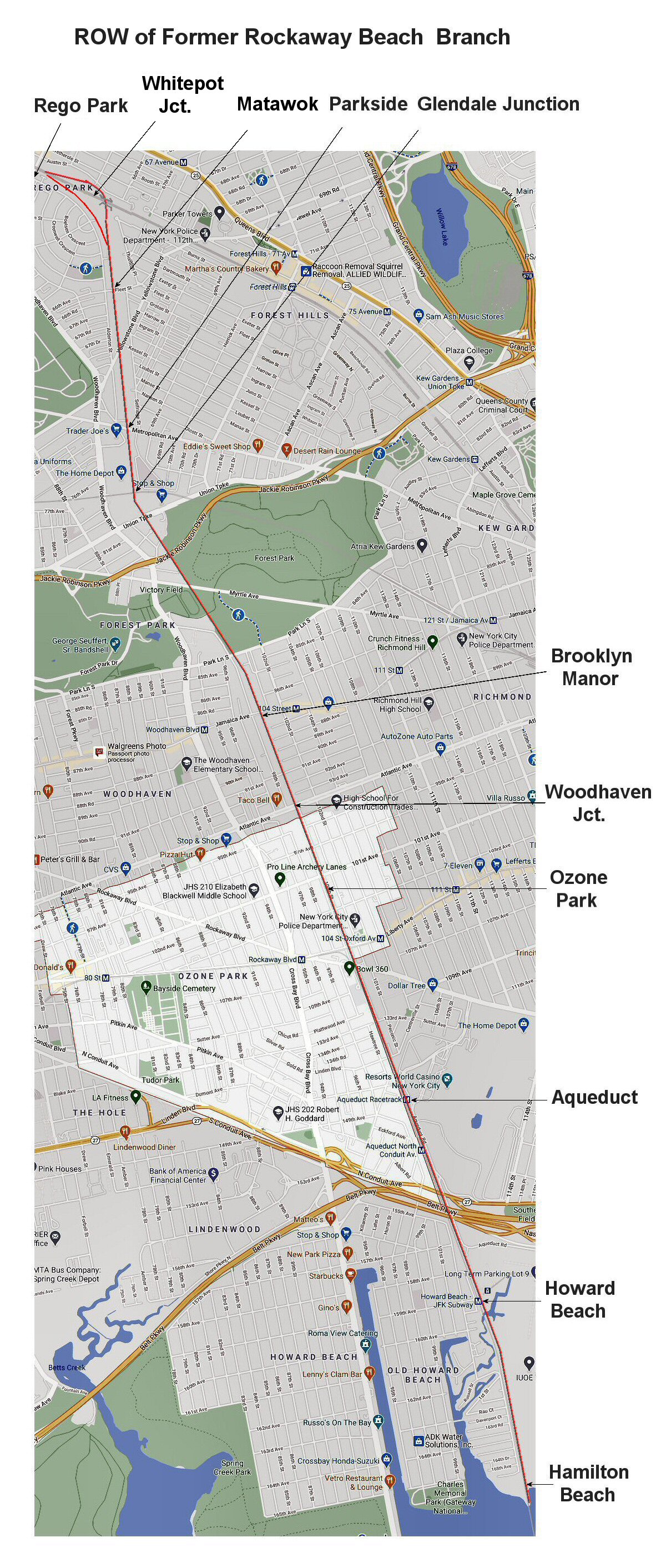 ROW of former Rockaway Beach Branch abandonment June 9, 1962 Map: Steven Lynch |
|||||
 LIRR Rockaway Beach Branch blueprint - 11/25/1947 Archive: Jeff Erlitz |
|||||||
|
|||||||
|
Rockaway Beach Branch - Stations that existed listing north to south: |
|||||||
| GRAND STREET | |||||||
|
|
Grand Street Station (east of Woodside) on Main Line & Rock Beach Branch on ETT #69, eff.: 5/25/13, but no trains scheduled to stop there. Shelter shed only with platforms in position to eventually serve both the Main Line and Rock. Bch. Became a Rock. Bch. stop per ETT #70, eff. 7/01/13 when Main Line and Rock. Bch. trains had scheduled stops. Shelter shed removed 1922 ETT #102, eff. 5/25/25 lists station, but indicates no trains stopping there. Discontinued as station stop between 5/25/25 and issuance of ETT #103, eff. 10/21/25 which does not list the station. Research: Dave Keller and Art Huneke | ||||||
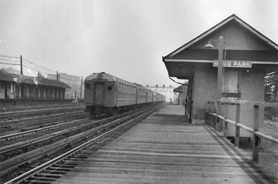
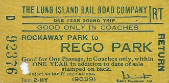
| REGO PARK | |||||||
|
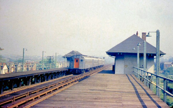
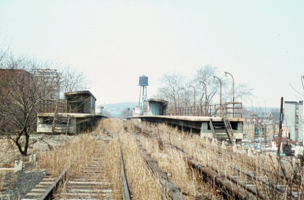
The station opened in May 1928 with two side platforms outside the two Rockaway Beach Branch tracks that bracketed the four-track Main Line, so only Rockaway trains stopped there. After the Rockaway Trestle fire in 1950, the line was closed station by station. Low platforms in service: October 29, 1958. The station closed on June 8, 1962, one day before the Rockaway Beach Branch was abandoned; June 9, 1962. Nothing remains at the site today. |
|||||||
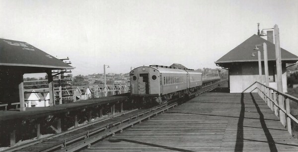
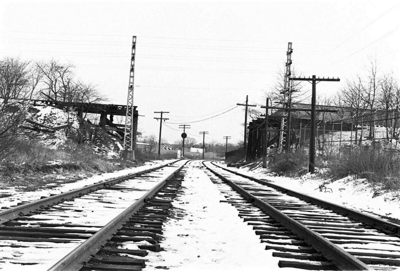
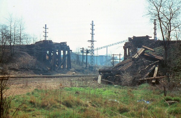
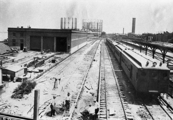
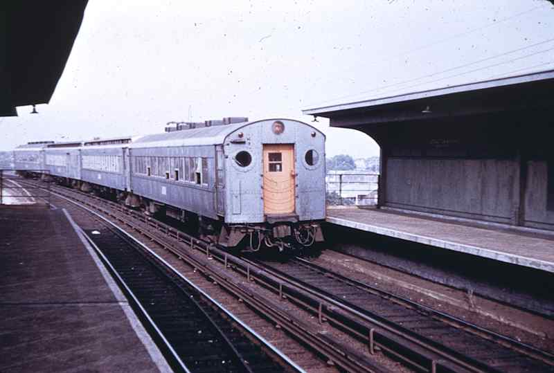
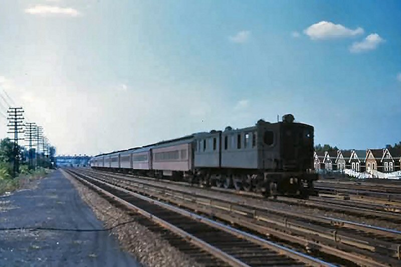
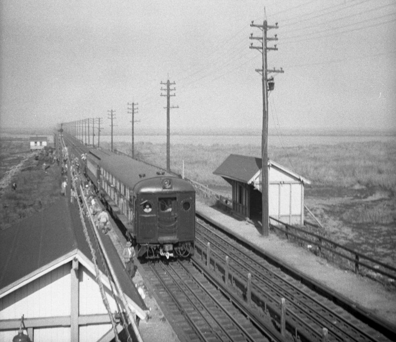
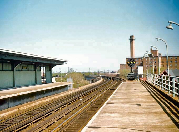
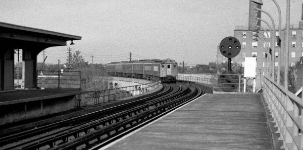
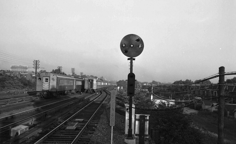 Early morning westbound MU electric and diesel-pulled trains are passing the westernmost junction of the Rockaway Beach branch with the Main Line west of the Rego Park station in this 1955 westward view. The original junction was much further west, but was cut back to this former crossover location in 1955. The remains of the continuation of the former trackage is visible in the distance. The position-light signal is at "stop" aspect to protect the Main Line from Ozone Park and Hamilton Beach trains approaching westbound via the White Pot underjump. Note the large round marker lamp in the rear vestibule of the diesel-pulled train at the right. These were installed as a result of the horrible rear-end collision between two trains east of Kew Gardens (commonly known as the "Richmond Hill disaster") on Thanksgiving Eve in 1950. These large markers were supposed to act as a more visible notification of the end of a stopped / stalled train. (Dave Keller data and archive) |
|||||||
 Rego Park station view E 1946 Archive: Brad Phillips  Current view E at Rego Park |
|
 Rego Park station view E 1954 Archive: Brad Phillips
|
|||||
| WHITE POT JUNCTION | |||||||
|
The Dutch originally colonized New York, shortly afterward in 1652 a group of Englishmen from the Massachusetts Bay Colony came and settled in the Dutch colony. They founded a town they called Newtown, which included Whitepot, which later became Forest Hills. There are two legends that surround the origin of the name Whitepot or Whiteput. The first being The Dutch had named it for the hollow or pit, "put" in Dutch, that was formed by a dry river bed in the area. The second legend is that the land was sold to settlers, by the local Indians, for three white clay pots. |
|||||||
|
|
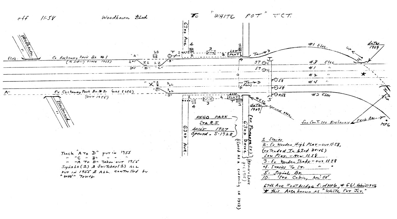 Emery map Woodhaven Blvd to White Pot MP6 11/58 Archive: Dave Keller
|
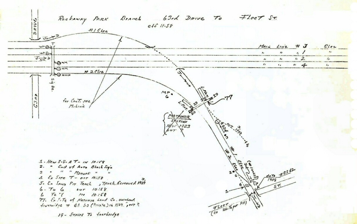 Emery map Rockaway Branch 63rd Drive to Fleet St 11/58 Emery map Archive: Dave Keller Emery crossed out Matawok Station for
incorrect dates only. Matawok station did exist at that
location; see following section. The spring switch was installed when they single-tracked the branch to Ozone Park; location #1 on map above. Info: Brad Phillips |
|||||
|
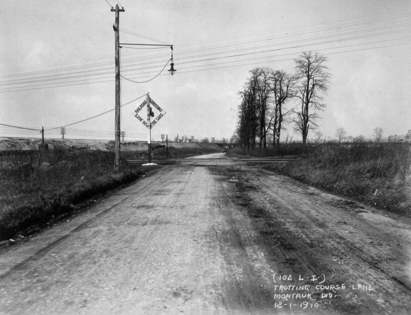
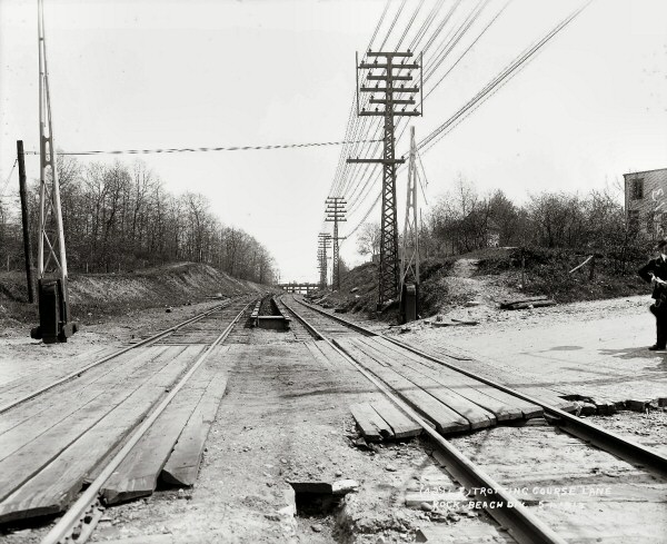
MATAWOK |
|||||||
|
OPENED: JUNE (?), 1910 WITH OPENING OF GLENDALE CUT-OFF. ORIGINALLY LOCATED 500' SOUTH (RAILROAD EAST) OF TROTTING COURSE LANE CROSSING AND 740' NORTH (RAILROAD WEST) OF MYRTLE AVE. OVERGRADE CROSSING. LISTED ON ETT #58, EFF: 9/8/1910. NO INDICATION OF STATION BLDG. PLATFORMS ONLY. STATION POSSIBLY DESTROYED BY FIRE IN EARLY 1913. (Data and LIRR blueprint and photo provenance by Art Huneke)
REPLACEMENT
STATION BUILT 1.1 MILES NORTH OF ORIGINAL LOCATION AT FLEET ST.
(FORMERLY WHITE POT RD) UNDER-GRADE CROSSING SOUTH OF WHITE POT JCT.
(Data and map provenance by Richard F. Makse). NO TRAINS INDICATED AS
STOPPING THERE. DOES NOT APPEAR ON PUBLIC TIMETABLES AT ALL. LAST
LISTED ON ETT #69, EFF. 5/25/13. PERMANENTLY CLOSED. DISAPPEARS FROM
SUBSEQUENT ETTS.
Research: Dave Keller
|
|||||||
|
|
|||||||
| PARKSIDE | |||||||
|
|
|
||||||
 Parkside- Metropolitan Ave View NE c.1940's BMT Trolley Metropolitan Ave. Line, abandoned June 12, 1949 Archive: Bill Mangahas |
 LIRR Eastbound (View N) MU at Parkside c.1955 (W. J. Edwards photo, Dave Keller archive) |
 MU at Parkside - LIRR eastbound- View N 1956 Archive: Dave Keller |
|||||
 MU train at Parkside Station view NW at Metropolitan Ave. 5/27/1958 Archive: Dave Keller |
 Parkside from last train: 6/08/1962 Photo/Archive: Brad Phillips |
 Parkside Metropolitan Ave View SE Google maps 2018 |
|||||
| GLENDALE JUNCTION | |||||||
|
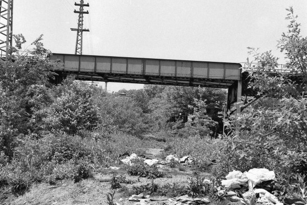
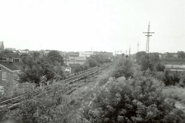
The Rockaway branch was originally built in 1880 from the Montauk branch east of Glendale at a spot called Glendale Junction, heading south towards Jamaica Bay. It crossed the LIRR's Atlantic branch at Woodhaven Jct. via trestle. The LIRR's FIRST electrification was in place in 1905 between Flatbush Ave., Woodhaven Jct. and Rockaway Park. The Glendale Cut-off was an electrified extension of this branch placed in service in 1910 northward from Glendale Junction to a connection with the Main Line via the underjump at Whitepot Jct. east of what later became Rego Park. Electrification was put in place between Glendale Jct. and Woodhaven Jct., bringing thru-electrification to the entire branch and cut-off. See the photo below. View is north. Tracks in foreground are the Montauk branch. Embankment in the left background is the recently constructed Glendale Cut-off. This embankment carried the Rockaway Beach branch northwards to the Main Line at Whitepot Jct. Note the fresh dirt on the embankment. |
|||||||
|
|
|
 Trestle remains over the Montauk Branch at Glendale view E 12/1970 Archive/Photo: Dave Keller |
|||||
|
|
 Glendale Jct. Hagstrom map 1934 Archive: Dave Keller 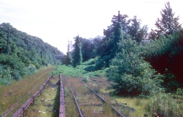 Glendale Jct. track remains view S 9/1962 Archive: Art Huneke |
 Trestle remains over the Montauk Branch at Glendale Jct. view SW 4/1965 Photo/Archive: Brad Phillips
Glendale Junction view
south towards Trotting Course Lane crossing and the Interboro Parkway
overpass. Double tracks at left of Rockaway Beach branch.
West leg of connection track to Montauk branch curving in the
foreground. Info: Dave Keller |
|||||
|
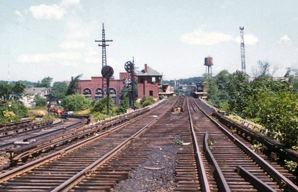
Looking east c. 1958 photo (above left) from the Woodhaven Blvd. overpass, an MU electric train on the Rockaway Beach branch is crossing over the Montauk branch at what was formerly Glendale Junction. The gated siding at the far left serviced the Standard Tube Co. The siding to the left of the main tracks curved around and serviced the General Electric warehouse, the General Fibre Box Co. and Henry Pape, Inc., stopping just short of Metropolitan Ave. "JD" tower once controlled the junction and stood to the right of the Montauk branch tracks, approximately where the near telephone pole is shown and was removed in 1910. A track curved southward off the Montauk branch, making the connection with the Rockaway Beach branch. There was a team track at this location and at the far right was the former storage yard for LIRR high tension poles. Service ended on this final portion of the Rockaway Beach branch in 1962, and the distant trestle was destroyed by fire sometime later. Its remains were visible for decades later. Research/Archive: Dave Keller |
|||||||
|
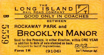
BROOKLYN MANOR:
OPENED: MAY, 1910 AT JAMAICA AVE. LISTED ON ETT #58 AND #59,
SEPTEMBER AND NOVEMBER, 1910 AS THE RELOCATED BROOKLYN HILLS STATION.
NAME CHANGED TO BROOKLYN MANOR: 1/9/1911. PART TIME
The Main track as well as the
station stops (Rego Park, Parkside, Brooklyn Manor, Woodhaven and
Ozone Park) were all taken out of service on 6/08/1962 per G.O. #903.
Agencies were closed prior to that date. Research: Dave
Keller |
|||||||
 Brooklyn Manor Station - Jamaica Ave. 1920 Archive: Tony Tenaglia |
%20(2).jpg) MU at Brooklyn Manor southbound 1950 Photo: W. J. Edwards Archive: Dave Keller |
%20(1).jpg) MU at Brooklyn Manor southbound 1950 View S (railroad east) - Photo: W. J. Edwards Archive: Dave Keller |
|||||
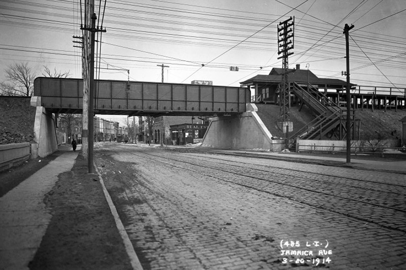 Brooklyn Manor - View E down Jamaica Ave 3/20/1914 Archive: Art Huneke Note: Photo is before the BRT Jamaica Line elevated was built! Although the Glendale Cutoff was opened in 1909, Brooklyn Manor station here only replaced the original Brooklyn Hills station (up at Myrtle Ave) on 1/09/1911. In this picture, the station is only a little over three years old. Info: Jeff Erlitz
|
 Brooklyn Manor c.1955
#1 shows the Rockaway-bound high
level platform, now unusable (since 10/29/1958).
|
||||||
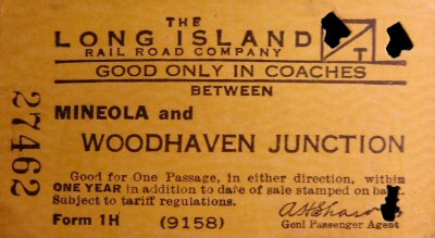
|
|
 The 1H reverse stamped with the RP #4 die 1944 GPA E. R. Comer |
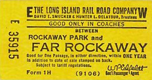
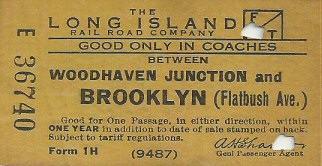
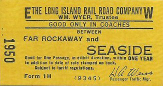
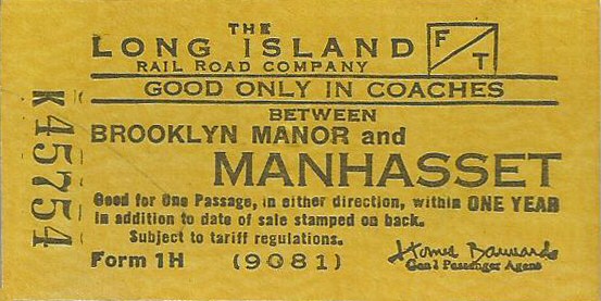 Brooklyn Manor to Manhasset ticket Form 1H Archive: Brad Phillips GPA: Bannard c.1948 |
|||||
|
"Multi-branch" printed
tickets (i.e., forms 1 H) were very rare; usually these tickets were
written using blank stock (LH-261/262). Working the extra board
as a ticket clerk from 1965 - 1973 I sold tickets at many LIRR
stations and never saw one except for the World's Fair tickets in
1964-65, which almost all stations had due to the large volume of
traffic to the fair. I have a Sag Harbor to East Hampton printed
ticket, so there were some over time but not very many. I'm
guessing there was a regular traveler(s) from Brooklyn Manor to
Manhasset which prompted the agent to order the ticket stock. It
was pretty much up to the local ticket seller to determine if a
printed ticket was justified. Info: Brad Phillips |
|||||||
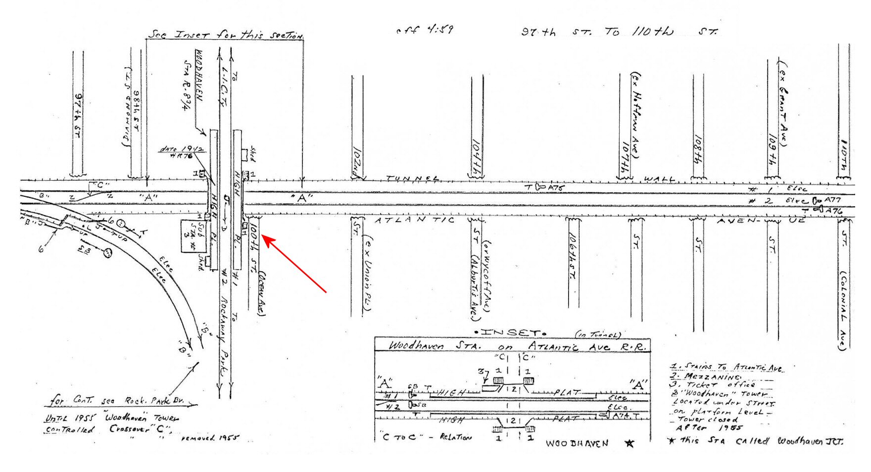
| WOODHAVEN JCT. | |||||||
|
WOODHAVEN JCT.: ELEVATED STATION CROSSING OVER ATLANTIC BRANCH WHICH
RAN AT GRADE ALONG ATLANTIC AVE. OPENED: ?. RAZED: c. 1940 DURING
ATLANTIC AVE. IMPROVEMENT PROJECT 2ND ELEVATED STATION, DESIGNED BY |
|||||||
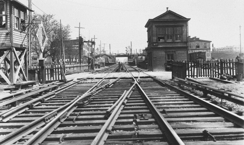
.jpg) MP41 MU train is heading eastbound on the Atlantic branch and the lead car is just entering the Rockaway Beach branch at Woodhaven Junction on September 1, 1907. This view is looking west from "WT" interlocking tower at the Junction (Dave Keller data and archive) |
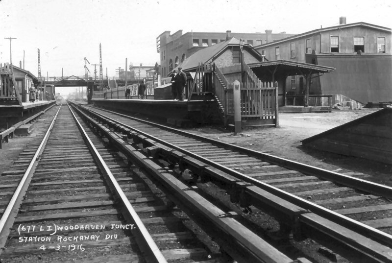 Woodhaven Jct. Station - View E towards Rockaway Division - Valuation photo 4/03/1916 (LIRR-Keller)
|
.jpg) The old, wooden, Woodhaven Jct. station is seen here in this c. 1925 view looking northwest. The LIRR electric sub-station number #3 at Atlantic Avenue is behind the platform shelters. This depot was razed in November, 1939 and its replacement built out of brick and concrete as a result of the grade elimination project along Atlantic Avenue. (James V. Osborne photo, Dave Keller archive and data) |
|||||
.jpg) An MU electric train is heading northbound (railroad westbound) at the 1939-40-era Woodhaven Jct. station. View is northeast (W. J. Edwards photo, Dave Keller archive and data)
Woodhaven Jct. only had a connection between the two branches with a curved track in the southwest quadrant of the junction. MU trains running southbound along here to Brooklyn would cross the Atlantic branch, clear the switch south of the station, then reverse direction and head westward to Flatbush Avenue. This procedure would be reversed to head BACK to Penn Station.
After the 1940-41 improvement, the station on the Atlantic branch was referred to as "Woodhaven Jct" and the elevated station on the Rockaway Beach branch was referred to solely as "Woodhaven." Dave Keller
|
 WT Tower - Woodhaven Jct. - Atlantic Branch 4/24/1918 Archive: Dave Keller
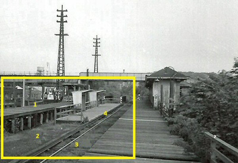
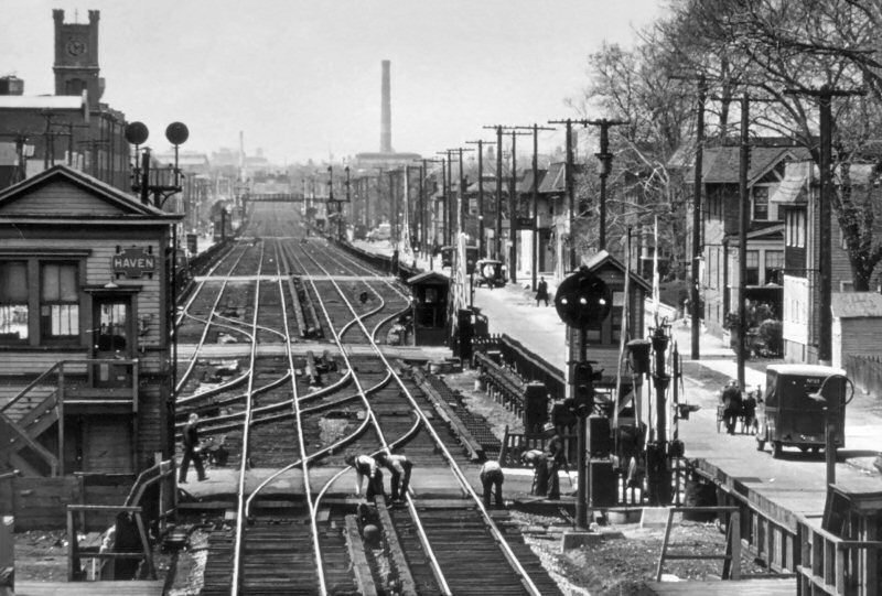
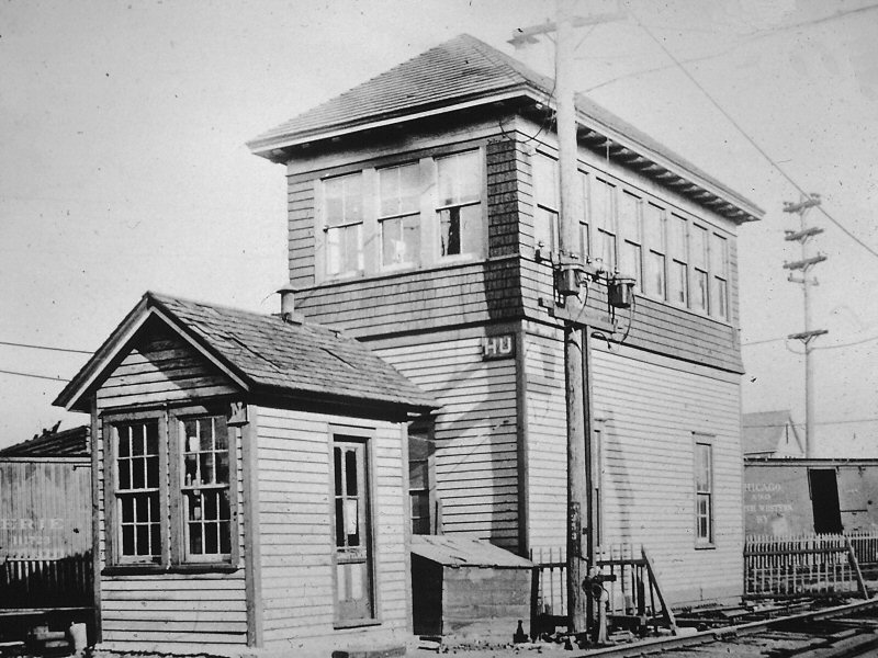
Super view looking west from the upper level Rockaway Beach Branch platform at Woodhaven Junction in April 1938, just a year and a half before the shoo-fly tracks were placed in service for the Atlantic Avenue grade crossing elimination project. Haven Tower and Interlocking are front and foremost but you can see Woodhaven station in the distance and a bunch of automatic block signals that are still lower quadrant semaphores on bracket masts. Most of the signals in this interlocking had been converted from lower quadrant semaphore to position light between 1930 and 1935. Haven was formerly known by its telegraph call letters, WT, and was renamed
HAVEN on 4/15/1937. Woodhaven Junction station, looking east from about WT Tower, just east of Napier Avenue (today's 97th Street) on 4/3/1916. That's automatic block signal A59 mounted on the Rockaway Beach Branch overpass. Almost 20 years later, on 9/18/1935, that signal was relocated east 425 feet and converted from lower quadrant semaphore to position light. Over on the right is Sub-Station #3, one of the original 1905 electrification sub-stations. Info: Dave Keller
|
 Woodhaven Jct. view NW from Rockaway Branch 05/23/1939 Archive: Art Huneke
|
|||||
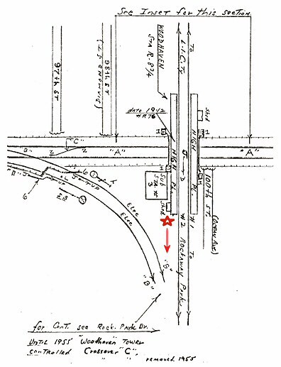 OZONE TOWER: The tower was located at the southernmost end of the Woodhaven Jct. station platform on the west side of the tracks (same side as the electric sub-station) where Emery's map is indicated by the red star. |
|
|
|||||
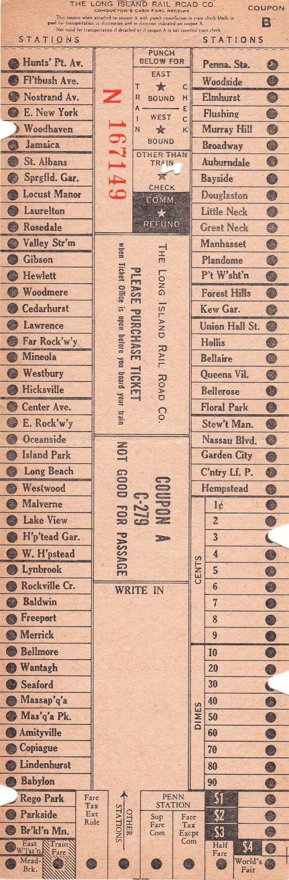 1962 IRR Coupon B Cash Receipt Form C-279 |
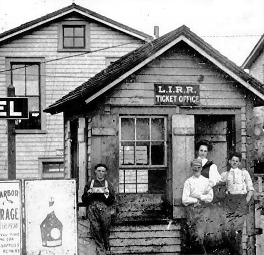
The C-279 forms (C-278 for steam territory) were revised many times over the years as stations changed. Interestingly, there were no Rockaway names on the C-279's for years after the 1950's abandonment of the Rockaway service via Valley Stream. Then, about 1961, they dropped East Williston and Meadowbrook and added the Rockaway stations. Note they did not list Ozone Park, and Woodhaven was already there for the Atlantic Division. Info/Archive: Brad Phillips
|
 Brad Phillips Woodhaven sign (now with RR Museum of LI). The LIRR's Atlantic branch tracks were placed under Atlantic Ave. and the old rapid transit station stops eliminated. One such stop was at Woodhaven. With the discontinuance of that station stop, the Woodhaven Junction stations on both the Atlantic and Rockaway Beach branches were renamed "Woodhaven" sometime during 1940-41 and although the actual junction remained in service until June 8, 1962, the "Junction" portion of the name was dropped. Data: Dave Keller
|
|||||

|
|||||||
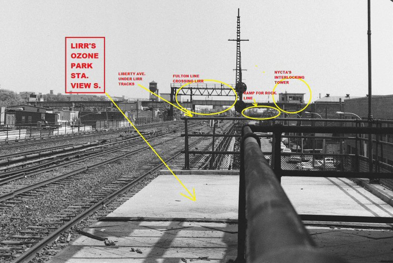
| "RK" TOWER | |||||||
|
OZONE
PARK - JCT. OF
ATLANTIC AND ROCKAWAY
BEACH BRANCHES. (FORMERLY
TOWER #91. ABOVE STATION BUILDING AT
GRADE ON WEST SIDE OF TRACKS.
TAYLOR 28 LEVER MECHANICAL MACHINE |
|||||||
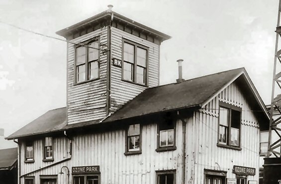 In this LIRR valuation image (zoom) from May, 1914, we see the old Ozone Park station at grade. What was unusual about this depot building is that RK interlocking tower was built as part of the structure, affording a good view down the tracks towards nearby Woodhaven Junction. This view is looking southwest. The depot was razed when the tracks were elevated through here in 1931. (Dave Keller archive) |
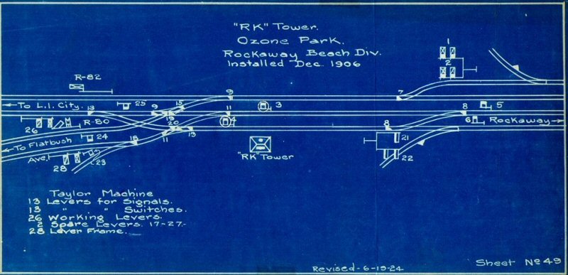 RK Interlocking blueprint revised 6/19/1924 The RK Interlocking diagram shows a single slip crossover 9-15-19, which permitted moves between the Rockaway Beach and Atlantic Branch.
|
 View West towards Woodhaven Jct. trackage from "RK" Tower
|
|||||
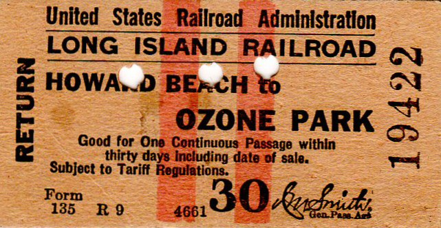
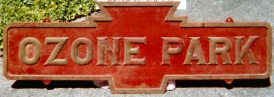
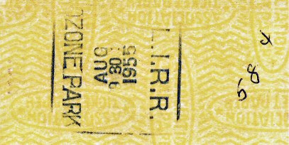
| OZONE PARK | |||||||
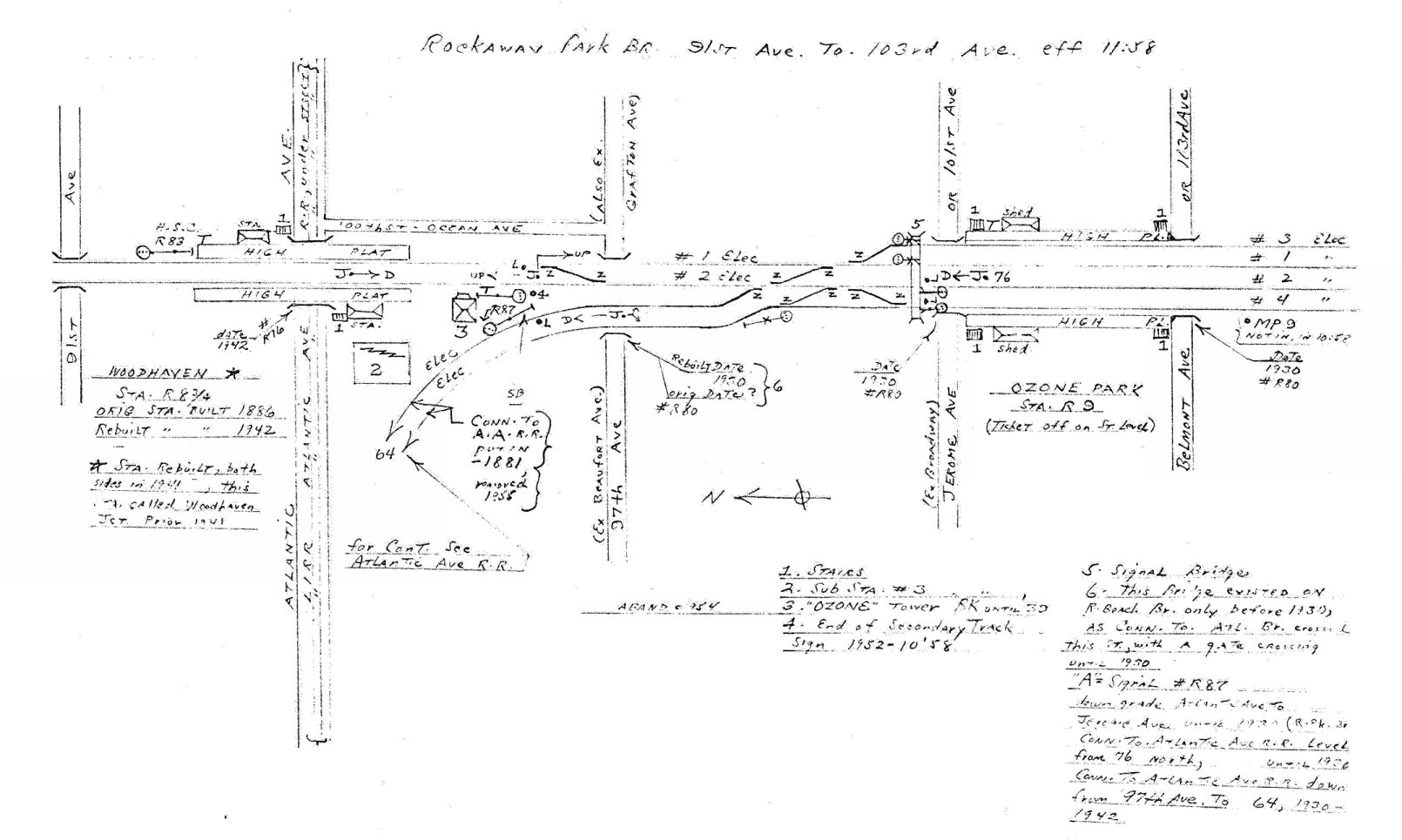
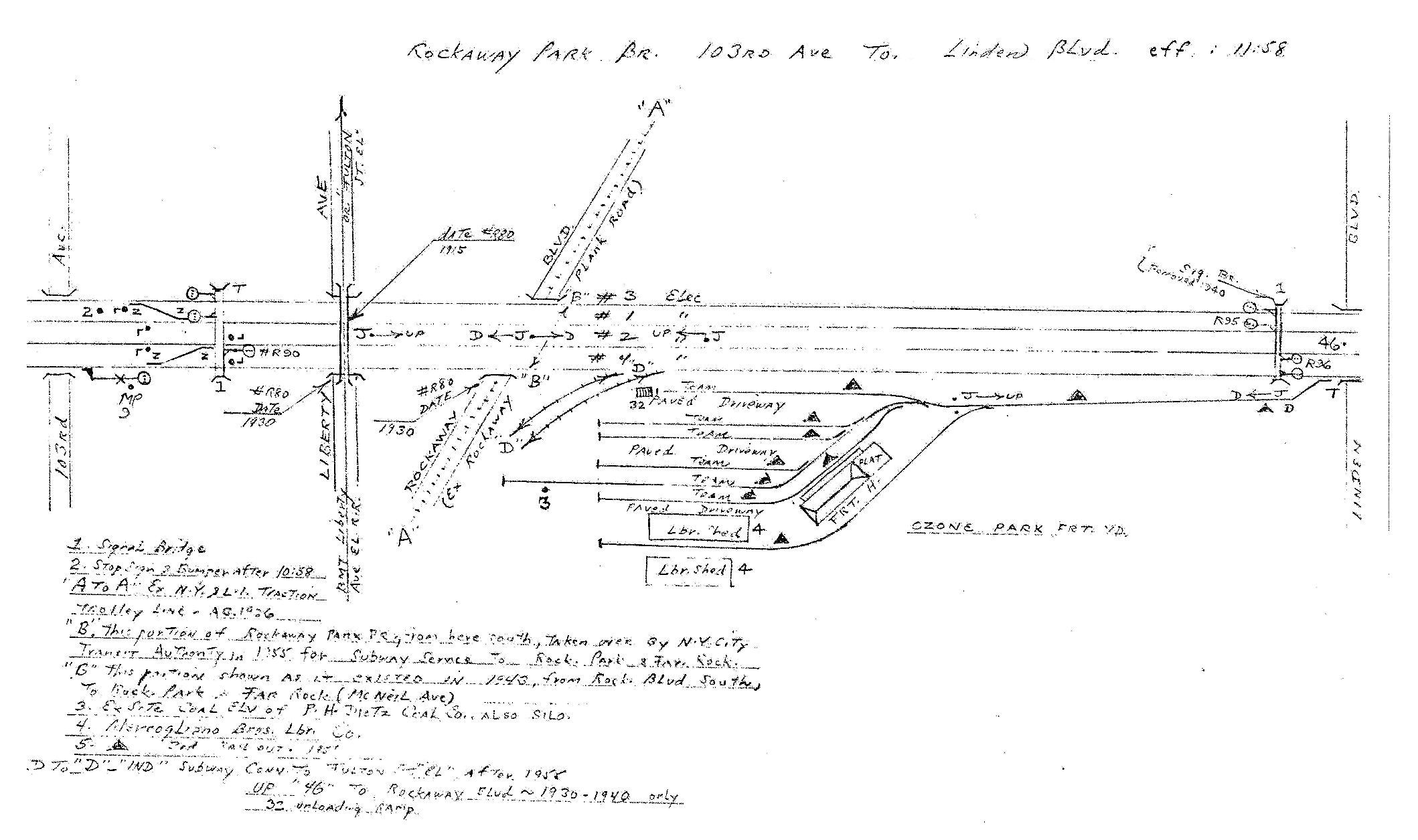
Emery Map -Ozone Park 91st Ave - 103rd Ave 11/1958 |
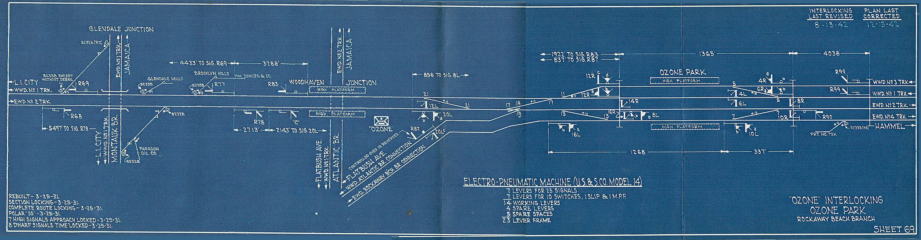 Ozone Interlocking blueprint 12/15/1942 Archive: Stephen McEvoy |
||||||
|
1884:
Original station constructed. 5/5/1930: Westward station facilities out of service due to account
grade crossing elimination. |
|||||||
| The OZONE PARK STATION Sign Story | |||||||
|
Having several duplicate items, Dick graciously offered me an assortment of signs (Woodhaven and Ozone Park being the most significant). The only hitch: getting them from Woodside to my home in Amityville. Being too young to drive (legally, anyway), my only option was the train. The Woodhaven sign and some other small items weren't too difficult; they were heavy and awkward, but manageable on the long walk to the Woodside station. The Ozone Park sign, however, was the typical PRR keystone cast iron sign, about 5 feet in length, and weighed about 150 lbs. A separate trip, and handling equipment, for that sign alone would be required.
Dick's Dad had
a small dolly which did the trick. You should have seen the
looks on people's faces as I carted the rusty sign through Winfield
and down to the LIRR platform at Woodside. Loading the sign on
the train from the high-level platform was no problem but the dolly
had to come too. I diligently propped-up the sign and dolly in a
vestibule, the trainman being unusually patient during the trip
to Amityville. Then it was down the steps to the low-level
platform at Amityville. At this point, the patient
trainman offered no help and it took me about 5 minutes to get the
sign and dolly safely off the train in one piece. The amused
and unbelieving stares of commuters made the whole tedious process
worthwhile! Then another mile-plus hike to my home and down 15
steps to the basement. Over the next month I scraped, sanded, and then painted the sign with my best attempt at PRR red and gold. It looked great in my basement model train room. A few years later I was off to college, marriage, the US Navy, and a business career which moved me from Long Island to several states and, eventually and finally, to California. The signs gathered dust at my parent's Amityville home for 20 years. Then, on relocating to California with a change of job, I took the signs with me. Finally, after another 25 years in my garage and realizing that I'd never have the proper place to display them, I sent them back home to the Railroad Museum of Long Island in Riverhead where they reside today. Having not been back to Long Island for almost 20 years to see for myself, I'm hoping they're on display for visitors to enjoy. Courtesy of Dick Makse and Brad Phillips |
|||||||
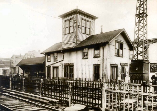 In this LIRR valuation image from May, 1914, we see the old Ozone Park station at grade. What was unusual about this depot building is that RK interlocking tower was built as part of the structure, affording a good view down the tracks towards nearby Woodhaven Junction. This view is looking southwest. The depot was razed when the tracks were elevated through here in 1931. (Dave Keller archive) |
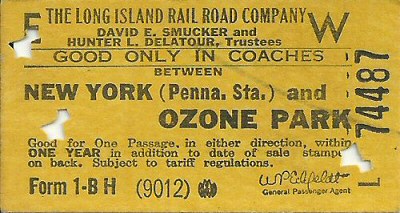
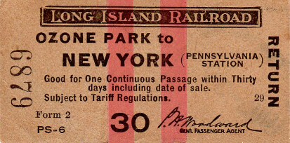 Ticket Ozone Park to Penn Station c.1925 - Archive: Brad Phillips |
|
|||||
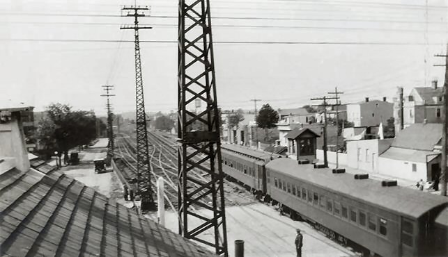
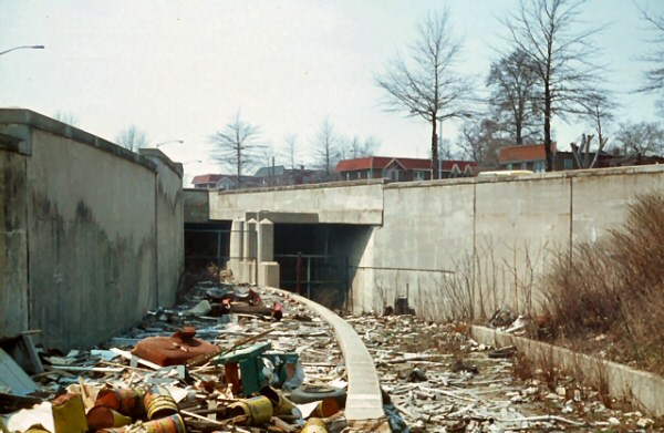
 Ozone Park street level view E 4/1965 Photo: Brad Phillips |
.jpg) ROW Ozone Park street level view S 5/1970 Archive: Dave Keller |
 Ozone Park Eastbound Platform view W 4/1965 Photo: Brad Phillips |
|||||
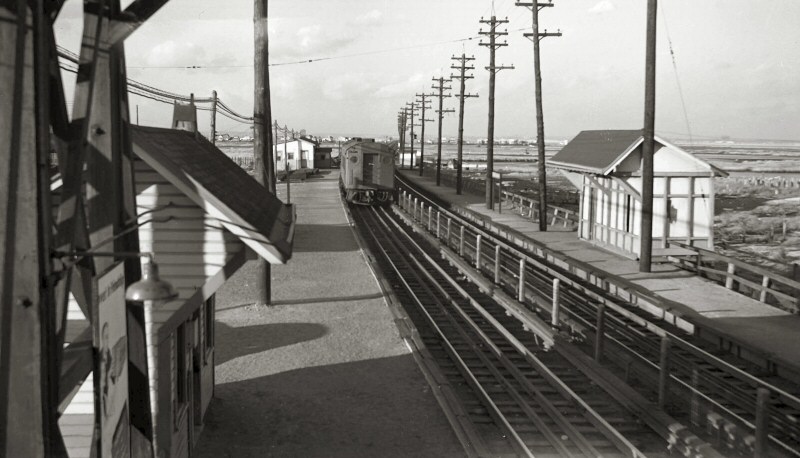
 Ozone Park view N ("railroad west") 7/1958 Photo: Art Huneke 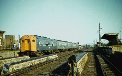 Ozone Park - MU Last train view S 6/08/1962 Photo: Brad Phillips |
 Ozone Interlocking from Atlantic Division connecting track 4/1965 Photo: Brad Phillips  Ozone Park station view E 6/1962 Photo: Brad Phillips |
 Ozone Interlocking view W 4/1965 Photo: Brad Phillips |
|||||
.jpg) Station Ozone Park MU train view N 1954 Photo: Edwards Archive: Dave Keller |
.jpg) Station Ozone Park Budd RDC 1, 2 Railfan Extra 4/28/1957 Archive: Keller |
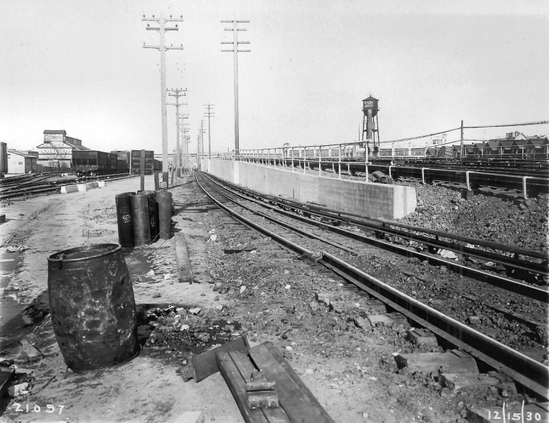 Ozone Park 1930 freight yard view N - Quartin Paper boxes Water tower Archive: Art Huenke |
|||||
.jpg) ROW Ozone Park track level view N 5/1970 Archive: Keller |
.jpg) ROW Ozone Park track Level view S 5/1970 Archive: Keller
|
.jpg) An MU electric train in Tichy color scheme is heading northbound (railroad westbound) at the Ozone Park station in 1950. This view is looking northwest. (W. J. Edwards photo, Dave Keller archive and data) |
|||||
 Last Run ticket Penn Station to Ozone Park 6/08/1962 Photo/Archive: Brad Phillips  |
 Only a 5 car consist on the last train in Ozone Park ending on what was left of the Rockaway Beach Branch. 6/08/1962 - Photo: Matt Herson  Ozone Park view N - 6/22/2018 Photo/Archive: Joe Diecidue |
 LIRR Notice 5/14/1962 - Rockaway Beach Branch lease expiration - Last run 6/08/1962 Archive: Brad Phillips |
|||||
|
After the 1950 trestle fire there was NO transit service to Rockaway Park OR to Far Rockaway. The LIRR stopped at Hamilton Beach, making stops at Ozone Park and Aqueduct Racetrack. After 1955, the LIRR terminated ALL their trains at Ozone Park until service was completely ended in 1962.
ROW Ozone Park track Level View S 5/1970 with Annotations/Info/Archive: Dave Keller |
|||||||
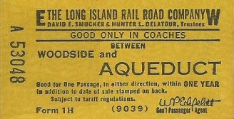
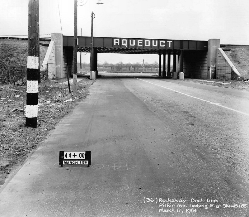
| AQUEDUCT | |||||||
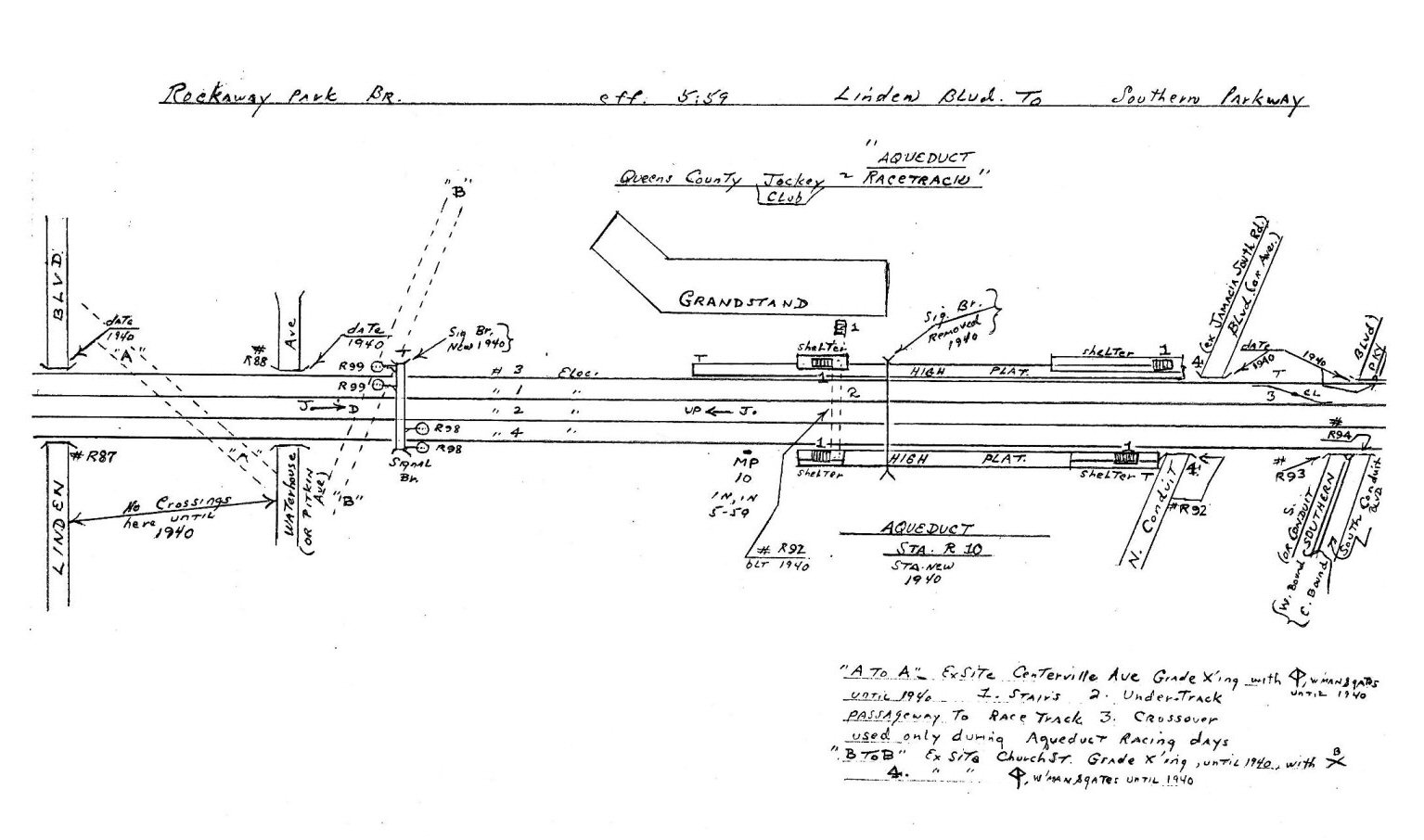 Emery Map Aqueduct post-1940 Archive: Dave Keller |
 Emery Map -103rd Ave to Linden Blvd 11/1958 |
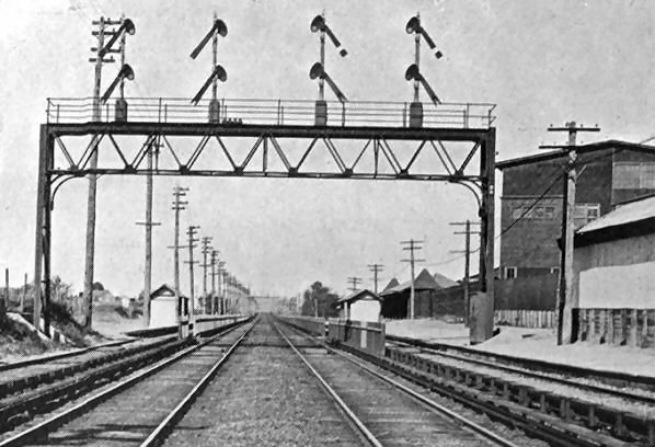
 Woodhaven-Ozone Park-Aqueduct Stations per G.O. 201 - 5/08/1955 Archive: Jeff Erlitz Adams Crossover Switches, from Timetable #2 dated 5/8/1955. Note that just to the right (railroad east) of Aqueduct station the four tracks reduced back to two. |
|||||
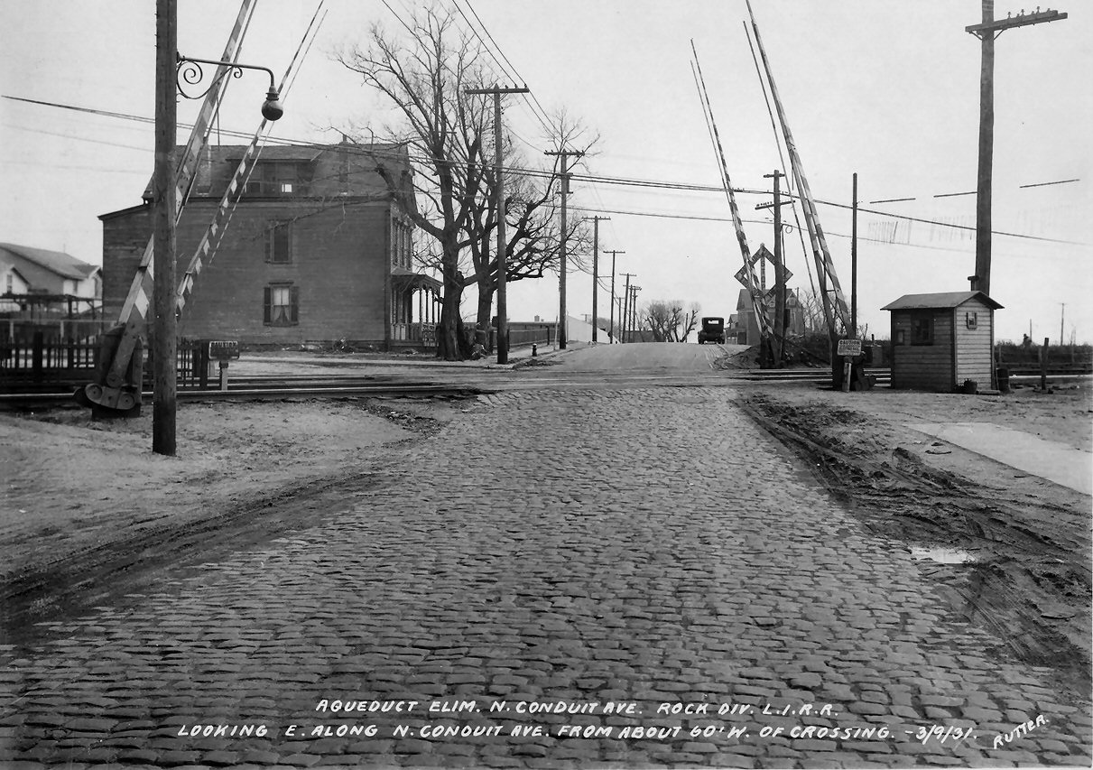
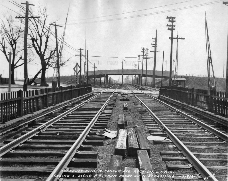
| Aqueduct Vicinity Grade Crossing Elimination Project | |||||||
| Edgar E. Rutter Photograph Collection, Queens Public Library photographs of the grade crossing elimination project in the vicinity of Aqueduct station prompted by the construction of the Belt Parkway. They were all taken on March 9, 1931. The railroad finally switched over to its temporary shoo-fly tracks for this elimination project on November 29, 1939! | |||||||
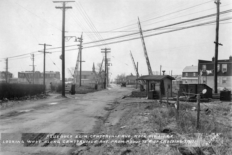 Looking west along Centerville Avenue across the tracks. After the elimination this street, now known as Centerville Street, no longer crossed the tracks. |
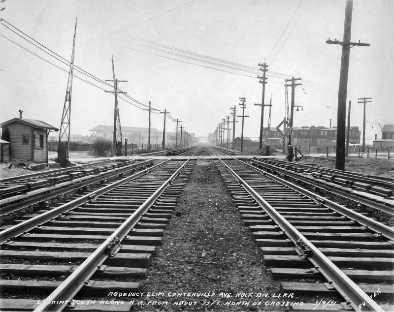 Looking south at Centerville Avenue with the original Aqueduct Racetrack grandstand in the left distance. |
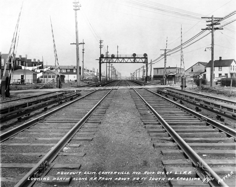 Centerville Avenue crossing view N Signal Bridge R93 |
|||||
|
(Above right) This is looking north at Centerville Avenue crossing. However, note the signal bridge, which is Signal Bridge R93. You are looking at the home (and dwarf, or low home) signals of CV Block Station! CV was the east end of the temporary shoo-fly tracks for the Ozone Park grade crossing elimination project! CV Cabin can be seen on the right side of the right-of-way beyond the signal bridge. The Ozone Park elimination project was completed two weeks after this photo was taken, on March 25. Talk about timing being everything! This exact track and signal configuration lasted from 12/15/1930 to 3/25/1931, that is all! This is a microscopic slice of LIRR history right here in this photo! Note also the abandoned signal masts on the left side of the signal bridge. Those were lower quadrant semaphore automatic block signals R93. Sometime between May 21 and December 15 in 1930 they were replaced with the position light signals seen on the bridge here. |
|||||||
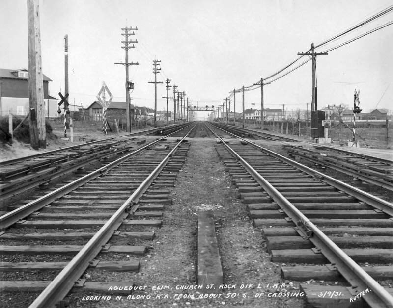 Looking north at Church Street, now 135th Avenue. Like Centerville, this street no longer crosses the tracks. Centerville and Church were replaced with new undergrads bridges at Linden Blvd and Pitkin Ave. |
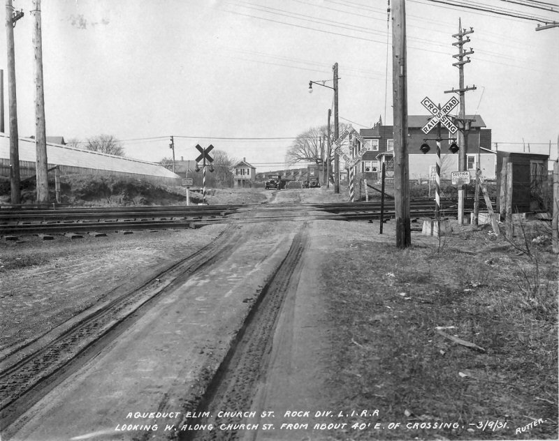 Looking west along Church Street. Note the early style grade crossing signal lights, as well as the large, cast iron Caution signs for the third rails. |
 At the south end of Aqueduct station is North Conduit Avenue. This is looking east. Paving blocks on this side and dirt on the other. |
|||||
 Looking north (railroad west) from the Conduit Avenue overpass, which was built in 1926. It was grade separated because it was, and still is, NY State Route 27. The bridge was torn down in 1942 with the construction of the Belt Parkway. |
 Looking west down North Conduit Ave. at the crossing. The crossing watchman’s shanty is on the far side on the left.
|
 Looking south across North Conduit towards the “main” roadway of Conduit Avenue |
|||||
|
|
|||||||
.jpg) Old crossing of Centerville Ave. (the name is incorrect on the official LIRR photo) located just north of the Aqueduct Race Track. view NE 10/21/1910 Archive: Dave Keller
|
|
.jpg) It's race day in 1949 and an MU electric train heading northbound (railroad westbound) is making the station stop at Aqueduct. Note the color scheme of the last car: Tuscan Red with bright aluminum-painted roof. View is northeast. (W. J. Edwards photo, Dave Keller archive and data)
|
|||||
|
Note: The photo (above center) is an official LIRR valuation image. When these images were taken a sign was placed visibly so the exact date and location of the image was preserved on the film, eliminating any question later on as to when and where the image was taken. This photo not only shows the date, but the mileage via the linkage system. Info: Dave Keller |
|||||||
|
RACE CABIN |
|||||||
|
AQUEDUCT RACEWAY (TEMPORARY BLOCK STATION WITH NO FIXED SIGNALS IN SERVICE DURING RACING SEASON ONLY. EAST SIDE OF TRACKS AND 380' SOUTH [RAILROAD EAST] OF EAST END OF AQUEDUCT STATION. IN SVC: 6/14/54 PER
G.O. #2228; OUT OF SVC: 7/10/54 PER G.O. #102; 8/30/54 TO 9/21/54 PER
G.O. #105; 6/13/55 TO 7/9/55 PER G.O. #204; 8/29/55 TO 9/20/55 PER G.O. #212.) |
|||||||
|
|
RACE Cabin: View N (railroad W) towards the 1940 Aqueduct station 6/26/1955 Photo: Bill Rugen Archive: Dave Keller
By
1954 and 1955, when "RACE" cabin was in operation, the
tracks ended at Hamilton
Beach
on the north shore
of
|
||||||
.jpg)
|
|||||||
|
"CL" on the crossover indicated in the red circle indicates a "Center Locked Crossover."
The switch lever / handle was located between the tracks where you see the red arrow. The switch tender and/or block operator would throw this lever and it would operate BOTH ends of the crossover switches at the same time; like two switches on a Lionel O-gauge train layout working in conjunction with each other as you throw one and they both operate. Info: Art Huneke Also, if you note that "RACE" cabin does not appear on Emery's map, that's because the cabin was in existence in 1954-55. The Emery map depicts the track layout as it appeared in 5/1959. Info: Dave Keller |
|||||||
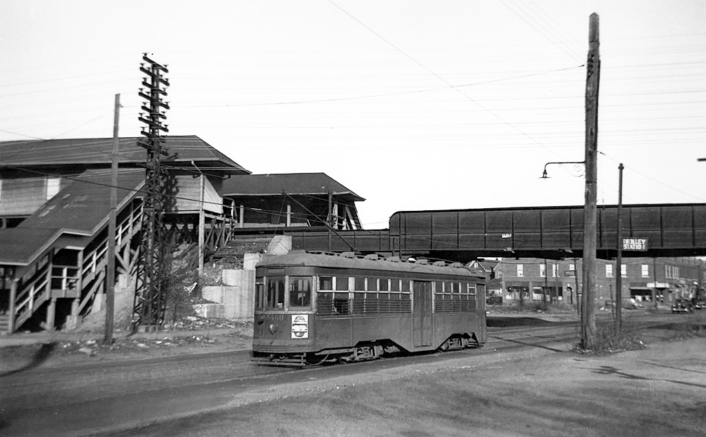
| HOWARD BEACH | |||||||
|
RAMBLERSVILLE: Opened: ? At 160th St. Closed: 4/1913 when
station stop relocated north 0.2 miles. Renamed “Howard Beach”:
4/1916
|
|||||||
| HOWARD BEACH: OPENED: 04/1913, AS “RAMBLERSVILLE” REPLACING ORIGINAL STOP 0.2 MILES SOUTH. RENAMED: 4/1916. SUMMER AGENCY ONLY AS OF 1/01/1924. AGENCY CLOSED: ? DEPOT REPLACED WITH SHELTER SHED ON OPPOSITE SIDE OF TRACKS SOMETIME IN THE MID-1930s. STATION STOP OUT OF SVC: 6/27/55. ACQUIRED BY NYCTA, RAZED: SUMMER 1956 Research: Dave Keller | |||||||
 Emery Map - Howard Beach Station Southern State Pkwy to MP11 5/1959 |
.jpg)
Howard Beach station looking north from the trestle over Hawtree Creek on October 3, 1934. The boardwalk at the right has been built atop the trestle span. Note the absence of any sort of guardrails! (Dave Keller data and archive) |
.jpg)
This view of Howard Beach station is looking south from the pedestrian overpass on December 17, 1934. The depot is at the far left and former freight house at the right. The trestle over Hawtree Creek is in the center of the image and narrow, rickety boardwalks are everywhere! (Dave Keller data and archive) |
|||||
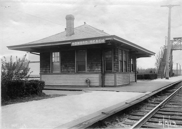
The old, wooden, Howard Beach depot building is seen here in this LIRR valuation photo SE view 5/06/1919. Originally opened in April, 1913 as "Ramblersville", it replaced the original station stop named "Howard" which was 0.2 miles south of this location. It was renamed "Howard Beach" in April 1916, and, in the mid-1930s, was replaced with a shelter shed on the opposite side of the tracks. Dave Morrison collection, Dave Keller data |
 |
Note: Old round dater die stamp from Ozone Park. Info: Dave Keller |
|||||
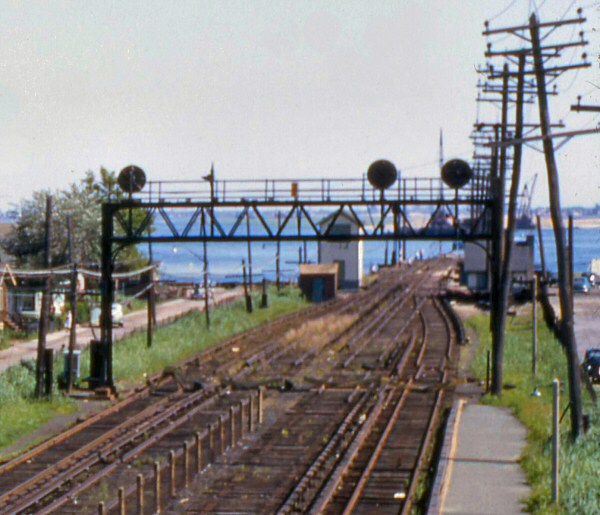
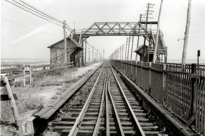
| HAMILTON BEACH | |||||||
.jpg) An MU electric train is seen here at the Hamilton Beach station. This 1949 view is looking northeast. (W. J. Edwards photo, Dave Keller archive and data)
|
.jpg) Here's a very old view of "WD" tower at Hamilton Beach taken c. 1910 and looking north towards the distant Hamilton Beach station and signal bridge. The power poles crossed over to the east side of the trestle behind the photographer. Originally built in 1904 with the identifying calls of Tower 93, it contained a 16-lever Saxby & Farmer mechanical interlocking machine. In 1907, per general notices, numbered towers on the LIRR system were changed to initials and this tower became "WD" which stood for "West EnD of Trestle." Beginning in 1937, the majority of the calls of block offices (primarily in electrified territory) were changed from initials to names and on May 1 of that year, "WD" became "BEACH." For a short period of time, beginning on November 13, 1939, this tower also contained a Union Switch & Signal Co. 7-lever style TC table machine which remotely controlled "HB" interlocking (Howard Beach). This additional machine was taken out of service on September 26, 1940. (Art Huneke photo, Dave Keller archive and data) 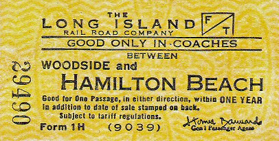
|
.jpg) Hamilton Beach station looking south towards "WD" tower and Jamaica Bay on March 14, 1932. "WD" stood for "West EnD of Trestle" and was changed to "BEACH" tower about 5 years later. In the distance the power poles can be seen switching from the west side of the tracks to the east side of the tracks along the Jamaica Bay trestle. (Dave Keller data and archive)
|
|||||
|
|
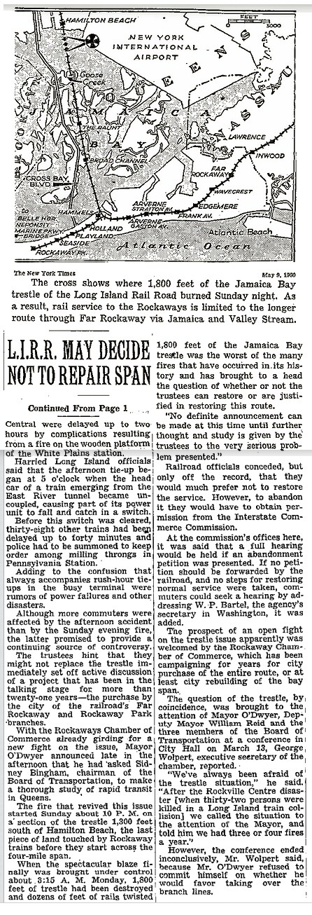
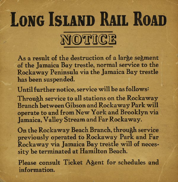
On the Sunday night of May 7, 1950 at approximately 10:00PM, a devastating 1,800' fire on the Jamaica Bay Trestle, south of Hamilton Beach, was destroyed by either sparks or a cigarette that was tossed from the train. The damage was estimated at $1 million. The railroad, then in bankruptcy, could not and would not rebuild it. With the subsequent cutting back of rail service to just north of the tower, BEACH was placed out of service on July 16, 1951. Rockaway
Beach Branch Termination Notice due to the 1950 Jamaica Bay Trestle
fire. Archive: Bill Mangahas |
||||||
|
The big
Jamaica Bay trestle fire started around 10:00 pm on the evening of
Sunday, May 7, 1950 and wasn’t brought under control until about
3:30am on Monday, May 8. I do not know how quickly the railroad
altered service to Rockaway Park that night. In those days, service to
the Rockaways was quite intense, especially on Sundays. They probably
operated an “ad hoc” service from Penn Station and Flatbush Avenue to
Rockaway Park via Valley Stream. |
|||||||
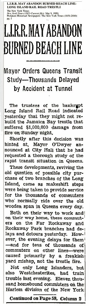
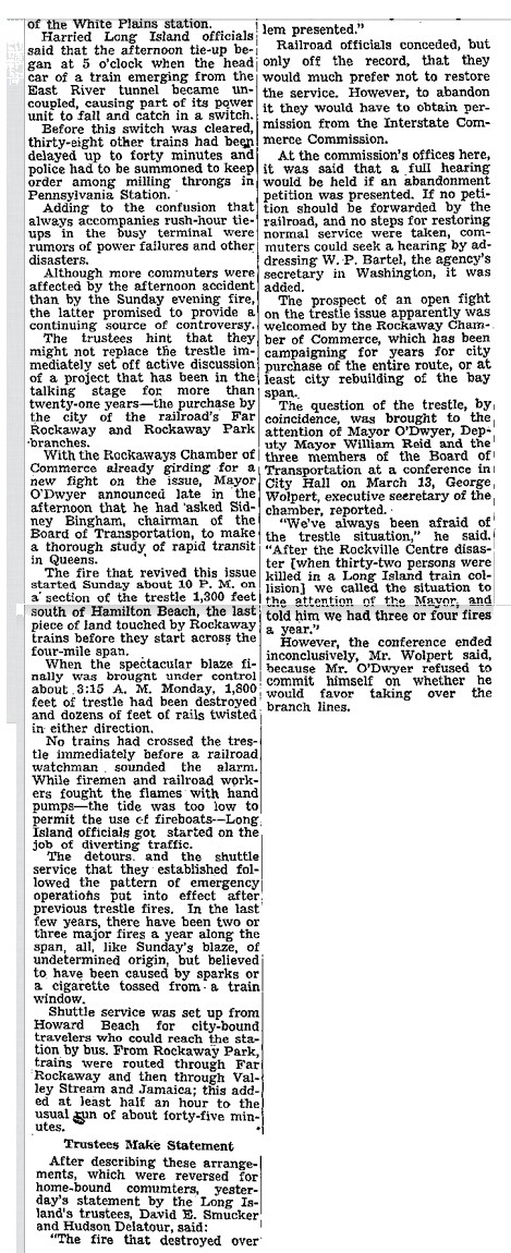
|
NY Times May 9th, 1950 |
|
|||||
.jpg) MP54 MU electric car #1827 and train in Tichy color scheme is laying up at the truncated end-of-track at Hamilton Beach on June 25, 1955. This view is looking northeast. (Bill Rugen photo, Dave Keller data and archive) |
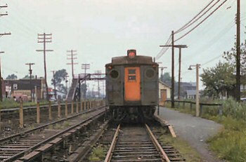 Hamilton Beach MP54 view N 1954 Archive: Brad Phillips |
||||||
 Hamilton Beach Station view S 1953 Photo: Bill Slade Archive: Art Huneke Tthe train in the distance by "BEACH" Tower is laying up or switching tracks for a return trip. The trestle was out of service since the fire in 1950. Dave Keller |
 Hamilton Beach Station - MU at end of line c.1953 view S Archive: Dave Keller |
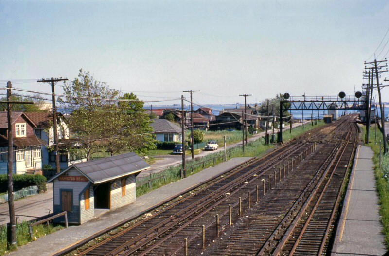 Hamilton Beach - BEACH Tower severed tracks view S to Jamaica Bay 5/1954 Archive: Dave Keller |
|||||
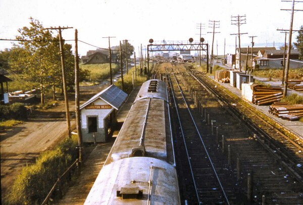
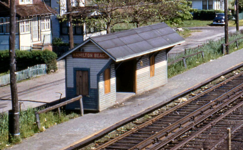 Hamilton Beach Shelter Shed view SE 5/1954 Archive: Dave Keller |
 BEACH Tower - Hamilton Beach severed tracks at Jamaica Bay view S 5/1954 |
 Emery Map Hamilton Beach Station MP11-12 5/1959 |
|||||
|
|
|||||||
| GOOSE CREEK | |||||||
.jpg) In this LIRR valuation photo from August 3, 1914, we are looking north along the trestle and tracks north of the Goose Creek station. (LIRR valuation photo, Dave Keller archive and data) |
.jpg) This terrific view taken the same day as the previous image, shows the Goose Creek station stop on its tiny little tuft of land in Jamaica Bay. This stop was primarily for fishermen. View is south. (LIRR valuation photo, Dave Keller archive and data) |
||||||
| "THE RAUNT" | |||||||
|
Opened:
1900 Out of service: 5/23/50 with abandonment of Jamaica Bay
trestle after fire of 1950 |
|||||||
 "The Raunt" 1933 view N Archive: Brad Phillips 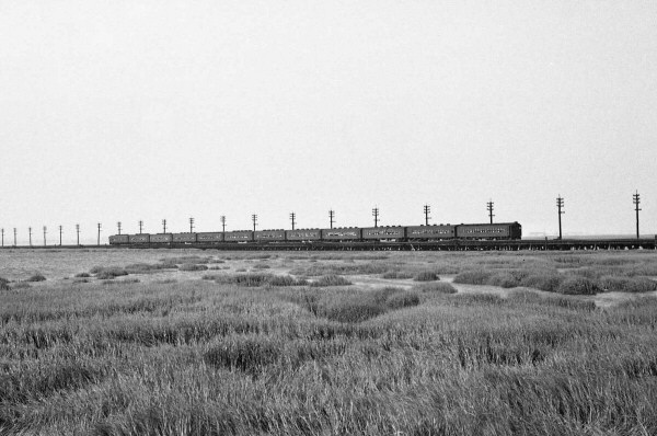 MU 12 car train Jamaica Bay trestle "The Raunt" 7/27/1947 view E Archive: Dave Keller
|
|
 "The Raunt" view S Archive: Brad Phillips
|
|||||
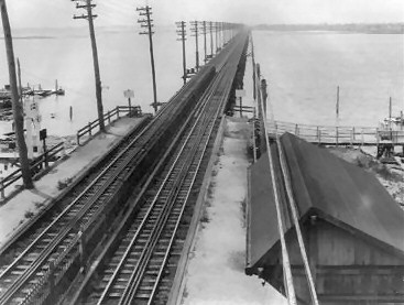
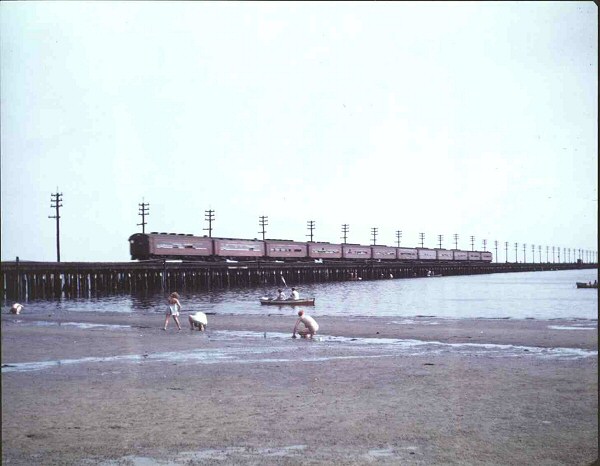
| JAMAICA BAY | |||||||
.jpg) An American-type (4-4-0) steam locomotive is pulling a 4-car train across Jamaica Bay c. 1900. Note the lead car is a baggage/mail car (the mailbag grab bar is visible across the rear door) and the second car is a combine baggage-passenger car which is coupled BACKWARDS. Must've had a lot of extra baggage on that run. Also note the absence of any form of power/telegraph lines along the trestle at this point in time. (Dave Keller data and archive) |
 The Howard station was located 0.1 mile east of "WD" tower ("West End of Trestle" later "BEACH" tower), about where Bill Rugen photographed this MU electric train of all-Tuscan Red, MP54 cars crossing the wooden trestle over Jamaica Bay sometime in the late 1940s. View is southeast. (Bill Rugen photo, Art Huneke archive and data) |
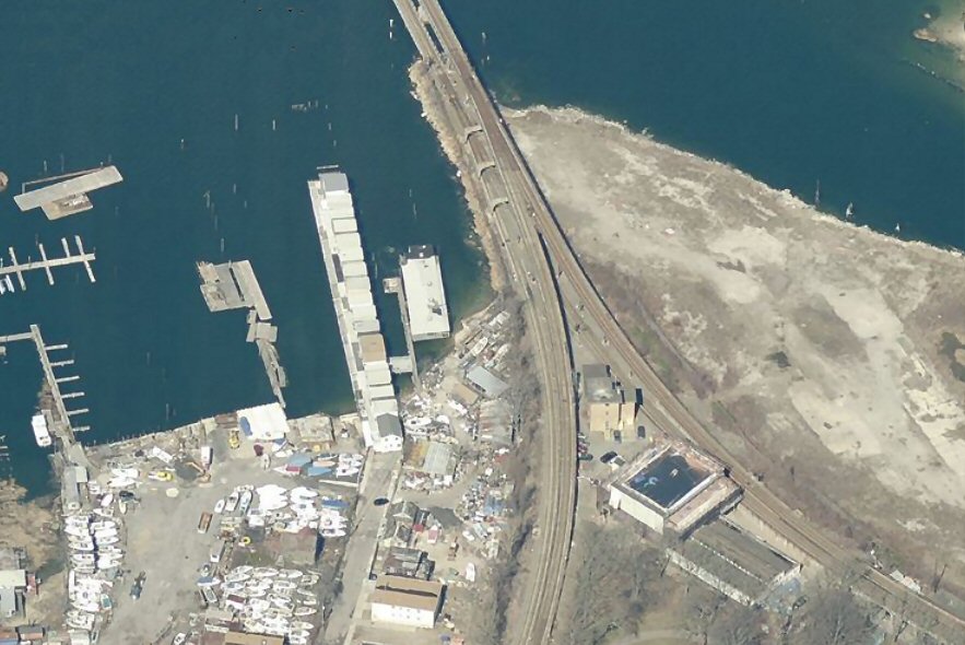
 LIRR Jamaica Bay Trestle - 1952 The Jamaica Bay Trestle was constructed almost entirely of wood and was prone to fires. A particularly devastating fire in 1950 led to its closure. The Rockaway Beach Branch South of Liberty Ave was sold to NYC in 1952 and was rebuilt as the IND Rockaway Line. Subway service to Rockaway began in 1956 and LIRR service on the Rockaway Beach Branch continued to operate to Ozone Park until 1962. Christopher Robert |
|||||
| BROAD CHANNEL | |||||||
|
Opened:
1900 Out of service: 5/23/50 with abandonment of Jamaica Bay
trestle after fire of 1950 Broad Channel
station and facilities were taken out of service on 5/23/50 because
the station was one of the stops along Jamaica Bay where the trestle
connected several isolated land-masses and, due to the fire, the
station no longer served any purpose to the LIRR.
|
|||||||
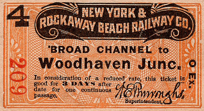 Ticket NY&RB Co. Broad Channel to Woodhaven Jct. c.1900 Archive: Brad Phillips |
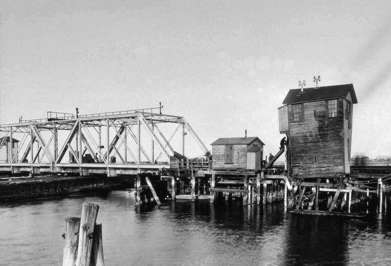
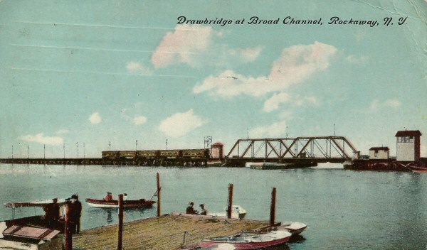 Drawbridge at Broad Channel postcard c.1905 Archive: Brad Phillips 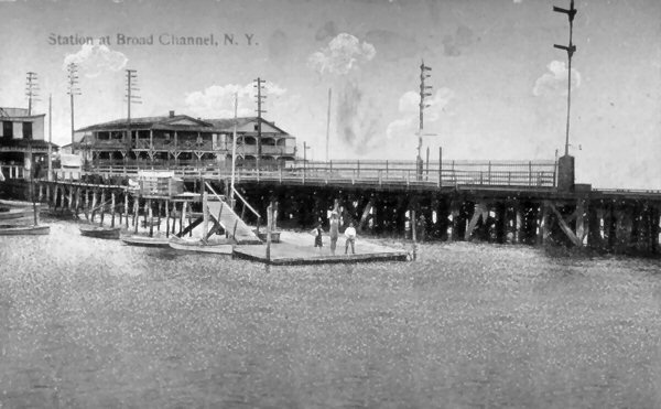 Broad Channel Station Archive: Seyfried/Boland |
 Broad Channel Station c.1905-1910 |
|||||
.jpg) A turn-of-the-century Mom and her kids are oblivious to the terrific scene occurring on the trestle behind them! TWO American-type class D53 camelback steam locomotives and their respective trains are passing each other on the Broad Channel swing bridge. Note the TWO baggage cars on the train at the left. I guess to them it was "just another day at the beach." Ho-hum . . . (Dave Keller data and archive) |
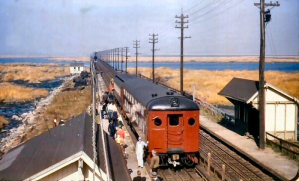
.jpg) A southbound MP41 MU electric train is making the station stop at Broad Channel in this c. 1907 view looking northeast. By now there are plenty of power/telegraph poles on the Jamaica Bay trestle. First electric service on the LIRR was via third rail to Rockaway Park in 1905. (Dave Keller data and archive) |
.jpg) A rare and very old LIRR valuation photo of the Broad Channel station and station area looking south from the pedestrian crossover (bridge) on August 3, 1914. The ticket office and waiting room appear to be housed in the first floor of the Delevan House at the left as evidenced by the bay window and scattered chairs. (LIRR valuation photo, Dave Keller archive and data) |
|||||
|
Above right: These places at Broad Channel, Goose Creek and The Raunt were strictly saloons and inns. The sign on the rear left building may read "Palm Garden" and was either the restaurant portion of the saloon, or a Bier Garten. The buildings are separate from each other, so may be two different business concerns. The signs posted by the pedestrian stairs in front of the "Palm Garden" and on the opposite side of the tracks at platform's edge read: "No Trespassing. No Crossing Tracks. Use the Bridge." The rowboats were for rent, as this was basically a fishing stop. Info: Dave Keller |
|||||||
.jpg) Although electric trains were run to Rockaway Park beginning in 1905, steam was still used on occasion as can be seen by this American-type (4-4-0) class D16b locomotive and southbound train speeding into the station at Broad Channel in 1916. Again, the view is looking northeast. (Dave Keller data and archive) |
.jpg) In this view from the opposite direction we see another southbound MP41 MU electric train making the station stop at Broad Channel in 1917. The view is looking southeast towards the swing bridge. (Dave Keller data and archive) |
 MU at Broad Channel station Jamaica Bay c. 1937 - Archive: Dave Keller |
|||||
.jpg) MU #1412 electric is clearing the swing bridge at Broad channel in this southeast view taken on 7/27/1947. Just about every window is open for a breath of fresh (?) sea air on this hot summer's day. (Ed Hermanns photo, Dave Keller archive and data) |
.jpg) A northbound MU train has made the station stop at Broad Channel on July 27, 1947. Compare this SE view with the previous image photographed 33 years earlier (above- left). It would appear that the hotels and beer halls have disappeared. (George E. Votava photo, Dave Keller archive and data)
|
.jpg) Another MU train is northbound, approaching the Broad Channel station on July 27, 1947. In this view south, we see quite a few fishermen on the wooden platform in the right background. (Ed Hermanns photo, Dave Keller archive and data) |
|||||
| BEACH CHANNEL | |||||||
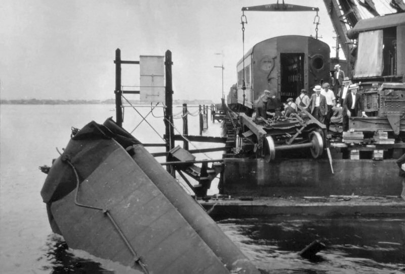
.jpg) An MP54 MU electric car decided it wasn't going to wait for the swing bridge at Beach Channel to close and tried to make the leap . . . but failed. In this view looking north on July 21, 1928 we see the aftermath of that mistake as the wreck crane, shored up on multiple wooden blocks, attempts to correct it. (Dave Keller data and archive) |
 A terrific view of the swing bridge at Beach Channel in operation as photographed by Harold Fagerberg in 1939. View is looking north. (Art Huneke collection)
|
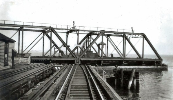
.jpg) This is an official LIRR blueprint from August, 1906 for swing bridge #R144 which was built in 1892 at Beach Channel. (Art Huneke collection) |
|||||
| DRAW TOWER | |||||||
.jpg) "DRAW" tower at the south end of the bay at the Beach Channel swing bridge had an altercation with a derailed train and looks like it didn't come out as the winner. This 1946 view is looking northeast. The tower was demolished shortly afterwards and replaced by a cabin, also called "DRAW". After train service over the trestle was ended after the destructive fire of May, 1950, "DRAW" cabin was once again relocated but this time to a point inside the east end of the wye at Hammel. (Dave Keller data and archive)
|
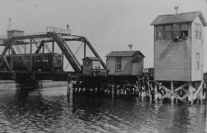 "HJ" tower ("DRAW" tower after 4/30/37) and swing bridge - Hammel (Hammels)- c. 1917 Note: Towerman fishing from upper window! Archive: Dave Keller Also note that "HJ" tower and "DRAW" tower are indicated as two separate locations, because HJ tower, which later became DRAW tower was destroyed in a train wreck in 1946 and replaced by a cabin AND a SECOND replacement DRAW tower (cabin, actually) was constructed some years later ON LAND inside the wye at Hammel. Info: Dave Keller
MPB54 1374 (?) (ACF, 8/1913) decided to take a drink on Saturday, 7/21/1928 at Beach Channel swing bridge (HJ Interlocking). Train 1318, operating a "Loop" service from Flatbush Avenue to Far Rockaway & Valley Stream via the Bay did not stop at home signal 1 & 2 and the first car plunged into the channel. No one was killed in this accident but 16 men were injured. Apparently, there were no women in the first car because it was a smoking car. The motorman claimed he had left Flatbush Avenue feeling sick to his stomach, saw the stop-signal and open bridge but simply didn't stop. He was arrested afterwards while still in the hospital. Fortunately, the water was at or very near low tide at that moment and was only about 30' deep. This occurred at 8:21 am at the height of the rush hour. This is 1928 so the work week was still six days. Apparently, the railroad was tied up in knots for a few hours after this. The newspaper account stated that even Montauk trains were affected and that all Rockaway service was operated via Valley Stream until the wreck got cleared that afternoon. Research: Jeff Erlitz
|
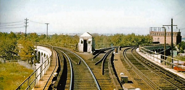
.jpg) "DRAW" cabin was photographed from the rear of a moving train headed westbound for Rockaway Park in this October 2, 1955 view. We are looking east along the elevated viaduct towards Far Rockaway. The tracks curving off to the left behind the cabin lead to Jamaica Bay but are no longer in use. (Bill Rugen photo, Dave Keller data and archive) .jpg) After "DRAW" tower was demolished in 1946, an adjacent cabin was put into service as an interlocking station. "DRAW" cabin is visible here are the far left, in front of the Beach Channel swing bridge as we look north on October 31, 1948. It will be relocated in 1950 to just inside the east leg of the Hammel wye when service over the Jamaica Bay trestle comes to an end. (Dave Keller archive and data) |
|||||
|
|||||||
| HAMMEL | |||||||
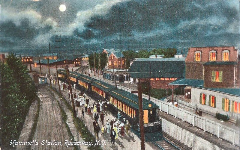 Hammel Station colorized postcard postmark 8/09/1907
|
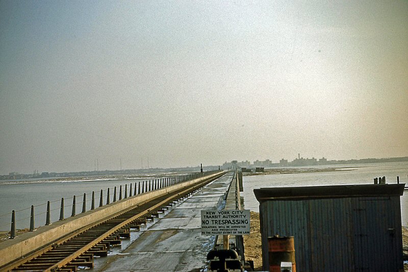
When the LIRR owned the ROW the tracks came off the Jamaica Bay trestle (double track on one structure) and entered the elevated viaducts. When the trestle was destroyed and the NYCTA acquired the ROW, they rebuilt the trestle to what you see here: two separate, parallel structures with some tracks above and some tracks below. Info: Dave Keller
The
Substation #5 and battery house contained two rotary converters and
the world's largest The battery building, on the right, was installed in 1899 to provide backup power for the LIRR's first electric venture, Rockaway's Ocean Electric trolleys which shared the LIRR tracks. The Queensborough Light, Heat and Power Company (LILCO and LIPA's predecessor) had just opened its power plant in the Bayswater section of Rockaway and it was considered unreliable. The battery, it was felt, would provide continuous power for the trolleys. |
||||||
|
|
|||||||
| Ocean Electric Company | |||||||
|
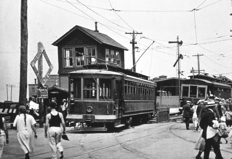
Ocean
Electric Co. trolley No. 30 (above) is leaving the LIRR's tracks at FX tower, Hammel's and entering its own tracks and right-of-way for the trip
westbound towards Neponsit. Trolley No. 7 behind it is
headed east towards the LIRR's station at Far Rockaway, Mott Ave.
Notice car No. 7 has no trolley pole extended. These
trolleys ran on LIRR tracks between this point and Far Rockaway, Mott
Ave. using third rail shoes. At FX tower they then continued on
to Neponsit via their own tracks and right-of-way using poles
connecting to overhead trolley wires. This August 4, 1921 view
is looking northeast. Hammel's station building and large
covered platform shed is visible behind the 2nd trolley car. This
joint service lasted only a few more years and the tower was
demolished in 1925. (Dave Keller data and archive) |
|||||||
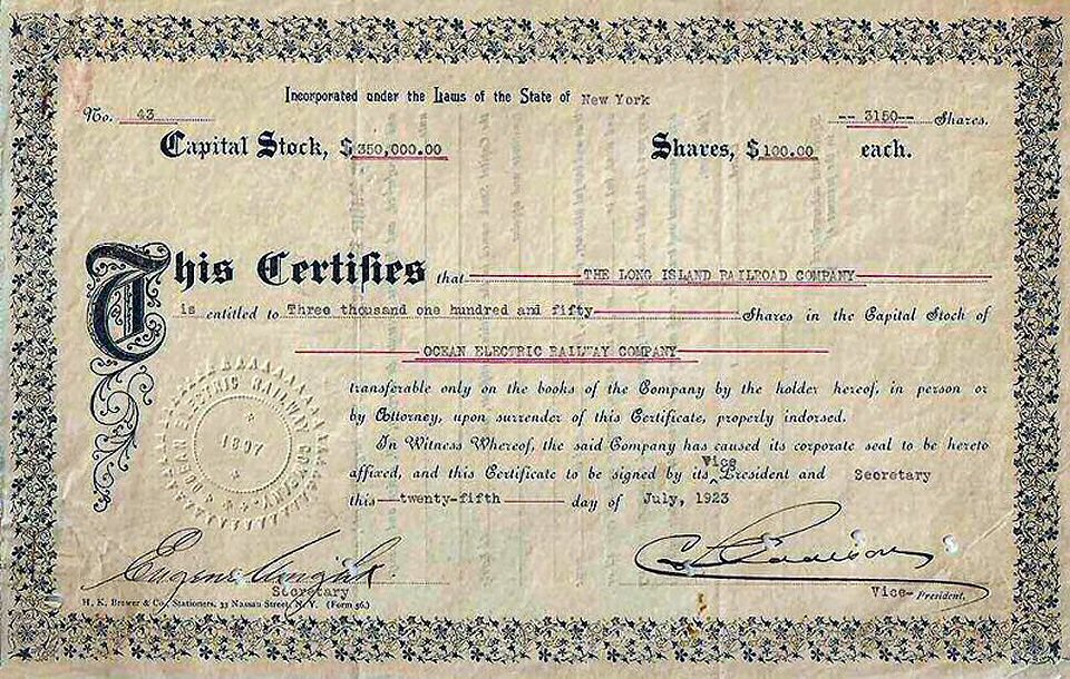 |
The acquisition of the Ocean Electric Ry. by the LIRR judging by the quantity of shares transferred and capitol value of $350,000 indicated. 7/25/1923 September 9, 1926 Ocean Electric Railway abandons service over LIRR between Hammel and Far Rockaway. The LIRR writes off stock of Ocean Electric Railway, Nassau County Railway and Montauk Steamboat Company, Limited.
|
||||||
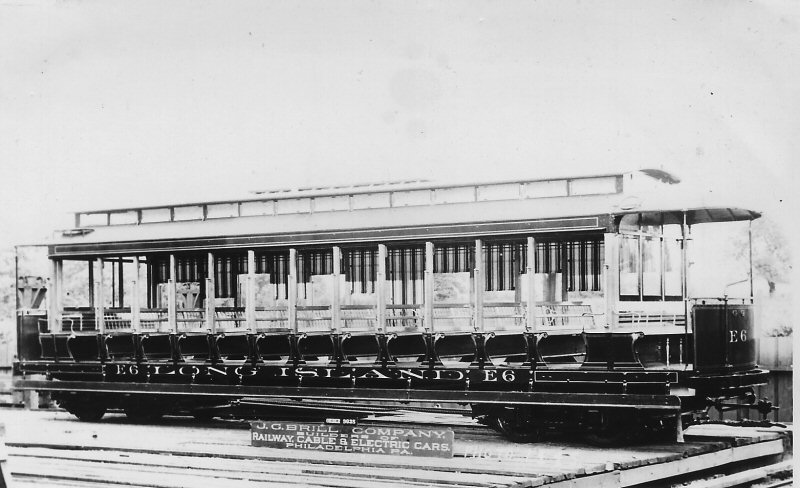 Brill builder photo - LIRR E6 Ocean Electric (Votava-Boland) |
 LIRR #997 OE trolley Jamaica 7/17/1934 (Votava-Boland) |
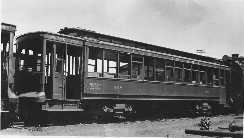 LIRR #998 OE trolley Jamaica 7/17/1934 (Votava-Boland) |
|||||
|
|
|||||||
 Emery Map Hammel's Wye post-1942 5/1959 Archive: Dave Keller The tracks were at grade as they came off the wooden trestle across Jamaica Bay and Emery has noted the point where they go up to be atop the viaduct. You'll also notice that the viaduct began SOUTH of the old substation (#2 in the map above). You can also see that there were only two tracks on the trestle and two tracks on the viaduct: one northbound and one southbound (railroad westbound and railroad eastbound).
|
Left
leg W to Rock Park, |
|
|||||
 Hammel's station and wye looking NE prior to construction of "FX" tower -c. 1905 (Dave Keller data)
|
.jpg) Looking northeast on November 10, 1927, we see the Beach 84th St. crossing just in front of the station and large shelter shed at Hammel's. In the left background is LIRR electric sub-station #5. The tracks at the left head north towards Jamaica Bay and the tracks at the right head towards Far Rockaway. To the right of the depot building is the express/freight house. Where the man is standing in the center of the image and to the right of the power pole was the site of "FX" tower which controlled the junction of the LIRR and Ocean Electric Trolley tracks during the years of joint operations. (Dave Keller data and archive)
|
.jpg) This view is also looking northeast towards the Beach 84th St. crossing and Hammel's station, only a few years later than the previous views. This 1934 image shows weeds growing on the tracks that connect Rockaway Park with Far Rockaway. (Dave Keller data and archive)
|
|||||
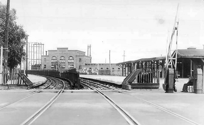
.jpg) This is the east end of the Hammel's wye at the grade crossing of Pleasant Avenue as seen on July 21, 1911. The view is looking northwest and in the distance is "HU" tower. Compare this view with the color image of "DRAW" cabin atop the viaduct looking in the same direction in 1955! The tracks at the right head north towards Jamaica Bay. The tracks at the left head towards the Hammel's station and on to Rockaway Park. The tracks in the foreground connect with Far Rockaway and are considered part of the "Far Rockaway branch" per employee timetables. (Dave Keller data and archive) |
.jpg) In this great view of the elevated viaduct looking east at what was once the Hammel wye, we see a MU electric train at the right from Rockaway Park heading eastbound towards Far Rockaway at Mott Ave. In the left background, we see a work train coming off the bay trestle. It's December 8, 1946 and there has recently been another fire on the trestle. The work train is assisting in making repairs. 3-1/2 years later and the trestle will have seen its final fire. (Ed Hermanns photo, Dave Keller archive and data)
|
.jpg) After service over the bay was abandoned, trains traveling to and from Rockaway Park made the trip via Valley Stream and Far Rockaway. The southern portion of the elevated wye at Hammel was used for this purpose. Here we see one such MU trains bound for Rockaway Park in 1954. View is east. Beach Channel Drive is in the foreground. In the left distance is the non-used east leg of the wye. (W. J. Edwards photo, Dave Keller archive and data)
|
|||||
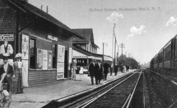
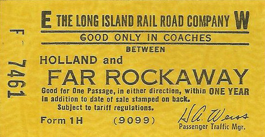
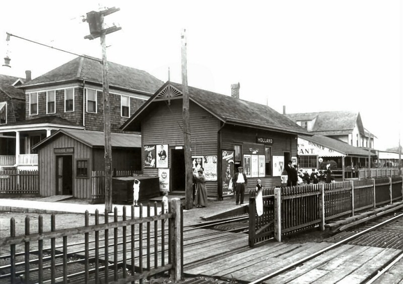
| HOLLAND (BEACH 92nd St.) | |||||||
 Holland Station Archive: Seyfried/Boland
|
-11101921-LIRR-BradPhillips.jpg) Holland Station (Beach 91st Street)11/10/1921 - Photo: LIRR valuation Archive: Brad Phillips
|
|
|||||
| STEEPLECHASE - Renamed PLAYLAND- (BEACH 98th St.) | |||||||
.jpg) Steeplechase Park was a great draw for summer crowds. People flocked here and to nearby Seaside by the thousands and wooden picket fences and gates were erected for crowd control. This July 21, 1916 view of the Steeplechase station shows the many picket fences and gates under the covered shelter. View is southeast. The Steeplechase station stop was changed to Playland in 1933. ( Dave Keller archive and data) |
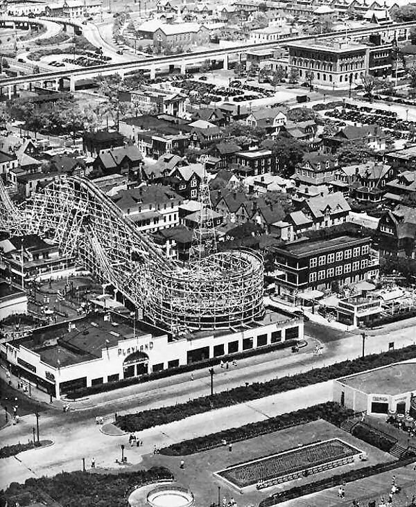 The Atom Smasher at Rockaways Playland late 1940s Archive: Historic Coaster Foundation. LIRR viaduct in the background. Based on the PLAYLAND sign on the building, at photo bottom, the view would have been shot near the Playland station stop (previously Steeplechase). |
.jpg) An MU train in Tichy color scheme is making the station stop at Playland station in this 1952 view. (W. J. Edwards photo, Dave Keller archive and data) .jpg) Atop the elevated viaduct, we see another MU train heading east as it approaches the distant Playland station. This c. 1954 view is looking east from the end of the Seaside station platform. ( Dave Keller archive and data) |
|||||
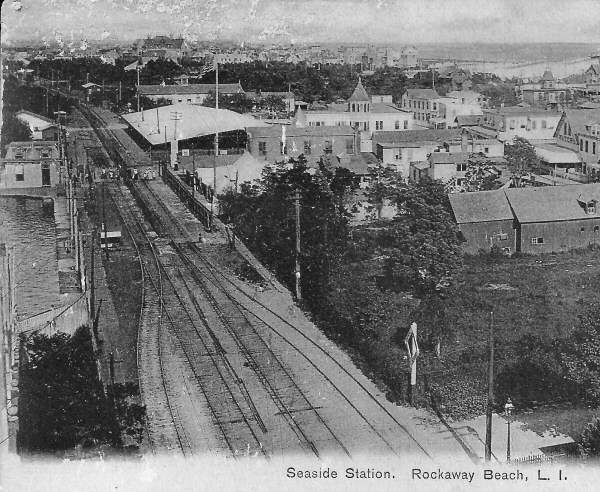
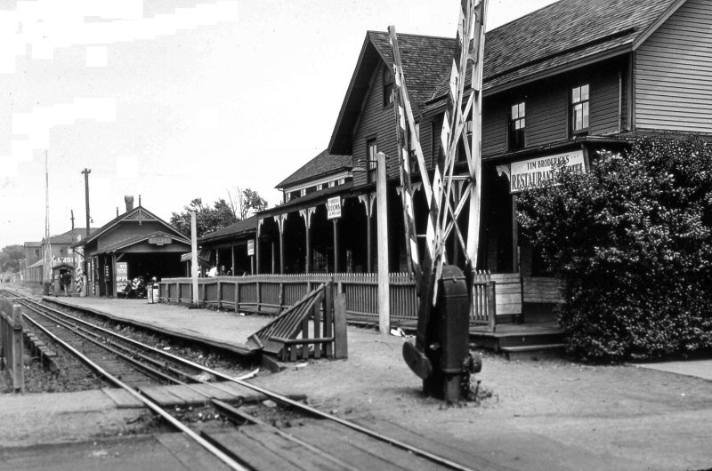
| SEASIDE (BEACH 103rd St.) | |||||||
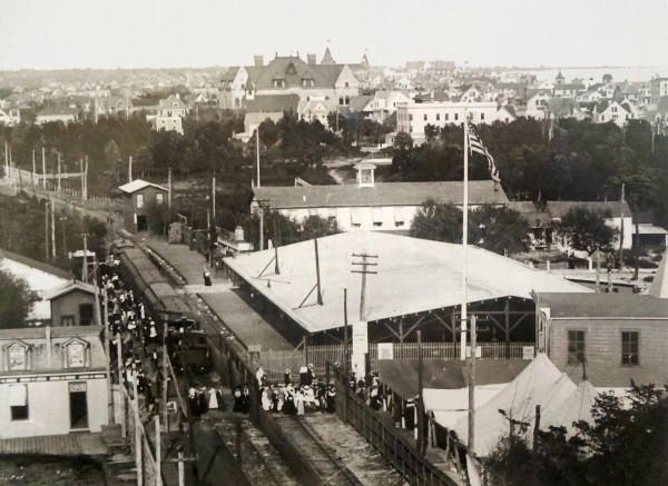 Seaside Station view E 1900 Archive: Dave Keller
|
|
 Seaside Station postcard c.1905 Archive: Brad Phillips |
|||||
| The massive shed shows you the amount of people that waited for trains at that station. I was told by a trainman that worked that line back in the late teens-early 1920s that the sliding picket gates kept the people away from the tracks and trains until boarding time when they were opened and it was pure pandemonium. Steeplechase station (later Playland) located one stop away had a similar massive covered shed and gates. Info: Dave Keller | |||||||
 Seaside Station MP41 MU train Rockaway Park bound view SE 1912
|
.jpg)
The crossing guard doesn't appear to be too busy although the sign on his crossing shanty warns against "Loafing"! Note also the "No Spitting" sign facing the tracks. This is the grade crossing of Conway St. in Seaside. Photographed on July 16, 1931, one of the expanding gas tanks at Rockaway Park is visible in the right background of this westward view. (Dave Keller data and archive) |
||||||
.jpg) Another major tourist draw during the summer months was Seaside, which boasted a very tall and extremely wide water slide. In this view looking southeast, taken on July 21, 1916, we see the Seaside station with guard who would operate the picket gates for crowd control. Note that one of the gates is across the eastbound track, to keep people from sneaking in the wrong way. Note the many heat ventilators on the roof of the vast shelter. (Dave Keller archive and data) |
.jpg) It's 1950 and the Tichy color scheme has begun. Looking southeast from street level, we see a Rockaway Park-bound MU train leaving the Seaside station. In the consist of Tuscan red coaches there's one Tichy coach sticking out like a sore thumb. (W. J. Edwards photo, Dave Keller archive and data) |
.jpg) Seaside station at track level shows another MU train with the same 8-car consist of the previous view. It would appear the photographer caught the train as it headed towards Rockaway Park, then, in this image, caught it the same day as it returned, displaying marker lamps at the rear. View is looking southeast. (W. J. Edwards photo, Dave Keller archive and data) |
|||||
|
The
Rockaway Beach branch was elevated on a concrete viaduct up to and
including Seaside station. West of Seaside station, just west of Beach
109th St. the tracks came off the viaduct and entered the Rockaway
Park/Beach 116th St. yard and station AT GRADE. This configuration
remained in place even after the NYCTA acquired the LIRR's former
trackage. Info: Dave Keller |
|||||||
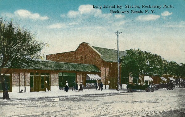
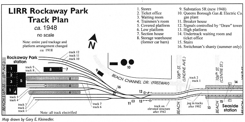
| ROCKAWAY PARK (BEACH 116th St.) | |||||||
 Rockaway Park - BRT 0-4-4T Forney #71 1901 Photo: Harold B. Fullerton Archive: Queens Library
|
 Rockaway Beach cards c.1910 Archive: Dave Keller
The BRT had a loop track that ran around the entire Rockaway Park Yard so the motorman didn't have to change ends. Westbound (geographically), on the north side of the yard, the track rose to an elevated position behind the depot building, and came down eastbound (geographically) on the south side of the yard where the BRT station platforms were located. Dave Keller
|
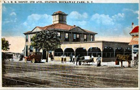 Rockaway Beach Station 5th Ave. prior to NY City mandated street name changes in 1916 to Beach 116th St. view NE c.1910
|
|||||
|
(Above left): Brooklyn Rapid Transit 0-4-4T Forney #71 is arriving at Rockaway Park, the end of the LIRR’s Rockaway Beach Branch, in 1901. This train either originated at the BRT’s Sands St/Brooklyn Bridge station in downtown Brooklyn or the Broadway Ferry station near the future Williamsburg Bridge. If it was the former, it would have run over the Fulton Street elevated, then down the Fifth Avenue el to Atlantic Ave, where it would've traversed the connection to the LIRR’s Atlantic Branch, thence to Woodhaven Junction and down the Rockaway Beach Branch. If the latter, it would’ve headed east on the Broadway-Brooklyn elevated to East New York, east towards Cypress Hills (City Line) on Fulton Street to the Chestnut Street incline, then onto the LIRR’s Atlantic Branch west of the Railroad (later Autumn) Avenue station. Then the same as above, Woodhaven Junction, Rockaway Breach Branch. Note, in back of the rapid transit train is a trolley car of the Ocean Electric Co., and then a standard LIRR steam-powered train. All sharing the same, un-signaled track! Four years later, in 1905, this branch received third rail for the LIRR’s first electric MU cars, the MP41s. Jeff Erlitz |
|||||||
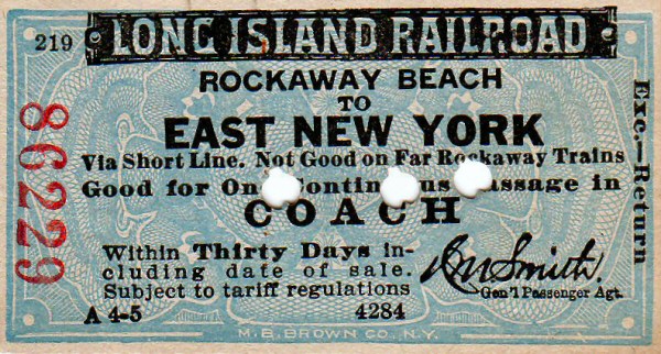
| Excursion Tickets | |||||||
|
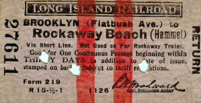
Railroads issued excursion tickets for many reasons; to get more traffic of course, but also to serve the public in enabling reasonable (cheap) fares to popular places and events (beaches, amusement parks, flower shows, etc.). There almost always a round trip and have a limited life (one day, weekend, etc.). Often, special trains were run in addition to regularly scheduled service. Of course, the LIRR offered many excursions over the years, the more famous being race trains and fishermen's specials. The East New York
excursion was obviously for city folk to get to the cool breezes and
surf of the Rockaway's. Of interest is that it's for a full
30 days which, perhaps, was geared to folks who rented bungalows for
several weeks during the summer (as my grandparents did in Averne). Most full fare
tickets had stopover privileges (i.e., you could leave the train at
an intermediate point in your journey and then continue on later without
paying an extra fare), but discounted excursion tickets did
not allow this. Additionally, this ticket specifies "via
short line" which means the most direct route to the destination
must be taken. It also goes further to specify that it's not
good on Far Rockaway trains which really is a redundancy in this case
as there were only two routes to Rockaway Beach, via Ozone Park or
Jamaica/Valley Stream. Thus, these restrictions prevented a
passenger from taking the long route to Rockaway, perhaps to
stopover in Jamaica for shopping or elsewhere en route to visit
family or friends. Info: Brad Phillips |
|||||||
 Rockaway Park station and yard View E fro |
 Looking west, we see the Rockaway Park yard and terminal as it looked in 1955. Note the mixture of dark-gray/orange end doors and Tichy color schemes in use. At the left we see the yard has been torn up and re-graded for the new tracks to be installed by the NY City Transit Authority who would take control of this terminal and all the tracks and rights-of-way on October 3rd of that year. (Bill Rugen photo, Art Huneke archive, Dave Keller data) |
 MU train in Rockaway Park Yard- View E with tracks at grade and in the distance the tracks are seen rising to meet the viaduct. 1946 (Edwards-Keller)  Rockaway Park station 10/02/1955 view E from behind the terminal building one day prior to the official end of LIRR service. Most of the yard tracks to the right have been removed. Info: Dave Keller |
|||||
|
|
|
.jpg) It appears the interior of the old Rockaway Park station building was quite roomy as is evidenced by this photo taken the same day as the view above. There are three Dietz kerosene lamps visible as well as the ubiquitous newsstand, wooden benches and one, lone, pot-bellied stove. 6/06/1916 (Dave Keller data and archive) |
|||||
.jpg) One month to go before this terminal is officially turned over to the NY City Transit Authority. This is Rockaway Park with one, lone, MU train at the platform. The rest of the yard has been torn up and groundwork appears to be underway for the new TA yard that will be constructed. This September, 1955 view is looking west. (Dave Keller archive and data)
|
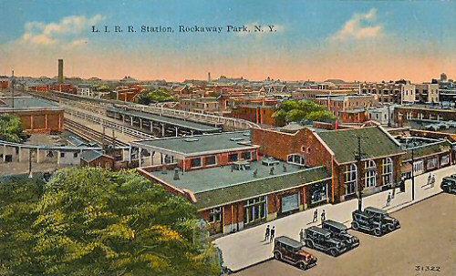
.jpg) Here is the 1917 brick terminal building at Rockaway Park as seen from the Beach 116th Street side c. 1952. Compare this image looking southeast with the 1916 view of the old, wooden structure and antique automobiles parked along the street. (W. J. Edwards photo, Dave Keller archive and data)
|
.jpg) This trackside view of the old, wooden Rockaway Park station is looking north on June 6, 1916. Interesting is the two-story bay window and at the far right can be seen a small portion of the BRT elevated wooden structure that looped around the entire yard for the years prior to 1917 when LIRR-BRT joint service was underway. (LIRR valuation photo, Dave Keller archive and data) |
|||||
| NOTE: Station stops ( Arverne through Wave Crest, inclusive) were considered part of the Rockaway Beach branch AFTER the December, 1950 fire that destroyed the Jamaica Bay trestle. After the fire, the trestle was placed permanently out of service and Rockaway Park trains were routed via Valley Stream, Far Rockaway (Mott Ave.) and on to Rockaway Park until ownership of the trackage across Jamaica Bay and from Far Rockaway to Rockaway Park was transferred to the NYCTA on October 3, 1955. | |||||||
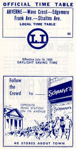
| ARVERNE | |||||||
|
|
 This view of the Arverne, Gaston Ave. station is looking west c. 1915. Note the cantilevered twin semaphore signals in the background. The island platform services two of the three tracks passing through this station. This center track was removed in the early 1930s. (Dave Keller data)
|
 The station building at Arverne, Gaston Ave. is shown here looking northeast c. 1915. Arverne got its name from the land developer there whose name was "R. Verne." Due to a dispute early on, a second "Arverne" station was opened at Straiton Ave. Note the ubiquitous warning sign on the mid-track fence advising of the active third rail. (Dave Keller data)
|
|||||
| STRAITON AVE. | |||||||
 Straiton Ave. station 1955 Archive: Brad Phillips |
|
||||||
| FRANK AVE. | |||||||
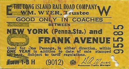
 An MP54 electric MU train is eastbound on the elevated viaduct approaching the station at Frank Avenue (Edgemere) in this c. 1950 view looking northeast. Note the train is in the new Tichy color scheme with the last car having a black roof. The station was called "Frank Avenue" because that was the original name of the cross street at which it was located. In later years the street was renamed several times finally ending up as Beach 44th Street. (Dave Keller data) |
|
||||||
|
EDGEMERE |
|||||||
 Edgemere Station view E 1915  Edgemere Station view W 11/05/1937 Photo: Fred Weber Archive: Ron Ziel Note the crossing shanty at the left atop the high level platform. Info: Dave Keller |
.jpg) Approaching Far Rockaway, Mott Ave. from Hammel's wye, we arrive at the Edgemere station. An MU electric train has made the station stop on April 6, 1934 when the station was still at grade. View W (Dave Keller data and archive) |
|
|||||
| WAVE CREST | |||||||
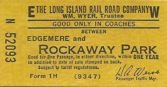
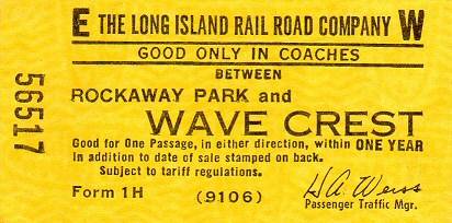
 Ticket Wave Crest to Rockaway Park Archive: Brad Phillips
|
.jpg) This is the Far Rockaway Blvd. grade crossing at Wave Crest as photographed in 1934. Note the cantilevered signals mounted on the wooden power pole at the right! Missing are the semaphore blades from both sets of signals which governed the middle track which has since been removed.(Dave Keller data and archive)
|
.jpg) The old at-grade station at Wave Crest is seen in this photo taken on April 11, 1939. This station stop was soon to be elevated and placed atop the viaduct, eventually becoming a stop for the New York City Transit Authority when they took control of the tracks west of Far Rockaway, Mott Ave. in October, 1955. (Dave Keller data and archive) |
|||||
|
FAR
ROCKAWAY BRANCH click for more |
|||||||
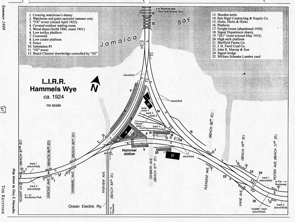
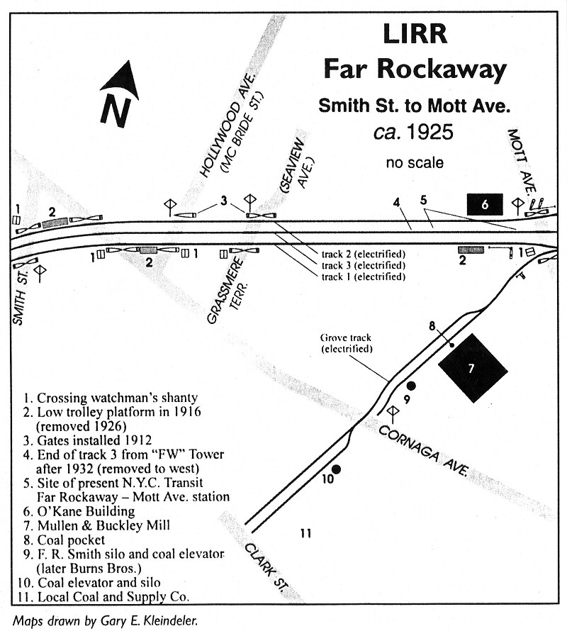 Far Rockaway Smith St. to Mott Ave. c.1925 Map: Gary Kleinedler - The Keystone Archive: Dave Keller |
 Far Rockaway Mott Ave to Team Yard c.1925 Map: Gary Kleinedler - The Keystone Archive: Dave Keller |
|
|||||
 Old station with train on elevated viaduct. View N c. 1955 (W. J. Edwards photo, Dave Keller archive)
|
|
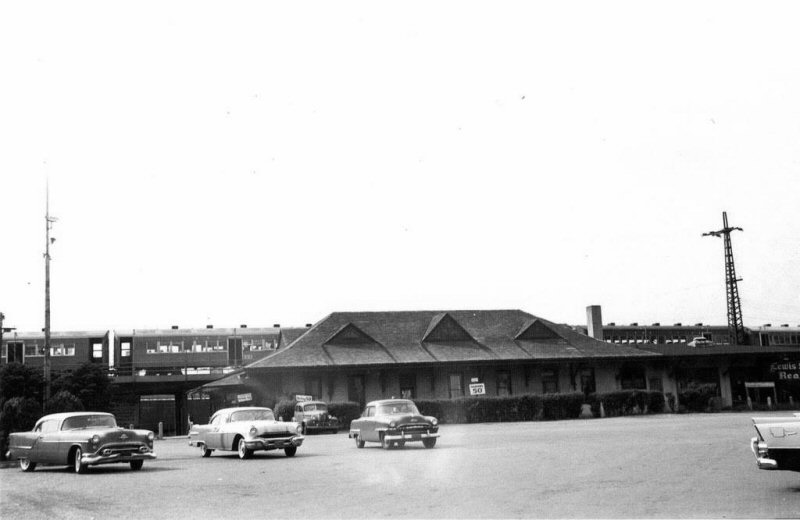
 Far Rockaway station at Nameoke Ave. after tracks were cut back from Mott Ave. View NE - 6/1964 Archive: Brad Phillips
|
|||||
02/27/2026


%20(Edwards-Keller).jpg)


%20-%2006-26-1955%20(Rugen-Keller).jpg)
.jpg)

.jpg)
.jpg)
.jpg)

.jpg)
.jpg)


.jpg)

.jpg)
.jpg)
.jpg)
.jpg)
.jpg)


.jpg)

.jpg)
.jpg)
