|
|
SHINNECOCK CANAL | |
|
|
||
 Shinnecock Canal original girder first bridge 1870. The canal had not yet been widened at the time. Photo: Hal B. Fullerton |
 Shinnecock Canal Bridge 1887 - LI Railroader 1953 Archive: Dave Morrison |
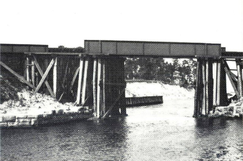
.jpg) View north from the Montauk Highway trestle towards the older iron railroad bridge over Shinnecock Canal in 1915 (Thos. R. Bayles photo, Dave Keller archive) |
 Shinnecock Canal bridge #S833, Canoe Place and North Highway crossing zoom view SE in 1904. Photo: Hal B. Fullerton Archive: Queens Public Library |
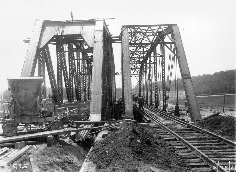 Shinnecock Canal - New K4 bridge left - View W 5/26/1931 Archive: Art Huneke |
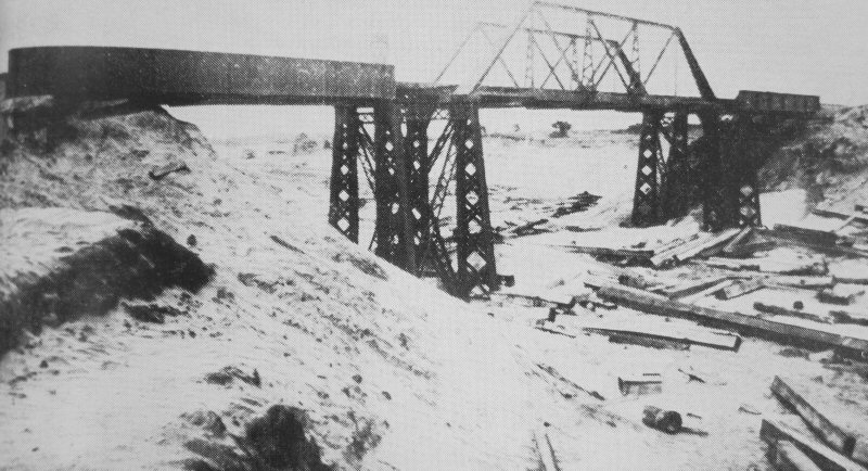
.jpg) View east with the older iron railroad bridge at the left and the heavier replacement "K4 bridge" at the right on May 26, 1931. (Dave Keller archive) |
.jpg) View NE with the replacement "K4 bridge" placed in service on June 21, 1931 and the older iron bridge behind it (Dave Keller archive) |
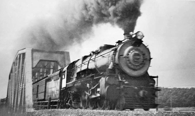 K4s #5396 eastbound on the K4 bridge - Canoe Place - 1947 View west from approximate location of Canoe Place station platform. Photo: Harold Carstens |
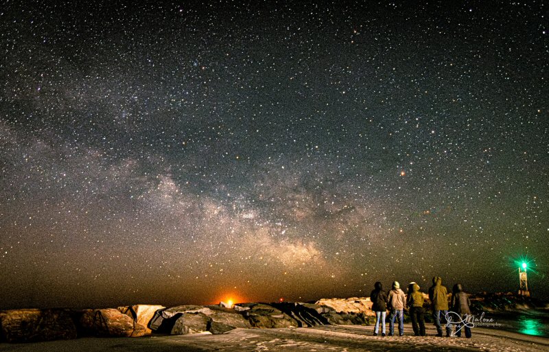 Shinnecock Inlet - 3/13/2026 Photo/Archive: Danielle Malone Photography |
| Prior to this bridge being placed in service, PRR-leased K4s class locomotives did not pull Hamptons/Amagansett/Montauk trains as the older bridge couldn't support the locomotive's weight; however two G5s class locomotives double-heading WERE allowed to make these runs. After the new bridge was placed in service, K4s locomotives regularly pulled these trains, hence the given nickname "K4 bridge." The K4s locomotives were returned to the parent road in 1950. Info: Dave Keller | ||
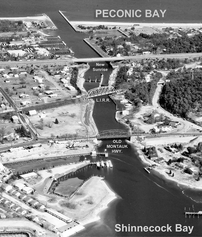
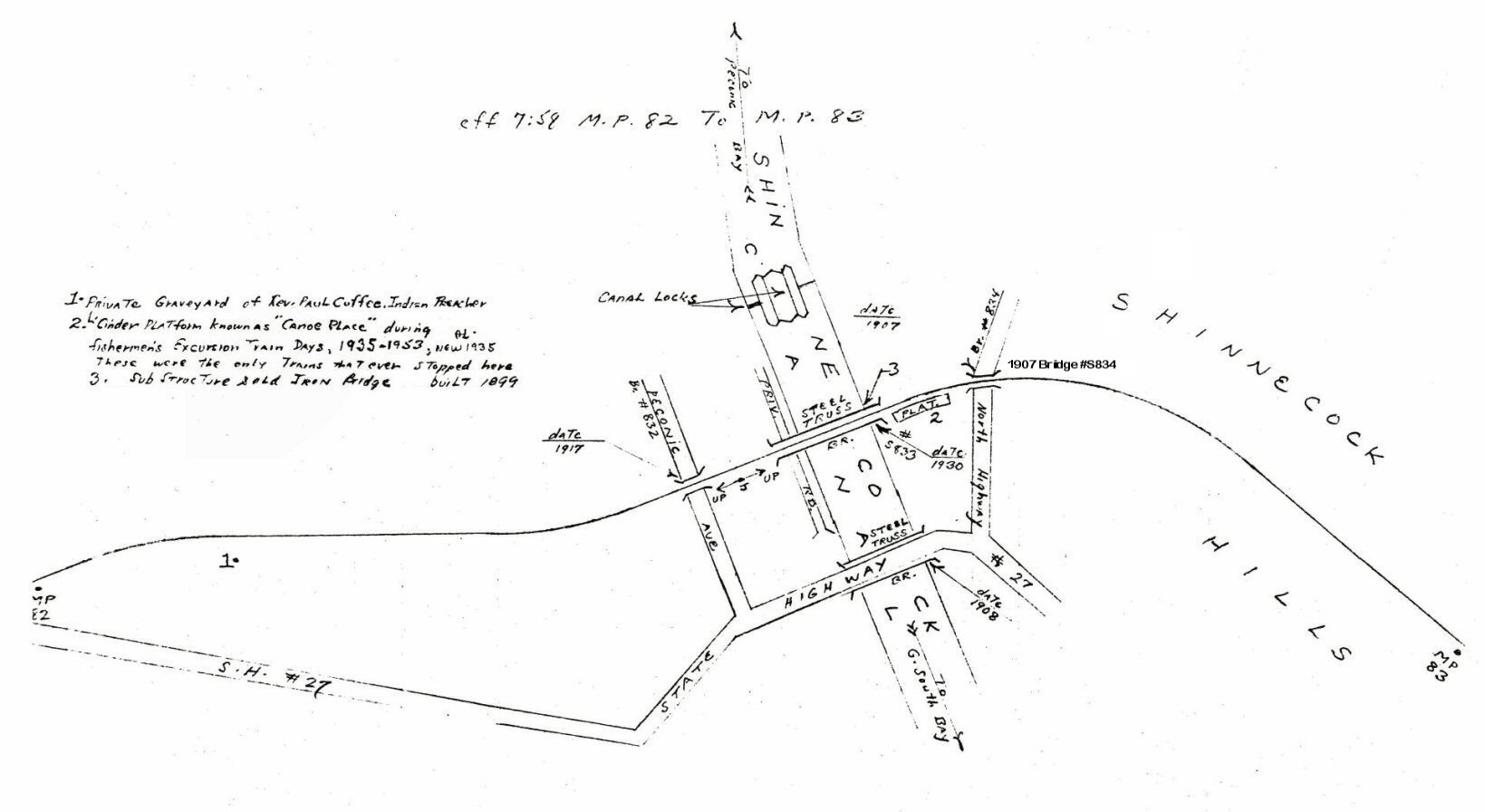 Emery map - Shinnecock Canal MP82-83 7/1958 Archive: Dave Keller Emery's bridge date of 1930 isn't correct unless the concrete abutments/supports were poured in 1930 and the date indicated thereon at that time. The actual replacement bridge was in service sometime between June and September, 1931 (photographic provenance). Dave Keller |
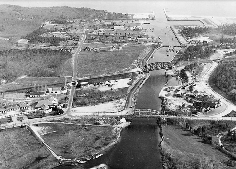 Shinnecock Canal aerial c.1935 Archive: Rick Nydegger |
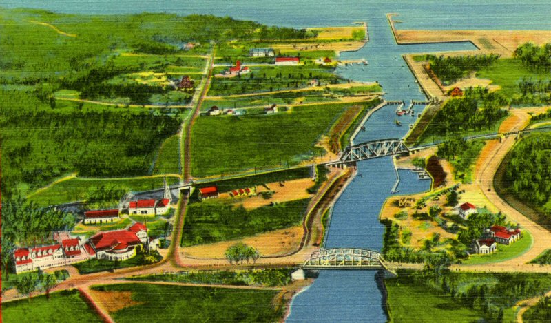 Shinnecock Canal - colorized post card c.1935 Archive: Dave Morrison |
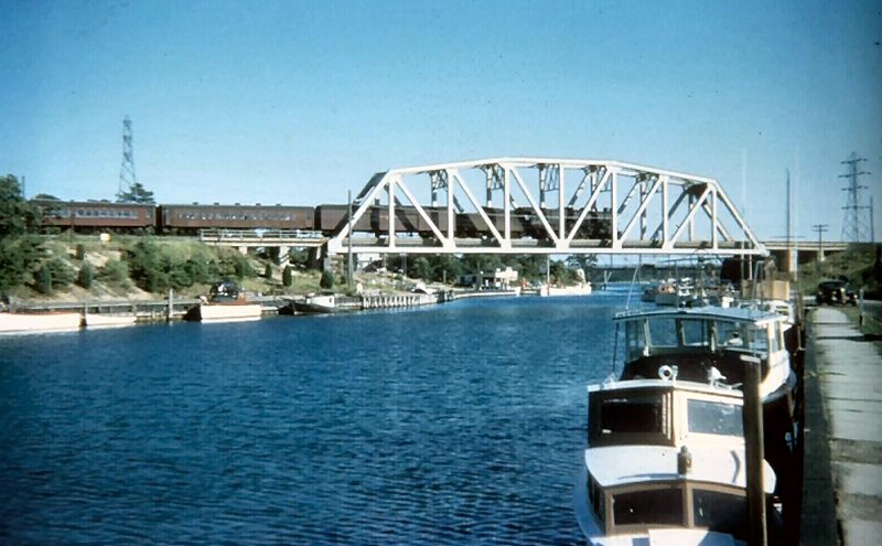
 Shinnecock Canal - c.1962 View N Photo/Archive: Chester Hartwell |
 |
 Shinnecock Canal - NYS historic marker 2013 Photo/Archive: Chester Hartwell |
 Shinnecock Canal - "K4 Bridge" c.1950 |
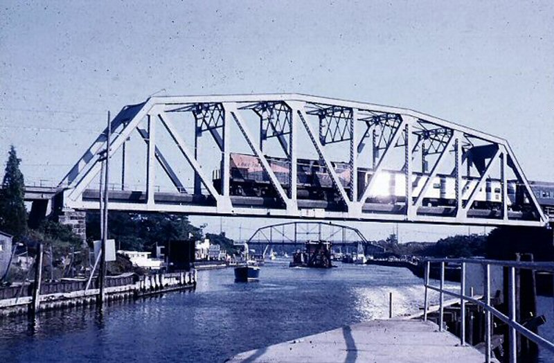 Shinnecock Canal K4 Bridge c.1965 View S Photo: Steve Hoskins Archive: Steven Lynch |
 LIRR #227, #620 ERA Special - Shinnecock Canal 4/1984 Photo/Archive: Jay Bendersky |
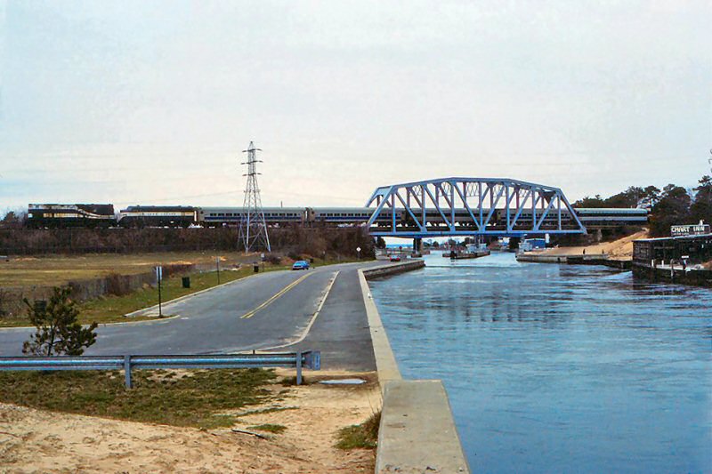
 Shinnecock Canal K4 Bridge View N 2/20/2007 Photo/Archive: Nick Kudreyko |
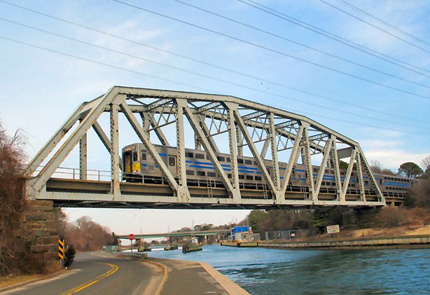
 Shinnecock Bridge - View N 1/31/2018 Photo/Archive: Marc Gluckman |
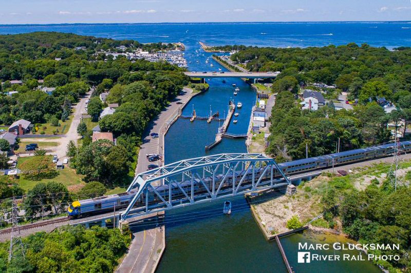
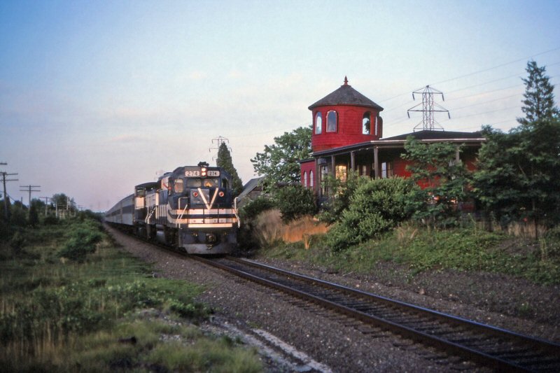
 Train #2716 Shinnecock Bridge - 6/03/2022 Photo/Archive: Joe Stroppel |
|
|
||
| CANOE PLACE | ||
|
CANOE PLACE: LOW CINDER PLATFORM ON SOUTHEAST SIDE OF SHINNECOCK CANAL. IN SERVICE: 1935 �1953 FOR �FISHERMAN�S SPECIAL� TRAINS |
||
%20-%2009-08-1931%20(Keller).jpg) It's September 8, 1931 and the new "K4 bridge" over the Shinnecock Canal at Canoe Place is now in service and ready to accommodate the heavier K4s locomotives in their runs to and from Montauk. This view is looking west from just east of the North Highway underpass, girders of which are visible in the foreground. The tracks between the tracks act as a stop for derailed equipment to keep from sailing off the bridge and can be seen at all bridge locations. (Dave Keller archive) |
%20(Keller).jpg) In this close-up of the previous 1931 view, the approximate location of the Canoe Place station is indicated. This was a low-level, crushed cinder platform only and was a scheduled stop for fishermen from 1935 until 1953 when "Fisherman's Specials" were discontinued and the stop was removed from the timetable. |
%20-%2007-05-76%20(Madden-Keller).jpg) The "K4 bridge" is seen in this color view looking east on July 5, 1976. (William Madden photo, Dave Keller archive) |
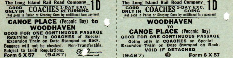 The Woodhaven to Canoe Place ticket is stamped as �Sample� on the reverse from Rand McNally dated April 1946. Samples are easily spotted as most don�t have serial numbers. The particular punch design is also consistent with Rand McNally samples generally. None of the above explains why Woodhaven would have so much traffic to Canoe Place. Fishing Specials originated there so perhaps the underlying purpose. Photo/Archive/Info: Brad Phillips |
 Canoe Place MP83 - Prior/Current 2024 Design/Archive: Joe Vila |
|
|
|
||
| Shinnecock Hills Station | ||
|
BUILT: APR-MAY/1887 WITH OPEN AIR VIEW PORTS IN TURRET TO OVERLOOK GREAT PECONIC BAY. LOW PLATFORM REMOVED: 1931 (Robt. Emery data). AGENCY CLOSED: 9/21/32. STATION STOP DISCONTINUED SHORTLY AFTER TIME- TABLE OF 9/32 WAS ISSUED, WHICH LISTED ONE TRAIN MAKING A FLAG- STOP. STATION CONTINUED TO BE LISTED ON TIMETABLES OF 1934 AND 1935 WITH NO TRAINS SCHEDULED TO STOP. LATER USED AS A U.S. POST OFFICE WITH ACTIVE MAIL CRANE UNTIL LIRR RPO SERVICE ENDED IN 1965. POSTAL FACILITY CLOSED: 1966. BUILDING ABANDONED AND PURCHASED IN 1974 FOR USE AS A PRIVATE RESIDENCE IN SITU. DESIGNATED A LOCAL SOUTHAMPTON LANDMARK: 10/22/2013. The LIRR built its branch from Manorville SE to Moriches and then E along the south shore to Bridgehampton and NE up to Sag Harbor in 1870. In 1881, the LIRR extended the former SSRR from Patchogue to connect with this branch at the new junction at Eastport, and the Moriches station on the old Sag Harbor branch a short distance west of this junction was lifted off its foundation and moved east and renamed Eastport. The line was extended from Bridgehampton further east to Montauk in 1895. Research: Dave Keller |
||
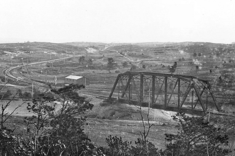
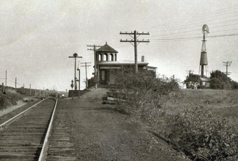
 Shinnecock Hills Station view SE c.1910. The track in the foreground closest to the photographer was the passing siding with a 16-car capacity. A team track led from it on the east end, running north of the siding westward, removed in 1930 and the passing siding in 1934. Info: Dave Keller |
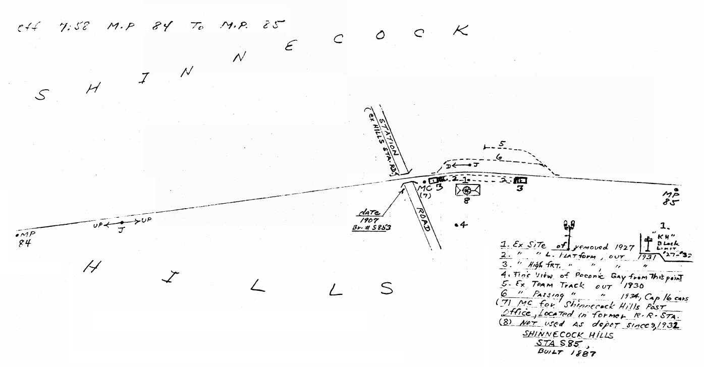 Emery map - Shinnecock Hills MP84-85 7/1958 Archive: Dave Keller
|
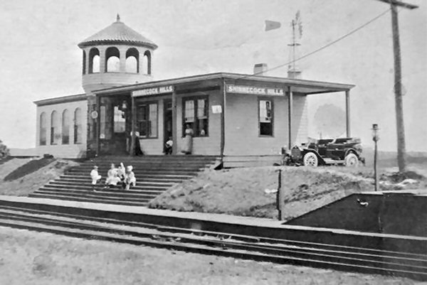
 Shinnecock Hills Station - KH Block Signal - View E c.1920 Archive: Dave Morrison Note: The eastbound and westbound high level express platforms with a scale on the westbound one, the passing siding, and the Spanish pan tiles on the roof of the turret. Info: Dave Keller |
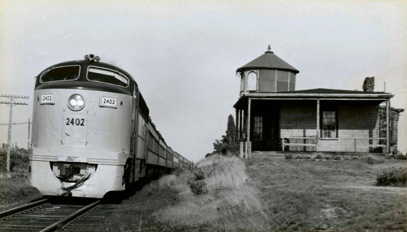 FM #2402 Train #4007 westbound from Montauk passing Shinnecock Hills Station 8/16/1959 Archive: Dave Morrison |
 Shinnecock Hills Station - 1982 Archive: MTA/LIRR |
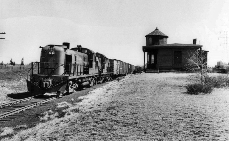 RS3 #1558 westbound freight passing Shinnecock Hills Station 3/27/1970 Archive: Dave Morrison |