|
ISLIP
|
|||||||||||
 S.S.R.R. timetable eastbound 1/01/1869 Archive: Art Huneke |
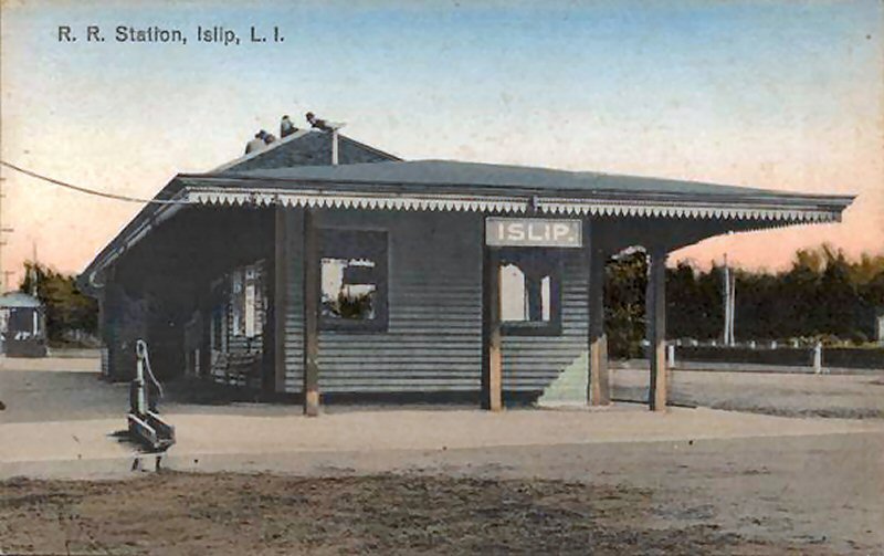
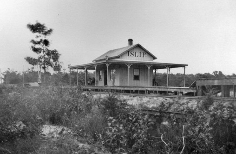 Islip Depot S.S.R.R (South Side Rail Road) first listed on timetable 5/20/1868 View SE Photo: George Brainerd Archive: Dave Keller |
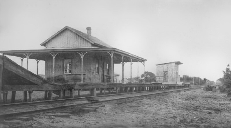 Islip Depot S.S.R.R (South Side Rail Road) Express House on the single track main. View SW c.1879 Razed: 1881. Photo: George Brainerd Archive: Dave Morrison |
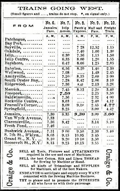 S.S.R.R. timetable westbound 1/01/1869 Archive: Art Huneke |
||||||||
|
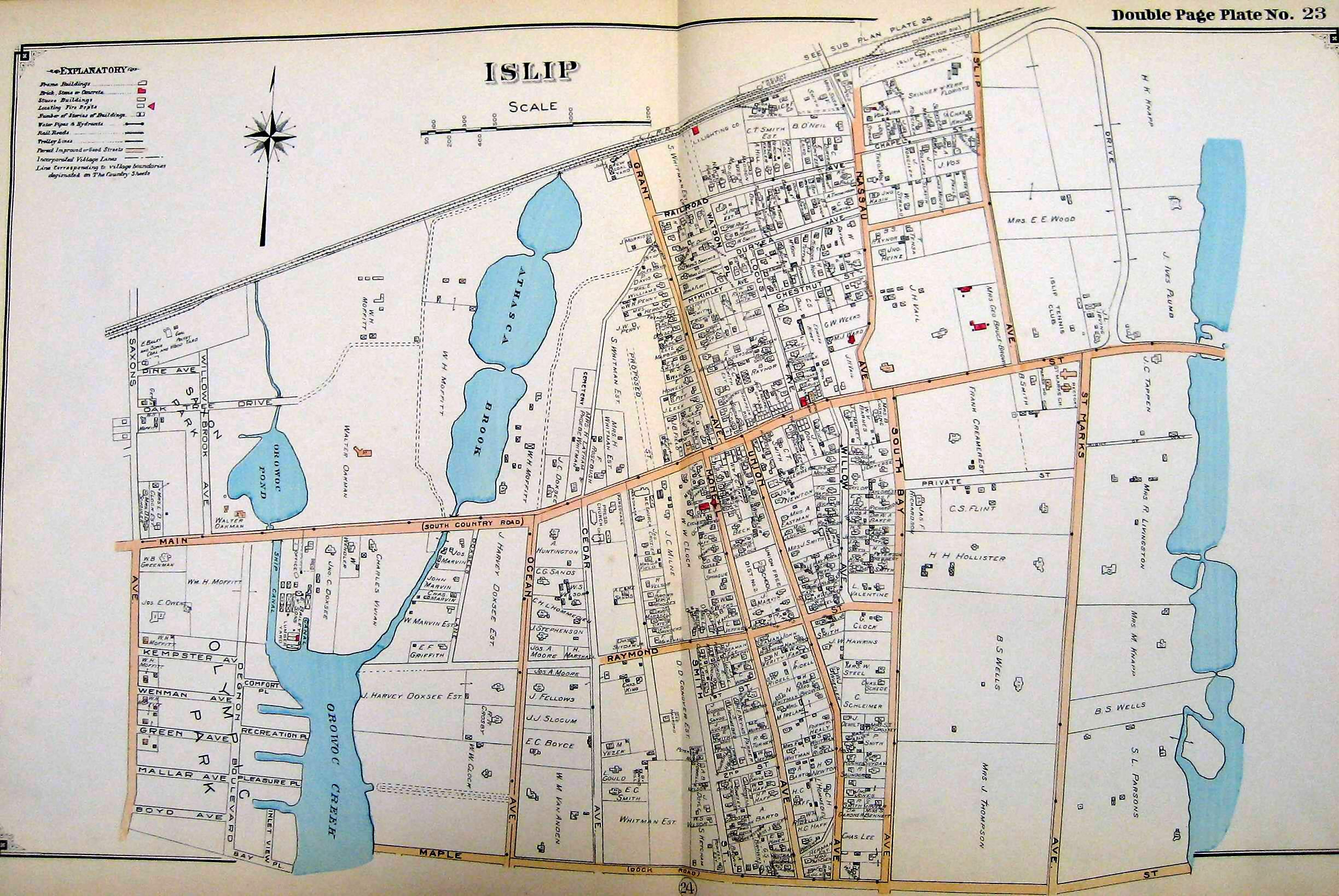
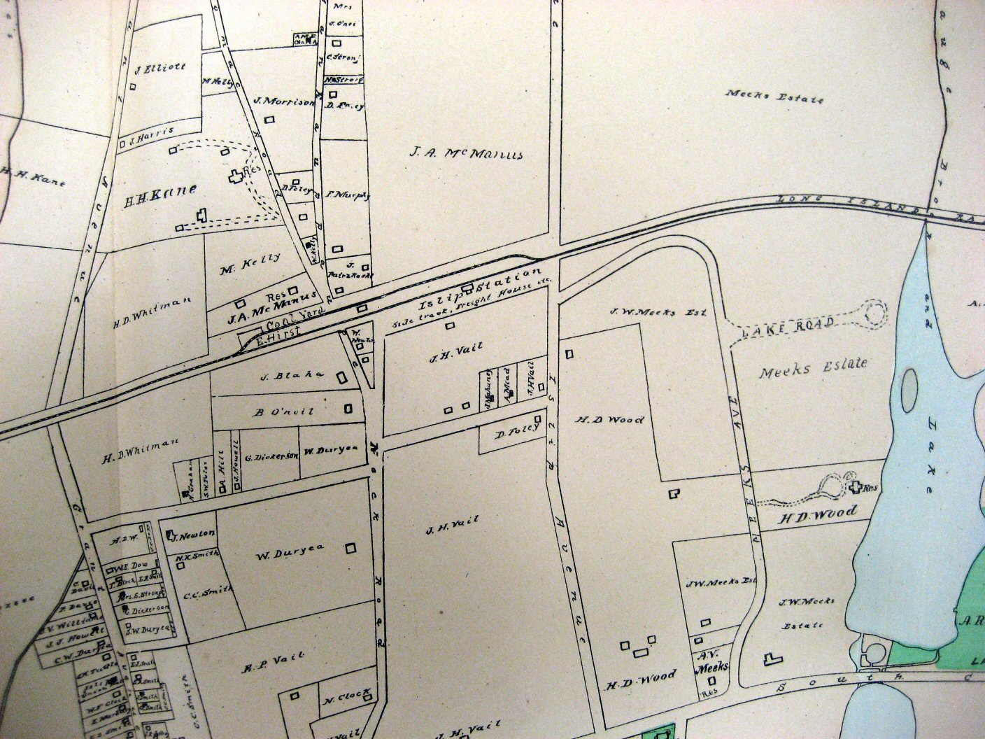
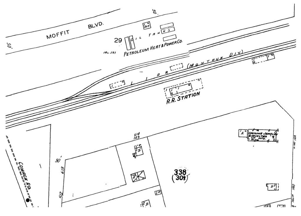
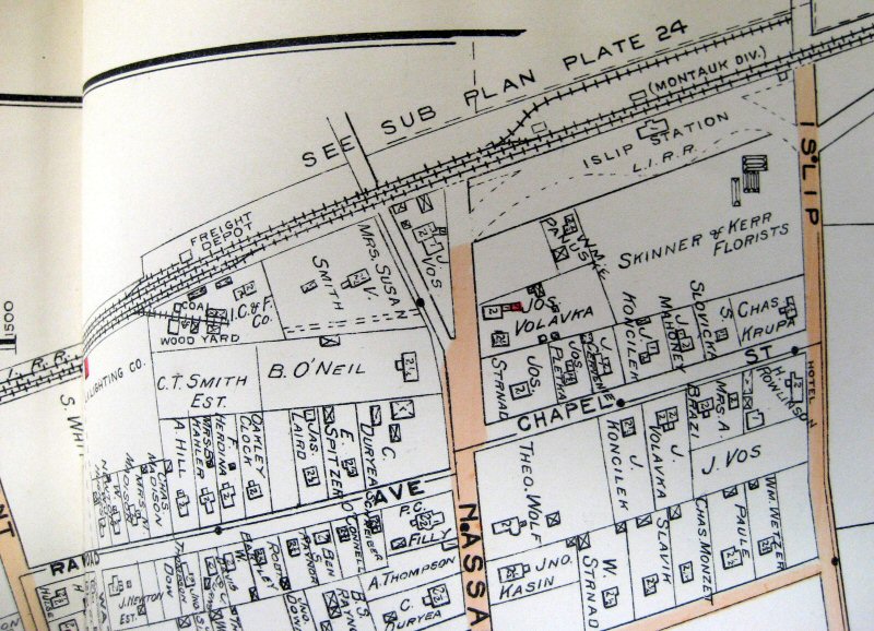
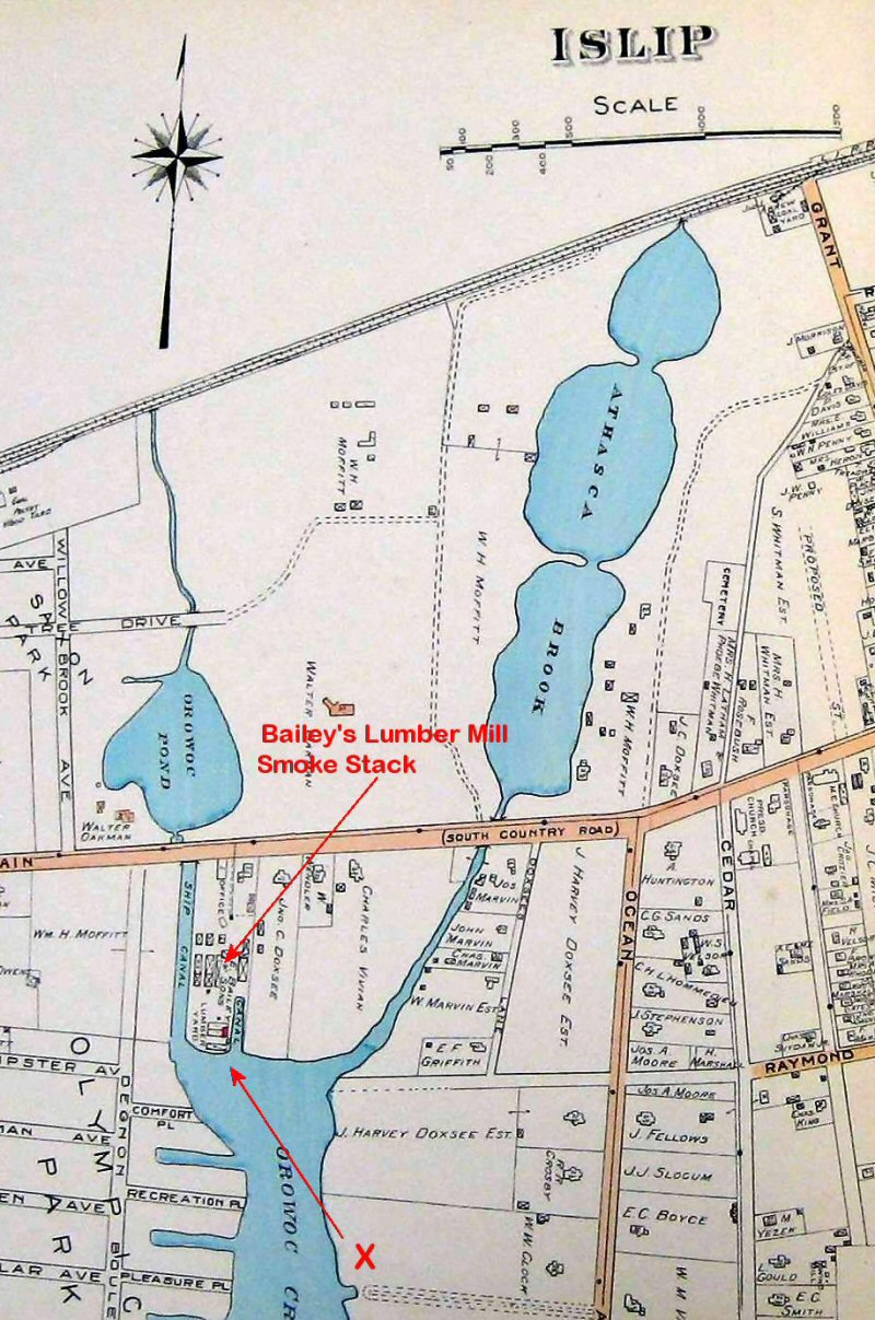
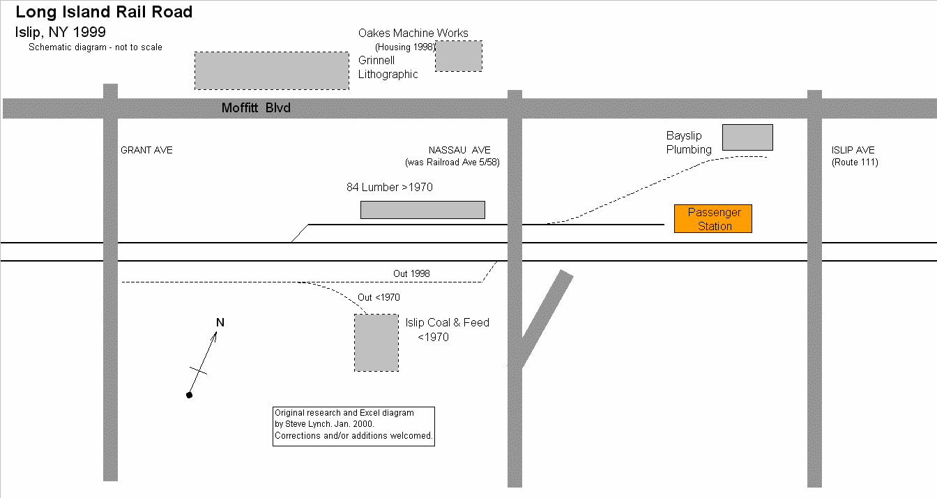
Public timetable of January 1, 1869 indicates Sayville was the terminus (left). Service began to Patchogue April 1869. The Public timetable of May 30, 1870 no longer lists Islip Centre. Islip Centre Depot location (12/1868-6/1889), one mile west of the Islip Depot MP43, may have served the Olympic Boat Club members at the foot of Saxon Ave., Islip as the property of the Olympic Club. The siding was for the use of the Olympic Club, on the Great South Bay funded by William H. Moffitt, a member of the Olympic Club and a real estate developer. Located on the south side of the tracks and crossing Saxon Ave. (Islip 1915 Hyde map, below).
|
|||||||||||
| ISLIP DEPOT HISTORY | |||||||||||
|
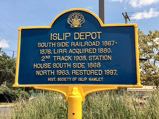
South Side Rail Road Depot opened: 5/20/1868 |
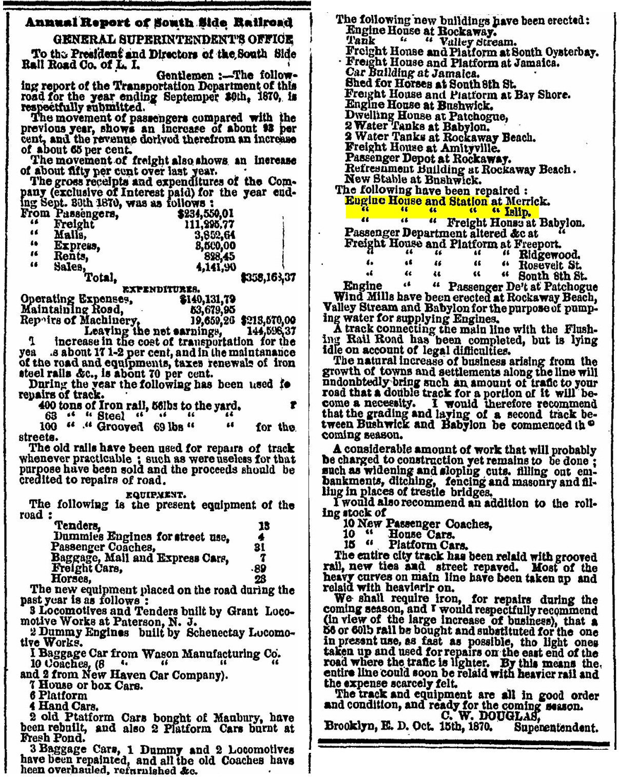 Engine House and Station at Islip repaired The Long Island Farmer 1/19/1871 |
||||||||||
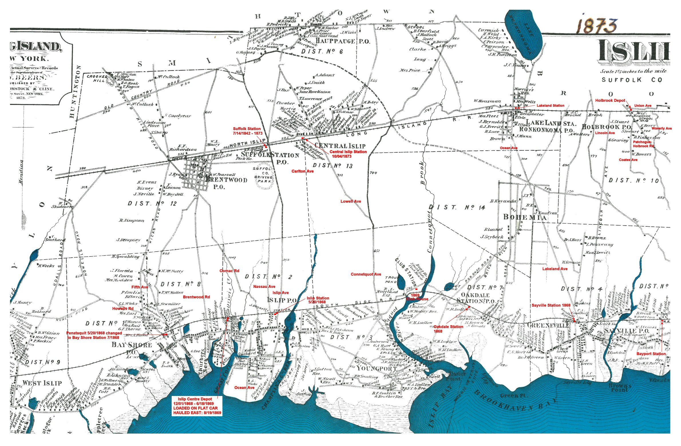 Islip Town Stations 1873 Beers map with annotations for the LIRR and South Side Rail Road (SSRR) Stations at the time. Archive: Islip Public Library Research/Annotations: Steven Lynch |
|||||||||||
 Islip zoom map - 1858 Creator: J. Chace Archive: Norman B. Leventhal Map Collection/Boston Public Library |
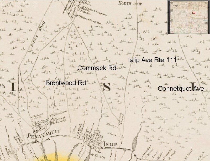
 Islip map c. early 1870's |
|
|||||||||
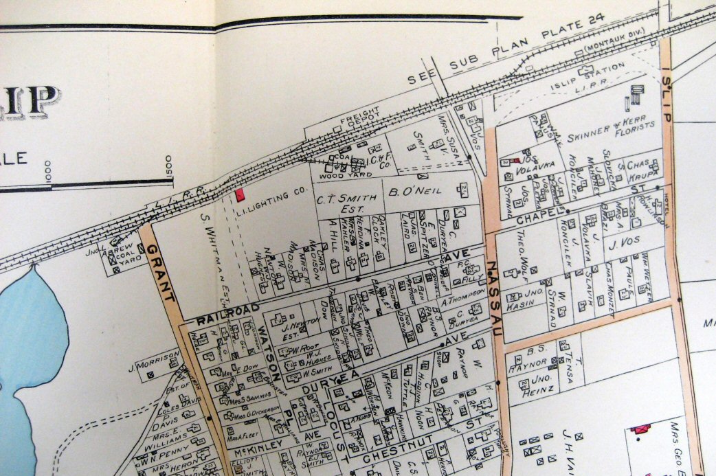
 Islip 1888 Hyde Map Collection: SUNY-Stony Brook |
 Islip 1915 Hyde Map Collection: SUNY-Stony Brook |
||||||||||
| ISLIP BUILD OUT 1867+ | |||||||||||
|
Let me deal with “the wrong side of the tracks”, if I may. The build out on the Montauk Branch of the South Side Rail Road from Babylon eastward towards Patchogue (as the short term goal) 1867-1880. Sep. 5, 1868 South Side Railroad of Long Island opens between Babylon and Islip. Dec. 11, 1868 South Side Railroad of Long Island opens between Islip and Sayville. April 10, 1869 South Side Railroad of Long Island opens between Sayville and Patchogue. (Info: PRR Chronology by Christopher T. Baer) The reality at the time in rail line building, primitive at the time, was to build the least expensive right of way (ROW) requiring the fewest grades, crossing, bridges, etc. Building directly east from Bay Shore, with no major roads, streams, AND unoccupied land made the previous SSRR and current Islip station location the ideal price/performance solution. There was no wrong side of tracks as the Village and homes didn't exist in this area. I'll concur that “the wrong side of the tracks” occurred in thousands of urban areas as the railroads split older neighborhoods during the 1880-1920's
and beyond. Evidence the Robert Moses Cross Bronx Expressway as a road building project as the same phenomena, as it destroyed the South Bronx area, for example. The phrase has emanated from either the wind blowing the soot/ashes from the steam locos into specific areas AND/OR the part of town that is not inhabited by the more well to do. Thus, the working class, poor or the extremely poor areas. |
|||||||||||
| F.G. Schlemmer - ISLIP Hygeia Ice COMPANY | |||||||||||
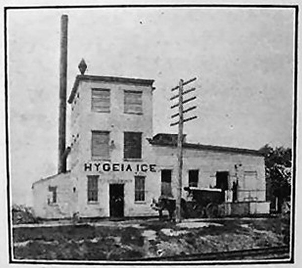 F.G. Schlemmer Hygeia Ice and Distilled Water Co. North Saxon Ave 1915 - View N Photo: Islip Presbyterian Church sponsor Archive: Barbara Corbett Bishop |
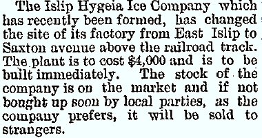 Suffolk County News, Sayville News edition April 13, 1900 |
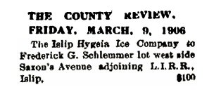 County Review March 9, 1906 |
|||||||||
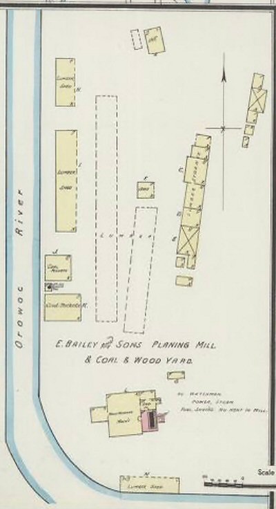
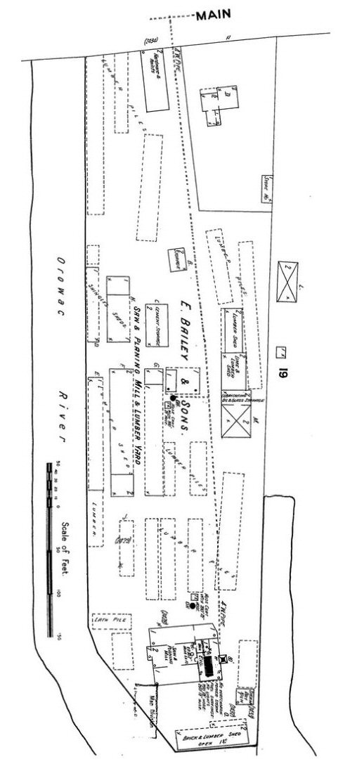
 Schlemmer Ice Co, and Bailey's Mill Islip - Sanborn map 1/1909 |
 Schlemmer Ice Co, and Bailey's Mill Islip - Sanborn map 4/1925 Note: The 'Olympic siding' has been cut back to east of Saxon Ave. and the Schlemmer Ice Co. 'not running'. |
 Islip Sanborn map 12/1946 Bailey's Mill 'not in operation'. Note: Post WW II Suffolk County Bimasco Asphalt Paving with a new siding occupies the older Schlemmer Ice Co. site. |
|||||||||
|
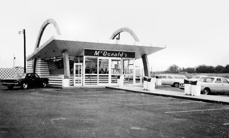
The building would be located (red X) on this 1915 Hyde map Islip segment, below: The Olympic siding was located .27 miles west of Islip station, based upon mileage indicated in the 1913 and 1919 CR4. It was for the use of the Olympic Club, funded by William Moffitt, on the Great South Bay. It was on the south side of the tracks and crossed Saxon Ave. By 1914, Moffitt was said to have been worth over $2 million and had bought and sold over $20 million in property. He had become a distinguished businessman whose company and accomplishments had been praised in the papers. However, the real estate industry began to decline and Moffitt found himself so greatly indebted he sold his home on Orowoc Pond to Walter G. Oakman, (who in 1918 sold it to George Graham, a senior member of the U.S. House of Representatives) in order to pay his mortgage. Moffitt was also forced to sell a factory he owned in Bay Shore and continued to sell off his assets for the next three years to make ends meet. Unable to pay back creditors, Moffitt fled to California and then became a fugitive. He had been indicted back in New York with a grand larceny charge as a result of real estate deals totaling $4 million and chose to not appear. Moffitt also spent time hiding in London but did come back to the United States where he was finally arrested and investigated. Eventually, Moffitt was able to pay back his creditors and returned to California where he established another real estate business in the 1920’s. All that was remembered of Moffitt however back in New York was Moffitt Boulevard located in Bay Shore. His estate eventually became the new Islip High/Middle School location by the lake behind McDonalds on Main Street when it opened 1965 when I attended. My “guess” with Moffitt in deep trouble financially, but the siding still in place for another 10 years until 1924. The LIRR may have spotted freight cars there for Baileys and a load for the Ice Company (team track style!?) across the street for wagon pickup. Similar to Grinnell Lithograph on Moffitt Blvd over in the area across from the Islip Freight station/later team track. Info: Steven Lynch |
|||||||||||
| BAILEY'S LUMBER & COAL | |||||||||||
 Islip 1915 Hyde map - E. Bailey and Sons Coal and Wood Yard LIRR siding at Saxons (sic) Ave. |
 Islip Sanborn map 12/1946- E. Bailey and Sons, Suffolk Co. Bimasco Division Paving |
 Islip Lumber & Coal Co. - ex Bailey's Lumber c.<1925 at Saxon Ave. location. |
In 1869 Edwin Bailey started
the lumber business of E. Bailey & Sons which employed about 300 men for
many years on the Patchogue River building ships and supplying lumber to
the expanding housing markets spurred by railroad development. He also had
a facility in Sayville and two locations in Islip as follows: |
||||||||
 |
 Sanborn Islip inset map - Bailey's Mill 12/1890 Archive: Chris Klug
Sanborn Islip inset map - J.C. Hawkins
Mill |
 Islip Montauk Hwy J.C. Hawkins Planing Mill -View W 1878-79 Photo: George Brainerd Archive: Brooklyn Museum-Chris Klug
|
 Bailey's Lumber Yard Islip c. 1890+ South Country Road (Montauk Hwy - 27A) near Orowoc Creek Note: Ship masts in background
|
||||||||
 Ex-Bailey's Lumber Yard, South Country Road (Montauk Hwy - 27A) Islip at Orowoc Creek view S 2017 Bing Maps |
 The Doxsee Sea Clam Company was one of the oldest family-owned and operated seafood businesses in New York State for more than a century. Thomas Doxsee emigrated from England and settled in Huntington in 1743. His son moved to Islip where the family began the enterprise of clamming, fishing, and canning beginning in 1866. The Doxsee Clam Factory circa 1900, located at the Ocean Ave. Dock in Islip. Photo from a private collection published in Hometown Long Island, a Newsday Book, 1999.
|
 Bailey's Lumber Yard, Islip Sanborn map 1/1909 - View N |
|||||||||
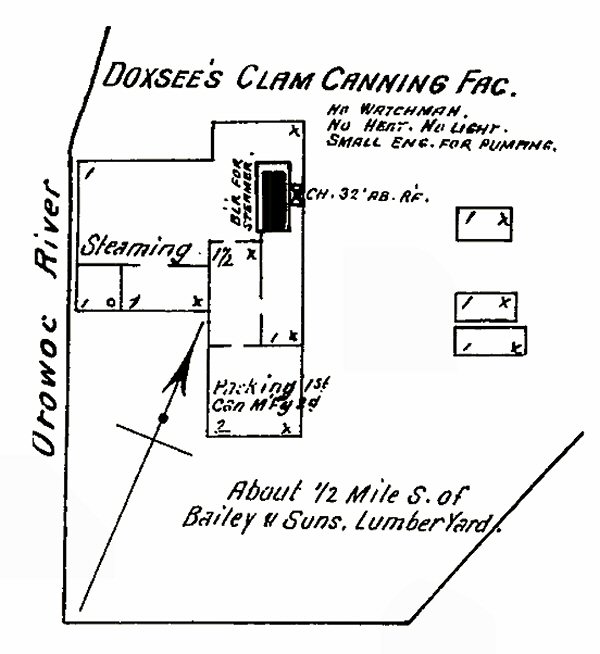 Doxsee Clam Canning Co., Islip Sanborn map 3/1897 |
 O. H. Doxsee Clam Company, Orowoc Creek, Islip |
||||||||||
| JOHN L. ABREW & CO. | |||||||||||
 John L. Abrew Co. Coal & Wood Yard - Grant Ave Sanborn map 1/1909
|
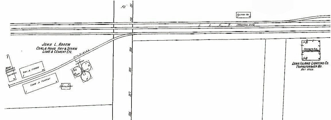 John L. Abrew Coal & Wood, Hay & Straw, Lime & Cement, LILCO transformer, LIRR Section House north of tracks - Grant-Ave. Sanborn map 7/1916
Note: Sanborn map
12/1946 indicates John L. Abrew Co. fire remains. This location later
|
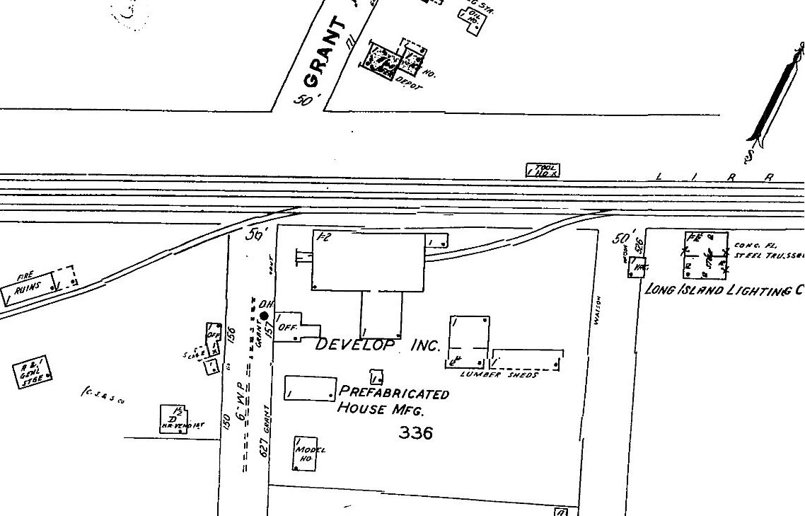
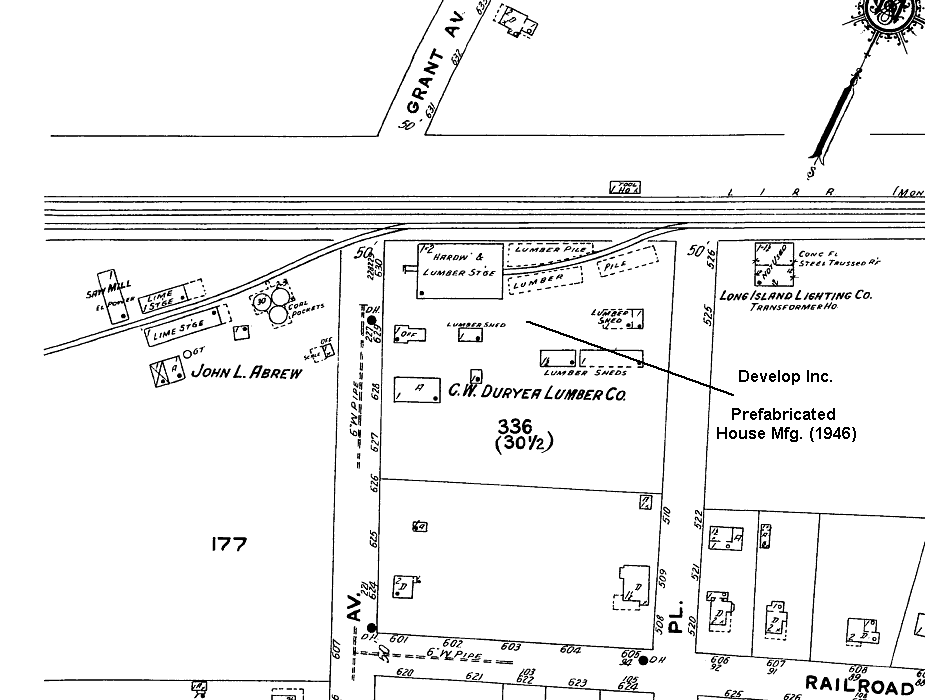 John L. Abrew Coal & Wood, C .W. Duryea Lumber Co., LILCO transformer. LIRR Tool House north of tracks. Sanborn map - Grant Ave. MP42 4/1925
|
|||||||||
| ISLIP FREIGHT HOUSE | |||||||||||
|
Islip- LIRR main
labeled as ''Southern Railroad of Long Island' from 1874 - 1st Freight
House Sanborn map 12/1890 Note: Comac Rd. South of Moffitt Blvd. - Comack
Rd. (SIC per Sanborn 1901 ) renamed Railroad Ave. c.1915 and further south
after the intersection with previous Neck Rd. as Railroad Ave (1958) then
later Nassau Ave. Previous South Side Rail Road structures: June 1876
listed the road as the "Southern RR of L.I. Division." |
|||||||||||
 Islip- Railroad Hotel at Comac Rd.. LIRR labeled as ''Southern Railroad of Long Island' from 1874 - 1st Freight House Sanborn map 12/1890 |
 1888 Hyde map - Islip Station area close-up. 1st Freight House, E. Hirst Coal Yard on north passing siding, N/S Neck Rd. leads to station parking area from the Islip village. |
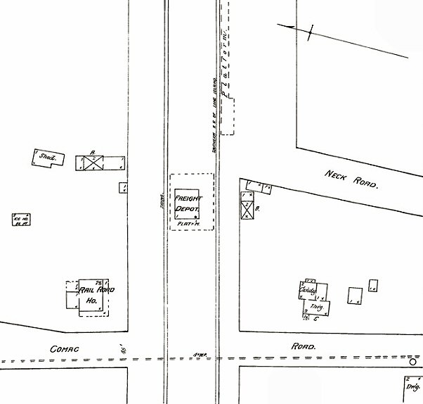
 Hyde map 1915 - 2nd freight house west of (Comac Rd.) Commack Rd. |
1868: Islip S.S.R.R. builds station and
wye 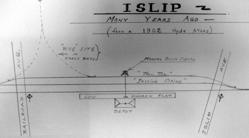 Emery drawing from 1902 Hyde map LIRR station on south side - wye razed Collection: SUNY-Stony Brook Note: The wye perhaps built as a function of the end of line at the time as Islip first appears on the timetable of South Side Rail Road May 20, 1868 as the terminal of the road and so remains until the September 1, 1868 timetable. Islip as terminus until 4/1869 when line extended to Patchogue. Patchogue Summer 1888 LIRR opened on a timetable 8/11/1869 Info: Art Huneke |
||||||||
| Original Islip Freight House east of Comac Rd. Secatogue Hotel Sanborn map inset 3/1897. So the older Railroad Hotel from the 1890 map has now been replaced by the Secatogue Hotel in this 1897 Sanborn map. (below) This could have occurred at anytime <1890 and 1897 as these maps are not update annually. Shortly thereafter, we have Monzet's Hotel 1898 (appears to be a name change) which appears on this map from 8/1902. | |||||||||||
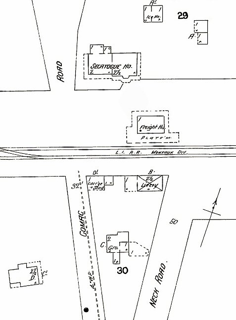 Original Islip Freight House east of Comac Rd. Secatogue Hotel Sanborn map inset 3/1897 |
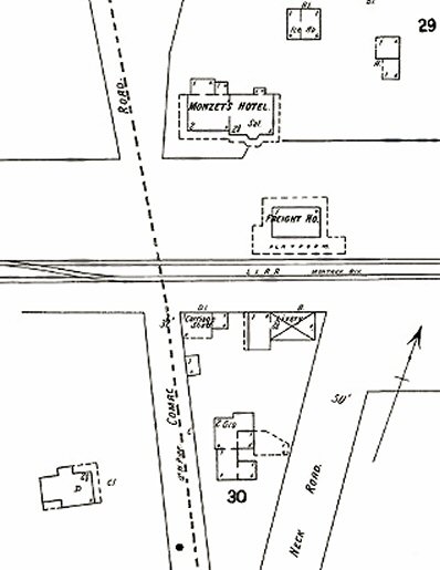 Original Islip Freight House east of Comac Rd. Monzet's Hotel 1898 (see Station Area section below) - Sanborn map inset 8/1902 |
 Islip Railroad Ave view E - Photo: c.1944 (Weber -Morrison) Note: South of Moffitt Blvd. - Comack
Rd. (sic per Sanborn 1901 ) renamed Railroad Ave. |
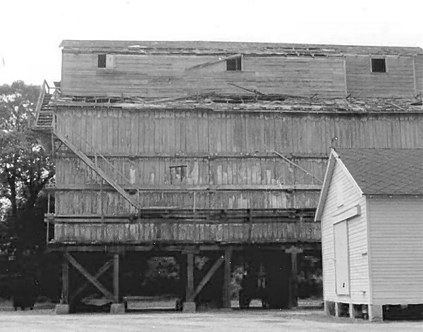
 Islip freight station (razed early 1950's) team track abandoned view E (W below) at Nassau Ave 6/21/2023 Photos/Archive: Dave Morrison 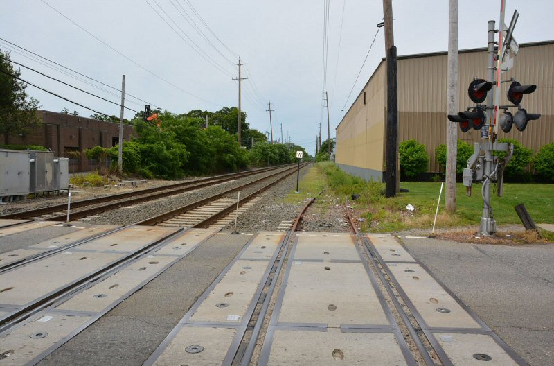 |
||||||||
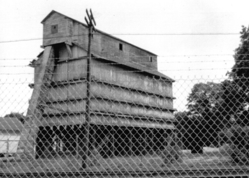
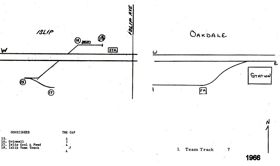
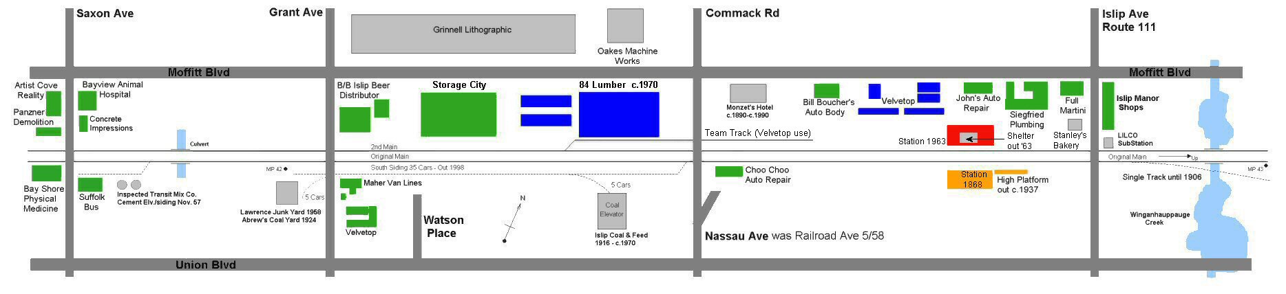
| ISLIP COAL & FEED | |||||||||||
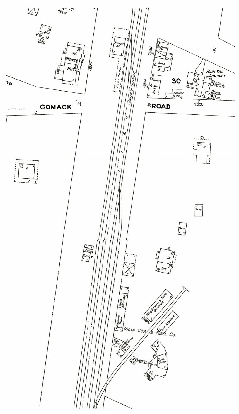
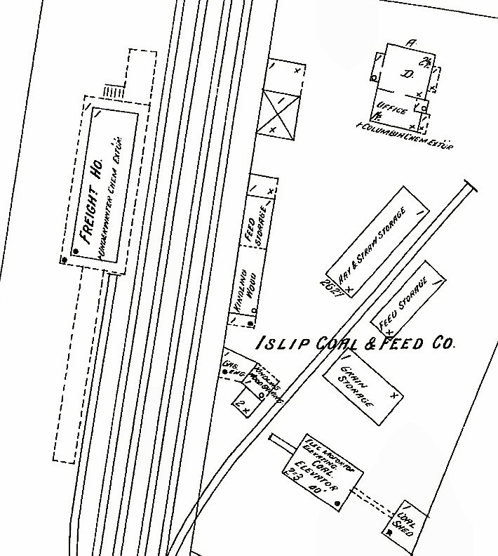
Sanborn map 1/1909 - Islip freight house east of Comack Rd. and Islip Coal & Feed Co. |
|
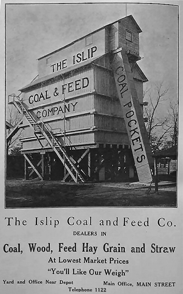 Islip Coal and Feed Co. 1915 - View SW Islip Presbyterian Church directory Archive: Barbara Corbett-Bishop
|
 Islip Coal & Feed c. 1968 view W Photo: Steve Lynch
|
||||||||
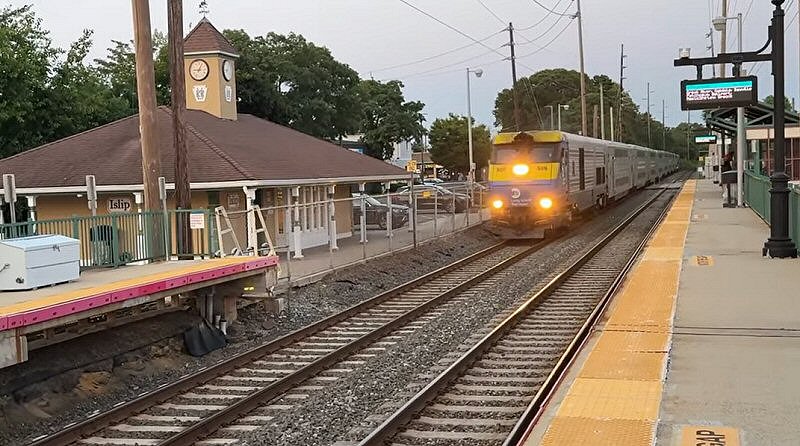
| ISLIP STATION AREA | |||||||||||
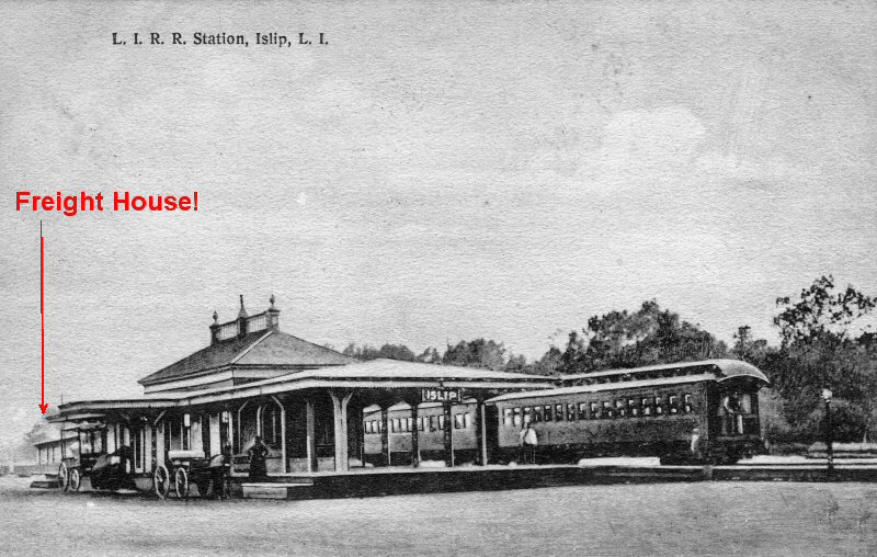
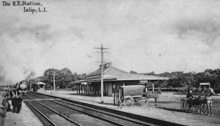
Islip post card View NW c.1905 Archive: Dave Morrison Note: 1st freight station in far left. |
 Islip Station - Petroleum Heat & Power Co. Sanborn map 12/1946 Note: Later replaced by John H. C. Haff in the 1950's (asphalt, propane, fuel) and later Velvetop 1970's. |
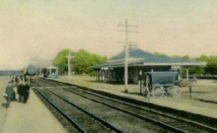 Islip view S E c.1905 Korten colorized post card 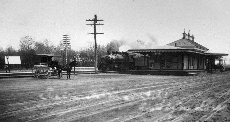 Islip 1908 view NE Collection: (Emery-SUNY Stony Brook)
|
|||||||||
 1st train direct from Penn Station out to Islip: 9/8/1910 Info: Dave Keller |
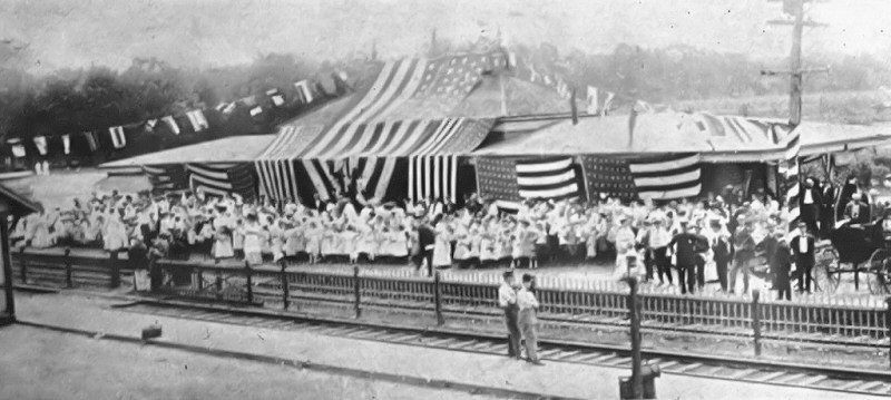
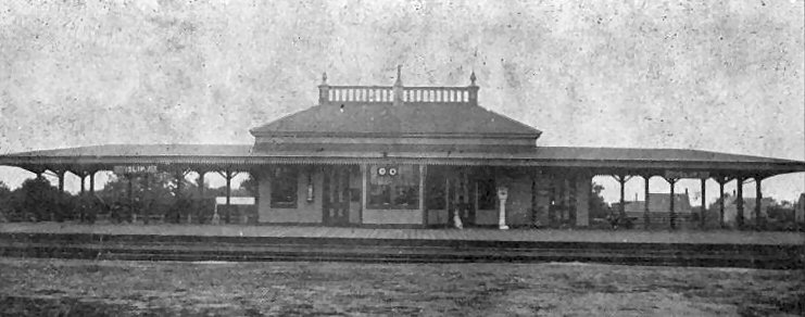
 Islip Station colorized post card - View E 1919 Express House in left background |
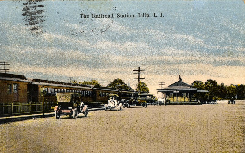 Islip post card c.1913 Korten colorized post card Archive: Dave Morrison |
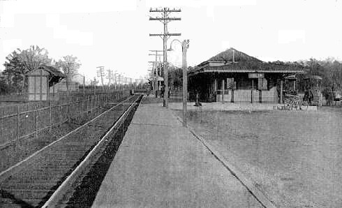 Islip Station c.1918 view east |
||||||||
 Islip Station LIRR D53a #51 Eng. John Amott View E c.1915 Archive: John Jett |
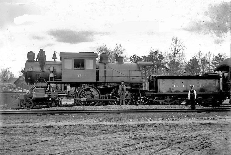 Islip Freight Station LIRR D53a #46 Eng. John Amott View N c.1915 Archive: John Jett |
 Islip Hyde Map 1915 Collection: SUNY-Stony Brook |
 Islip Station c.1925 view NE |
||||||||
 from moving train c.1925 Archive: Dave Keller |
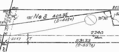
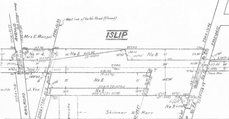 LIRR Islip Land Plan 1915 - 1919/1920 for the valuation maps Collection: Art Huneke
|
 LIRR Islip Land Plan Property Owners c. 1915 - 1919/20 Archive: Art Huneke
|
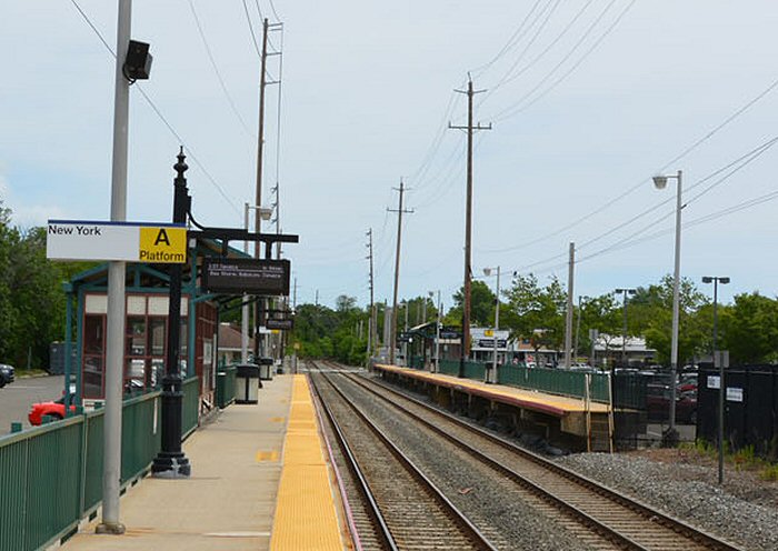 Islip Station platform view E 6/21/2023 Photo/Archive: Dave Morrison |
||||||||
|
The above are parts of the LIRR Land Plan. The ROW was about 66 feet
wide, but on the north side the property runs diagonally to a width of about 125 feet.
Room for a turntable, but not a wye. Sylvester P. Doxsey was one of the oldest and most highly thought of LIRR engineers. Top of the seniority roster at one time. If, I recall correctly, Jeff Skinner told me that Sylvester Doxsey was in the cab of the first train out to Montauk in 1895. |
|||||||||||
.jpg) LIRR Rules & Rates of Pay - Islip 1/01/1924 Archive: Dave Keller |
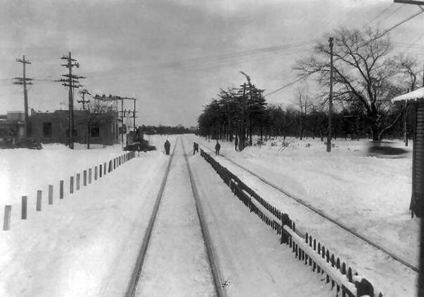
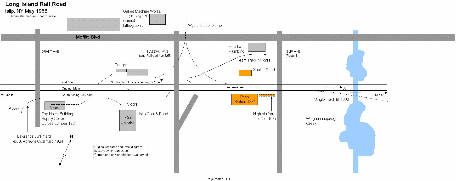
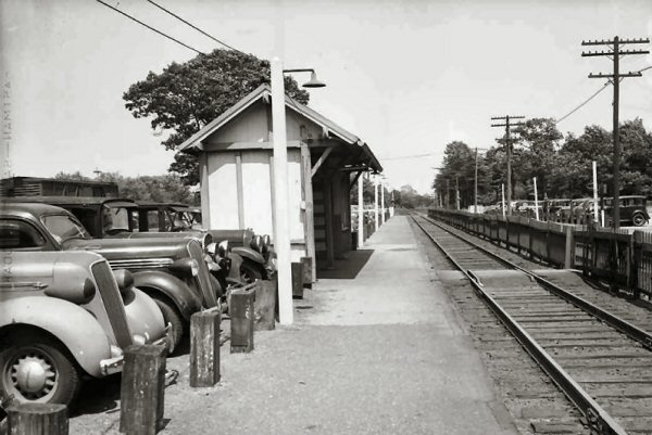 Islip Shelter view east c.1935 |
 Islip station - Islip Coal and Feed coal bunker rear view W c.1944 (Weber-Morrison) |
|||||||||
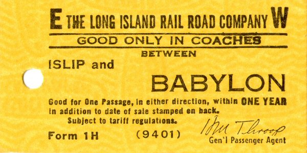 Ticket - Islip-Babylon c. 1965 Archive: Brad Phillips |
 Islip - Bayslip Plumbing, LILCO sub-station View E c. 1970 (Gaudiosi-Morrison) |
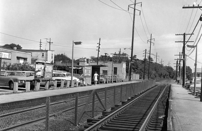
 Islip View W c.1970+ (Gaudiosi-Morrison) Note: Islip Coal & Feed bunker razed |
|||||||||
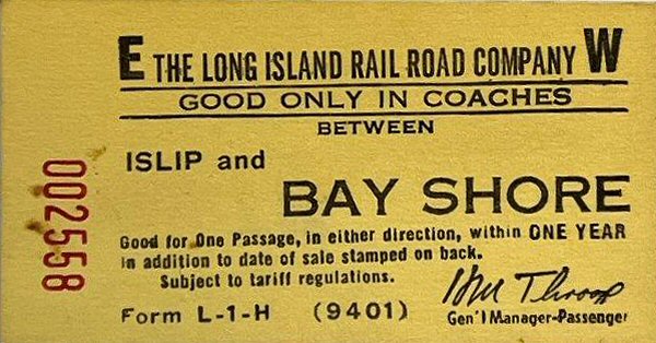 Ticket - Islip-Bay Shore 5/27/1968 Archive: Jerry Landesman |
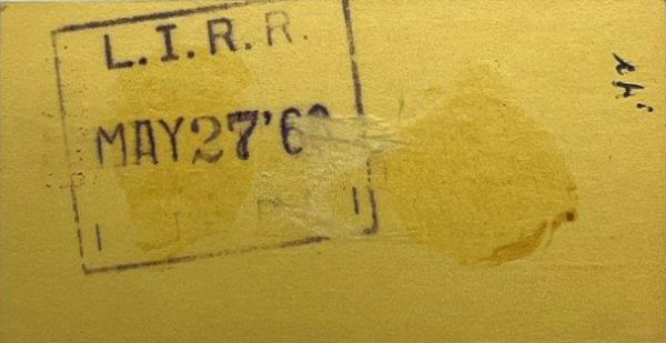 Ticket back - Islip-Bay Shore 5/27/1968 Archive: Jerry Landesman |
 Ticket - Islip-Nostrand Ave. 5/02/1968 Archive: Jerry Landesman |
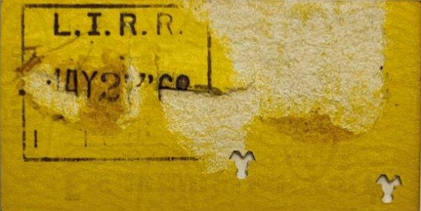 Ticket back - Islip-Nostrand Ave. 5/02/1968 Archive: Jerry Landesman |
||||||||
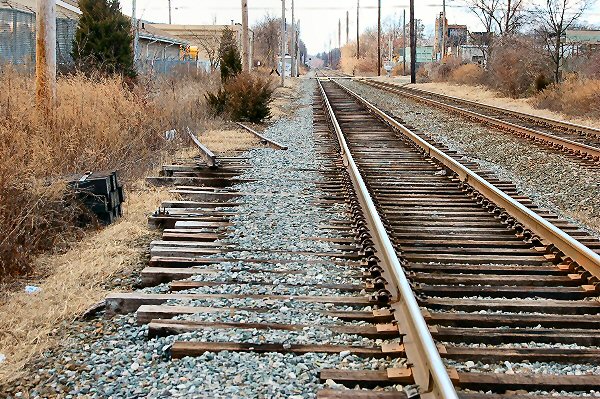
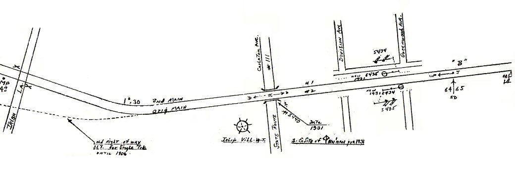
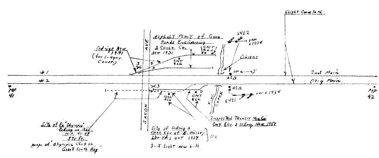 Emery map MP 41-42 1958 Site of ex-"Olympia" 870 ft. siding in 1924 at MP 41.49 Prop. (property) of Olympic Club on Great South Bay
|
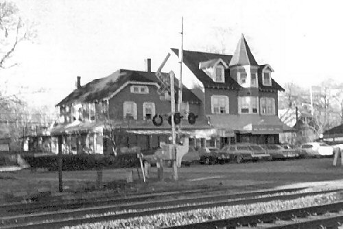 Secatogue later Monzet's Hotel 1898 built in the 1890's view NE 3/1980 Photo: Steven Lynch Nolan's Inn 1966-1971 followed by a series of restaurants and club names: Chandler's Restaurant, Casablanca, Saturdays, Tavern on the Tracks, Silhouettes until burnt down in the 1990's 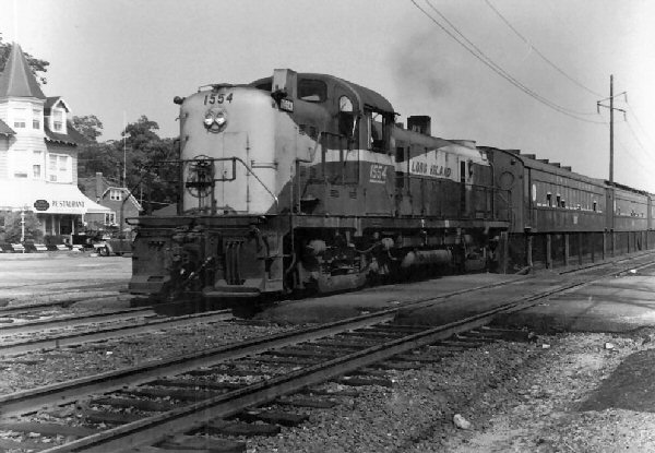 RS3 #1554 Scoot View NW 1969 Photo: J. P. Krzenski Archive: Dave Keller
|
|
|||||||||
|
|
Back years ago there was a husband and wife photographic team called the Kortens. They photographed all over LI and printed postcards that they sold. They were big on removing "unsightly" items from their postcard negatives by their skillful retouching of the images. They retouched their images regularly, removing any form of unwanted stuff . . . even people, but telephone/telegraph poles were one of their specialties. Colorized postcards were very big in the 1920s and 30s. They are still very popular among collectors. Research: Dave Keller |
||||||||||
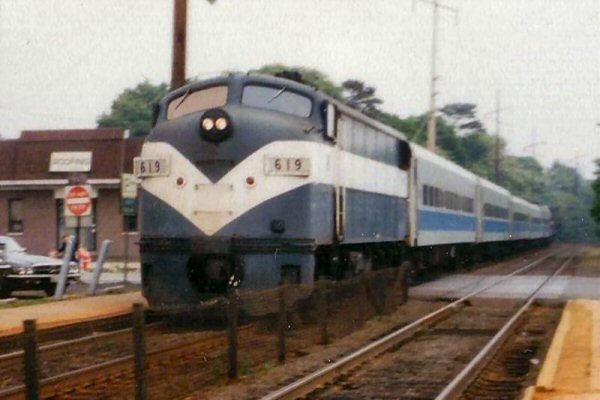
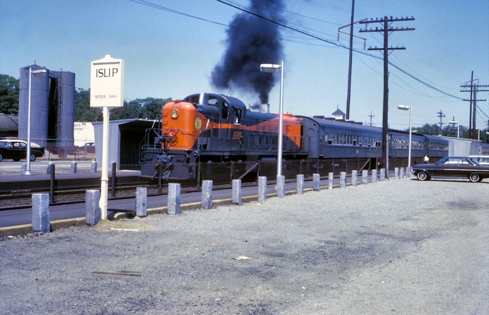 LIRR #1520 westbound Photo: Art Huneke
|
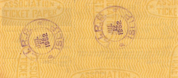
 Ticket Coach Only Islip to Bay Shore 07/12/62 front Archive: Brad Phillips |
|
|||||||||
|
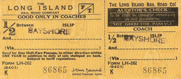
As late as July, 1962 (pictured above right), the Islip ticket office was still using ROUND brass dater dies from the 19th century. Research: Dave Keller This is blank ticket stock. All ticket agencies had tickets with printed destinations as well as blank ticket stock. ALL were numbered for auditing purposes. They also had a bunch of destination station rubber stamps. If a ticket wished to be purchased to a station for which the ticket clerk had no printed tickets, a blank ticket was pulled from the case, was stamped with a destination station and then stamped on the back with the dater and dater die, validating the ticket. Sometimes tickets were purchased at a station for two totally different starting and destination points, not involving the purchase station, such as someone going to Patchogue and purchasing a ticket between Islip and Babylon. TWO rubber stamps would be used on that ticket, then validated with the dater die. Its officially referred to as a "half-fare" ticket and was used for years for children up to a certain age as well as clergy. Years later, special ticket stock was printed that read "Clergy" on them and there was also yet another rubber stamp that said "clergy" that the clerk would stamp blank ticket stock, similar to Brad's ticket at Islip. But children always got the Half Fare tickets.
|
|||||||||||
Western Suffolk County Map 1941 Collection: East Islip Historical Society Research: Ray Lembo Archivist/Trustee |
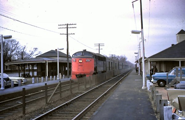
 LIRR # 2403 CPA-24 Eastbound at Islip mail Crane 9/1962 Archive: Art Huneke |
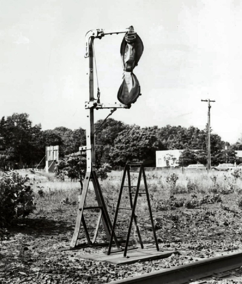 Islip mail crane view SW - 6/17/1965 Photo: Ron Ziel Archive: Queens Public Library |
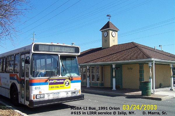 Islip Station (north of tracks) 3/24/2003 Photo: Dan Marra |
||||||||
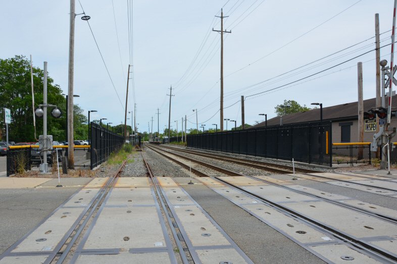
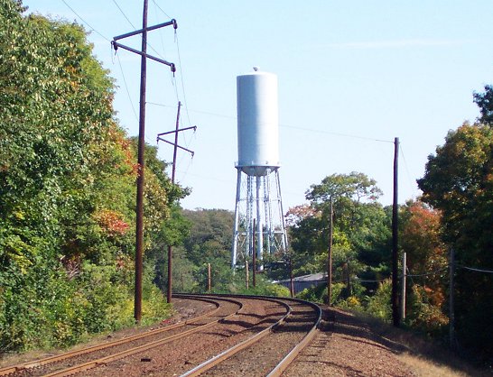
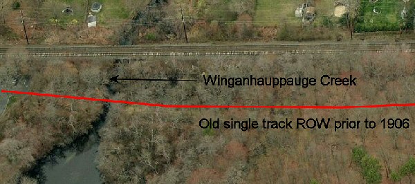
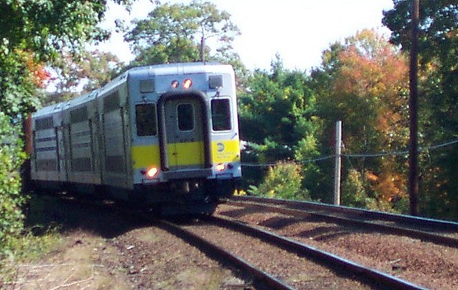 Westbound approaching Irish Lane view east of MP43 Photo: Steve Lynch 10/12/2001 |
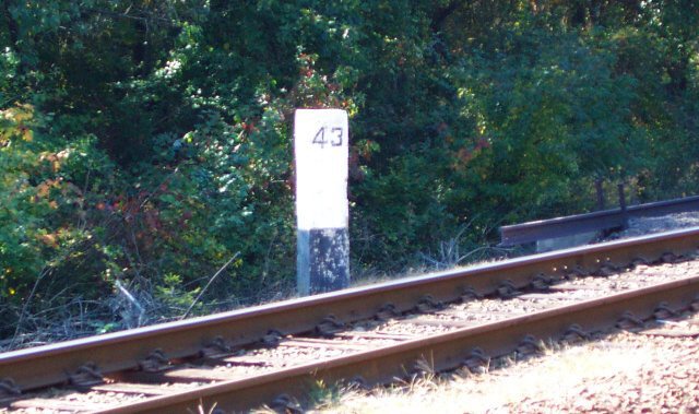 MP 43 Just west of Irish Lane 10/12/2001 Photo: Steve Lynch |
 Irish Lane view east Photo: Steve Lynch 10-12-2001 |
Islip Avenue, Joshua's Path, Wheeler Road, Town Line Road, Hauppauge Road
NOTES: For many years, NY 111 was the designation for Carleton Avenue between East Islip and Hauppauge, while CR 17 was assigned to Islip Avenue. The alignments for NY 111 and CR 17 were switched in 1972. Further north, NY 111 is multiplexed with CR 76 for one block along the Town Line Road segment in Hauppauge (near Hauppauge High School). In the mid-1960's, the NYSDPW proposed a four-lane divided arterial highway, partially on new alignment, for NY 111. Rights-of-way for this plan were obtained near the northern terminus in Smithtown, where the route was straightened (but never widened).
|
||||||||
|
|
|
|
|||||||||
.jpg) Stanley R. Jones Ticket Clerk/Telegrapher Islip 2/1958 (Stanley R. Jones - Dave Keller) |
Stanley R. Jones, LIRR ticket clerk/telegrapher in white shirt and bow tie sending on his Vibroplex "Lightning Bug" key, with the telegraph sounder in the resonator at his ear - Islip station - February, 1958 just before his retirement. Stanley entered the roster of LIRR Telegraph Employees on May 2, 1919. In addition to the sounder being placed in the resonator to amplify the sound, it was typical old-style telegrapher fashion to insert a metal tobacco tin that was flattened and placed behind the sounder to make the "dots and dashes" even THAT much more audible. Notice the sign advertising Pullman accommodations . . . interline tickets were still being sold at this time. Research: Dave Keller |
||||||||||
 Islip 11/23/1963 - Photo/Archive: Brad Phillips |
 Islip 11/23/1963 - Photo/Archive: Brad Phillips |
 LIRR #2004 Eastbound 11/23/63 Photo: Bradford Phillips |
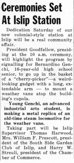
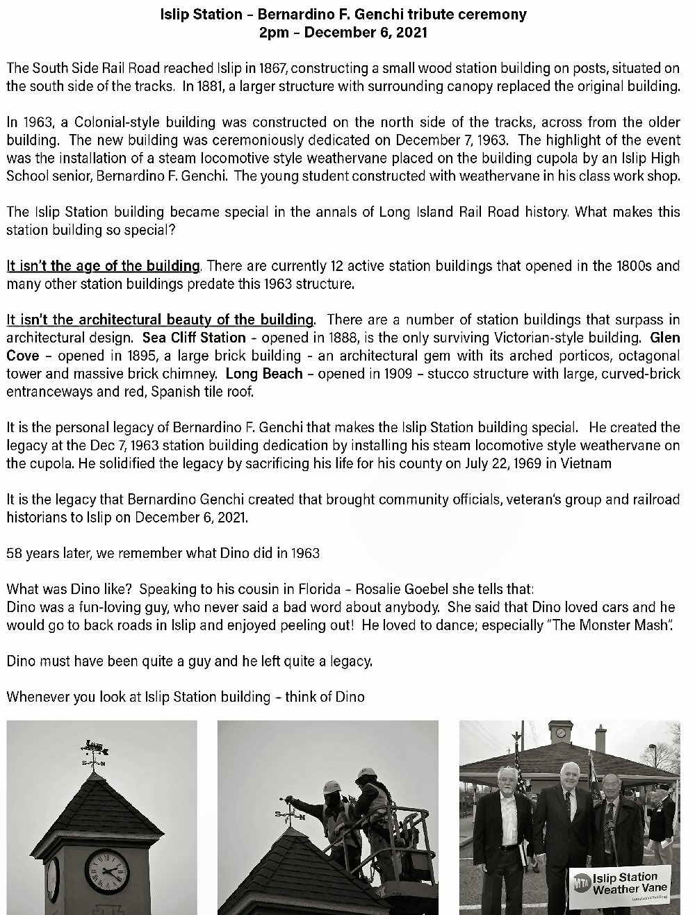
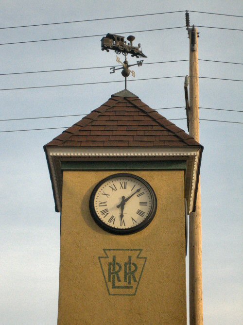
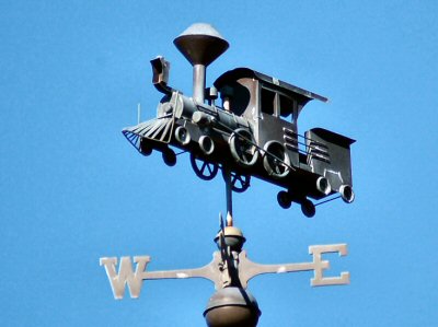
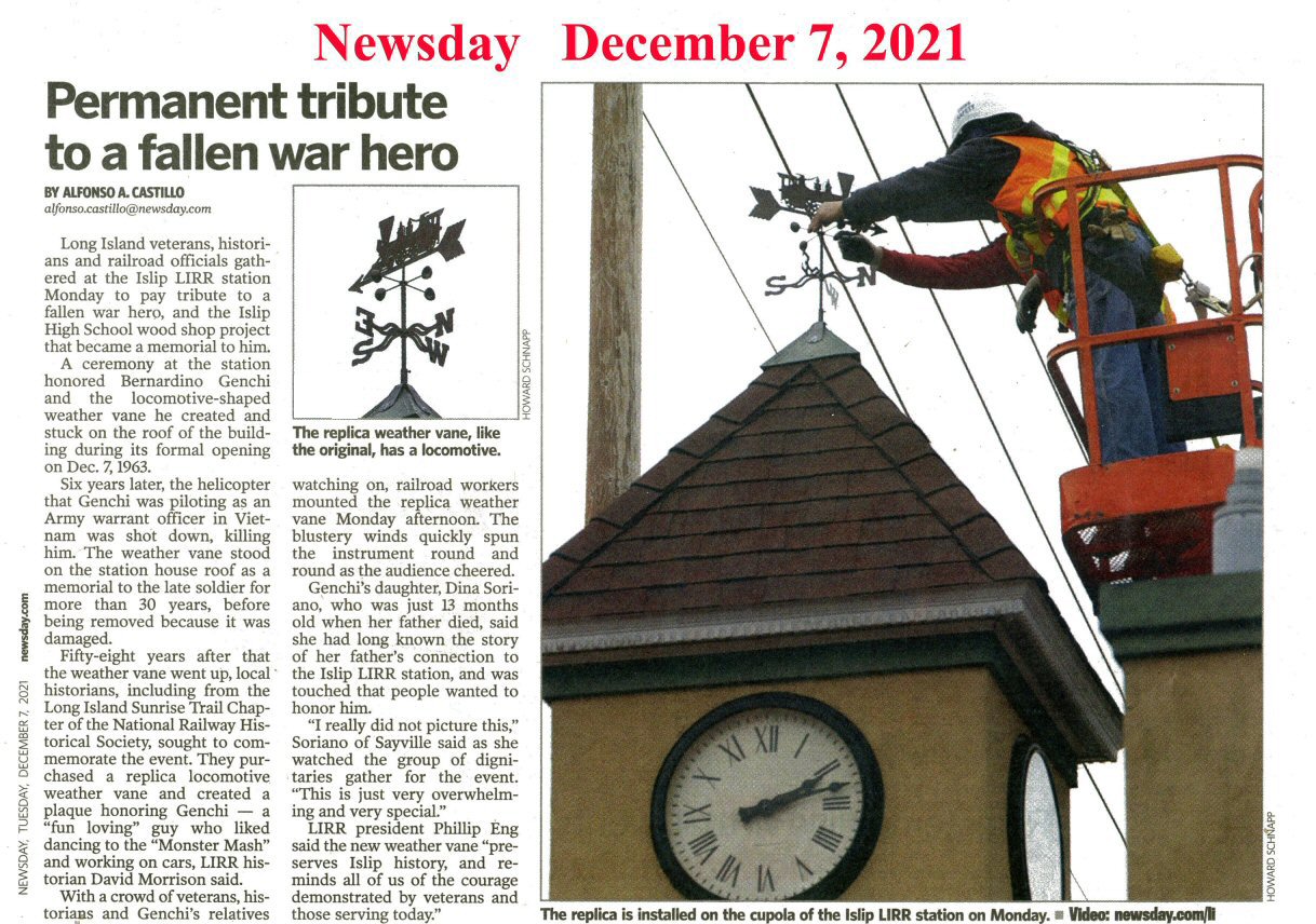
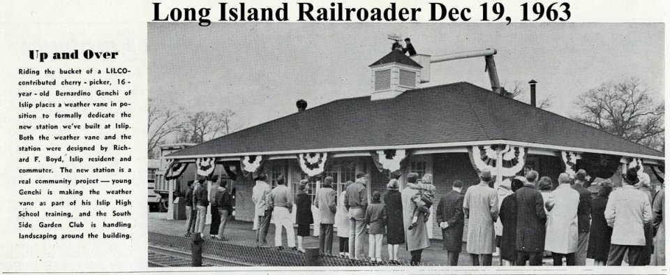 LIRR Railroader December Issue - Dedication of new Islip Station - Dino Genchi placing the weather vane he designed. 12/07/1963. Info: Brad Phillips |
||||||||
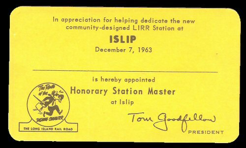 Islip New Station Dedication Pass Honorary Station Master 12/07/63 Archive: Brad Phillips |
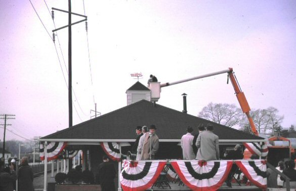 Dedication of new Islip station - Dino Genchi placing the weather vane he designed. 12/07/1963 Photo: Bradford Phillips |
 Goodfellow at dedication of new Islip station 12//07/1963 Photo: Bradford Phillips |
 Islip Station - View NW 12/1971 Photo/Archive: Dave Keller |
||||||||

This is the weathervane my brother Dino Genchi made in metal shop and placed atop the Islip Train Station in 12/07/1963. My cousin still has the template (designed by someone else) in his garage. They used a cherry picker to have him place it! Info: Diana J. Genchi
|
 Islip Station - LIRR President Goodfellow Dedication 11/21/1963 |
 Islip Station 1971 (Sturm-Fehn)
|
|||||||||
|
|
|||||||||||
|
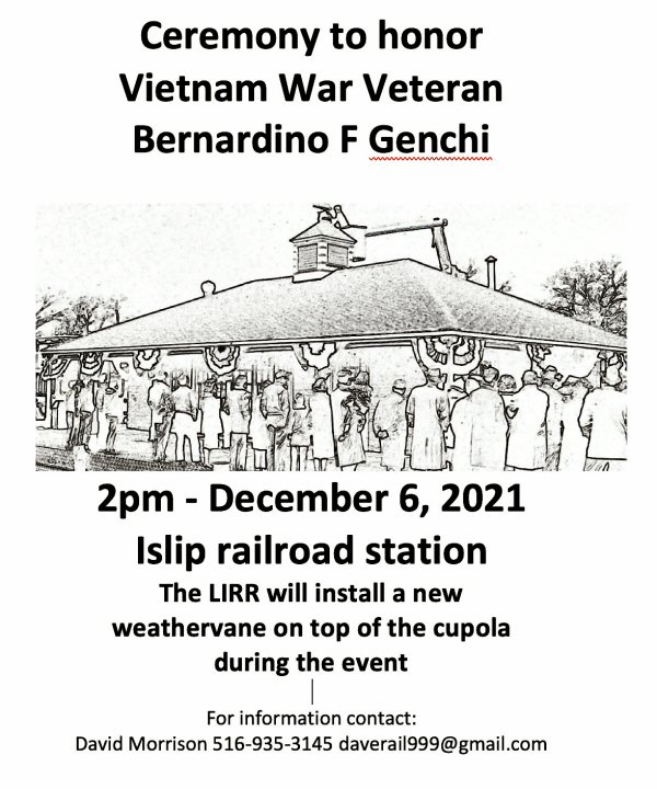
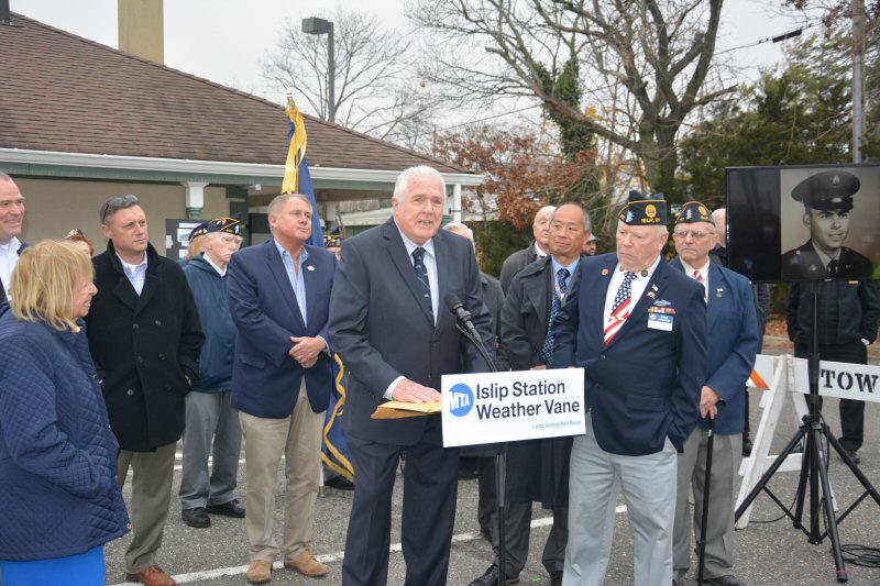
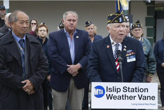
BERNARDINO F. GENCHI TRIBUTE -
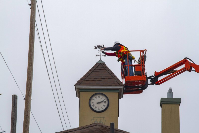
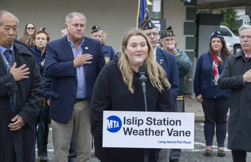
ISLIP STATION December 6, 2021 There will be a Rededication Ceremony at Islip Station at 2pm on December 6th, 2021. A photo display (left) will be placed into the display case inside the station waiting room. In addition, a locomotive weathervane will be placed atop the building cupola by the LIRR Bridge & Building (B&B) Department prior to the event. Islip Town Supervisor Angie Carpenter, LIRR President Eng, President of the LIST-NRHS, Stephen Quigley, and Organizer Dave Morrison will be in attendance. |
|||||||||||
 A photo display will be placed into the display case inside the station waiting room |
|
 Islip Station waiting room display case 11/06/2021 Photo/Archive: Dave Morrison |
|||||||||
 |
LIRR restores weathervane
at Islip Station
December 6, 1963 - The metal weathervane that Islip High School student Bernardino F. “Dino” Genchi, as a shop class project, was making wasn't ready yet, so a wood version was installed. Shortly thereafter, Genchi's metal version was installed. In the photo (see below) taken during the December 6, 2021 event, the boy was holding a prototype from which Genchi's weathervane was produced. LIRR historian, Dave Keller, indicates Genchi's weathervane had "disappeared" sometime between 1971 and 1975. There is absolutely NO record of it being blown down in a storm (although it could have been). The 1970s were a time of copper thefts on the LIRR, particularly contact tips from the Morris Park Shop and 250mcm copper wire from overhead power lines. In the 1997/98 renovation, a three-dimensional weathervane was installed. At that same time, a similar weathervane was installed at Nassau Blvd Station. The three-dimensional weathervane (let's call it the second weathervane) became loose and the locomotive part fell off onto the roof of the station building. Don Konrad got the locomotive piece off of the roof in September 2018. That is the second Islip weathervane piece that is now at RMLI. The weathervane installed December 6, 2021 is the third weathervane. Info: Dave Morrison Photo: LIRR/Glen Sager |
||||||||||
 |
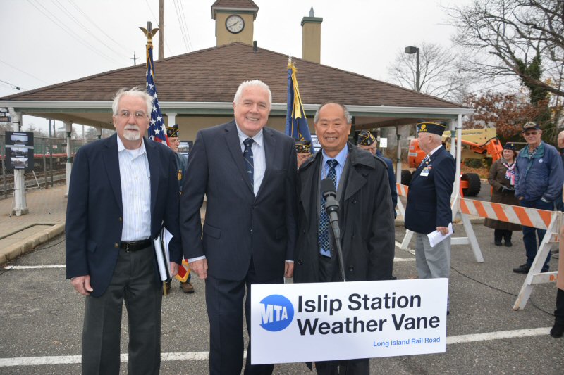 Stephen Quigley-NRHS-LIST, Dave Morrison-Organizer, LIRR President Eng |
 Dave Morrison-Organizer, LIRR President Eng, Roby Johnson-Commander Suffolk County American Legion |
 LIRR President Eng, Roby Johnson-Commander Suffolk County American Legion presentation |
||||||||
 Islip Station - Bernardino F. Genchi tribute ceremony December LIST-NRHS Semaphore |
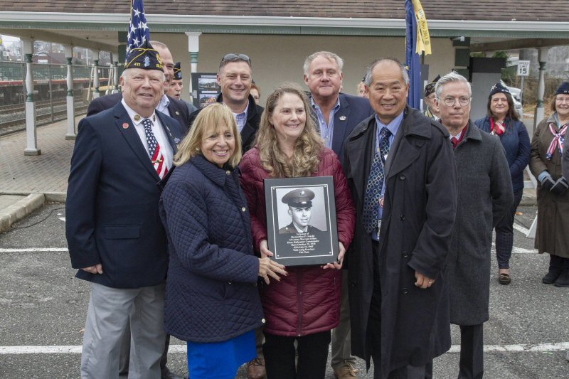 Roby Johnson, Islip Town Supervisor Angie Carpenter, Dina Soriano, LIRR President Eng
|
|
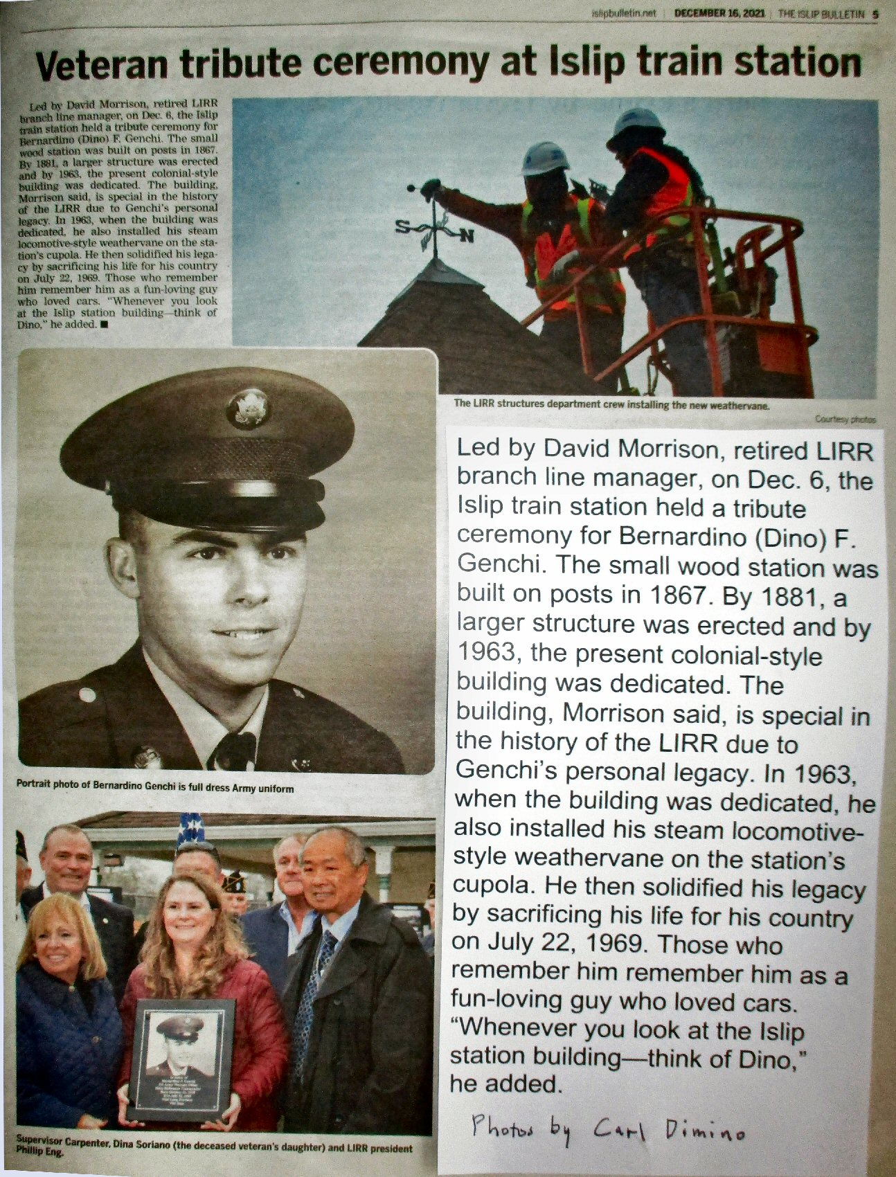 Genchi Tribute - Islip Bulletin 12/16/2021 Photos/Archive: Carl Dimino |
||||||||
|
|
|||||||||||
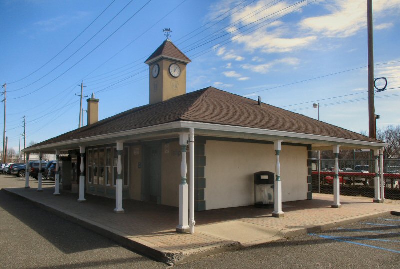
 2006 Station view NW |
Islip Station views west and east 6/07/2012 Photos/Archive:: Al Castelli |
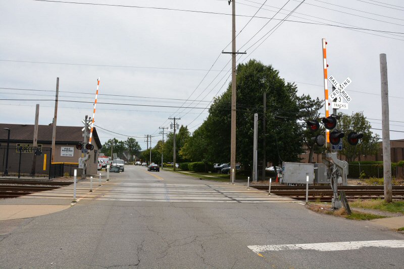
 Islip Pedestrian crossing warning bell c.2008 connects the north/south parking lots west of station View N |
|||||||||
|
|
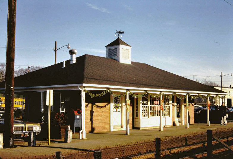
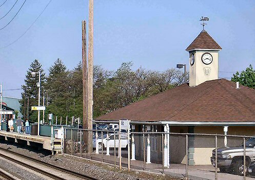
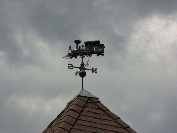
 Islip Station cupola weather vane 4/2012 |
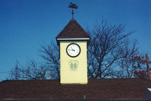 2006 Station Clock Tower view looking North
|
|||||||||
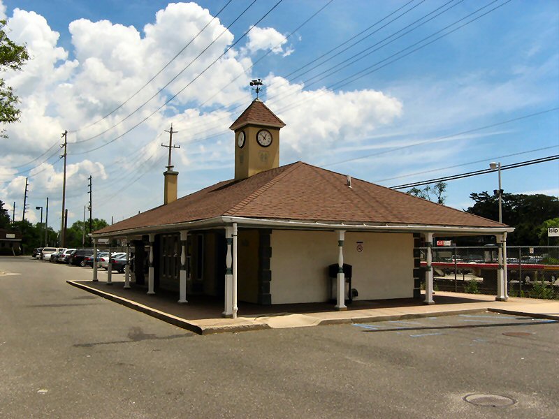
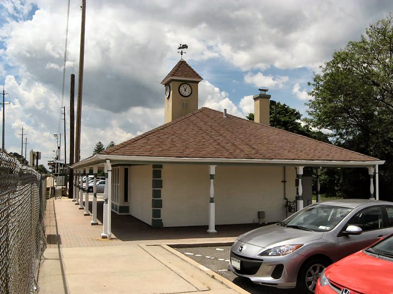
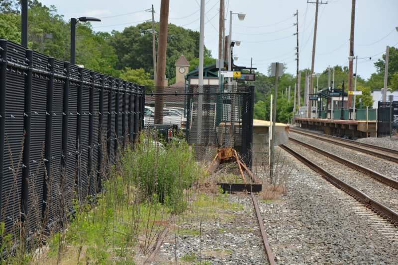
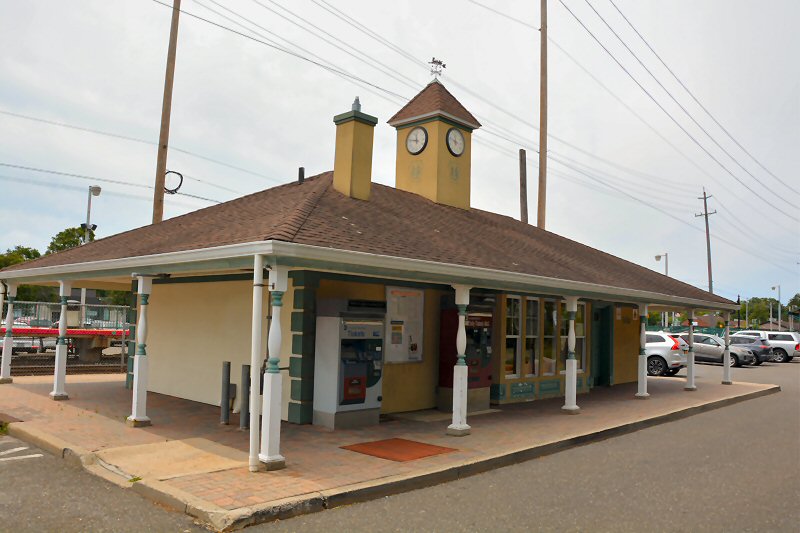 Islip Station - View SW 6/21/2023 Photo/Archive: Dave Morrison |
 Islip Station - View SE 6/21/2023 Photo/Archive: Dave Morrison |
||||||||||
|
|
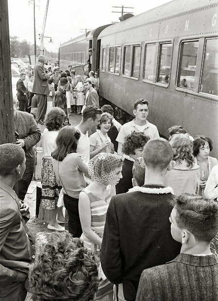
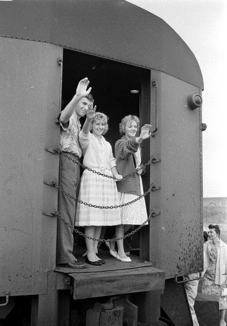
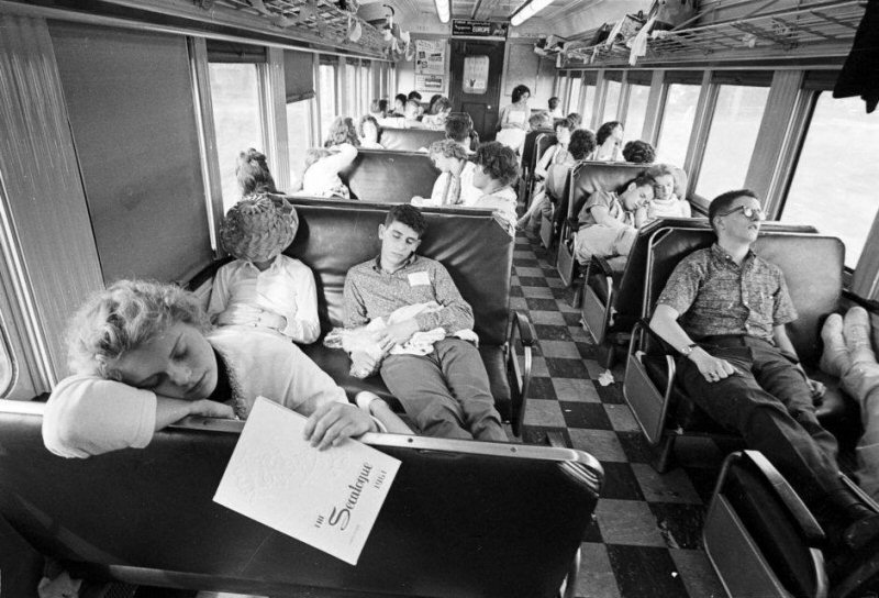
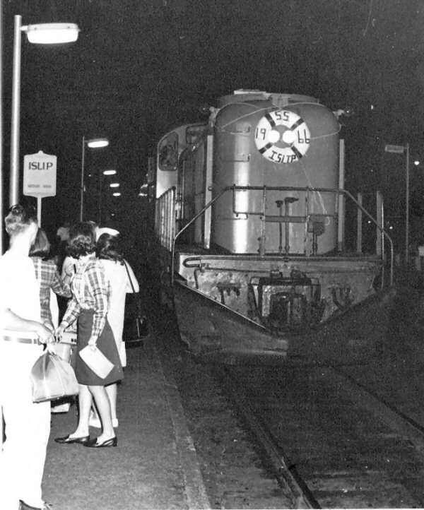 Islip 1966 Class Montauk Train Ride Photo: Carl Wopple |
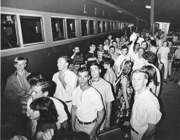 Islip 1966 Class Montauk Train Ride boarding Photo: Carl Wopple |
|||||||||
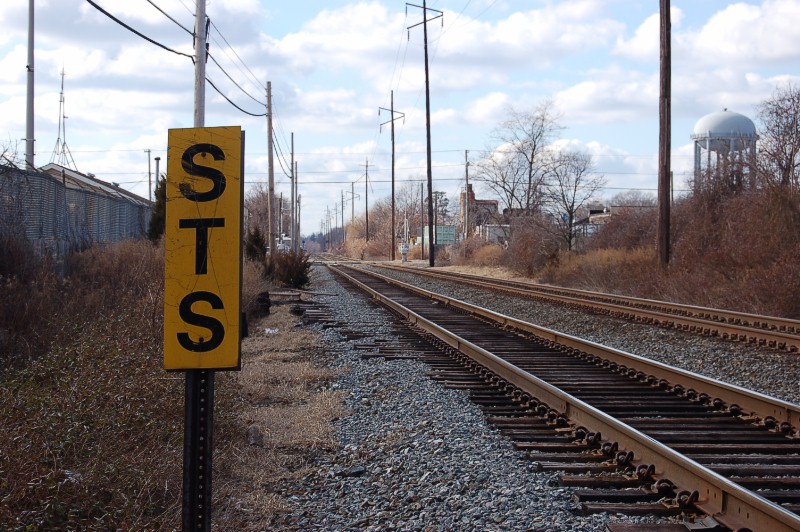 STS Sign east of Saxon Ave View West 01/27/2008 Photo: Mike McDermet Speedometer test section sign, as per Special instructions 1038-A1 all STS are 1/2 mile in length and are located where speeds are 30 mph or greater; most are located near terminals. |
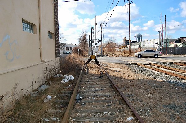 Saxon Ave Siding View West 01/27/2008 Photo: Mike McDermet |
 Saxon Ave Switch View West 01/27/2008 Photo: Mike McDermet |
 Train #6017 westbound 8/03/2025 Photo/Archive: Timothy Hosey |
||||||||
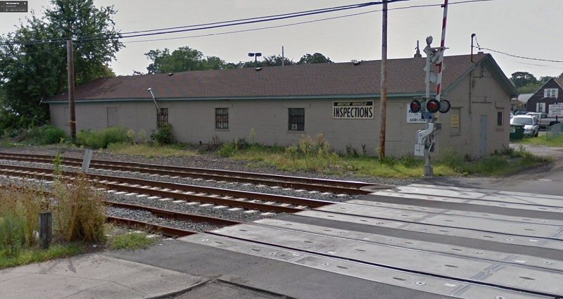
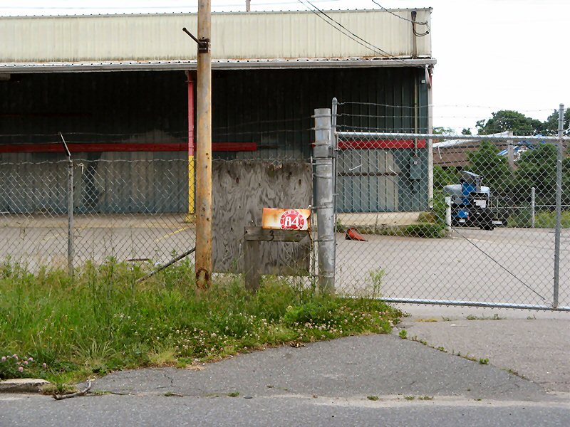
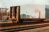
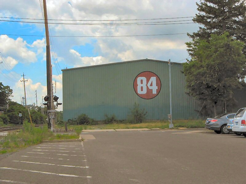 84 Lumber closed view W 6/01/2012 Photo: Al Castelli |
 84 Lumber view SW 6/07/2012 Photo: Al Castelli |
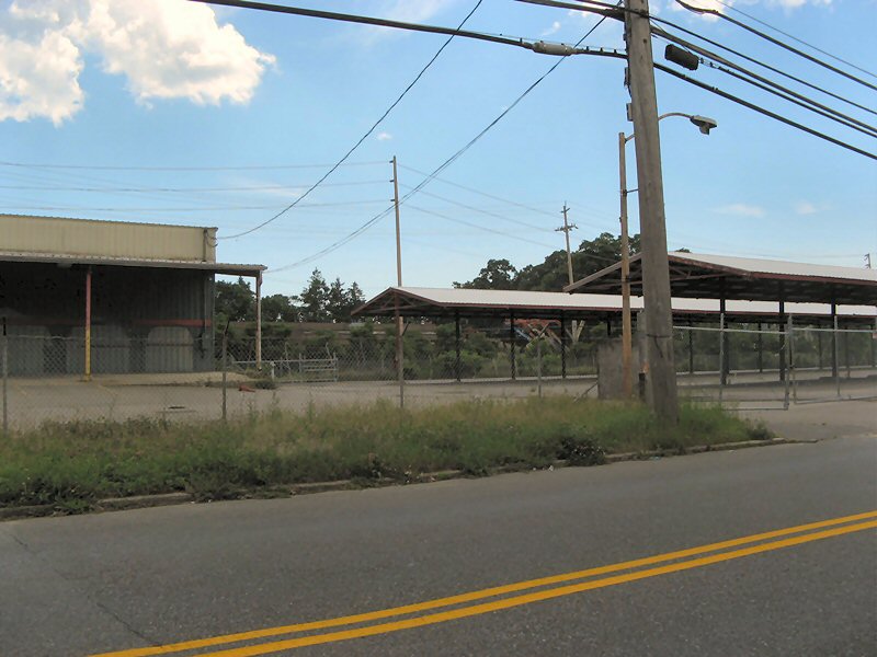
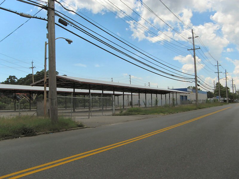 View SW towards Storage City 6/07/2012 Photo: Al Castelli |
|||||||||
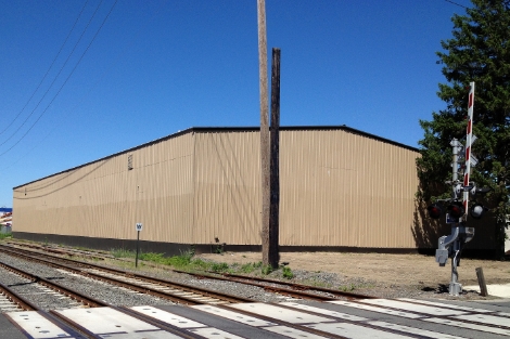 PRIDE Equipment view NW 6/04/2013 Photo: John DeMarco 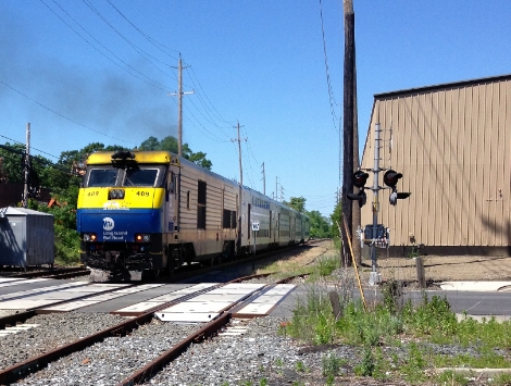 LIRR DE #409 PRIDE Equipment view W 6/04/2013 Photo: John DeMarco |
|
 84 Lumber view SE 6/07/2012 Photo: Al Castelli
|
|||||||||
| ISLIP ODD's & END's | |||||||||||
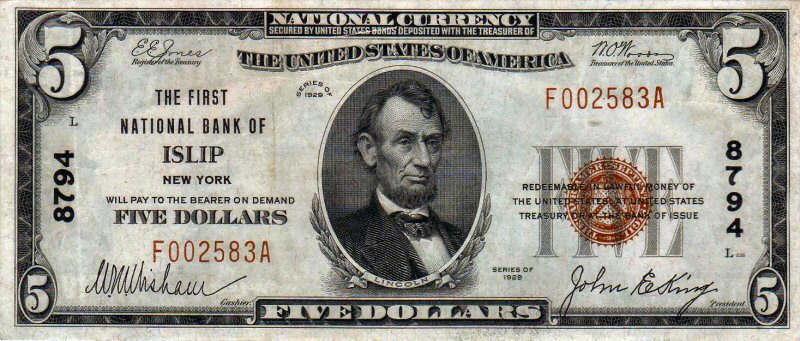 First National Bank of Islip - National Currency Five Dollar 1929 series 1863 to 1935, National Bank Notes were issued by banks throughout the country and in US territories. Banks with a federal charter would deposit bonds in the US Treasury. The banks then could issue banknotes worth up to 90 percent of the value of the bonds. The federal government would back the value of the notes, the issuance of which created a demand for the government bonds needed to back them Source: Wikipedia
|
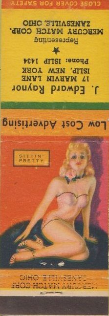
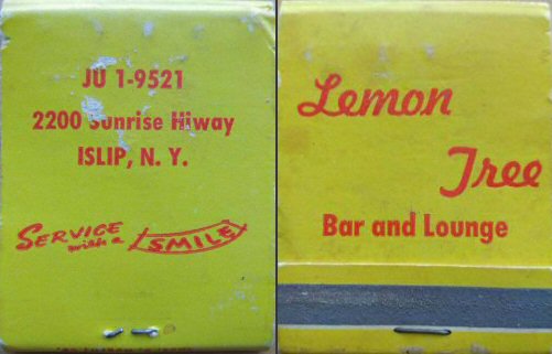 Lemon Tree Matchbook |
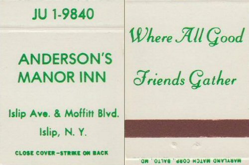 Manor Inn Matchbook Cover 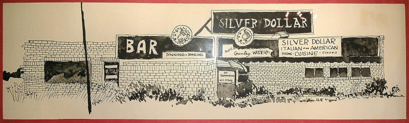 Silver Dollar Bar & Grill Archive: Ray McGinley corner of Commack Rd/Sunrise Hwy |
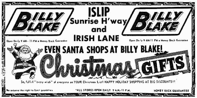 Billy Blake - Christmas Ad 1960's
|
||||||||
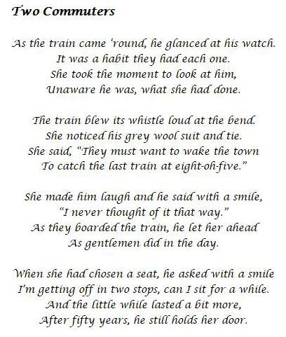
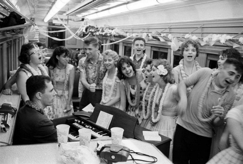
'Two Commuters' by Wayne Martin, Class of '68, - March, 2018 |
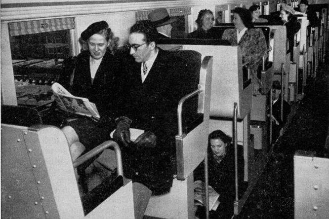 Double Decker Interior 1950's
|
|
|||||||||
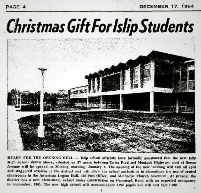 New Islip High opening 1/04/1965 news article 12/17/1964 |
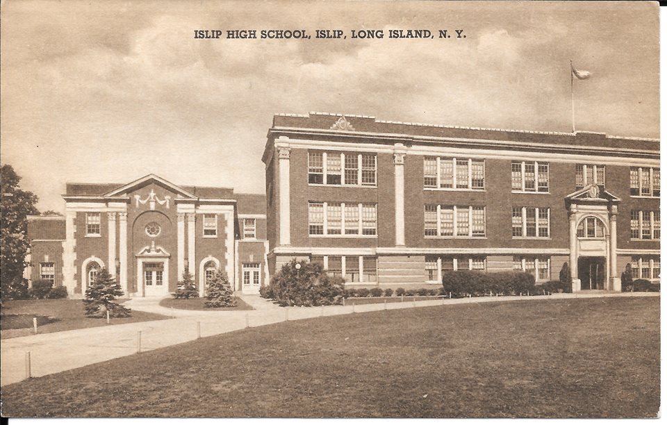 Islip High School - "Old Main" Class of '68 50th Reunion History |
 Islip High Gymnasium Archive: Vivian Kirkbride |
 Islip Buccaneers banner Archive: Vivian Kirkbride |
||||||||
 Islip Movie Archive: Henry Bollinger |
 Islip Beach Archive: Bill Carlsen |
 Seascape Inn 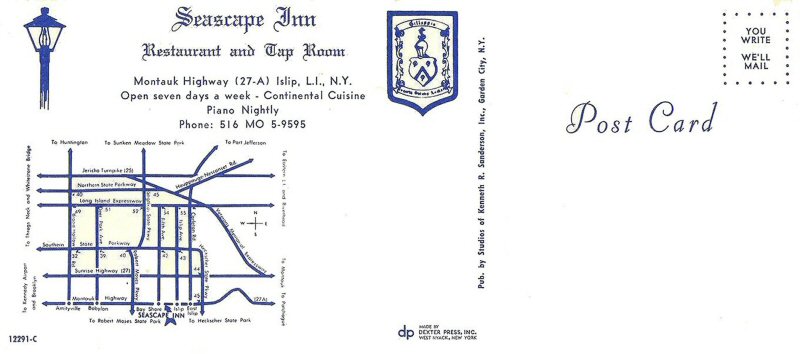 Seascape Inn post card 1960's Archive: Bruce Smith |
 Seascape Inn -Montauk Hwy, Islip - Collection: Bruce Smith |
||||||||
 Islip Town Hall - Veterans Memorial Park 911 Memorial - 3/17/2023 Archive: John Redshaw |
 Islip World War I Memorial Archive: Vivian Kirkbride |
 Bay Shore Farmers Market Archive: Doug Aichroth |
 West Maple Street dock Archive: Loretta Thornton Dalia |
||||||||
|
|
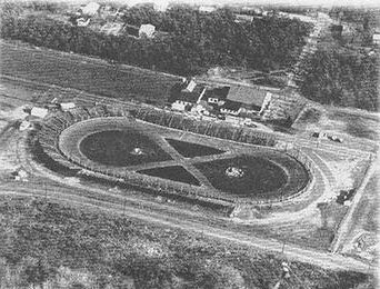
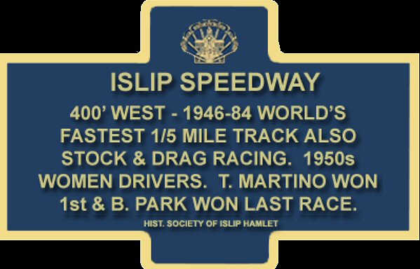
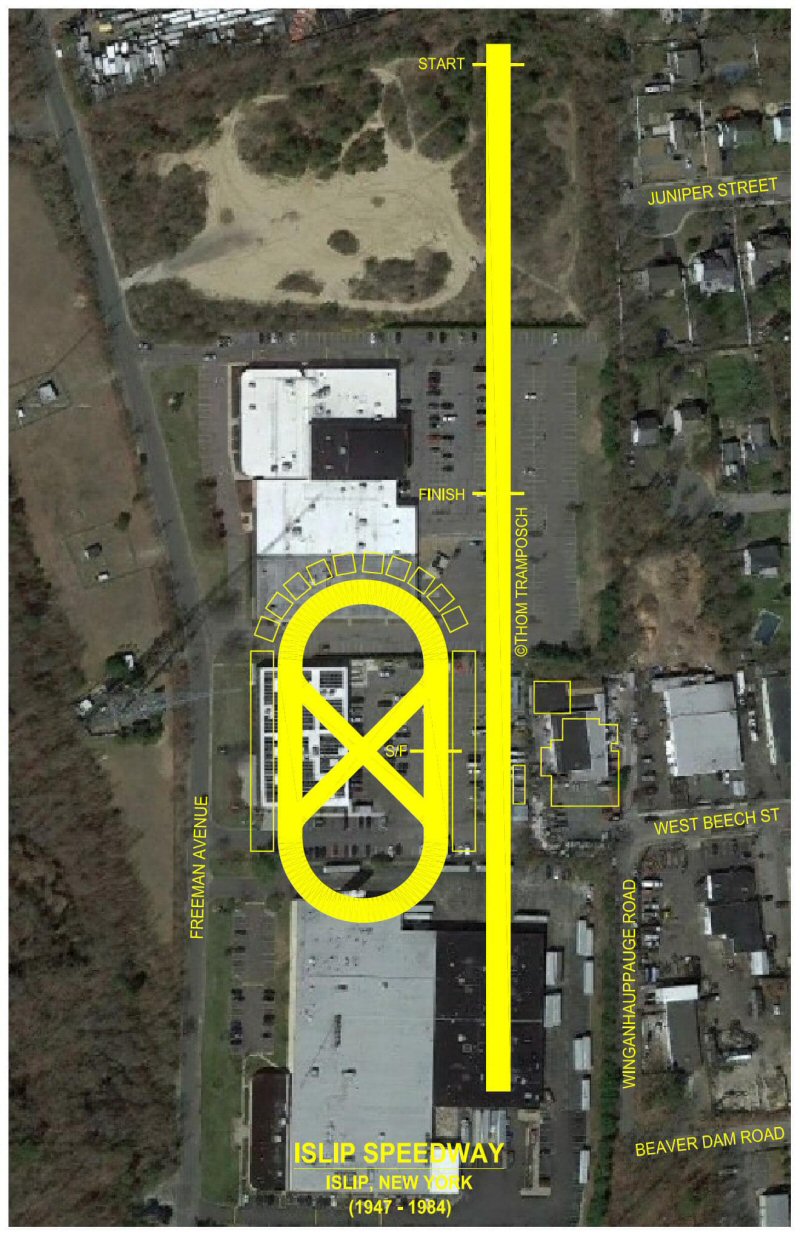
ISLIP SPEEDWAY Islip Speedway (1947-1984) was a .2-mile oval
race track located 1 mile N of the Islip Station. The first demolition
derby took place at Islip Speedway in 1958. The speedway has since been
demolished.
|
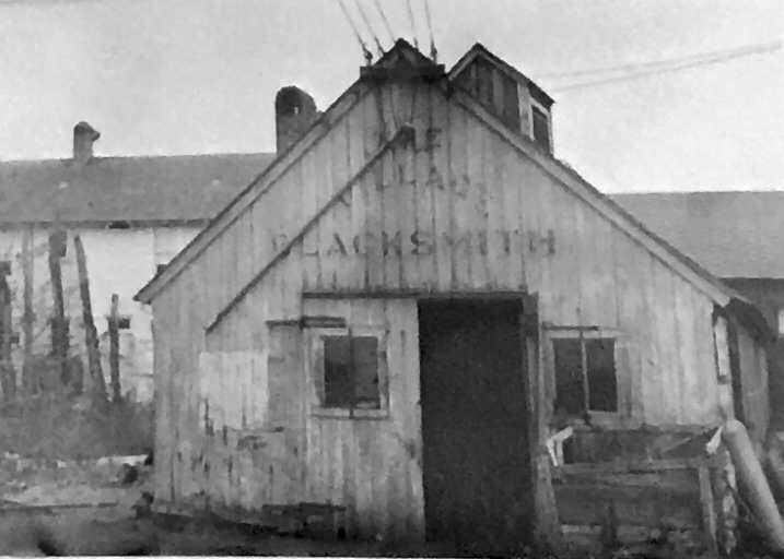 "Village Blacksmith" c.1940's+ Archive: Don Ochs
Opinion: Located on the Bailey's Mill site.
|
|||||||||


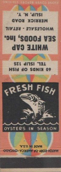 O-Co-Nee East Diner Al's Delicatessen White Cap Seafood |
 Viking Restaurant |
 Islip Masonic Temple post card Archive: Vivian Kirkbride
|
|||||||||


 LOCATION: Islip (at NY 27A) to Smithtown (at NY 25 and NY 25A)


 In
1914, as World War I began, Andrew Wolpert Sr., a Bavarian native who
had been a real estate agent in New York City, and his three sons began
building houses in the woods between East Islip and Central Islip State
Hospital. The Wolpert's wanted to attract people of German origin, according to historians. The place was known as Germantown, but the war brought pressures to change the name of the community. Many people who moved there worked in the state hospital. Info: East Islip Historical Society.
In
1914, as World War I began, Andrew Wolpert Sr., a Bavarian native who
had been a real estate agent in New York City, and his three sons began
building houses in the woods between East Islip and Central Islip State
Hospital. The Wolpert's wanted to attract people of German origin, according to historians. The place was known as Germantown, but the war brought pressures to change the name of the community. Many people who moved there worked in the state hospital. Info: East Islip Historical Society. 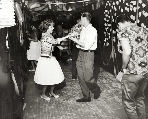