OYSTER
BAY BRANCH 
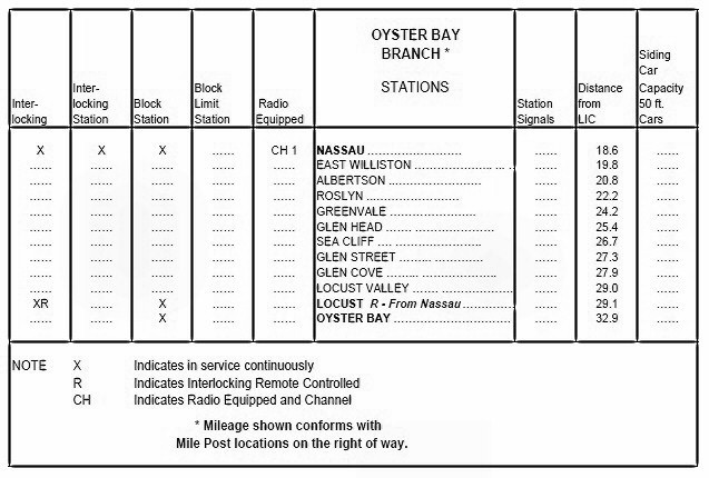
LIRR Employee Timetable
No.4 page VI 5/14/2012
Oyster Bay Branch LIRR
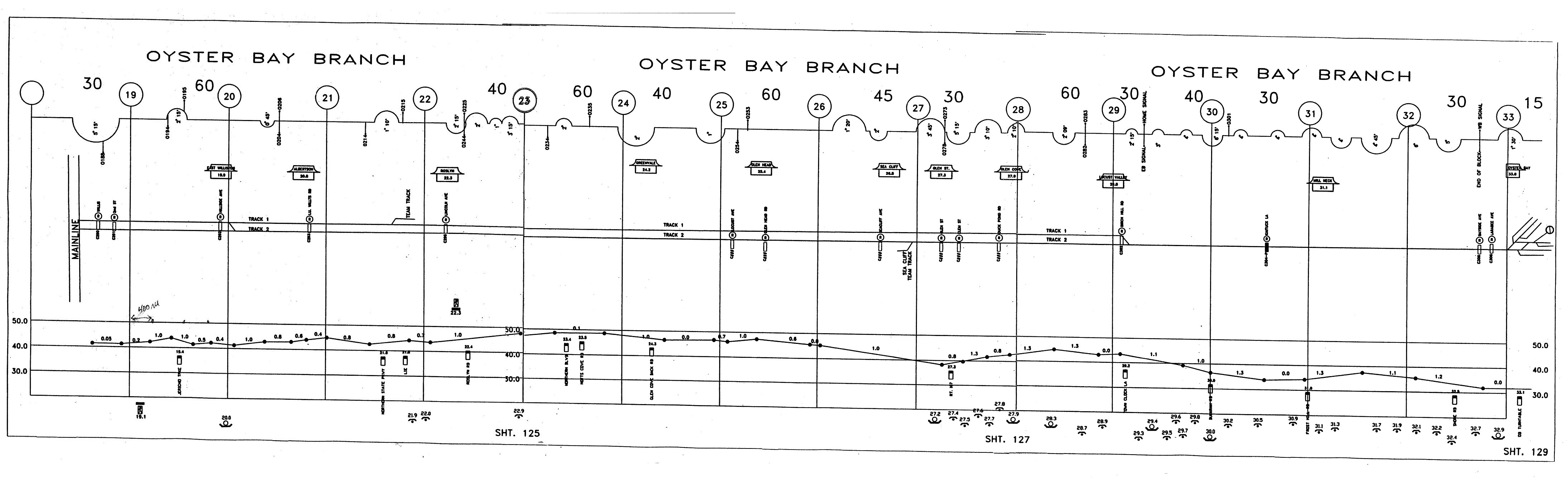
Track Profile Map
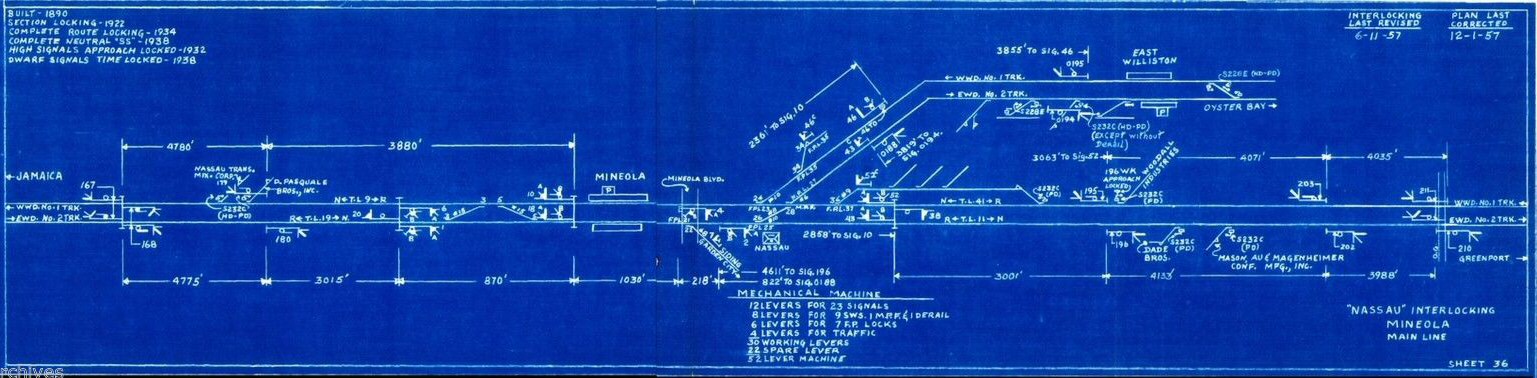
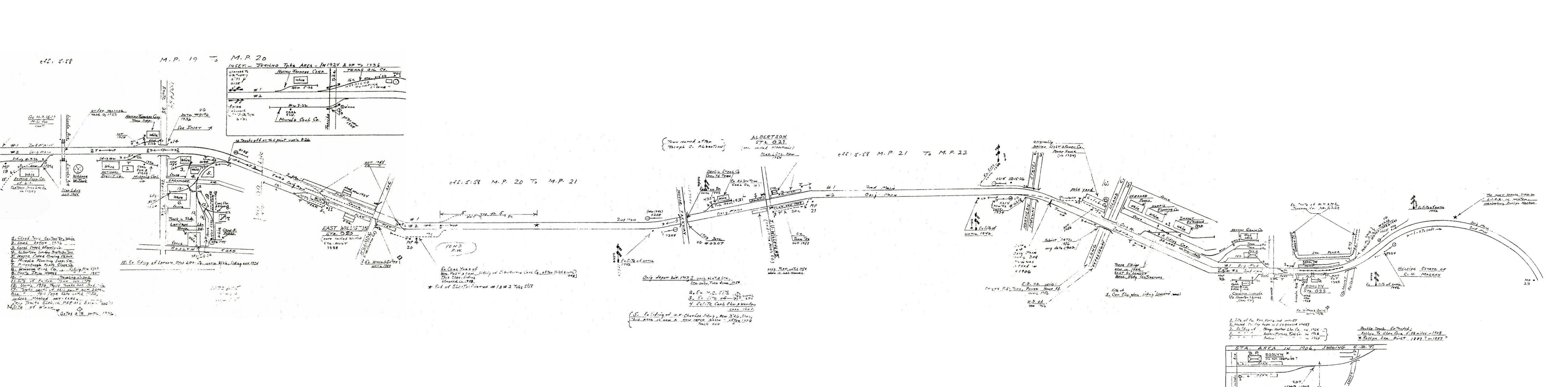
LIRR Nassau
Interlocking sheet 36 Revised 6/11/57 and corrected 12/01/57 Archive:
Art Huneke
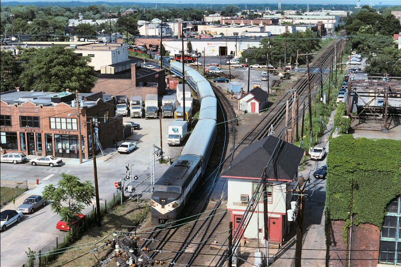
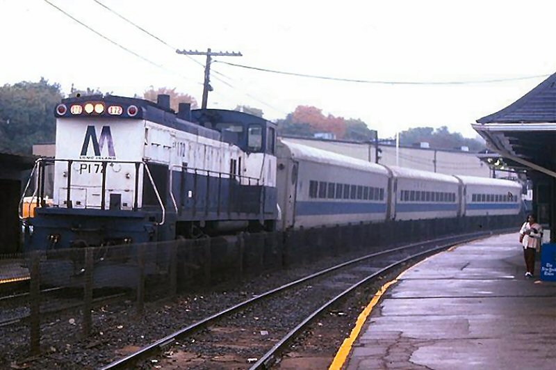
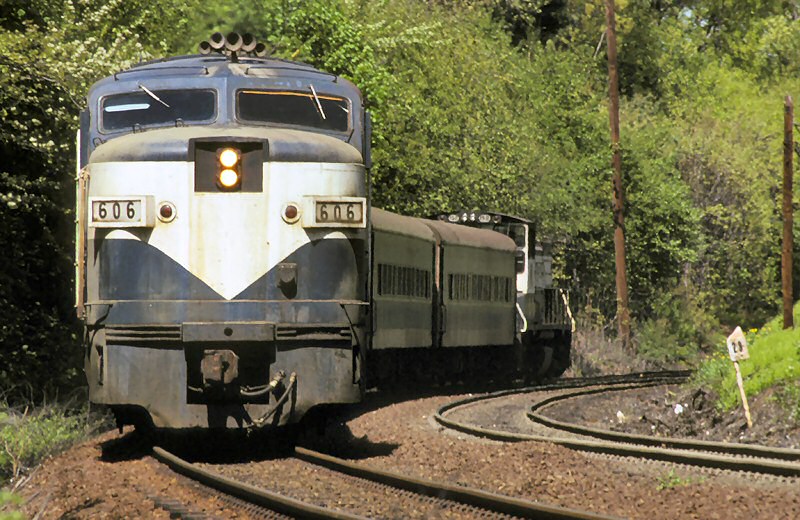
LIRR Alco FA # 616 at Nassau /06/16/92 Train 4555
Photo: Kevin Gulau from top of the municipal parking garage

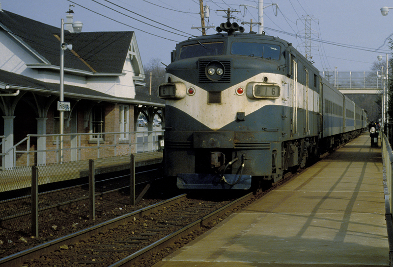
LIRR #607 at Nassau Tower, Mineola view E c.mid-1990's
Photo/Archive: A. Joseph Daly
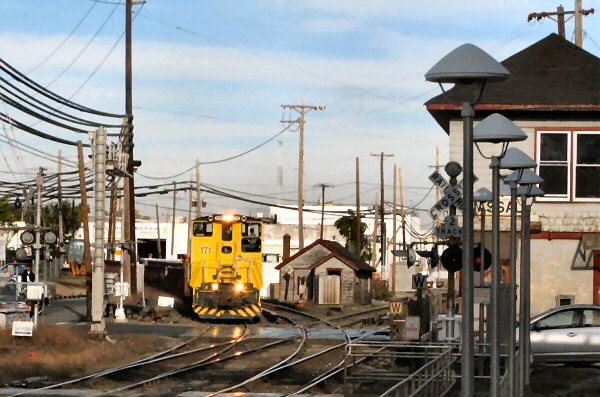
LIRR # 171 approaching Nassau Tower from Oyster Bay Branch 10/08/2008
Photo: Mark Edelman
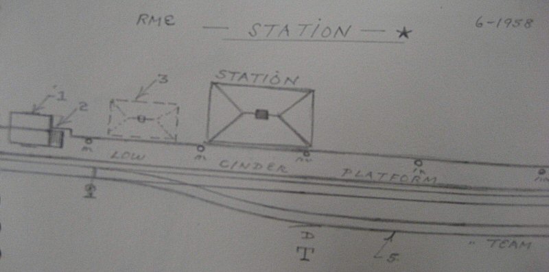
Robert Emery maps 1958
Oyster Bay Branch MP19-23 Composite:
Steven Lynch
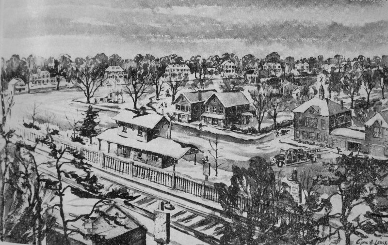
East Williston Station Winter painting by Cyril A. Lewis Archive: LI Railroader newsletter, Dave Morrison
Built: c
1880. Agency Closed: 12/10/96 Razed: 12/11/20
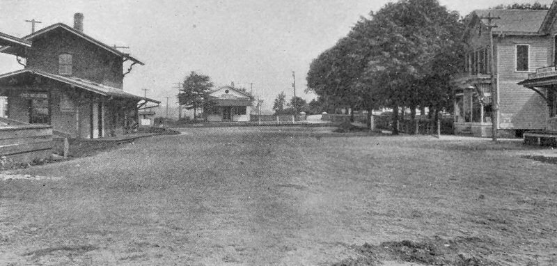
East Williston Station c.1908
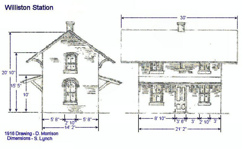
East Williston Station drawing 1916
(Morrison-Lynch)
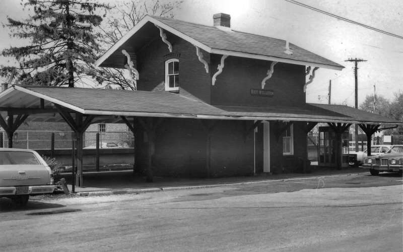
East Williston view NW 1960 Archive: Dave Keller
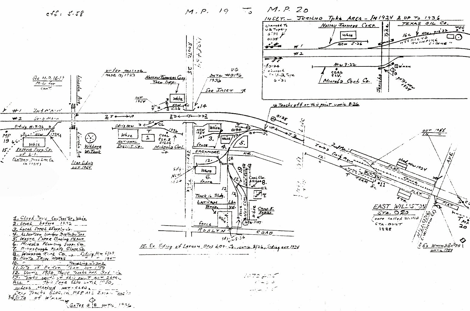
Emery map East Williston MP19-20 5/1958 Archive: Dave Keller
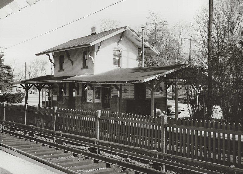
East Williston - View NW c.1970
Archive: Dave Morrison
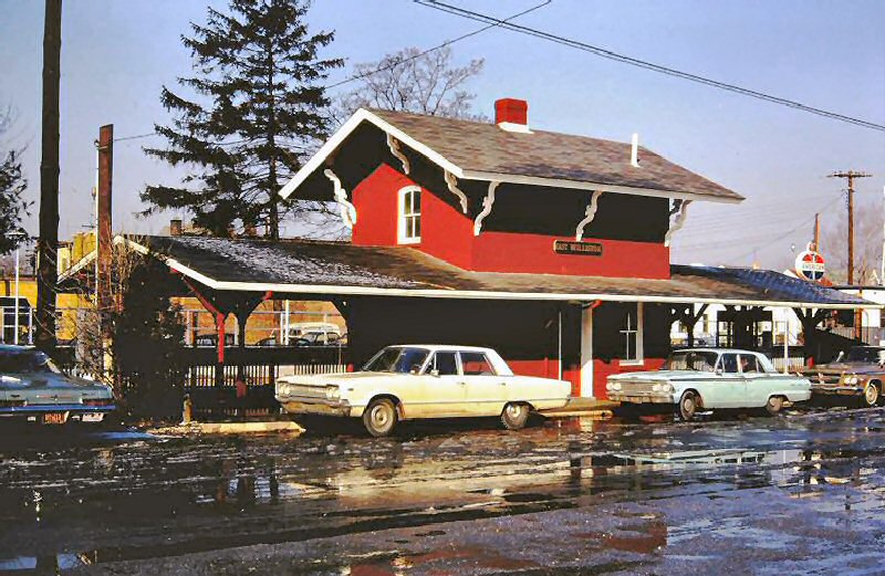
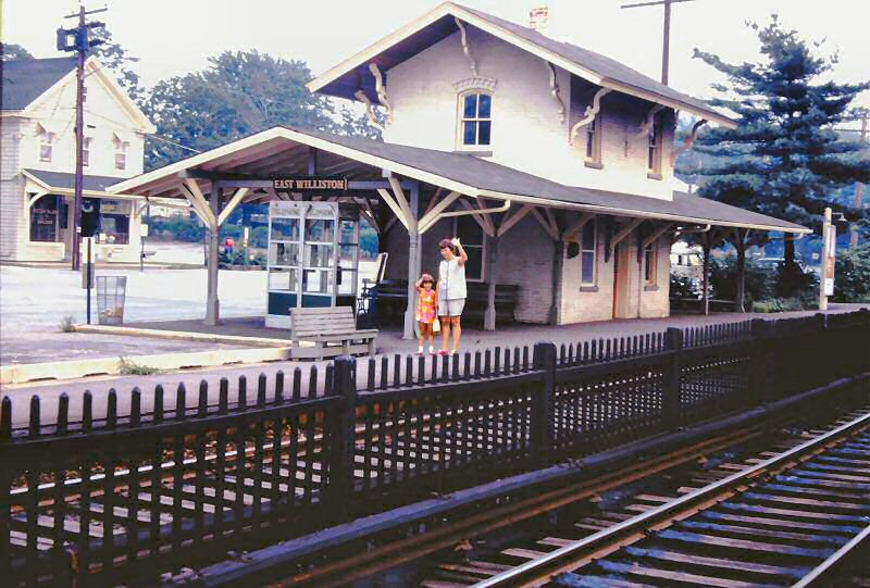
East Williston view SE c.1970 (Sturm-Fehn)
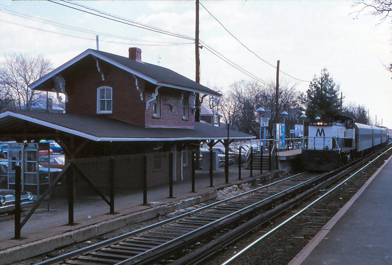
East Williston view SE 4/1981
Photo: Bill McBride
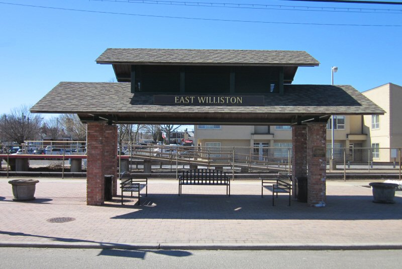
East Williston Station monument View W
3/18/2018 Photo/Archive: Dave Morrison
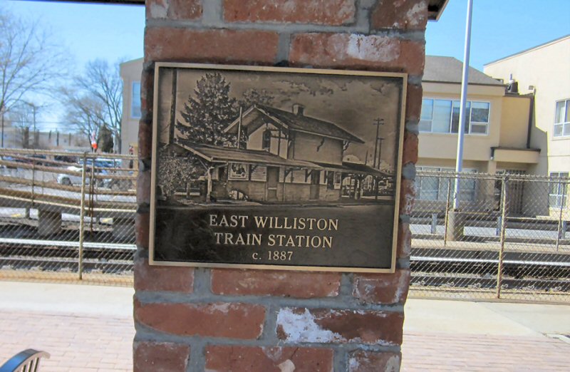
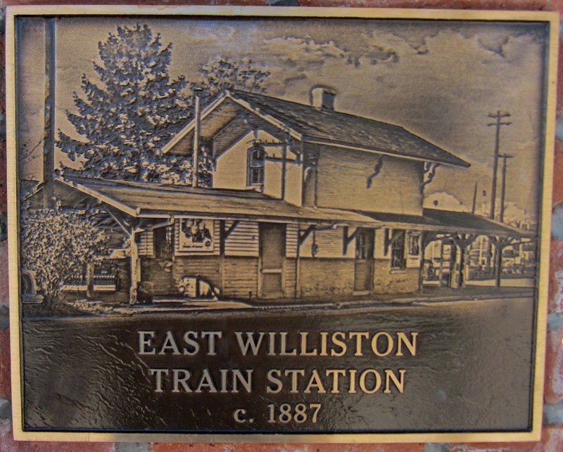
East Williston Station monument marker.
Bricks from original station.
3/18/2018 Photo/Archive: Dave Morrison
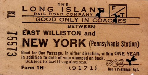
Ticket - East Williston to New York, Penn Station
Archive: Brad Phillips
%20-%2010-04-75%20(Madden-Keller).jpg)
Long Island Motor Parkway - Trestle west of Albertson View E 10/04/1975 (Madden-Keller)
Not every day can be sunny! An eastbound has just passed under the old Vanderbilt Motor Parkway overpass, between East Williston and Albertson on the Oyster Bay Branch. November, 1983 Photo/Archive: Jay Bendersky
Built: 1913,
Agency Closed
Razed: 1954
Shelter Shed Built: C. 1954
Ticket Office added to one end of Shelter Shed: ?
Monday-Only Agency Indicated in "Long Island Rail Road Ticket
Office Hours" Listing of 9/18/67.
Agency Closed: ?
Replaced With New Shelter Shed: 19 ?
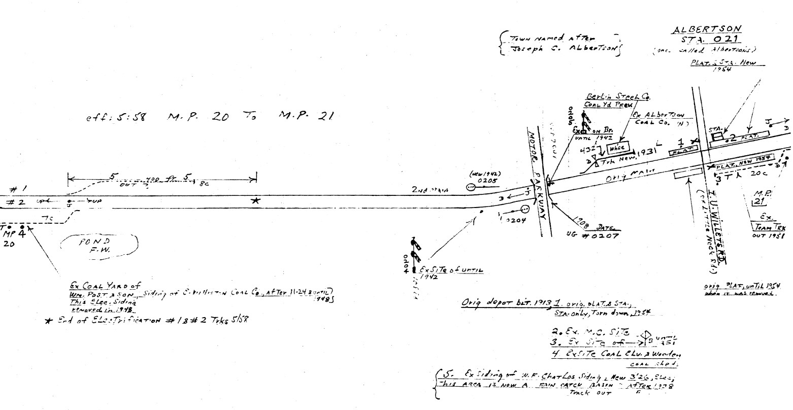
Emery map Albertson MP20-21
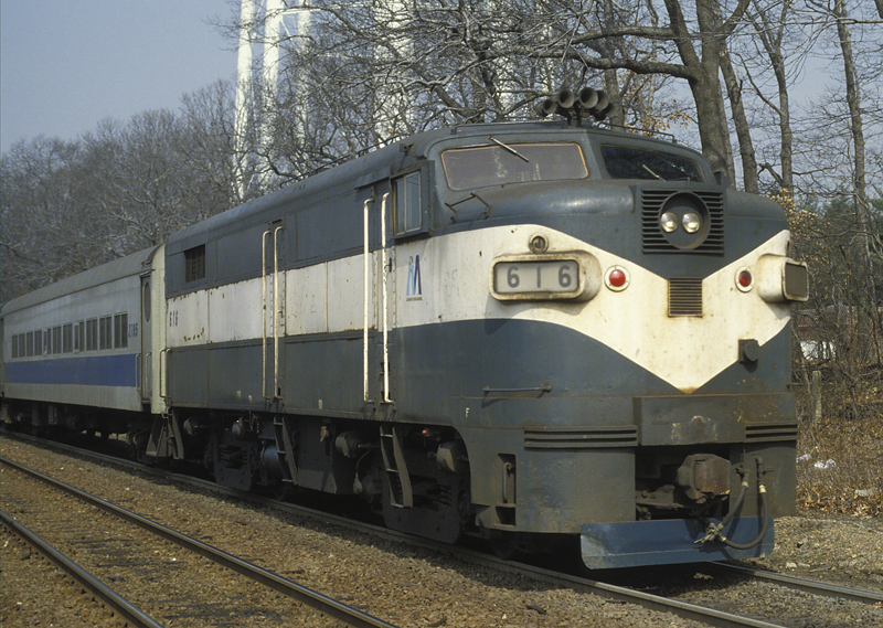
LIRR #616 Albertson c. Spring 1994 Photo/Archive: A. Joseph Daly
.jpg)
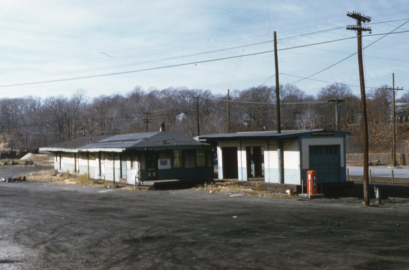
Albertson Shelter and Monday morning-only ticket window. View NW 6/1987
Photo/Archive: Dave Keller
Opened:
1/23/1865, remodeled and moved: Summer/1885 to accommodate a new
Freight Station
2nd Depot Built: June-July/1887
Depot moved to west side of Lincoln Ave. (N. Side Of Tracks) to
improve visibility of roadway traffic: 1988
Agency Closed: ?
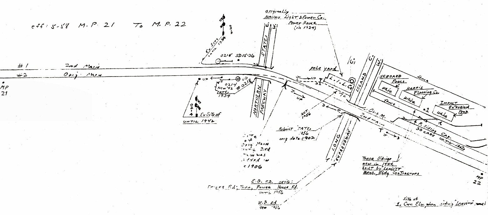
Emery map south of Roslyn Station MP21-22
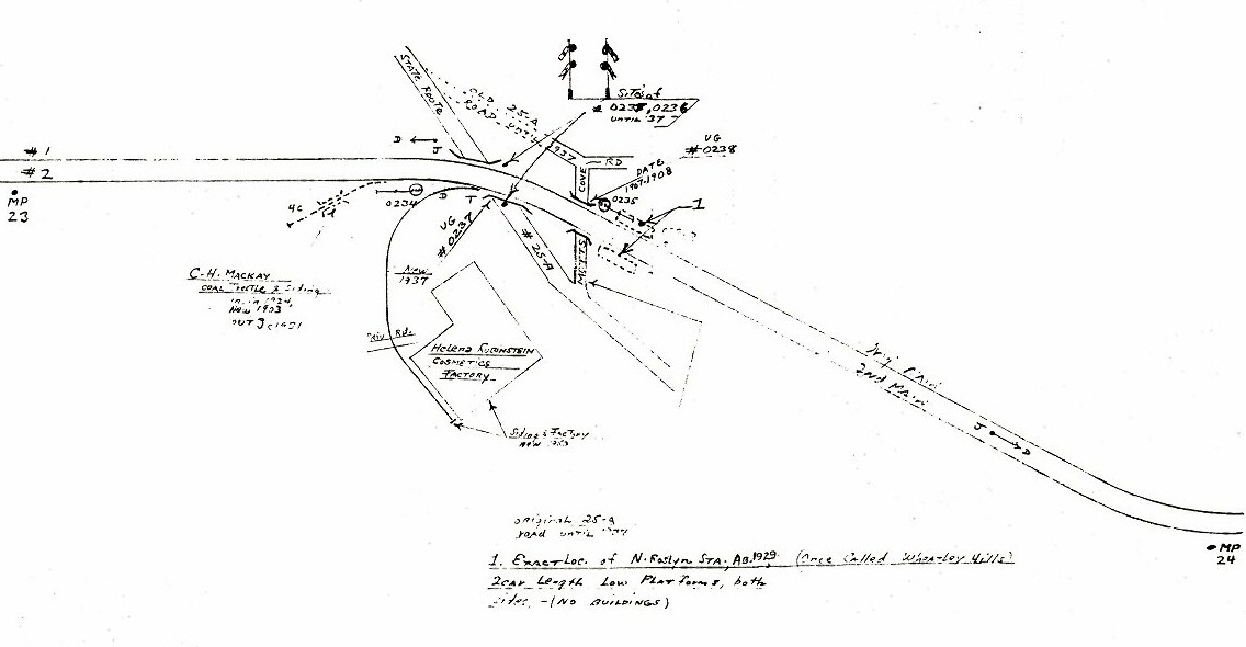
Emery map (Ex-site of N. Roslyn Sta.) MP23-24
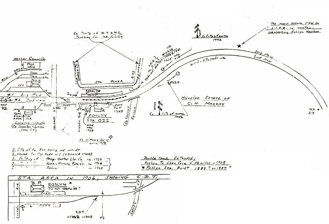
Emery map Roslyn Station MP22-23
LIRR #616 Roslyn c. spring 1994 Photo/Archive: A. Joseph Daly
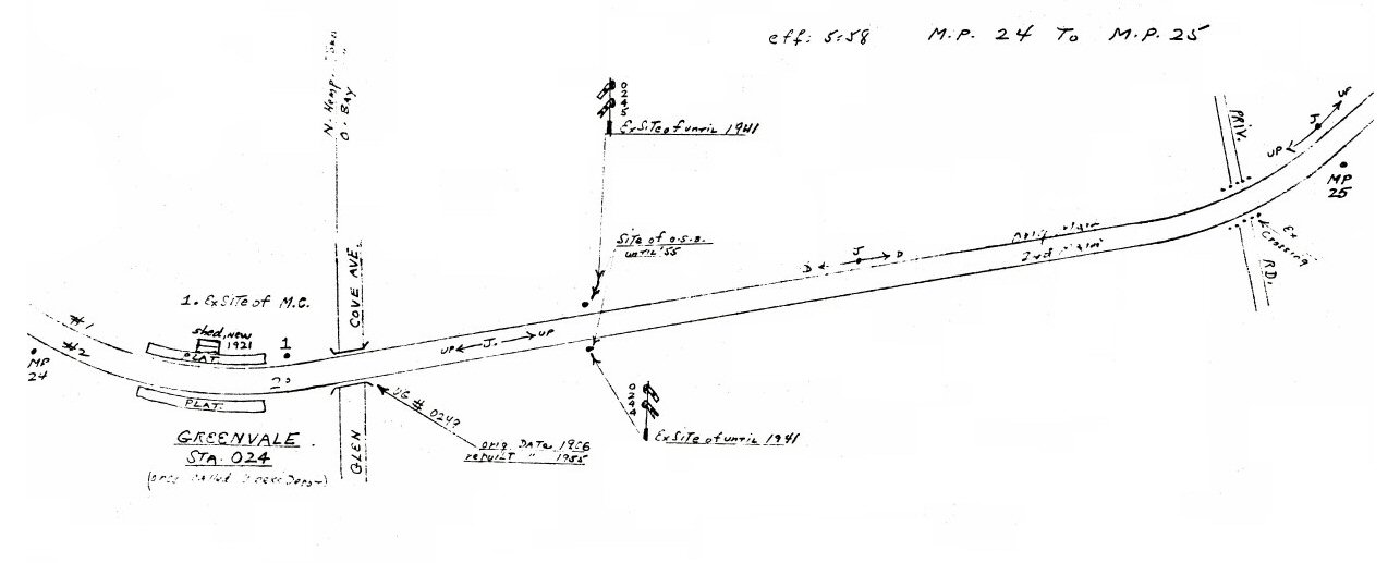
Robert Emery maps 1958 Oyster Bay Branch MP23-28 Composite: Steven Lynch
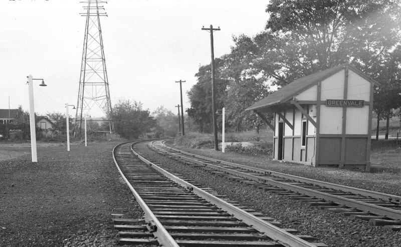
Greenvale
Freight station
in use as early as 1866 on timetable in 1875 only. Back on timetable
during 1880s and 1890s as stop primarily for milk trains.
Shelter shed built: ?, No agency. May, 1891 newspaper
account describes the shed which shortly after was demolished by 4-4-0
locomotive #112 when it derailed on 5/17/1891 after hitting a horse
whose foot got stuck in the switch points. The engine made it over the
switch but the cars derailed causing the loco to roll over,
demolishing the shed and trapping the engine crew underneath the
engine killing both men. (per Vincent F. Seyfried, historian and John
Hammond, Town of Oyster Bay historian)
2nd Shelter
shed built: ? No data or photo evidence as to anything being
constructed on site between 1891 and 1921.
3rd (?) Shelter
shed built: 1921 (per Robert Emery notes) 1937 photos (below) show two mail
cranes on north (R.R. east) side of the shelter for mail pick-up in
each direction. Crushed cinder platforms with Dietz kerosene platform
lamps. Electric lamps and paved platforms added in later years. Razed:
1991.
4th (?) shelter shed with hi-level platforms built: 1991 Research: Dave Keller
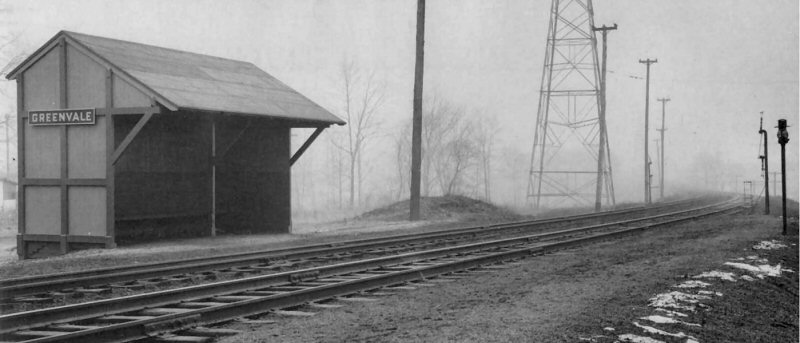
Greenvale shelter shed - View NW 1937
Photo: Fred Weber Archive: Queensborough Library
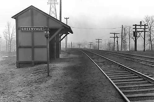
Greenvale shelter shed - View W 1937
Photo: Fred Weber Archive: Queensborough Library
Greenvale shelter shed - View W 10/20/1944 (Weber-Morrison)
Greenvale shelter shed - View E 10/20/1944 (Weber-Morrison)
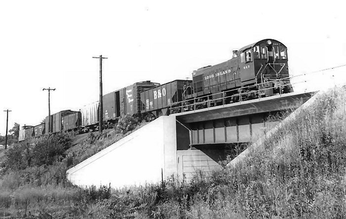
LIRR S2 #443 crossing Glen Cove Ave. bridge Greenvale - View NE c.1955
Archive: Ricky Imparato
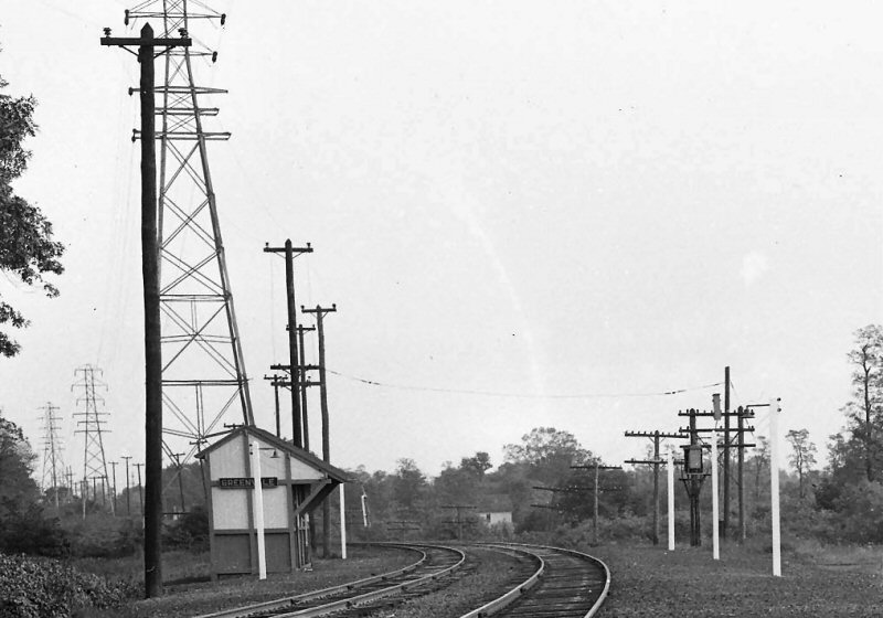
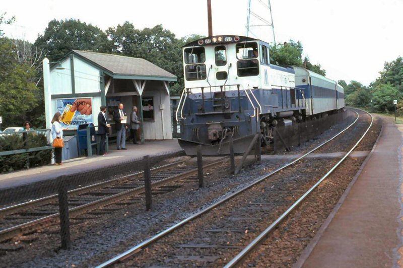
Greenvale shelter shed 1967
Greenvale Station - MP15ac #153 - View NW
9/16/1980 Archive: Dave Keller
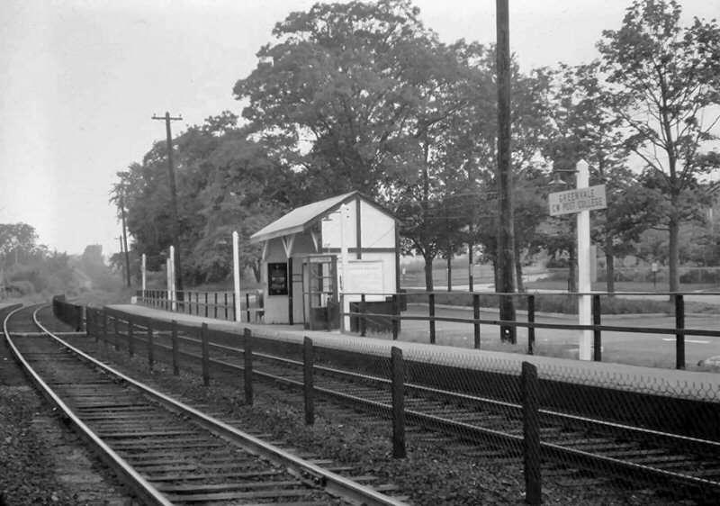
Greenvale shelter shed with hi-level platforms
View W 2020
Original
depot opened: 1/23/1865
2nd depot opened: 5/1888
Out of service: 4/61 with opening of new depot. old unused depot stood
for awhile afterwards and was razed
3rd depot in service: 4/61. agency closed: ?
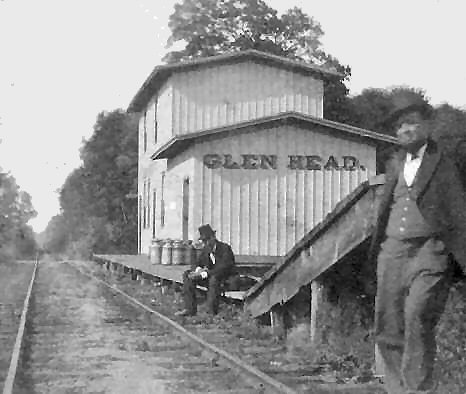
Glen Head Station c.1870
.jpg)
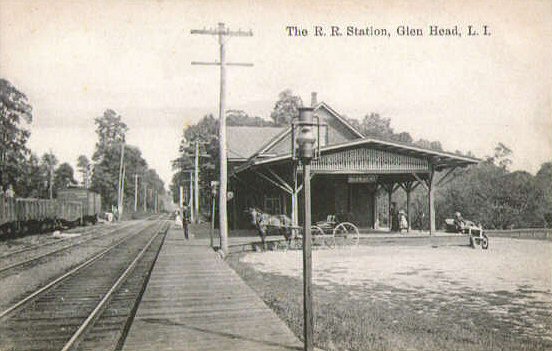
Glen Head Station view NE c.1905
Archive: Dave Keller
Glen Head Station View N 1910
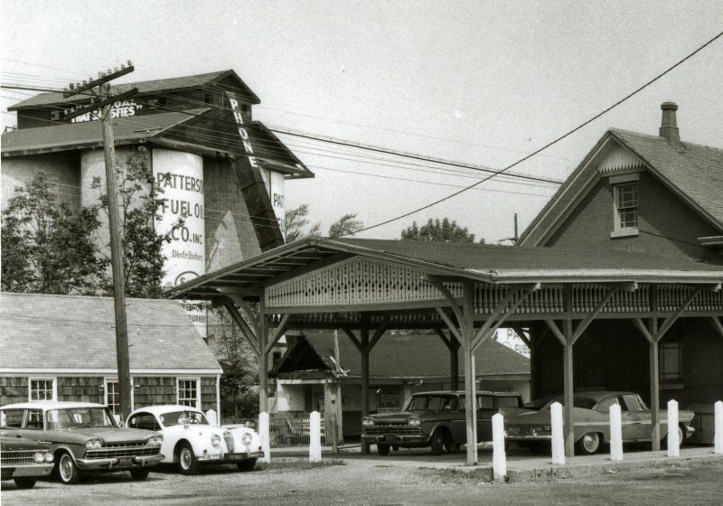
Glen Head Station - Patterson Fuel Oil Co., ex-Scranton & Lehigh Coal Co., ex-C.W. Bell
view NW 1961 (B. Seixas-Morrison)
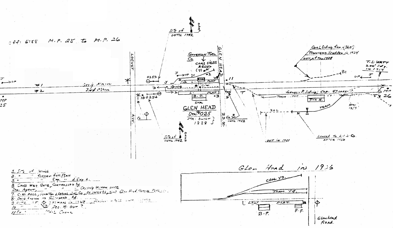
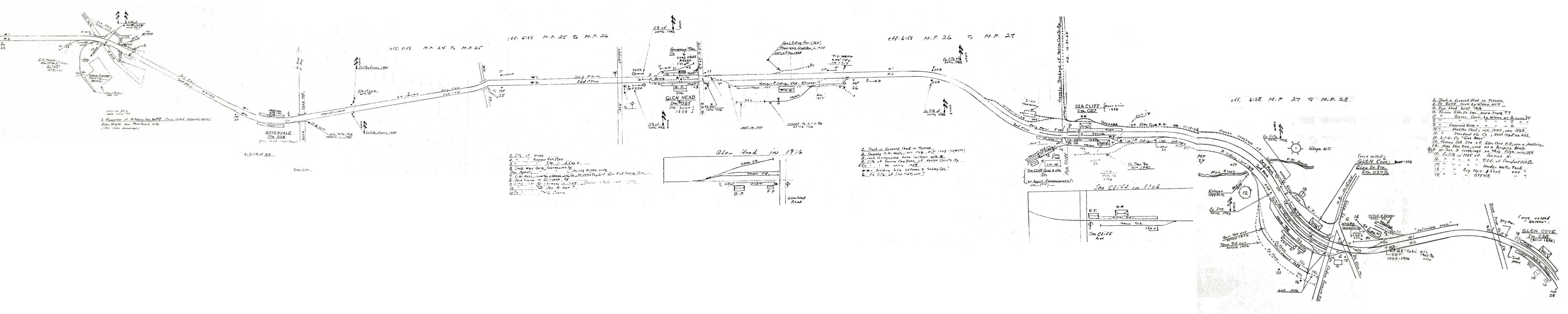
Emery map Glen Head MP25-26
Glen Head Station view W 1961
(B. Seixas-Morrison)
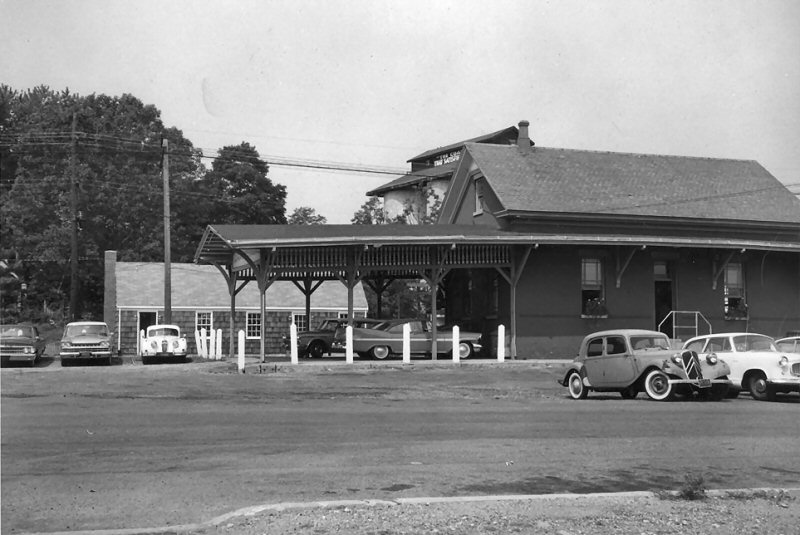
Glen Head Station view SE 1960 Photo: LIRR
Archive: Jim Gillin
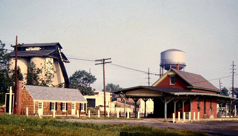
Glen Head Station - Patterson Fuel - 1961
Norman Kohl photo, Dave Keller archive.
.jpg)
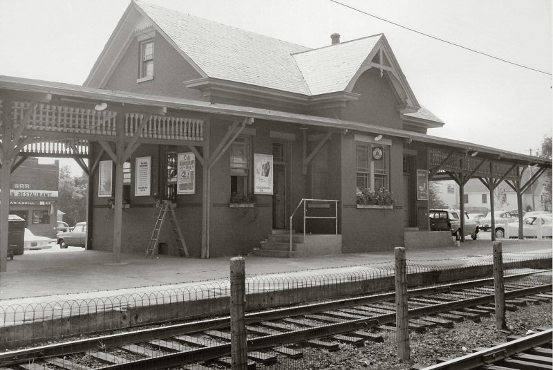
Glen Head Station 1966
Photo/Archive: Dave Keller
Note: The ticket office at the far left with screens on the door and window and none on the waiting room at the right, the flower boxes under all the windows, and the mid-track fence with the pedestrian at-grade crossing. Dave Keller
.jpg)
Glen Head Station pedestrian crossing warning lights - 1966 Photo/Archive: Dave Keller
.jpg)
Glen Head Station - Entrance to waiting room 1966 Photo/Archive: Dave Keller
.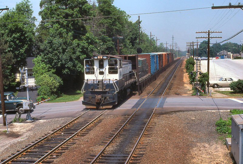
Glen Head, Locust Ave. freight westbound - LIRR MP15ACs #151
6/05/1979 Photo: Terry Guy Archive: Rick Imparato
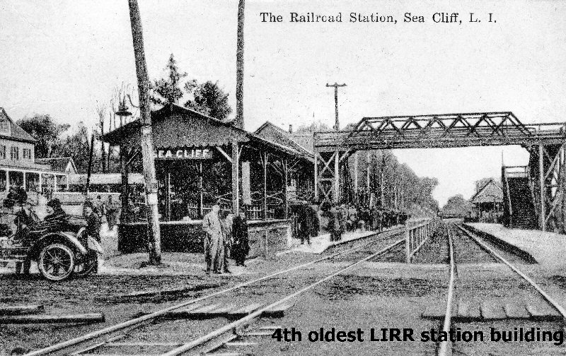
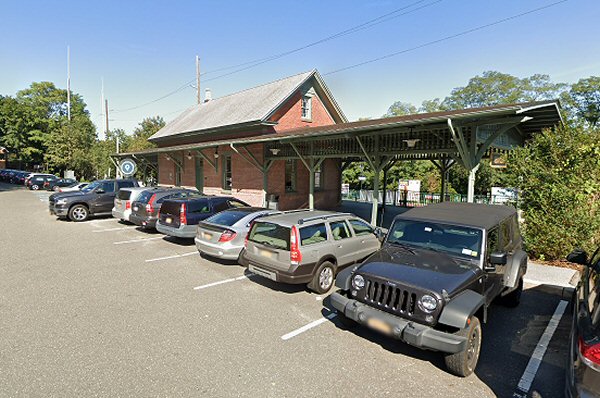
Sea Cliff
2nd Depot opened: 5/1888. Agency closed: ?
Portion of eastward station facilities west of Sea Cliff Ave. out of
service and removed: 12/16/83
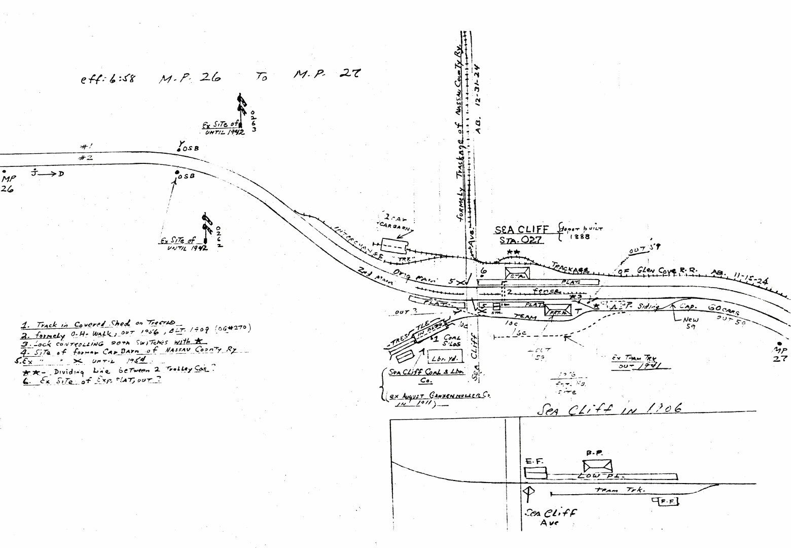
Emery map Sea Cliff MP26-27
Archive: Dave Keller
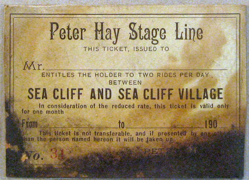
Peter Hay Stage Line coach ticket 1900
Photo/Archive: Dave Morrison
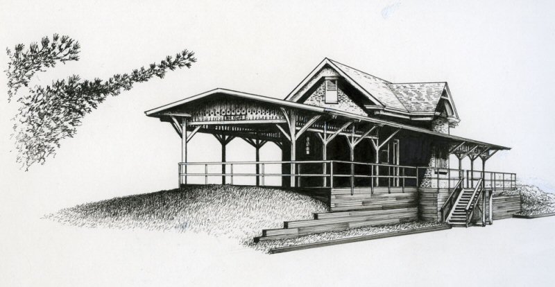
Sea Cliff Station line drawing
Artist: James Montelione
Archive: Dave Morrison
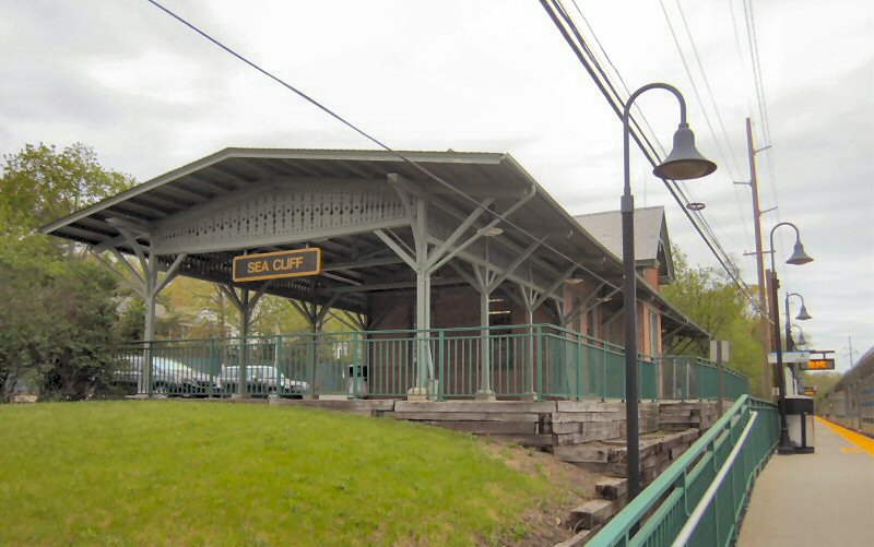
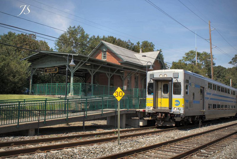
Sea Cliff Station 6/2022
Photo/Archive: Dave Morrison
Sea Cliff Station - View N 1910 Photo: Henry Otto Korten Archive: Sea Cliff Museum
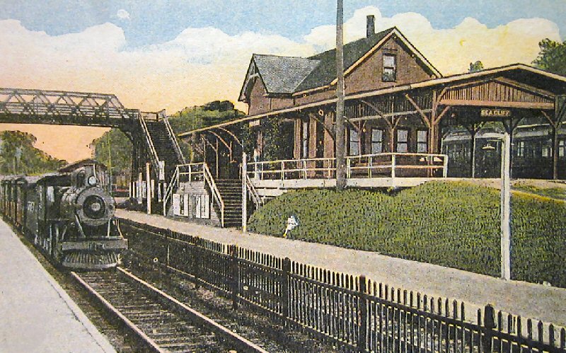
Sea Cliff Station post card
Photo/Archive: Dave Morrison
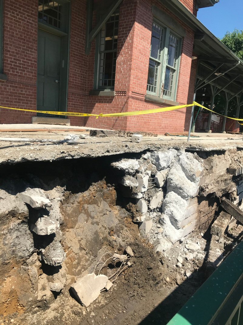
Sea Cliff Station 6/2022
The B&B department (now known as "Structures") is currently restoring
the embankment in order to save the station building.
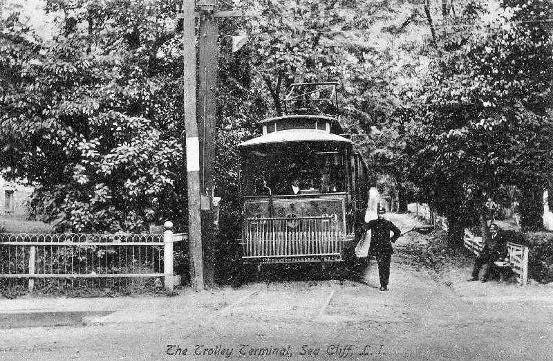
Nassau County Railway and Glen Cove Railroad trolley lines
c.
1907
Archive: Dave Morrison
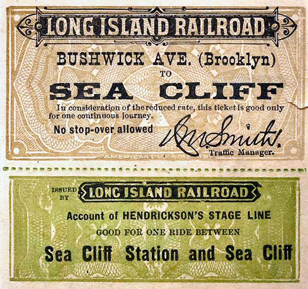
Bushwick to Sea Cliff sample
ticket c.1900
Archive: Brad Phillips
Bushwick to Sea Cliff
sample ticket, having no serial number: Included in the price
would is a portion that would subsequently be remitted to
Hendrickson's Stage Line. The “division” of revenue would be
negotiated between the parties. This arrangement was done, of course,
for the convenience of passengers. An additional motive could be that
the stage line accepted a discount from its regular fares to entice
the railroad to provide the stage ticket hoping for additional
patronage (my speculation). And further (speculation), seeing that
the ticket is issued at a “reduced rate”, there could have been a
special event in Sea Cliff which the railroad was promoting, again to
encourage patronage.
Info: Brad Phillips
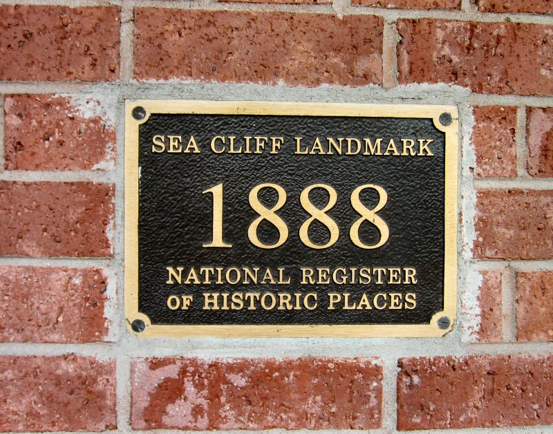
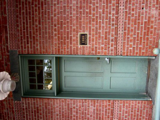
Sea Cliff Station landmark plaque 4/30/2017 Photo/Archive: Dave Morrison
Sea Cliff Station -
View NW c.1940
Archive: Joe Vila
In the 1907
photo below, the Nassau
County Railway tracks are in the foreground
and ran geographically west into the village along Sea Cliff Road. The
track curving off to the far right led to a 2-car car barn. The
Glen Cove Railroad tracks are in the background and ran geographically
north to Glen Cove. The Nassau County Railway and Glen Cove
Railroad trolley lines operated from 07/02/1902 to 12/31/1924.
The two lines divided at the rear center of the station, as seen here.
The car at the left is of the Glen Cove RR and the car at the right is
of the Nassau County Ry. This view is looking geographically NE.
The LIRR runs geographically north/south at this point on the Oyster Bay
branch before it makes a curve to the east. Research: Dave Keller
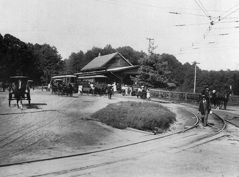
Sea Cliff Station - Trolley 1907
Photo: Henry Otto Korten Archive: Sea Cliff Museum
Sea Cliff Station - View SE 2021 Google maps
Sea Cliff Station - View NW - 8/28/2020 Photo/Archive: Joe Stroppel
Sea Cliff interior 4/30/2017
Photo/Archive: Dave Morrison
![]()

Emery map Glen Cove MP27-28
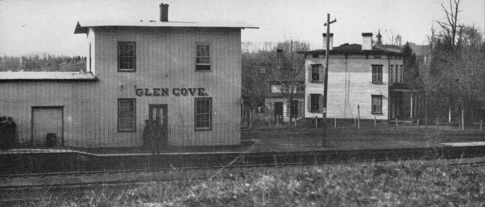
Glen Cove Depot - Stroppel's Depot Hotel View N 1878
(Brainerd-Brooklyn Public Library)
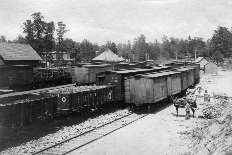
Glen Cove team track yard - View NW 6/02/1903
(Boerckel-Morrison)
Glen Cove team track yard - View NW 6/02/1903 (Boerckel-Morrison)
The freight/express houses combined with garage added - Glen St., Glen
Cove (view NW) - 11/24/1960. The expanse at the rear of the buildings
was once a many track freight yard.
Archive: Dave Keller
Glen St. Station c.1965 (Sturm-Fehn)
Glen Cove view NW of Glen St. Station
in the background c.1978
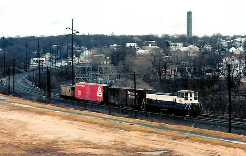
MP15AC #172 at Glen St. Station, Glen Cove
1983 - Photo/Archive: Tom Beckett
Glen Street, Glen Cove - View W 12/31/2020 Photo/Archive: Joe Stroppel
An aerial view at Glen Street, within the City of Glen Cove, taken on New Year's Eve, 2020. Train #552 to Oyster Bay stops on the "Reverse S" curve as it discharges passengers. To the right (north) of the station, where the American Community Bank (partially seen here) stands today, was the site of my family-run bar - Stroppel's Tavern by the Tracks - which closed in 1997. Joe Stroppel
Glen Street Station - 11/2025
Archive: Leonard Wilson
Built: July-Aug/1895
serviced nearby Nassau Country Club beginning in 1898 when Nassau
County was formed
Part time Agency only per "LIRR Ticket Offices open for sale of
Tickets" of 9/12/55
Agency closed: 11/7/96. New High-level platforms built: 1999 to
accommodate newly arrived C3 Bi-level cars which were placed in
service July, 1999. (Robert L. Myers 1999 data)
Emery map Glen Cove MP27-28
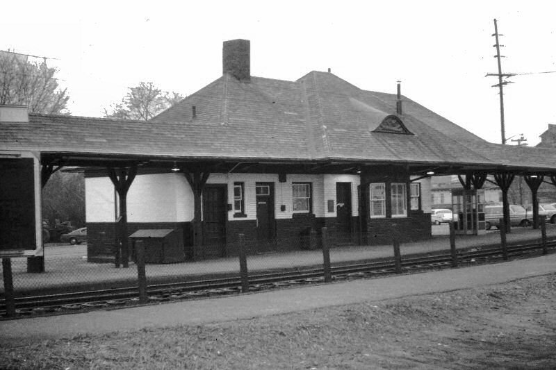
Glen Cove Station 5/1973 Photo/Archive: Brad Phillips
LIRR #606 approaching Glen Cove Station
View NE 5/12/1988
Photo/Archive: A. Joseph Daly
Glen Cove Station 1903
Archive: Dave Keller


Glen Cove Station c.1905
Glen Cove Station 1992
An eastbound train to Oyster Bay arrives at the Glen Cove Station
at sunset on 12/30/2020. View W Photo/Archive: Joe Stroppel
An aerial view of Nassau Country Club in Glen Cove, NY, as a late-afternoon eastbound train to Oyster Bay disappears around the curve alongside. View E Photo/Archive: Joe Stroppel
Glen Cove Station - 11/30/2020
Photo/Archive: Joe Stroppel
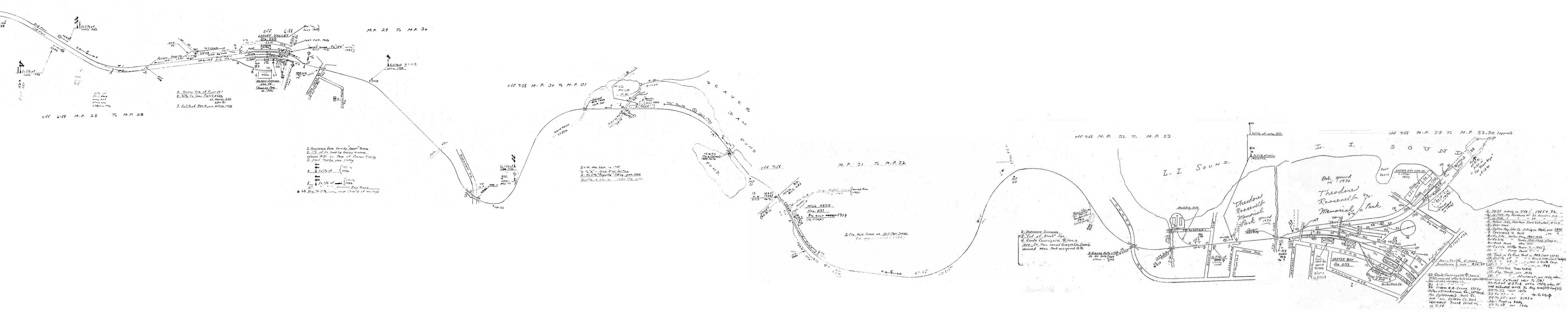
Robert Emery maps 1958 Oyster Bay Branch MP28-34 Composite: Steven Lynch
Opened:
4/19/1869
2nd Depot opened: 11/1872, remodeled: 1885, moved to private location:
c. 1906
3rd Depot opened: 12/1906
Agency closed: ? Research: Dave Keller
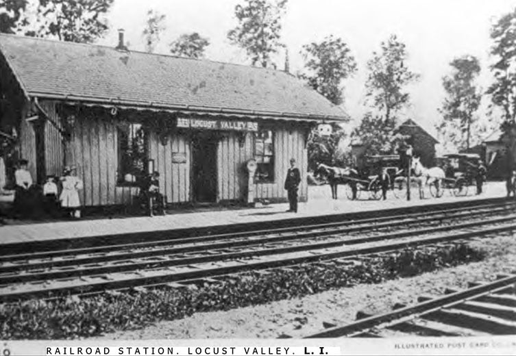
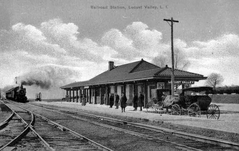
Locust Valley Station c.1900
Archive: Thomas Valentino
Locust Valley Station coal bunker View W c.1910 Archive: Dave Morrison
Locust Valley drawing 1937 - Emery SUNY-Stony Brook
Locust Valley Station View NW 1908
Archive: Dave Morrison
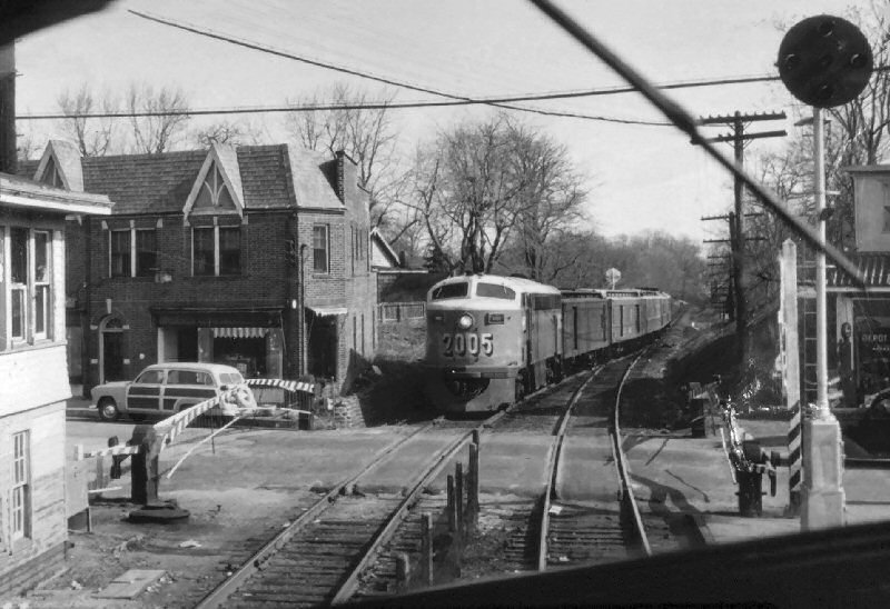
Cab shot of FM CPA20-5 #2005 Locust Valley View E c.1952 (Emery-SUNY-Stony-Brook)
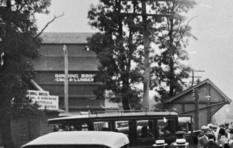
Downing Bros Coal Lumber - View W
Locust Valley Archive: Dave Morrison
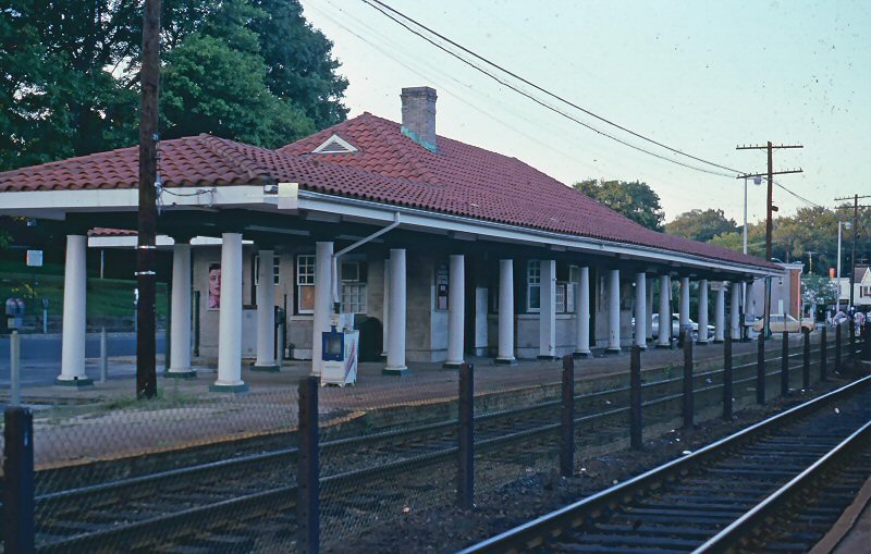
Locust Valley Station View NE 8/24/1987
Photo/Archive: Edward Hand
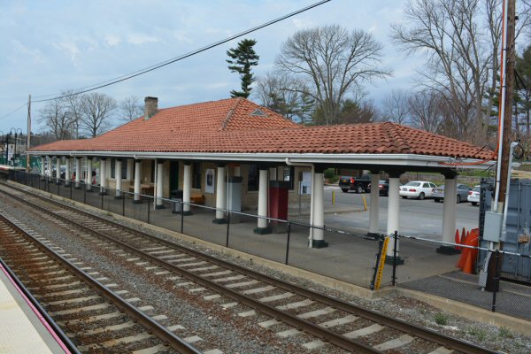
Locust Valley Station View NW 4/12/2017
Photo: Dave Morrison
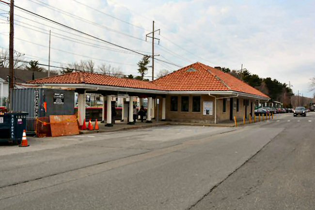
Locust Valley Station View SW 4/12/2017
Photo: Dave Morrison
Norman Kohl at age 67 - Locust Valley 7/31/979 Photo/Archive: Terry Guy
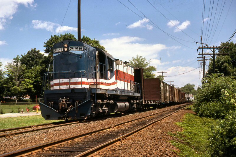
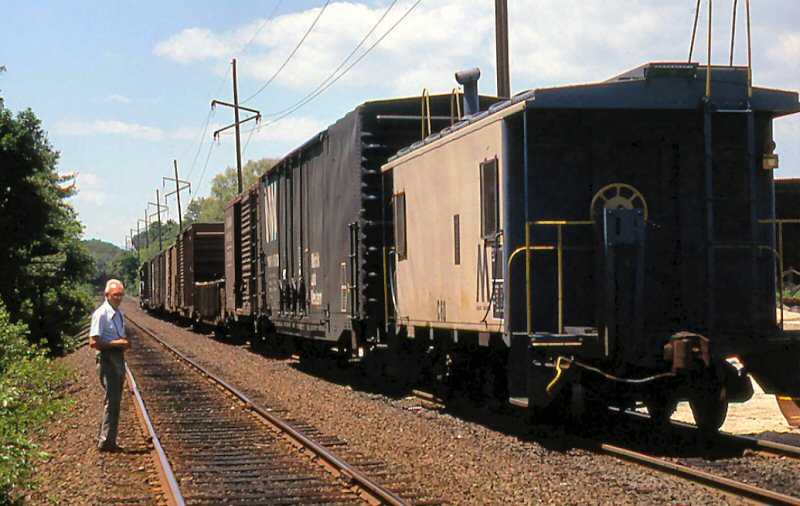
Locust Valley C420 #228 7/31/1979
Photo: Terry Guy Archive: Rick Imparato
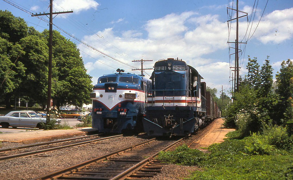
Locust Valley LIRR #614 and 228 7/31/1979
Photo: Terry Guy Archive: Rick Imparato
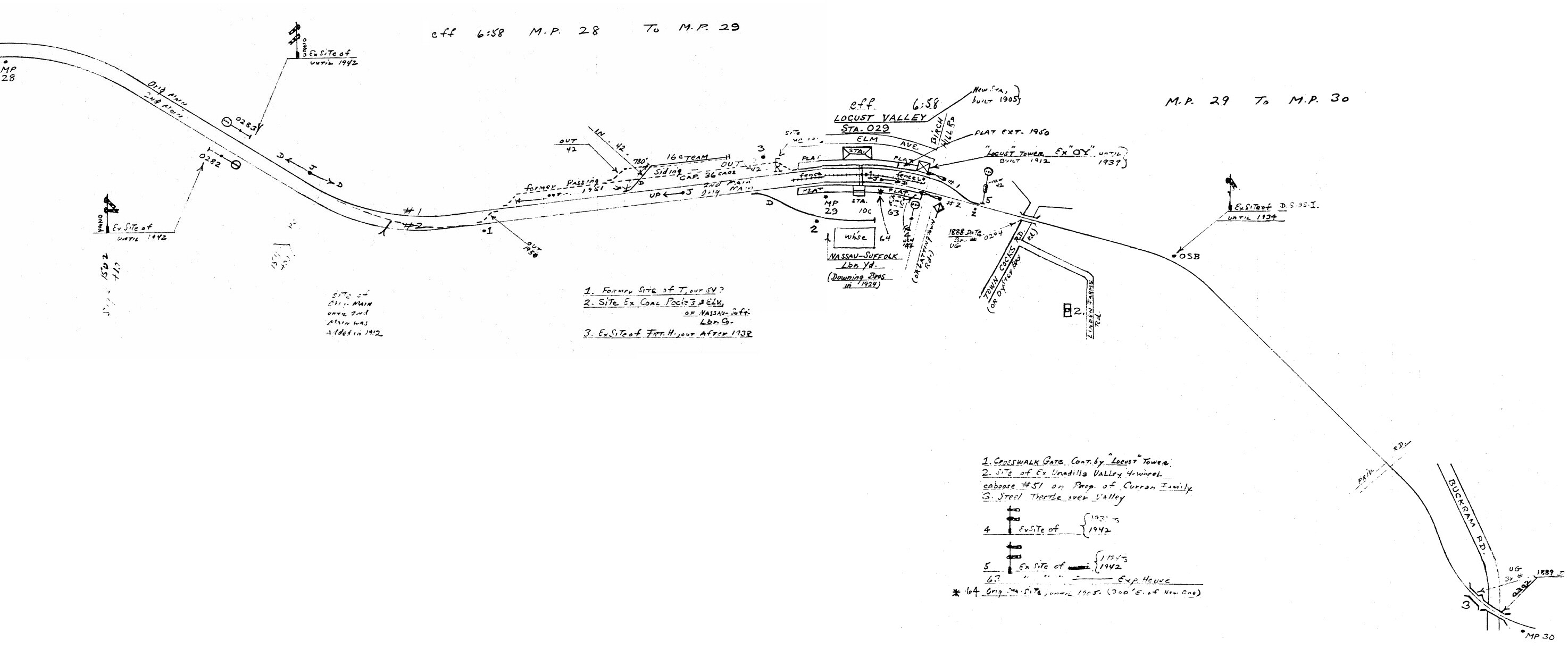
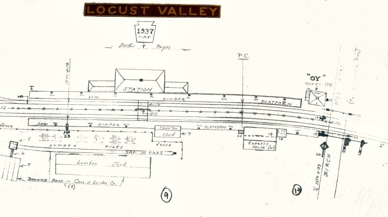
Emery map Locust Valley MP28-30
6/1958 Archive: Dave Keller
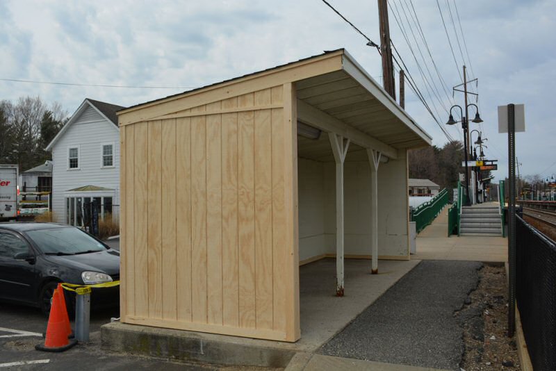
Restored shelter shed View W 4/12/2017 Photo: Dave Morrison
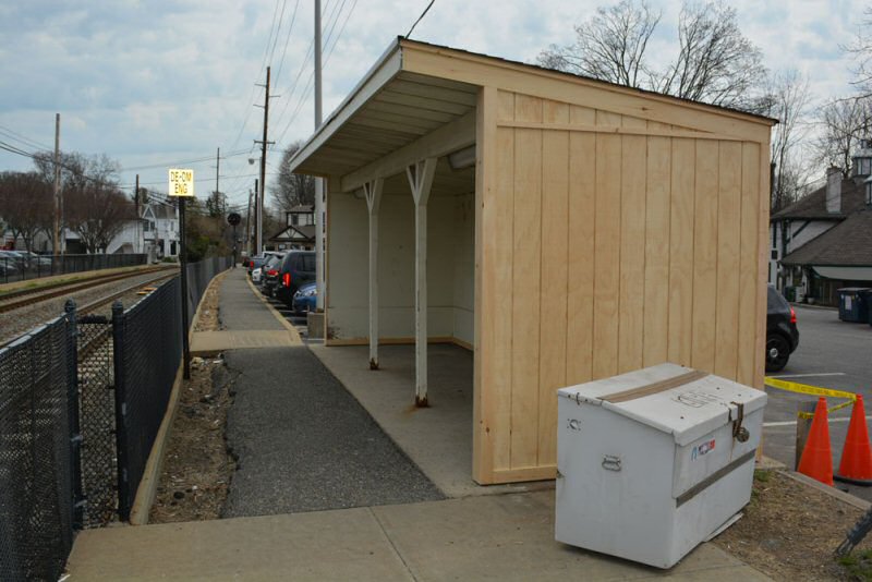
Restored shelter shed View E 4/12/2017 Photo: Dave Morrison
Locust Valley Lumber Yard 4/12/2017 Photo: Dave Morrison Note: No rail connection.
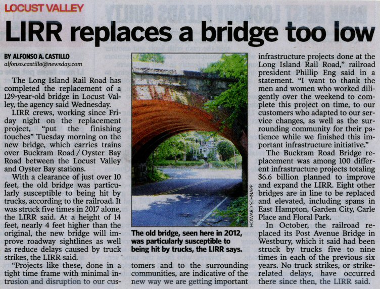
Buckham Rd Bridge - Newsday 10/11/2018
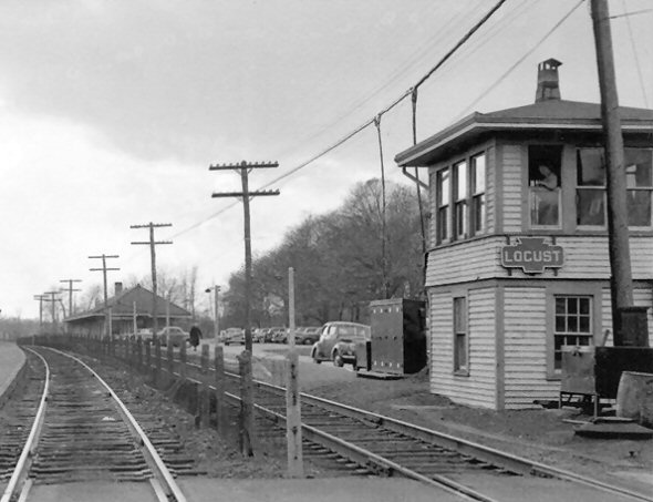
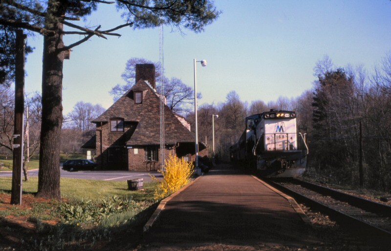
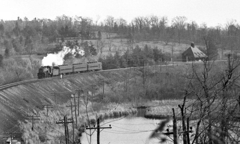
“OY” Tower:
North side of tracks at east end of station platform. 8-lever Std.
Signal Co. style mechanical machine in svc: 6/1912.
Renamed “LOCUST”: 4/30/1937
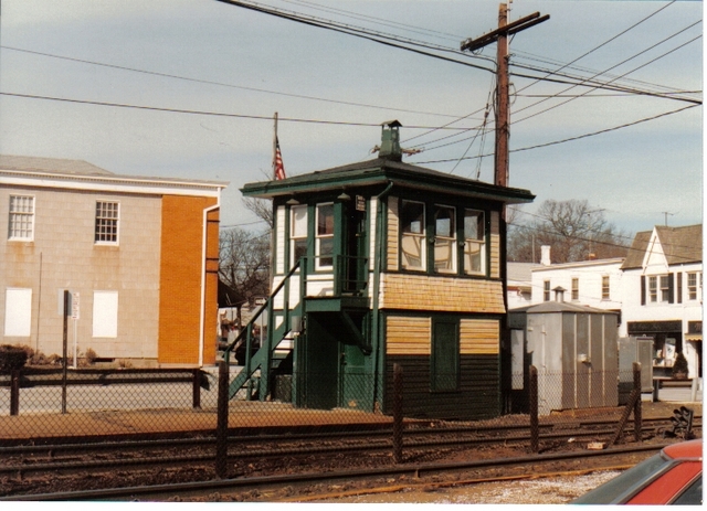
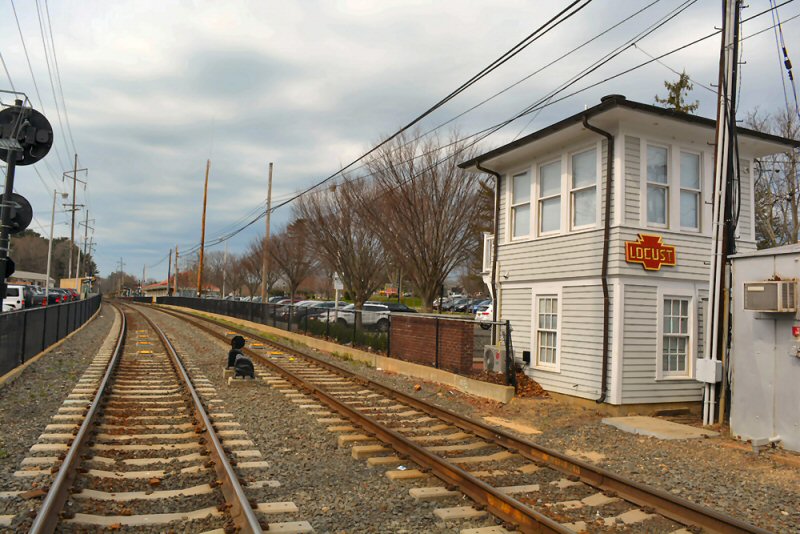
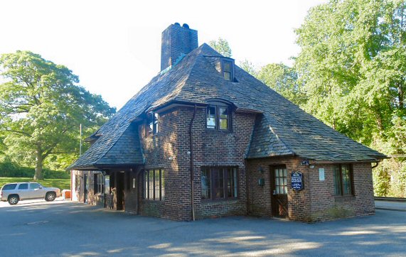
“LOCUST” Tower: 8-lever Std. Signal Co . style replaced with US&S3 lever style B-30 control panel: 11/11/1965. Relocated from tower to hut: 11/17/75 and tower abandoned. In use as Nassau County Police precinct annex. Exterior completely restored to original condition for use by Nassau County Police and dedicated at ceremony: 8/8/2006
Locust Tower view W late 1940's
Photo: Fred Weber
Locust Tower
2/88 Photo: John Fusto
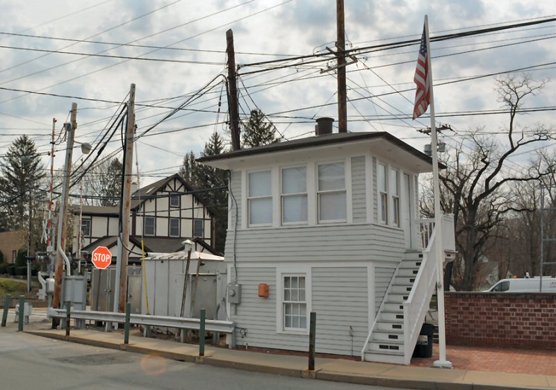
Locust Tower view NW 4/12/2017
Photo: Dave Morrison
Locust Tower view W 4/12/2017
Photo: Dave Morrison
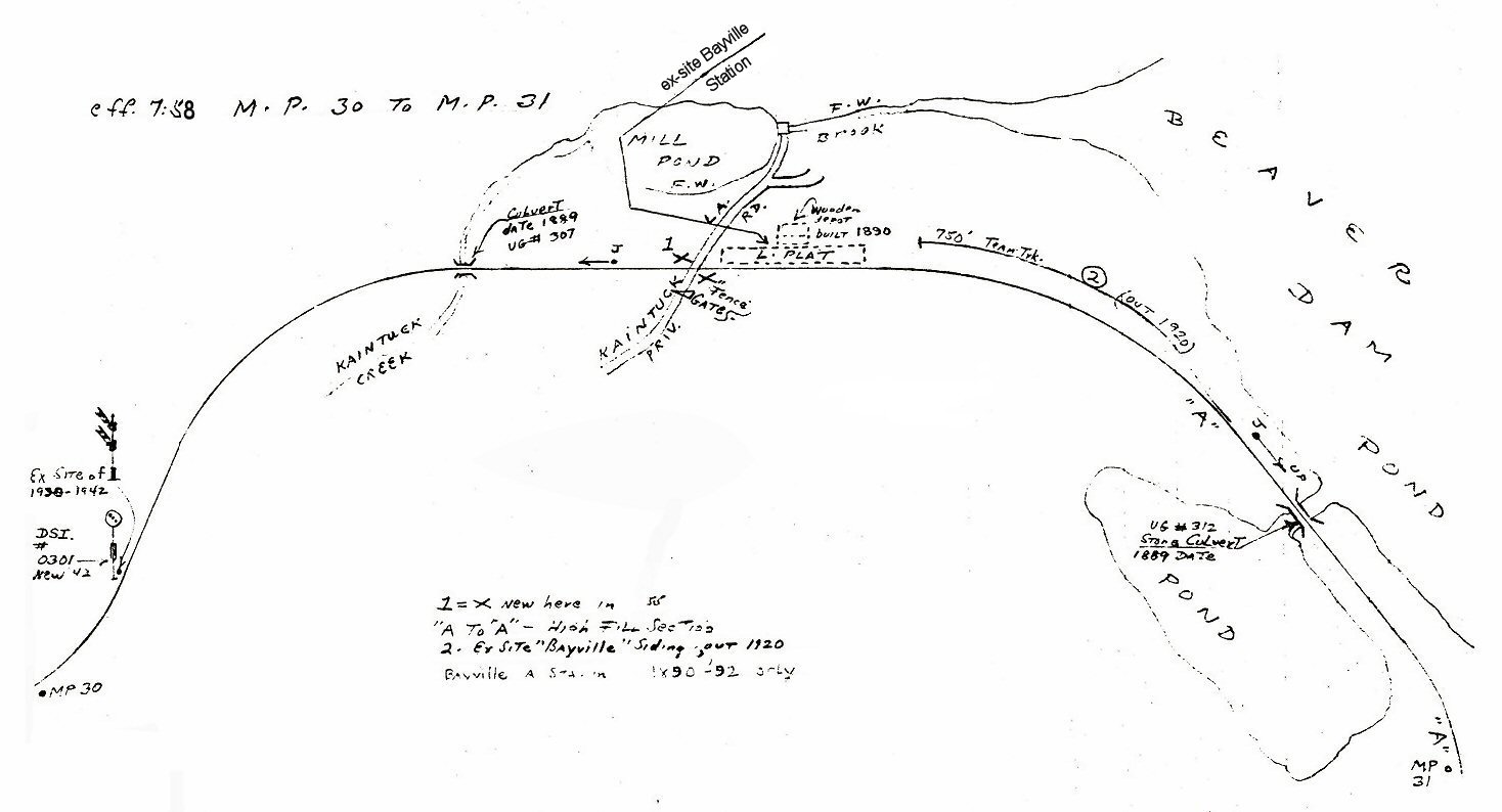
Emery map Bayville MP30-31
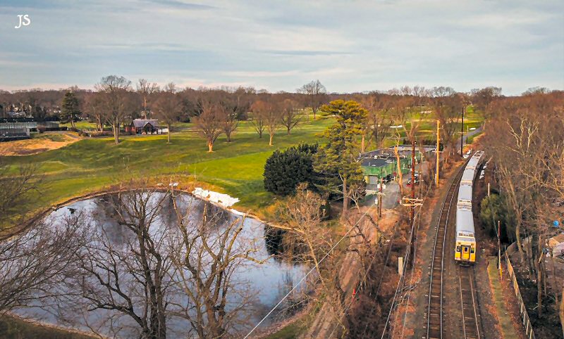
Bayville Kentuck Pond - View W 11/25/2020 Photo/Archive: Joe Stroppel
APPEARS ON TIMETABLE EFF: 10/1/1889. PER TOWN OF OYSTER BAY HISTORIAN JOHN HAMMOND, STATION STOP WAS A BOXCAR PLACED AT THE CROSSING OF KAINTUCK LANE ON W. SIDE OF SHU SWAMP. ALSO THE SITE OF 500’ SIDING FOR PLACEMENT OF WORK TRAINS AND EQUIPMENT WHILE EXTENSION WAS BEING BUILT O OYSTER BAY. PER ROBERT EMERY'S MAP, DEPOT WAS A WOODEN FRAME BLDG WITH LOW PLATFORM.
BAYVILLE BECAME A SIGNAL STOP: 11/1891. DISCONTINUED AS STATION STOP: 11/1892. REPLACED BY STATION AT MILL NECK ½ MILE
FURTHER EAST ON E. SIDE OF SHU SWAMP. (per 11/3/1892 edition of “Brooklyn Daily Eagle”and John Hammond). “BAYVILLE SIDING” REMAINED IN PLACE AND WAS IN USE AT MILL NECK FOR MANY YEARS AFTER. (per Art Huneke).
Note: Kentuck Pond (sic) as is Kaintuck Lane as per current maps 2020. Steve Lynch
ORIGINAL DEPOT OPENED: 11/1892
ON E. SIDE OF SHU SWAMP TO REPLACE DISCONTINUED BAYVILLE STATION ½
MILE FURTHER WEST. (per 11/3/1892 edition of “Brooklyn Daily Eagle”
and John Hammond, Town of Oyster Bay official historian's data).
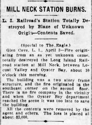
SMALL, ONE-STORY WOODEN STRUCTURE ALSO SERVED AS POST OFFICE DESTROYED
BY FIRE 4/3/1911 (Per "Brooklyn Daily Eagle" article.)
2ND DEPOT CONSTRUCTED: 1912, SIMILAR IN SIZE AND STYLE TO THE FIRST
DEPOT. RAZED: 1918 FOR REPLACEMENT BY NEW STRUCTURE (John Hammond
data).
3RD DEPOT OPENED: 1919 (Robert Emery data) SLIGHTLY E. OF PREVIOUS
DEPOTS. 2 ½ STORY BRICK STRUCTURE WITH SLATE ROOF. U.S. POST OFFICE
BUILDING ADDED STRUCTURALLY TO EAST SIDE OF DEPOT BUILDING: LATE
1940S/EARLY1950s (?) AGENCY CLOSED: 1958. DEPOT BUILDING CONVERTED TO
THE TOWN HALL AND POLICE DEPT. c. MARCH, 1958 (per "NEW YORK TIMES"
article of 3/10/58). POST OFFICE STILL IN USE. STATION STOP
DISCONTINUED:
3/16/98. STILL IN USE AS VILLAGE HALL, POLICE DEPT. AND U.S. POST
OFFICE (2019). Research: Dave Keller

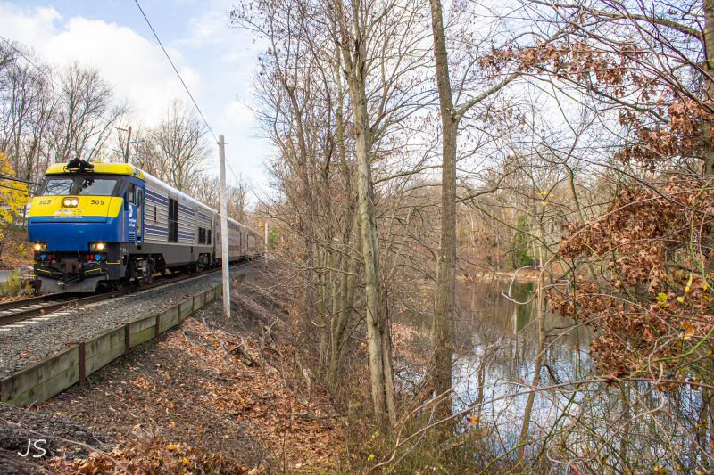
Shu Swamp, Mill Neck Nature Preserve LIRR train #6505 westbound
10/04/2021 Photo/Archive: Joe Stroppel
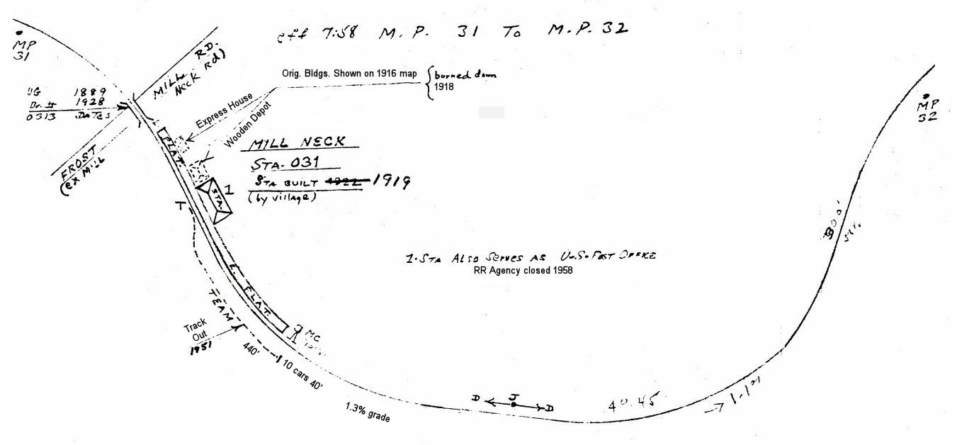
Emery map Mill Neck MP31-32
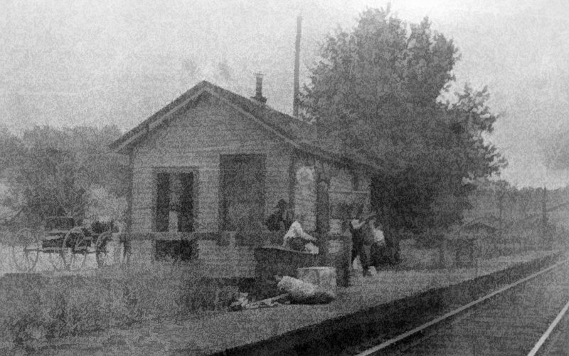
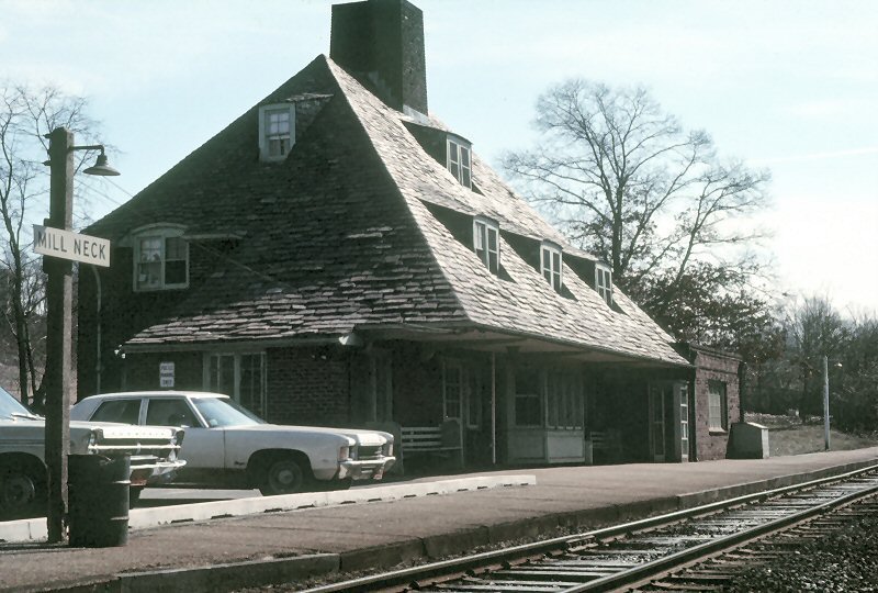
Mill Neck
Station view NE c.1890
Collection: Locust Valley Historical Society
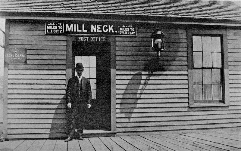
Mill Neck Station and Post Office c.1907
Archive: John Hammond 1907 close-up image of the original Mill
Neck depot that burned in 1911 and was replaced by the 2nd wooden
depot in 1912. (right).
The sign
over the door reads "Post Office" so it would appear that
Mill Neck originally had its post office in a depot building and,
after moving elsewhere for a period of some decades, had it back in a
depot building in 1958 when the LIRR's agency closed.
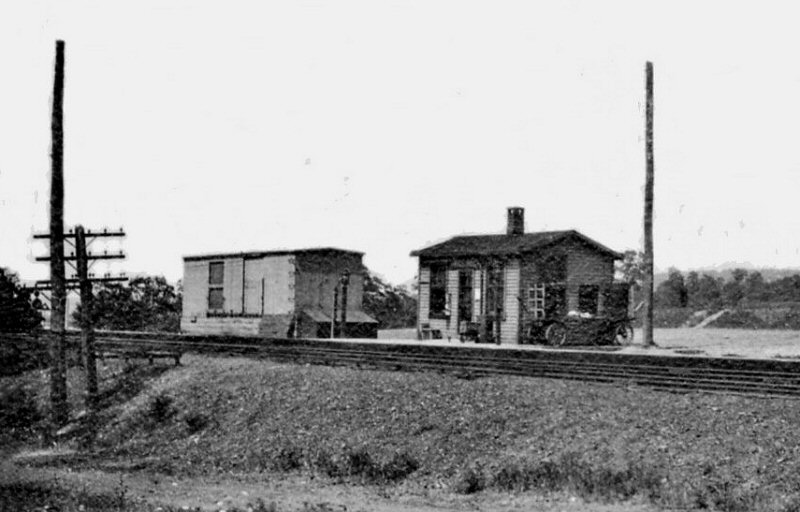
Mill Neck View N c.1917 Archive: John Hammond
Mill Neck view
SW c.1917 Archive: John Hammond

Mill Neck Station 1921 - Emery SUNY-Stony Brook

LIRR #39 2-6-0 Mill Neck 1949 (Krause-Erlitz)

LIRR #614 Mill Neck Station 1973
Photo/Archive: Richard Glueck
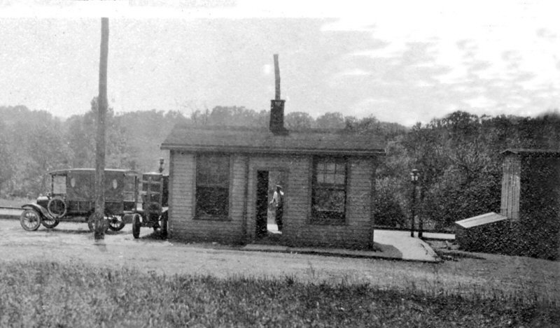
Mill Neck ex-Station is use as USPS and Police Station view E 2/1975 Photo/Archive: Steve Rothaug
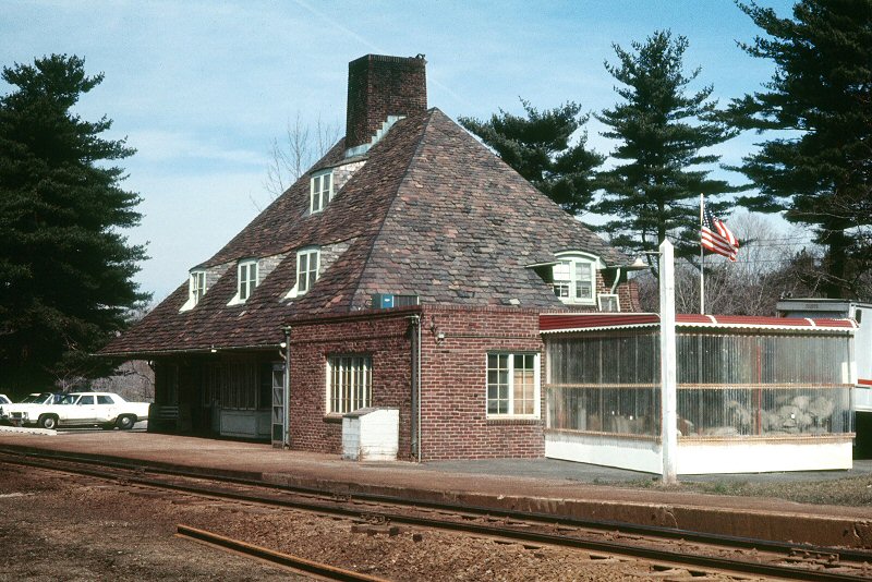
Mill Neck ex-Station is use as USPS and Police Station view W 2/1975
Photo/Archive: Steve Rothaug
.jpg)
GP38-2 #252 Train #508 eastbound approaching
Mill Neck 3/05/1981 (Scala-Keller)
MP15ac #168 Mill Neck Station view E 4/1989 Archive: Dave Keller
Mill Neck ex-Station view SE 6/07/2014
Photo/Archive: Derek Stadler
Mill Neck Station MP31 11/940 (Votava-Keller)
Beaver Brook, Shu Swamp Nature Preserve at Frost Mill Rd.
(ex-Mill Neck Rd.), Mill Neck
LIRR #610 11/1972 at Mill Neck MP31
Mill Neck ex-Station 4/2018
Photo/Archive: Brandon Kulik
(Oyster Bay pages)
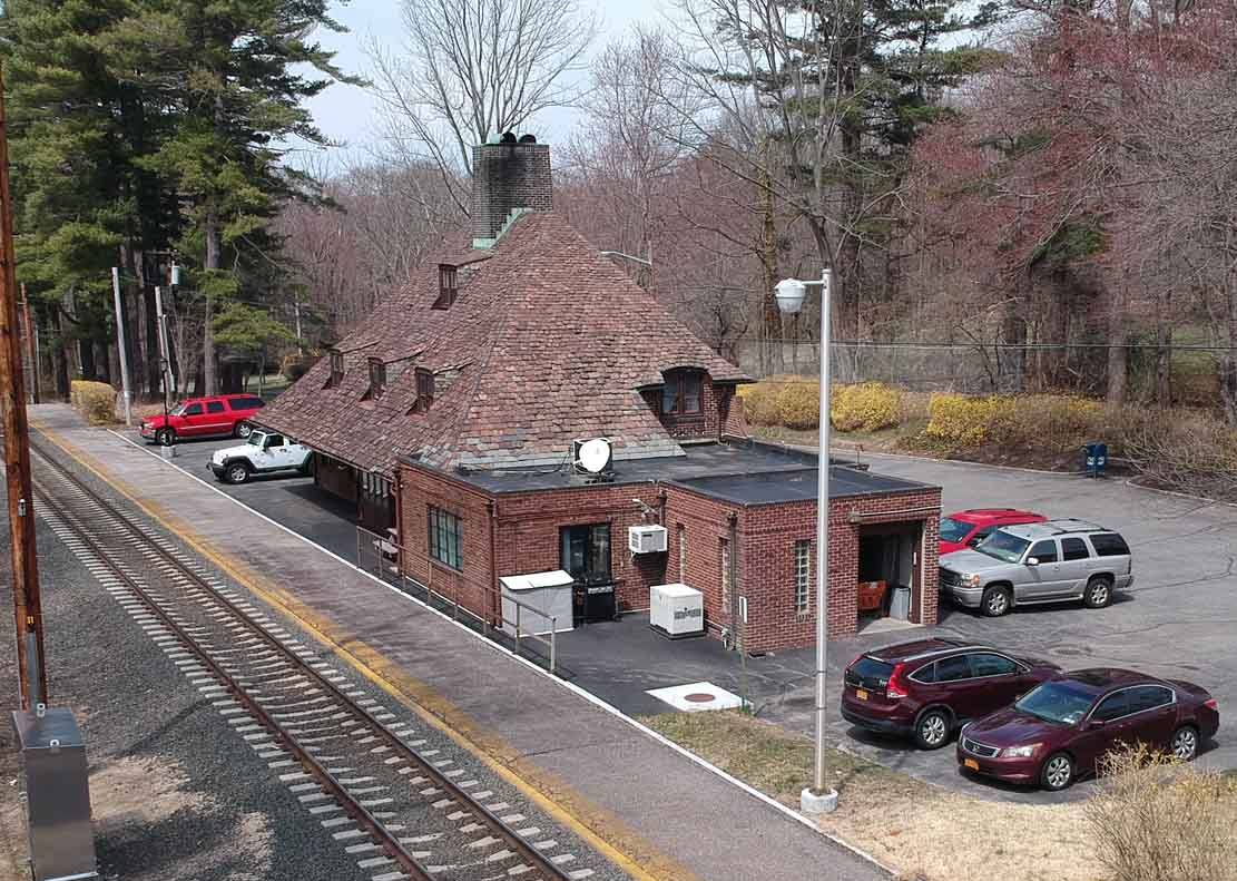
Built:
6/25/1889 with Porte Cochere at rear, extensively remodeled: 1902
Covered platforms removed: 1941
Closed: c. 1988 under renovation for restoration to 1902 remodel for
museum historical site (2003)
**4-stall engine house demolished: 8/24/29 (David Morrison data)
- Research:
Dave Keller
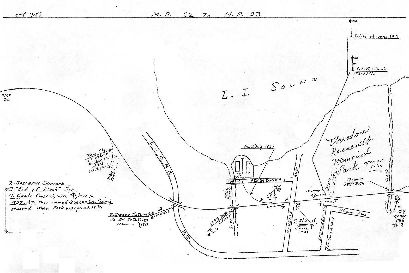
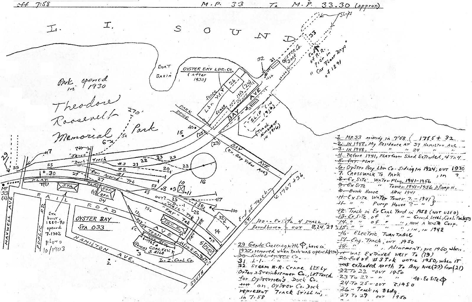
Emery map Oyster Bay MP32-33 Emery map Oyster Bay MP39-34
Maps, research and photos courtesy: Dave Keller, unless otherwise noted.
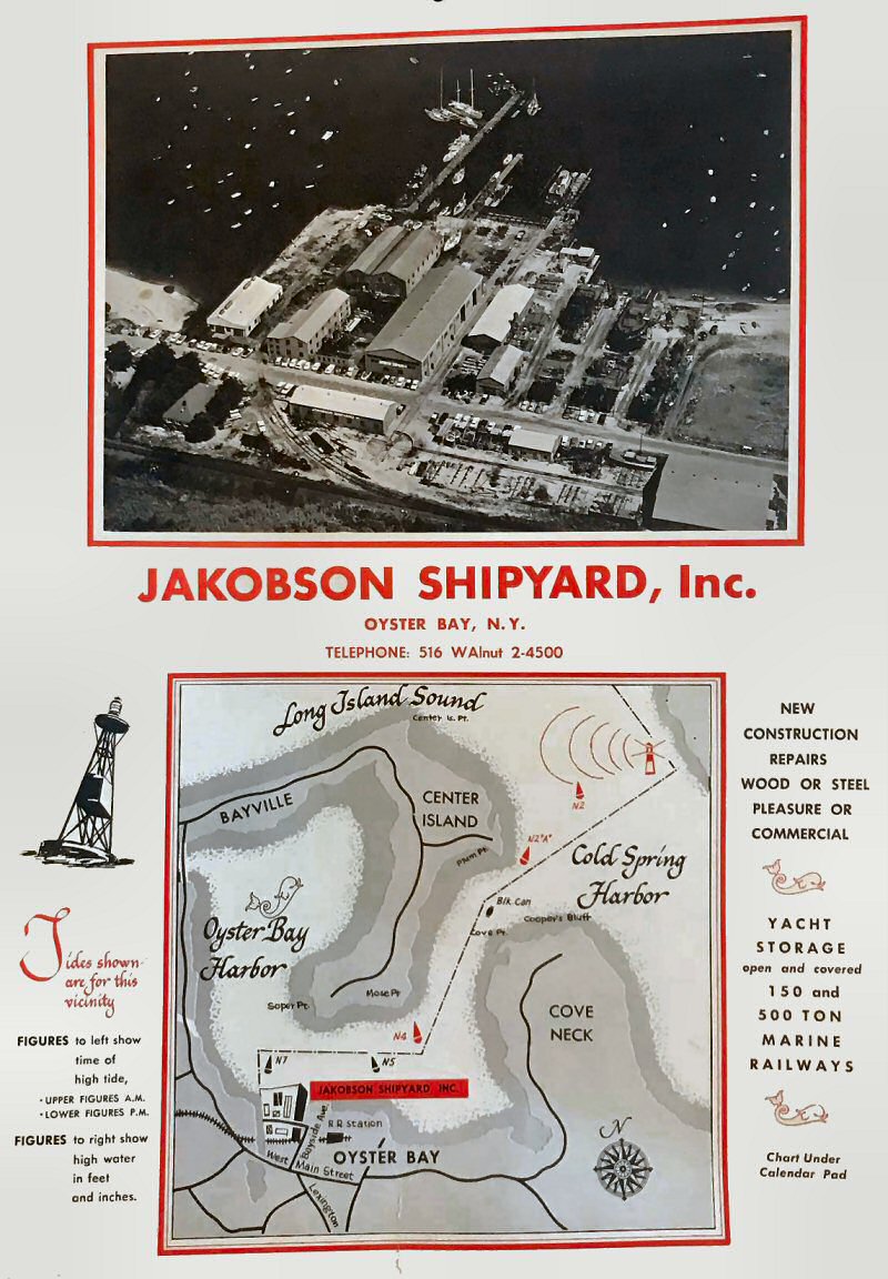
Jakobson Shipyard, Oyster Bay c.1960
Archive: Henry P. Doll

LIRR #24,23,25,47 4-6-0 G5's 06/12/49
(Bill Rugen- Art Huneke)

LIRR ALCO C-420 L-1 was just turned for its westbound journey later in the early afternoon of Spring 1968 at Oyster Bay.
The engineer and fireman will exit the locomotive as the Hostler on the ground, gets ready to do his rounds.
Photo/Archive: John Schaub