|
|
|
|
|
|
|
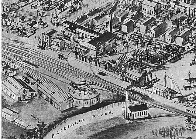
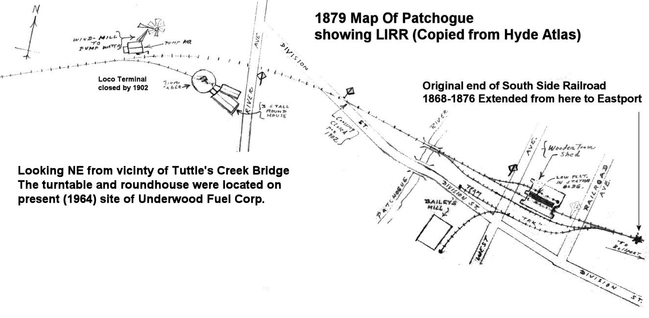
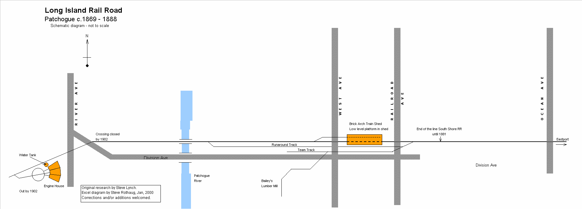
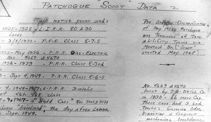
PATCHOGUE - SOUTH SIDE RAIL ROAD:
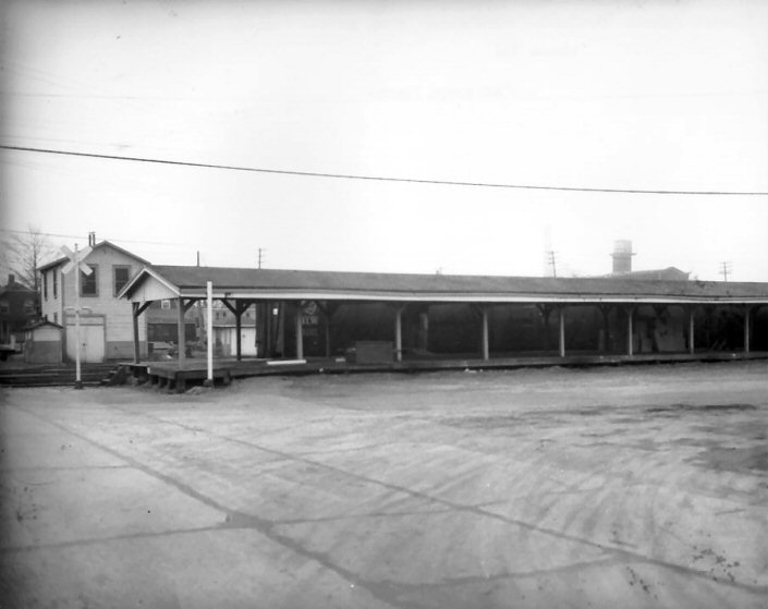
S. S. R. R. NEW TERMINAL IN SVC: 4/1869. 220’ LONG, 2-STALL
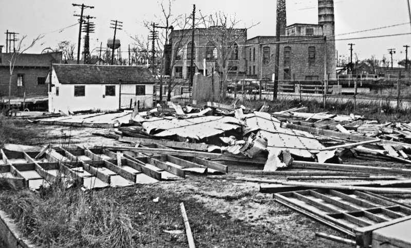
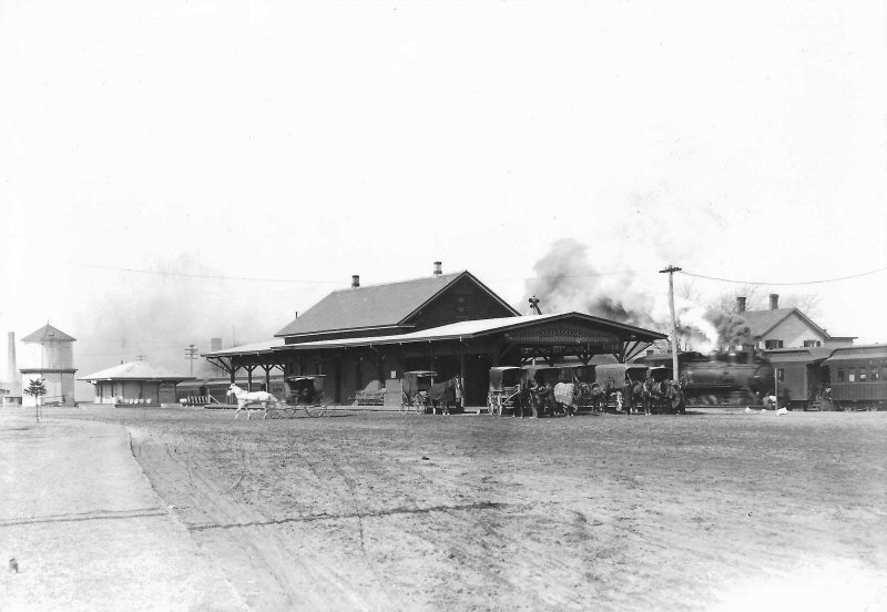
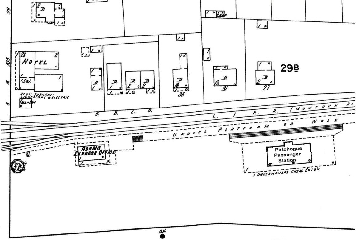
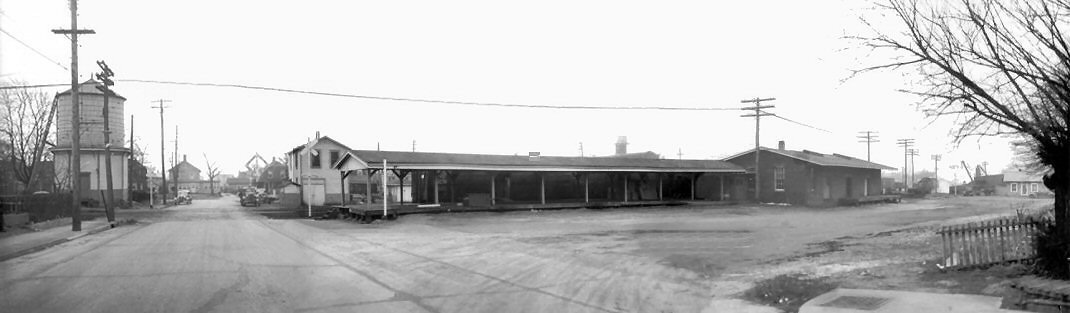
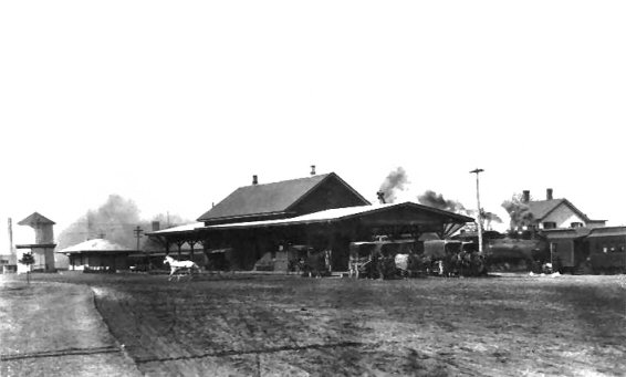
TRAIN SHED / DEPOT OPENED: 8/1869. LOCATED BETWEEN TODAY'S RAILROAD AND WEST AVENUES. END OF TRACK OF SSRR LOCATED IN FRONT OF TODAY'S STATION FACILITIES. DEPOT REPAIRED PER SSRR ANNUAL REPORT OF 10/15/1870 APPEARING IN 1/19/1871 ARTICLE IN THE “LONG ISLAND FARMER.” SSRR ACQUIRED BY LIRR. DEPOT RAZED: 1888. 2ND DEPOT OPENED: SUMMER/1888, WAS A TRAIN ORDER OFFICE UNTIL 05/29/1912 WHEN "PD" TOWER PLACED IN SERVICE. (Photographic provenance). RAZED: 5/16/63 TEMPORARY TICKET OFFICE LOCATED IN TRAILER DIAGONALLY IN FRONT OF “PD” TOWER IN SVC. DURING CONSTRUCTION OF NEW DEPOT. 3RD DEPOT OPENED: 7/30/1963, COVERED, HI-LEVEL PLATFORMS ADDED: 1997. AGENCY SCHEDULED TO CLOSE (?) **4-STALL ENGINE HOUSE DEMOLISHED: 1928 (Robert Emery data) - Research: Dave Keller |
||
 Patchogue: "A Brief History" Patchogue-Medford Library Research: Mark Rothenberg & Carrie Locke |
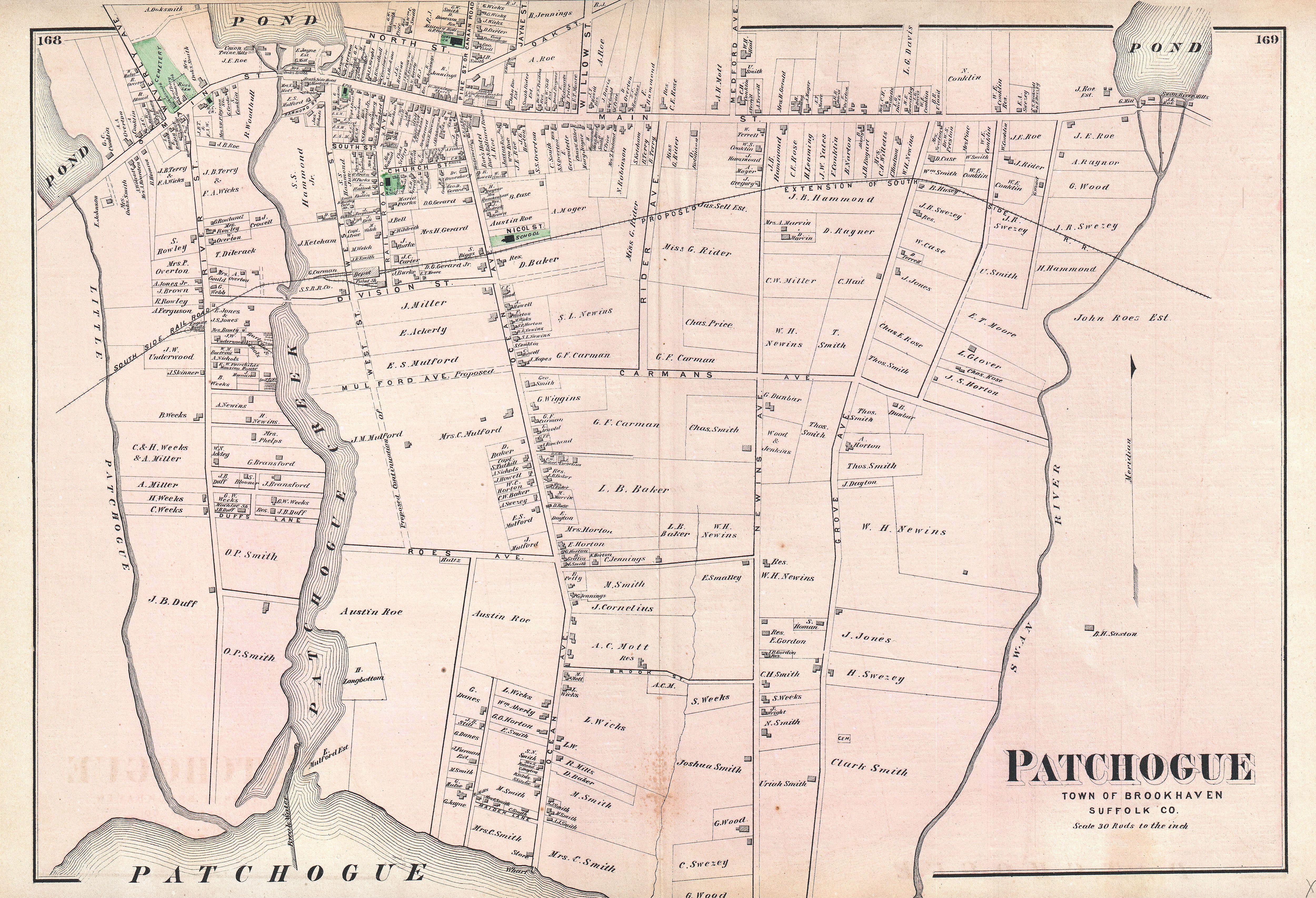 1873 Beers map South Side Rail Road Note: D. Baker corner property of Ocean Ave and LIRR. Future site of the Old Brookhaven Town Hall  Patchogue zoom 1858 Creator: J. Chace Archive: Norman B. Leventhal Map Collection/Boston Public Library |
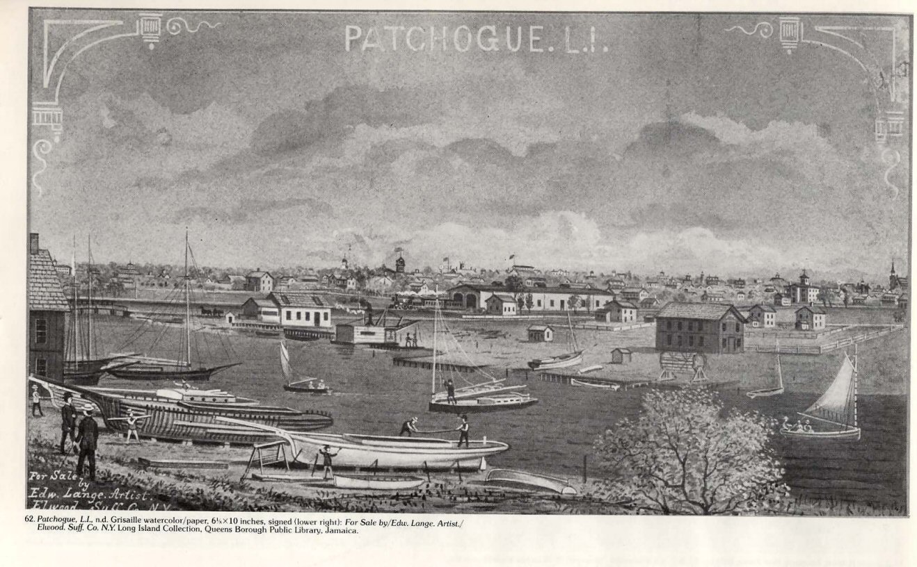 South Side RR Train Shed 1876 Painting: Edward Lange Collection: Queensborough Public Library 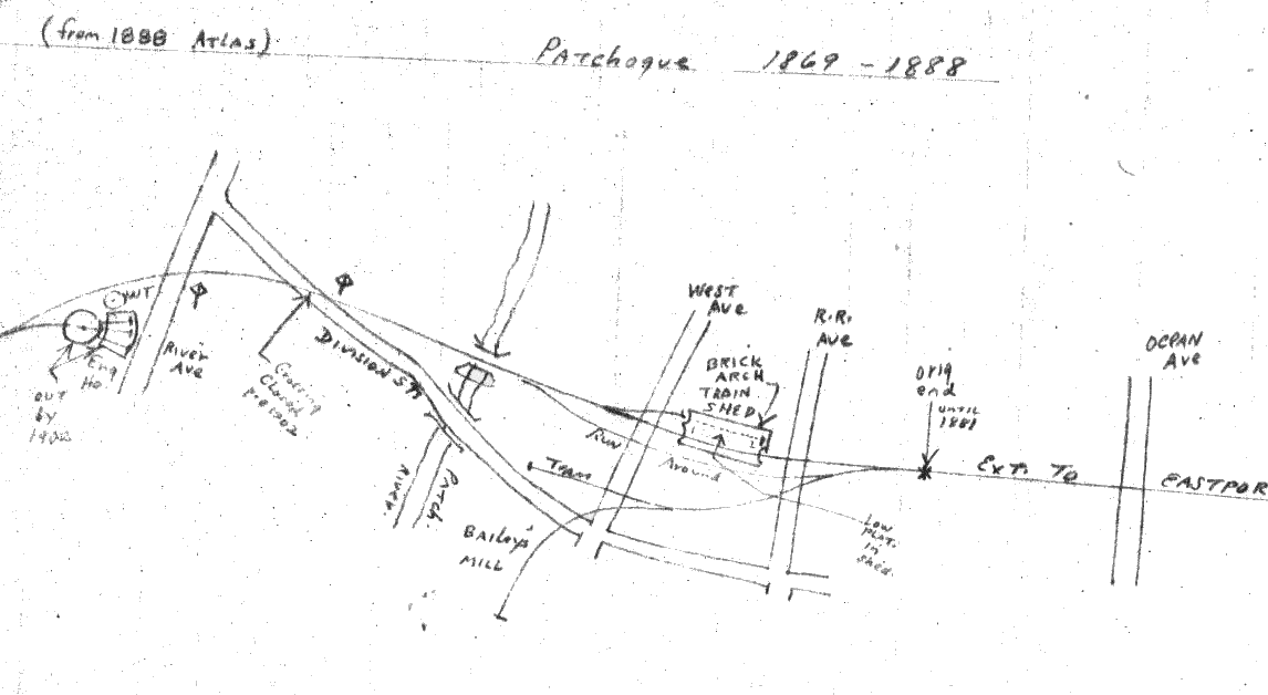 Pre-1888 South Side Rail Road
|
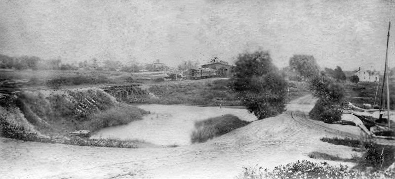 South Side RR crossing Patchogue River into Train Shed 1878 Photo: George Brainerd Archive: SUNY, Stony Brook  |
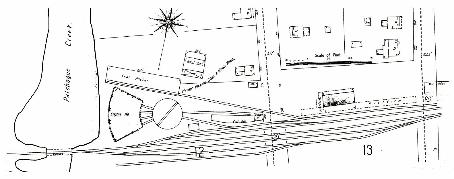
 SSRR turntable and enginehouse, Little Patchogue River (later Tuthill's Creek) 1878 Photo: George Brainerd Archive: SUNY, Stony Brook George Brainerd photos indicate the early beginnings of Bailey's Mill (center right). Notice the dirt road off Division St. as indicated in the 1888 Hyde map (left).
|
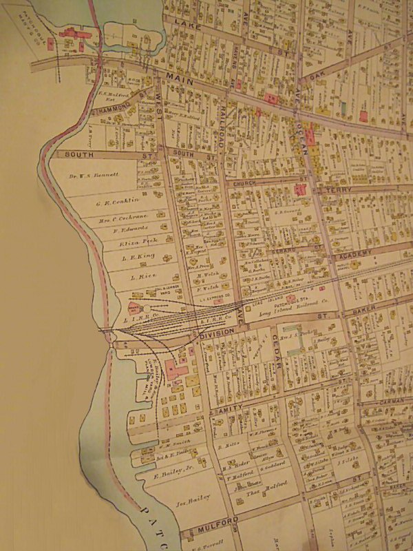
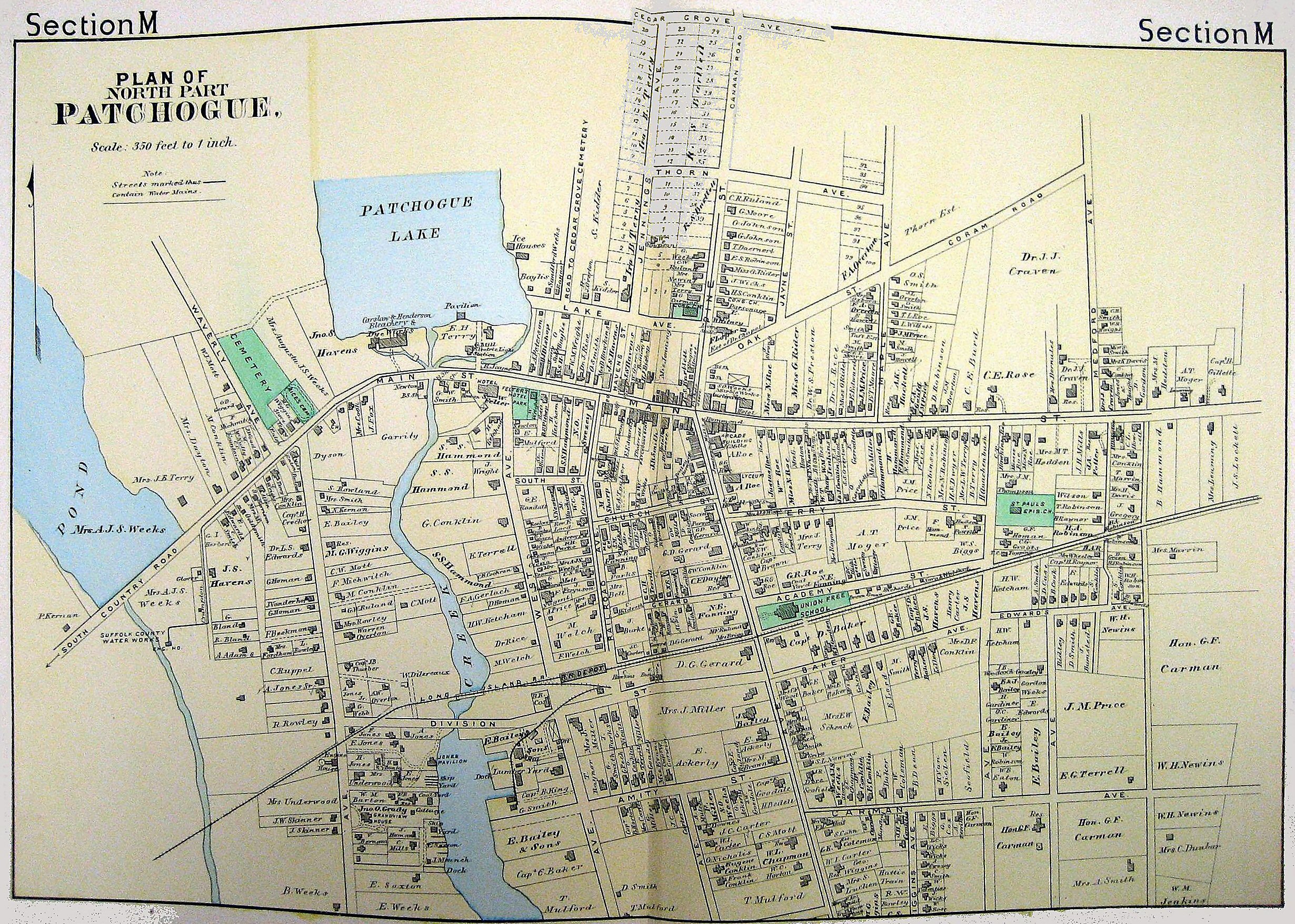 Hyde Map 1888 - Patchogue |
|
Regarding the SSRR’s train shed pictured above by LIRR artist Edward Lange I thought the artist may have taken “artist’s license”, however, everything else in the painting is realistic which leads me to believe that perhaps he’s correct. The 3 roof vents are spaced farther apart because this is almost a broadside view. The photo in Ziel’s book shows them closer together and that’s probably because that shot is almost head-on. Also, the shed is cut off by the edge of the photo and some trees (?). Went to Seyfried’s “Volume I: The South Side Rail Road” and the description for Patchogue station in the back of the book said a “substantial shed” was constructed in July/August, 1869 and it was 220 feet long, definitely a “substantial” shed. 220 feet is the equivalent of four (4) P54 steam cars coupled with the left over 4 feet being taken up by the couplers. You can’t go by the cars depicted in the painting because they’re not only, most probably, out of scale, but the cars back then weren’t 54 feet long, either! A 220 feet long shed could have held a 5-car train of 40 feet long varnish coaches plus engine and tender! Info: Dave Keller |
||
| LIRR - EARLY PATCHOGUE BEGINNINGS - Patchogue Incorporated in 1893 | ||
 Swezey Grist Mill Swan Lake, Patchogue 1906 Photo: A. Noble Chapman Archive: Queens Public Library
|
 Patchogue view SE Pen and Ink c. 1888 Archive: Dave Keller |
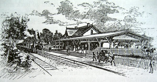
 Patchogue Station view NW 1905 Photo: H. Noble Chapman Archive: Dave Keller Patchogue opened Summer, 1888 - razed 05//16/1963 |
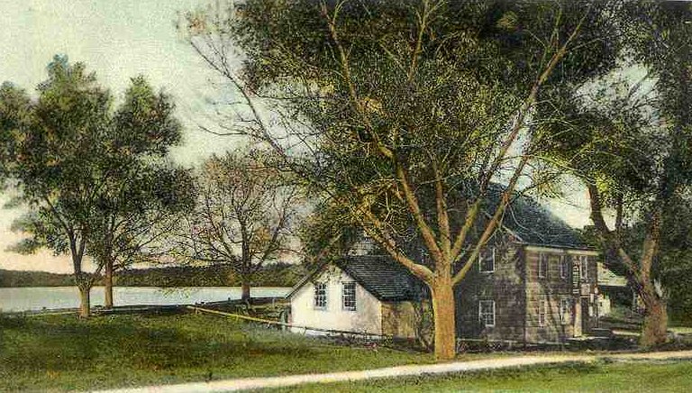
 Swezey St. Bridge across the Swan River view N from boat c.1900 East Patchogue |
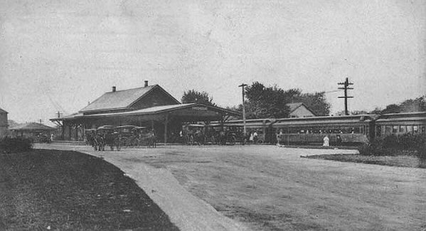 Patchogue Station view NW |
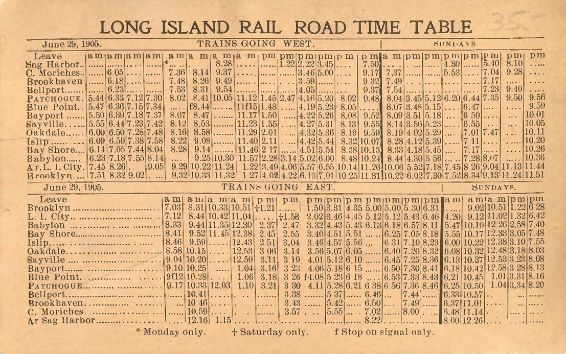 LIRR June 29-1905 Timetable Collection: Dave Morrison |
| EARLY PATCHOGUE MAPS | ||
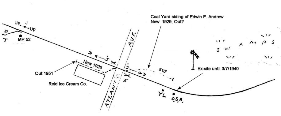
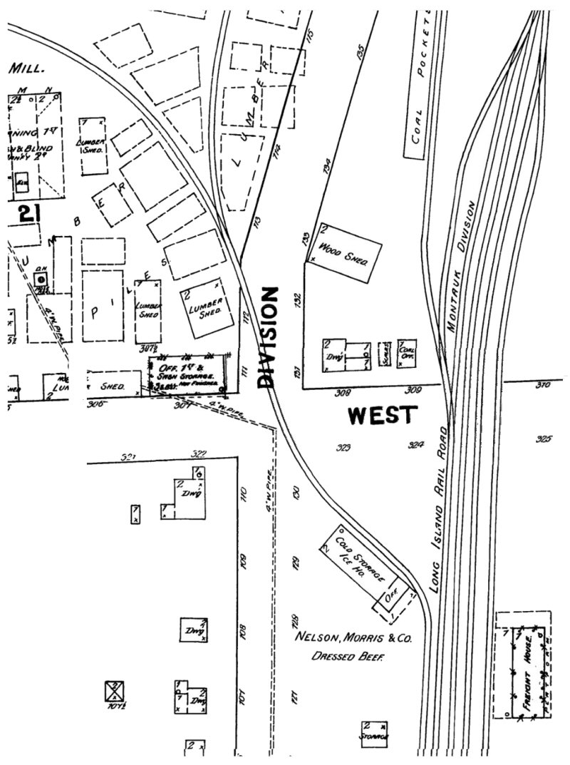
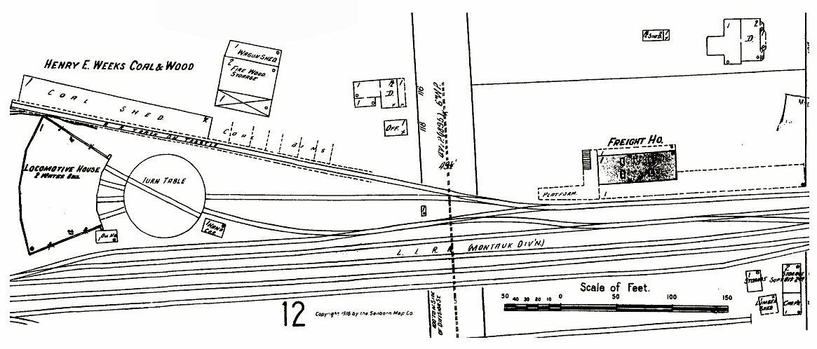
 1917 Hyde Map - Yard Area 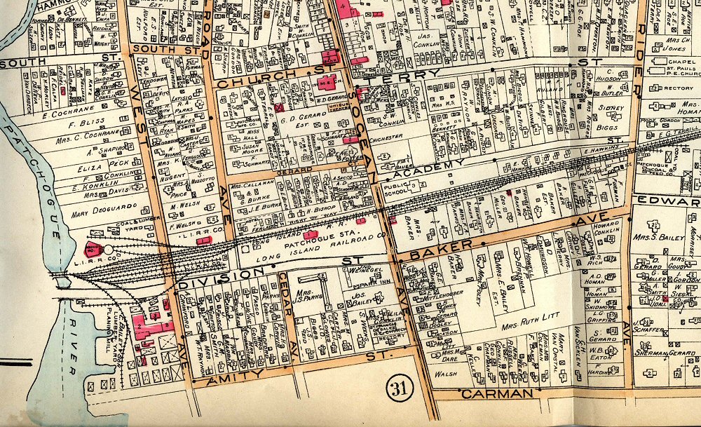 1917 Hyde Map - MP53-54 Baker Ave., later changed to Baker Street. Indicates Patchogue Coal & Feed Yard prior to Swezey Coal & Feed and Knickerbocker Ice located on west side of Rider Ave |
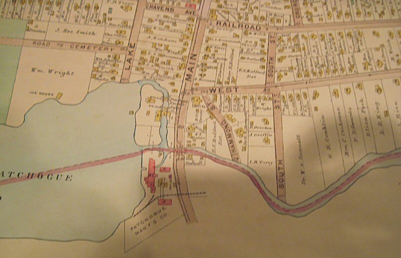 Hyde Map - Patchogue Mfg. Co c.1900 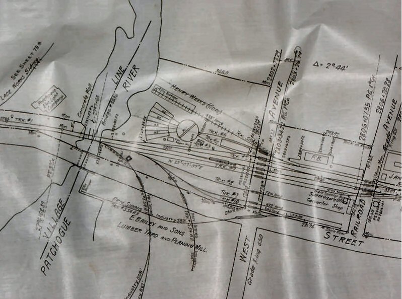 1918 Yard area valuation map |
 Hyde Map - Yard Area c.1900 |
|
1910 Schematic MP 53 |
1926 Composite Sanborn Map area West of Ocean Ave. The small building east of PELCO reads, 1 Pump. Outside (perhaps) as follows: "Finished Floor Construction Except Exposed Steel BR(ICK)-W(AL)LS Conc(rete) Fl(oor) & P(ainted) F(inish)" |
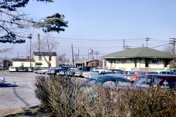
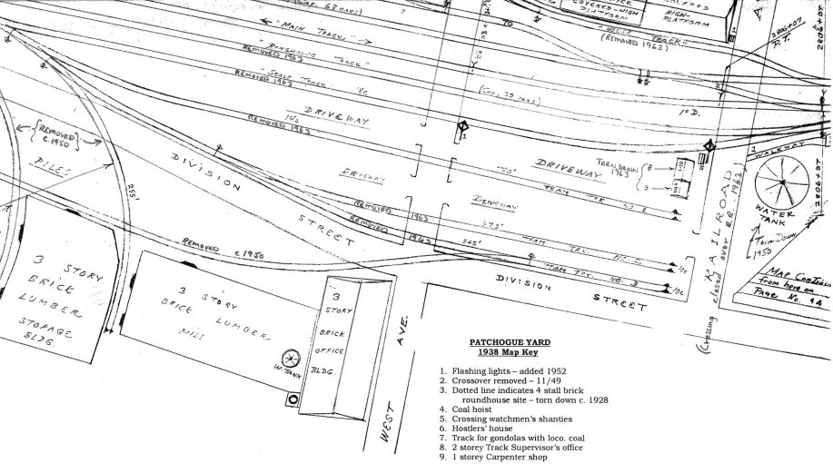 Emery Map Patchogue Yard 1938 Archive: SUNY Stony Brook |
| PATCHOGUE MAPS - 1950+ | ||
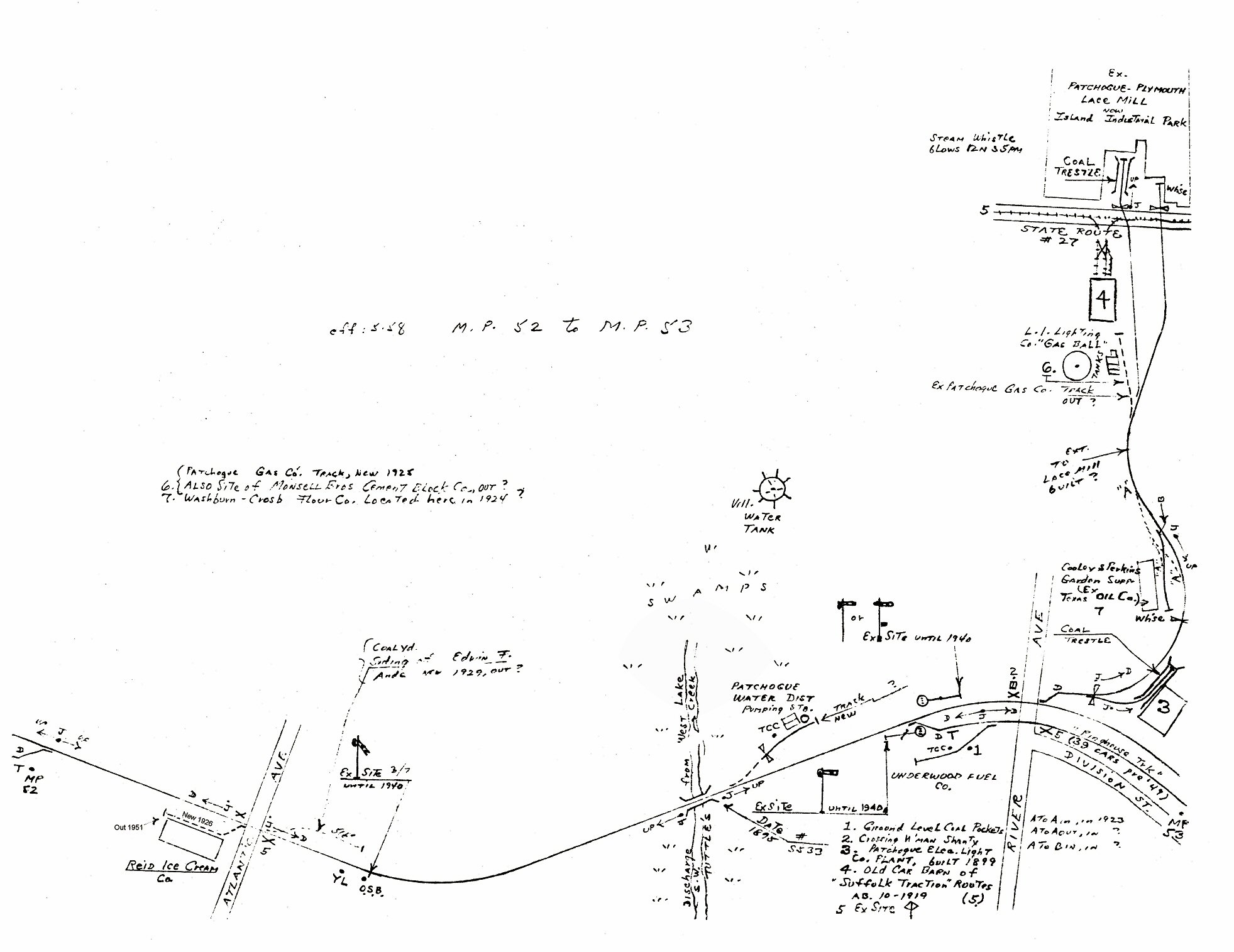 Emery map 5/1958 MP 52-53 Reid Ice Cream, Atlantic Ave., Blue Point to Lace Mill siding, River Ave. Patchogue Note: The Patchogue Former Manufactured Gas Plant (MGP) was operated from 1904 to 1926. The company was a small operation, converting coal and/or petroleum products to a flammable gas for use in lighting and industry. The company was sold to Long Island Lighting Company (LILCO). |
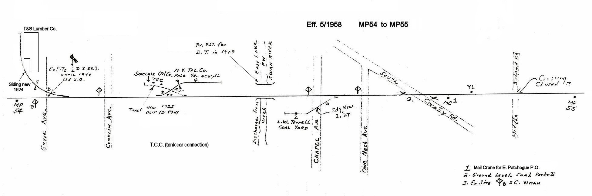
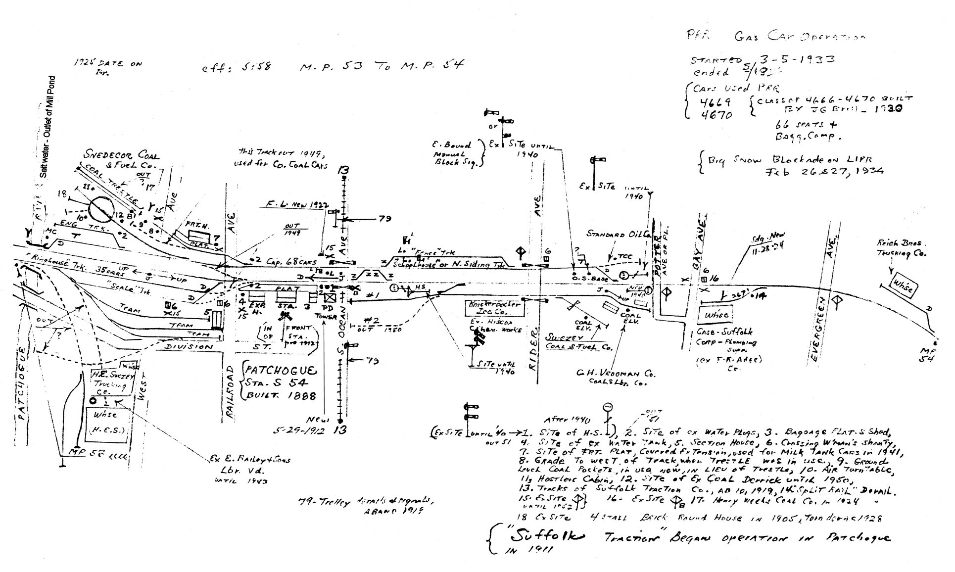 Emery map 5/1958 MP 53-54 Patchogue River to Evergreen Ave, Patchogue
|
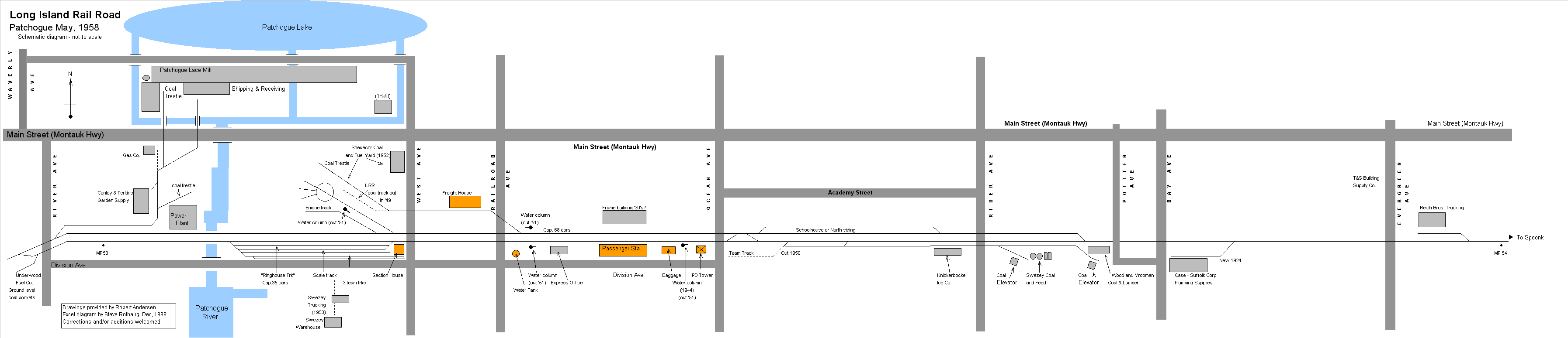 1958 Schematic MP 53
|
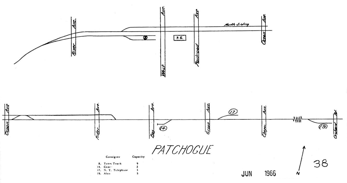 LIRR map 1966 - page 38 |
 Patchogue Interlocking map 1988 |
|
|
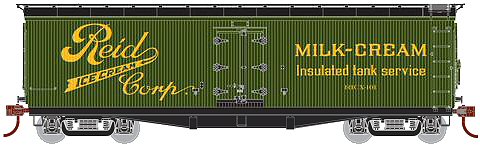
REID ICE CREAM Note: Located just east of MP52 SW corner of Atlantic Ave (Bluepoint) part of "Y" cabin. Included for proximity to Patchogue as an industry of note. |
||
|
|
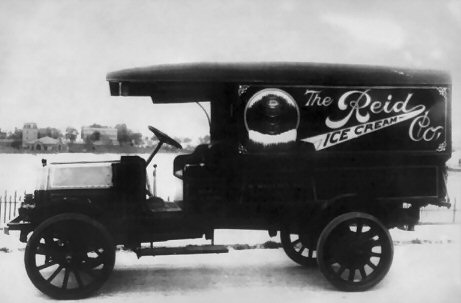 Reid Ice Cream Co. truck poster c.1925 |
|
|
|
|
|
|
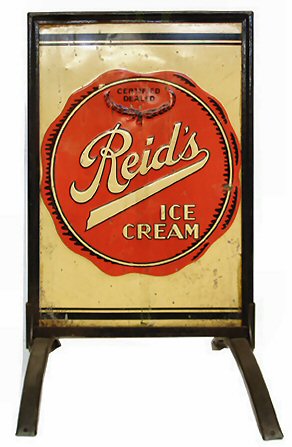
The article also said that Suffolk County's real ice cream baron, and the man who first cornered that commercial market, was Augustus Floyd Smith, of East Patchogue, starting in 1879. "Blocks of ice were cut from Robinson's Pond. Some of it was stored...and some of it was chopped and liberally salted. The salted ice was packed around a freezer container into which the ice cream mixture was poured. A horse was then harnessed to a large wheeland walked 'round and round' to agitate the paddles. In this manner Smith was able to provide ice cream to all the hotels and restaurants in Patchogue; to both Clarence and Charley Hawkins' Bellport confectionery store and, with some 'modernization' of his equipment, to the men stationed at Camp Upton during WW I." (p. 3.) His son took over in 1919, and sold out to Reid Ice Cream Corp. in 1926. Reid's Ice Cream Plant does show up on Atlantic Avenue Gene Horton's Blue Point, Long Island, New York, Then and Now. East Patchogue, NY: Searles Graphics, Inc., 1999: p. 6. At the time the "now" shot shows it still there. Courtesy Research of: Mark Rothenberg, Senior Reference Specialist, Suffolk Cooperative Library System & Patchogue-Medford Library Photo: Reid Ice Cream retail
sidewalk sign |
||
|
|
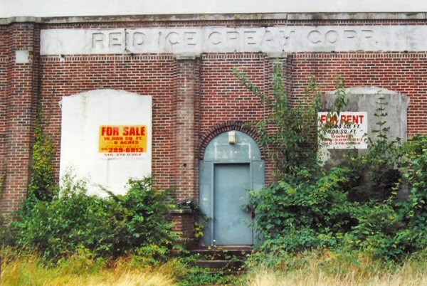 Reid Ice Cream view W 2001 Atlantic Ave, Blue Point Photo: Steven Lynch
|
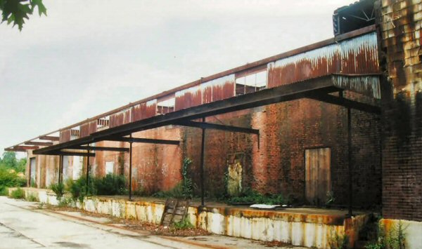 Reid Ice Cream view SE 2001
|
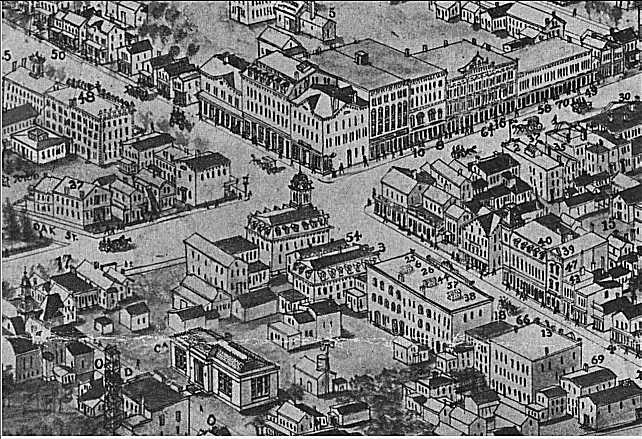
 Patchogue Hughes-Bailey Aerial 3D drawn view SE 1906 - Created by a team that walked the streets and drew the buildings, houses, industries, rail, roads, etc. with the appropriate notes. The material was then taken back and complied into the 3D aerial style as the finished product. 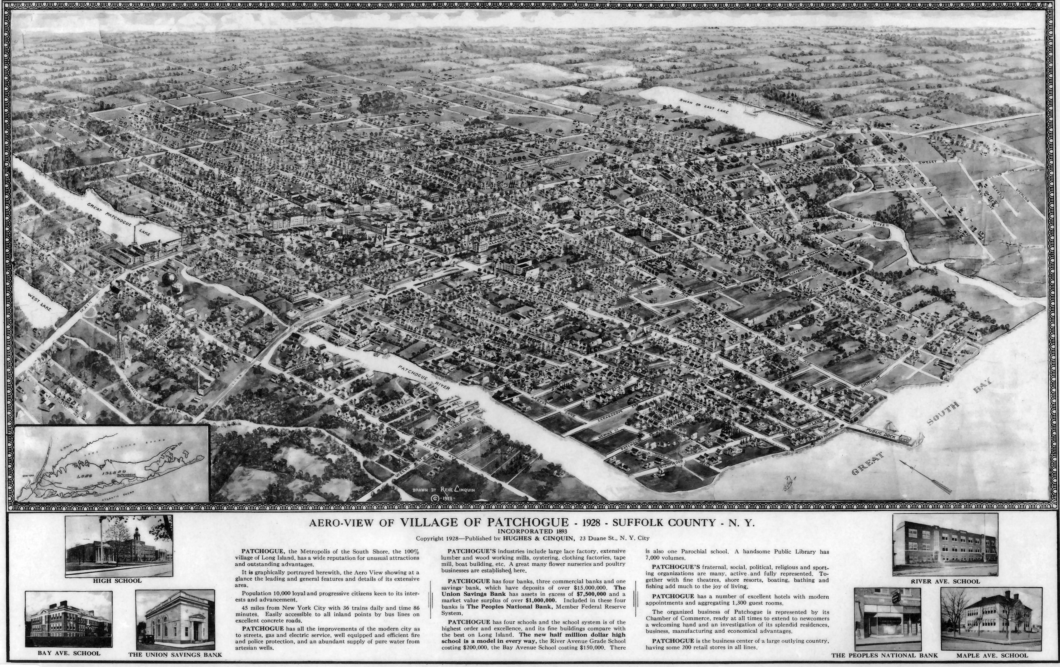 Patchogue Hughes & Cinquin Aerial 3D drawn view NW 1928 |
||
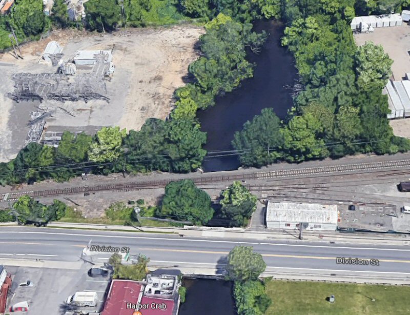
| TUTHILL'S CREEK | ||
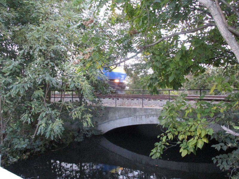
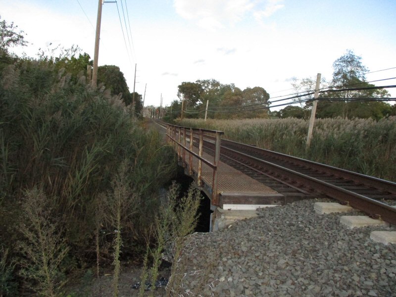 Tuthill's Creek Bridge - View E 10/17/2019 Photo/Archive: Dave Morrison |
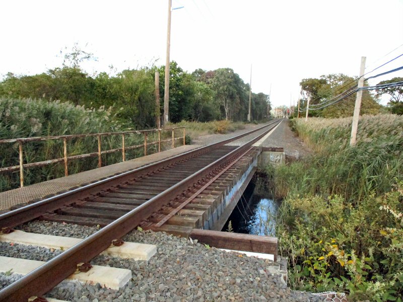 Tuthill's Creek Bridge - View W 10/17/2019 Photo/Archive: Dave Morrison Note: Previously named: Little Patchogue River |
 Tuthill's Creek, Patchogue 7/10/2015 view N |
 Tuthill's Creek aerial View E 1970's Photo/Archive: John Jett |
A document in the
"Records of the Town of Brookhaven" pertaining to Nathaniel Smith and
Daniel Gillet's damming, written in 1832, refers to "little Patchogue
Stream". An early map of Patchogue, made sometime between 1869 and 1881,
shows it as "Little Patchogue". Moving forward to 1873, the 1873 F. W.
Beers map of Patchogue also lists it as "Little Patchogue". |
|
| PATCHOGUE RIVER | ||
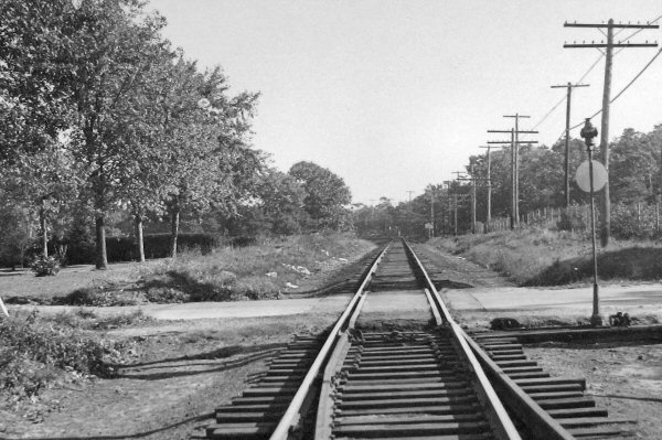
 The entrance to the yard from the west is over the 30' bridge spanning the Patchogue River. View N west bank 2001 Photo: Steven Lynch
|
 Patchogue River - View N 2019 Google maps aerial As you can see the overgrowth along the
Patchogue River |
 Patchogue River bridge east bank - Westbound Dwarf Signal - View N 10/17/2019 Photo/Archive: Dave Morrison |
| BAILEY'S MILL | ||
| 1869 Edwin Bailey & Son 10 acres 275 men, branch yards Sayville/Islip | ||
|
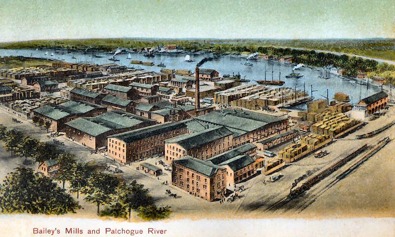
The Patchogue River was dredged in 1875 and again in 1897 to become the only deepwater port on Long Island’s South Shore. Patchogue was an official United States port of entry from 1875 until 1922. The huge Bailey lumberyards thrived near the river’s head for many decades. The Patchogue River has been home to numerous boat and shipbuilding yards. The most prominent was Gil Smith’s boatyard whose sleek, wooden catboats were among the worlds finest, repeatedly winning international competitions off the Long Island coast between 1876 -1938. Some of his models and boat plans now grace the Smithsonian Institution and Long Island Maritime Museum. In the days when boats and ships were the most efficient means of transportation, Patchogue shipbuilders made four hundred ton schooners, sloops, barges and boats as small as dories. |
||
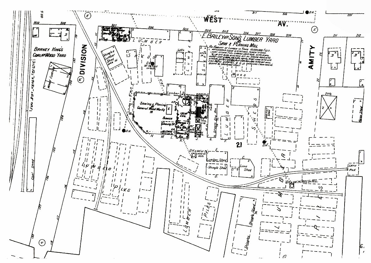 Bailey's Mill Patchogue Sanborn map 5/1897 |
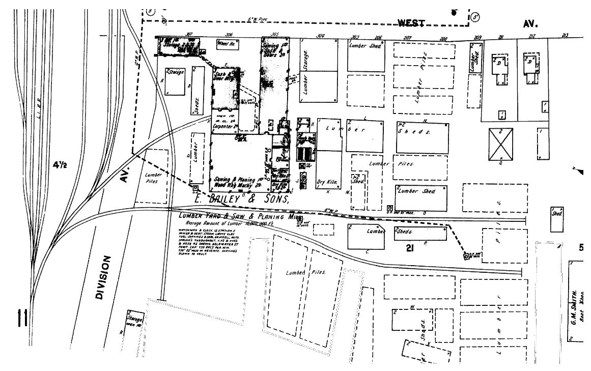 Bailey's Mill Patchogue Sanborn map 8/1902 |
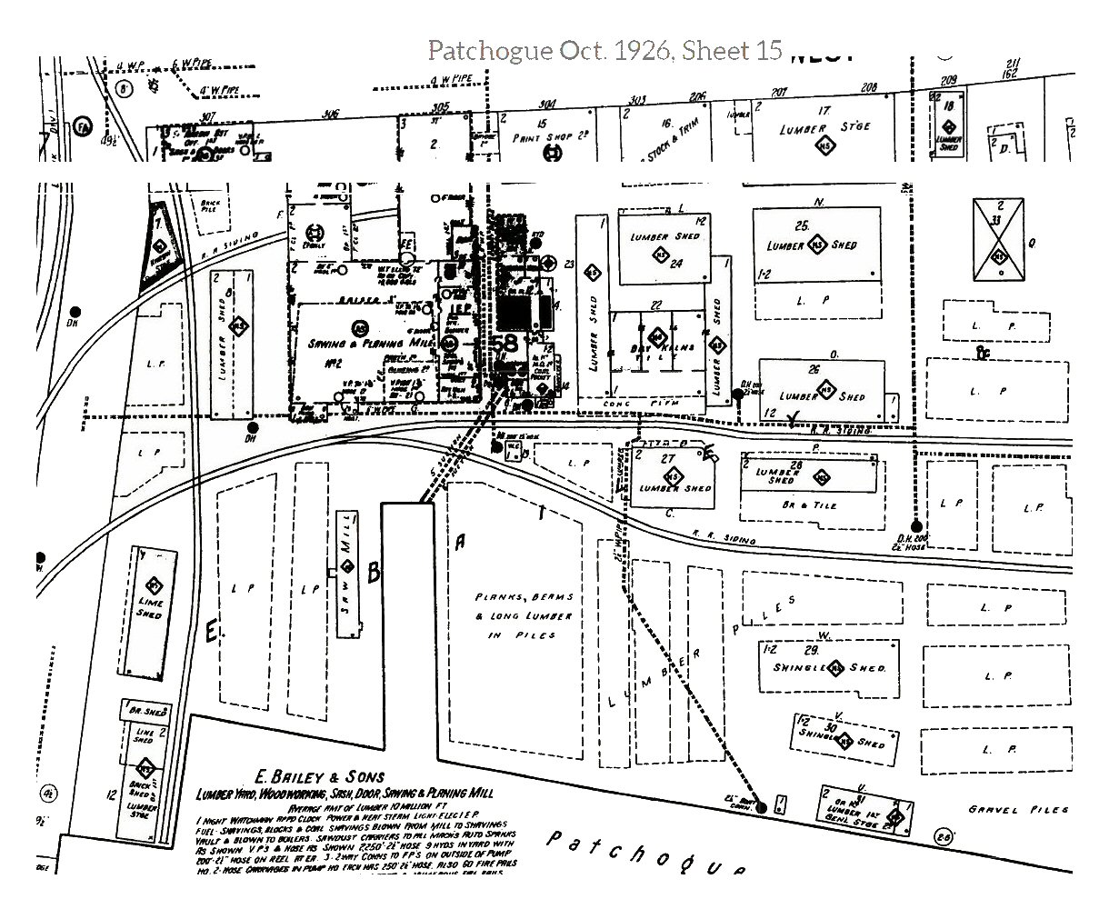 Bailey's Mill Patchogue Sanborn map 10/1926 |
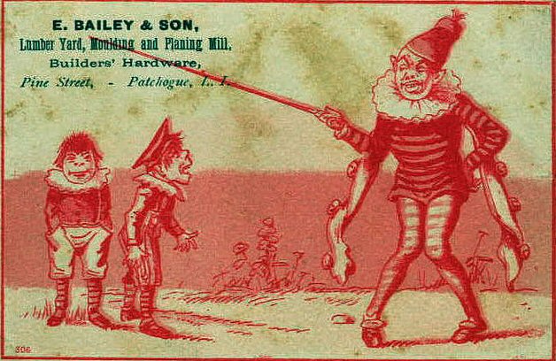 Bailey & Son business card or advertisement c.1884 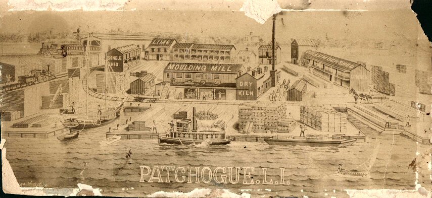 Bailey's Lumber Mill 1896 Edward Lange drawing Archive: Patchogue Library
|
|
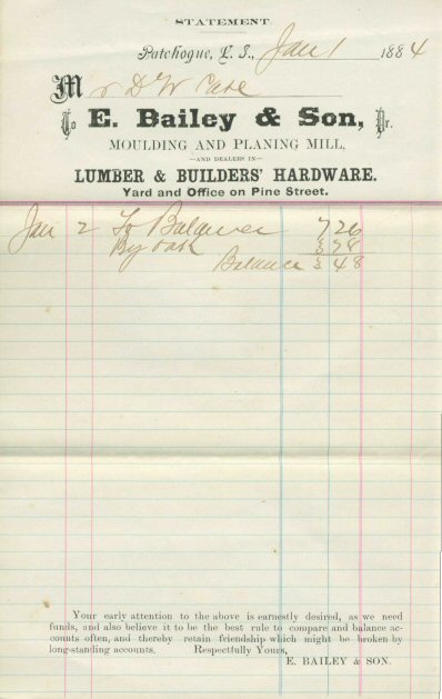 Bailey & Son Invoice 01/01/1884 |
|
Pelletreau states: Bailey, for more than three years in his early business life, partnered with O. S. Smith and Martinus Smith, of Smith boat-building fame. And the mill, in its heyday, owned (i.e. not necessarily built) their own lumber vessels, one of which had a capacity of 400,000 feet, and lumber was brought to the mill on schooners and barges, and the mill had three tugboats to move the barges; Bailey cut slips in the bank next to the mill for vessels to dock and land their cargoes. And "Portrait and Biographical Record of Suffolk County"states that by 1896 the firm had abandoned, for the most part, carpenter's and contractor's work, although they were still filling orders when sent in. The Bruns-Kimball Company built aircraft rescue boats for the first few years when they occupied the mill property after operations ceased in 1939. Research: Gary Lutz Patchogue-Medford Library |
||
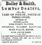
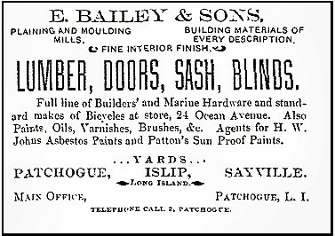 Bailey & Sons Lumber Dealers Ad c.1888+ Pine Street was changed to Ocean Ave. Note: AT&T founded 1885 At this time the telephone exchange was a single digit: "2" |
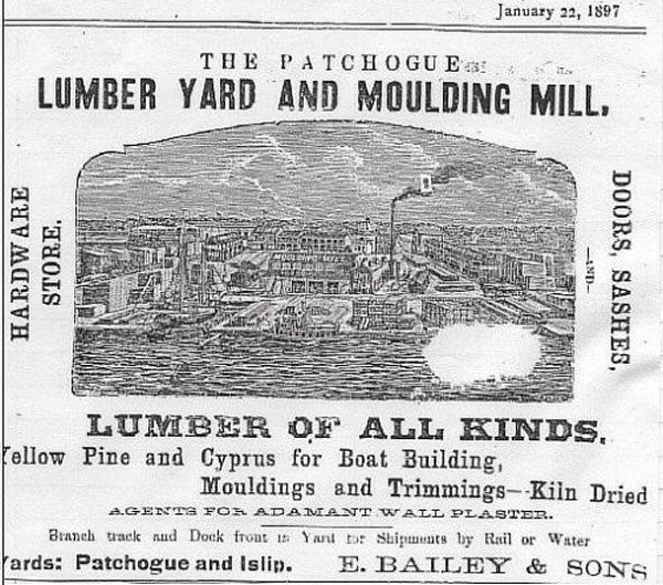 E. Bailey & Sons shipments by rail and water, Yards in Patchogue and Islip 1/22/1897 |
|
|
||
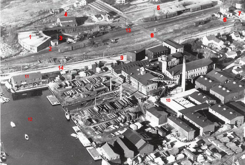
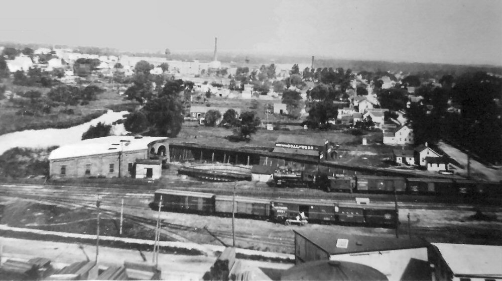
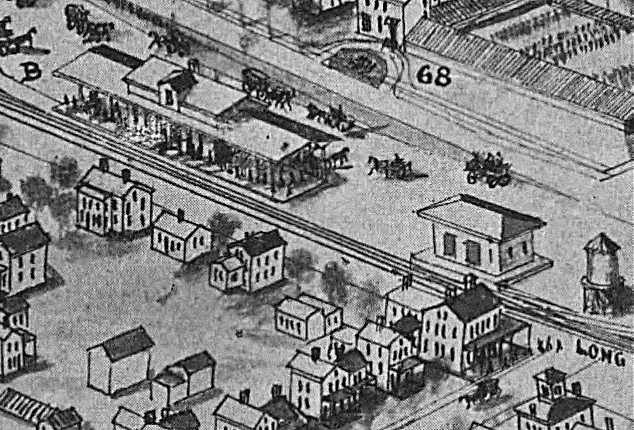
| Patchogue Yard - Fairchild Aerial View NE 1923 LEGEND: | ||
|
1. Four stall Roundhouse Razed: 1928 |
||
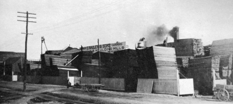
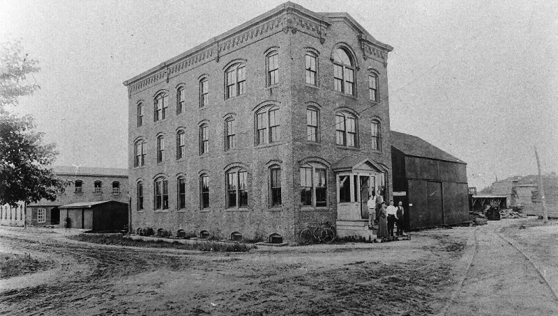 Bailey Planning Mill Office c.1900 view SW from West Ave. The 3 story brick Lumber Mill building, to the right of the office, was added sometime later c.1910+ see far right photo. Archive: John Jett
|
 View SW c.1906 postal card - 3 story Brick Mill not yet constructed
|

|
 Patchogue yard - Aerial view NE c.1920 |
 Patchogue yard view NE c.1920 |
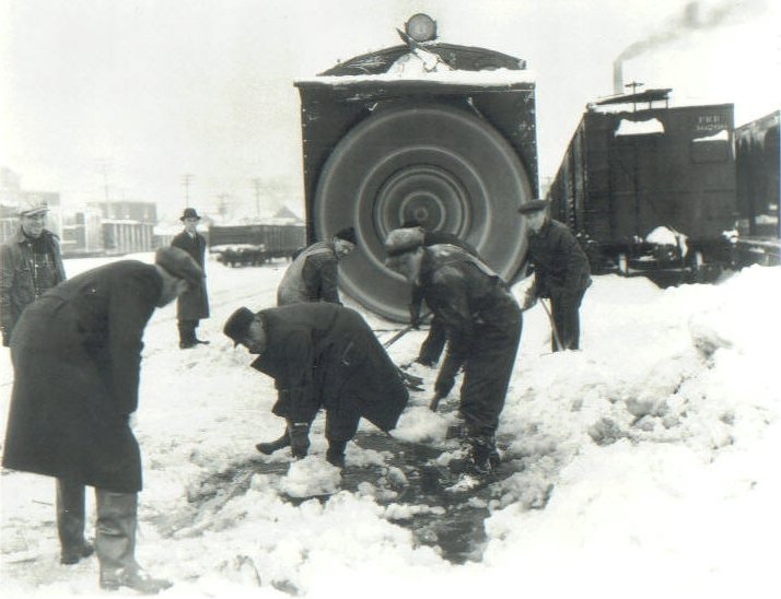 LIRR #193 Rotary Snowplow across from Bailey's Lumber Mill, south yard 1921 Archive: Dave Keller |
|
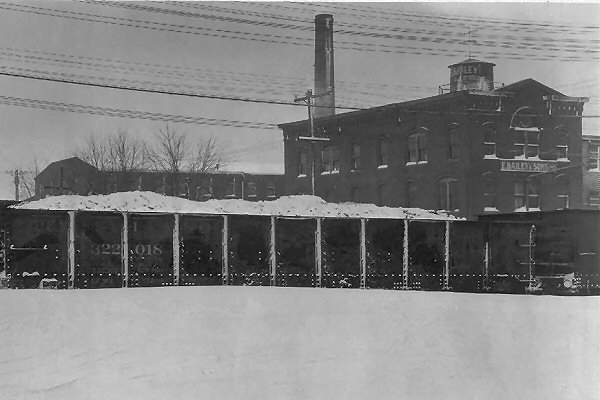
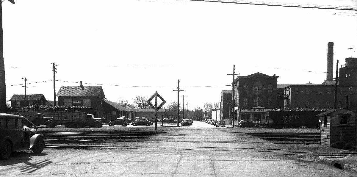
The Bailey Lumber Mill (right) went out of business in 1939 and the site was taken over by the Bruns –Kimball Company in 1940. This company was building aircraft rescue boats for the Defense Department until their contract expired. THE SUFFOLK COUNTY NEWS, SAYVILLE/N.Y. FRIDAY, JUNE 28, 1946 United States Prefab Corporation took over Bossert-Bailey Lumber Mills. The United States Prefab Corporation, a subsidiary of the Adirondack Log Cabin Company, was awarded a government contract under the Land – Lease Program, to build thirty thousand prefab homes for England, but this contract was cancelled after the construction of only 300 homes. In the following years the mill complex was leased to several other firms and manufacturers. The LIRR siding was removed in 1950. Shortly thereafter, on November 22, 1951, a large fire, causing $500,000 damage, wiped out three firms leasing in the mill and damaged a fourth. The National Lock Corner Cabinet Corporation, Colonial Art, and the Castle Silver Company were the firms totally wiped out. The Castle Silver Company produced plated hollowware and was finishing surgical instruments for the Department of Defense, employing 35 people. |
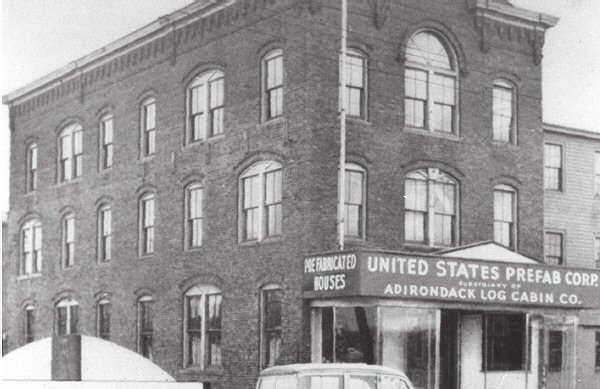 United States Prefab Corporation 1944 |
|
 Patchogue view N c.1920 Archive: John Jett |
 Mill Office as a US Coast Guard Recruiting Station on Division St. View W at West Ave 1955 Archive: John Jett |
 E. Bailey & Sons Mill Envelope 3/02/1937  |
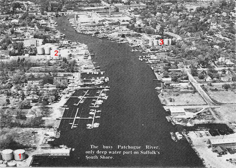 Patchogue River aerial - Oil Terminals View N c.1950s Archive: John Jett 1. Patchogue Oil Co. 2. Rite Fuel Co. 3. Marran Oil Co. |
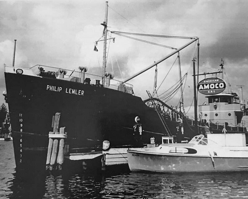 US Merchant tanker Philip Lemler (1947-1969) docked in the Patchogue River, by Marran Oil Co. c.1960. Patchogue was the only ‘deep water port’ on the South Shore and able to receive this craft and many others for a century prior. The Patchogue River was dredged in 1875 and again in 1897, transforming it into Long Island’s South Shore’s only deepwater port. This change made Patchogue a major hub for industry and commerce, even serving as an official U.S. port of entry until 1922. Tom Farrell
|
|
 Patchogue River - View S 1957 Aerial Photo: Jim Mooney Archive: John Jett |
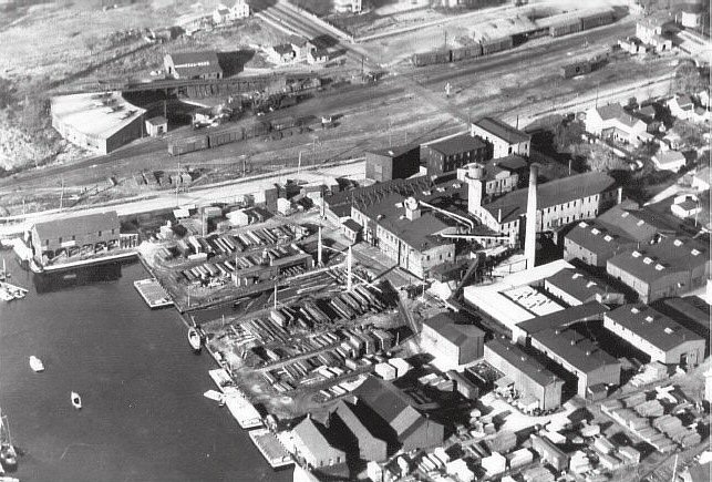
 Bailey's Mill yard remains view NW c.1972 Archive: John Jett |
|
| PATCHOGUE STATION AREA | ||
|
PATCHOGUE: SOUTH SIDE
RAIL ROAD ACQUIRED BY LIRR. DEPOT RAZED: 1888. |
||
|
|
||
|
With the dedication of the new railroad station in
1889 the virtual growth in population made possible by rail access, tourism
during the summer months to the South Shore beaches, and a demand for
building materials and products grew the railroad in this area over the next
30 years. By then the turntable had been moved into town, amidst
protests, a 3 stall engine house erected, and no fewer than 15 plus
industries had sprung up. These included: several coal supply
companies, plumbing supplies, an electric plant, gas company, brewery, cold
storage, pharmaceutical company, and a cement block company to mention the
major customers. In 1880 the population was 2500. By1900, the population of the Village was 2,926, which represented 20% of the population of the entire Town of Brookhaven. The first train from Penn Station out to Patchogue was 9/8/1910, pop. 3800, which was a major historical, social and economic event. Patchogue Village’s population grew significantly in the 1920s to 6,860 by 1930. |
||
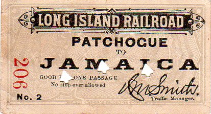 Ticket No.2 Patchogue to Jamaica 9/1905 Archive: Brad Phillips 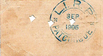 |
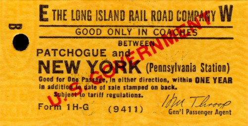
 Ticket 1-B H Patchogue to Penn Sta. 8/30/1946 Note: ER Comer, whose signature is on this ticket, was appointed in October 1943 and succeeded by Homes Bannard in 1946. Thus, the issue date was probably 1946 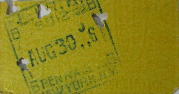 |
Note: The rubber stamp imprint (used on regular tickets) or printer's overprint (specially printed tickets with 1H-'G' suffix) indicate the ticket was paid for by a US Government transportation request. The logo was affixed to prevent the user from returning the ticket for a cash refund (unused one-way tickets could be refunded in cash over the counter). |
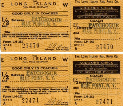 Ticket LH-262 Patchogue to Blue Point 04/09/1962 Archive: Brad Phillips |
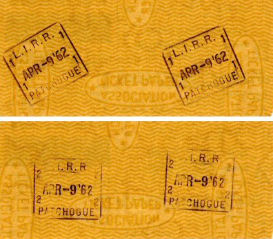 Ticket Patchogue to Blue Point reverse 04/09/1962 Archive: Brad Phillips |
|
|
|
|
|
|
|
.jpg) Rules & Rates of Pay - Nostrand Ave. thru Riverhead 1/01/1924 Archive: Dave Keller |
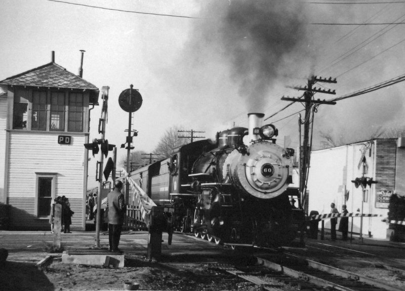
Note: Patchogue had both a Station Master AND a Freight Agent, in addition to a Ticket Agent-Operator and Operator-Clerk. As "PD" tower was in service at this time, the operator positions would have been telegraph operators, and not block operators. Remember, this book included "Employes in the Station, Tower and Telegraph Departments." Info: Dave Keller
|
|
|
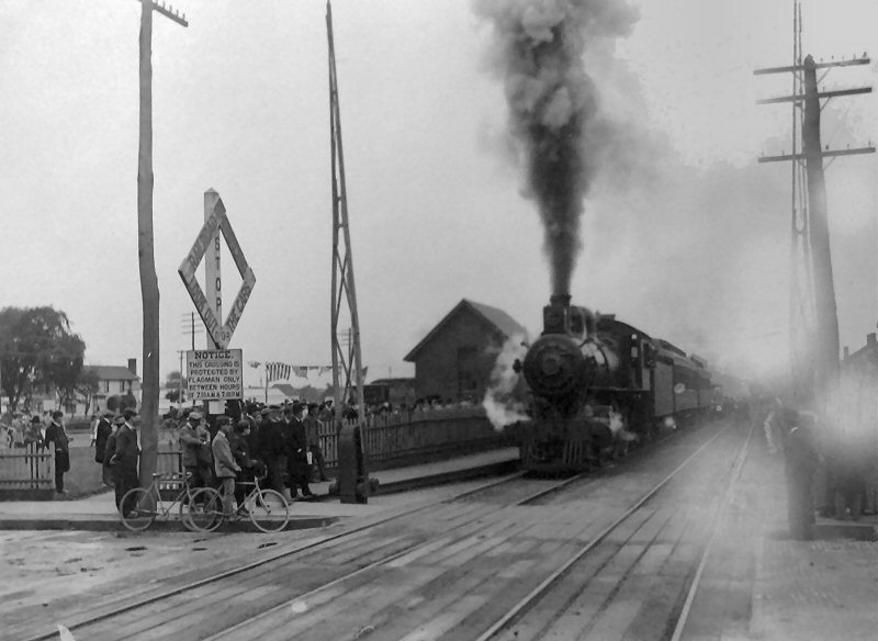
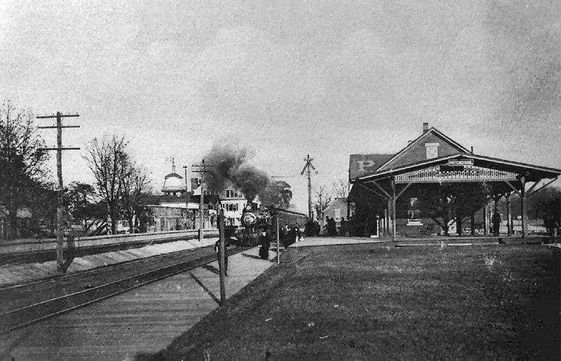
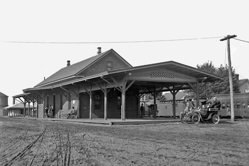
A really nice action shot of an eastbound
D16b, ten were built in 1905 and 21 were built in 1906. They were
super-heated starting in 1914 and this locomotive has NOT yet been superheated. There is a train order
signal in front of the depot, therefore this image would have to be shot
prior to May, 1912 when PD tower The date window: 1905-06 to 1911-May, 1912 Dave Keller
|
|
|
|
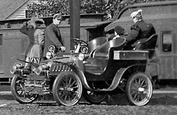 In
1901, the De Dion-Bouton Motorette Company began manufacturing De Dion-Bouton
automobiles under license in Brooklyn, New York. A small quantity of
American De Dion Motorettes were made. These were either a 2-seater or
closed coachwork and were powered by 3.5 hp American-made engines. Wiki In
1901, the De Dion-Bouton Motorette Company began manufacturing De Dion-Bouton
automobiles under license in Brooklyn, New York. A small quantity of
American De Dion Motorettes were made. These were either a 2-seater or
closed coachwork and were powered by 3.5 hp American-made engines. Wiki |
|
|
|
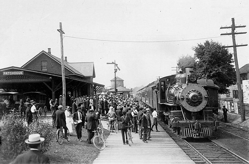
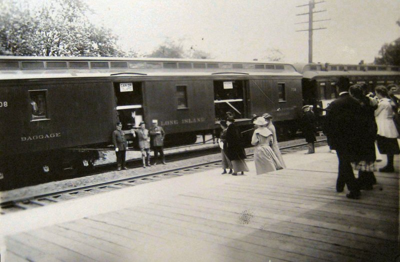
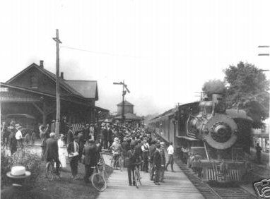
The "Canning Train" was photographed at
Patchogue on May 25, 1917. Car no. 708, a baggage and Adams Express Company
car, carried exhibits on promoting the "how to" preserve fruits and
vegetables. The signs, "Can or Collapse" and "Preserve or Perish" reflected
the strong home-front sentiments of the day. These particular slogans were
authored by the irrepressible Harold B. Fullerton, who carried out many of
the LIRR's wartime projects.
The United States entered the war on April 6th , 1917 and a month later the LIRR ran this special car. The military personnel present are probably from Camp Upton. Research: Dave Keller |
|
 Patchogue Special LIRR #217 Ocean Ave. View W 10/15/1906 (Howard S. Conklin-LI collection, Queens Borough Public Library) |
"Special" train at Patchogue Station while Senator Charles Evans Hughes delivers a campaign speech for the US Presidency from the rear observation car. He lost and later became a Chief Justice of the Supreme Court. LIRR #217 and the two car train view west from South Ocean Ave. crossing. 10/15/1906 Note: Howard
S. Conklin A prominent citizen of Patchogue, Long Island, Howard S. Conklin
(1863-1925) was active in many local civic organizations and business
groups. As an amateur photographer, Mr. Conklin used his camera to document
many of the activities of these organizations, as well as a wide range of
daily life in Patchogue and its neighboring communities during the first two
decades of the twentieth century. Ref: Queens Library |
|
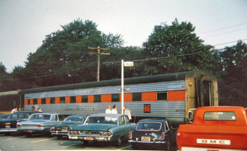 Patchogue - Manomet Point ex-NH 8/01/1969 (Emery-SUNY Stony Brook) |
Ex-New Haven MANOMET POINT, in service on LIRR at Patchogue. In the photo, we see the car is clearly the rear car on a westbound train. The open vestibule indicates the train is stopped in the station at Patchogue. This may be a Sunday evening or Monday morning train from Montauk back to Jamaica and Hunterspoint Avenue. There are ferries between Patchogue and Fire Island, so they may board westbound passengers, including parlor car passengers, at Patchogue. LIRR did have a lightweight car numbered 2052 and named PATCHOGUE in parlor car service. This car was the former PRR six double bedroom lounge car 8135 JUNIPER FALLS, built by Pullman Standard in 1940, acquired by LIRR in September 1968, retired in 1975 and presumed scrapped. Alas, we have no photo of PATCHOGUE operating in a train at the station in Patchogue. http://dominionrailvoyages.com/jhd/lirr/patchogue.html Research: John Deasy |
|
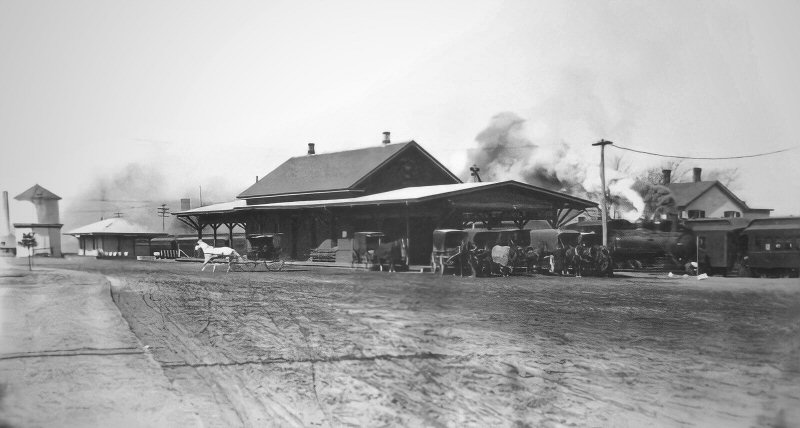
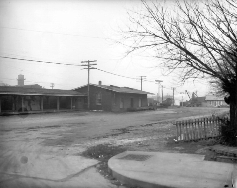
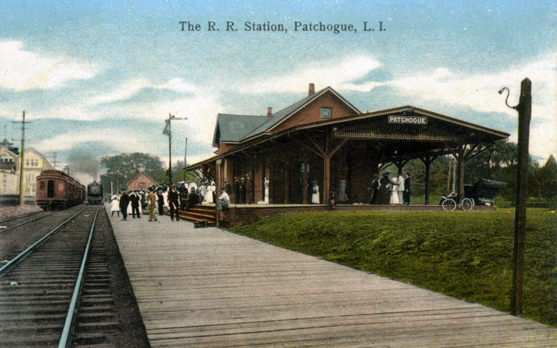
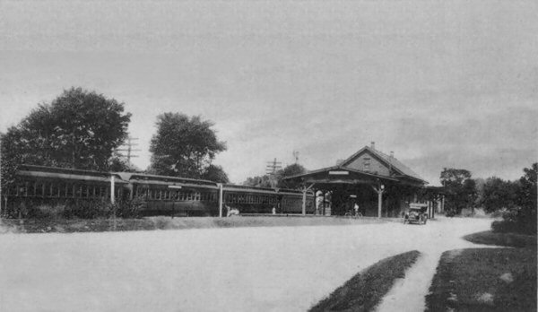
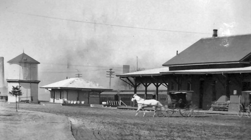
 Patchogue Water Tank, Express House, Station view NW 1905 (Howard S. Conklin-Dave Keller) |
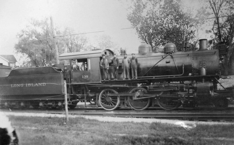 Patchogue- LIRR 4-6-0 Class G53 #139 5/16/1913 (Emery-SUNY Stony Brook) |
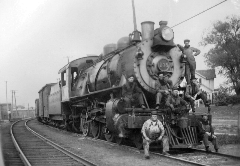 Patchogue- LIRR #139 Crew 5/16/1913 (Emery-SUNY Stony Brook) |
|
Raymond Robinson, Sr., LIRR freight
conductor (with mustache) |
 Patchogue - Wreck 6/12/1909 Archive: Patchogue Library
|
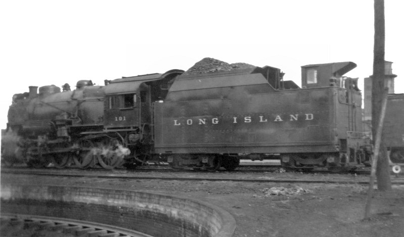
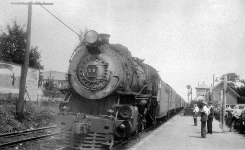 Patchogue - LIRR #39 View E 1945 (Emery-SUNY Stony Brook)
|
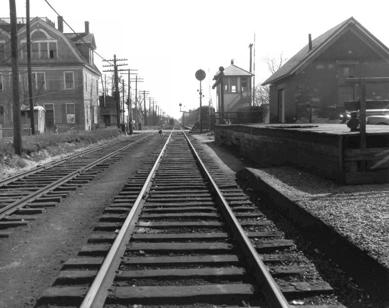
 View west "North siding" 1947 Photo: F. Weber Archive: Dave Keller
|

Train Orders pickup c. 1955  FM 2006 Patchogue Express House 1956 Collection: Dave Keller |
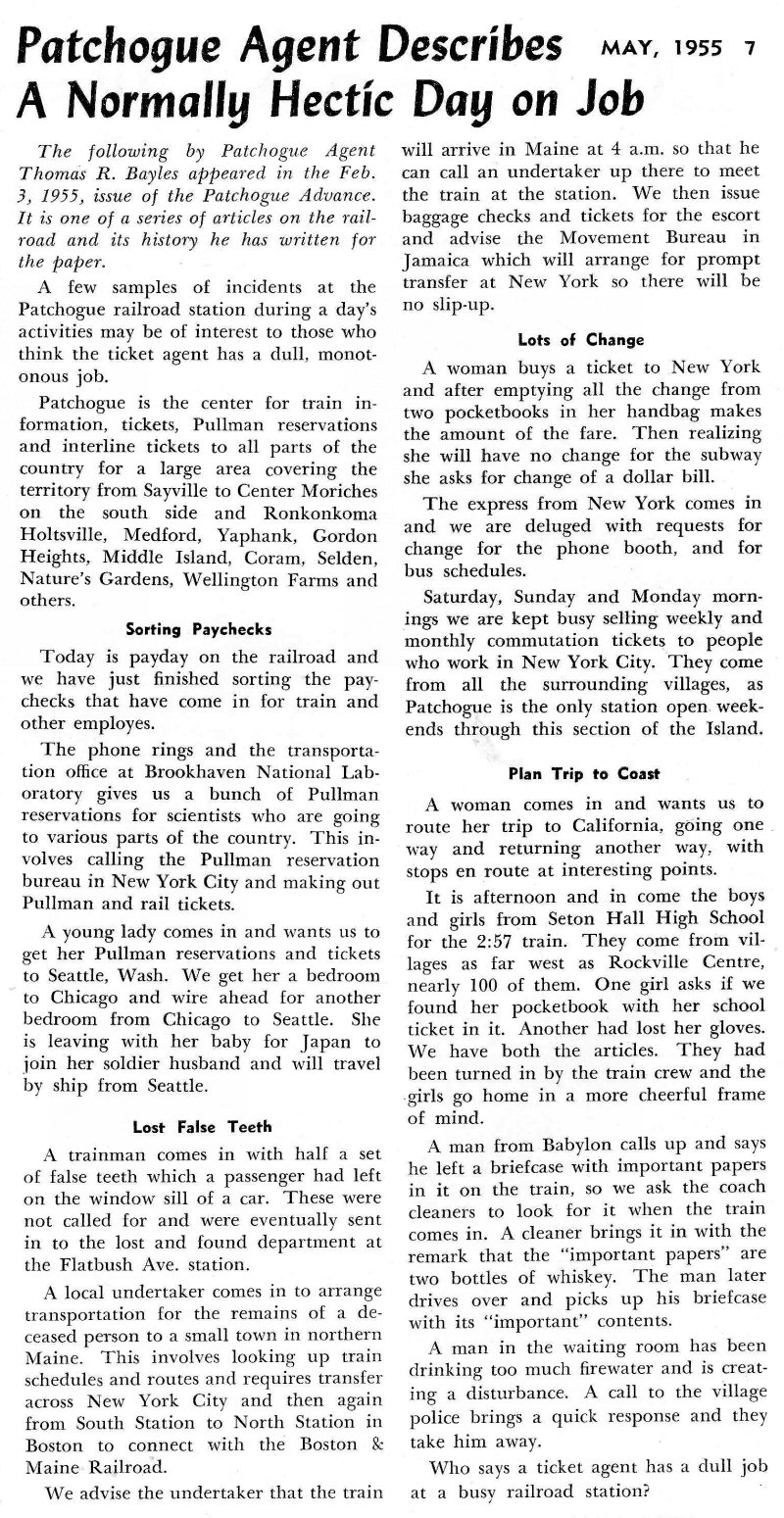 Patchogue Agent Thomas R. Bayles A Normally Hectic Day LI Railroader 5/1955 Archive: Mike Boland |
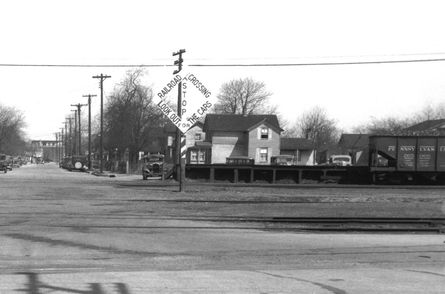
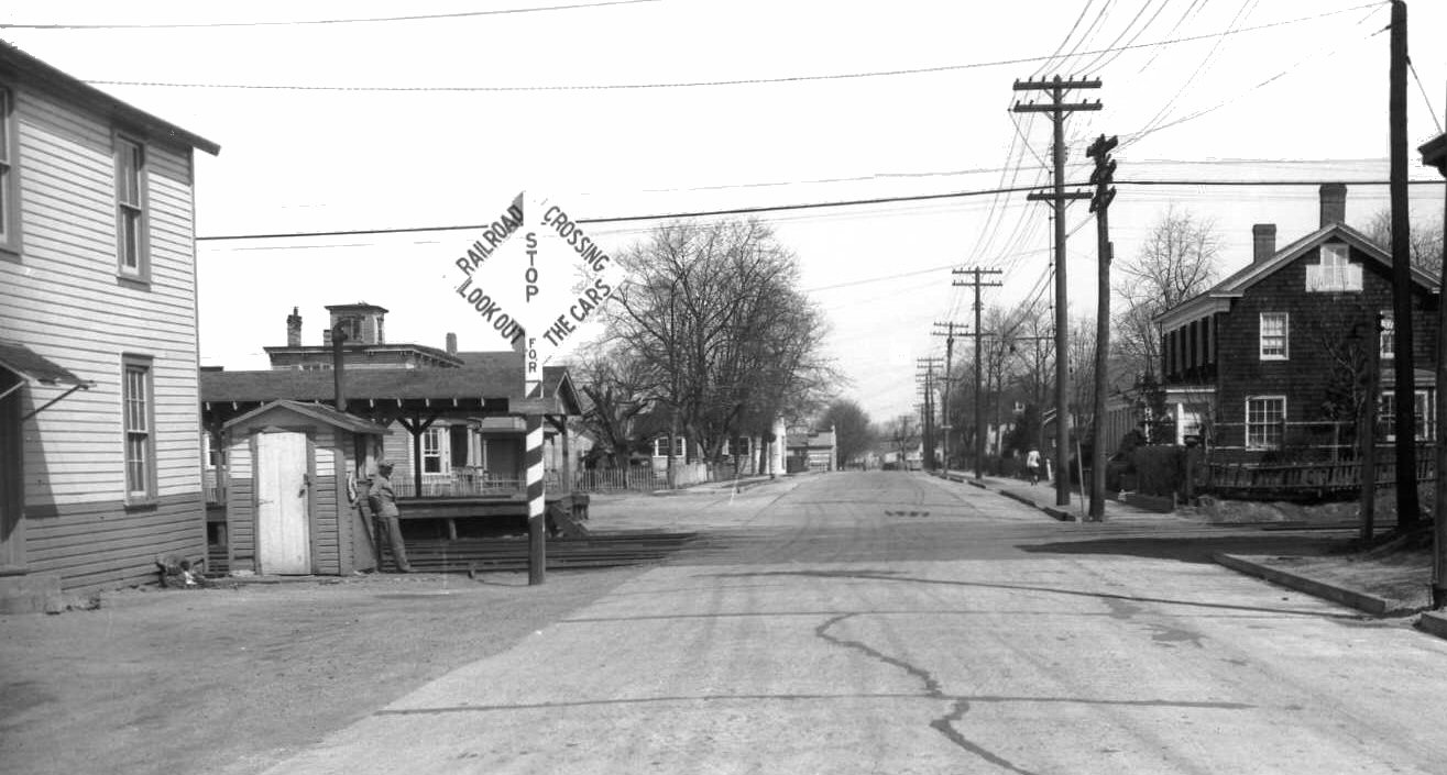
 Adams Express Office (1913-1918) - Sanborn 10/1916 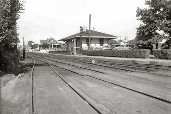 Express House, Water plug View SE c.1943 (Weber-Keller) 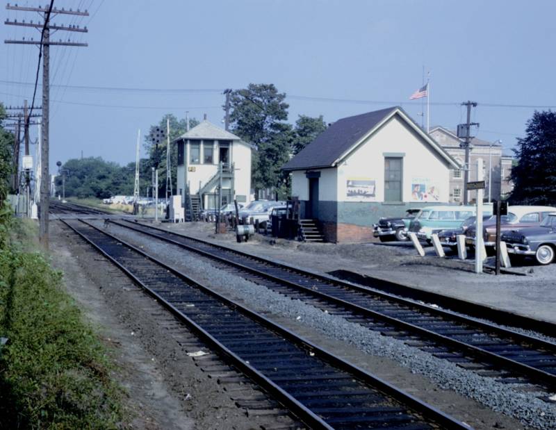 PD Tower Baggage House c.1960 Photo/Archive: Art Huneke 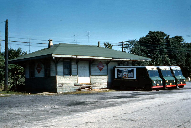
Patchogue Express House - REA trucks View NE 9/1959 Archive: Dave Keller Last day for Railway Express Agency service on this branch: 2/3/1960 (?) Info: Robert Emery
|
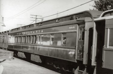
PRR Heavyweight parlor at east end of Baggage House view NW. Note: parlor car. If you look closely at the image, you will see the word Parlor lettered near the vestibule door. In addition, the window arrangement is another clue. John Deasy
|
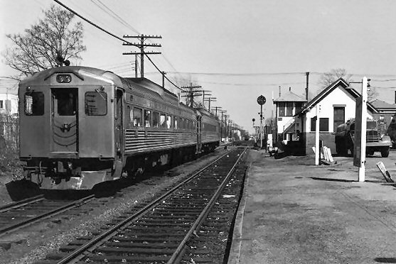
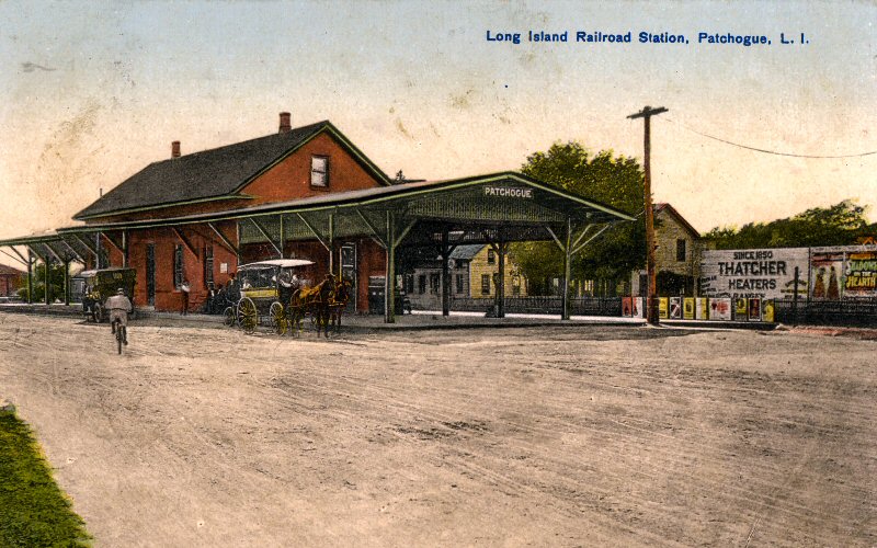 Patchogue Station post card View NW 1905 Archive: Dave Morrison 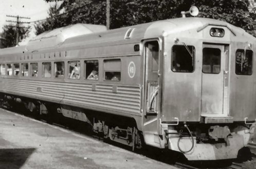 LIRR RDC-1 #3101 renumbered #49 view NW
|
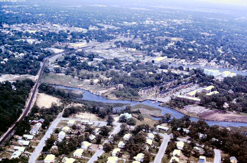
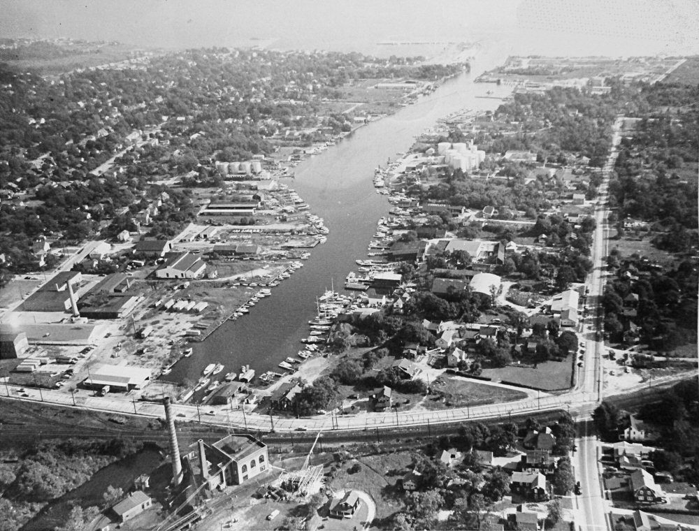
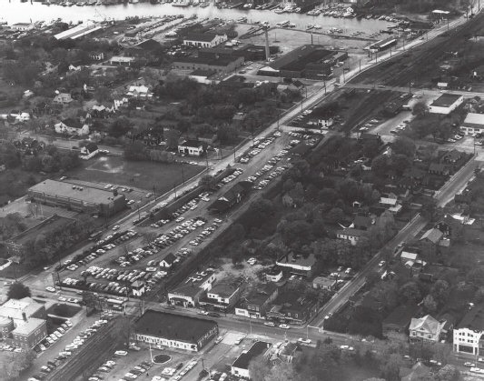 Patchogue aerial photo 1962 Jim Mooney "Eagle Eye Air Photo" |
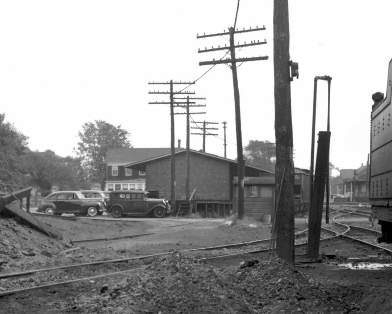
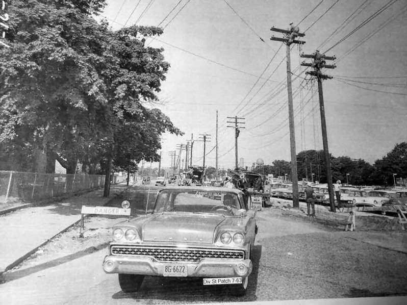
 Patchogue temporary Ticket Office - View N 7/1963 - Archive: Dave Keller |
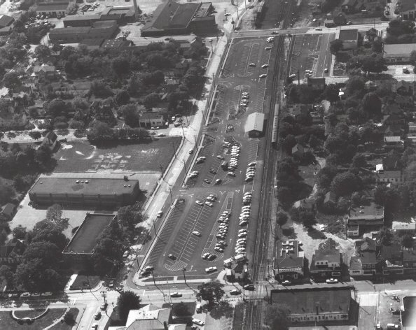 Patchogue aerial photo 9/28/1963 Jim Mooney "Eagle Eye Air Photo" |
| The temporary ticket office trailer has been set on the site of what will be the replacement depot. It appears that the trailer was set here initially, but once construction began on the new depot, the trailer was relocated further east to diagonally across the front and side of "PD" tower. Research: Dave Keller | ||
 LI Railroader Vol. 8 No. 6 3/14/1963 page 1
|
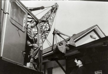
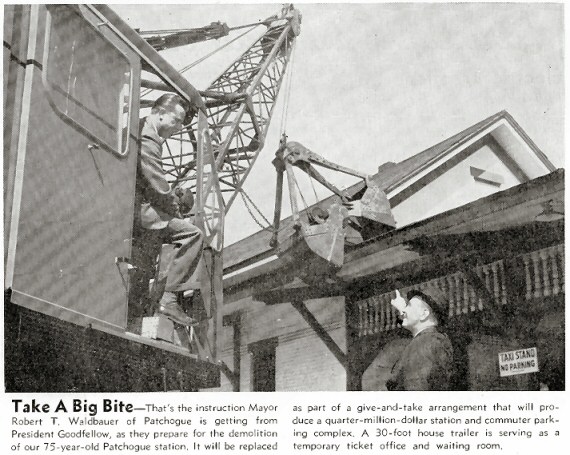 LI Railroader Vol. 8 No. 11 05/23/1963 page 4 Patchogue Station demolition "Take A Big Bite" - That's the instruction Mayor Robert T. Waldbauer of Patchogue is getting from President Goodfellow, as they prepare for the demolition of our 75-year-old Patchogue station. It will be replaced as part of the a give-and-take arrangement that will produce a quarter-million-dollar station and commuter parking complex. A 30-foot house trailer is serving as a temporary ticket office and waiting room.
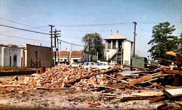
Note: All the structures except PD tower (razed 8/22/2006) came down in May, 1963 with the water tower and turntable having come down much earlier (1950) (All Emery data). |
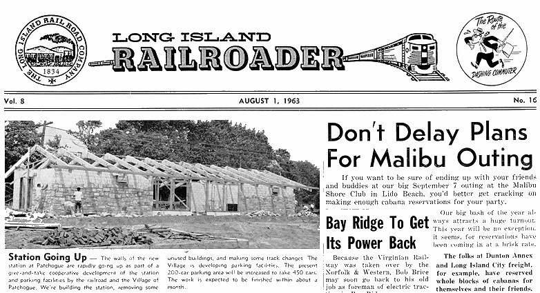 LI Railroader Vol. 8 No. 16 08/01/1963 page 1 Patchogue Station "Going Up"
|
|
|
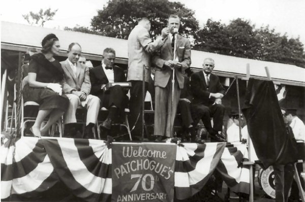 New station dedication - Mayor Waldbauer, left of podium Senator Otis Pike on the right Suffolk County Executive Lee Dennison 9/28/1963 Photo: Jim Mooney |
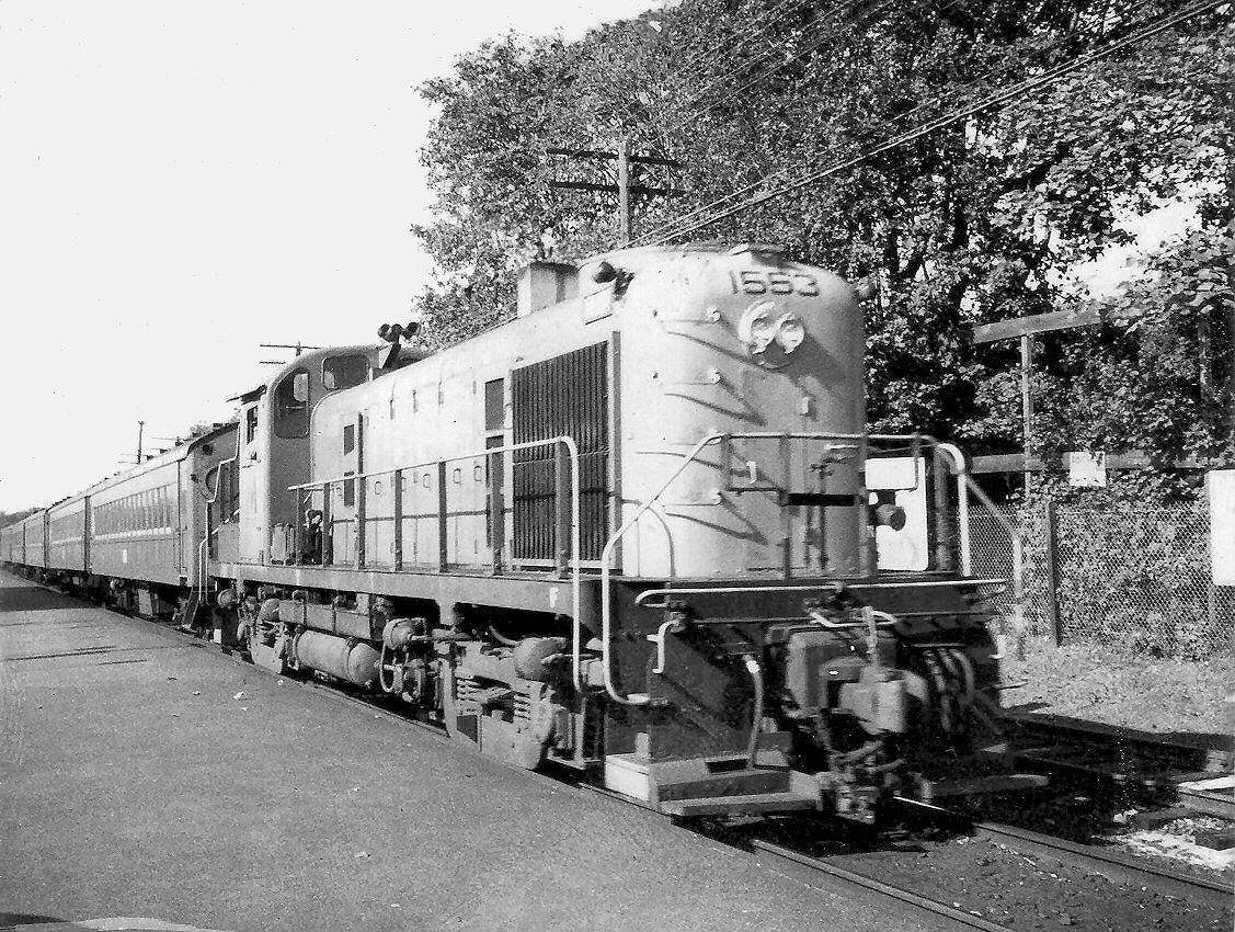
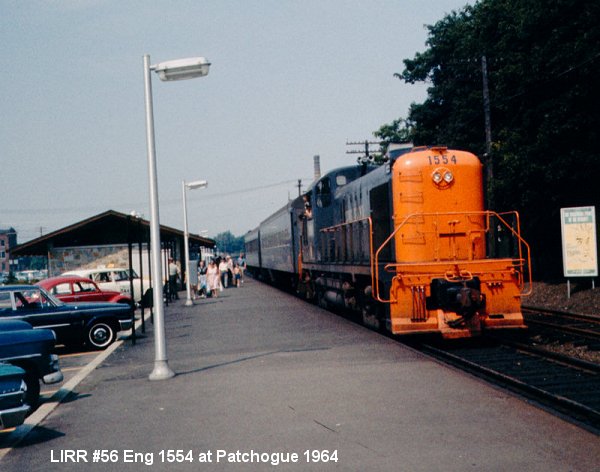 LIRR Train 56 Eng #1554 Photo: 1964 |
|
The older depot was razed as of 5/16/1963. This depot was torn down before the new depot was built as the newer depot was constructed on nearly the same spot as the old depot, unlike other LIRR locations where the old building remained in service while the new depot was built and
opened on 7/30/1963. Note: The new station platform lights are already in place as the PELCO pole-climbers are very busy. |
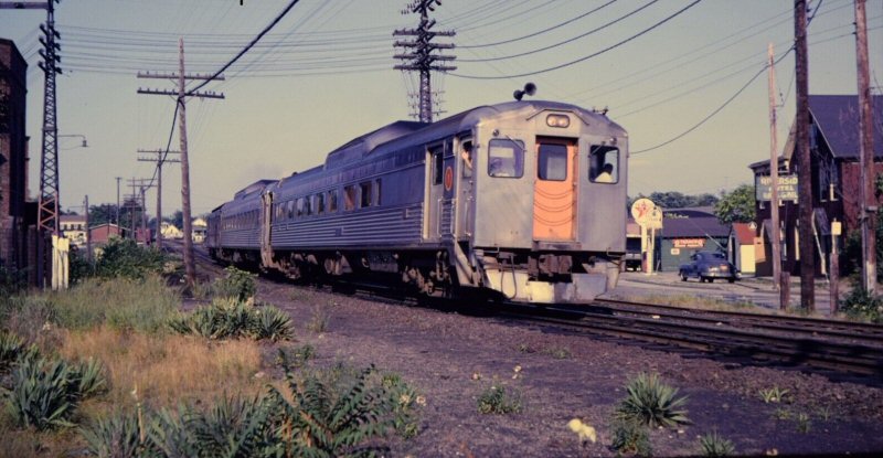
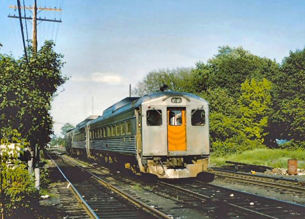 LIRR RPO #7734 RDC 1-2 #3101 lead unit Patchogue 6/1965 |
|
 Patchogue resident, Steven Gramps Trypuc, departs September 1967 for Key West, FL Sonar School. View E Photo/Archive: Steven Gramps Trypuc |
 LIRR Parlor Eastbound at PD Tower. George Pins’ private car Pennsylvania 120, visiting the LIRR, on the rear of a Montauk train passing Patchogue on June 20, 1975. |
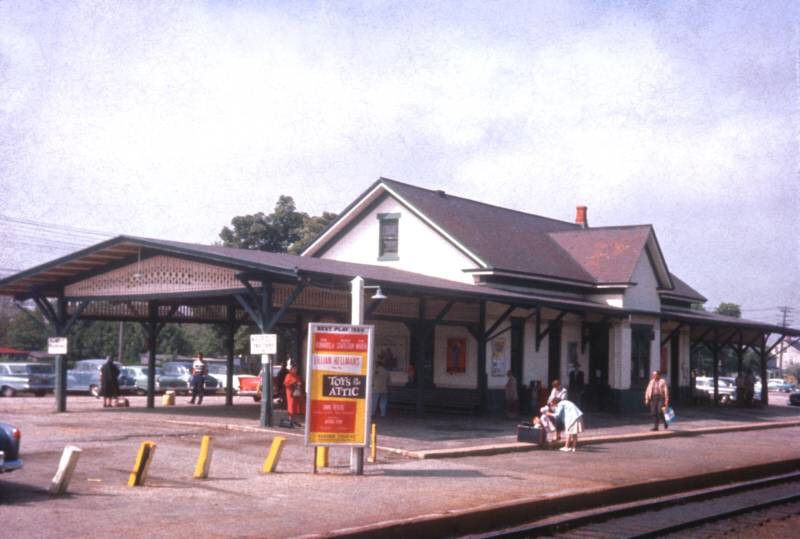
 Patchogue Station view NW 6/15/1978 Photo/Archive: Dave Morrison |
 Alco FA #617 c. late 1980's View E |
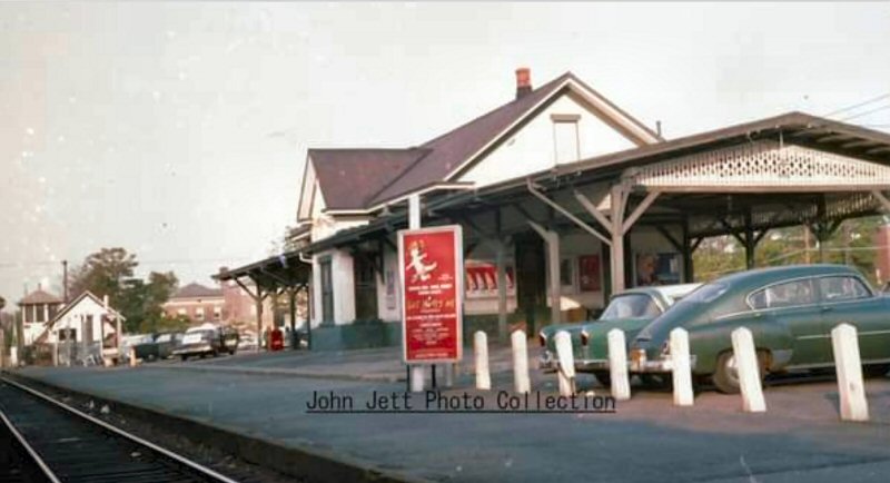
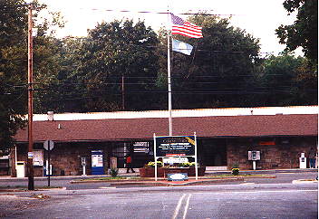 Patchogue Station view N 2000 Photo: Steve Lynch Alco FA #617 c. late 1980's |
 Patchogue Station view NE 11/07/2022 Photo/Archive: Dave Morrison |
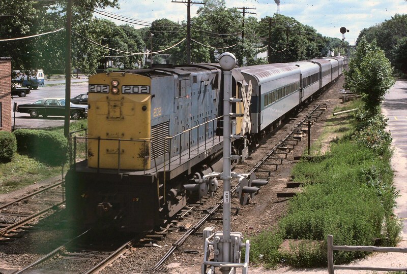 LIRR #202 Ocean Ave. view E 1975 |
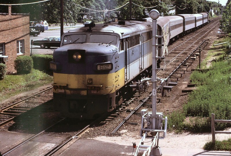 LIRR #612 Ocean Ave. view E 1975 |
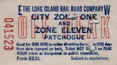 Ticket Patchogue - Penn Sta. 1986 |
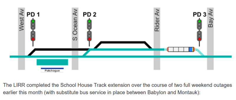
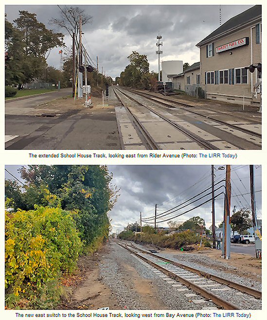 Extended School House track views east/west |
 Previous School House track Photos/Archive: The LIRR Today
|
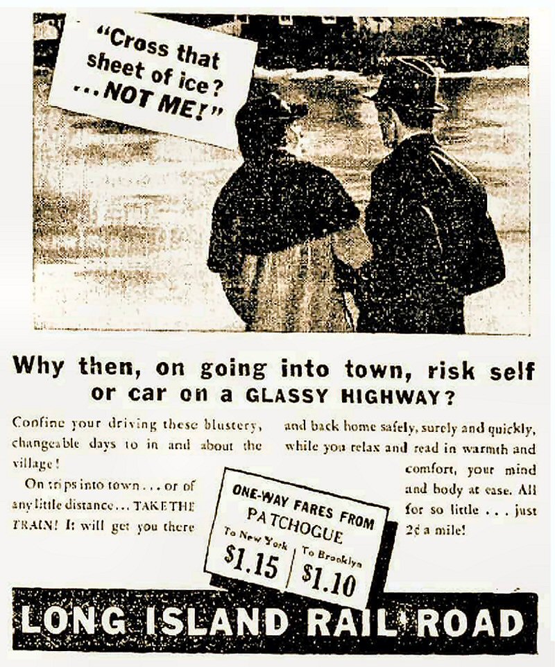 LIRR Patchogue One-Way Fares Ad 1947 Archive: Carlos Bolanos |
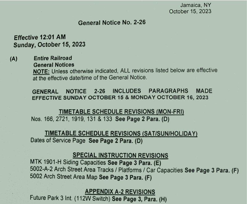 General Notice 2-26 Section A PD Interlocking 10/15/2023 |
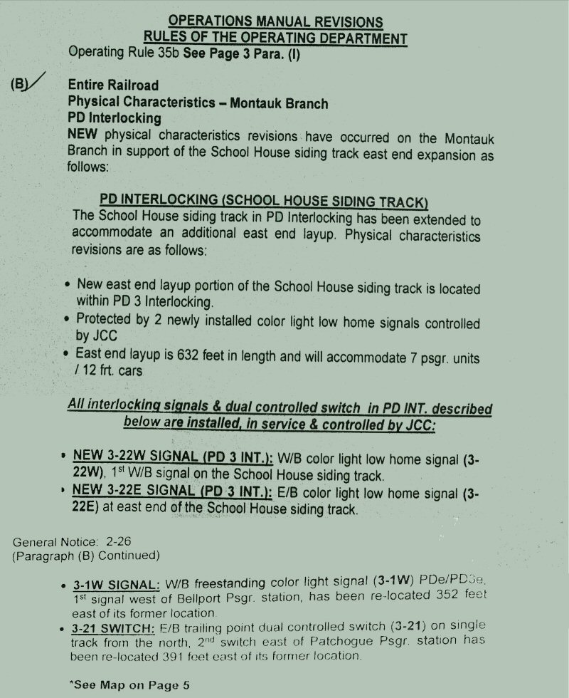 General Notice 2-26 Section B PD Interlocking 10/15/2023 |
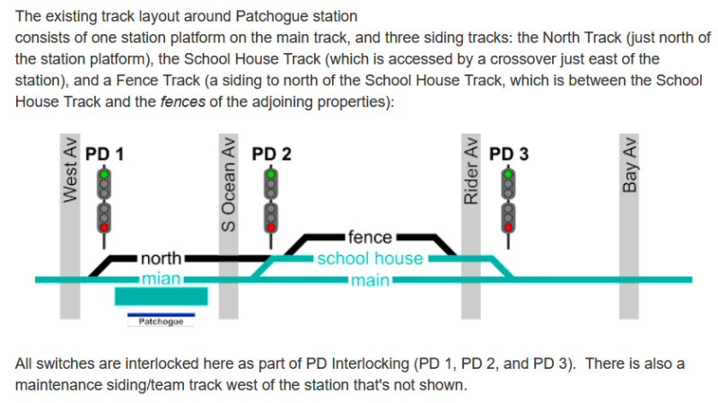
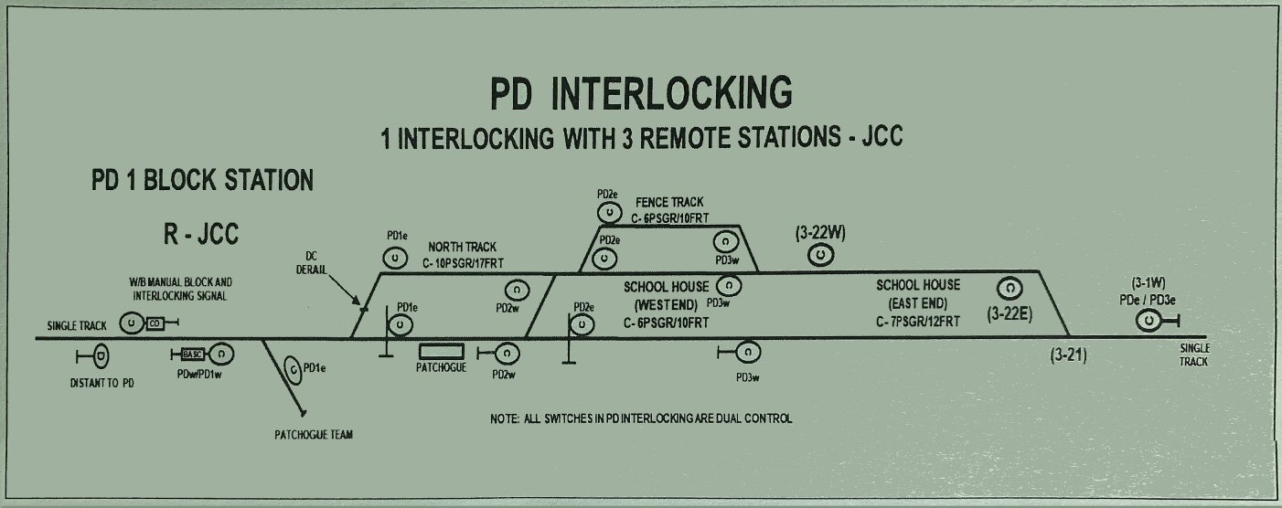 General Notice No. 2-26 PD Interlocking - School House Siding Track map 10/15/2023 |
|
|
 View SE 1906 drawing Rail Yard 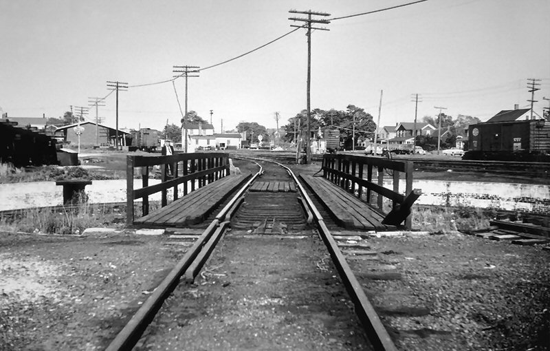 Armstrong turntable view SE 1955 Photo: Bill Slade
|
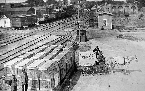
This photo is an example; Victorian households had parlor rooms which, in many cases, had the entertainment center: piano and the Edison phonograph! The ability to transport a piano from NY City/Queens would have been nearly impossible via horse and wagon prior to the railroad. Here we see the result of a thriving Village with middle class residents able to buy pianos. See PATCHOGUE VILLAGE section below.
|
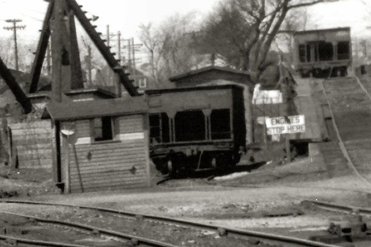
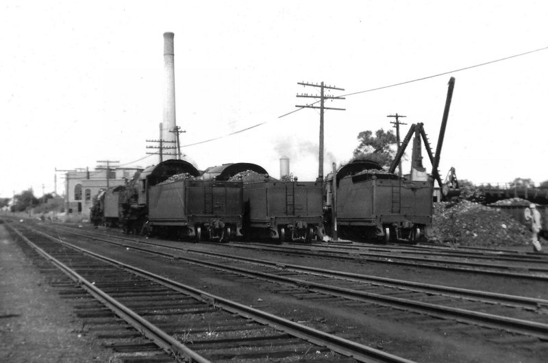
 Coaling Facilities - freight warehouse view E 09/1944 Photo: F. Weber, Archive: Dave Keller |
 Freight Warehouse Westside Platform view East 09/1944 Photo: F. Weber, Archive: Dave Keller |
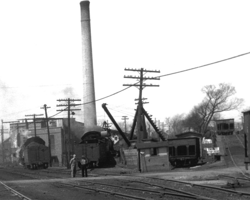
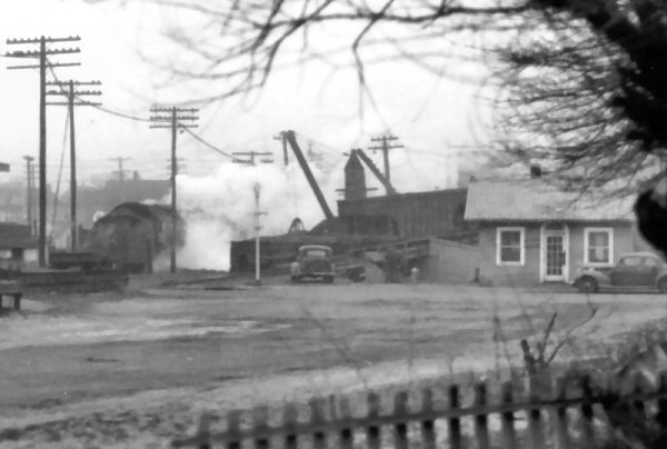
 Loco Coal Facilities and local dealer coal dock on West Ave. View North 05/1943 Photo: F. Weber, Archive: Dave Keller |
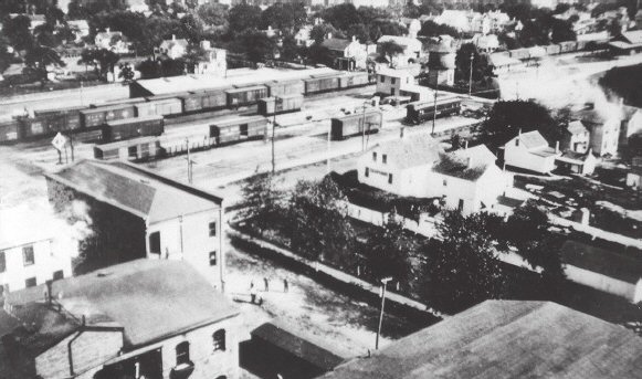
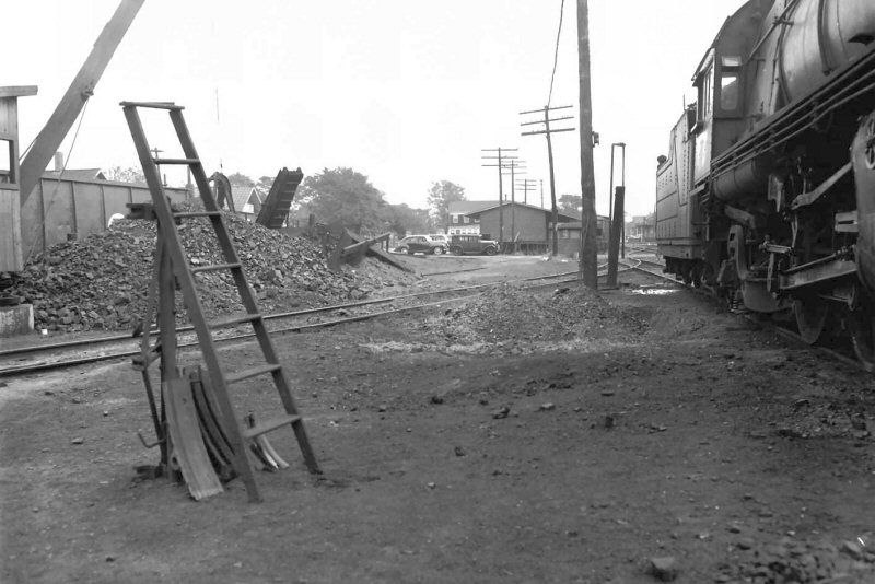
 Patchogue MP53 view E 5/1943 It's May, 1943 and we're
looking east into the Patchogue yard and station area from the west side of
the Patchogue River bridge at MP 53. The track in the right foreground
is the Ringhouse siding, which came off the Main just west of River Avenue.
At the right is the old brick office building of Bailey's Lumber Mill.
In the distance can be seen the section house and office with the water tower
rising beyond. At the left a locomotive is laying up in the engine
service area, with coaling derricks visible and at the far left is a leased
PRR locomotive on one of the turntable "garden" tracks, at the
former location of the 4-stall engine house. (F. Weber photo, Dave
Keller archive) |
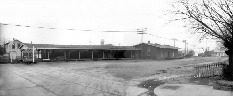
 Freight station view SW 03/1946 Photo: F. Weber, Archive: Dave Keller
|
 Freight station west side platform view S 03/1946 Built c. <1900 Photo: F. Weber, Archive: Dave Keller Composite: Steve Lynch
|
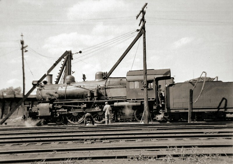 Leased 4-4-2 PRR E3sd #917 c.1935 on the turntable lead Archive: Dave Keller 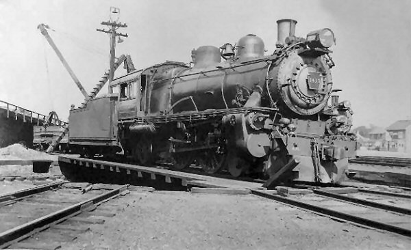 E7s Atlantic (4-4-2) 1940 on the turntable Photo: Fagerberg LIRR #193 Rotary Snowplow across from Bailey's Lumber Mill, south yard 1921 Archive: Dave Keller
|
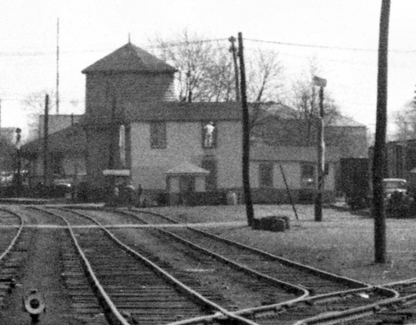 Section house View E 5/1943 Archive: Dave Keller 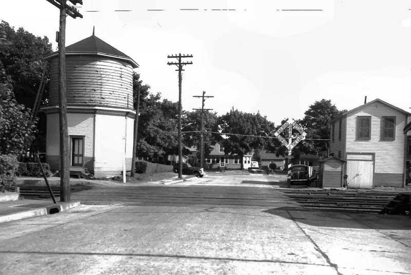 Patchogue Water Tank -Section House Railroad Ave. view S 7/43 Fred Weber   Patchogue Section House view W - 1958 Photo: Art Huneke Archive: Dave Keller Model the Section House Drawing |
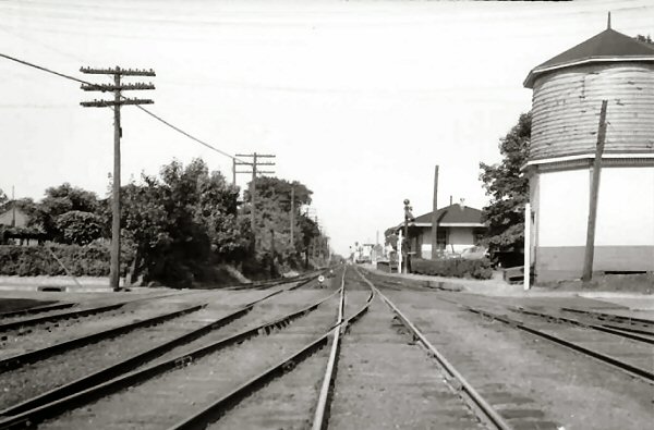 Railroad Ave. Water tank, Express House View E c.1943 (Weber-Keller)  Railroad Ave view West 05/1943 Photo: F. Weber, Archive: Dave Keller  PRR Erie built FM #4973 Railroad Ave view N Patchogue 6/1949 Archive: Art Huneke The LIRR was in need of a 2000 HP locomotive to handle Montauk trains in order to return the K4-s back to the PRR. This photo shows a PRR cab unit on the Long Island RR. It is an Erie built FM 2000HP cab unit. in Summer of 1949. The PRR had previously sent an Alco PA-1 to LI for test back in December 1948. Both of these tests were short stints. What is known is that shortly after the Erie built was on LI, the PRR placed the LIRR in Bankruptcy. In the coming year, the Trustees placed orders with FM which brought the 2000HP and 2400 HP C liners to the LIRR in the Tichy colors. All the K-4s on the LIRR went back to the PRR once the C Liners were on the LIRR in 1951. They were no longer needed for the Montauk trains as C Liners now were handling these trains. |
 Freight station west side open platform view North 3/1946 Photo: F. Weber, Archive: Dave Keller |
 Railroad Ave view North 05/1943 Photo: F. Weber, Archive: Dave Keller |
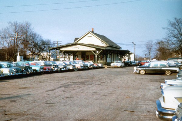
 Railroad Ave view North 1960 |
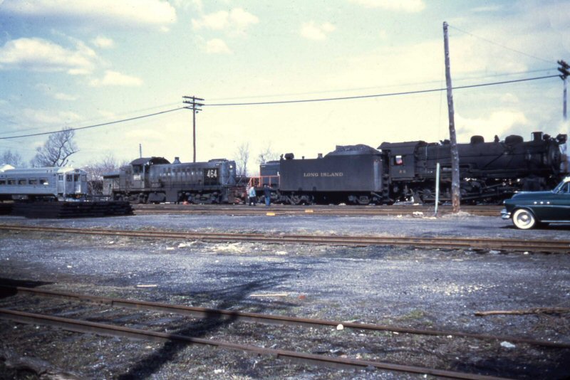
Budd RDC RS1, S2 #464 & #455, G5s #28 Patchogue Yard 1955 Photo: Art Huneke, Archive: Dave Keller |
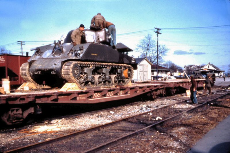 Army Sherman M4 View NE 1960 Photo/Archive: Art Huneke |
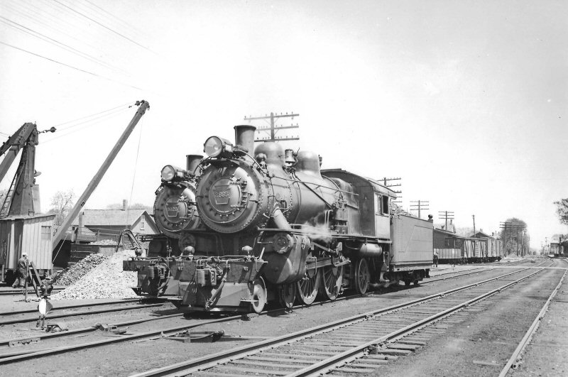
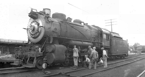 LIRR #110 Class H10s 2-8-0, ex-PRR #8610, freight engine at the Patchogue loco engine terminal . The view is NE with the Week's Coal Yard trestle in the rear background. The 'crew' of LIRR workers are undoubtedly viewing an issue with this specific engine as minor repairs were performed at this facility. As the engine still has classification lamps atop the smoke box, to be removed from LIRR locomotives in June, 1940, this places the photo c.mid-1930's, as the LIRR acquired these from the PRR 1928-1930. Research/Archive: Dave Keller |
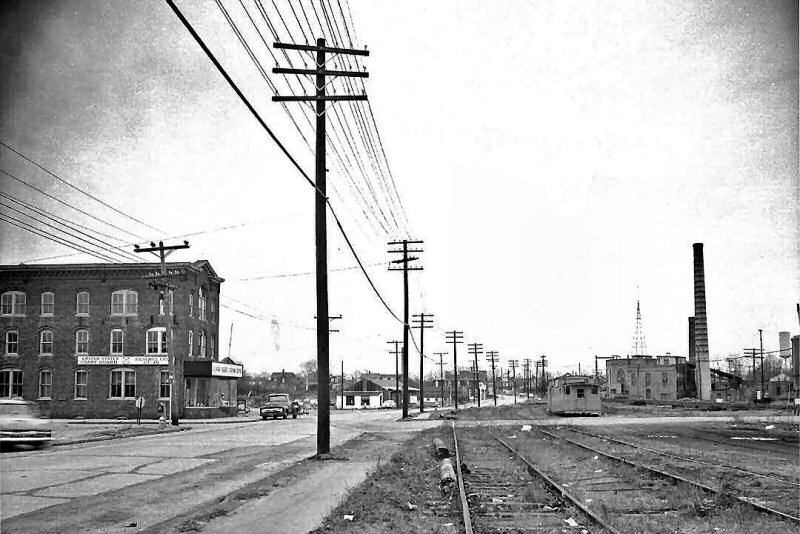
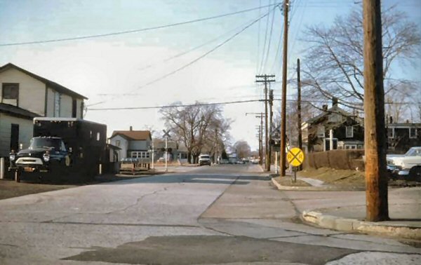
 West Ave crossing view W 2001 Photo: Steven Lynch |
|
Emery Map Patchogue Yard 1938 Archive: SUNY Stony Brook |
 LIRR MOW Yard view W 9/20/2022 Photo/Archive: Joe Vila |
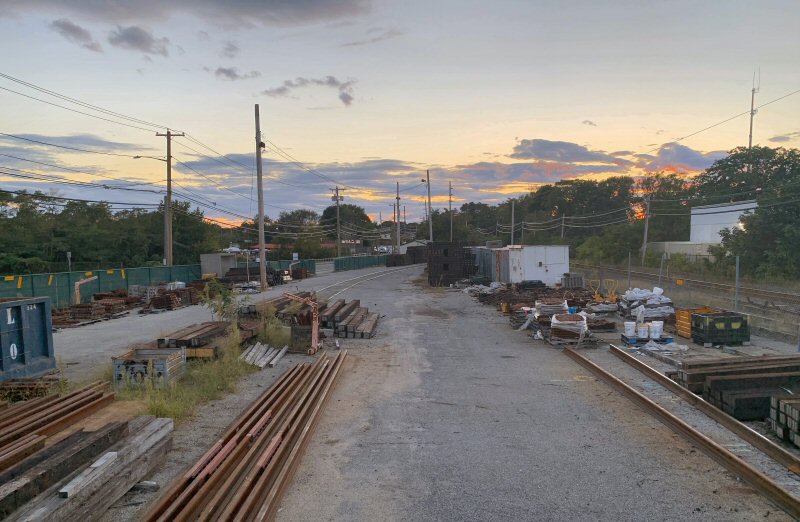 LIRR MOW Yard view W 9/20/2022 Photo/Archive: Joe Vila |
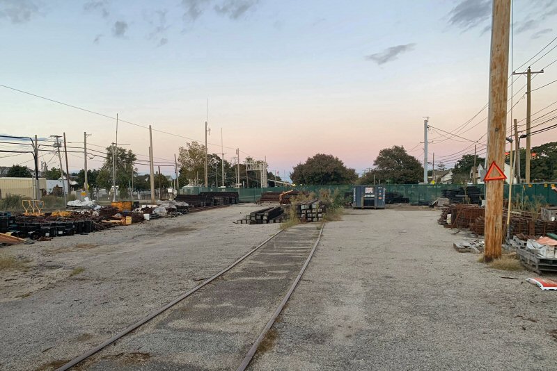 LIRR MOW Yard view E 9/20/2022 Photo/Archive: Joe Vila |
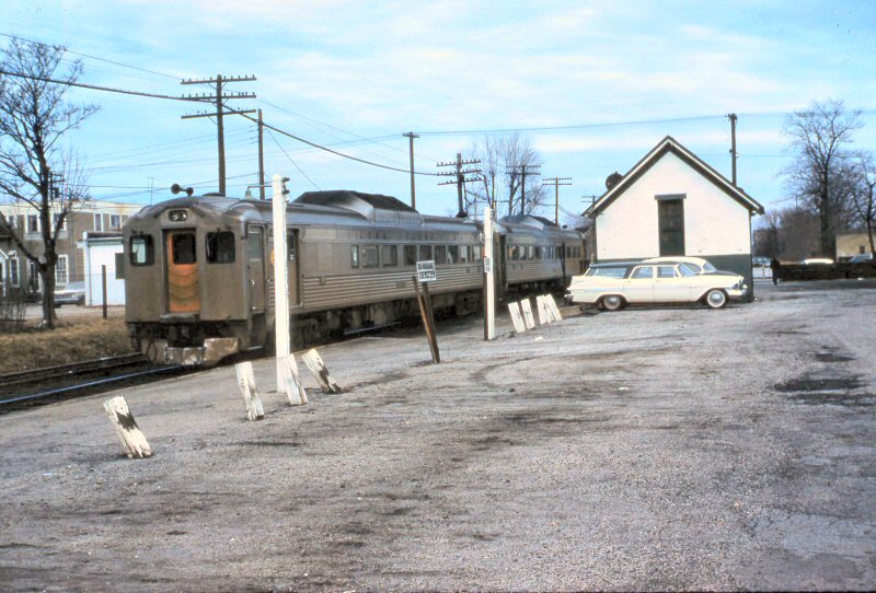
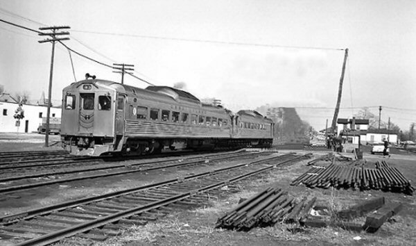 RDC Scoot westbound crossing West Ave., Patchogue View E c.1960 |
 West Ave., Patchogue - View E 9/20/2022 Photo/Archive: Joe Vila |
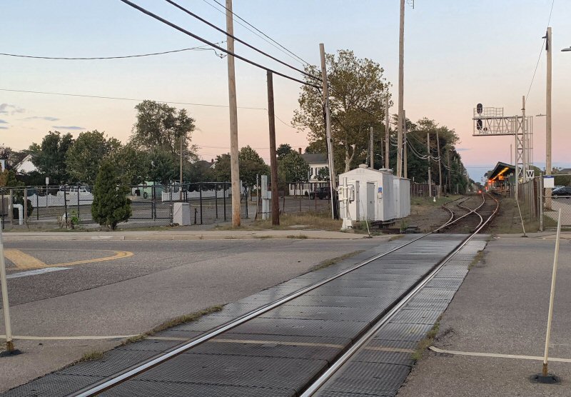
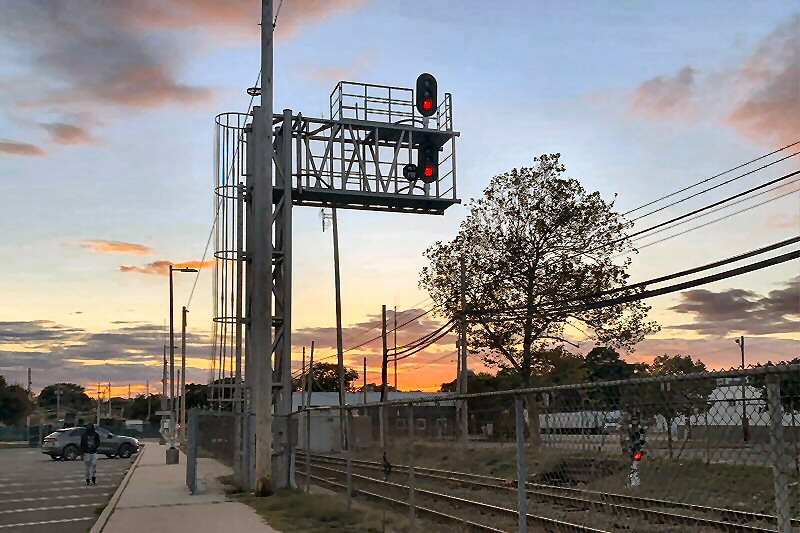 PD1 Interlocking - Cantilever Safetran color light signals Lower Home color light - View W 9/20/2022 Photo/Archive: Joe Vila |
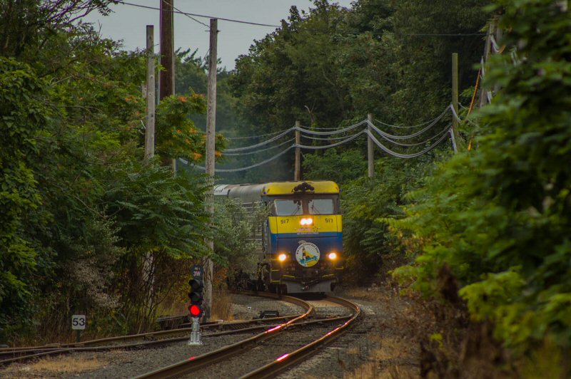 Cannonball eastbound at MP53 Patchogue 8/25/2023 Photo/Archive: Craig Lignelli |
||
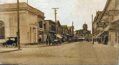
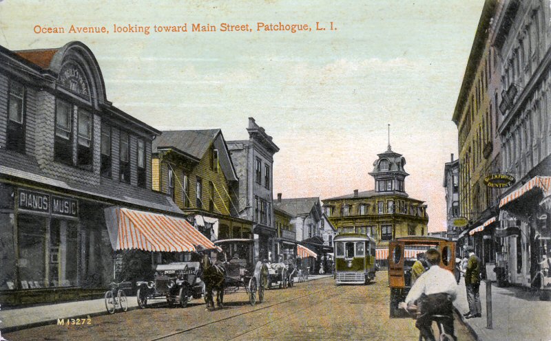
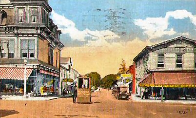
| PATCHOGUE VILLAGE - FOUR CORNERS | ||
|
Sanborn
Patchogue maps indicate: Mark Rothenberg, Senior Reference Specialist, Patchogue-Medford Library |
 Patchogue - Ocean Ave - View S 1880 Archive: D. Raven Foncell |
|
|
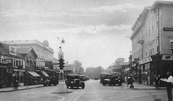 |
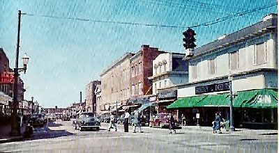
Patchogue Four Corners: view is looking east. McBride’s Drug Store at the far left, wooden framed building at right burned c. mid-late 1950s. It was replaced with one-story storefronts. Havil’s Jewelers was on that corner for years. The church spire in the left background is the red/brown stone Congregational Church that used to be across the street from the Patchogue Stationery store. Photo: Milt Price c. 1930 Info: Dave Keller |
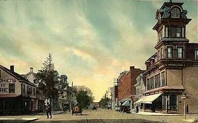 4 Corners view W c. 1923  4 Corners view W c. 1930 |
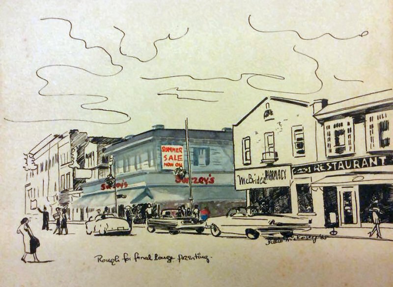 Patchogue 4 Corners View NW c.1965 Artist sketch: Wilhelmina "Billie" Miskosky |
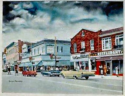 Patchogue 4 Corners View NW c.1965 Artist: Wilhelmina "Billie" Miskosky |
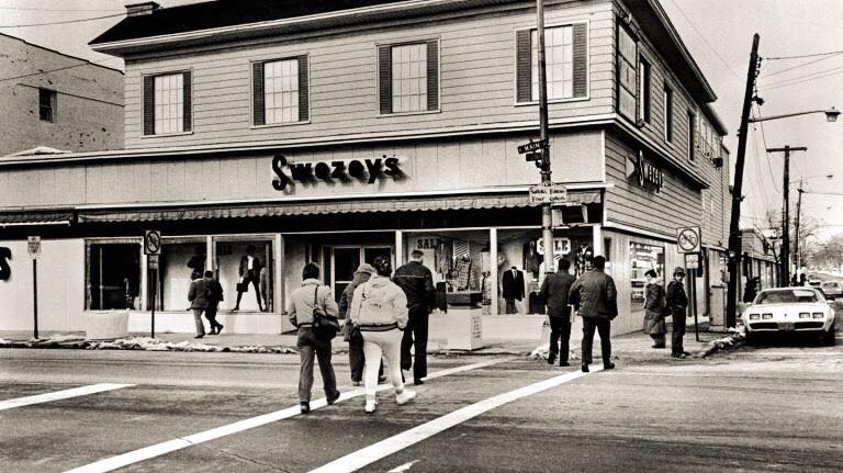 Patchogue 4 Corners View NW c.1980 Archive: Robert Garcia |
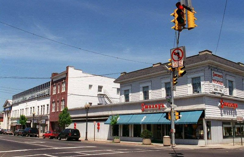 Patchogue 4 Corners view NW c.2002. The store closed 2003 razed 2012. |
||
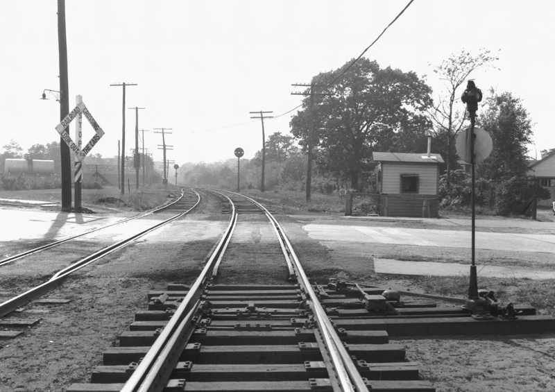
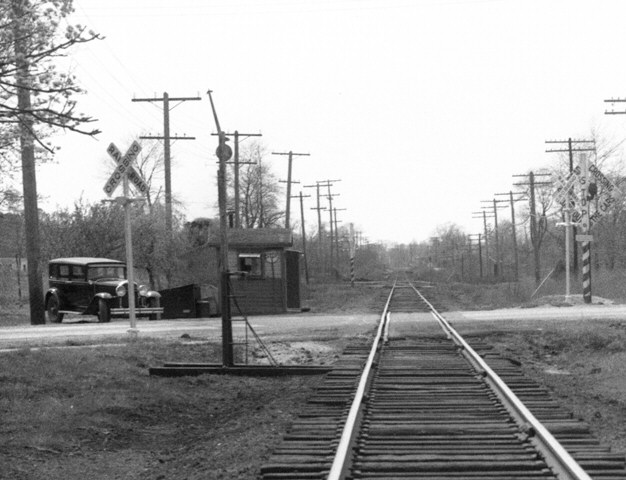
| PATCHOGUE CROSSING SHANTIES | ||
|
Patchogue Crossing Shanties map Research/design: Steven Lynch http: |
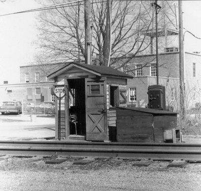 Bay Ave Shanty 1968 view N close-up |
Railroad Ave - Patchogue view N 5/1943 (Fred Weber photo, Dave Keller archive) |
Underwood Coal Co. 10/1943 view W of River Ave. Photo: F. Weber, Archive: Dave Keller |
 South Country Road view W Mail Crane for the East Patchogue Post Office and Crossing Shanty - 04/24/1946 |
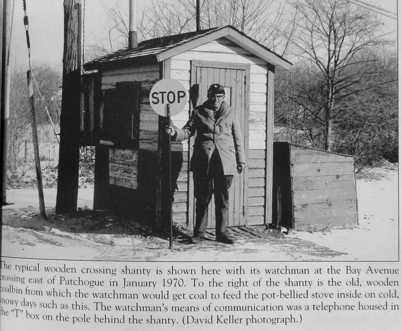 Bay Ave crossing shanty 1/1970 Photo/Archive: Dave Keller |
| PATCHOGUE PAGE 2 | ||
02/02/2026
 Patchogue
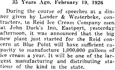
 The Reid Ice Cream Corp. factory (of Bayport), opened in 1926, and was sold to Borden Corp. at some point in the very early 1930s. The plant officially closed its doors on October 3, 1969. This is per an article by Jo Ann McGrath. "Reid Plant in Local History." [no source indicated, but could be the Bayport-Blue
Point Historical Society Newsletter, n.d.]: pp. 3, 6. The article reports the property and factory on the market placed with McDee Realty, for $1.2 million, so it was written before the factory was demolished.
The Reid Ice Cream Corp. factory (of Bayport), opened in 1926, and was sold to Borden Corp. at some point in the very early 1930s. The plant officially closed its doors on October 3, 1969. This is per an article by Jo Ann McGrath. "Reid Plant in Local History." [no source indicated, but could be the Bayport-Blue
Point Historical Society Newsletter, n.d.]: pp. 3, 6. The article reports the property and factory on the market placed with McDee Realty, for $1.2 million, so it was written before the factory was demolished.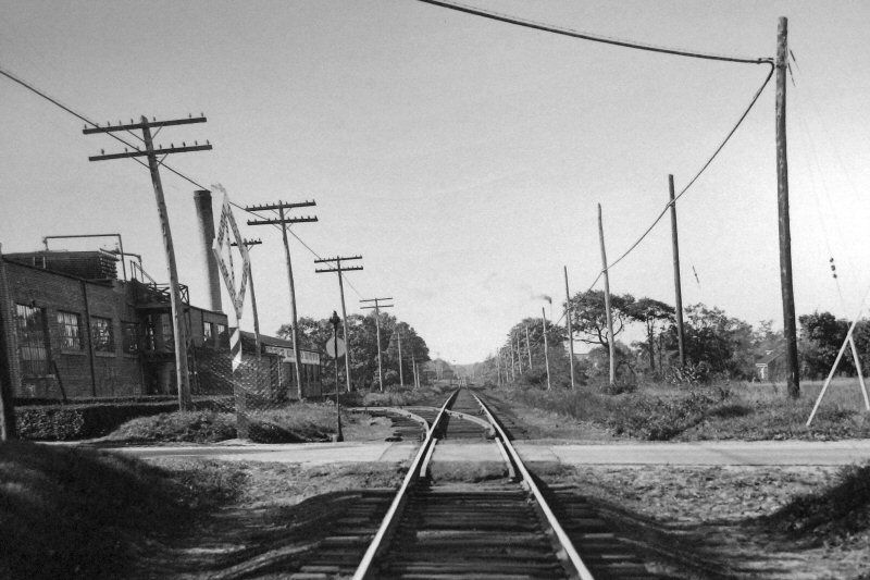

.jpg)


-1564_viewE_3-1946-Weber-Boland.jpg)