|
|
|
||
| PATCHOGUE DEPOT - CALL LETTERS | |||
|
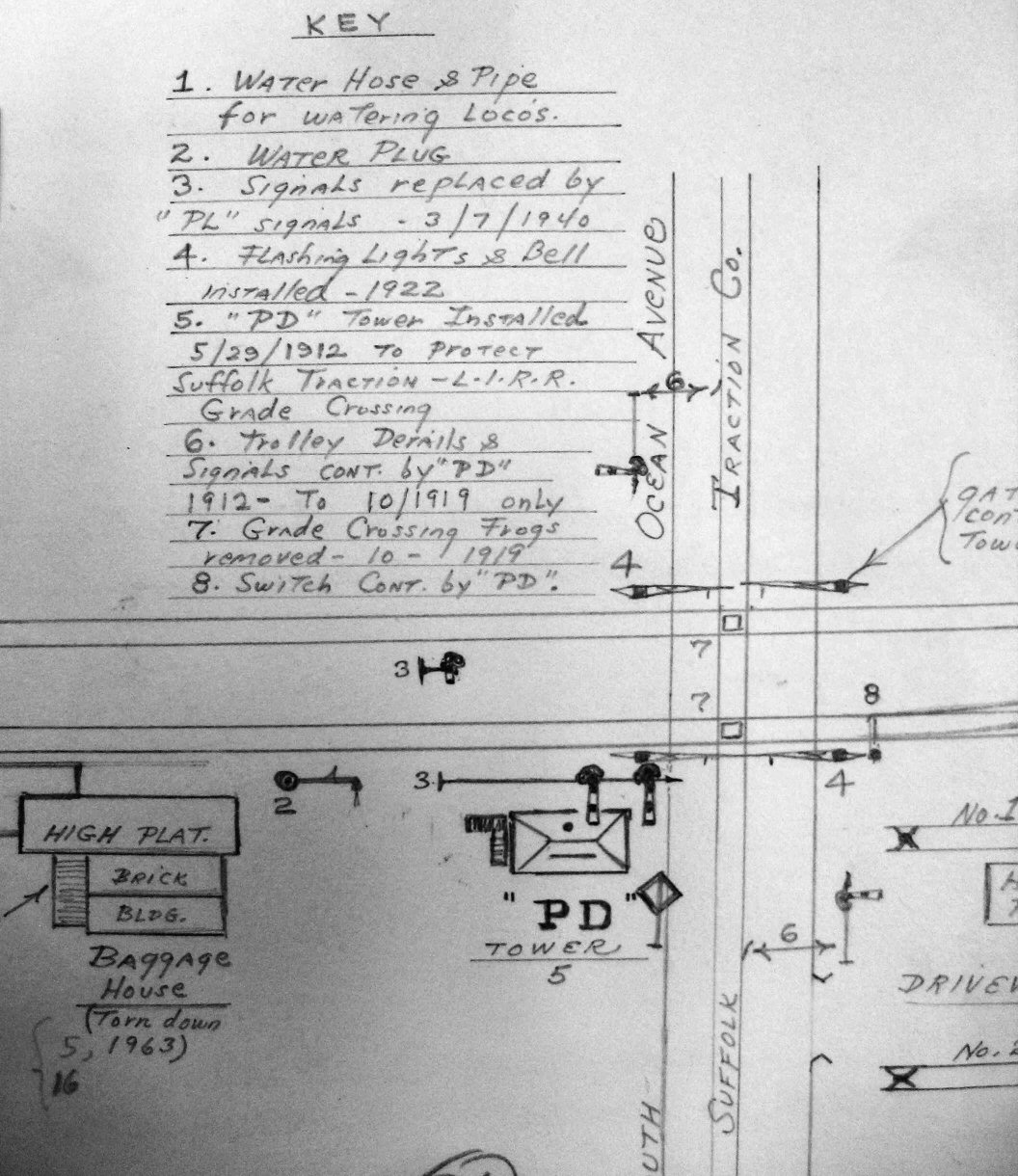
PATCHOGUE Depot: PatchoGue (1903 CR4 - Formerly “P”) Used as train order call letters until construction of "PD" Tower, 1912. Remained in use as station call letters. Because Patchogue depot was PG, already in place, and after the tower opened as PD, the depot remained and retained PG to handle daily telegraph communication to differentiate the tower from the depot when sending and receiving non-block-related telegrams. The original purpose of the tower was to protect the crossing of the tracks by the Suffolk Traction Company's tracks, with derails installed north and south of the LIRR's tracks with the traction company's tracks heading south towards the dock. Research: Dave Keller |
|||
|
|
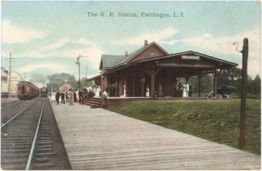
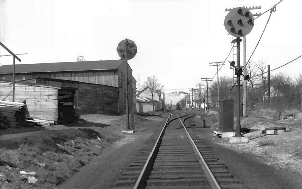
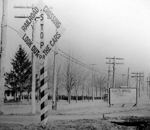
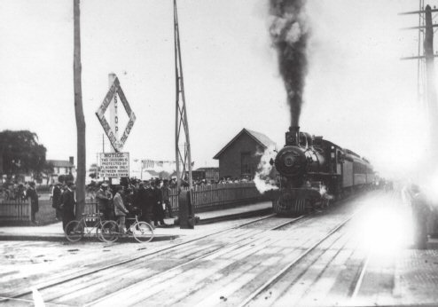
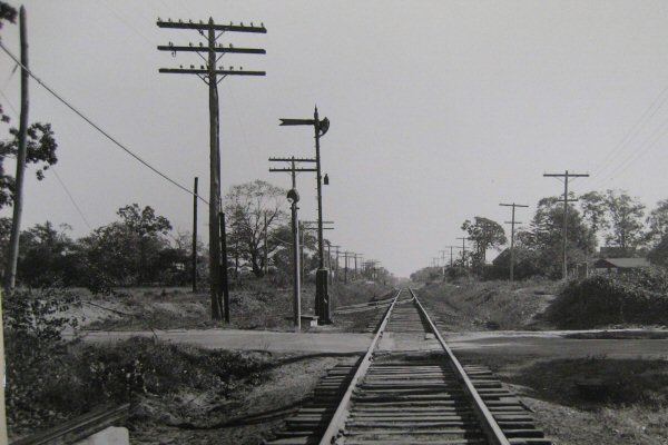
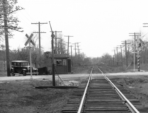
Ocean Ave view W pre-PD Tower c.1905 Archive: Dave Keller |
||
.jpg)
|
Form
19 Order 4/06/1906 for "PG":
To C/E (conductor/engineer )No. 504
History
of Train
Order Forms 19 |
||
.jpg)
|
Form 31 Order 10/30/1907 for "PG" To C&E No. 195 No. 192 has right over no. 195 Eastport to Patchogue.
Made complete by operator Hulse. History
of Train
Orders |
||
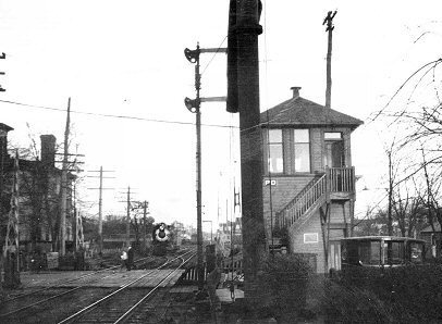
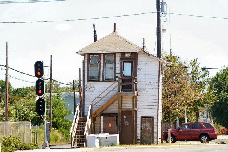
| PD TOWER May 29, 1912 - August 22, 2006 | |||
|
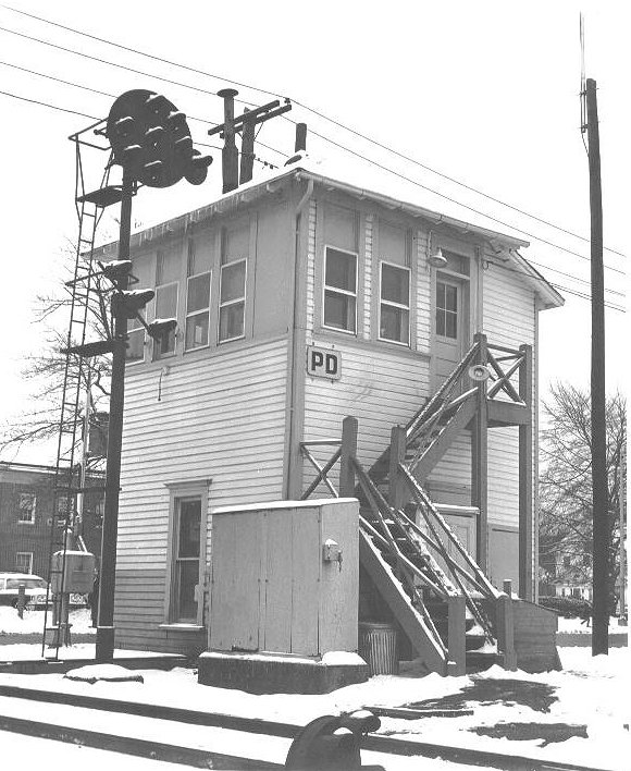
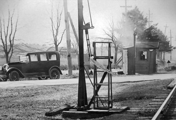
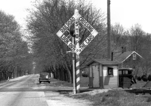
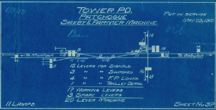
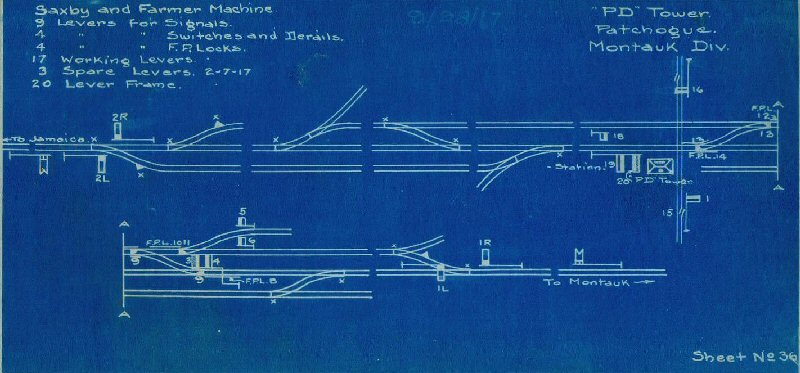
PD TOWER: Located on the south side of the tracks at the east end of the station platform and west side of South Ocean Ave. crossing for protection of LIRR tracks crossed by the Suffolk Traction Co., bound for Patchogue dock. Call letters possibly refers to Patchogue Dock or, possibly, Patchogue Derail, as a derail was an integral part of a Trolley crossing interlocking, and, although this was a storage battery car line, derails were still required when crossing LIRR tracks at grade. It's been bandied about that the call letters refer to Patchogue Depot which really doesn't work as the calls for Patchogue station were "PG" (see train orders above) before the tower's construction and remained the calls for years after. And why would the LIRR refer to a tower as a depot? Saxby
& Farmer 20 lever mechanical machine in service: 5/29/12.
2-lever US&S model 6 electrical locked semaphore indicator and
circuit controller in service: 1913 Interlocking
rebuilt and two TC style 1-lever table machines added designated “l” and
“R” to control train movements over hand operated switches installed in
raised locations in SE and SW corners of the tower, in service:
9/28/17. Suffolk Traction Co. out of service: 1919. Tower retained for
LIRR use. TC machines out of service: c. mid-1930s (?) Saxby &
Farmer 20 lever machine replaced by electronic control panel: 1991. Out of
service: 5/8/2006. Razed: 8/22/06 (Data,
per photos and interlocking blueprints, kindly provided by Art Huneke. Date
of removal of interlocking plant courtesy of LIRR Block Operator: Chris
Soundy) |
|||
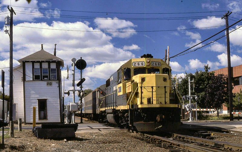 LIRR #266 GP38-2 passing PD Tower eastbound 1996 |
|||
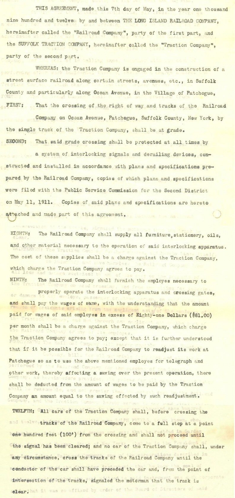
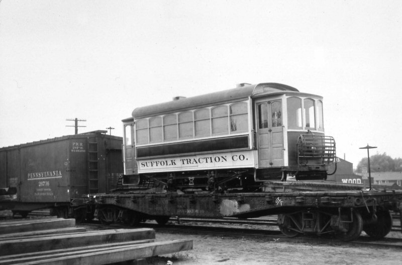
| In 1912, the Suffolk Traction Company built a track down Ocean Avenue and across the LIRR. A twenty lever interlocking machine and frame tower were installed to protect the crossing. These are some excerpts of the legal agreement, 5/07/1912. Archive: Art Huneke | |||
.jpg) Suffolk Traction Co, installing track turnouts at Four Corners, Patchogue 1910 view NW (Thos. R. Bayles collection, Dave Keller archive)
|
 Suffolk Traction Co. and LIRR agreement 5/07/1912. Archive: Art Huneke |
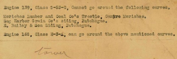 Loco Curve Restriction: c.1912-1913 PD "Tower" was placed in service May, 1912. CR4 March 1, 1913 does not list this siding. Archive: Art Huneke, Info: Dave Keller
|
|
|
Interlocking PD - H. Wilhelm Map 08/07/1921 - Map stitched by Steven Lynch 10/2012
|
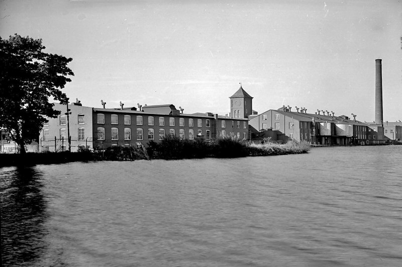
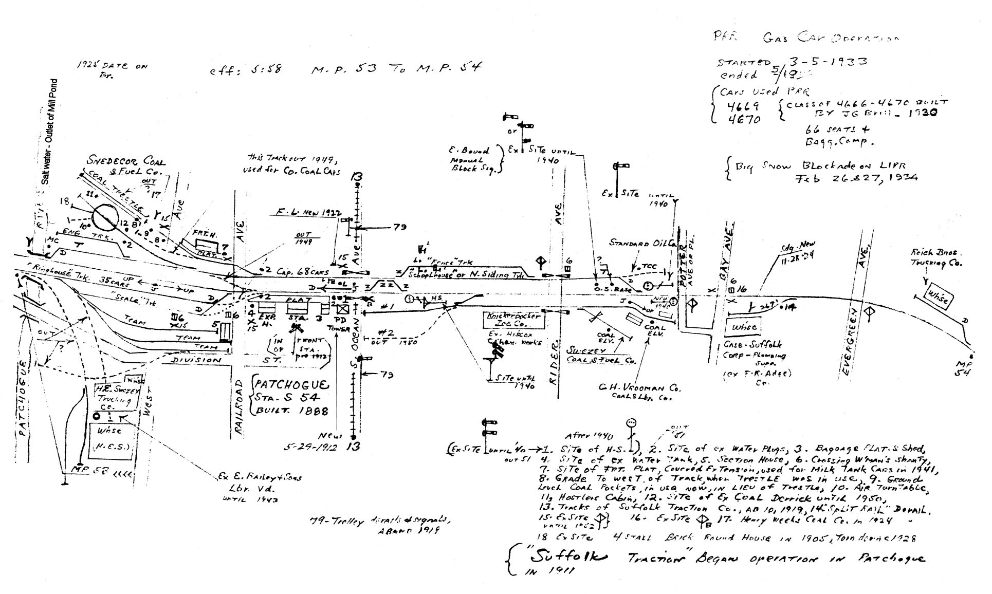
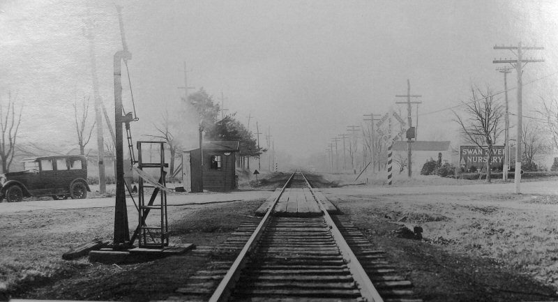
 Patchogue - PD Tower 5/1958 (Emery-SUNY Stony Brook) |
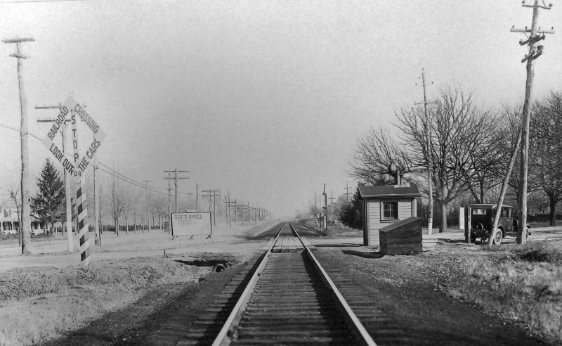
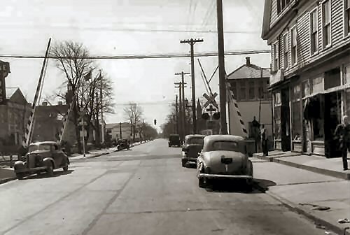 Ocean Ave View South 1947 Photo: F. Weber, Archive: Dave Keller |
|
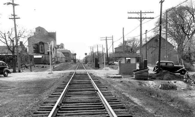
| From 1939 it appears that "PD" Tower controlled the tracks extending from an unmeasured point west of Atlantic Ave., and west of Reid's Ice Cream siding (unnumbered signal indicated- perhaps S484, to a point 5,113 feet east of South Country Road, or 2,023 feet east of Signal S551. (Signal S551 is indicated at 3,090 feet east of South Country Road.) Quite a stretch of track! Author: Dave Keller | |||
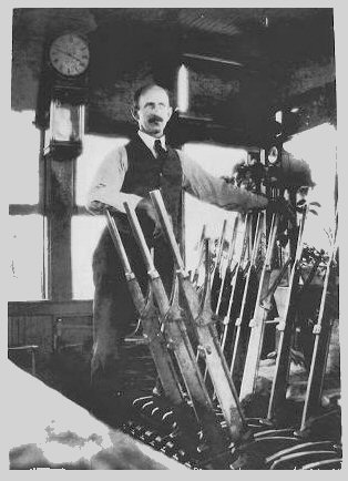 Al Bunker, block operator, at PD Tower levers March, 1930 view E (J.V. Osborne photo, original image at Queensboro Public Library) |
 Form 19 train order written and signed by Al Bunker; the same month and year that the photo was taken of him leaning against the levers. 3/30/1930 You can see from the time that this order was issued and made complete that he was the 2nd trick operator there at the time; AND it was a weekend as the trains are numbered with the prefix “4” Research/Collection: Dave Keller |
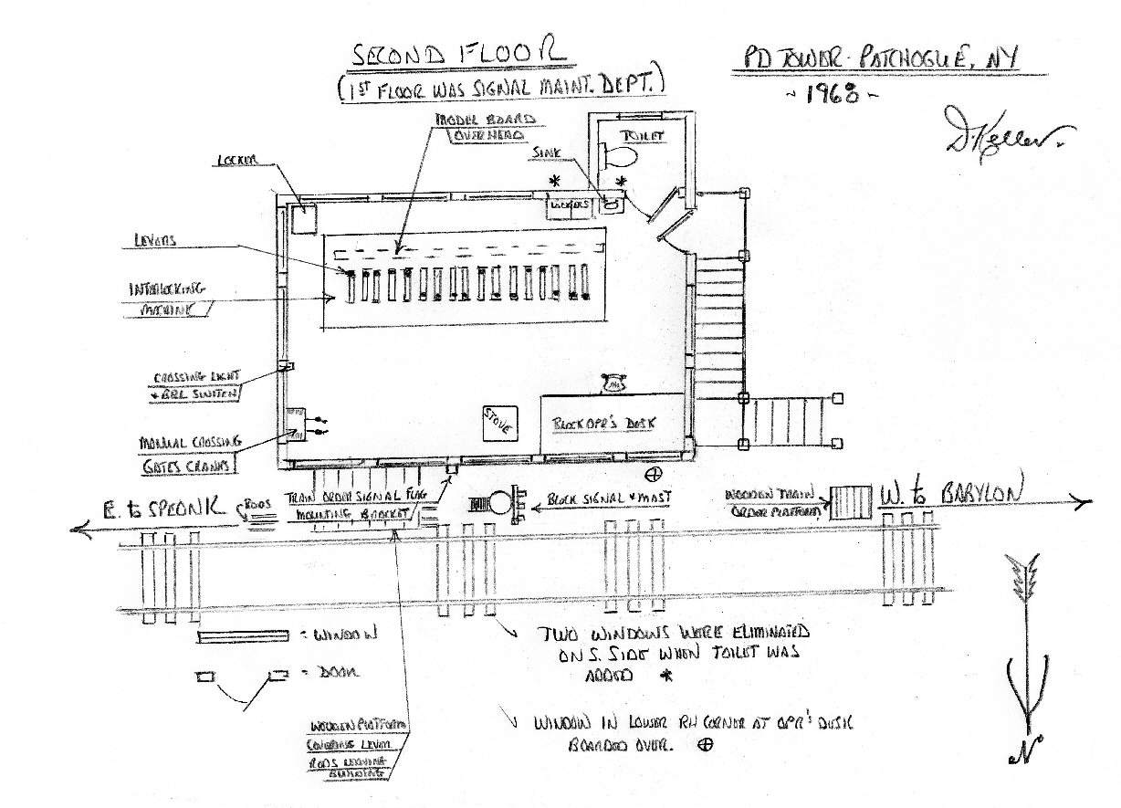 PD Tower floor plan 1968 indicating Armstrong Lever location Research/Design/Archive: Dave Keller |
|
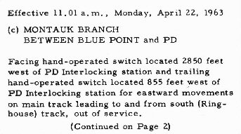
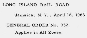 LIRR General Order (GO) No.932 April 16, 1963
|
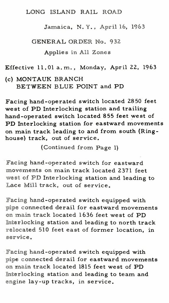 General Order (GO) No. 932 4/22/1963 Archive: Art Huneke
|
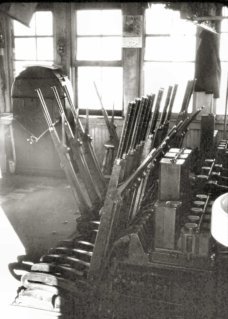 The Robert B. Dunnet photo, 1/1968, shows the levers in PD tower as well as the manual gate cranking mechanism to operate the crossing gates. This is the rounded box in the left background with the two crank handles bound together by a steel ring. One crank handle operated clockwise and the other one counterclockwise and were cranked in sequence. . . first right, then left, then right, etc. The switch to operate the flashing lights and bells was mounted on the wall above the gate controls.
The following year the manual gates were replaced with
automatic ones and the manual control box was removed from the tower. |
|
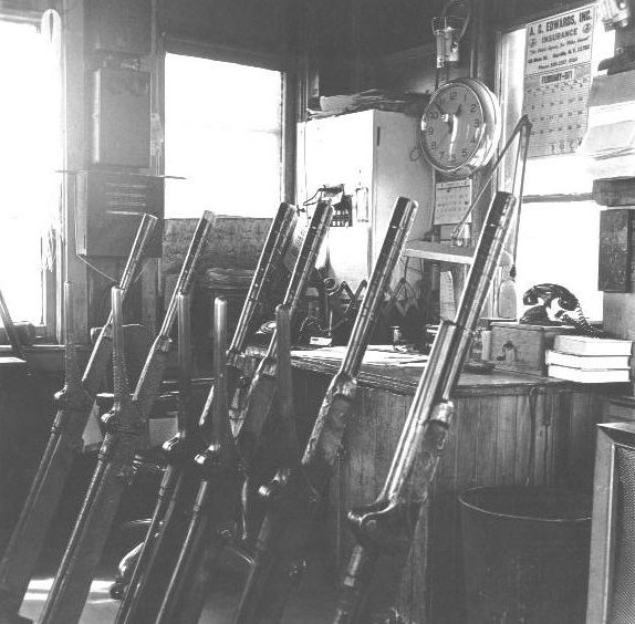 PD Tower Levers - 1971 |
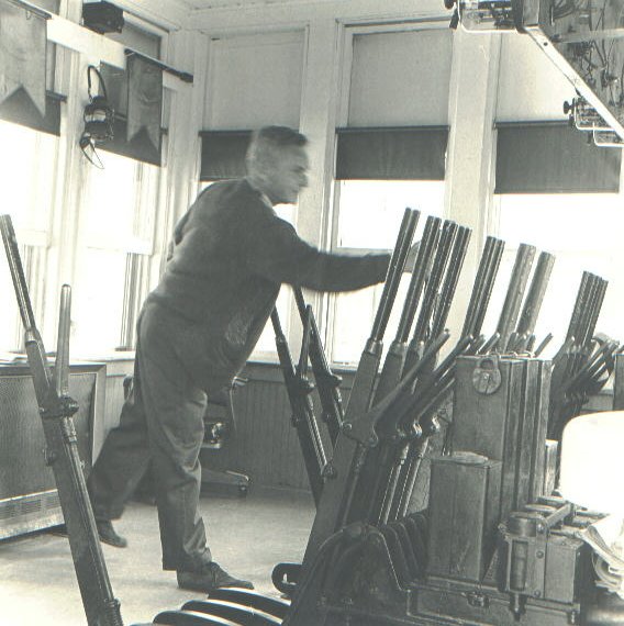 PD Tower Lever operator 1971 |
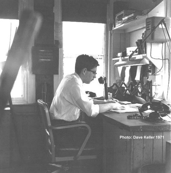 PD Dave Keller 1971 at the desk Archive: Dave Keller |
|
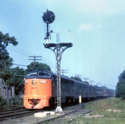 LIRR #2001 CPA-20 westbound approaching PD Tower 9/1963 Photo: Art Huneke |
 PD Tower view W c. 10/1966 - early '67, the back of the #2038 "Setauket" on a LIST-NRHS excursion, the car was tacked onto the back of the morning Montauk run one Saturday Photo: Steve Hoskins |
 PD Tower PRR Position light signals 01/1972 Photo: Dave Keller |
|
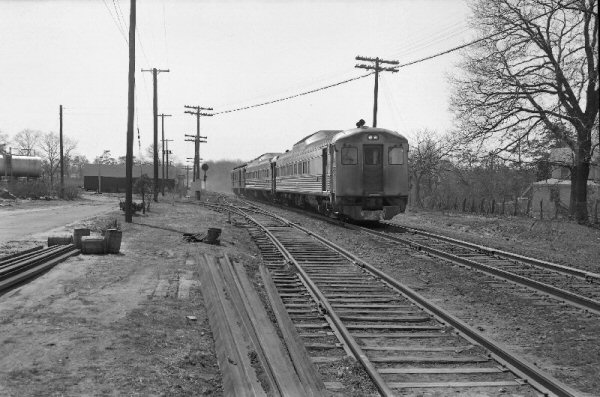
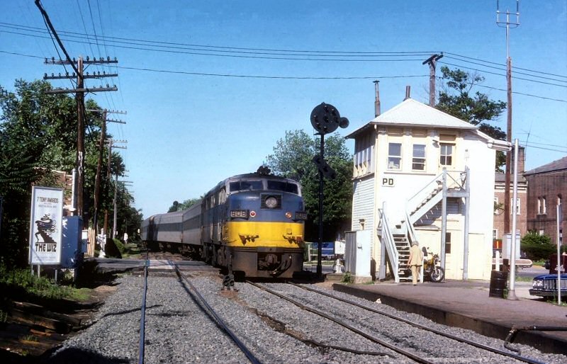 LIRR FA #608 PC (power car) eastbound passing PD Tower headed into the North Siding Track (Schoolhouse Track) for the return trip. 6/1975 Photo: Art Huneke |

Last Steam Special Ocean Ave view W 11/26/1967 |
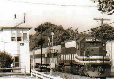 PD Tower eastbound GP38-2 #273 09/18/1983 |
|
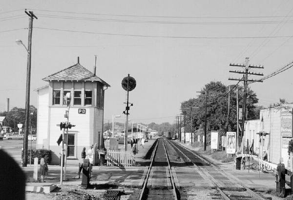
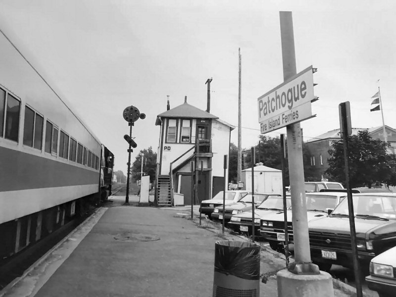 PD Tower - Patchogue Station - View E 1987 |
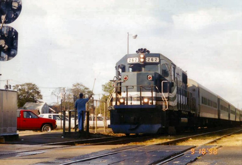 LIRR #262 PD hooping orders 09/18/98 Photo: Joe Saullo |
 LIRR #268 eastbound after hoop order pickup 09/18/1998 Photo: Joe Saullo |
|
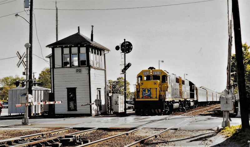
LIRR #252 Cannonball at PD Tower c.1995 Photo/Archive: William H. Birkholz
|
 View E 2001 Photo: Steve Lynch |
 View W 2001 Photo: Steve Lynch  PD Tower at Ocean Ave E view 2001 |
|
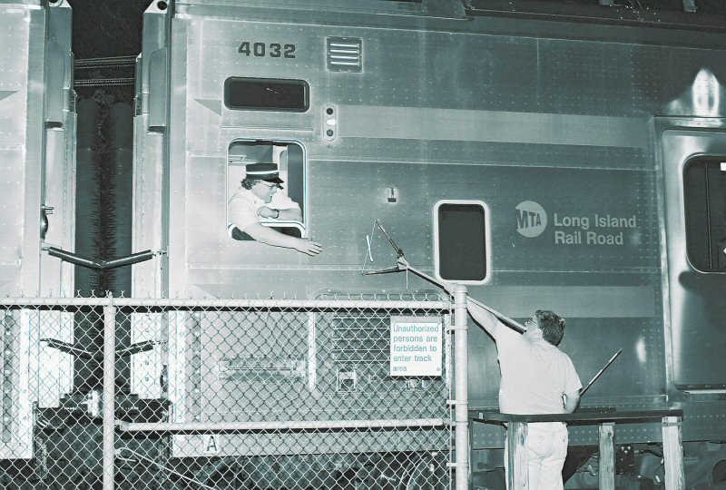 Block Operator Chris Soundy hooping some of the last orders from “PD” tower to the Conductor of eastbound DE-30ac #420 Photo: Pat Masterson |
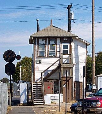
 PD Sign 05/04/2006 |

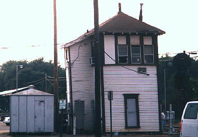
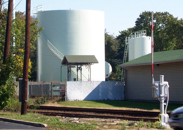
BDH "PD BirDHouse" Tower Photo: "Jersey" Mike |
|
|
|
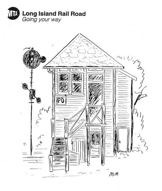 PD Tower MTA rendering by Mike Maione c. 1980's |
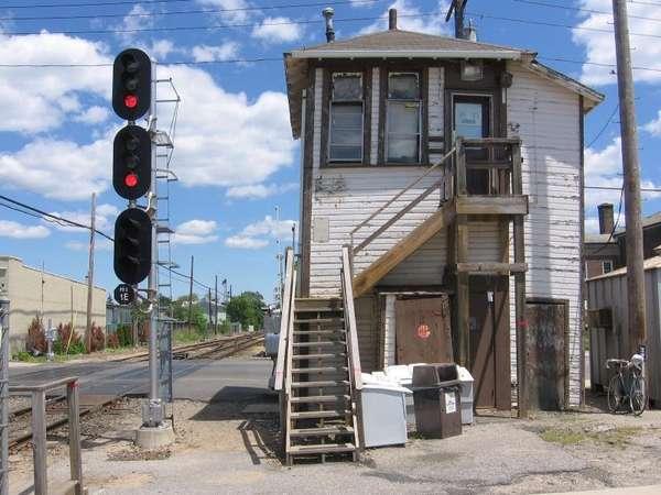 PD Tower 3 Light signals in use 04/2006 |
|
|
|
|||
| PATCHOGUE INDUSTRIES | |||
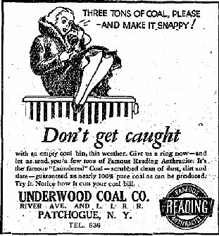
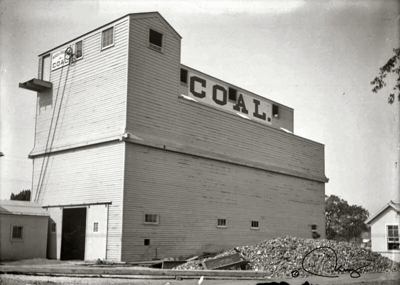
| UNDERWOOD COAL CO. | |||
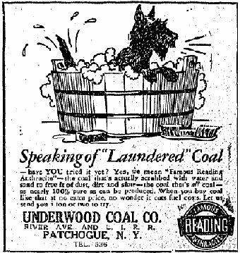
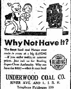 Patchogue Advance 06/17/1932 |
 Patchogue Advance 08/12/1932 |
 Patchogue Advance 1/13/1933 |
|
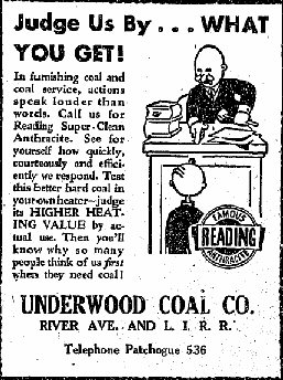
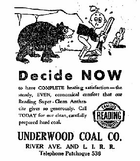
 Patchogue Advance 11/12/1937 |
 Patchogue Advance 11/19/1937 |
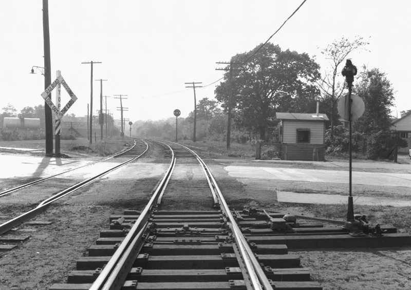
Underwood Coal Co. 10/1943 view W of River Ave. Photo: F. Weber, Archive: Dave Keller |
|
| Underwood Coal Co. ads running in the Patchogue Advance weekly newspaper 1937 - At this time the telephone exchange had gone to 3 digits (536) | |||
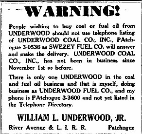
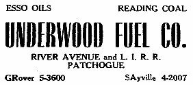
| UNDERWOOD FUEL CO. | |||
 Underwood ad -Patchogue Advance 11/18/1954 |
Underwood ad -Patchogue Advance 10/04/1956
|
 Budd RDCs 1 & 2 heading eastbound past Underwood Fuel with RPO car in tow, approaching River Avenue crossing, Patchogue, NY. 4/06/1963 Photo: Wm. Lichtenstern |
|
| Underwood Fuel Co. ads running in the Patchogue Advance weekly newspaper 1954-1961 - At this time the telephone exchange has gone to 7 characters GR 5-3600 | |||
|
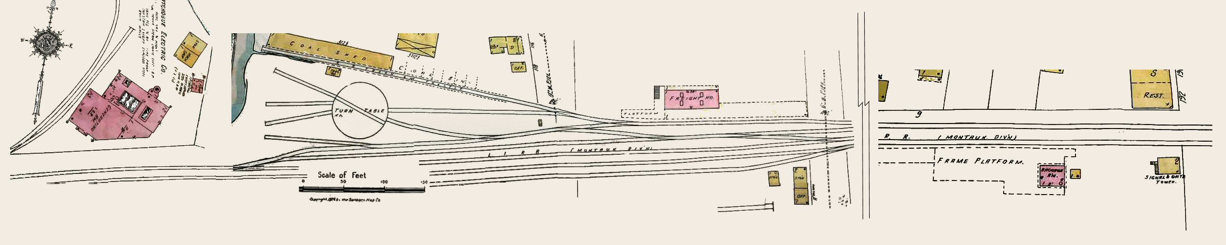
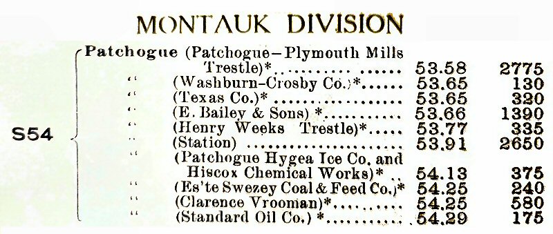
PATCHOGUE LACE MILL SIDING Sanborn Maps compliments of Gary Lutz - Researcher Patchogue-Medford Public Library |
|||
|
CR4 1903
|
 Patchogue CR4 1903 |
||
 Patchogue CR4 1913 - Patchogue Archive: Dave Keller
|
|||
|
1. Patchogue Gas
Co. new siding 1925, per Emery. Hughes &
Cinquin 1928 drawing both expandable gas tank
and the “Gas
Ball”.
|
 Patchogue Mill Siding - Emery map 5/1958 Archive: Dave Keller |
||
|
G.O. 932 Eff. 4/22/1963: Facing
hand-operated switch for eastward movements on main track located 2,371’
west of PD Interlocking Station leading to Lace Mill track out of service.
|
|||
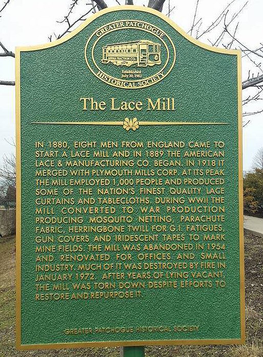
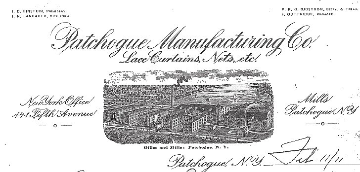
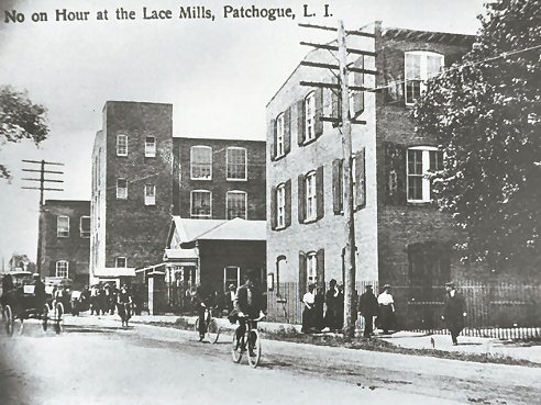
| PATCHOGUE LACE MILL | |||
|
|
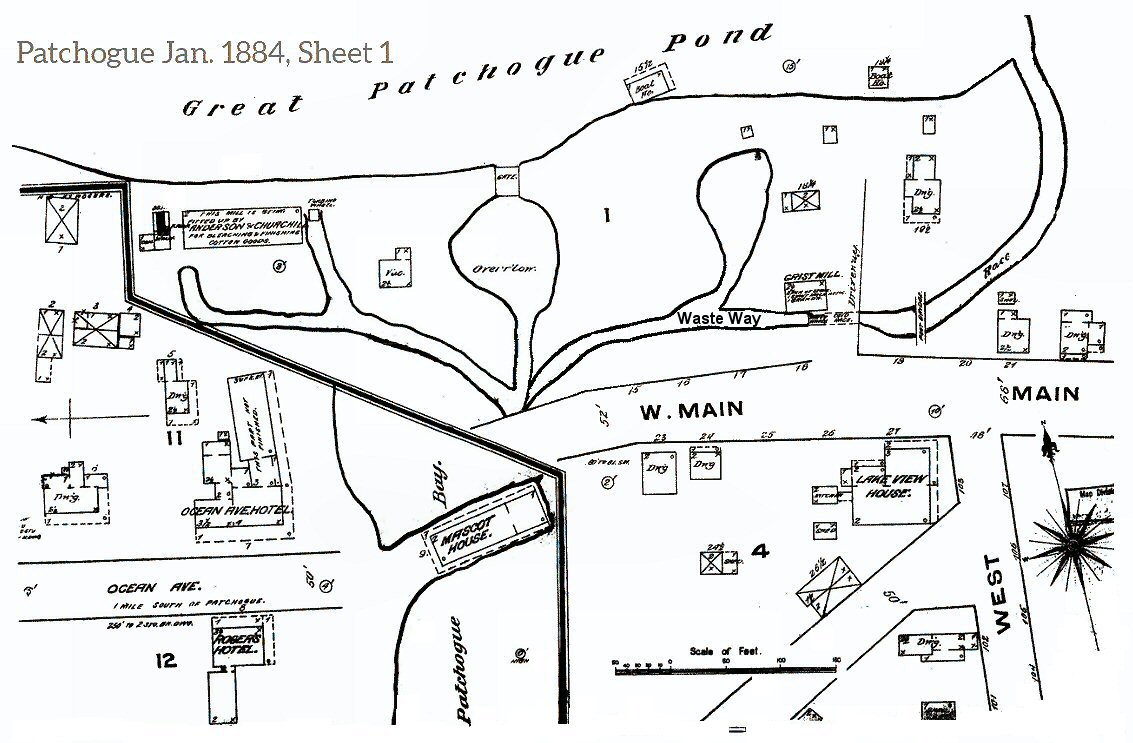 Lace Mill and Grist Mill Patchogue Sanborn map 1/1884 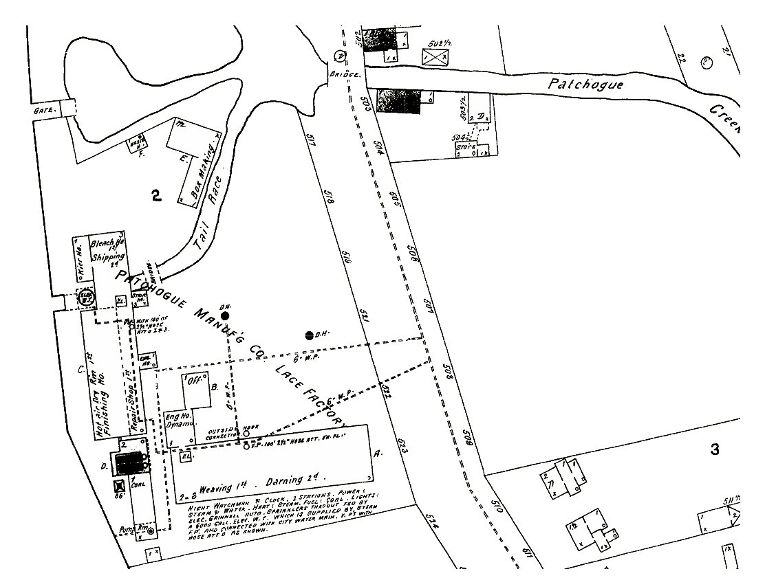 Lace Mill - Patchogue Sanborn map 5/1897 |
||
 View N 1909 Patchogue Manufacturing Co.  Lace Mill - View NE 1910 |
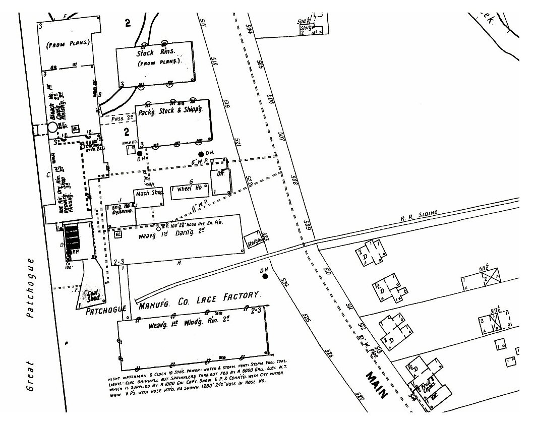 Lace Mill - Patchogue Sanborn map 8/1902 Coal siding installed between 1897 and 1902 Boxcar siding installed between 1902 and 1910 Boxcars delivered raw
materials: cotton, fibers, silk, etc. Outbound would be the finished
products: Originally, crinoline described a stiff fabric made of horsehair
("crin") and cotton or linen which was used to make underskirts and as a
dress lining, for example. |
 Lace Mill - Patchogue Sanborn map 2/1910 Boxcar siding installed between 1902 and 1910 |
|
Lace Mill - View N c.1905
|
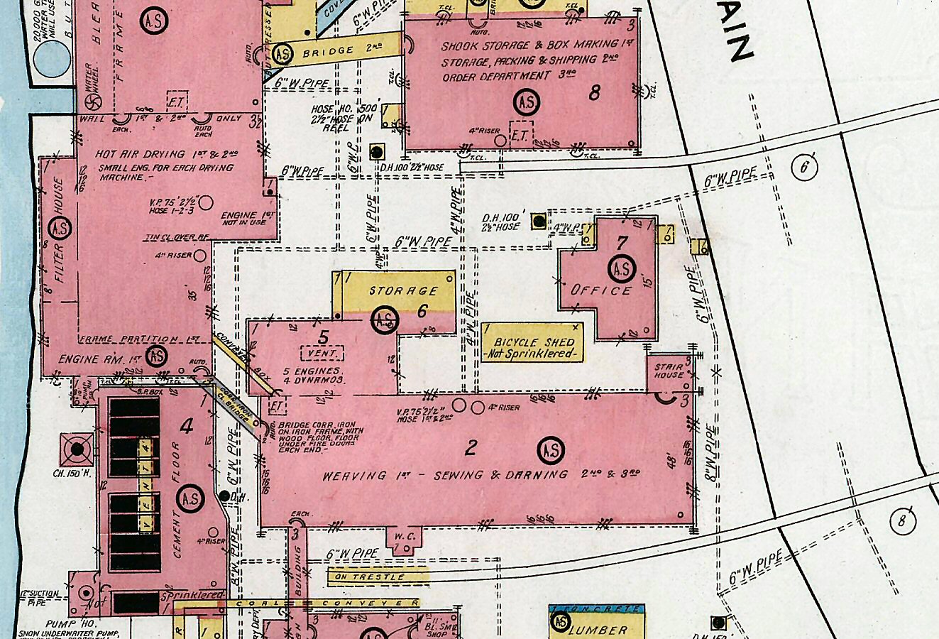 Lace Mill LIRR rail sidings Patchogue Sanborn map 10/1916
|
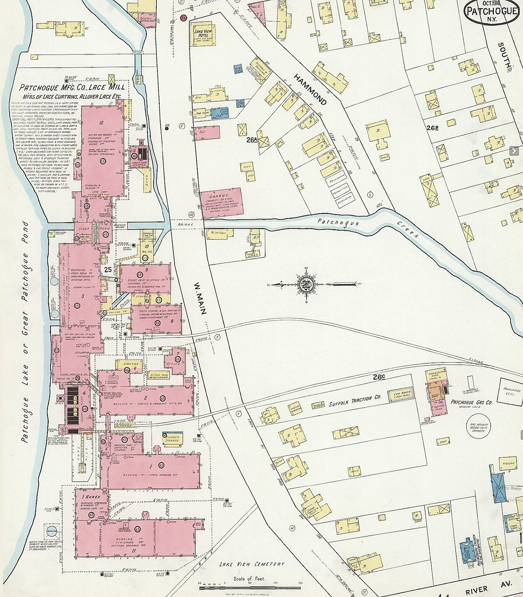 Lace Mill - Patchogue Sanborn map 10/1916 |
|
 Lace Mill view SE |
 Lace Mill view NW |
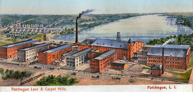
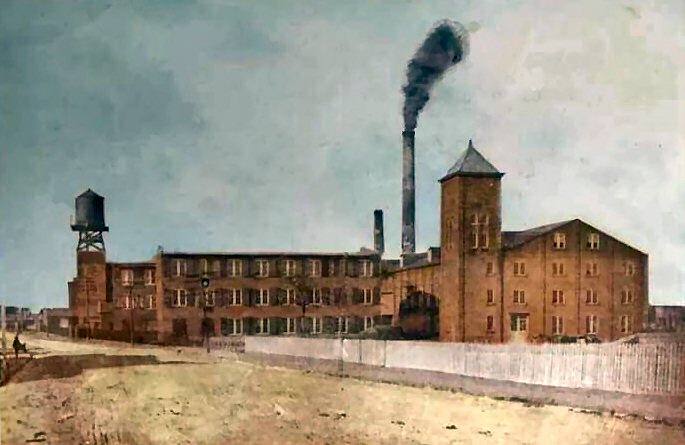 Lace Mill colorized postcard View W c.1900 Archive: Brian Egan |
|
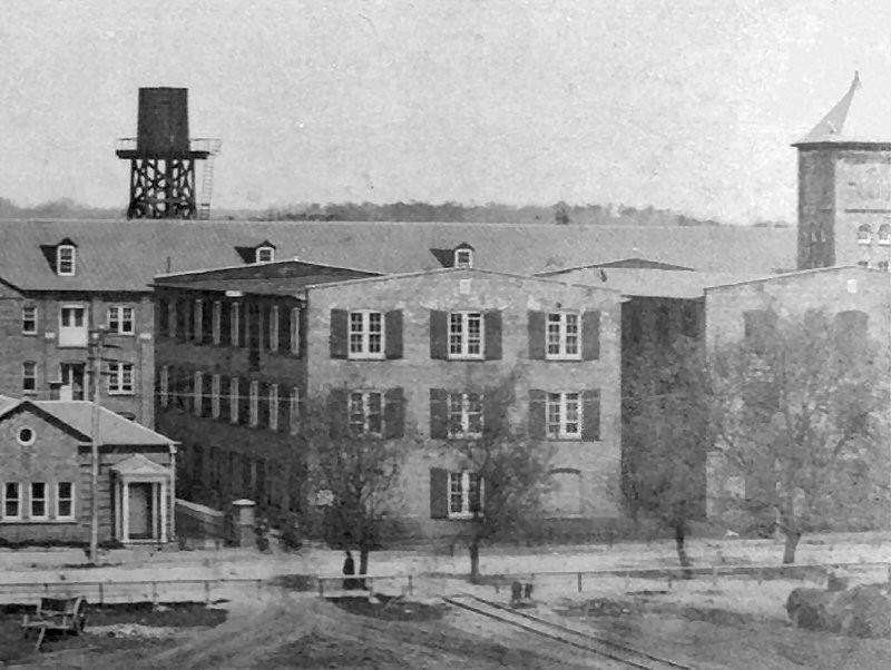
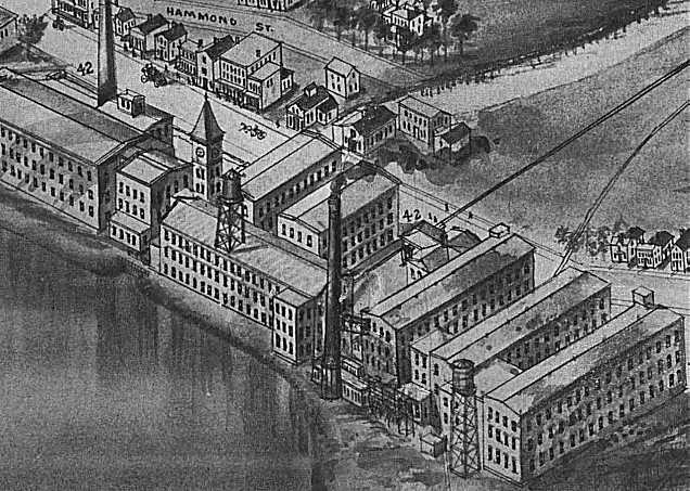
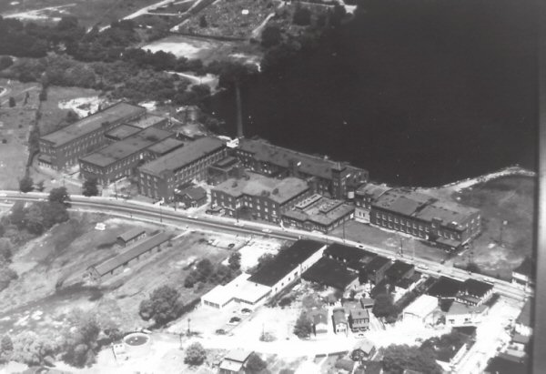
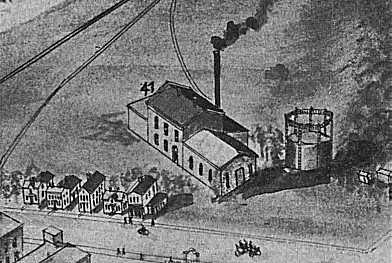
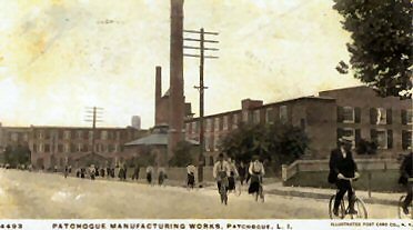 Patchogue Manufacturing Works c.1906 |
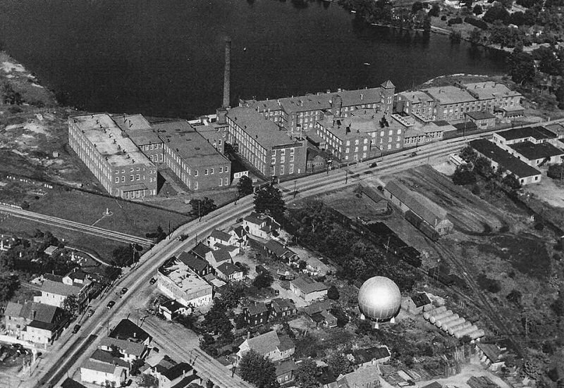
Here we see the two Patchogue Mill sidings; shipping/receiving and coal trestle delivery, and the Patchogue Gas Co. Gas Ball and storage tanks. |
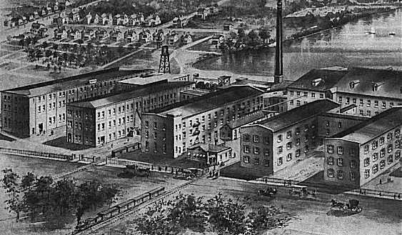
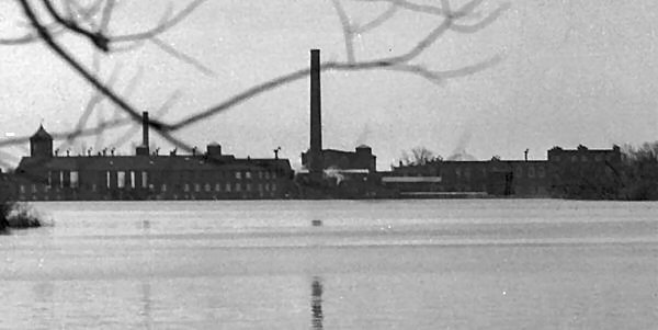
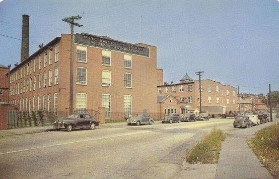 Patchogue Plymouth Mill View NE c.1950 Archive: D. Raven Foncell |
|
 Lace Mill view SW
|
 Aerial Lace Mill view NW sidings razed Photo: Jim Mooney |
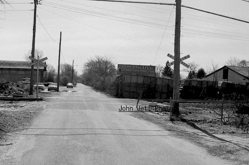
 Lace Mill view SW 1950 Archive: John Jett |
|
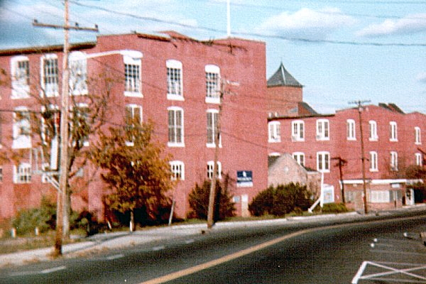 Lace Mill view E c. 1985 |
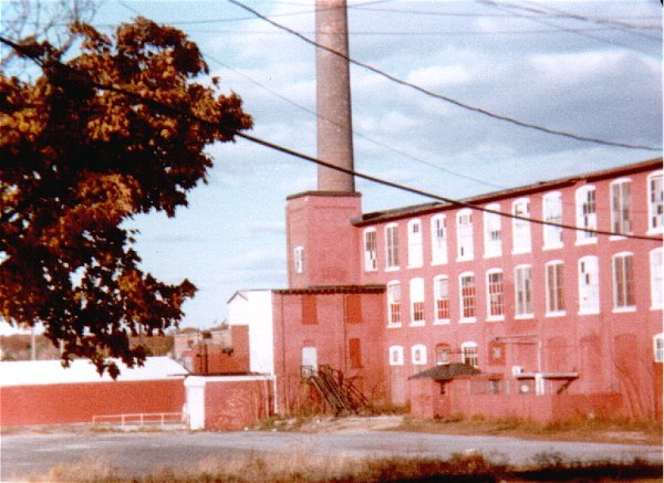 Lace Mill view N c. 1985 |
 Aerial Lace Mill view NE after 1972 area road work Photo: Jim Mooney |
|
 |

 Patchogue - Blue Point Brewing Company 2024 Photos/Archive: Thomas McMahon |
||
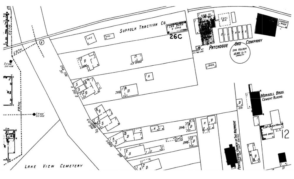
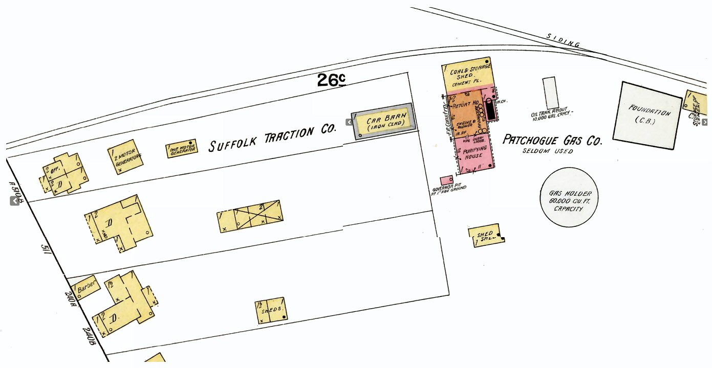 Suffolk Traction Co. - Patchogue Gas Co. Sanborn map 10/1916 |
 Suffolk Traction Co. - Patchogue Gas Co. Sanborn map 10/1926
|
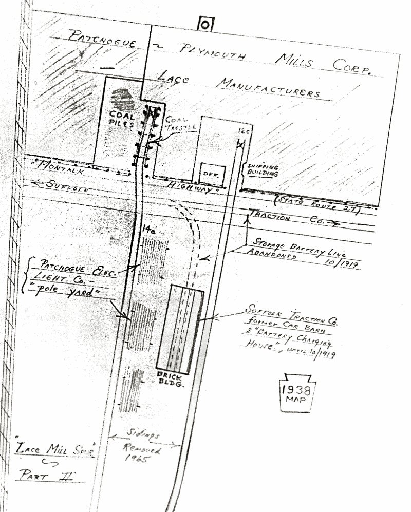 Lace Mill - Abandoned Suffolk Traction Co. 10/1919 car barn Emery map 1938 Archive: SUNY Stony Brook |
|
|
|
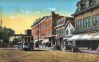
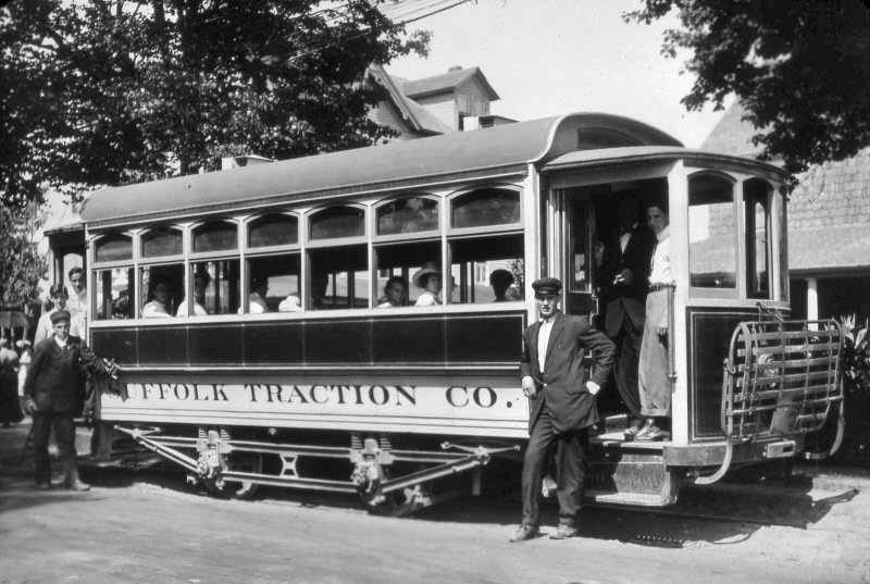 Close-up of Suffolk Traction Co. Battery car #1 with track close to curb Sayville, NY on opening day July, 1911. |
|
|
|
PATCHOGUE GAS CO. |
|||
|
The Patchogue Gas Company was in operation from 1904
to 1926. After only a few years of operations, the Patchogue Gas Company
was sold to LILCO, and gas production - although not gas distribution and
storage - at the site ceased. The facility remained until the 1970s, when
LILCO sold the property to a third party.
The conventional coal-gas process involves heating bituminous (soft) coal in an oxygen-free Retort House so it would not burn. The heated could would release flammable hydrocarbon gases that were collected and purified, then stored and delivered. The Purifying House removed hydrogen sulfide from the gas by passing it over wooden trays containing moist ferric oxide. The gas holder (Gas Ball) was a spherical tank used for storage of the gas and to maintain even pressure in the distribution pipes. From 1910 through the 1970s, a 60,000 cubic foot gas holder (i.e. the Gas Ball) and seven horizontal, above ground storage tanks were used to store gas produced elsewhere. Also, gas was purchased from the Suffolk County Gas and Electric plant in Bay Shore and distributed from the Patchogue plant from 1914 through 1918. Sanborn map - 2/1910 |
|||
 Gas Company. c. 1906 later owned by LILCO view SW Retort House, Purifying House, and Gas Holder
Note: Gas Ball, per Emery siding 1925, on drawing above. |
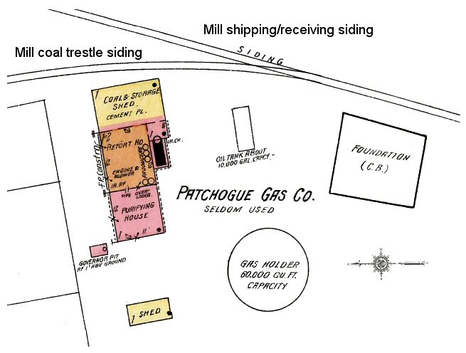 Sanborn map zoom - 2/1910
Right: The two Patchogue Mill sidings; shipping/receiving and coal trestle delivery, the Patchogue Gas Co. Gas Ball and storage tanks, and the remains of the Suffolk Traction Co. |
Sanborn map 10/1926
Expandable Patchogue Gas Co. Holder |
|
|
The Patchogue Gas Company was in operation from 1904 to 1926. After only a few years of operations, the Patchogue Gas Company was sold to LILCO, and gas production - though not gas distribution and storage - at the site ceased. The facility remained until the 1970s, when LILCO sold the property to a third party. The conventional coal-gas process involves heating bituminous (soft) coal in an oxygen-free Retort House so it would not burn. The heated could would release flammable hydrocarbon gases that were collected and purified, then stored and delivered. The Purifying House removed hydrogen sulfide from the gas by passing it over wooden trays containing moist ferric oxide. The gas holder (later Gas Ball) was a
spherical tank used for storage of the gas and to maintain even pressure in
the distribution pipes. From 1910 through the 1970s, a 60,000 cubic
foot gas holder (i.e. the Gas Ball) and seven horizontal (Sanborn above
right), ground storage tanks were used to store gas produced elsewhere.
Also, gas was purchased from the Suffolk County Gas and Electric plant in
Bay Shore and distributed from the Patchogue plant from 1914 through 1918. |
|||
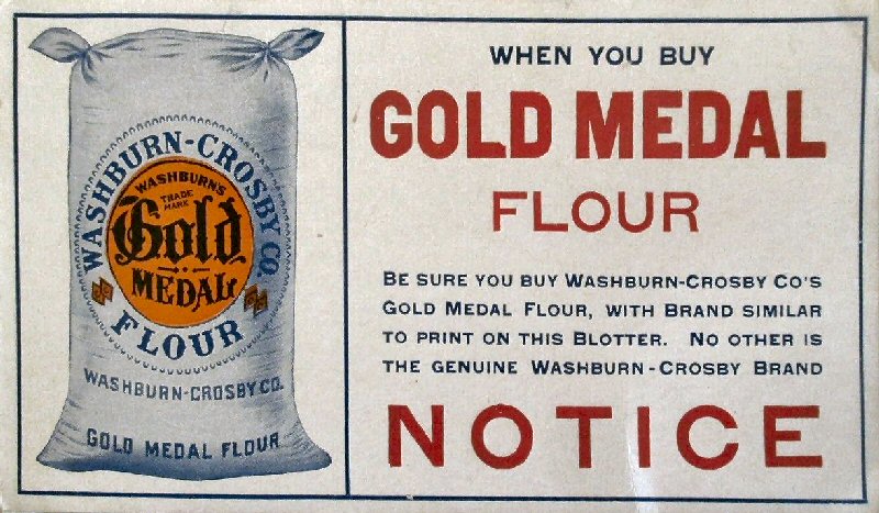
| Washburn Crosby | TEXAS CO. OILS | Cooley & Perkins | |
|
Patchogue Grain Co.
CR4 1919
Washburn-Crosby Co. (Flour, etc. until 6/20/1928 |
 Texas Co. Oil (1902–1959) replaced by Cooley & Perkins per Emery map 5/1958 LIRR Patchogue CR4 1924 at mileage 53.65 Sanborn map 10/1926 page 13
|
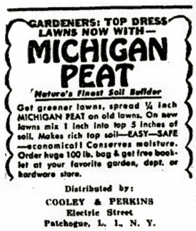 Cooley & Perkins garden supplies ad The Patchogue Advance 10/02/1952 |
|
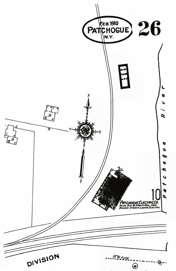
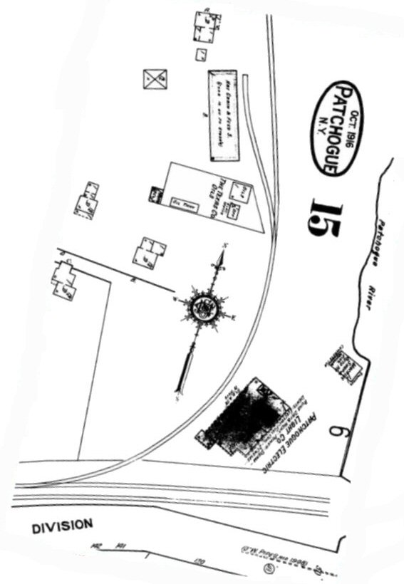
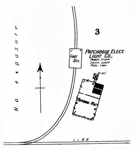
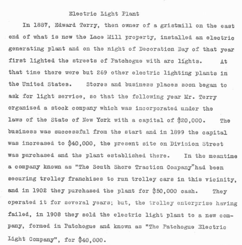
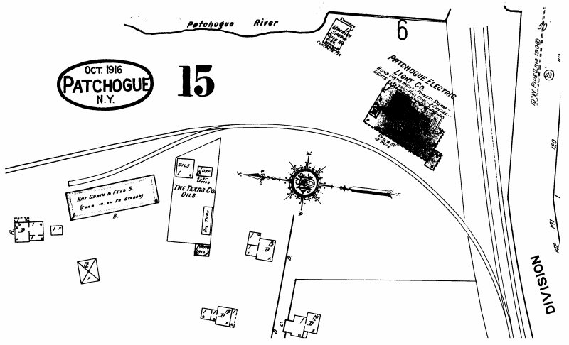
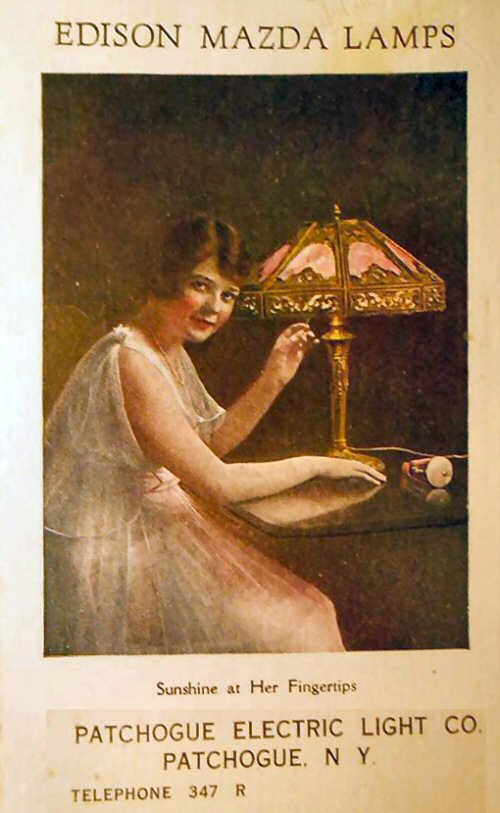
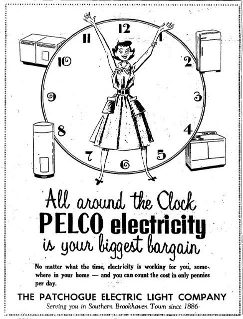
| PELCO - (Patchogue Electric Light Co.) built 1899 | |||
|
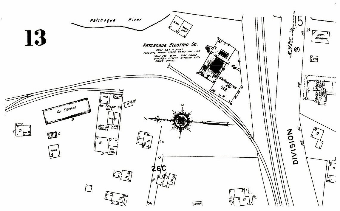
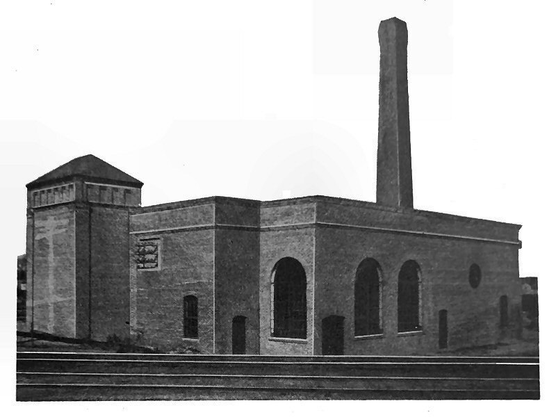
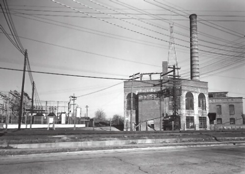
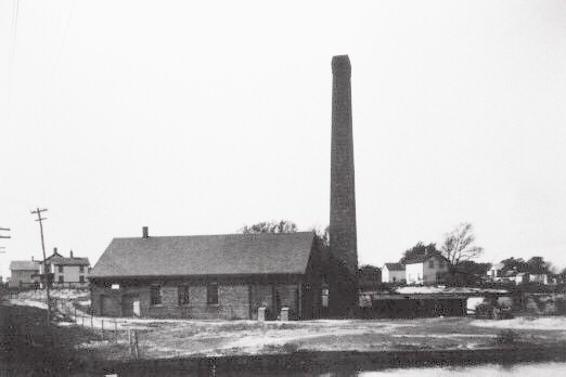
The Patchogue Gas Company (PELCO) Division Street plant was constructed in November 1899. The demand for electricity increased rapidly and the original power plant had to be enlarged several times. In 1912, a 600kw generator with steam turbine drive was installed. In the following years the generating capacity was upgraded several more times. Large extensions to the building were constructed in 1923 to house a large boiler that could produce 1,000 horsepower, thereby doubling the capacity of the plant. Patchogue Village Historian, Hans Henke |
|||
 PELCO 1904 - View W taken from the Patchogue River bank.
|
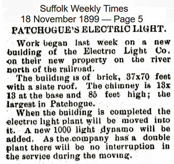 PELCO construction begins 11/1899 Suffolk Weekly Times - 11/18/1899 Archive: PMLibrary
Excerpted: "...and in 1899... the plant established there..." |
 Patchogue Electric Light Co. ad during WW II Archive: John Jett |
|
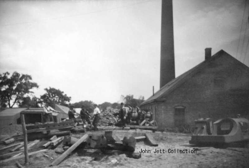 PELCO Division St. - Note on back; "Patchogue Electric Light Co. uncrating new engine June 16, 1908" Queensborough Library Archive: John Jett  |
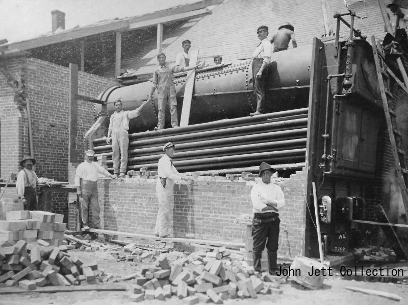 PELCO construction Supervisor Jack Basin (center, facing left) View NE c.7/1908+ - Queensborough Library Archive: John Jett Based on the roof still being pitched, this photo is the “engine installation” in 1908-1909 and the expansion of PELCO indicated by the 1910 Sanborn. |
 Sanborn map 1910 - PELCO Archive: PMLibrary |
|
 PELCO c.1915 page 17 - Patchogue Sayville and Bellport Long Island and Their Attractions by Geo. W. Richardson 1917 Archive: PMLibrary
|
 Sanborn map 1916 - PELCO, Texas Oil Co. View N - Archive: PMLibrary |
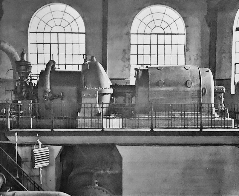 PELCO interior 1923 Photo/Archive : Hans Henke Patchogue; Queen City of Long Island's South Shore In the Twentieth Century
|
|
 1926 Composite Sanborn maps area west of Ocean Ave. Archive: PMLibrary |
|||
|
|
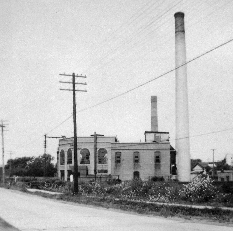
PELCO View NW 8/03/1941 Photo: Robert Emery Archive: SUNY - Stony Brook
|
|
|
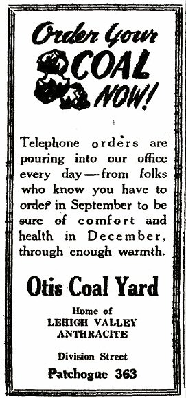
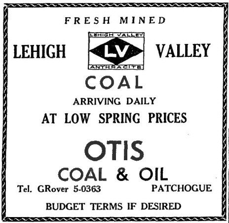
| OTIS COAL & OIL | |||
 Otis Coal ad - Patchogue Advance 9/09/1948 |
 Otis Coal & Oil ad - Patchogue Advance 5/14/1959 |
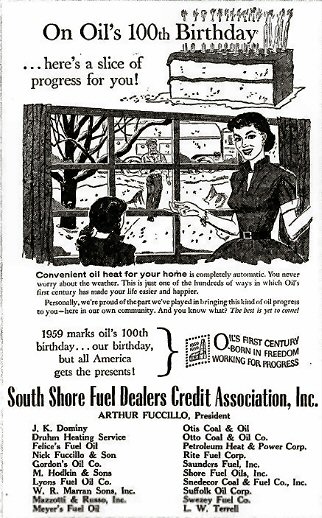 Otis Coal & Oil ad - Patchogue Advance 8/27/1959 |
|
| WEEK'S COAL & WOOD | |||
|
|
|
|
|
|
|
|||
| PATCHOGUE SOUTH SIDING | |||
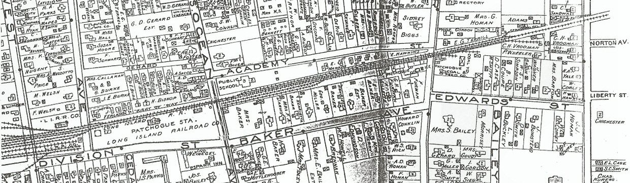 Patchogue Hyde map -1915 Archive: Patchogue-Medford Library |
|||
 |
|||
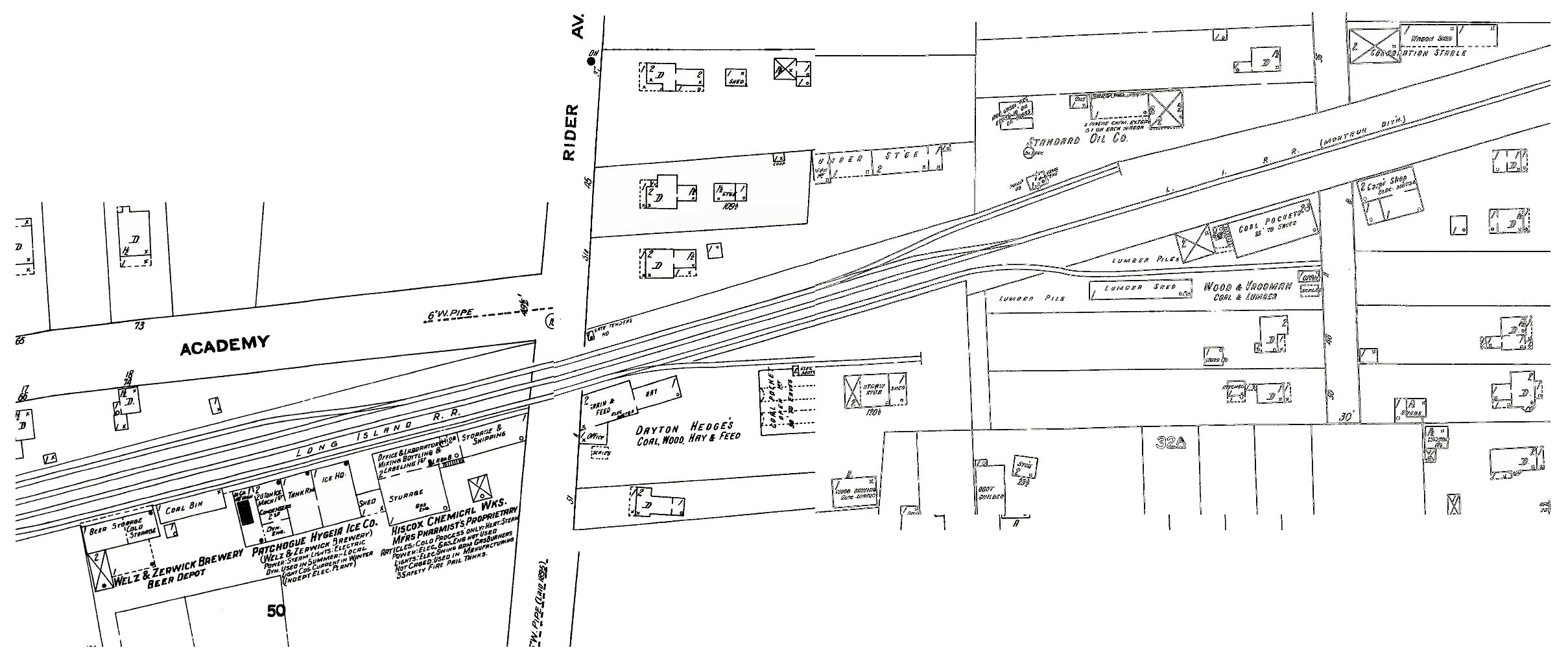
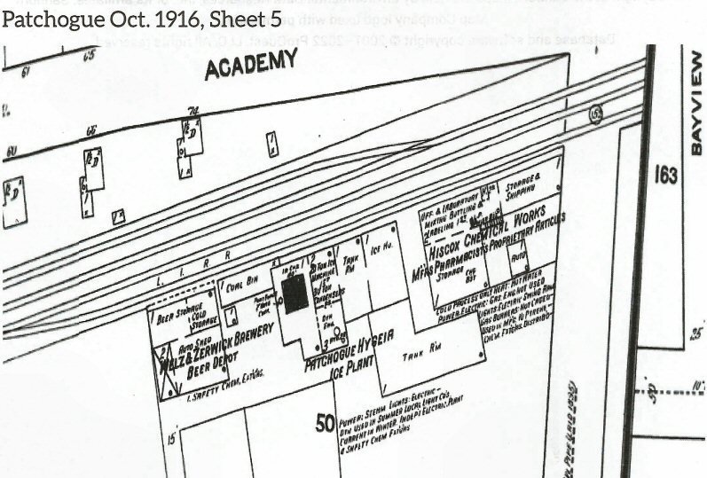
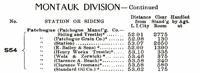
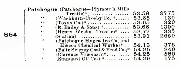
| Welz & Zerwick Brewery Beer Depot, Patchogue Hygeia Ice. Co., Hiscox Chemical Works, Dayton Hedges Coal & Feed, Standard Oil Co., and Wood & Vrooman - Sanborn map 2/1910 | |||
|
|
|||
| Welz & Zerwick Brewery BEER DEPOT - PATCHOGUE ICE CO. - HISCOX CHEMICAL WORKS | |||
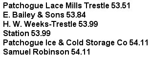
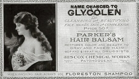
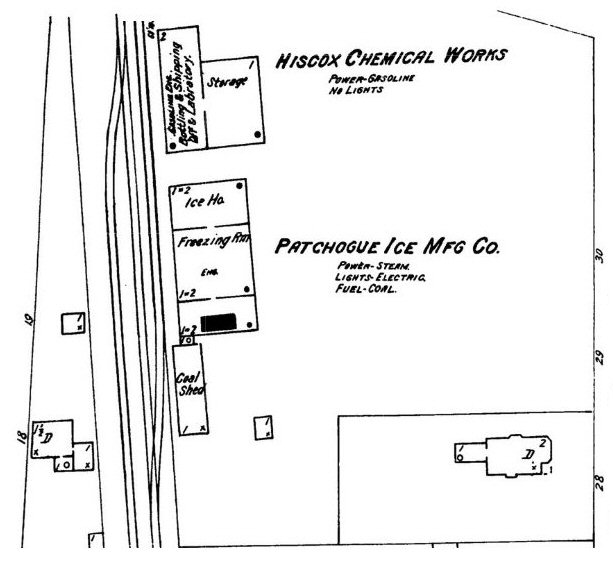 Patchogue Ice Mfg. Co. and Hiscox Chemical Works 8/1902 LIRR CR4 1903: Info: Art Huneke Patchogue Ice & Cold Storage Co. MP 54.11 Samuel Robinson (Hiscox Chemical Works) MP 54.11 |
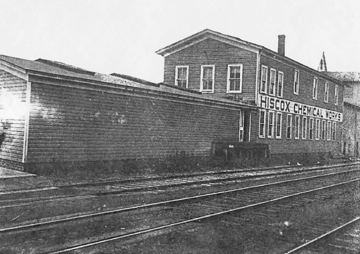 Hiscox Chemical Works est. 1876 (Patchogue Business News) view SW c.1902 built c.1893, unverified.
|
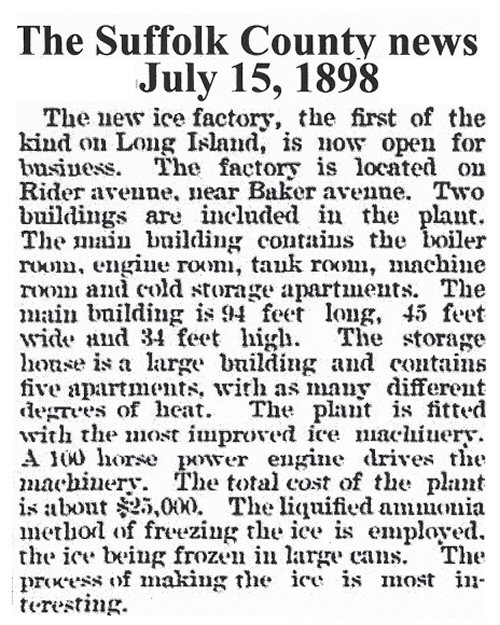 Patchogue Ice Hygeia House opens - Suffolk County News 7/15/1898 Archive: Patchogue-Medford Library |
|
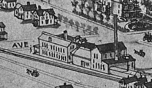 Patchogue Hygeia Ice. Co. - View SE 1906 |
 Welz & Zerwick Brewery Beer Depot, Patchogue Hygeia Ice. Co. and Hiscox Chemical Works - 10/1916 |
 CR4 1919 - Patchogue
|
|
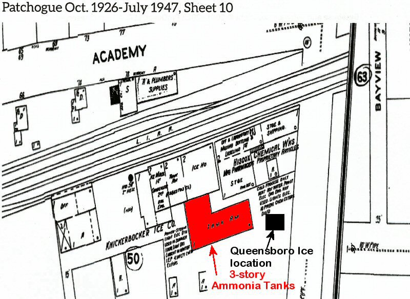
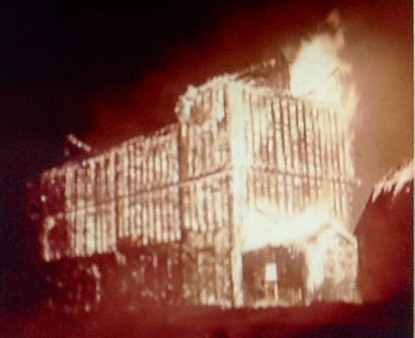
| KNICKERBOCKER ICE CO. - HISCOX CHEMICAL WORKS | |||
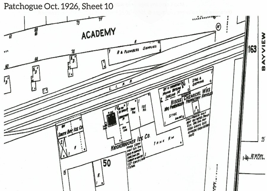 South Bay Ice Co., Knickerbocker Ice. Co. and Hiscox Chemical Works - 10/1926 |
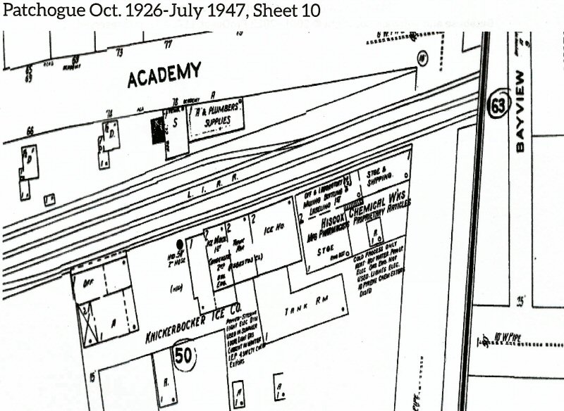 Knickerbocker Ice. Co. and Hiscox Chemical Works 7/1947 |
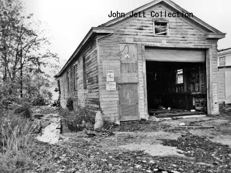
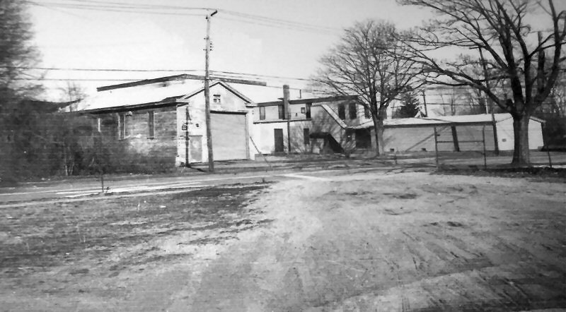 Knickerbocker Ice Co. - View NW c.1982 Photo/Archive: John Jett
|
|
 Knickerbocker Ice Co. south side rear View E c.1970's Photo/Archive: John Jett 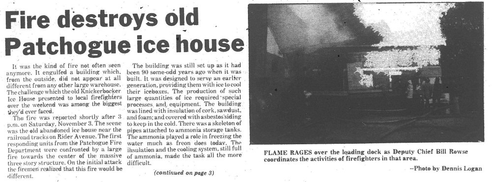 Knickerbocker Ice House fire -Patchogue Advance 11/08/1984 Archive: Patchogue-Medford Library |
 Knickerbocker Ice Co. Patchogue south siding fire location 11/03/1984
|
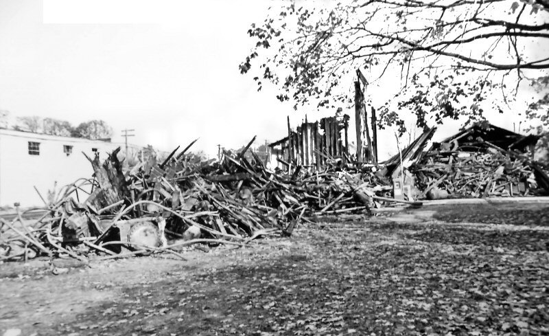 Knickerbocker Ice Co. post fire view E c.1985 Photo/Archive: John Jett
|
|
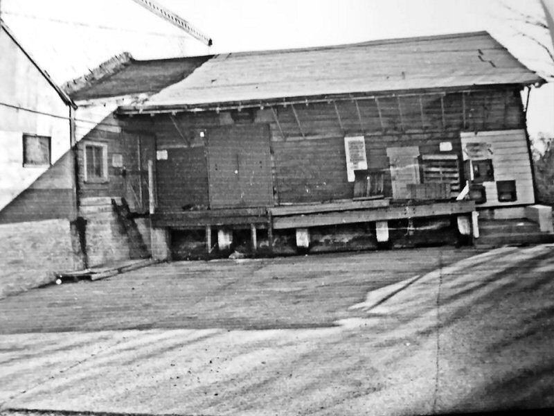
 Ex-Queensboro Ice House location on Rider Ave View W c.1985+ Photo/Archive: John Jett |
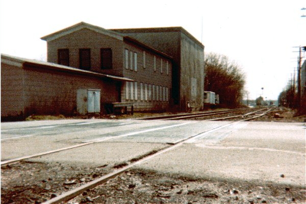 Ex-Knickerbocker Ice Co./Hiscox Chemical Work Rider Ave., view W 1996 Photo/Archive: Steven Lynch |
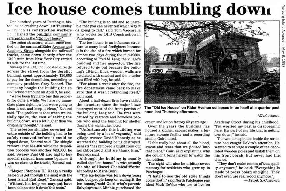 Knickerbocker Ice. House raze LI Advance 5/08/1997 Archive: Patchogue-Medford Library |
|
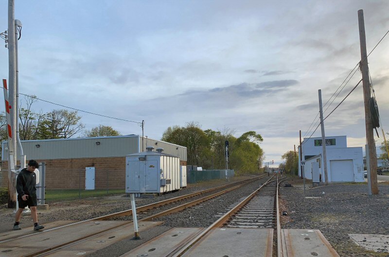
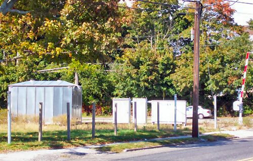
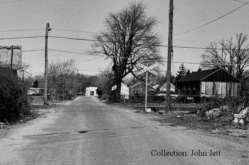
 Rider Ave crossing view W 2001 "Fence Track" siding |
 Rider Ave view W 5/03/2022 Photo/Archive: Joe Vila |
 Ex-Knickerbocker Ice Co. location Patchogue south siding View E 4/27/2022 Photo/Archive: Joe Vila |
|
 Rider Ave crossing view NW 2001 ex-site of Ice Companies Photo: Steve Lynch |
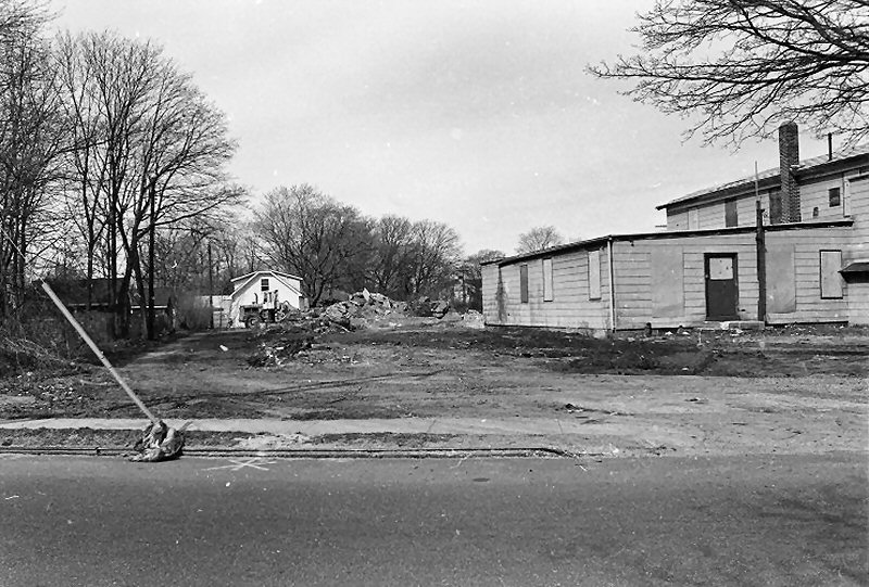
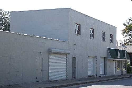 Buildings north of LIRR by Fence Track - Academy St./Rider Ave. View SW 2001 Photo: Steve Lynch |
||
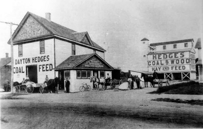
| DAYTON HEDGES COAL & FEED | PATCHOGUE COAL & FEED CO. | ||
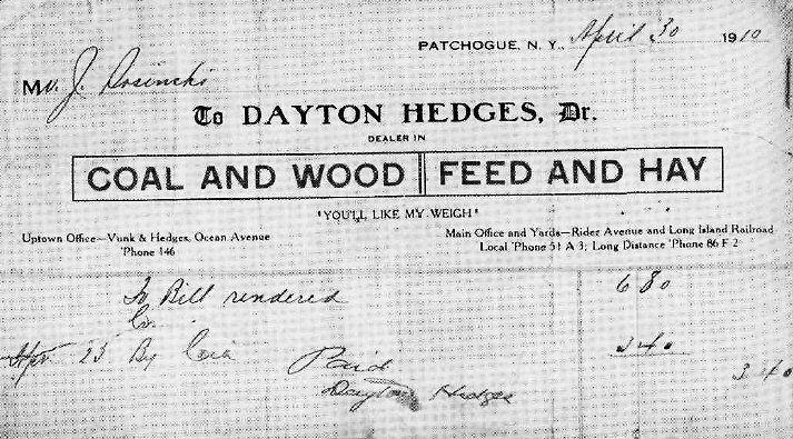 Dayton Hedges Coal/Wood & Feed/Hay receipt 4/30/1910
|
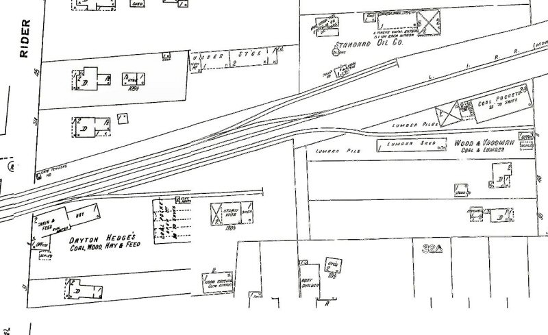 Dayton Hedges Coal Wood Hay & Feed Sanborn map 2/1910
|
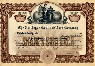 Patchogue Coal & Feed Co. - formed 11/29/1911 stock certificate |
|
SWEZEY COAL & FEED CO.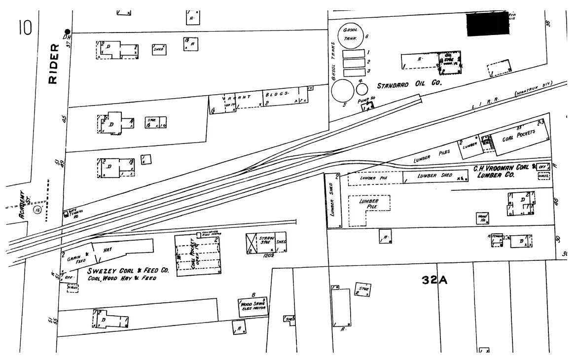 Swezey Coal & Feed Co. - Sanborn map 10/1926 |
|||
| SWEZEY FUEL CO. | |||
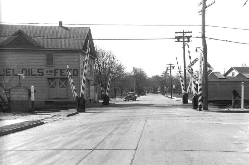 Swezey Coal & Feed, Rider Ave. View S 5/1943 (Fred Weber photo, Dave Keller archive) |
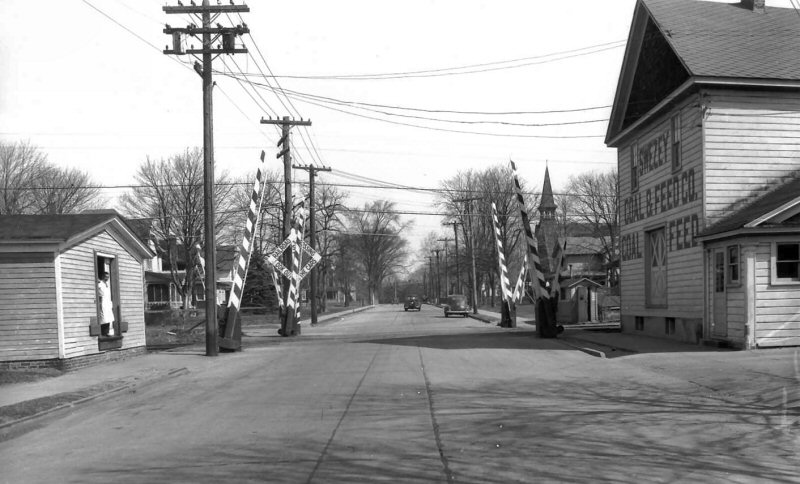 Swezey Coal & Feed, Rider Ave. View N 5/1943 (Fred Weber photo, Dave Keller archive) |
 Swezey Coal & Feed, Potter Ave crossing view W 05/1943 |
|
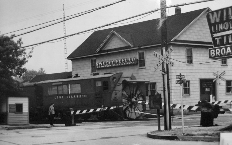 LIRR Rotary Plow #193 westbound 1968 at Swezey Fuel - Rider Ave. view SE (Dave Keller photo and archive)
|
 Swezey Fuel View E c. 1985 Photo: Steven Lynch
|
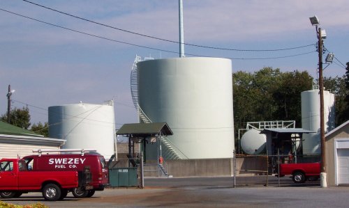
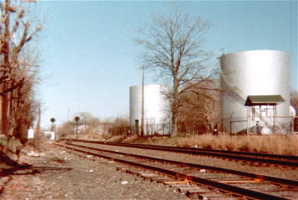
 Swezey Fuel View E 2001 - Swezey Fuel Oil View NE 9/2017 Photo: Steven Lynch
|
|
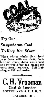
| WOOD & VROOMAN COAL & LUMBER | |||
 Situated alongside the LIRR tracks at the crossing of Potter Avenue is the interesting coal silo of the Wood & Vrooman Patchogue Coal Pocket and adjacent lumber yard. View is looking SW c. 1910. For many years a landmark trackside, the building was destroyed by fire on May 6, 1964.
|
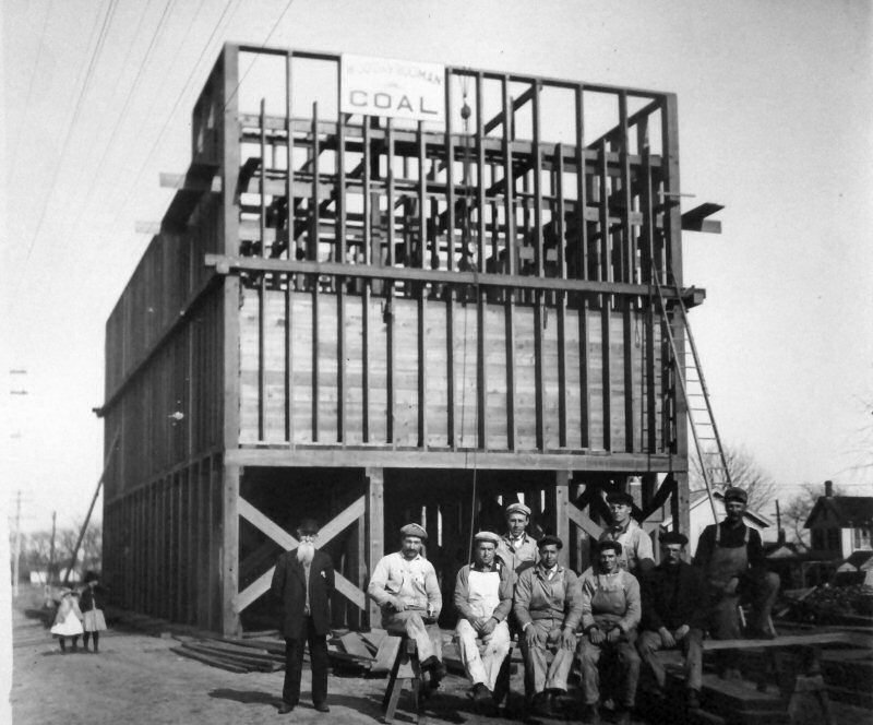 Vrooman Coal construction early 1900's View SE Archive: John Jett
|
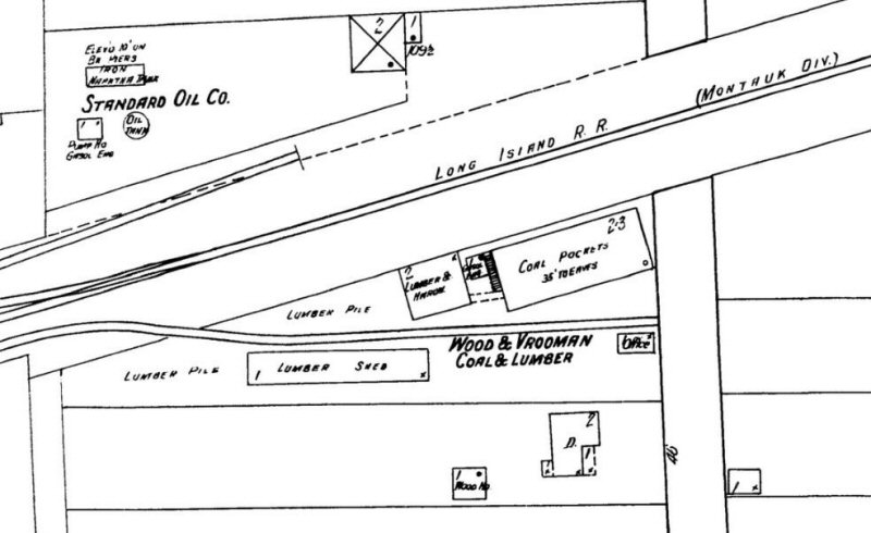 Wood & Vrooman Coal & Lumber - Sanborn map 2/1910
|
|
| CASE SUPPLY CO. | NY TELEPHONE | ||
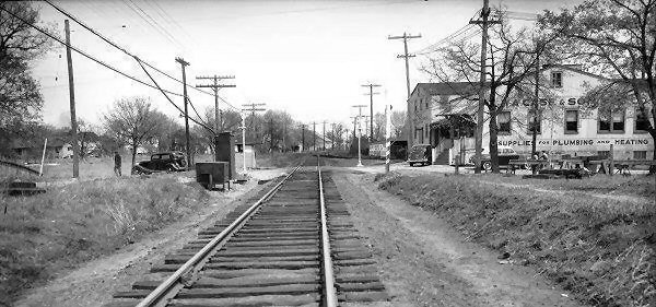 W. B. Case and Sons Supply View E 04/24/1946 (Fred Weber photo, John Jett archive) |
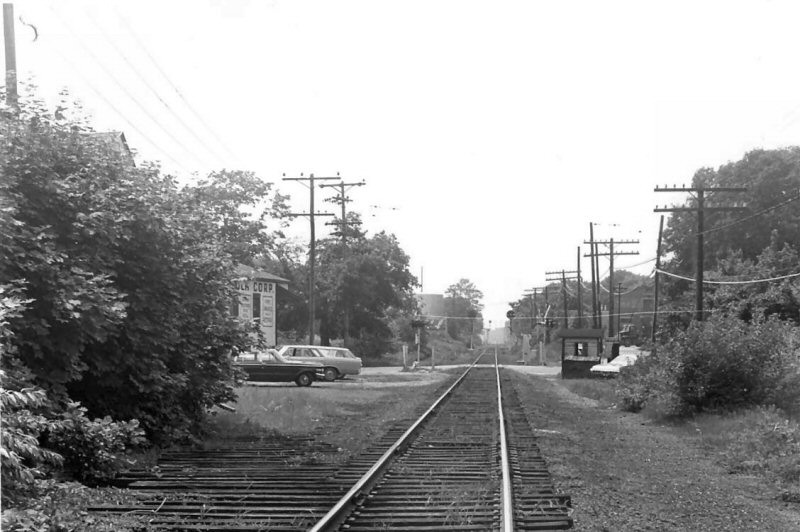 Ex-siding to Case Suffolk Corp - Plumbing Supplies Bay Ave View W c.1968 (Raynor-Morrison) |
 NY Telephone Pole Yard east of Conklin Ave c.1952 Photo/Archive: John Jett |
|
| EVERGREEN AVE. MP54 | GROVE AVE. | SOUTH COUNTRY RD. | |
 Emery map 5/1958 MP 53-54 Patchogue River to Evergreen Ave, Patchogue
|
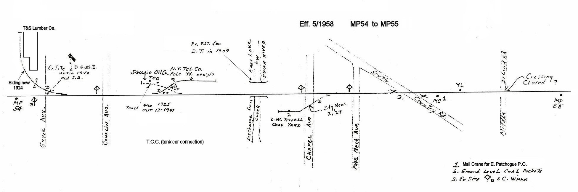 Emery map 5/1958 MP 54-55 Grove Ave to Middle Island Rd. (now Hewlett Ave), Patchogue
|
Emery Patchogue at South Country Rd pre-1930 Archive: SUNY-Stony Brook
|
|
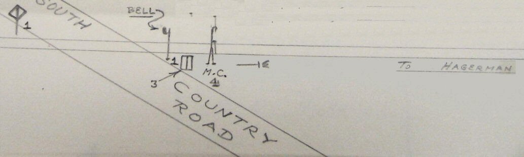
 Patchogue South Country Rd Diamond Crossing sign close-up view E 1/19/1930 |
 Patchogue South Country Rd Crossing Shanty close-up view W 1/19/1930 |
 Patchogue South Country Rd Crossing Shanty close-up view SE 4/24/1946 (Fred Weber photo, Dave Keller archive)
|
|
| CHAPEL AVE. | |||
 Chapel Ave., East Patchogue - View N c.1970 L. W. Terrell Coal Yard ground-level coal pockets siding in foreground. Archive: John Jett |
 Chapel Ave., East Patchogue - View S c.1970 Archive: John Jett |
||
|
The bells were for additional crossing protection. . . probably at times when the crossing was unmanned. See attached images above. South Country Rd has the bell staff mounted in 1930 and later attached to the crossing sign in 1946. Emery's South Country Rd. map represents a time PRIOR (pre-1930) to the crossing shanty being moved from the SE to the SW corner location. Chances are, the Crossing Shanty being located next to the mail crane caused a problem with the mailbag being tossed off in the same location . . .maybe it slammed into the shanty on more than one occasion and it was deemed prudent to MOVE the shanty as far away from the mail crane as was physically and practically possible. Info: Dave Keller |
|||
| RULAND'S MARBLE & GRANITE WORKS | |||
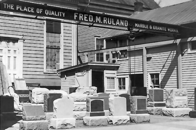 Ruland's Marble & Granite Works N. Ocean Ave view W 1911 Archive: Hans Henke |
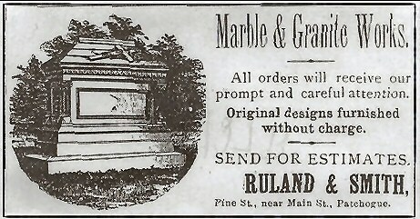 Ruland & Smith Works Memorial ad (c.1875+) Pine Street (or Canaan Rd) later changed to N. Ocean Ave. |
Note: Both Ruland's Marble & Granite and Roe & Sons Steel Tapes Co. (below) were not rail served. Research: Steven Lynch | |
| JUSTUS ROE & SONS | |||
 Roe & Sons Co. c. 1880+ Archive: Hans Henke |
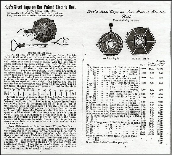 Roe Catalog sample Pages 6-7 |
 Justos Roe & Sons, manufacturers of steel tapes and measures (patented 1892) packing slip c.1900 In 1878 Justus Roe began the manufacture of steel tapes and reels for surveyor's use. |
|
| PATCHOGUE - OTHER MATERIAL | |||
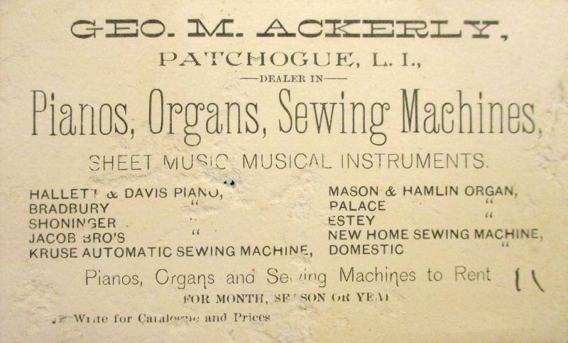
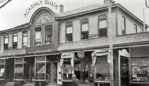 Ackerly Piano Store 1906 |
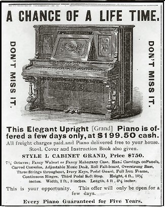 Ackerly Upright Piano Ad c.1906 |
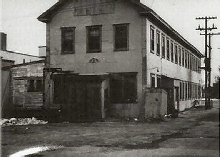
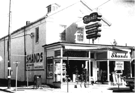 Shand's Feed & Hardware Main St. c. 1970 |
|
.jpg) LIRR #2020 P74D Parlor "PATCHOGUE" Montauk Yard 5/15/1966 (Rugen-Keller) Built by Pullman in 1926 as a 28 seat 1 drawing room parlor car. Sold to PRR and leased back to Pullman 12/31/1945. Withdrawn from lease 10/01/1956. Acquired by LIRR March 1961. Retired November 1966 after car was wrecked in a derailment; scrapped. Research: Jack Deasy |
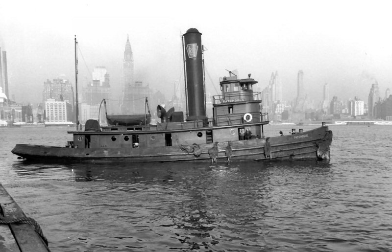 LIRR tugboat "Patchogue" leaving the dock at Long Island City - View west towards Manhattan Island - October, 1944 (Fred Weber photo, Dave Keller archive) |
||
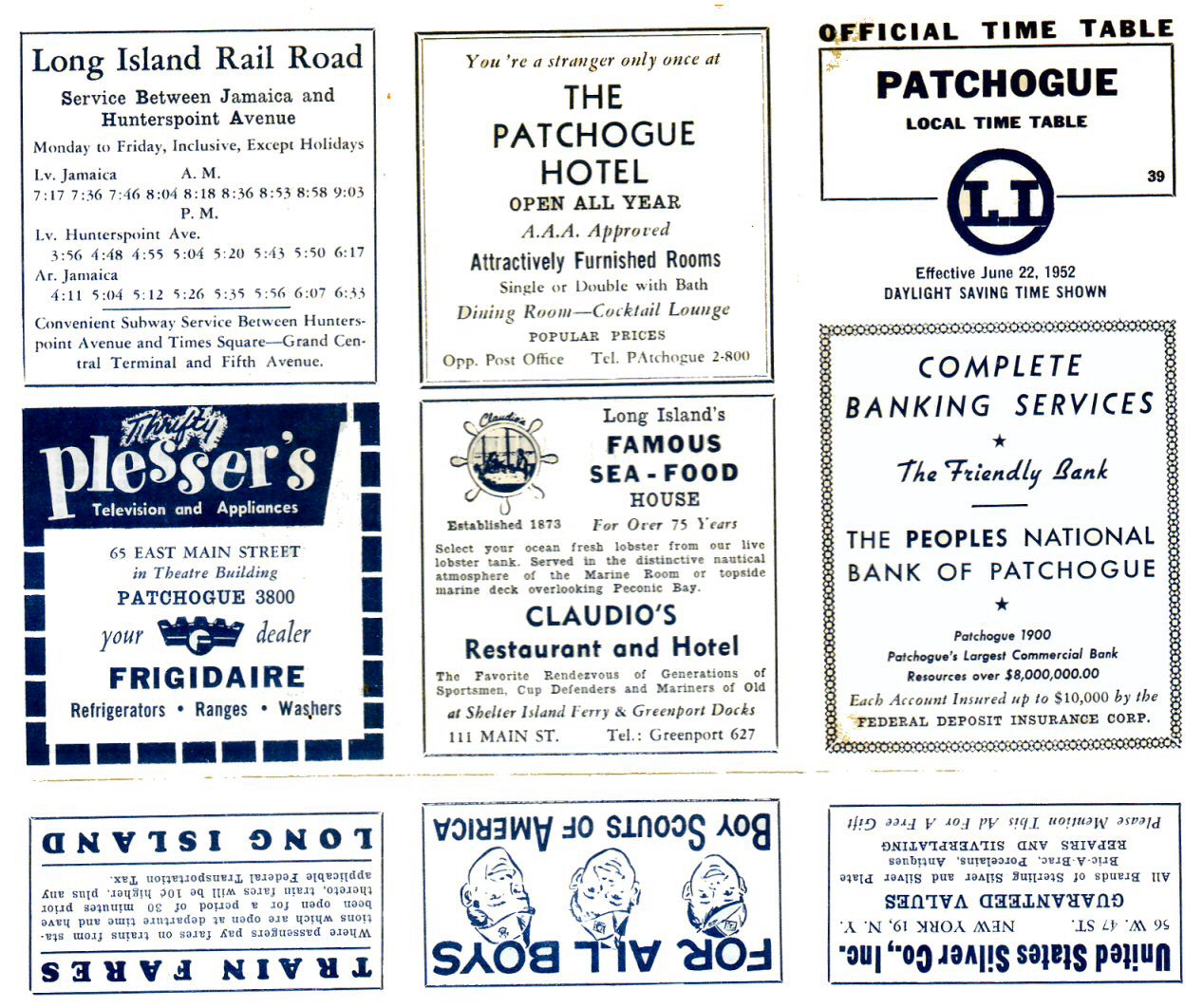 Patchogue timetable 6/22/1952 |
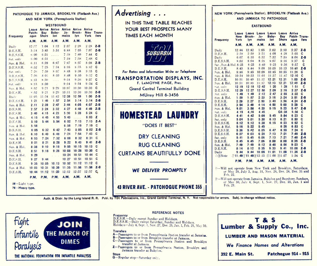 Patchogue timetable schedule 6/22/1952 |
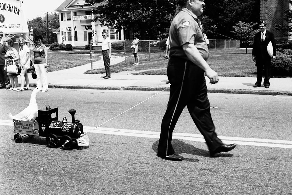 Mascot Memorial Day Parade -Patchogue 5/28/1973 Photo/Archive: John Jett A bit of Memorial Day LIRR whimsy: An early LIRR engine model 0-4-2 with the Long Island Duck tender mascot. |
|
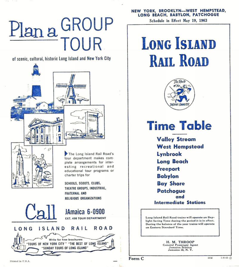 Timetable cover - Valley Stream to Patchogue 5/19/1963 |
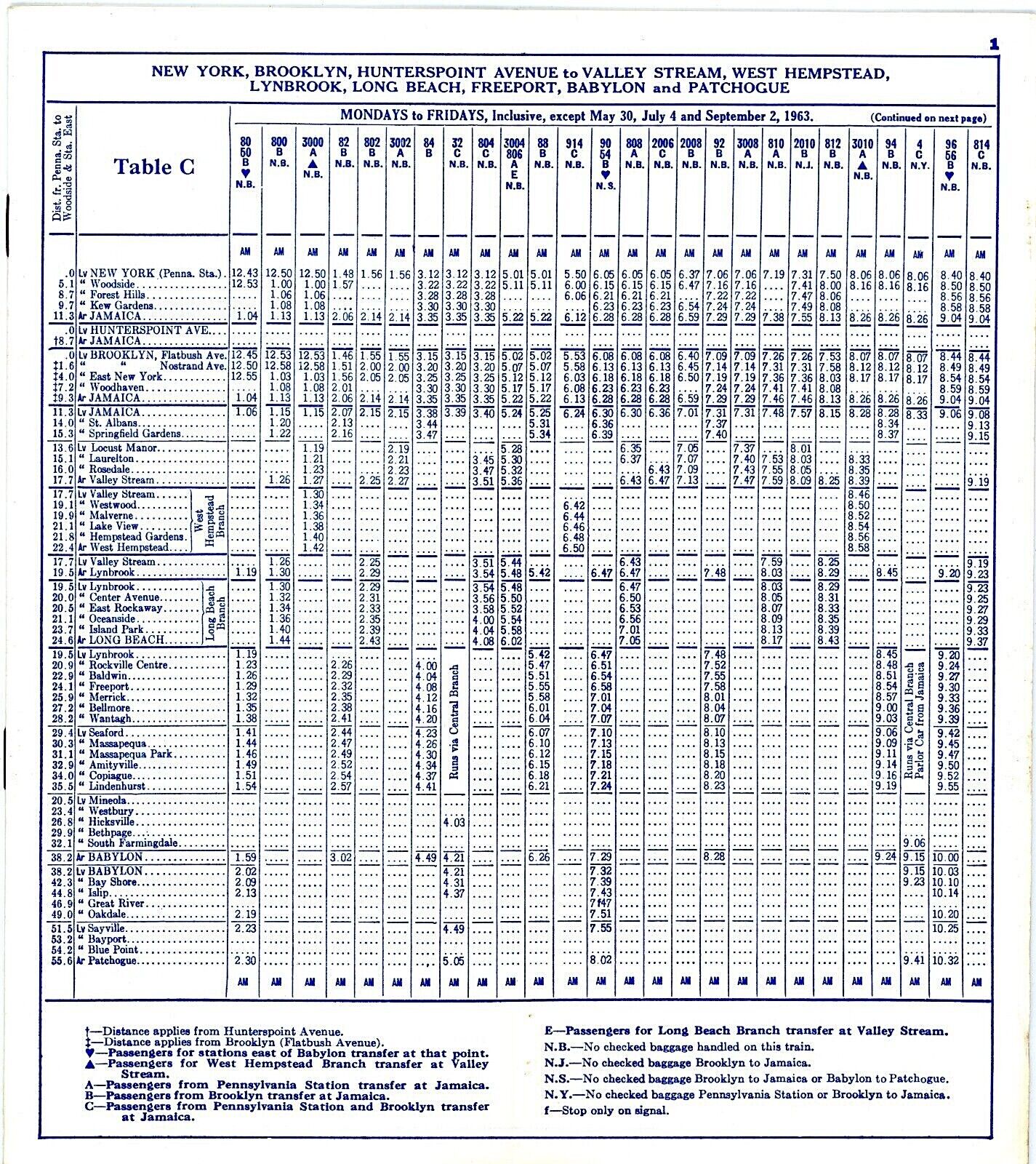 Timetable- NY Penn to Patchogue 5/19/1963 |
||
 Dodge City: SW corner of Sunrise Hwy and Waverly Ave. Patchogue Post card c.1960 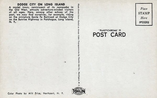
|
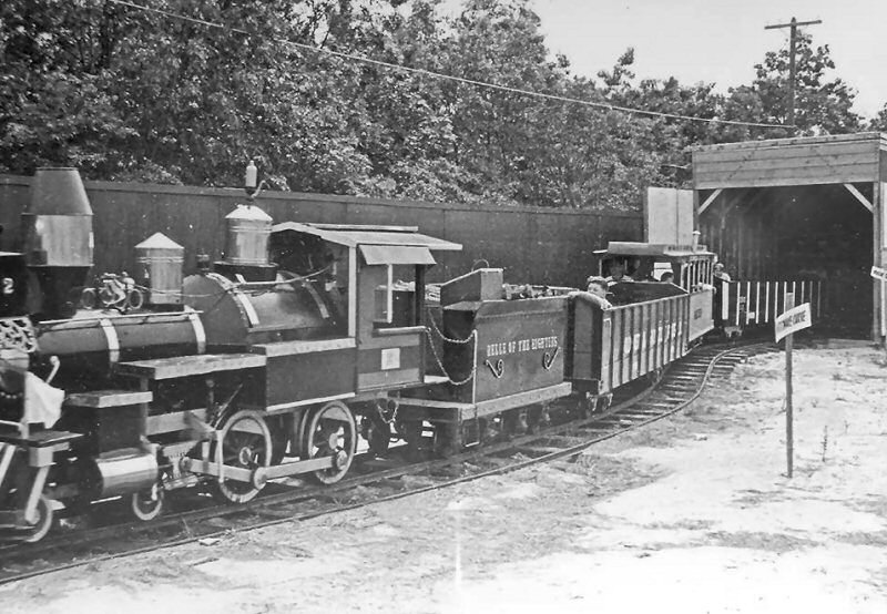 Dodge City train Patchogue c.1960 Archive: John Jett
|
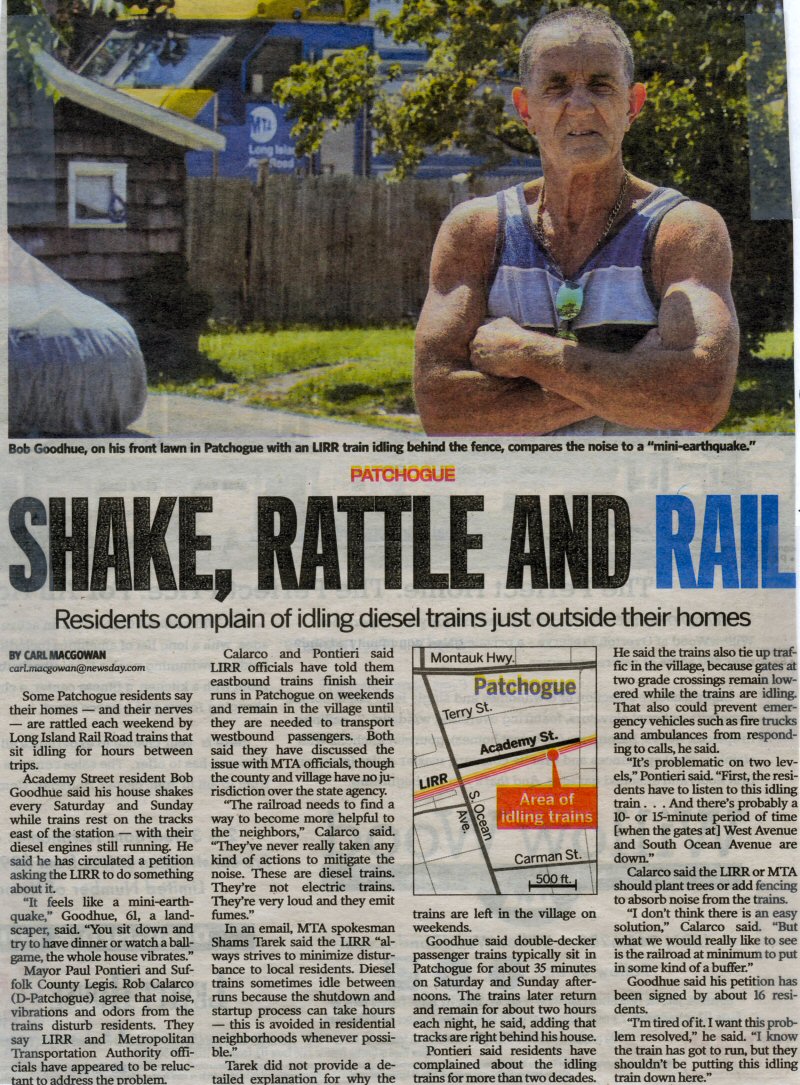 Newsday: SHAKE, RATTLE AND RAIL Patchogue Station Noise 8/21/2017 Archive: Dave Morrison |
|
| Patchogue Page 1 | |||
 Patchogue


