|
LIRR GRADE CROSSING ELIMINATION PROJECTS |
||||||
|
1930's DEPRESSION ERA LIRR PROJECTS |
||||||
|
The
Jamaica East Improvement project, elevating Union Hall St., adding
high-level platforms at Hillside, and the elevated flyover of the
"Springfield" branch
at Holban Yard/Hillside completed in late 1930. Elevation of Corona Station with the related grade crossing elimination project in 1930. Elevation of Ozone Park station with the related grade crossing elimination project in 1930. Removal of the Whitestone branch tracks and structures in 1932. Elevation of Valley Stream station with the related grade crossing elimination project in 1933. Elevation of St. Albans station with the related grade crossing elimination project in 1935. Elimination of Great Neck station grade crossing in 1935. Elevation of Springfield Gardens with the related grade crossing elimination project in 1936. Elevation of Deer Park station with the related grade crossing elimination project in 1937. Elevation of Smithtown station with the related grade crossing elimination project in 1937. Construction of the Ronkonkoma new depot in 1937. Elevation of Lynbrook station with the related grade elimination project in 1938. Elimination of Atlantic branch grade crossings in 1939. Removal of the Wading River extension AND the Sag Harbor branch tracks and structures in 1939. Elevation of Aqueduct station with the related grade crossing elimination project in late 1939/early 1940. Elevation of Edgemere, Arverne (Gaston Ave.), Arverne (Straiton Ave.), Frank Ave. and Wavecrest with the related grade crossing elimination projects all begun in 1940. Elevation of Medford station with the related grade crossing elimination project in 1940. Construction of the elevated Republic station for Republic Aviation with the related grade crossing elimination project in 1940. Construction of the elevated Woodhaven Junction station and new "OZONE" interlocking tower on the Rockaway Beach branch, replacing the old wooden structures, in 1940-41. Hammels, Holland, Playland and Seaside stations were elevated with their related grade crossing elimination projects in 1941-42, but as they were underway when we entered the war, I don't know if they would count as depression-era projects, as the Great Depression was technically over with the arrival of WWII. Pretty impressive accomplishments as these depression-era projects, carried out by the LIRR, despite hard times, tight funds, large payroll, a large equipment roster, and low fares. Research: Dave Keller |
||||||
|
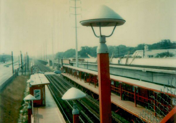
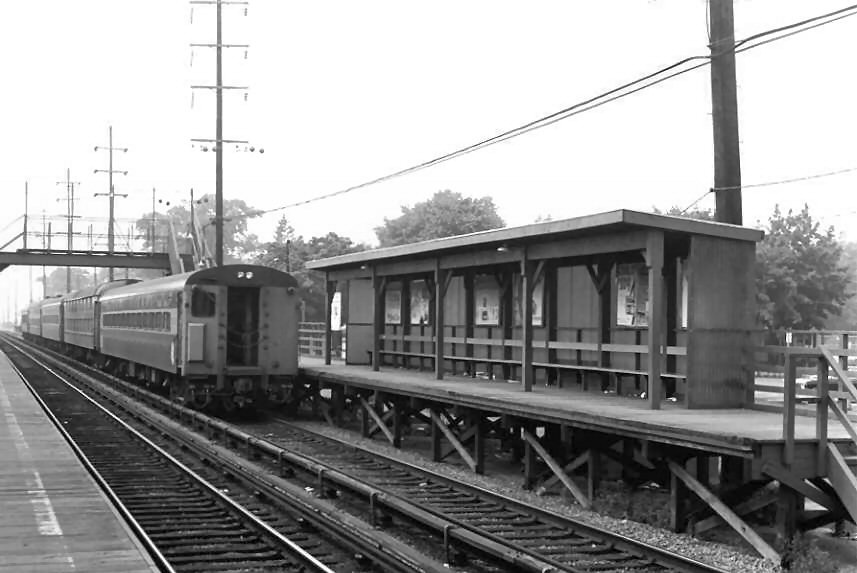
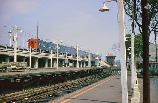
Valley Stream Station Elevation - Grade Crossing Elimination Project 1932-1933 |
||||||
|
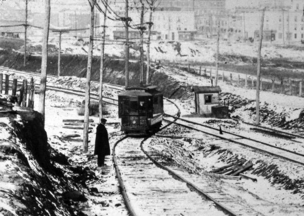
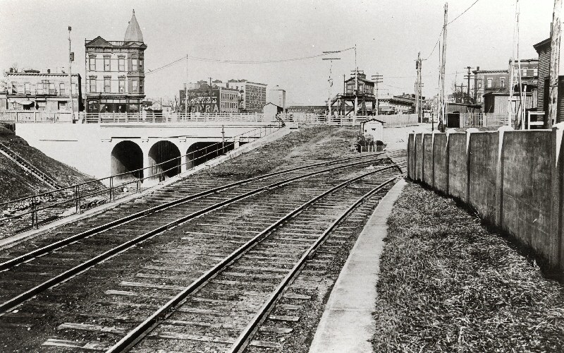
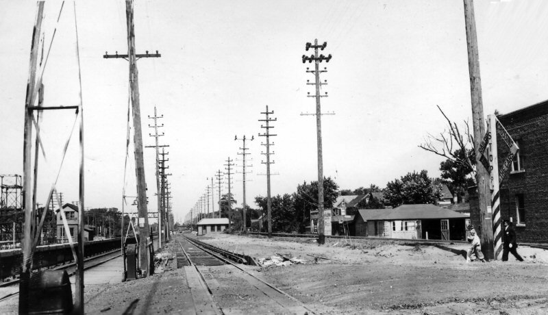
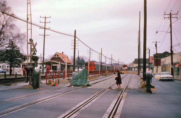
VALLEY STREAM: South Side Rail Road service began: 10/28/1867. Depot opened: 7/1869 with opening of branch to Far Rockaway. Built inside the legs of the wye.
2nd depot built at same location or
the original depot remodeled: c. 1881 out of service: 8/10/32 due to grade
crossing elimination project. Razed: 1933. Temporary station relocated on
shoo-fly north of former location in svc: 8/10/32 tracks and station
platforms on Far Rockaway Branch out of service: 8/31/32. Elevated
temporary tracks and platforms on Far Rockaway Branch in service: 2/7/33.
The project lasted 4 1/2 months in 1932 and 6 to 8 1/2 months in 1933. |
||||||
|
|
|
|
|
|||
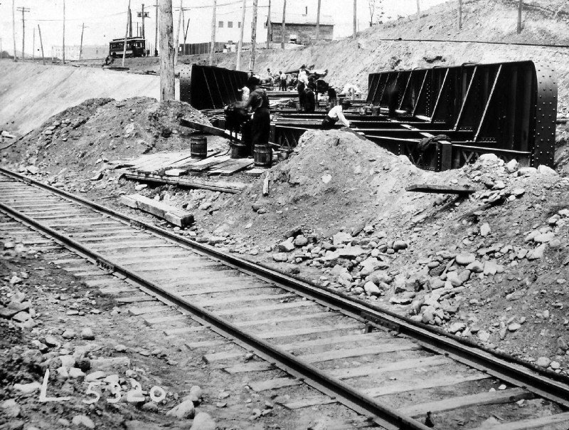
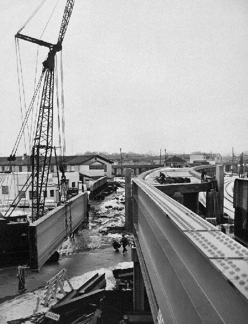
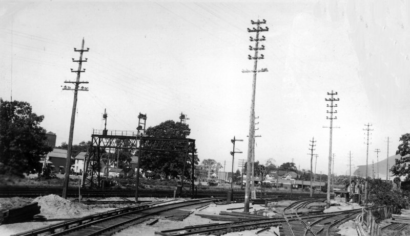 Looking westward at the point where the West Hempstead Branch joins the Main Line. Showing temporary track laying on Pipeline preparatory to abandonment of at grade line. Location known as "HW" interlocking. July, 1932 |
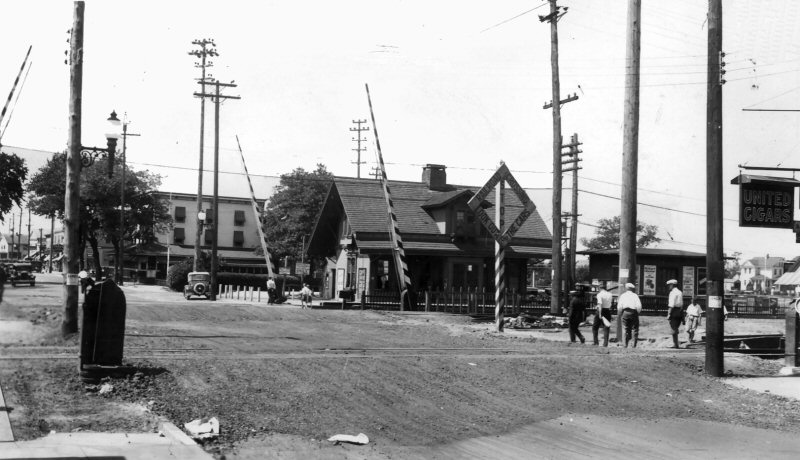 Temporary tracks across Rockaway Ave after being filled in. Old station and express shed in background June, 1932 |
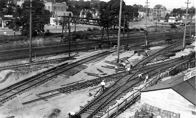 View of crossovers, etc. "HW" in course of construction showing how piles and trestle were used to carry the rail line over brick and iron pipe line. At grade line in background in 100% service Early July, 1932 |
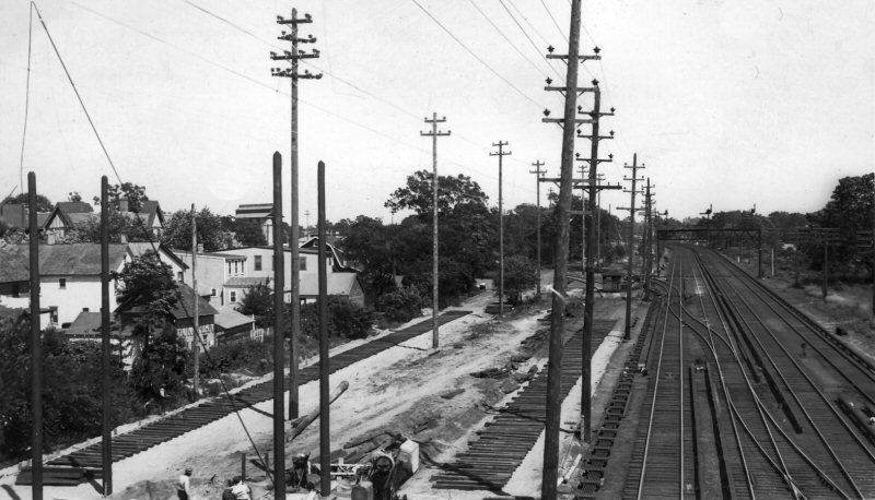 View east from #52 signal bridge showing temporary line being constructed. At grade tracks still 100% in service. Old "VA" switches 16-18, 22 in foreground. June, 1932 Temporary "HW" cabin in distance at junction of W. Hempstead branch. |
|||
|
"HW CABIN": West of HaWthorne Ave., Valley Stream. Controlled temporary connection to the West Hempstead branch. US&S 11-lever style TC table machine in service: 8/10/32 on account of Valley Stream grade crossing elimination. Out of service: 6/27/1933. Research: Dave Keller |
||||||
|
Photos/Captions: Win Boerckel Archive:
Dave Morrison except as noted. |
||||||
|
BAY RIDGE - MANHATTAN BEACH BRANCH - Grade Crossing Elimination Project 1905-1918 |
||||||
|
Crossing eliminations by street. Most are based on the dates on the elevated bridges/overpasses.
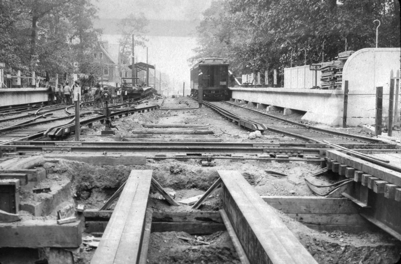
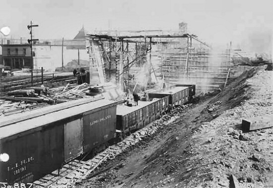
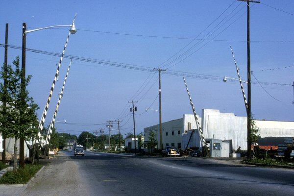
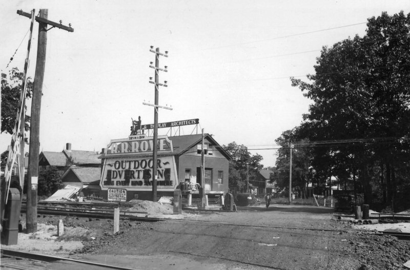
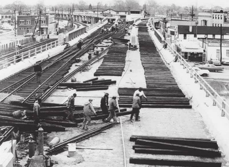
Info: Kevin Wong The LIRR performed a multi-year grade crossing elimination project that was an engineering marvel and which resulted in a combination of depressed and elevated ROW, with construction of many overpasses, underpasses, tunnels and elevated/depressed stations. What we may be seeing in the below image is probably temporary tracks laid for all the work trains and ore cars laden with fill. You can see the grade is at the left alongside the temporary work tracks. The newly-elevated ROW is at the right. Chances are all the wood framing in the image was for construction of retaining walls, overgrade crossings, etc. and may be in the process of being removed as is evidenced by the pile of loose lumber in no neat piles in the lower left portion of the image. |
||||||
|
Sea
Beach crossing where the LIRR was crossed by the BRT's Sea Beach line in
Brooklyn. In the images above you can see trolley wire overhead on the
BRT tracks, suspended by cantilevered supports attached to the telegraph
poles, as the BRT's trolleys ALSO used the at-grade EL's tracks as needed!
The girder bridge being installed so the at-grade crossing of the two lines
could be eliminated. |
||||||
 Sea Beach Crossing BRT car #1778 at LIRR Bay Ridge- 1911 Crossing guard has placed a signal flag on the LIRR's track (right) to warn trains that the trolley was crossing their ROW. |
 LIRR Bay Ridge Branch readying a double girder bridge at Sea Beach Crossing 1911 |
 LIRR tracks crossing BRT Brighton Line tracks at grade Avenue H Station, Brooklyn 1907 |
||||
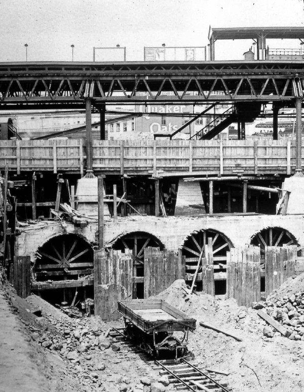 Station Fulton St. Tunnels under construction East New York 1913 |
 Station Fulton St. Manhattan Beach Branch East NY 1916 Archive: Art Huneke 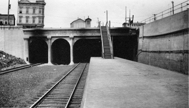 Station Fulton St. Tunnels Manhattan Beach Branch East NY 1924 Archive: Art Huneke
|
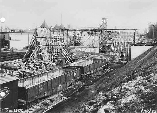
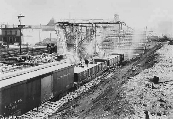 Bay Ridge Branch elimination valuation photo #887 LIRR #3191 boxcar 1/20/13 Archive: Art Huneke
|
||||
|
MONTAUK
BRANCH
In Order Going EAST, station name and opening day of elevation. Note: The temporary tracks constructed for the grade crossing elimination project at Amityville, Copiague and Lindenhurst (completed August 1973) were north of the then-existing tracks. Other projects constructed during that era (Wantagh-Seaford previously, Merrick-Bellmore and Massapequa Park later) had temporary tracks and stations on the south side adjacent to Sunrise Highway. Info: Mike McEnaney |
||||||
| Station Location |
In Service Date |
|||||
| Richmond Hill | c. 1924 |
 Hillside Ave and Babbage Street. Photo: Kevin Wong 7/27/2007 |
||||
| St. Albans | 10/22/1935 | |||||
| Springfield Gardens | 07/24/1936 | |||||
| Rosedale | 10/31/1950 | |||||
| Valley Stream | 02/07/1933 | |||||
| Lynbrook | 10/18/1938 | |||||
| Rockville Centre | 07/17/50 |
|
|
|||
| Baldwin | 10/02/1957 |
 Westbound at Baldwin Station 2/1957 |
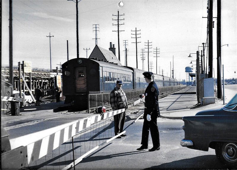
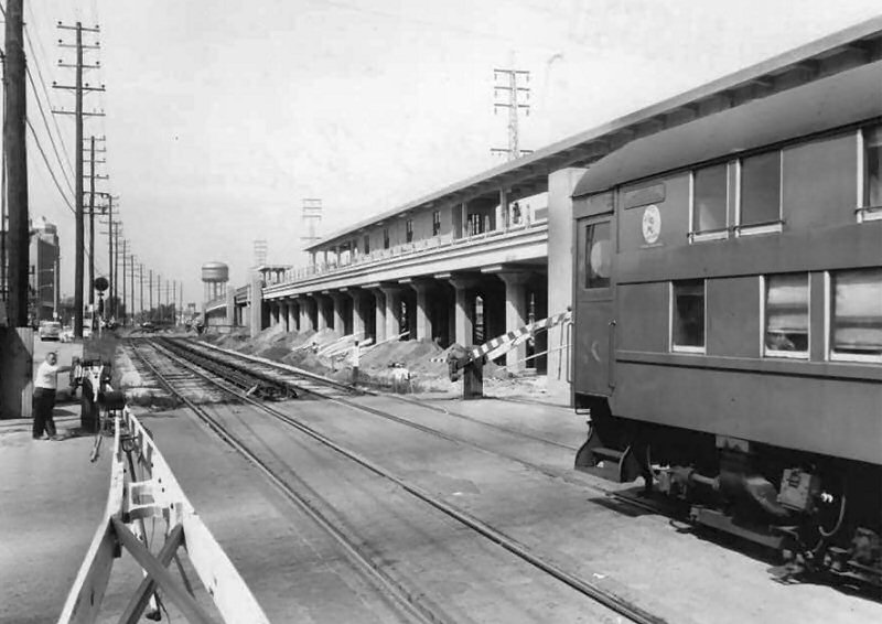
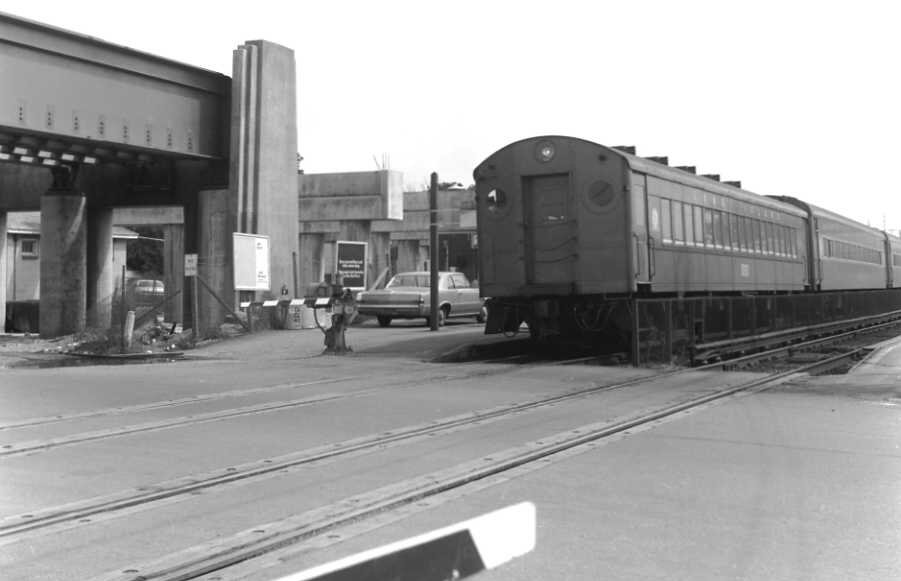
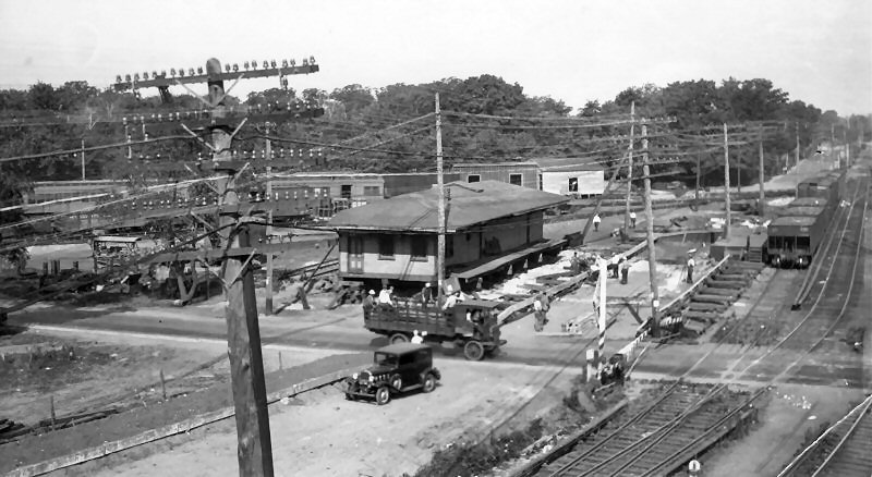
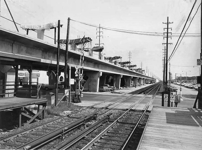
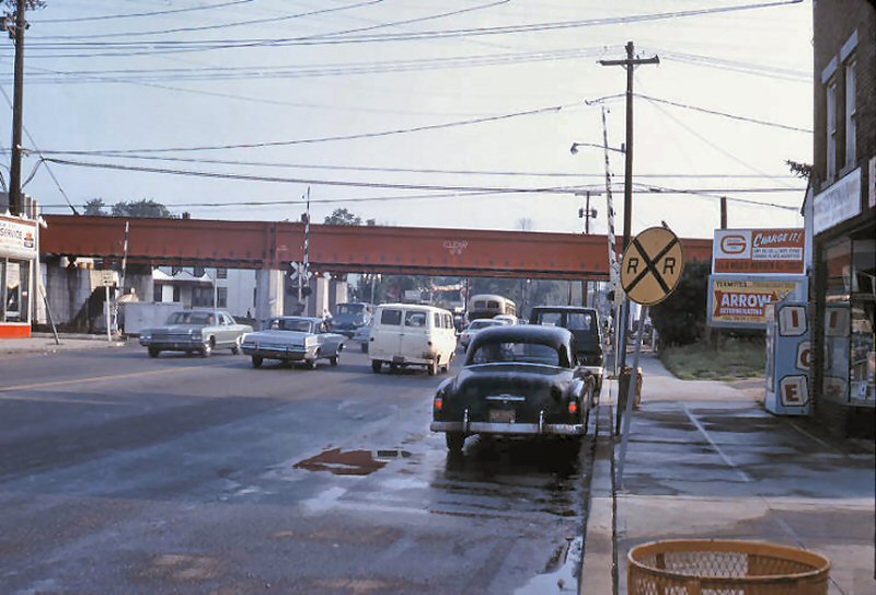
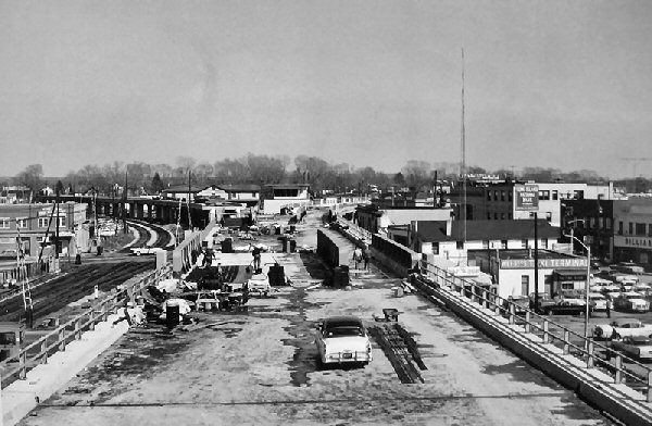
Grand Avenue grade crossing. A westbound is leaving Baldwin Station in Feb 1957 while the grade crossing elimination project is in full swing. One of Nassau Co. finest chats up a gate tender on this chilly mid winter afternoon. These shoo-fly tracks were placed in service 8/14-15/1956 and the elevation opened on 10/02/1957. |
|||
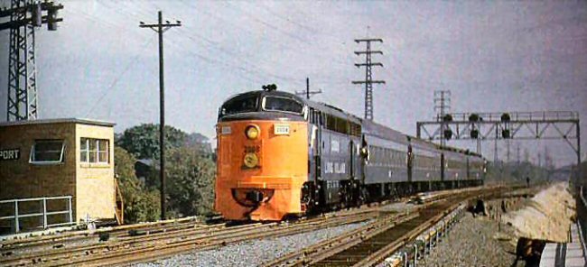
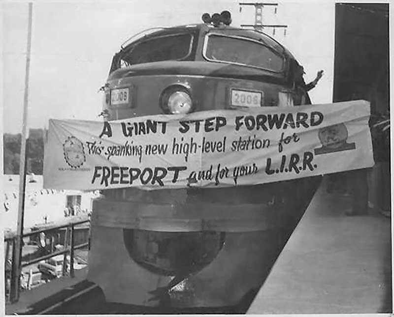
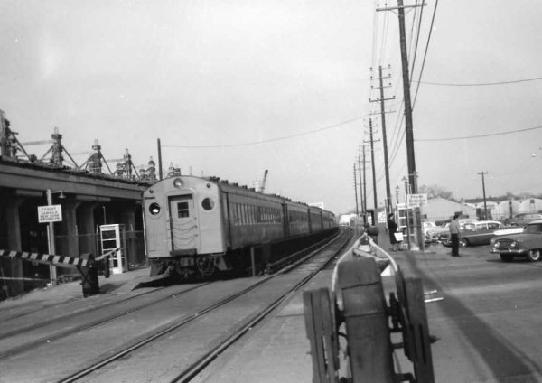
| Freeport | 10/08/1960 as per G.O. 709, eff. 10/08/1960 |
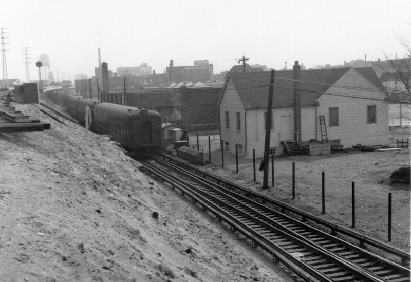
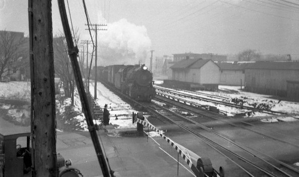 H10s Freight Eastbound past freight house View from PORT Tower c.1940 Archive: Dave Keller |
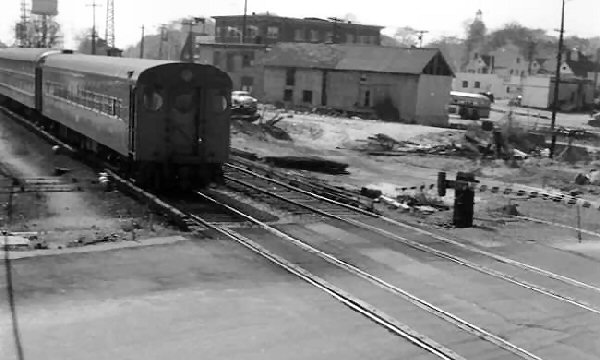 Freeport MU eastbound view from PORT Tower past the same location (Henry St. crossing) in 1959 during the grade elimination. Old warehouses remains, the freight house is gone. Info/Archive: Dave Keller |
|||
|
|
|
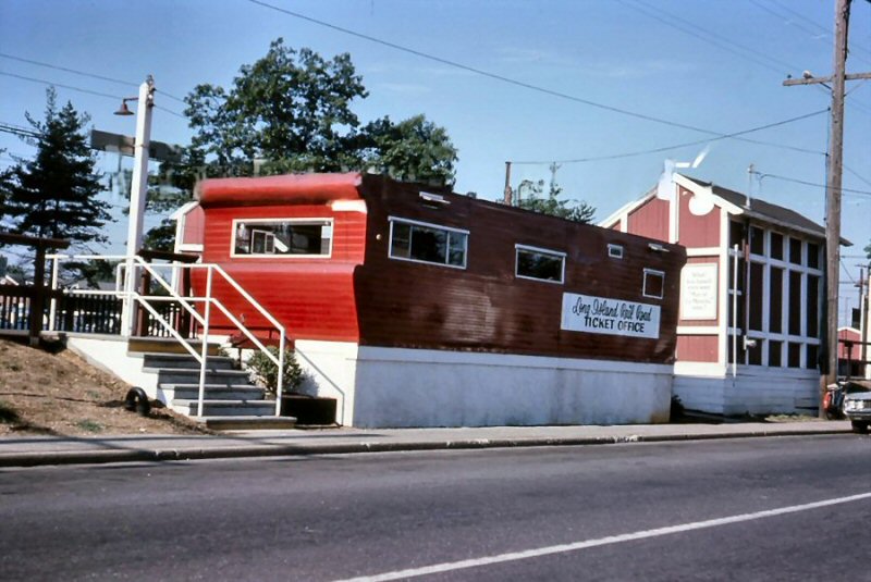
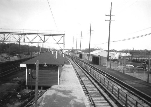 Freeport Temporary Station Archive: Dave Keller |
%20-%20Summer-1959%20(Keller).jpg) MU Double Deck & Train eastbound at N. Grove St. crossing, Freeport View W - Summer 1959 Archive: Dave Keller |
|||
|
|
|
 Freeport Grade elimination temporary tracks View W 1960 |
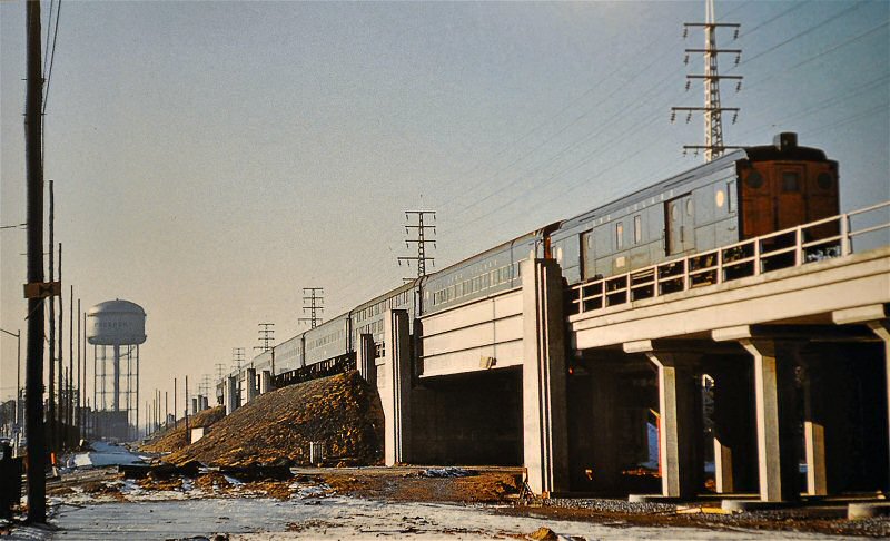 Freeport Grade Elimination Project completed View W 1/1961 Archive: Steven Waldman |
|||
| Merrick | 6/28/1975
|
 MU train passing Merrick temporary station View W 1968 (Dave Keller archive) .jpg) Merrick Station Grade Elimination - view E c. 1968 (Dave Keller archive) |
.jpg) Zoomed-in view of the old Merrick Station looking east from the pedestrian crossover of the temporary station facilities in c. 1968. (Dave Keller archive)
|
|||
|
|
||||||
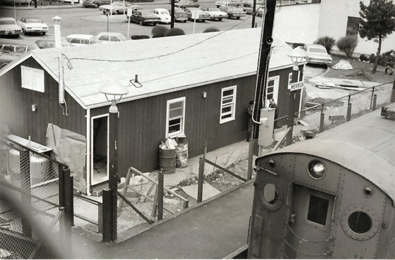 Merrick temporary ticket office on N side of tracks 3/1969 Archive: Merrick Library 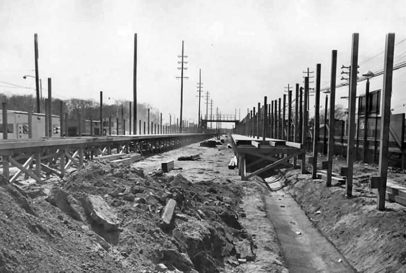 Merrick temporary station construction - View W 4/1969 Archive: Merrick Library 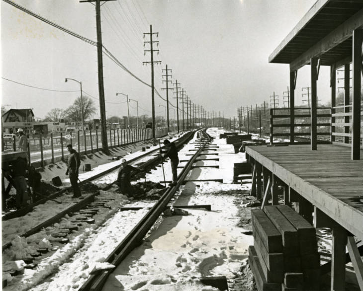 Merrick Station temporary track install - View W 1/1970 Archive: Merrick Library |
 Merrick temporary station - View E 1/1971 Archive: Merrick Library  Merrick Ave - View NE 2/1974 Archive: Merrick Library The concrete beam across Merrick Avenue has recently been put in place. The Warning sign reads: Danger. Stop. Trains may be approaching from either direction. 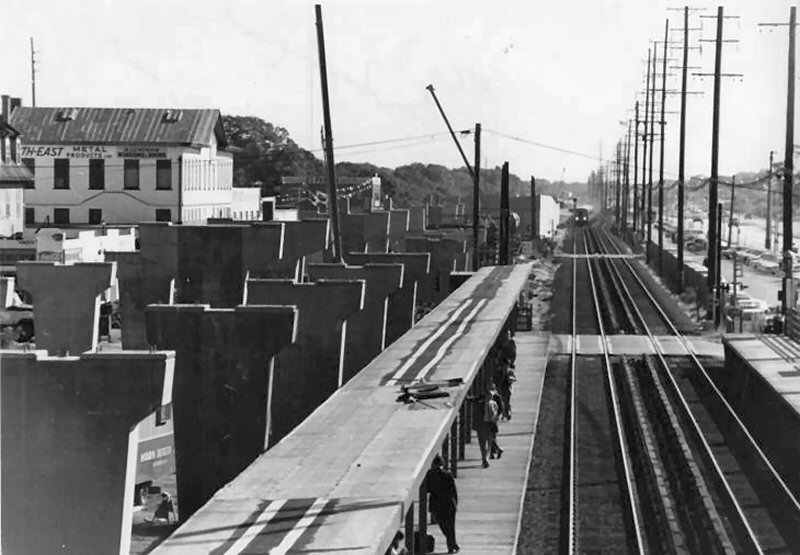 Merrick Station - Merrick Ave - View E 1974 Archive: Merrick Library |
|
|
|||
| Bellmore | 6/28/75 |
 View east 11/11/1974 Photo: William J. Madden Archive: Capt. William Gilligan, US Navy |
 Bellmore view E towards Bedford Ave 11/11/1974 (William J. Madden-Wantagh Preservation Society) |
|||
|
|
 Bellmore - View E 6/27/1975 (William J. Madden-Wantagh Preservation Society) |
 Bedford Ave., Bellmore - View E 6/27/1975 (William J. Madden-Wantagh Preservation Society) |
 Bellmore view W towards Centre Ave 6/27/1975 (William J. Madden-Wantagh Preservation Society) |
|||
| Wantagh |
10/22/1968
|
|
|
|||
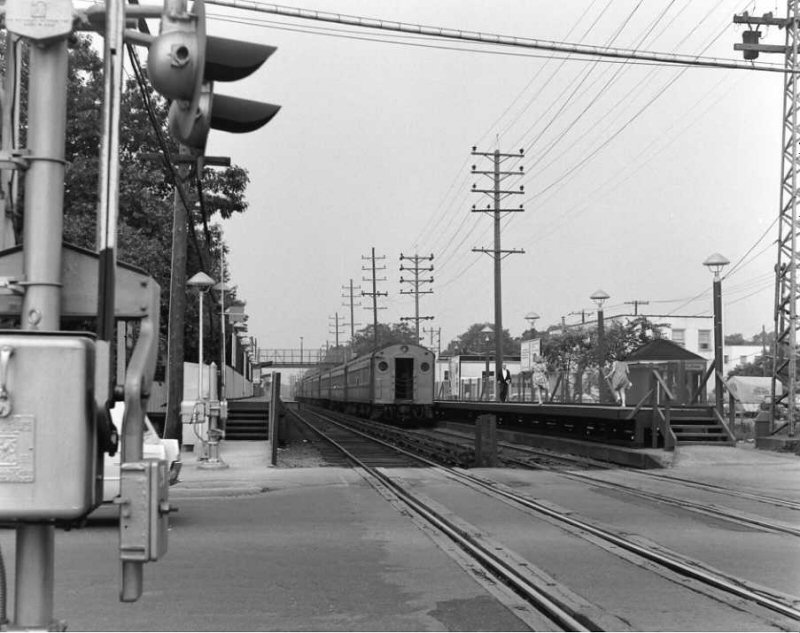
 Wantagh MU train passing Elimination Project Archive: Dave Keller |
 Wantagh Station during elevation work Archive/Photo: Brad Phillips |
 Wantagh - Seaford Grade Crossing Elimination Archive/Photo: Brad Phillips |
||||
| Seaford | 10/22/68 |
 Seaford Elimination Elevation West Archive: Dave Keller |
 Seaford Temp Station and Elimination Elevation East Archive: Dave Keller |
|||
|
|
||||||
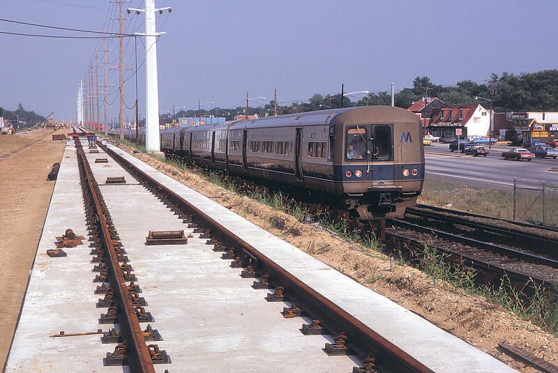
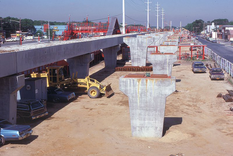
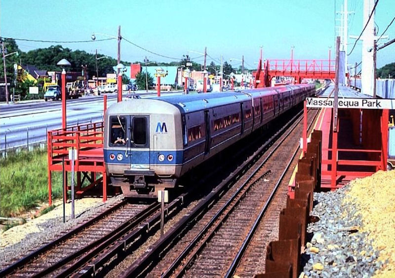
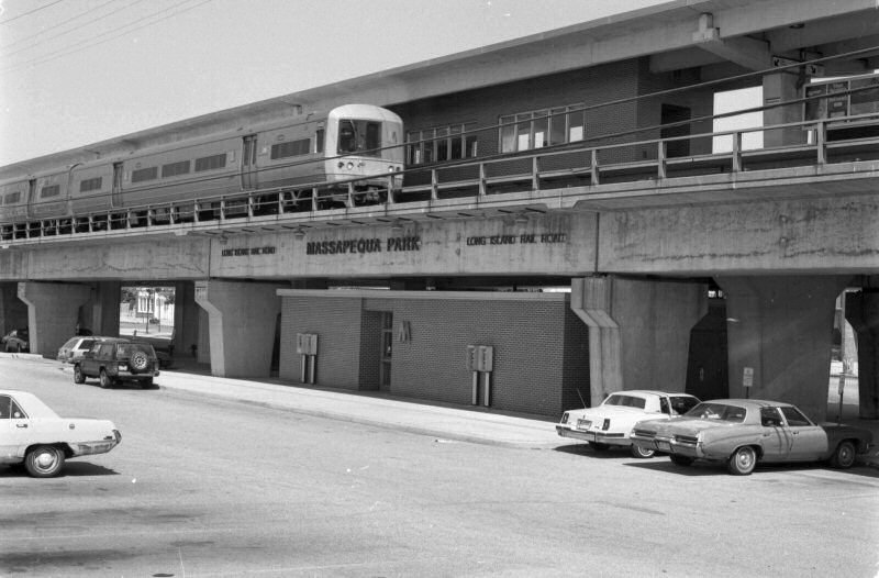
| Massapequa |
12/14/53 | |||||
| Massapequa Park |
12/13/1980
|
|
|
|||
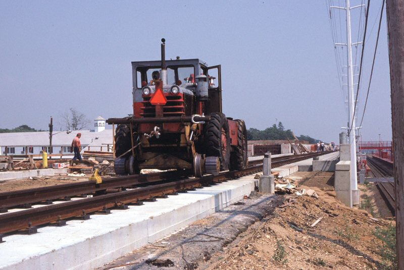 Massapequa Park - grade crossing elimination - Pettibone 441B tractor 1979 Photo: Paul De Luca |
 Massapequa Park - grade crossing elimination View E 1979 Photo: Paul De Luca |
 Massapequa Park - grade crossing elimination View W - 1979 Photo: Paul De Luca |
 Massapequa Park temporary facilities LIRR M1 eastbound 6/18/1979 Photo: Paul De Luca |
|||
 Massapequa Park July 1979 view west towards Park Blvd Photo: Capt. William Gilligan, US Navy
|
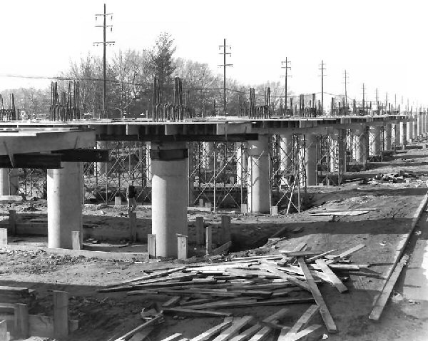
 Massapequa Park elevated station in distance View E 12/13/1980 Photo/Archive: Bill Mangahas
|
As I witnessed, the temporary west bound track was severed and shifted to align with the new westbound track. Then, rail joints were welded or bolted, ballast dumped, then tamped and the new westbound track was now connected. Bill Mangahas |
|
|||
| Amityville |
8/07/1973
|
|
|
|||
| Copiague | 8/07/1973 |
|
||||
| Lindenhurst | 8/07/1973 |
|
||||
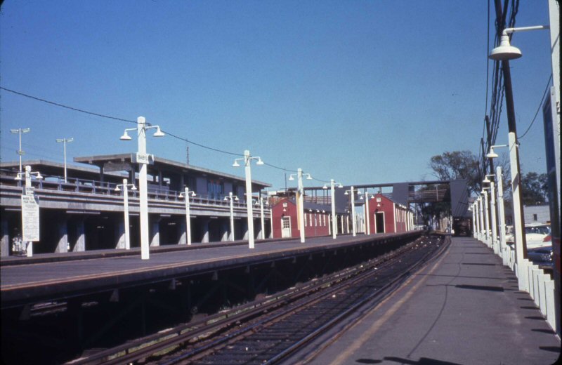
| Babylon |
9/09/1964
|
Note:
As temporary, the roof and the
stairwell for the pedestrian crossover have not been shingled.
|
|
|||
| The Montauk Branch between Jamaica and Babylon is completely grade-separated.
The grade reconstruction program lasted 30 years, 1950-80, beginning at Rockville
Centre in 1950 and ending at Massapequa Park in December 1980.
Abandoned freight sidings: Some that come to mind, west to east. 1)
West
of St-Albans are remains of former freight sidings that used to
trail eastbound into Montauk 2. |
||||||
| East
Islip Carleton Ave (old Rt 111) |
04/1932 |
|
||||
| Sayville (Rte 27) | 1931 |
|
||||
| Hampton Bays (Rte 27) | 07/1929 |
|
||||
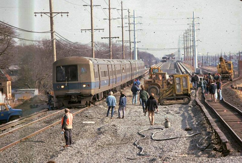
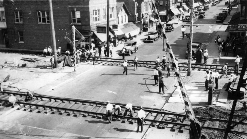
| A few more details on crossing signals of that time period were the number of tracks sign was black background with white letters, which is the opposite of what they use today. The last black and white stripped crossing gate I saw was in late 1978 at the Second or Third Ave crossing just east of Bay Shore. The first time I saw the red and white stripped single plank fiberglass gates similar to those in use today were around 1973-4 at Yaphank and a few crossings east of Patchogue. By the late 1970's the Massapequa Park group had the single plank fiberglass style gates. The last dual-plank gates I remember seeing were in the mid 1990's along the main line at Lowell Ave, Rte 111, Merritt's Rd, Broadway, Grumman Private Crossing and Herrick's Rd, which were stripped red and white. Around 1974, the LIRR went on an aggressive program to put automatic crossing gates at all railroad crossings, especially the ones out east. By 1976, the Main Line west of Ronkonkoma had only Pond Road, 2nd St and Pine Aire Drive/Long Island Ave with flashing lights only. Recent developments have added electronic bells (vice the old mechanical style) at some locations, LED Flashers and larger roundels for the flashing lights. Author: Unknown | ||||||
|
PORT WASHINGTON BRANCH Crossing eliminations by street. Most are based on the dates on the elevated bridges/overpasses.
Info: Kevin Wong |
||||||
| Station Location |
In Service Date |
|||||
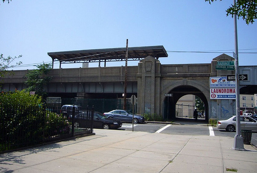
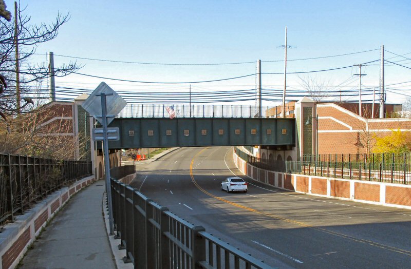
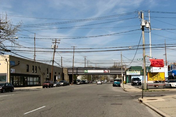
| Elmhurst | c. 1927 |
 Broadway & Whitney Ave, view SE Photo: Kevin Wong 8/19/2005 |
||||
| Corona | c. 1930 |
 National St. View NE Photo: Kevin Wong 4/04/2007 |
||||
| Flushing Main Street | 1913 | |||||
| Murray Hill | 1913 | |||||
| Broadway | 1913 | |||||
| Auburndale | 1930 | |||||
| Bayside | 1928 | |||||
|
MAINLINE
Other Stations: Crossing eliminations by street. Most are based on the dates on the elevated bridges/overpasses. Info: Kevin Wong Queens |
||||||
| Station Location |
In Service Date |
|||||
| Woodside | 10/17/15 | |||||
| Forest Hills | 1911 | |||||
| Kew Gardens | 1910 | |||||
|
Jamaica |
3/9/1913 |
|
 Jamaica elimination LIRR valuation #887 LIRR boxcar #3191 1913 Archive: Art Huneke |
|||
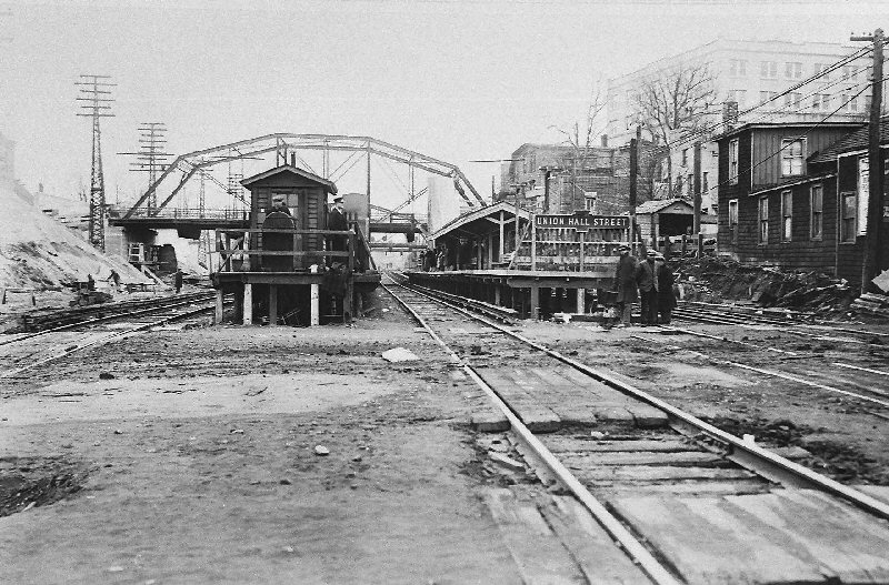
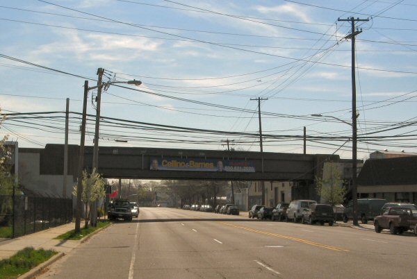
| Union Hall St. | Eastbound 6/21/1930 Westbound 2/26/1931 |
 Jamaica
Station at grade near Union Hall Street Archive: Dave Keller Jamaica
Station at grade near Union Hall Street Archive: Dave Keller While Jamaica was elevated in 1913, Union Hall St. was not part of that project. Union Hall St. was created as a substitute station stop to appease the riders who lived in the location of the OLD Jamaica station when it was at grade. It was near Union Hall Street. When the station was moved further west, the people felt they were being inconvenienced by having to trek all the way west to Jamaica so the LIRR gave them Union Hall St. station. After the grade elimination project was finished at Jamaica, the tracks leading up to that new elimination from east of the station, passing right through the former Jamaica station site were depressed BELOW grade level and the tracks were crossed by a combination of grade crossings as well as iron bridges.  Turntable at Washington St. near Union Hall Street Archive: Dave Keller Union Hall
St. station was newly-created and opened in 1913, and was later elevated
in 1930-31 as a result of the Jamaica East project, which stretched all the
way from east of Jamaica station up to and including Hillside station.
My father, an electrician for the LIRR at the time, actually wired the
elevated Union Hall St. station for lights.
|
||||
| Hillside | 10/01/30 |
|||||
| Hollis | 1915 | |||||
| Bellaire | 9/20/24 | Special
dedication ceremony opening day. |
||||
| Queens Village | 9/20/24 | Special dedication ceremony opening day. | ||||
| Bellerose | 11/08/62 | |||||
| Floral Park | 06/28/1962 More: Click Here |
|
|
|||
|
|
|
|||||
| Mineola
- Herricks
Road |
4/1998 |
|
|
|||
 Herricks Rd. - View View N 4/03/2021 Photo/Archive: Dave Morrison |
 Herricks Rd. - View View S4/03/2021 Photo/Archive: Dave Morrison |
|||||
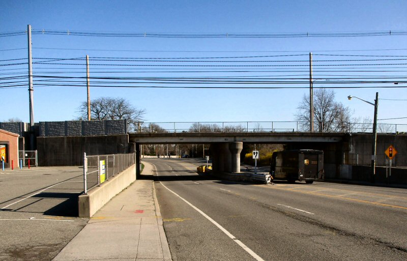
Roslyn Road |
2009 |  |
View S on the original Roslyn Road crossing at grade. It is looking towards the Mineola Court Complex, which is over Old Country Road and to the west out of the picture Main Street (right next to the tower) |
|||
|
|
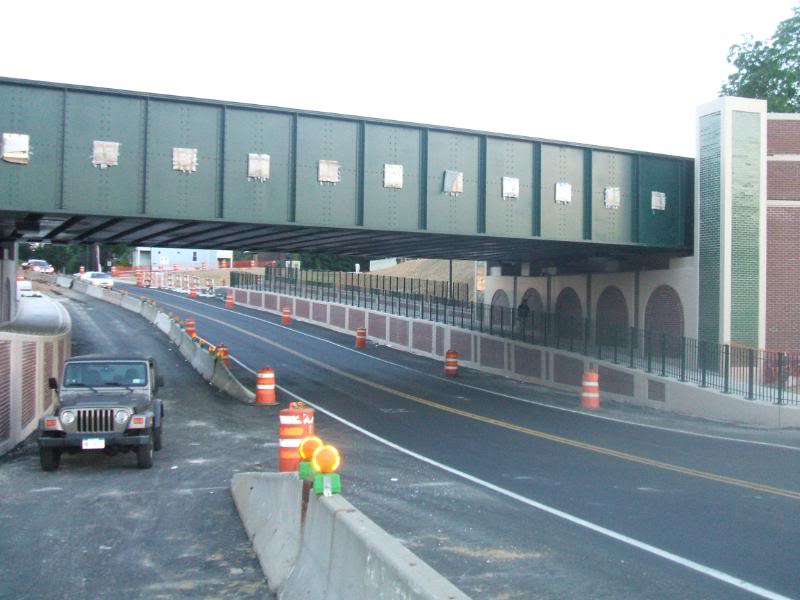 View N elimination project nearing completion. |
|||||
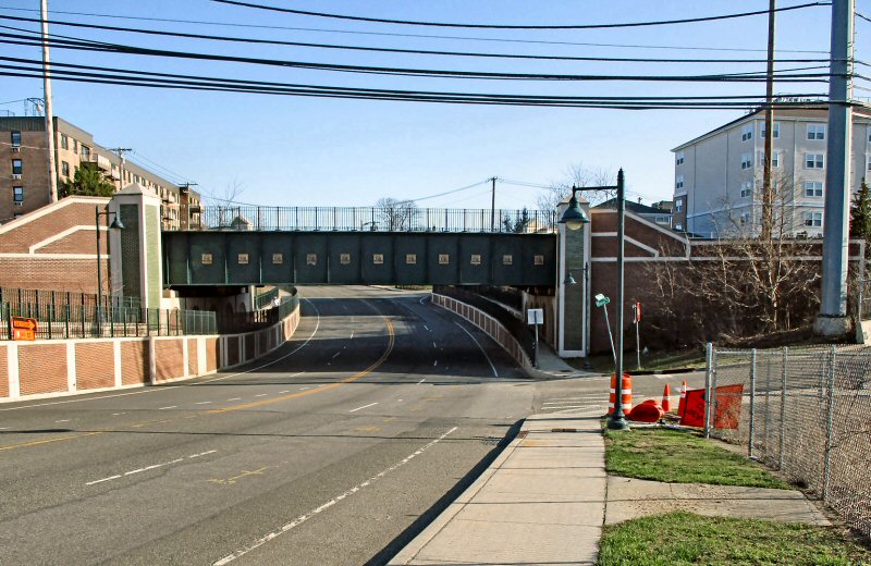 Roslyn Road view S 4/03/2021 Photo/Archive: Dave Morrison |
 Roslyn Road view N 4/03/2021 Photo/Archive: Dave Morrison |
|||||
| Charlotte Avenue | 1973? | |||||
Hicksville |
9/12/1964 |
|
 Lifting bridge girder Photo: Ed Bady |
|||
|
|
|
 "Taking down the gates" Photo: Ed Bady |
||||
| Hicksville - Bethpage Rd |
 Bethpage Rd view SE 08/1963 |
 Bethpage Rd view SE 4/07/2010 Photo: Al Castelli |
||||
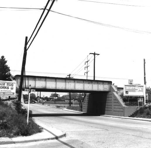
| Deer Park Ave. | 12/17/1936 |
|
More details: Deer Park |
|||
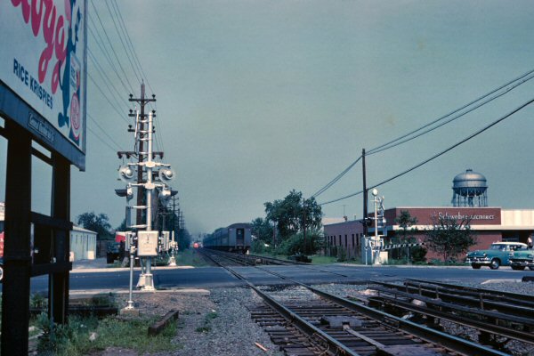
| Medford | 9/09/1940 | .jpg) Rt. 112 crossing at grade, looking north – 4/19/40 Albert Bayles photo, Dave Keller archive More details: Medford |
 The double-wide girder trestle over Rt. 112, looking northeast. 1969 Photo/Archive: Dave Keller |
|||
|
ATLANTIC BRANCH |
||||||
| Station Location |
In Service Date |
|||||
| Nostrand Ave | 1903 | |||||
| East New York | 1940 | |||||
| Woodhaven | 1942 | |||||
| Locust
Manor |
1959 | |||||
| Laurelton | 10/31/50 | |||||
| Rosedale | 10/31/50 | |||||
.jpg)

_Makse-Keller.jpg)
.jpg)


%20-%2006-23-63_Keller.jpg)

.jpg)
%20with%20Notes.jpg)
.jpg)
.jpg)

%20-%201936%20(Ayling-Keller).jpg)
%20-%201936%20(Ayling-Keller).jpg)
%20-%201936%20(Ayling-Keller).jpg)