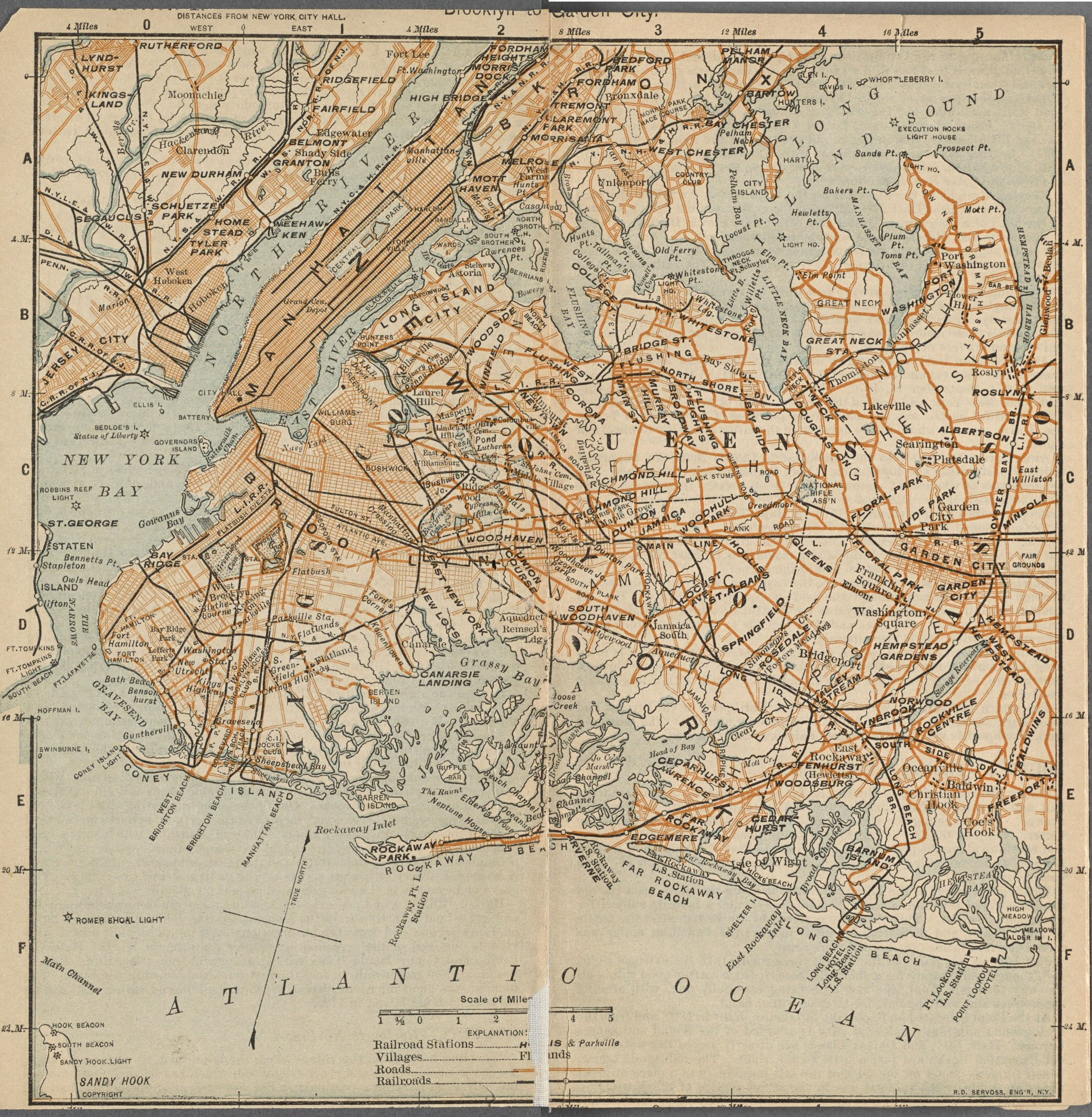
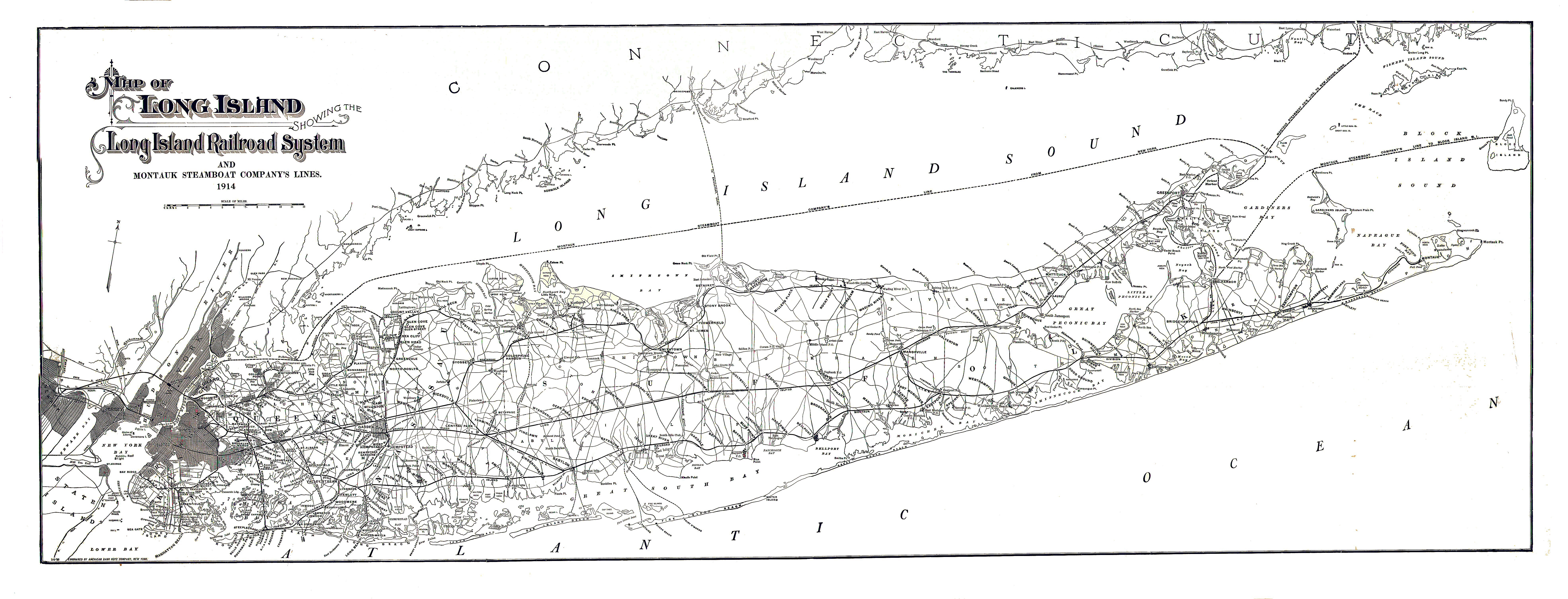
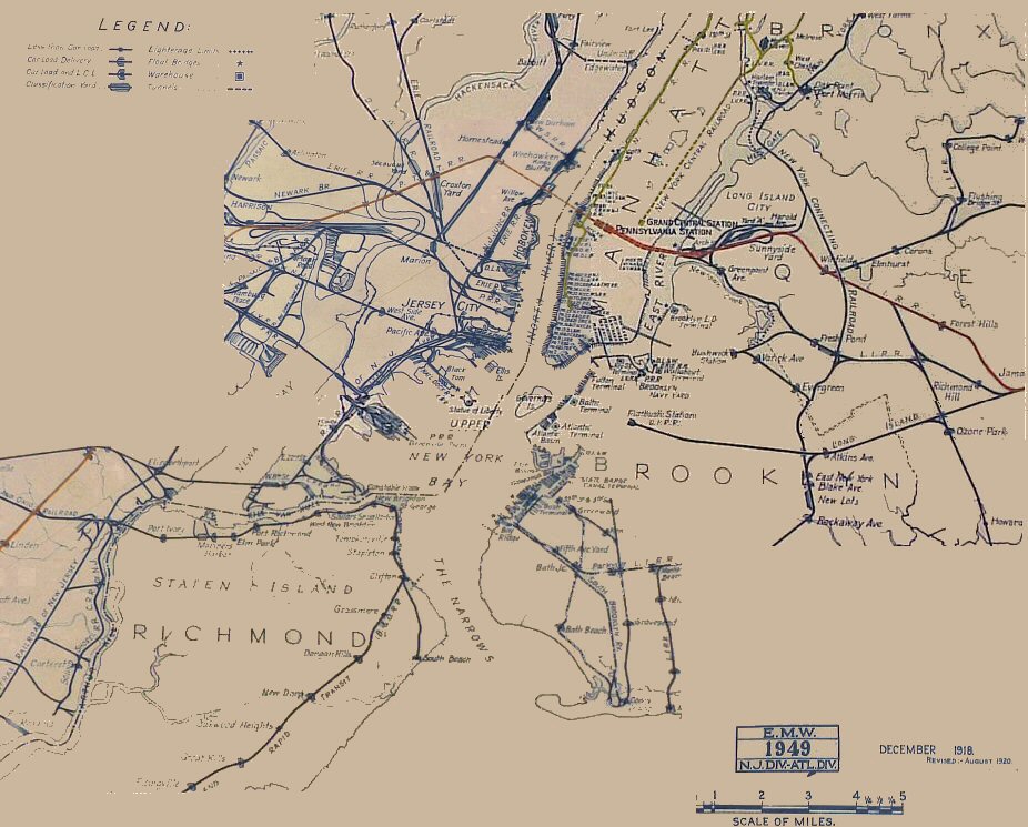
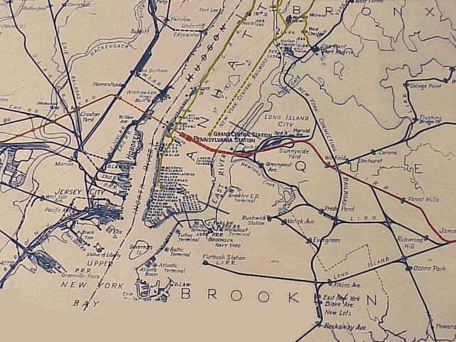
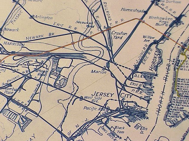
 LONG ISLAND - LIRR MAP ARCHIVES
 |
|||||
|
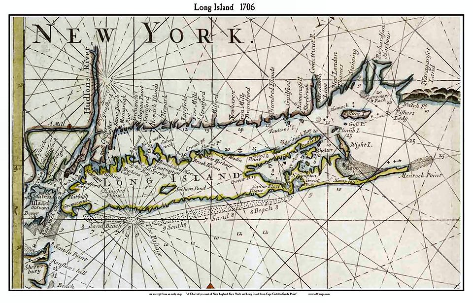
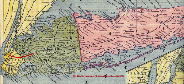
In 1609, the Dutch East India Company hired English sailor Henry Hudson to find a northeast passage to India. After unsuccessfully searching for a route above Norway, Hudson turned his ship west and One can see the early Dutch influence on place names such as Flatbush, Flushing, and Brooklyn as follows: Haarlem -> Harlem Native American influence abounds: Sachem
Pond (Lake Ronkonkoma), Mentock Point, Hamsted Plains, Meritiock Bay, etc. and
of course English influence: Hampton, New York, Newtown, Bedford, etc. all yield
a rich cultural naming influence early on that influences the current geographic
and place name history to this day! Info: Steven Lynch |
|||||
|
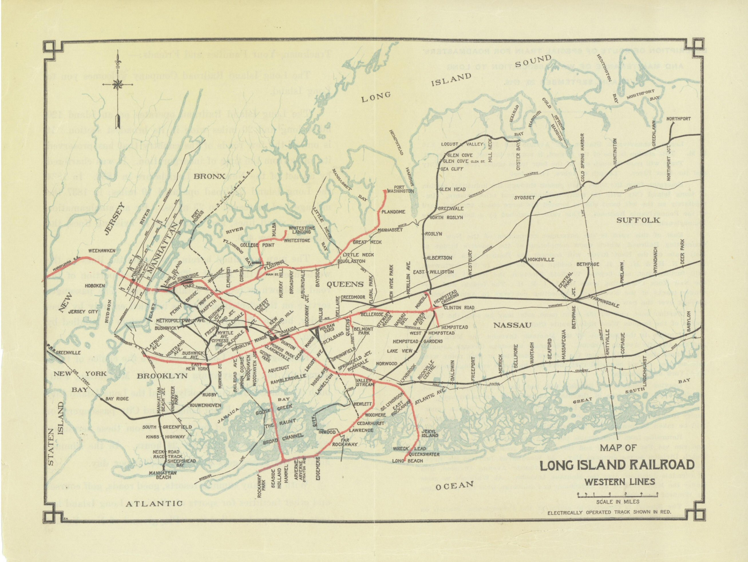
LIRR
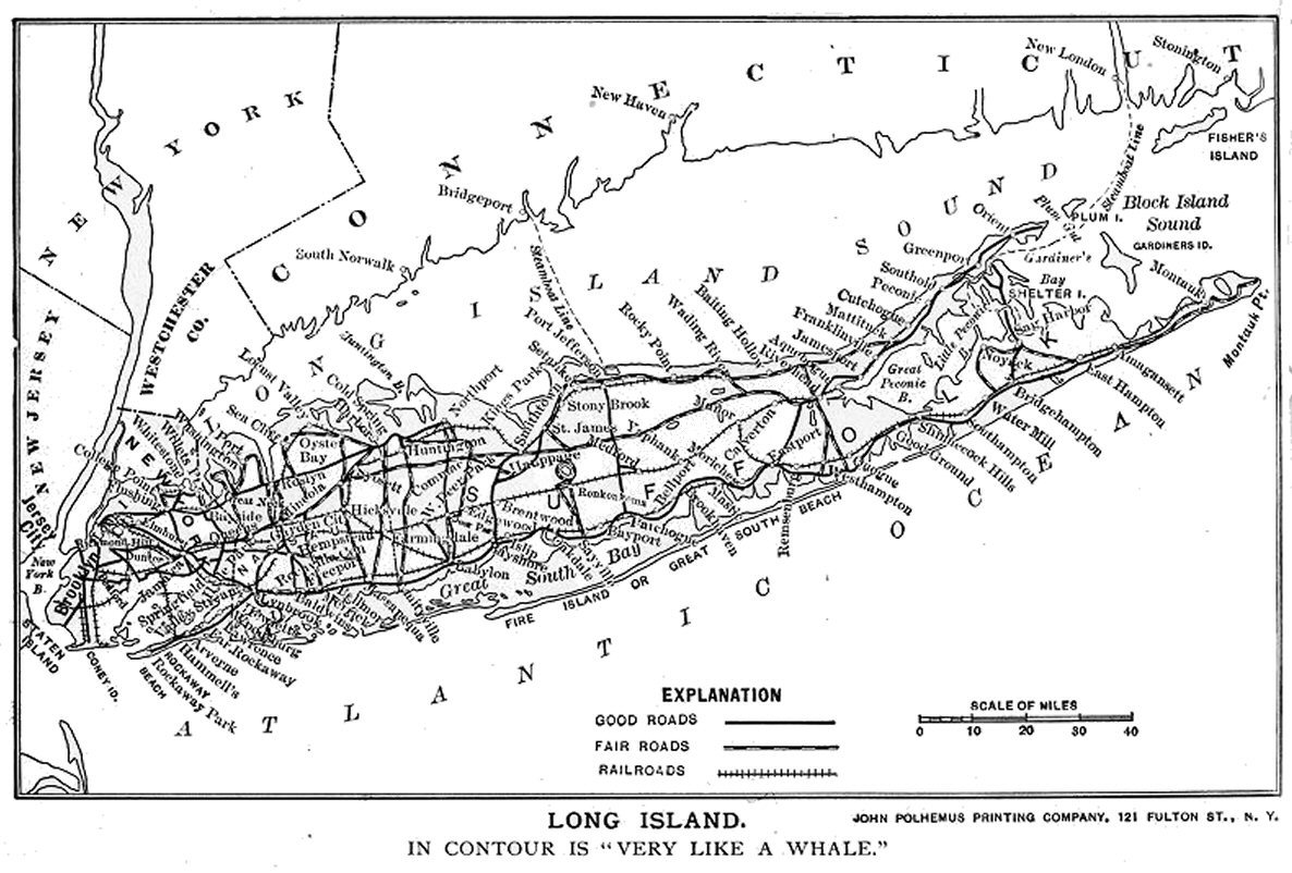
Fan Trips with Maps Topographic Maps:
|
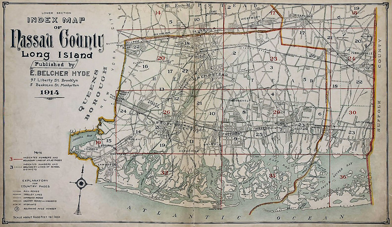
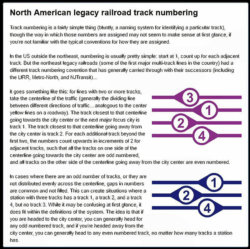 LIRR Legacy Track Numbering 1/02/2021 |
||||
|
|
|||||
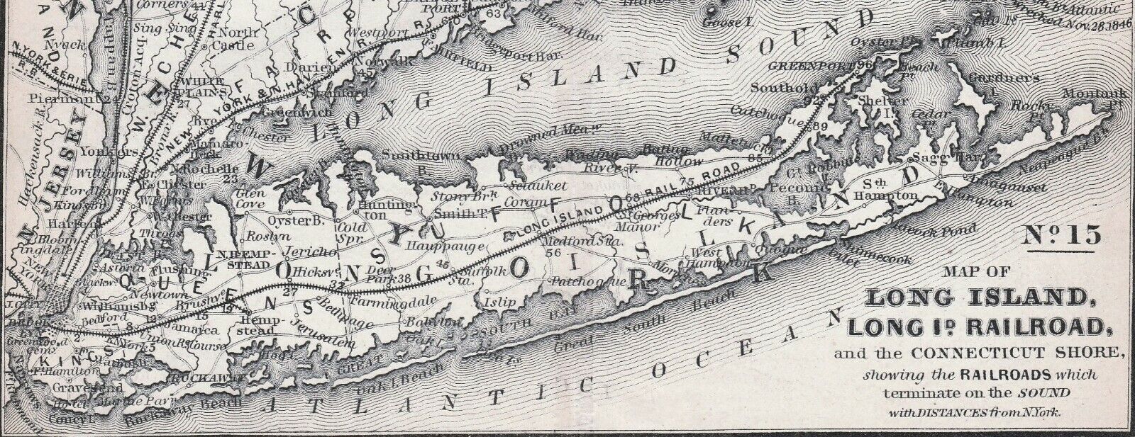
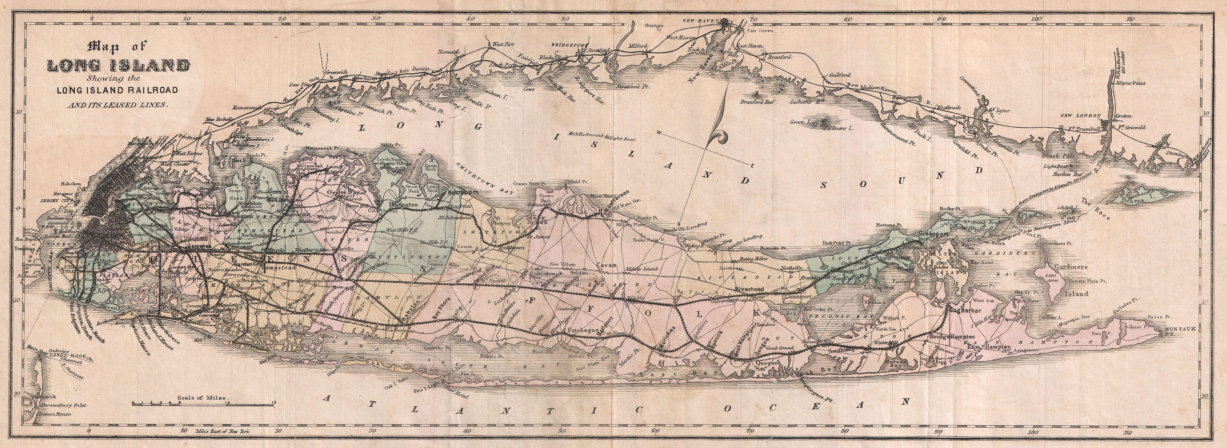
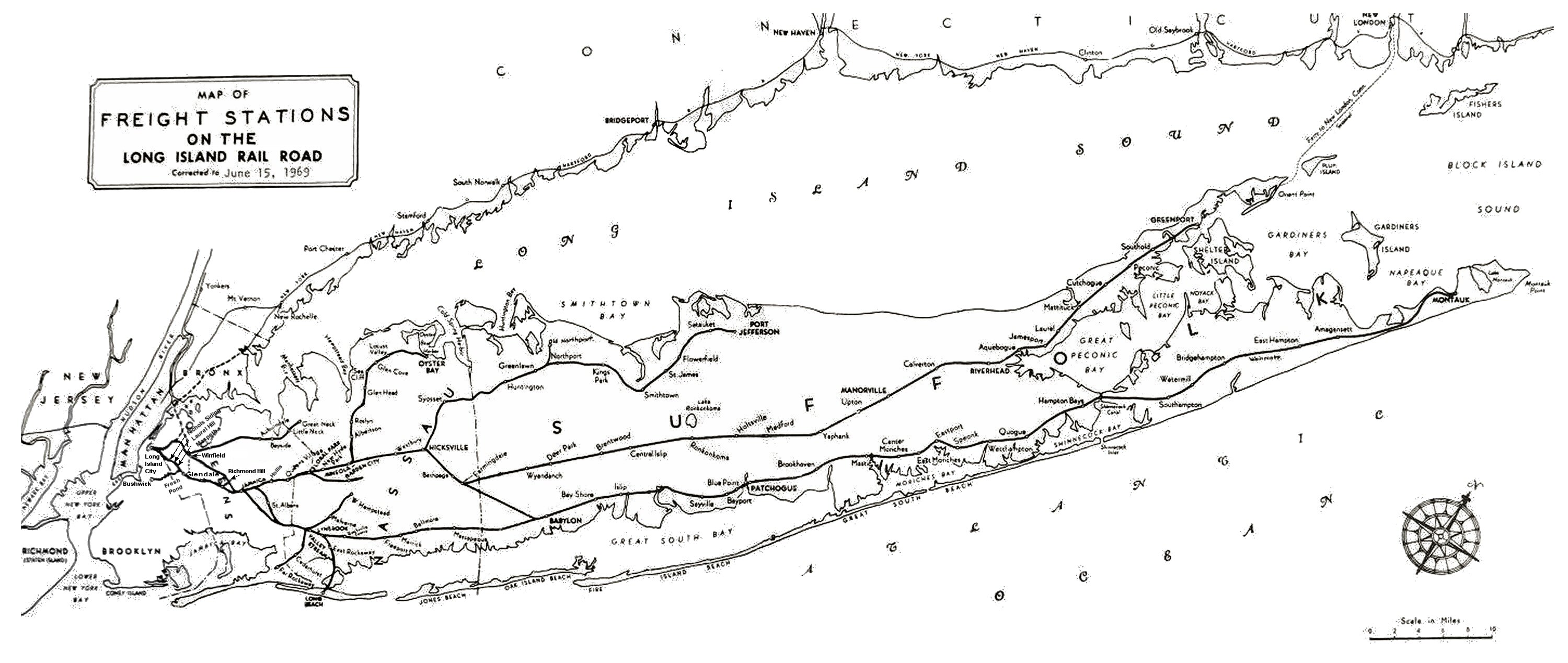
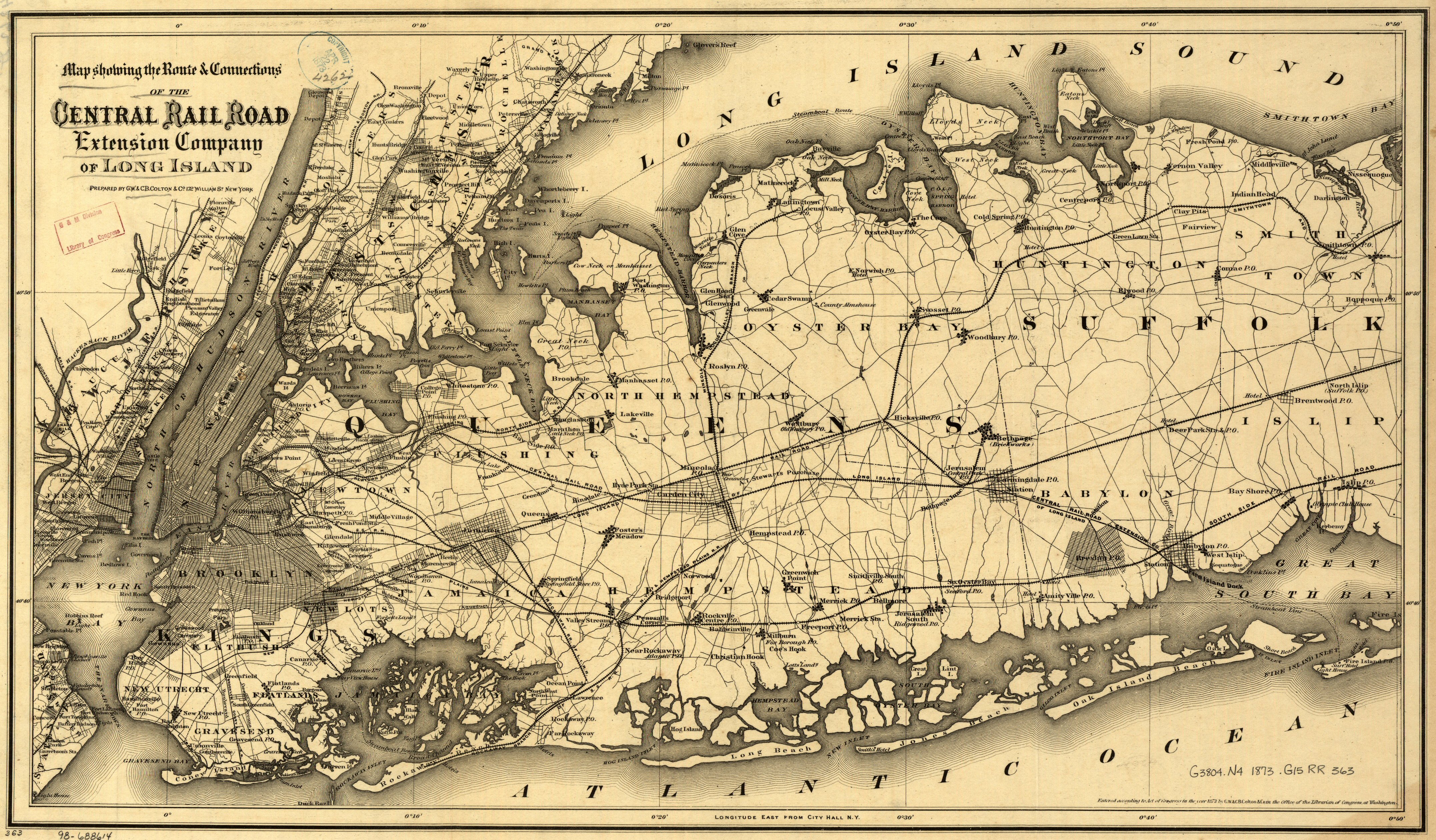
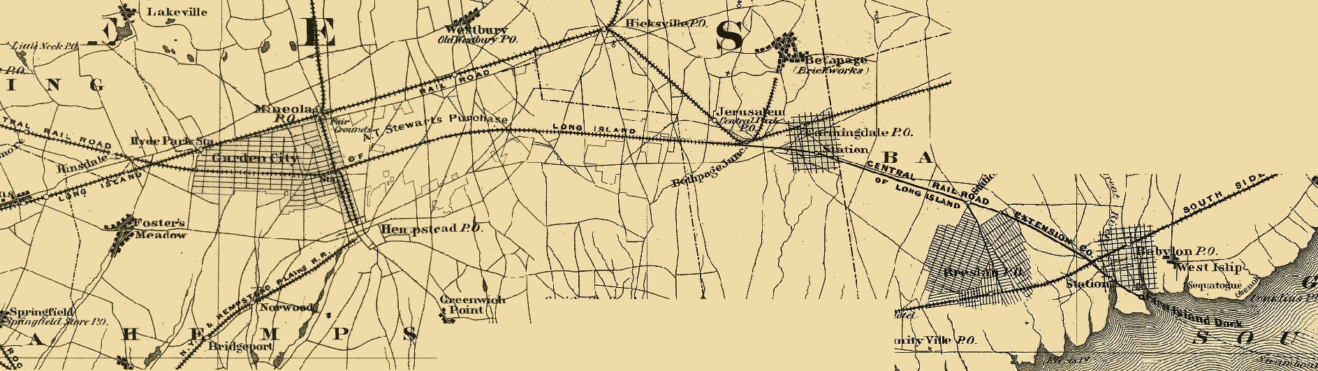
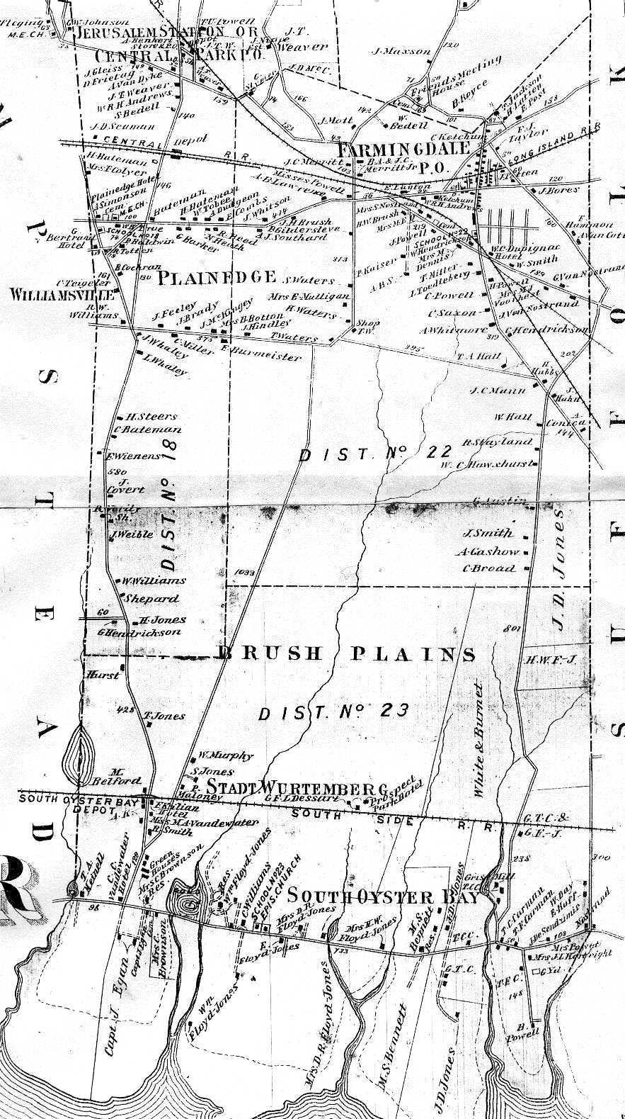
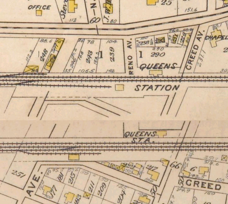
| 1873 Beers Maps - Babylon to Eastport | |||||
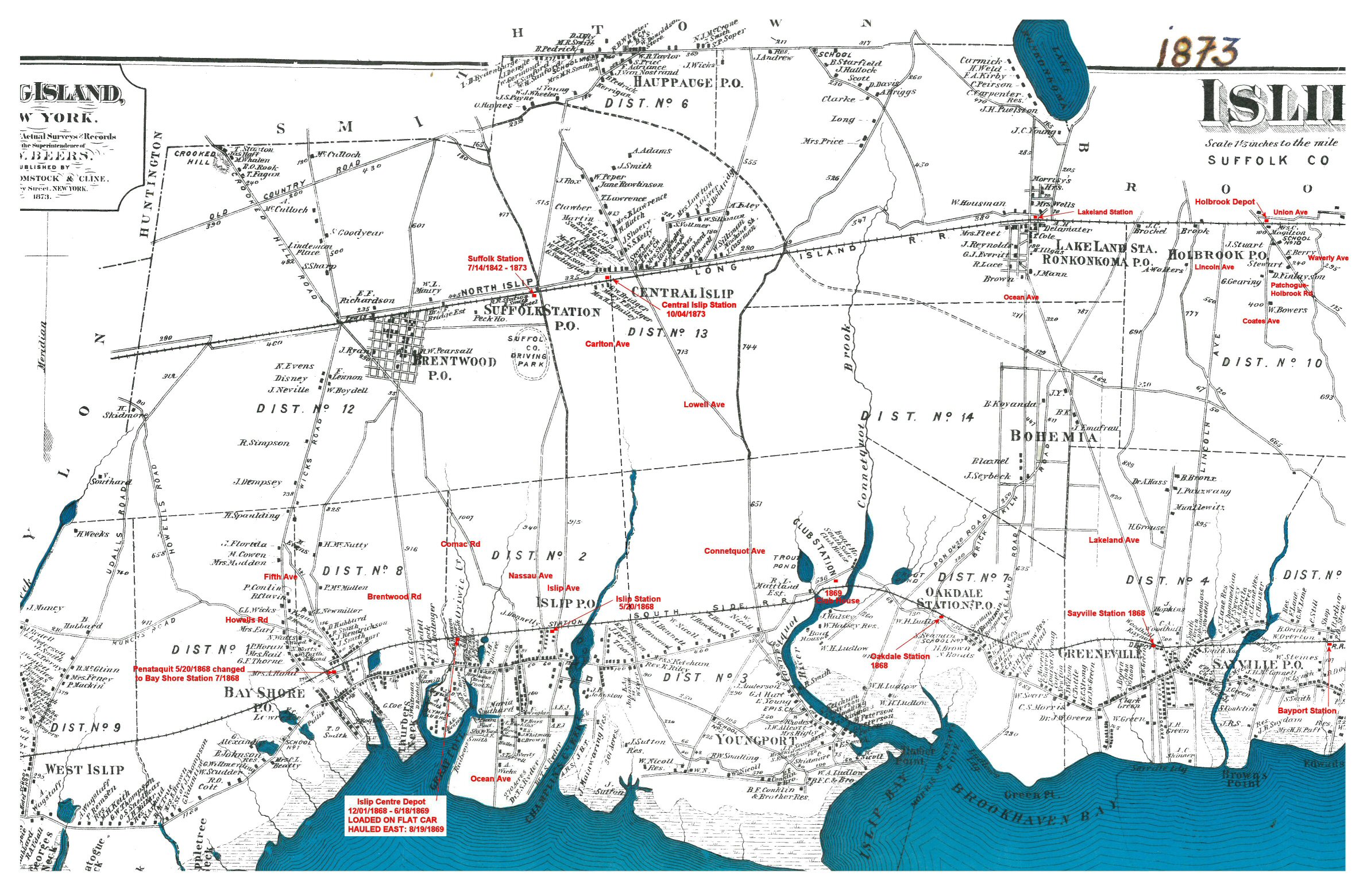 Islip Town Stations 1873 Beers map with annotations for the LIRR and South Side Rail Road (SSRR) Stations. Archive: Islip Public Library Research/Annotations: Steven Lynch |
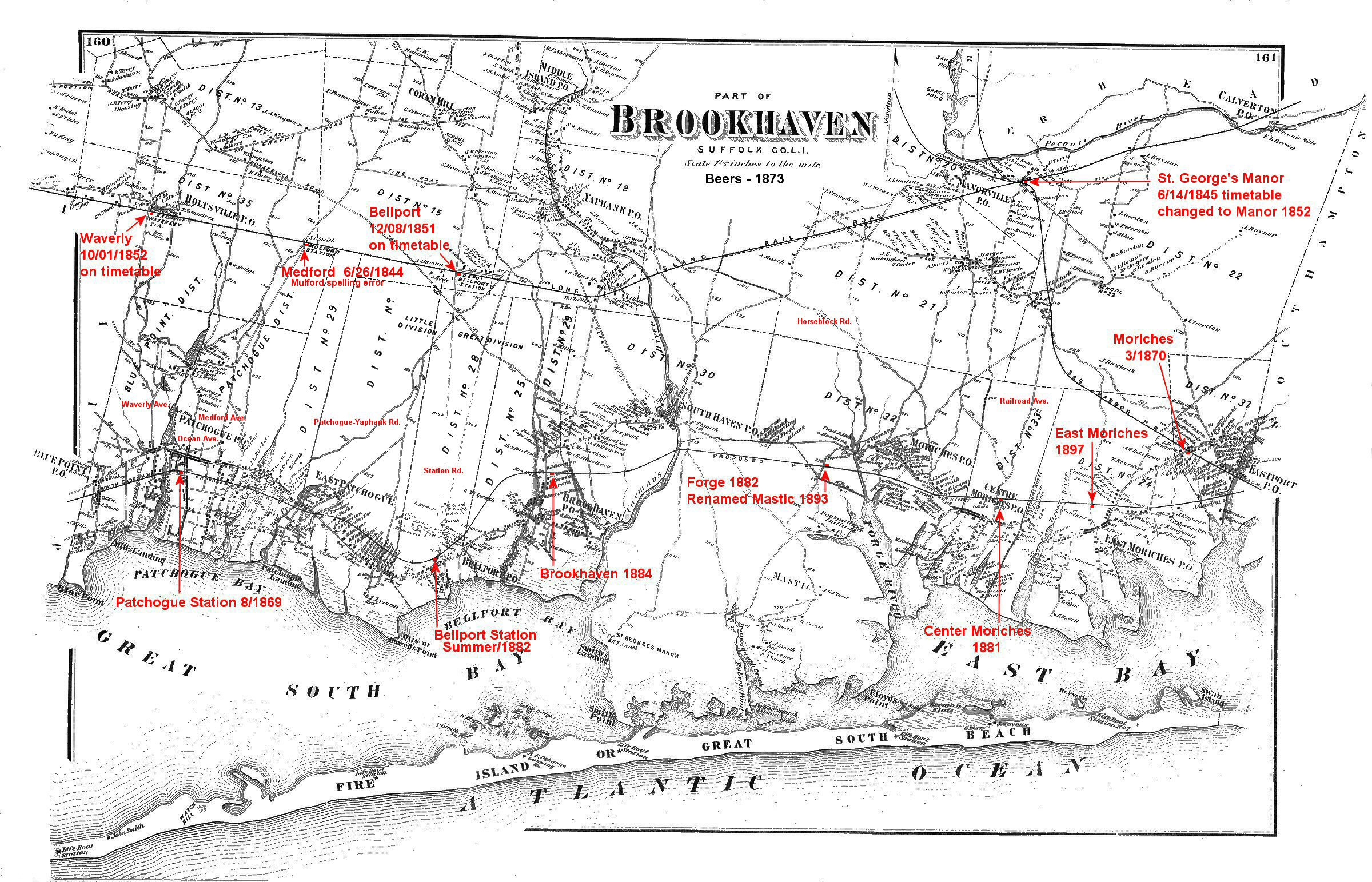 South Brookhaven Town Stations 1873 Beers map with annotations for the LIRR and South Side Rail Road (SSRR) Stations. Research/Annotations: Steven Lynch |
||||
|
|
|||||
|
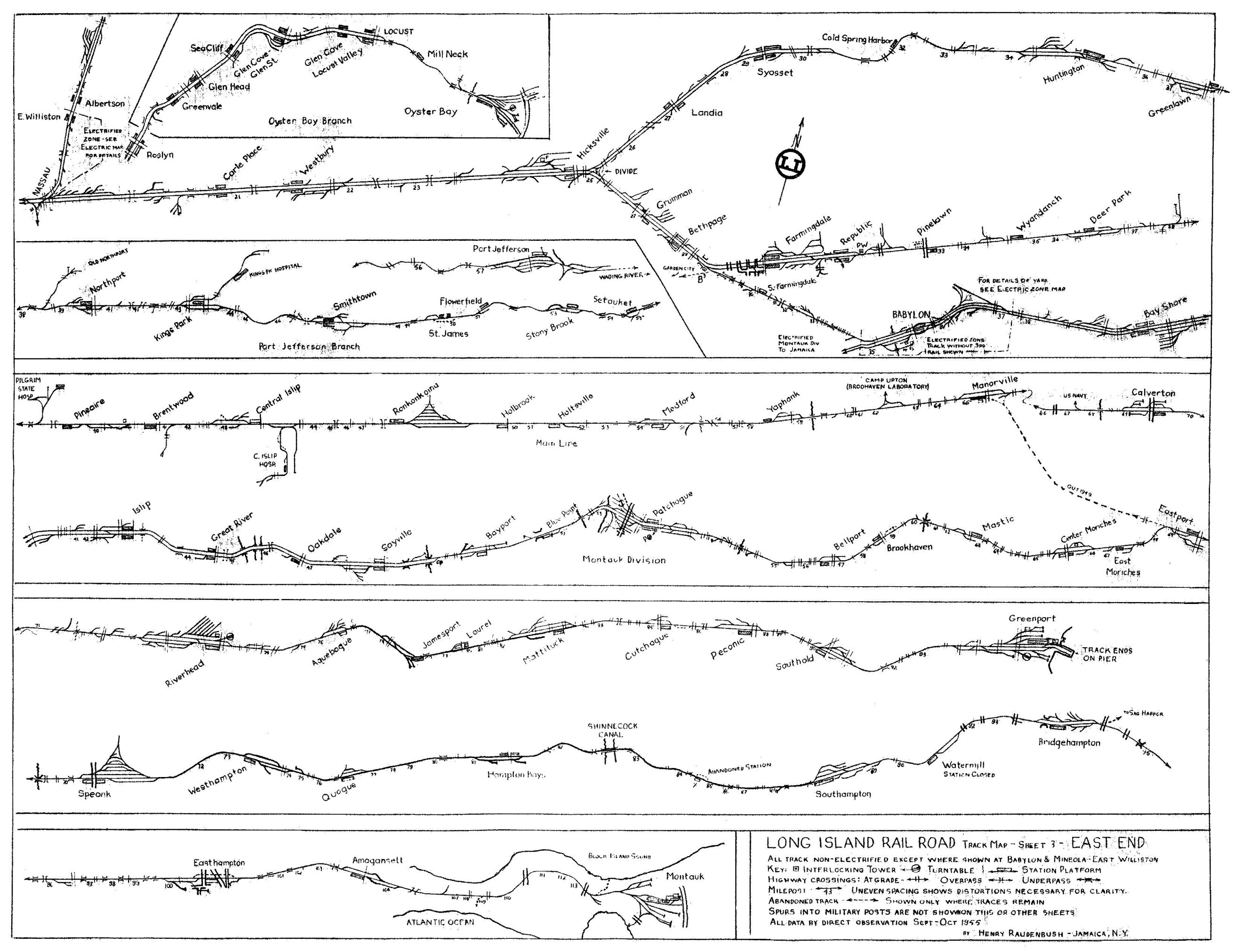
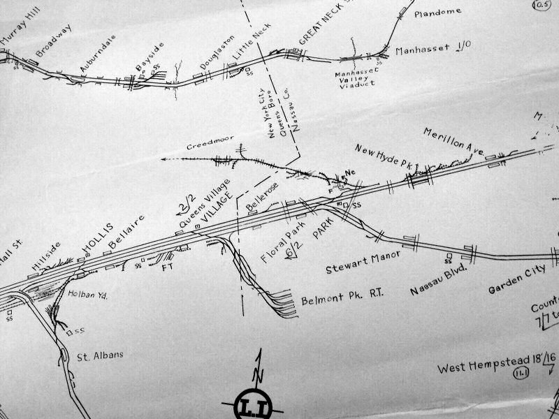
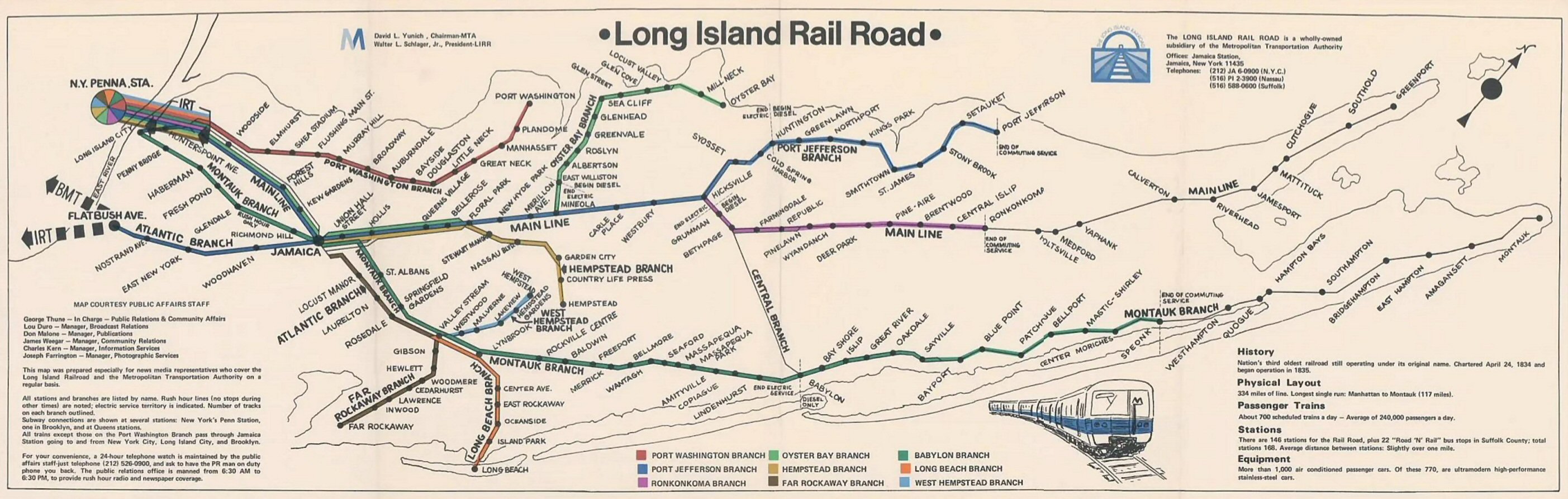
LIRR Maps 1952-1955 Henry Raudenbush |
|||||
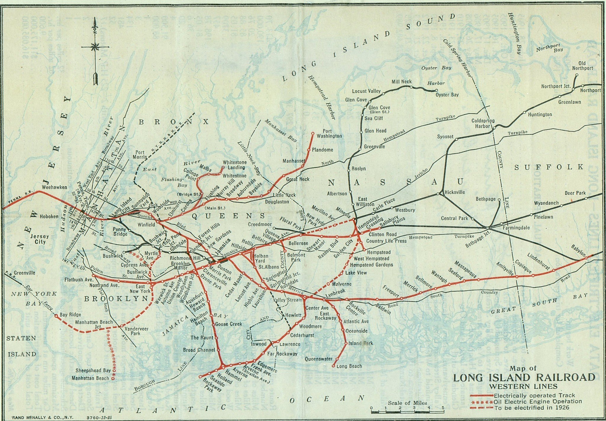
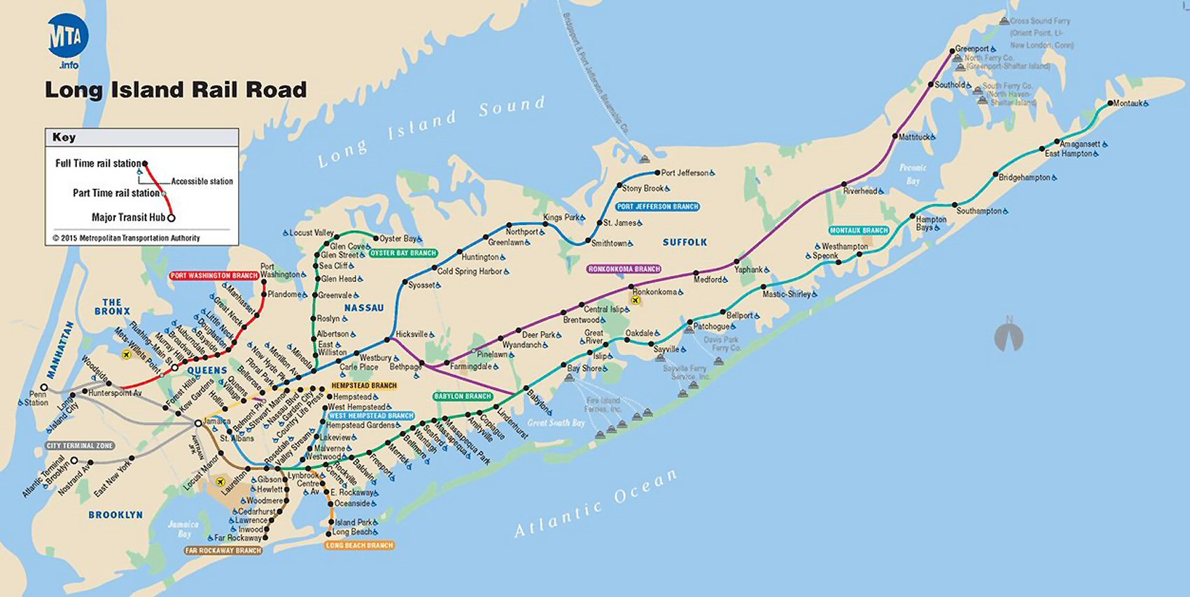
 LIRR Electrified Archive: Jeff Erlitz |
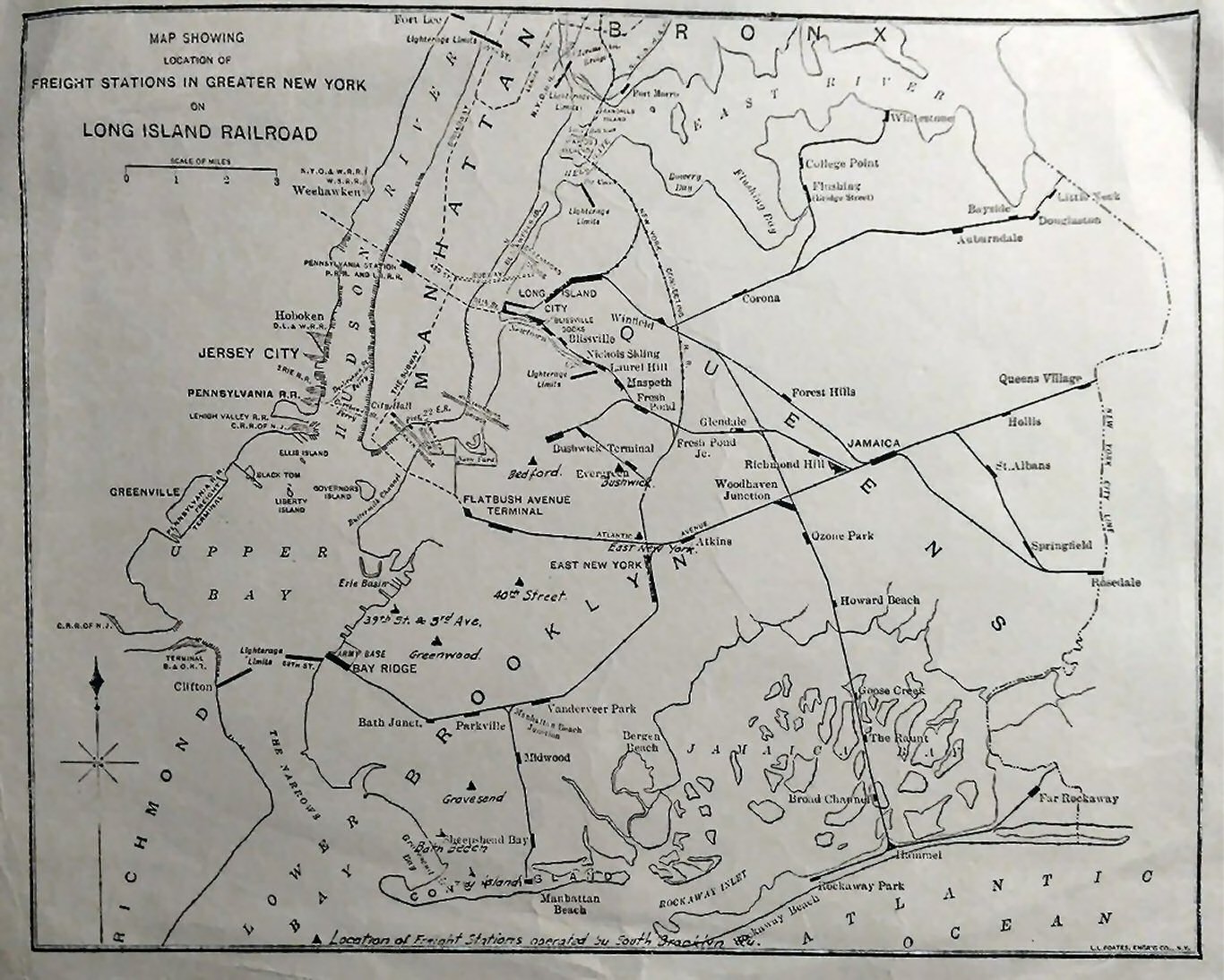
 LI City Archive: Jeff Erlitz |
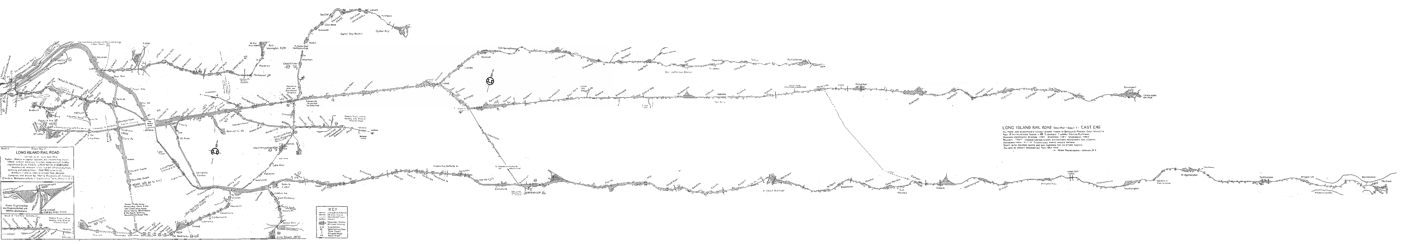
 LIRR East End Archive: Jeff Erlitz |
|||
|
|
 |
 |
|||
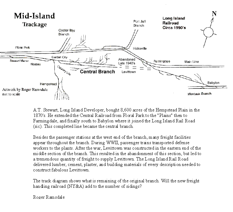
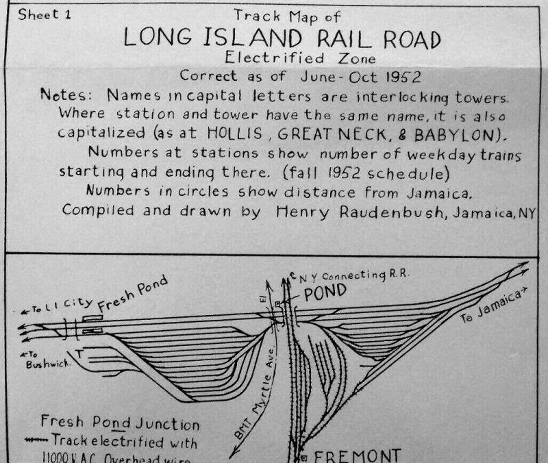 Fremont October 1952 Map 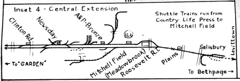 Central Branch Extension |
I
spent a lot of time digging out the data for that map. Where I
couldn't see things from trains, I walked. So I walked all around
Hempstead
crossing and that's when I saw those feeder rails. Then I walked the
lines from there to Mineola and to
West Hempstead
. On the following Monday, I had a call from Paul Blauvelt, the LIRR PR department. He wanted to know if the RR could buy 20 copies, and would I be willing to be interviewed for the Railroad. I went down to Jamaica, and that's when that picture was taken. In the summer of 1957, I worked in the Chief Engineer's office, and found a copy of my map in the file there.
On
the stretch to
West Hempstead
, the track ran on a diagonal to the street grid. Somewhere along
there, there was a place where it crossed an east- Things were more casual then, and what's more everybody on Long Island knew, and taught their kids, the dangers of the 3rd rail. 6/06/2010 Henry Raudenbush
|
||||
|
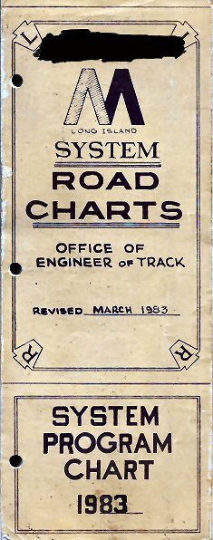
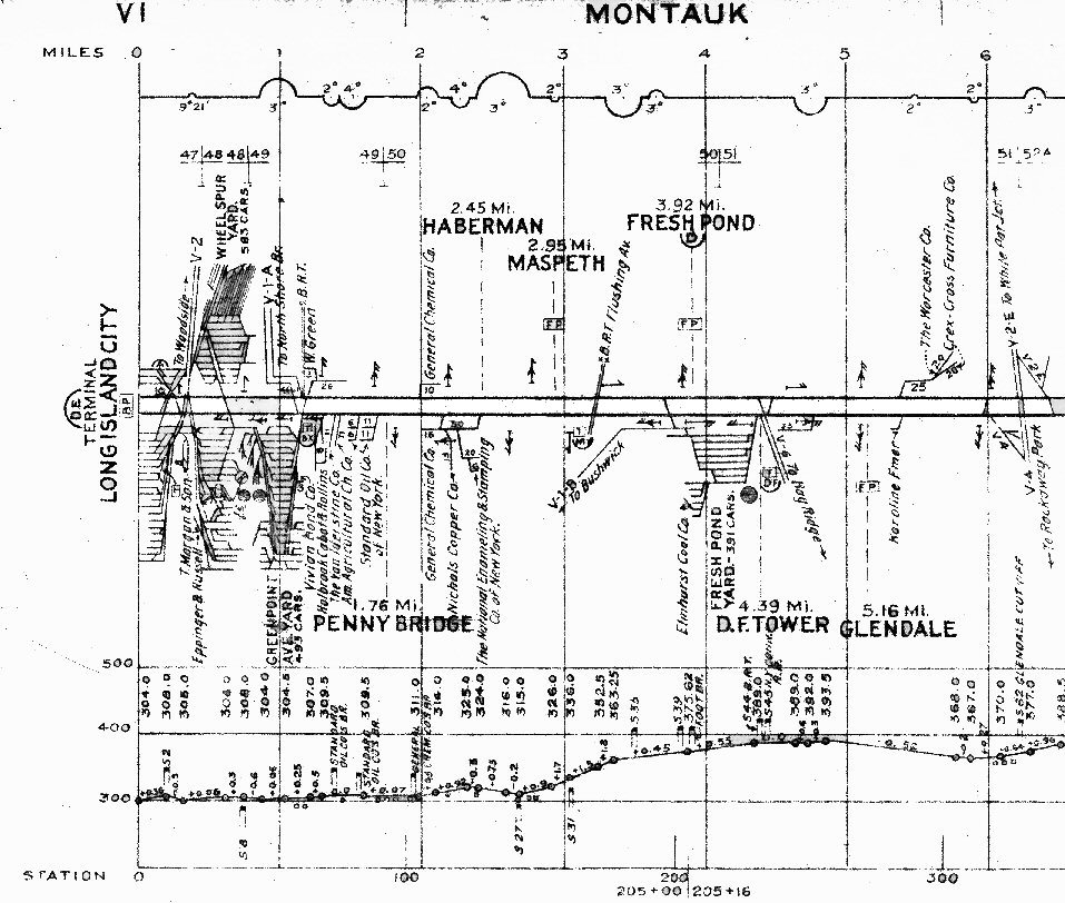
LIRR Track Profile Maps 1983 Archive: John Fusto |
|||||
|
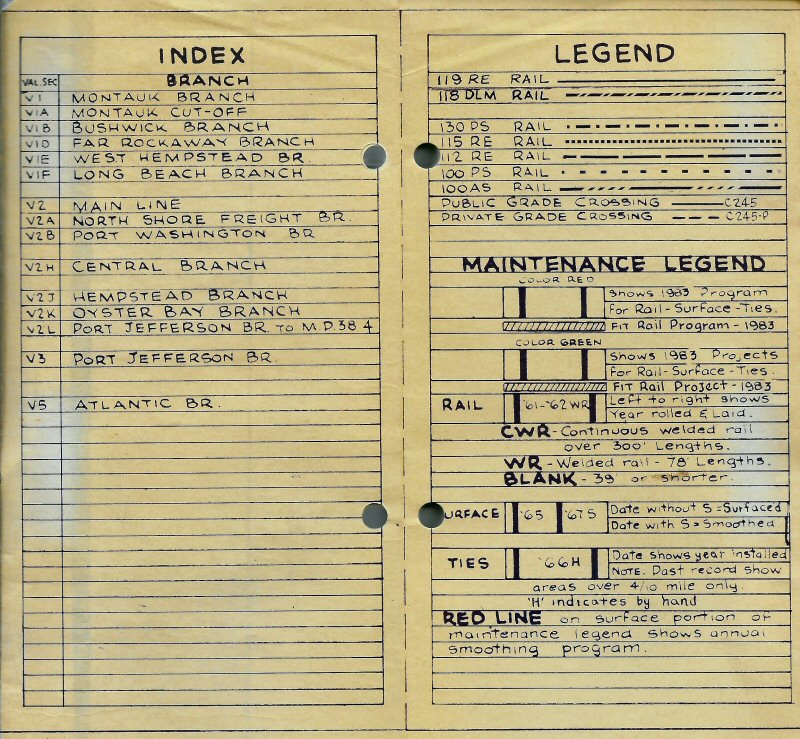
LIRR System Road Charts Index/Legend March 1983 |
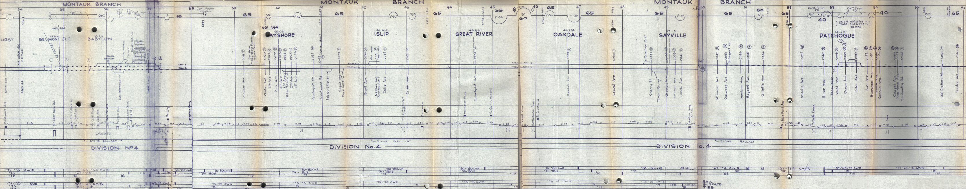
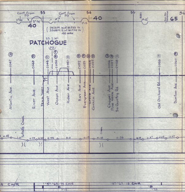 Patchogue 1983 Archive: John Fusto
|
|||
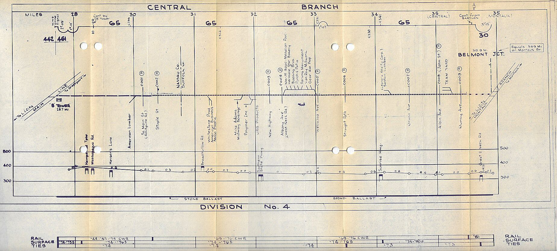 Central Branch track profile map -1983 |
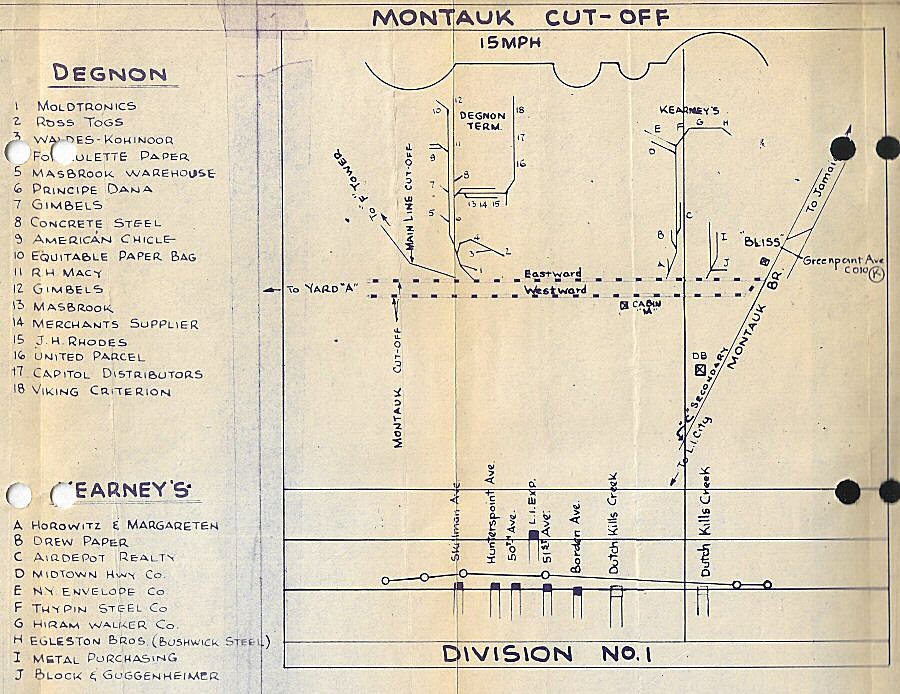 Montauk Cut-Off track profile map 1983 |
Bushwick Lead & Freight Tracks track profile map 1983 |
|||
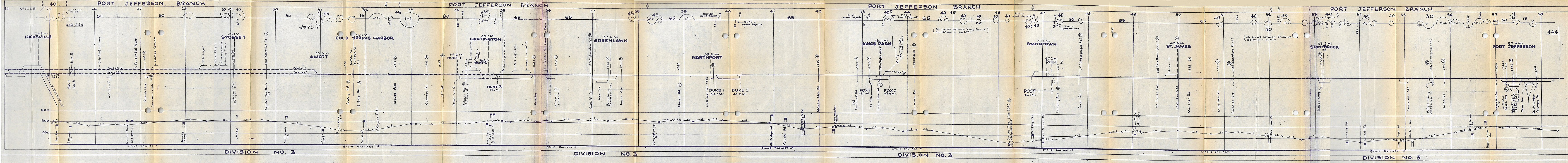 Port Jefferson Branch 1983 - Composite Map Creation: Steve Lynch |
|||||
|
|
|||||
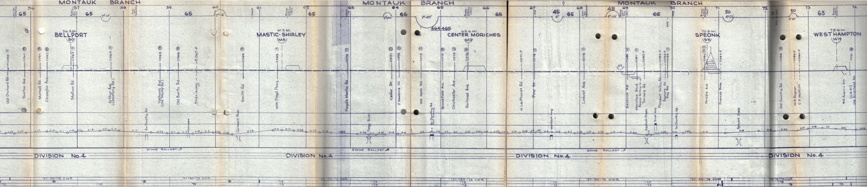 Bellport to Westhampton - Composite Map Creation: Steve Lynch |
|||||
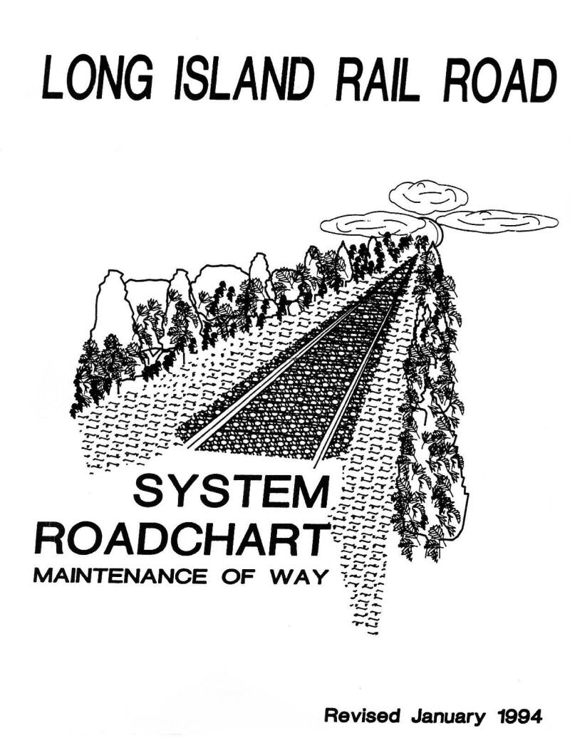
| LIRR Track Profile Maps 1994 | |||||
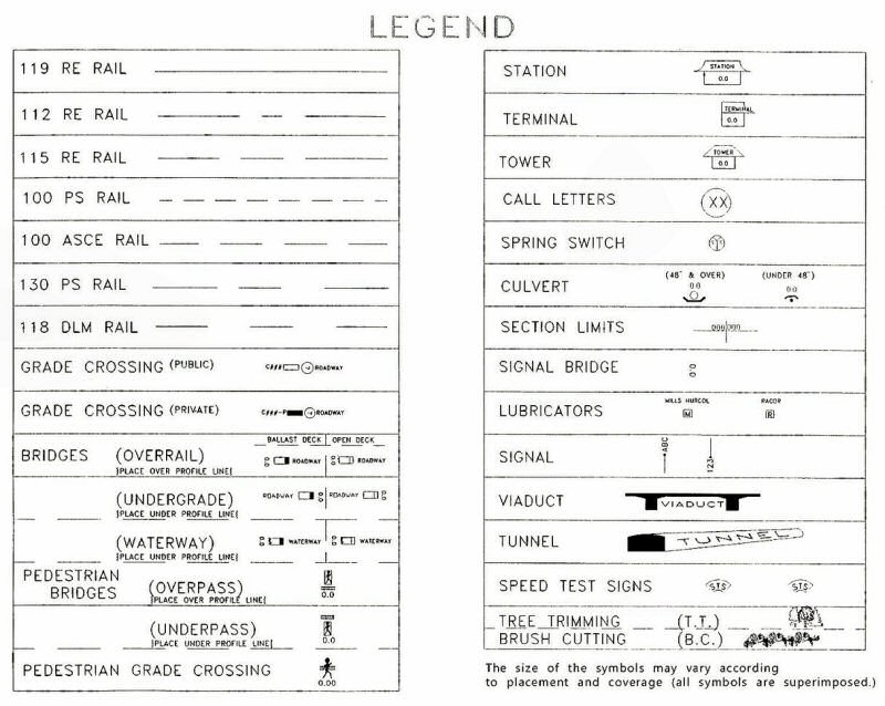 LIRR MOW System Track Profile Maps LEGEND 1/1994 |
 Main Line Track profile map LI City MP0-MP5 1994 LIRR 1994 MOW System Track Profile Maps
|
||||


