 Built:
Hicksville to Syosset, by Hicksville & Cold Spring Branch R.R.: 1854,
which was then leased to LIRR and eventually acquired by the LIRR: 1863
Built:
Hicksville to Syosset, by Hicksville & Cold Spring Branch R.R.: 1854,
which was then leased to LIRR and eventually acquired by the LIRR: 1863Built: Syosset to Northport, by the LIRR: 1868 (became the end of the “Old Northport” spur.)
Built: Northport Junction to Port Jefferson, by the Smithtown & Port Jefferson R. R. Co. (LIRR subsidiary): 1870
Built: Port Jefferson to Wading River by the LIRR Co. North Shore Branch (LIRR subsidiary): 1895
First train: Smithtown to Port Jefferson: 11/12/1873
Doubletrack: Hicksville to “S” cabin, Syosset: 1911-12, Syosset to “S” cabin (MP 31): 1914 (“S” cabin was moved from Syosset to MP 31: 1914)
All block limit signals once had semaphores with the exception of “MI” and “WG.”
Unattended block signals added at “SJ,” “BK,” “AU,” and “JF”, PRR “K” card system new: 5/1928
Abandoned: MP 58 east of Port Jefferson to Wading River: 10/9/1938
Last Day: Railway Express Agency service on Port Jefferson branch: 2/3/1961 Research: Robert Emery’s notes
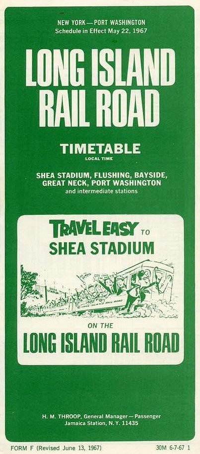
Form-F Port Jefferson Branch timetable 6/13/1967
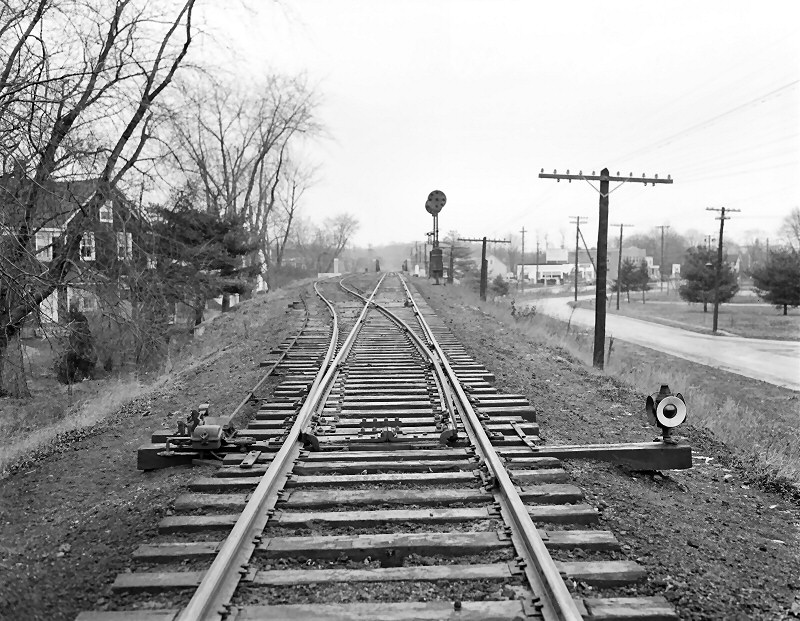
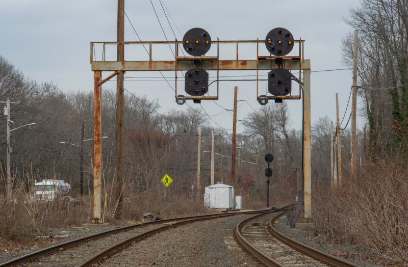
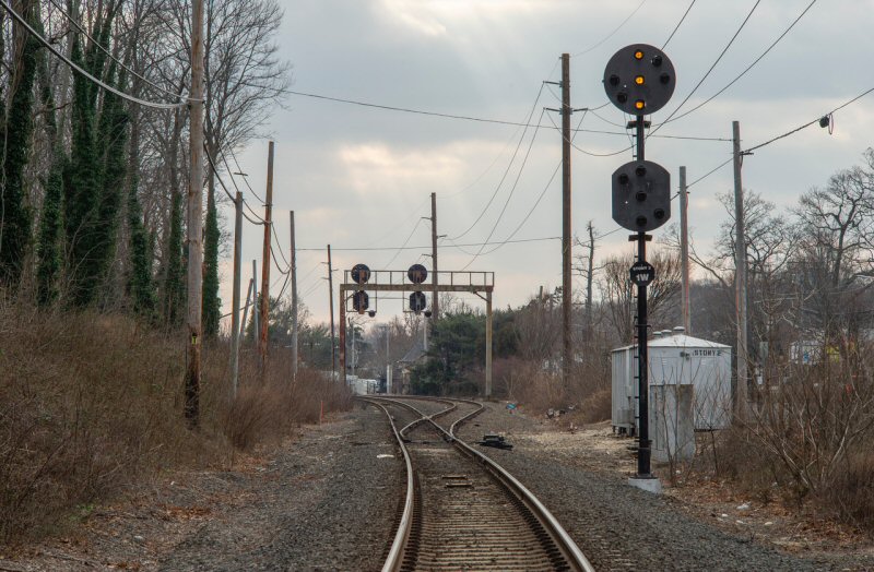
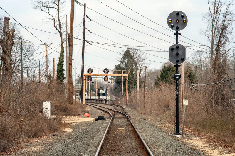
“DIVIDE”
TOWER: 1 HICKSVILLE - (PREVIOUSLY
“HX”, “HN” TOWERS)
(PORT JEFFERSON BRANCH AND MAIN LINE DIVIDE
AT JUNCTION.
LOCATED BETWEEN LEGS OF WYE, EAST OF STATION. RENAMED: 4/23/37.
US&S 9 STATION TRAFFIC CONTROL CENTER CONTROL PANEL IN SVC:
10/7/61.
TOWER OUT OF SVC: 11/13/62
WITH GRADE ELIMINATION.
“DIVIDE”
TOWER: 2 HICKSVILLE - NEW TOWER BUILT DIRECTLY
BEHIND OLD TOWER DURING GRADE ELIMINATION.
IN SVC: 11/13/62.
OUT OF SVC: 9/12/64.
TRANS-CONTROL 19 LEVER
CONTROL PANEL IN SVC:
9/12/64. US&S
14 STATION TRAFFIC CONTROL CENTER CONTROL PANEL IN SVC:
9/12/64
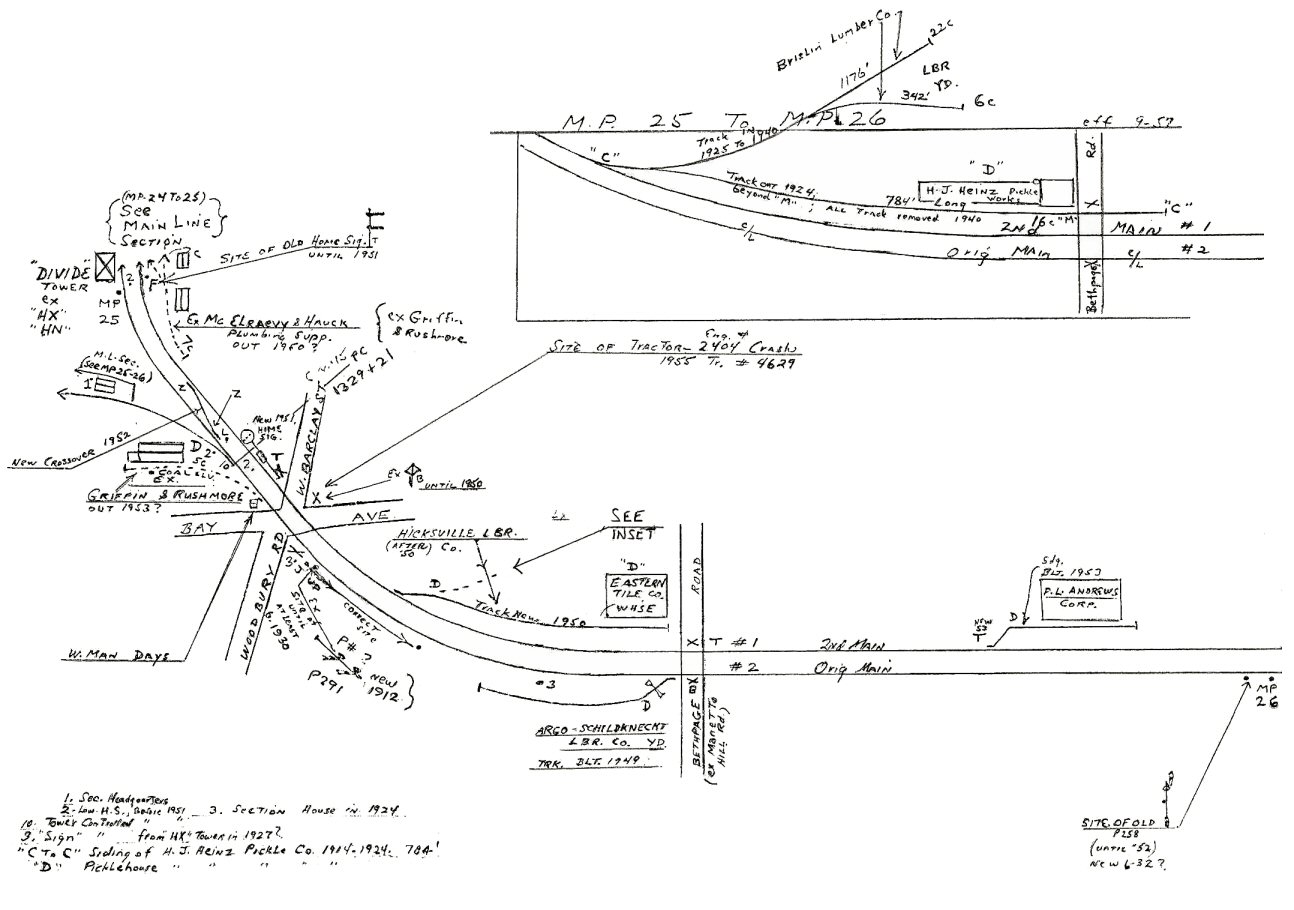
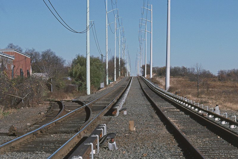
Emery map Hicksville-Divide Tower MP25-26
Archive: Dave Keller
.jpg)
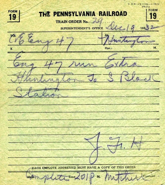
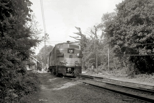
FM C-liner eastbound hooping orders at DIVIDE 12/1954
Archive: Dave Keller
..jpg)
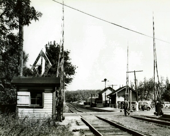
DIVIDE Tower, Hicksville View SE 1962
Archive: Dave Keller

LIRR 1966 Hicksville - Syosset map #54 Archive: Dave Keller
.jpg)
DIVIDE Tower The new tower under construction - RS3 #1559
on temporary tracks View E 04/1963 Archive: Dave Keller
.jpg)
DIVIDE Tower The new tower under construction - RS3 #1558 on temporary tracks View W 04/1963 Archive: Dave Keller

Port Jefferson Branch - Divide Track profile map 1994

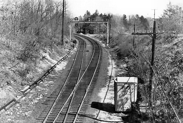
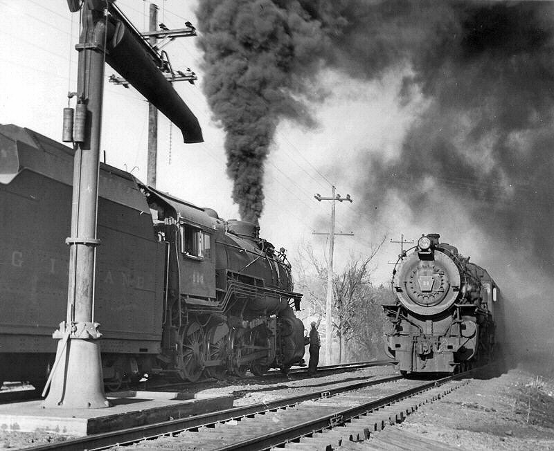
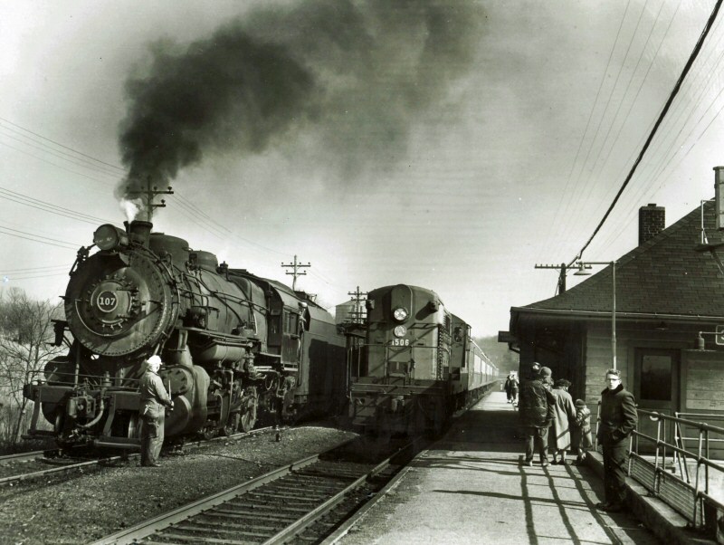
FM CPA20-5 #2004 and train railroad eastbound (tracks actually ran northbound at this point) on the Port Jefferson branch between Hicksville and Syosset, approaching the Northern State Parkway overpass from which the photo was taken looking SE (railroad west) on July 10, 1953. Miller Road/Place is off to the left. (George E. Votava photo, Dave Keller archive)
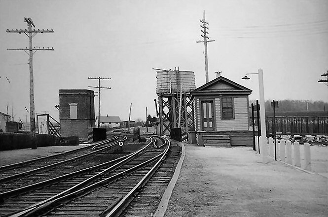
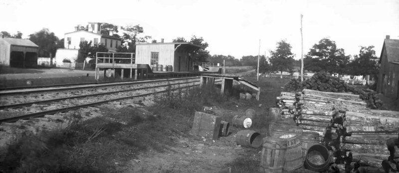
LOW PLATFORMS IN SVC: 12/15/52 BOTH SIDES OF TRACK TO SERVICE EMPLOYEES OF CIRCLE WIRE (LATER CERRO WIRE). CLOSED: 10/3/1973 Research: Dave Keller

Landia Station sign - 11/25/1969
Photo/Archive: Richard F. Makse

Train #623 Landia Station - 11/25/1969
Photo/Archive: Richard F. Makse
Train #606 discharging passengers east of Robbin's Lane
on Track 2, Landia Station 11/25/1969
Photo/Archive: Richard F. Makse

Jamaica and Landia One-way ticket 2/19/1964
Photo/Archive: Richard F. Makse
.jpg)
MU Railfan Extra eastbound at Landia Station platform
east of Robbin's Lane 1970 - (Edwards-Keller)
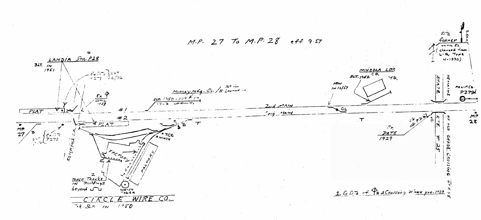
Emery map Landia MP27-28 9/1957 Archive: Dave Keller
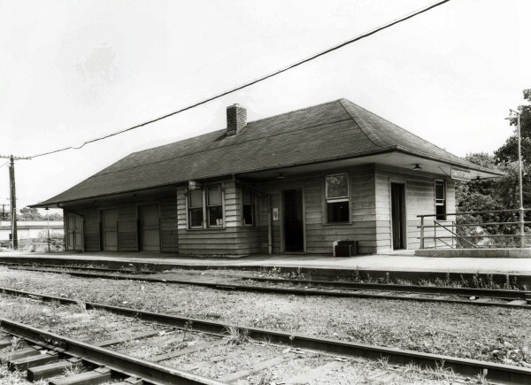
Landia Station 10/26/2023 Photo/Archive: Dave Morrison
Built: 1872 at Lockwood’s Grove, Far Rockaway Moved: 9/1877 Greatly remodeled: 1944, Razed: 1948 2nd Depot Built: 1948 Research: Dave Keller
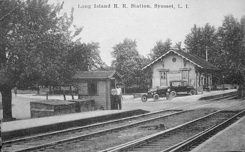
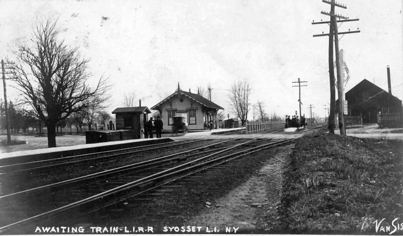
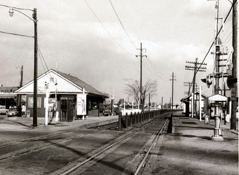
Syosset Station - View NW c.1915 Source: eBay
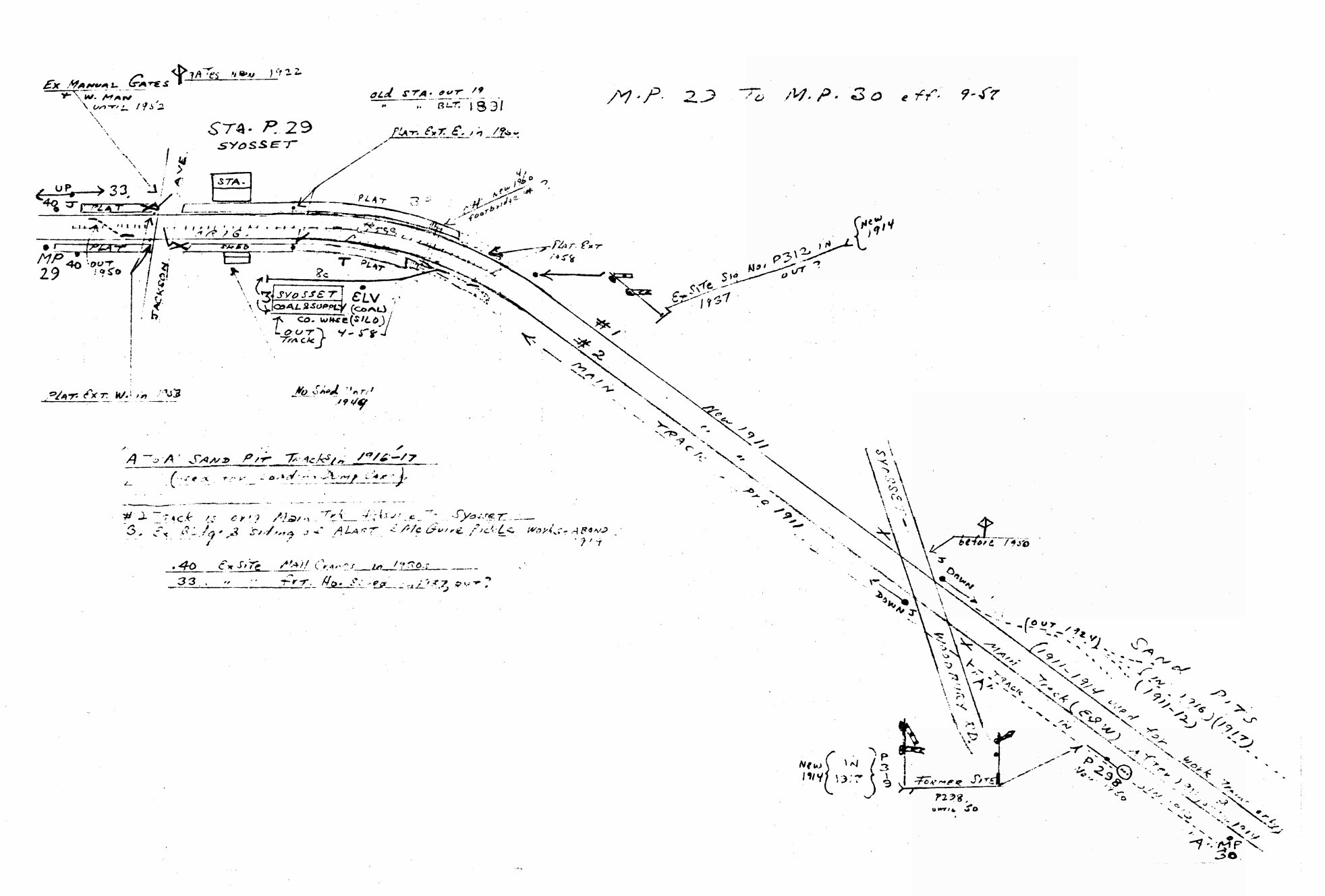
Emery map Syosset
MP29-30 9/1957
Archive: Dave Keller
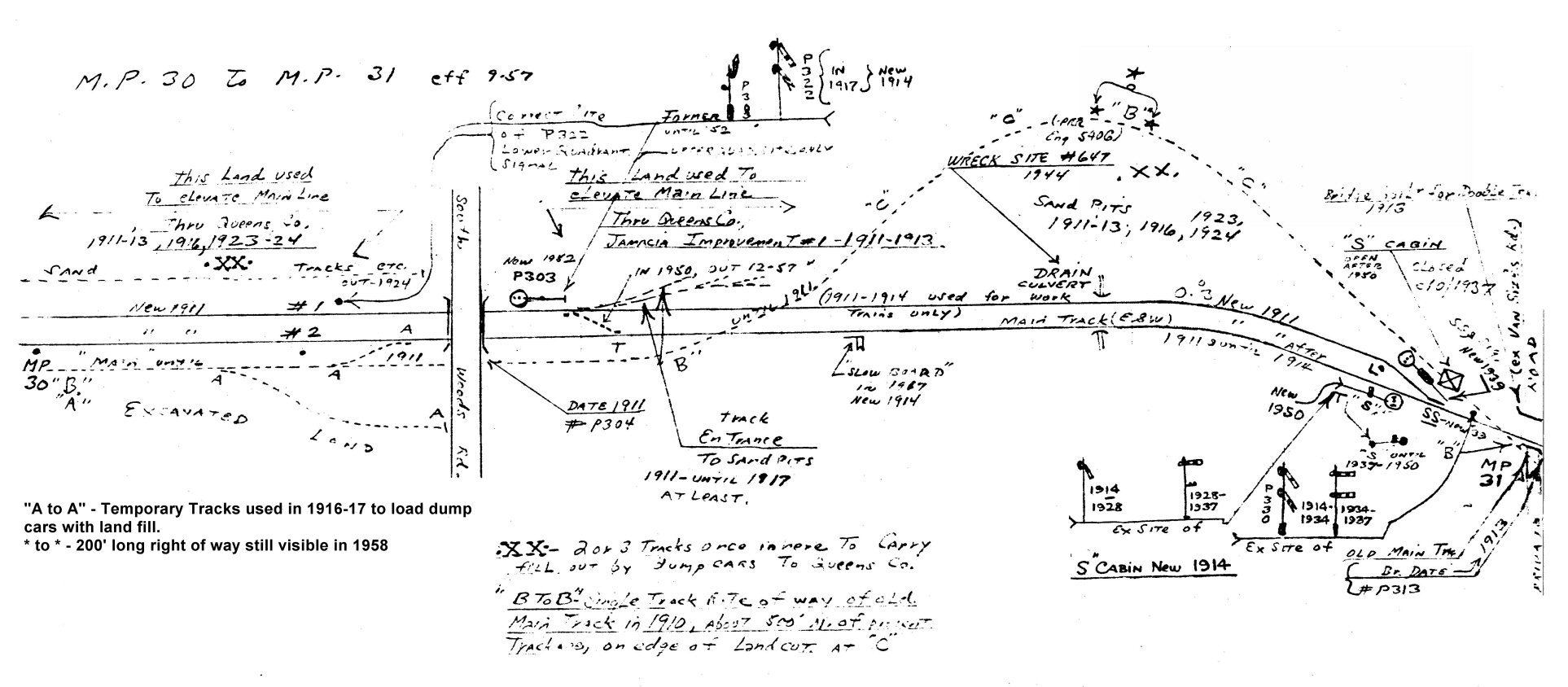
Emery map Syosset
MP30-31 9/1957
Archive: Dave Keller
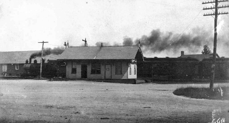
Syosset Station View S c. pre-1910
Archive: Tom Montalbano From "A Syosset Scrapbook," courtesy of John Delin
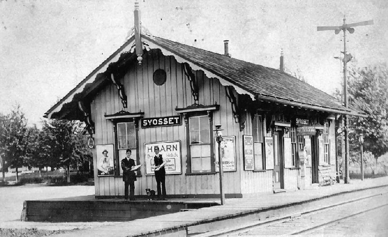
Syosset
Station telegraph agents c.1910 Archive:
Tom Montalbano
From "A Syosset Scrapbook," courtesy of John Delin
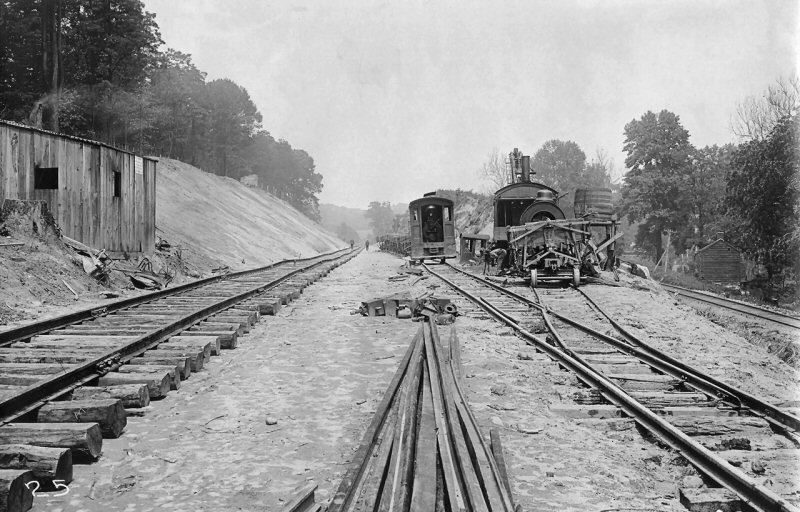
Syosset MP30-31 View E 6/15/1910 Archive: Bill Rugen-Queens Public Library
The sandpits provide fill for the 1910-1913 relocation and elevation of the
new Jamaica station and yard.
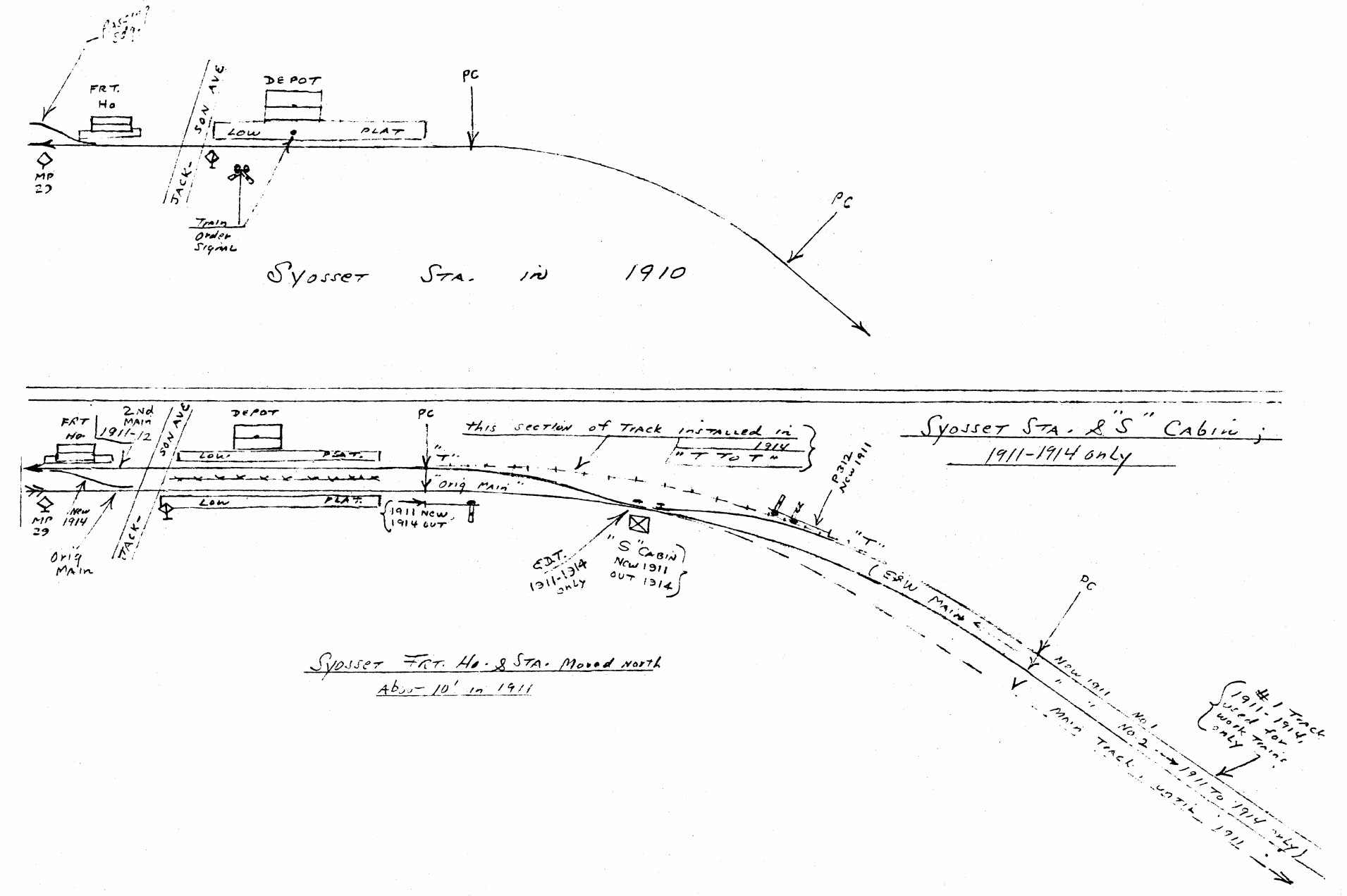
Emery map Syosset MP29-30 1910, 1911-1914
Archive: Dave Keller
Syosset
Station
View NE c.1912
From "A Syosset Scrapbook," courtesy of John Delin
Syosset Station after remodeling 1944
Razed/Rebuilt 1948
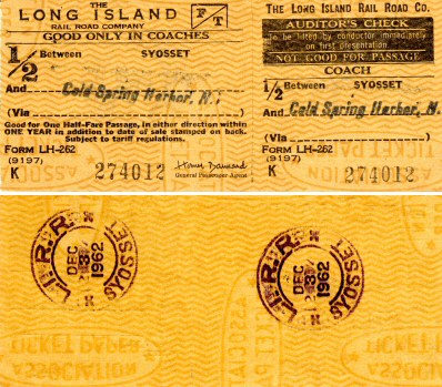
Ticket - Syosset to Cold Spring Harbor 12/03/62
Archive: Brad Phillips
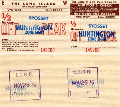
Ticket - Syosset to Huntington 11/26/76
Archive: Brad Phillips
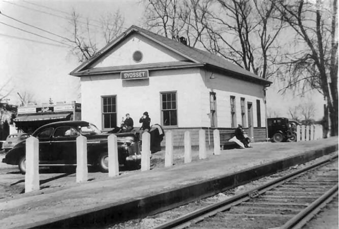
Syosset Station view E winter 1961 Photo: Irving Solomon
Archive: Brad Phillips
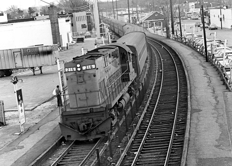
LIRR #216 at Syosset 1968 - The high tension and third rail poles are in place, but the third rail is not yet boarded over, nor has the platform been elevated. Photo/Archive: Richard Glueck

Syosset Station View W c.1970 Photo: Michael Mark
From "A Syosset Scrapbook," courtesy of John Delin

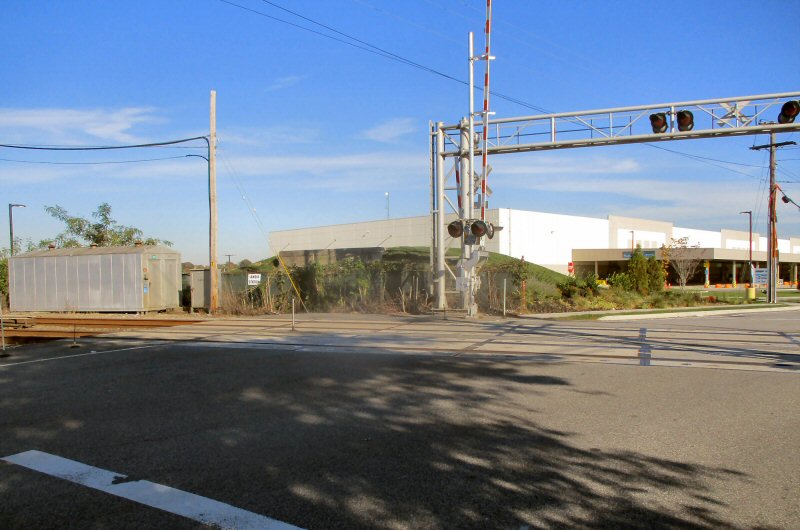
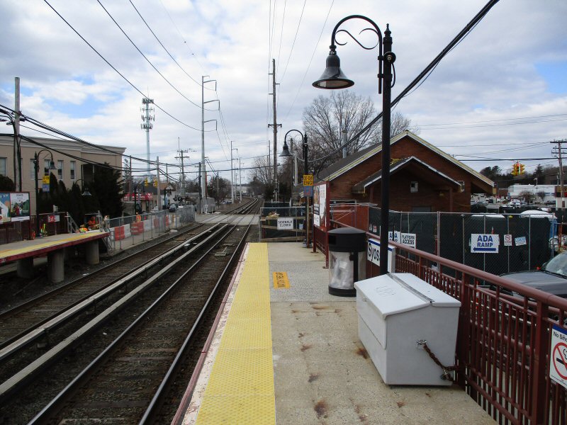
Syosset Station - View SE 6/2018 Google maps
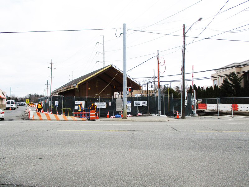
Syosset Station construction - View E at Jackson Ave. 3/12/2019

Syosset Station Improvements MTA/LIRR sign 3/12/2019
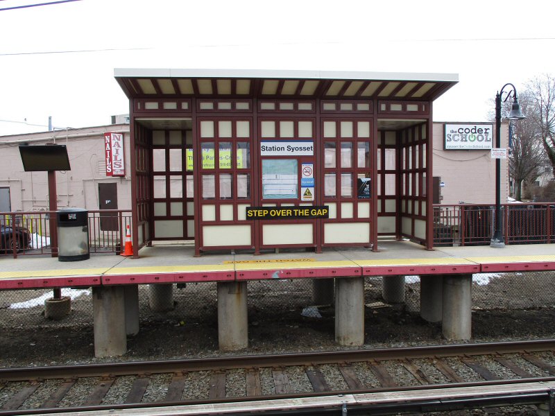
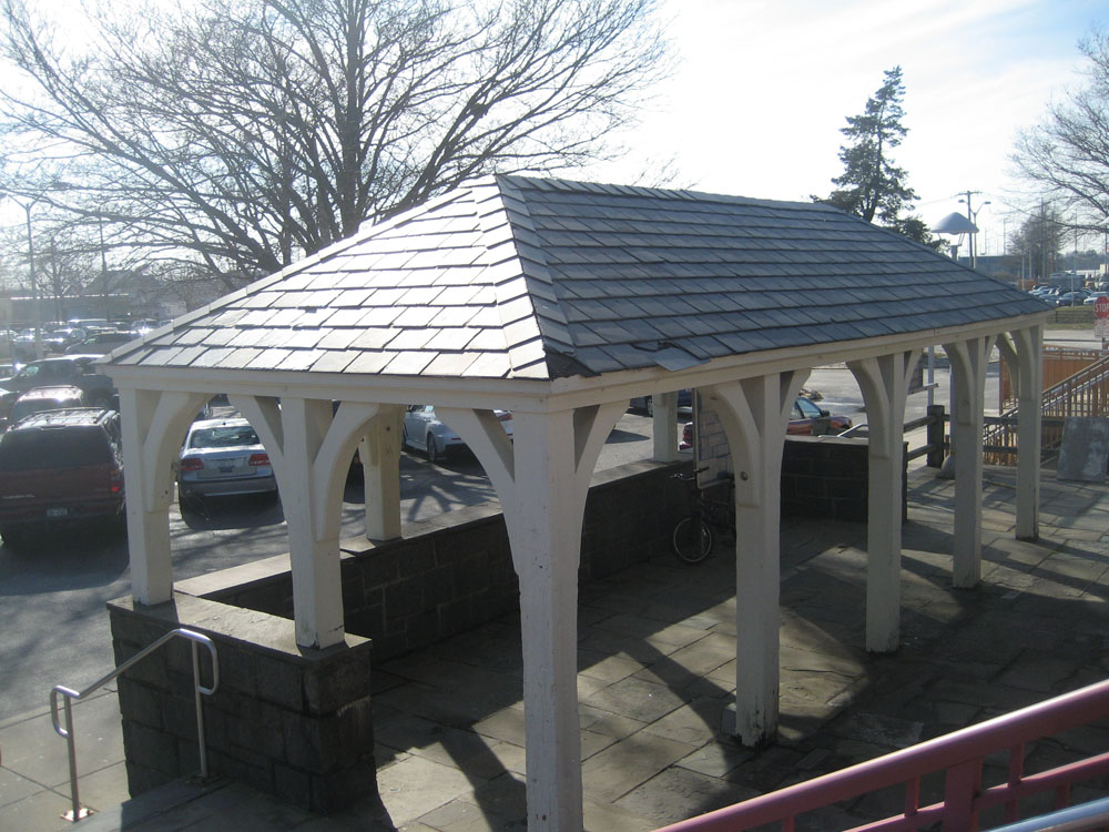
Syosset shelter - View S 3/12/2019
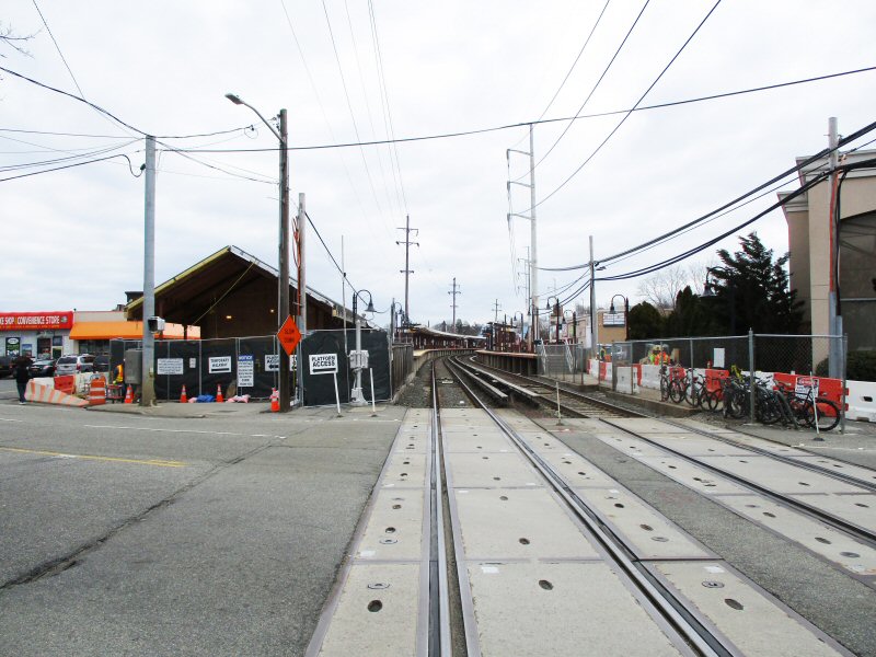
Syosset Station construction - View E at Jackson Ave rail crossing 3/12/2019
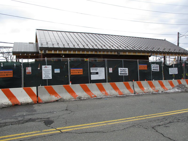
Syosset Station construction - View S 3/12/2019
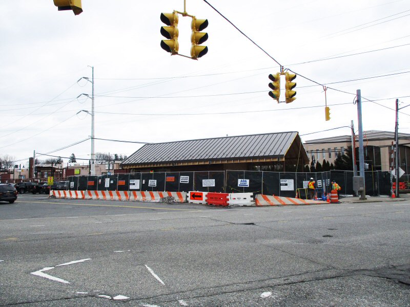
Syosset Station construction - View SE
Jackson Ave./Underhill Blvd. 3/12/2019
Syosset Station construction - View W 3/12/2019
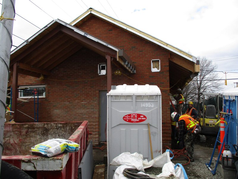
Syosset Station construction - View W close-up 3/12/2019

Syosset Station - 6/12/2019
Photos/Archive: Dave Morrison
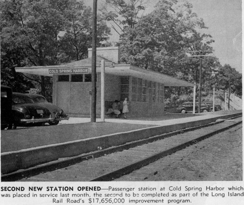
MOVED EAST ACROSS COUNTY LINE TO PRESENT STATION LOCATION:
1903 (Scott Schultz Reference Librarian Cold Spring Harbor
Library.)
RENAMED “COLD SPRING HARBOR” SOMETIME BETWEEN ETT #59 EFF:
11/3/1910 AND ETT #61 EFF: 6/28/1911 TO MATCH THE TOWN'S
ACTUAL NAME,
WHICH WAS CHANGED IN 1826 TO AVOID POSTAL CONFUSION AS THERE
ALREADY WAS A "COLD SPRING" IN UPSTATE N.Y.
DEPOT RAZED: 1948.
2ND DEPOT BUILT: 1948. AGENCY CLOSED: 12/10/96.
Research: Dave Keller
Cold Spring Harbor Station c.1902 Archive: Dave Morrison

Emery map - Cold Spring Harbor MP31-32
9/1957 Archive: Dave Keller
Note: Location "F" - NYS Conservation Dep't. “Adirondack”
fish-car spotted for the Cold Spring Harbor Fish Hatchery
personnel to load and service it.
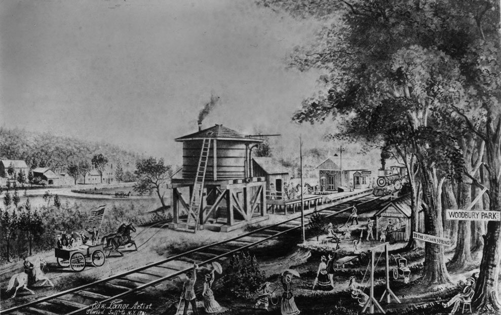
"Woodbury" by Edward Lange
Woodbury Station 1878 (Brainerd-Emery SUNY Stony
Brook)
.jpg)
Cold Spring Harbor G5s #33 Train #4613 2/02/1947 (Votava-Keller)
LI Railroader - Cold Spring Harbor Station 7/1948
Archive: Dave Morrison
Cold Spring Harbor - FM H16-44 1505 east of station West Rogues Path c.1958 (LIRR Emery-SUNY Stony Brook)

Cold Spring Harbor view E 1950's
Archive: Brad Phillips

Cold Spring Harbor view W c.1953

Ticket - Cold Spring Harbor and Syosset
7/24/62 Archive: Brad Phillips
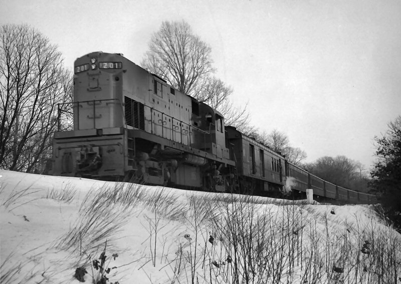
Alco #201 Cold Spring Harbor MP31 c.3/1964
Archive: Dave Morrison

FL9 #301 C1s Cold Spring Harbor station - 9/1994 Photo/Archive: Bill Mangahas

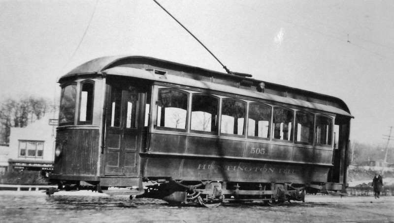
LIRR #505 Train #6668 eastbound at East Gate Drive approaching Cold Spring Harbor - View S 5/18/2020 Photo/Archive: Jeff Erlitz
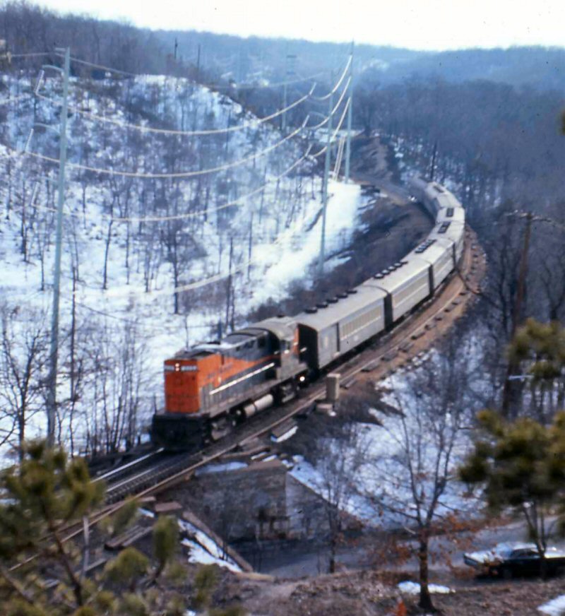
LIRR C420 train American Flyer Osgood Bradley cars
at West Rogues Path - View SW 1968
Photo/Archive: Richard Glueck
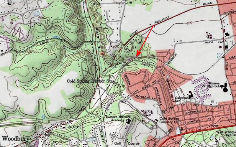
Cold Spring Harbor - "Cold Spring Hill" West Rogues Path - Red arrow indicates
photos location on topographic map
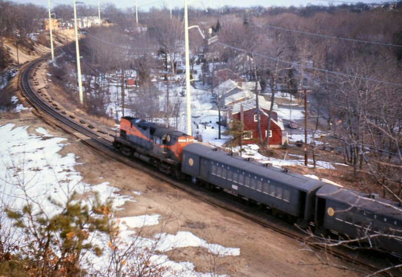
LIRR C420 train PB57 combine and P54s (pings) at West Rogues Path view SW 1968Photo/Archive: Richard Glueck
LIRR C420 train P72s at West Rogues Path - View E
1968 Photo/Archive: Richard Glueck
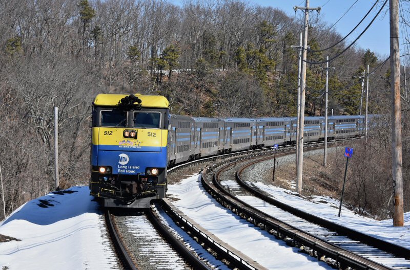
LIRR #512 Train #6609 westbound approaching
Cold Spring Harbor station 3/09/2019 Photo/Archive: William J. Skeats
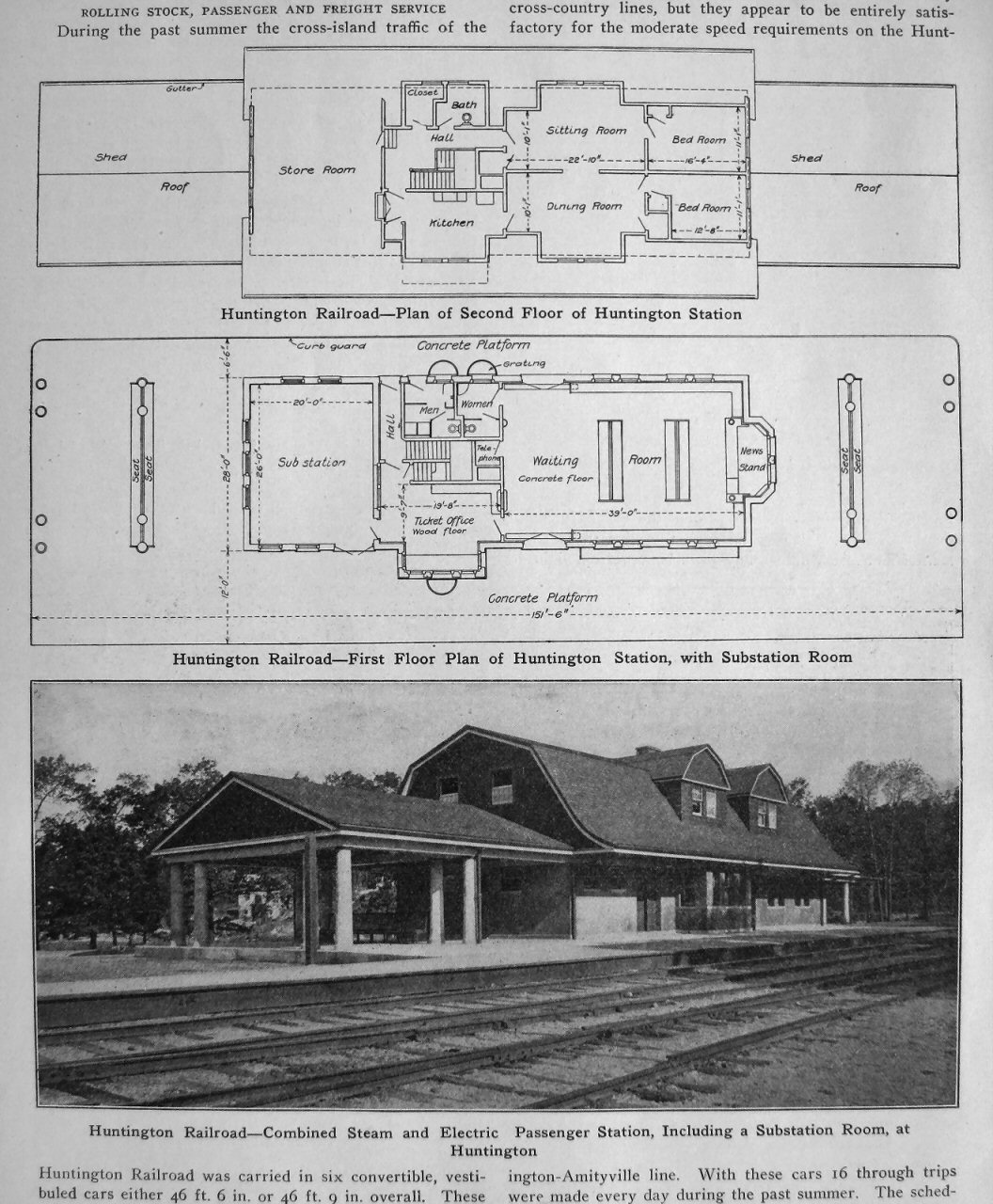
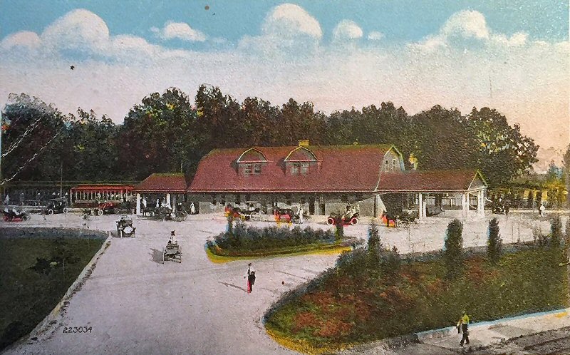
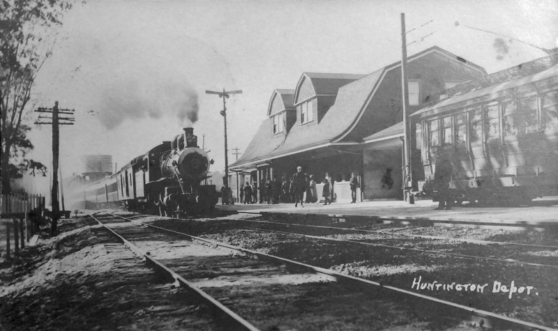
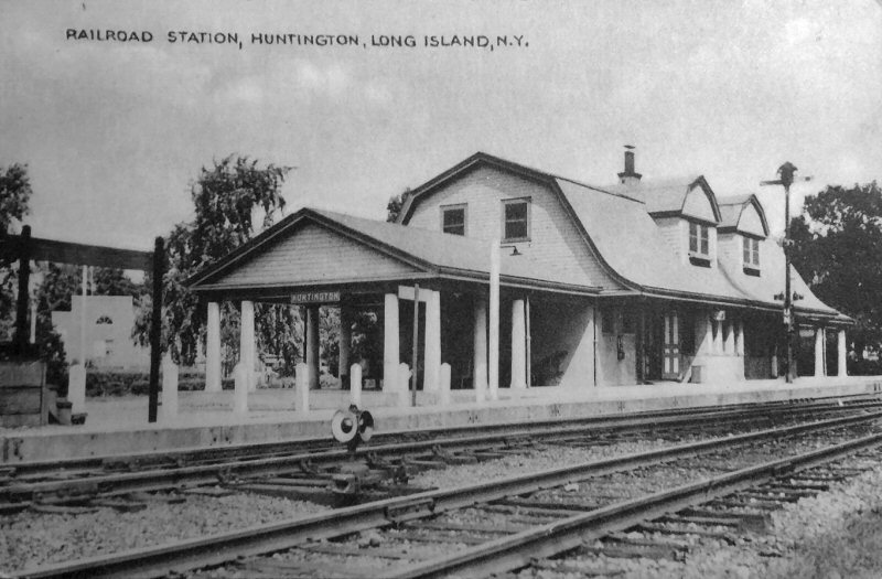
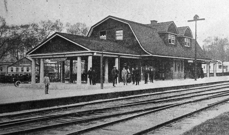
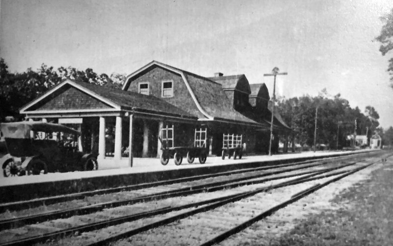
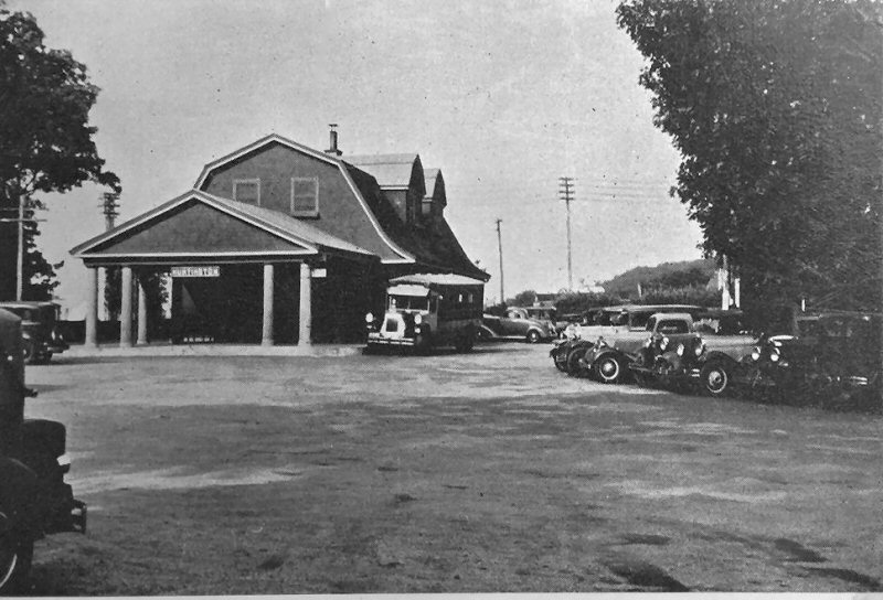
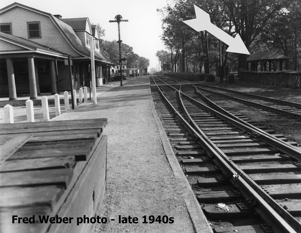
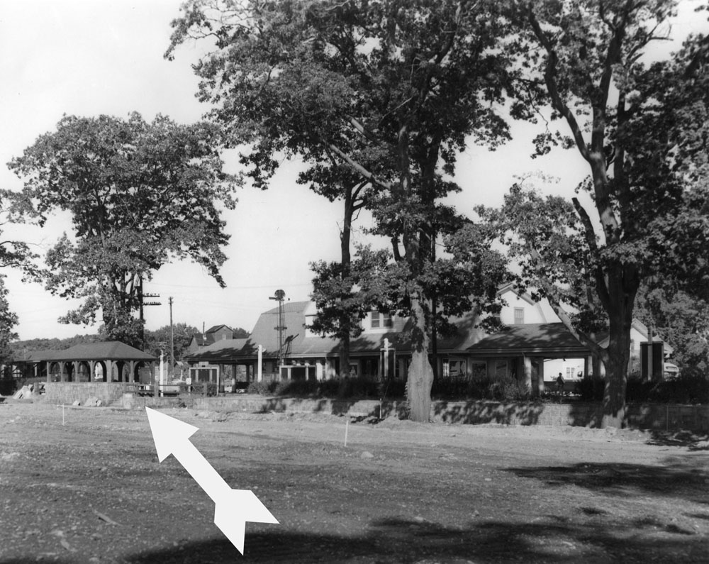
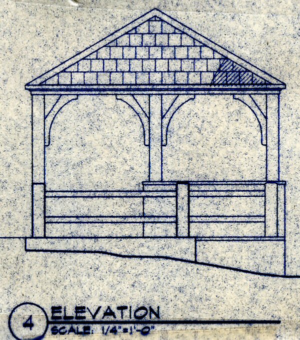
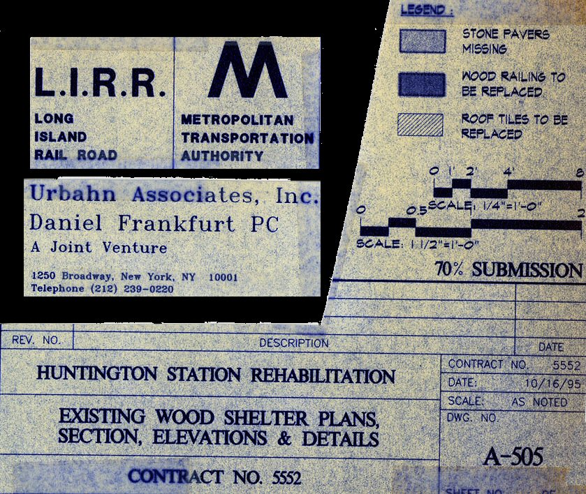
HUNTINGTON STATION: BUILT 1868 (?) ON THE NW SIDE OF N.Y.
AVENUE. CLOSED: 10/1909 WITH OPENING OF NEW DEPOT FURTHER EAST AND
RAZED SOMETIME AFTER.
2ND DEPOT OPENED: 10/1909 ON THE NE SIDE OF N.Y. AVENUE.
Archive/Research material: Dave Keller unless noted
Huntington Station 1906 Emery SUNY-Stony Brook

A coupon of a (probably 4 coupon) Brooklyn –
Huntington excursion ticket. It’s stamped on the back but it’s a
partial and is illegible. The signature sure looks like “S. Spencer”
with a title of General Sup’t.
Per Seyfried’s “The Cross-Island Line” the LIRR reached Huntington in
1868. Transportation to the village was by stage until the first horse
car line opened on 7/19/1890 to great enthusiasm by the public. That
would put the ticket in the range of 1868 through +/-1890. The stage
line went out of business that same year. Info/Archive: Brad Phillips

.jpg)
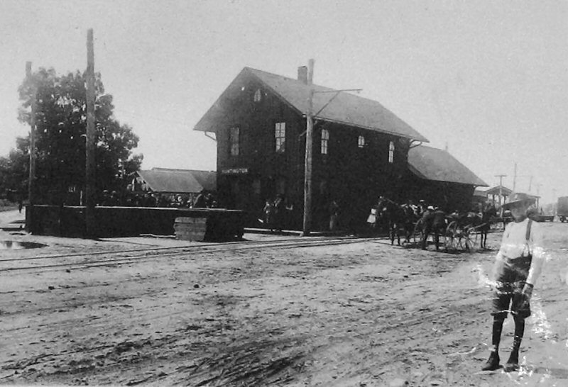
The old Huntington Station located west of New York Avenue (Emery map 1957 location #7 map below), showing a crowd waiting for the New York train due to arrive at 10:12 am, June 9, 1907. Note the summer trolley at right and Petit's Grain and Feed Depot. View NW

Huntington by Edward Lange
Huntington Trolley c.1925 - Emery SUNY-Stony Brook
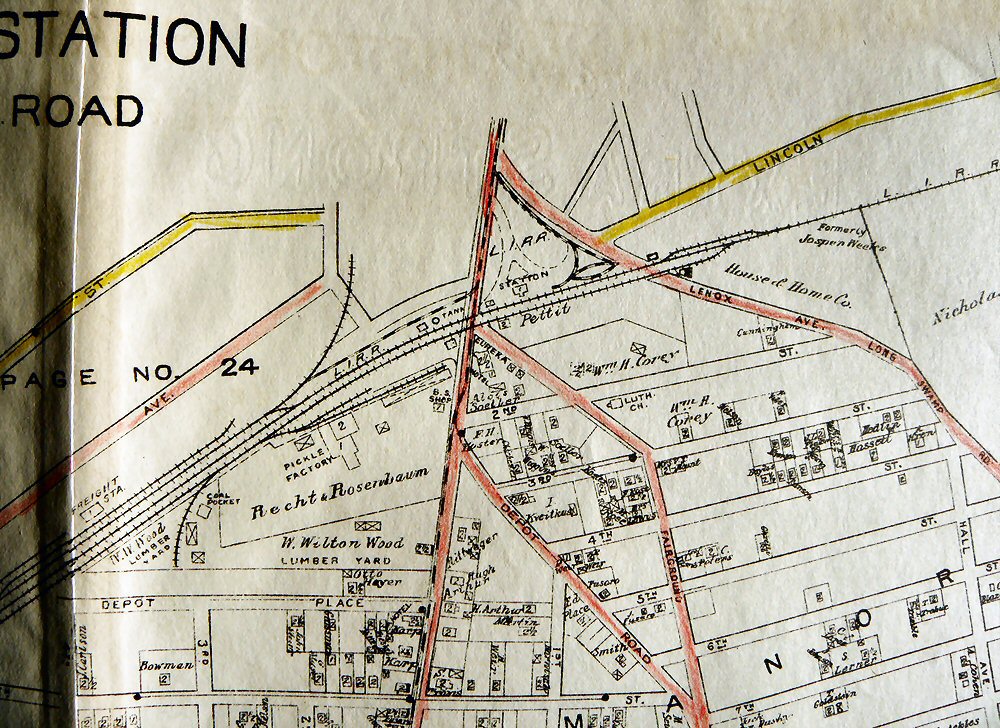
Huntington Belcher-Hyde map 1917
Archive: Dave Morrison
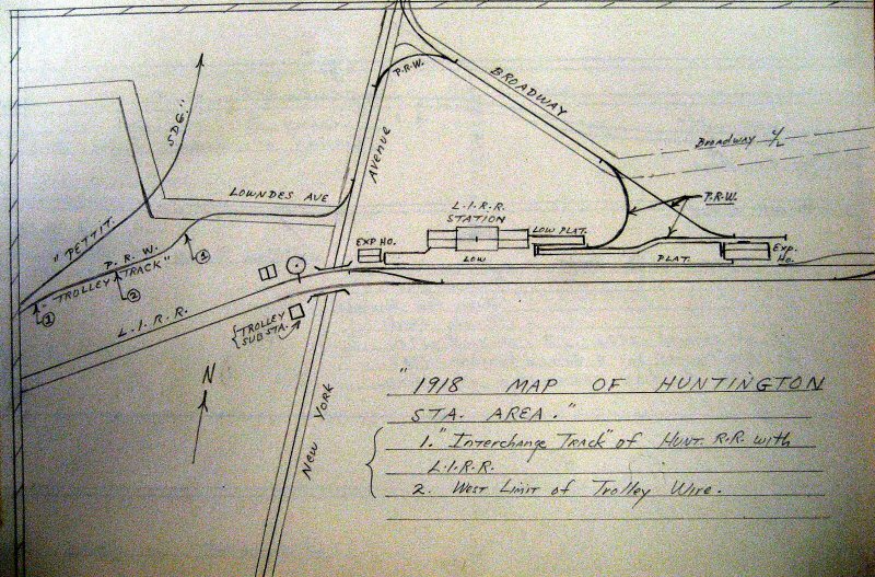
Huntington Station area drawing 1918
Emery SUNY-Stony Brook

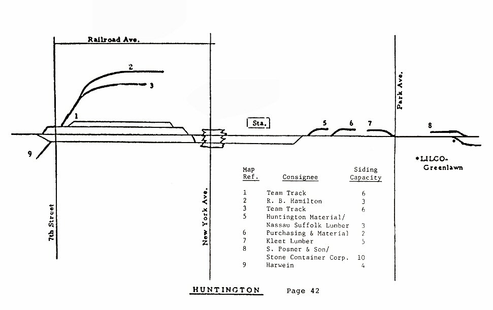
Port Jefferson Branch - Huntington to Greenlawn
Track profile map 1994
Emery map MP35-36 9/1957 Archive: Dave Keller
LIRR 1966 Huntington map #55
LIRR 1978 Huntington map Archive: Jeff Erlitz
#5 Huntington Matl. -Nassau Suffolk Lumber
#6 Mars Cup (later Mars Sales)
#7 Kleet Lumber
East of Huntington Station hand-operated switch 353W
leading to Mars Cup, later Mars Sales - View NE 1/27/1979
Info/Photo/Archive: Jeff Erlitz
East of Huntington Station hand-operated switch 353W
leading to Mars Cup - View NE 11/08/1981
South Siding Extension under construction with Third rail on Main Track
being extended to 1000 feet east of Park Avenue placed in service 1/5/1982
Info/Photo/Archive: Jeff Erlitz

LIRR 1986 Huntington map Archive: Jeff Erlitz
#5 Huntington Matl. -Nassau Suffolk Lumber
#6 Purchasing & Material
#7 Kleet Lumber
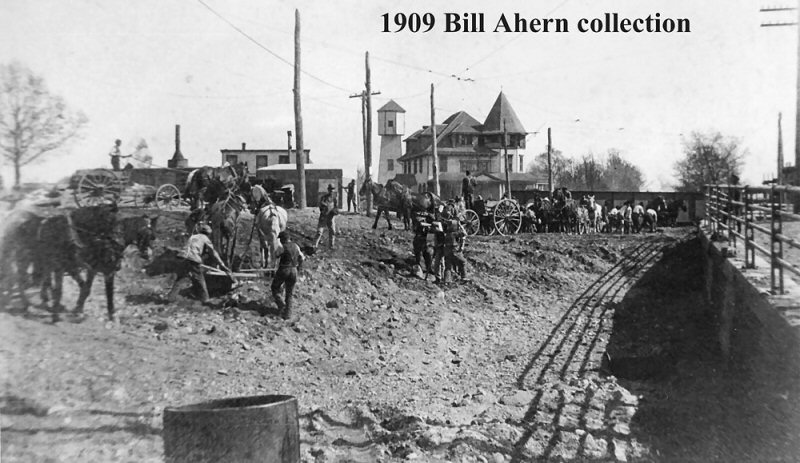
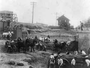
Grade
Crossing Elimination Project 1909
Archive: Bill Ahern, whose
grandfather was the construction foreman on the project,
unless noted.
Huntington Construction 1909 grade crossing (New York Ave. - Route 110) elimination. New station under construction in background. View E
Huntington Construction 1909 grade crossing (New York Ave.) elimination.
Old station in background view W (left), New station view E (right). Archive: Tom Farell
Huntington Construction 1909 grade crossing view S along New York Ave.
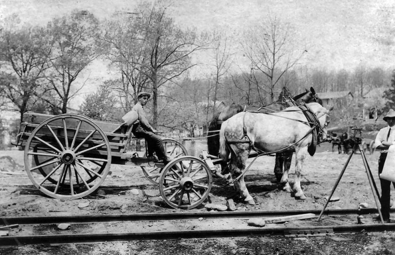
Huntington Construction 1909 grade crossing elimination horse team and construction worker.
Huntington Construction 1909 grade crossing (New York Ave.) elimination.
Old station in background. View SW across Route 110.
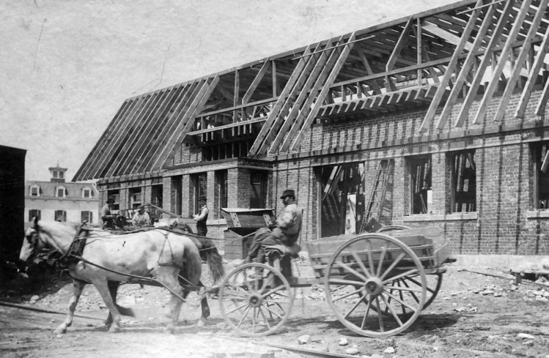
Huntington Construction 1909 grade crossing (New York Ave.) elimination. New station under construction. View NW.
LIRR #80 4-4-0 D55a westbound from Wading River. View is NE from west of the depot, looking towards the depot 1904. Photo: Hal Fullerton Archive: Dave Keller
.jpg)
LIRR #39 G5s train eastbound at Huntington 1950 (Edwards-Keller)
.jpg)
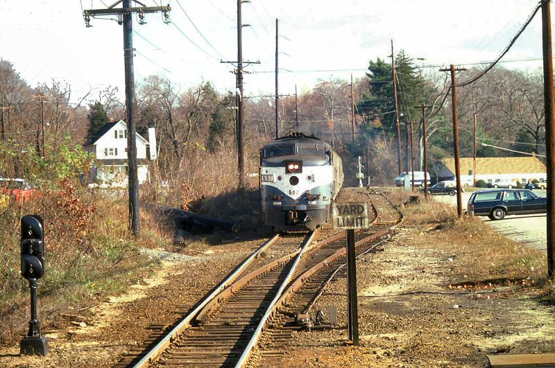
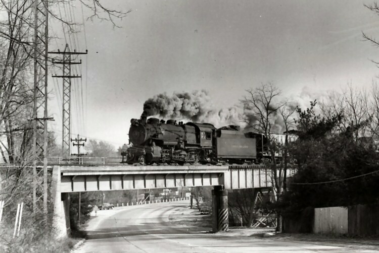
FA2 #603 Push-Pull train 604 Port Jefferson Shuttle eastbound at Huntington 7/26/72 LIRR #227 C420
at power end
LIRR #205 at Huntington Station 1971
Photo/Archive: Richard Glueck
LIRR #611 at Huntington Station 1973
Photo/Archive: Richard Glueck
HUNTINGTON STATION. BUILT: 1868 (?), CLOSED: 1909 2nd RELOCATED DEPOT OPENED: 10/1909
%20-%2010-30-1909%20(Keller).jpg)

.jpg)
.jpg)
.jpg)
.jpg)
.jpg)
.jpg)
.jpg)
.jpg)


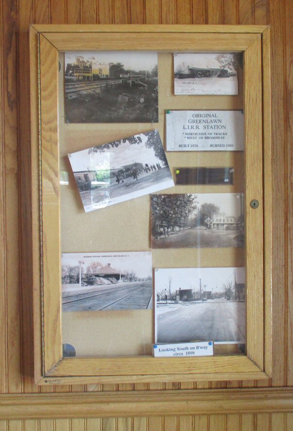
BUILT: 1868 AS "CENTERPORT" RENAMED "GREENLAWN." BURNED: 1909. 2nd DEPOT OPENED: 9/1911. AGENCY CLOSED: ? Research: Dave Keller
Centerport Station c.1878 Photo: George Brainerd
Archive: Queens Borough Public Library

Greenlawn by Edward Lange
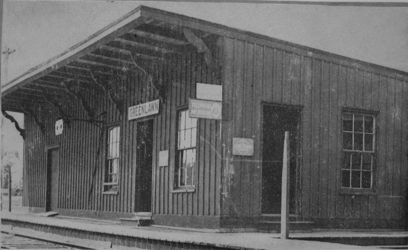
Greenlawn Station original building c.1890

Greenlawn Station - 1909 postcard
Archive: Dave Morrison

.jpg)
Greenlawn Station - LIRR valuation photo 2/14/1918
Archive: Dave Keller

LIRR 1966 Greenlawn map #56
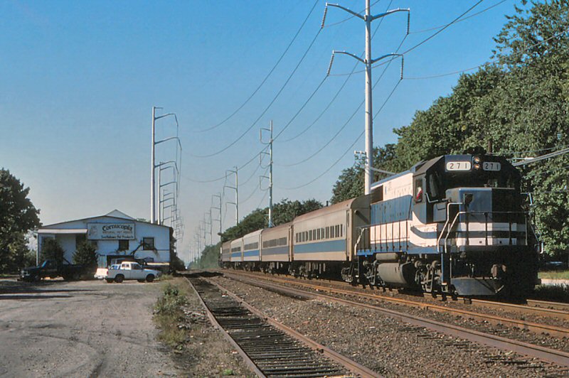
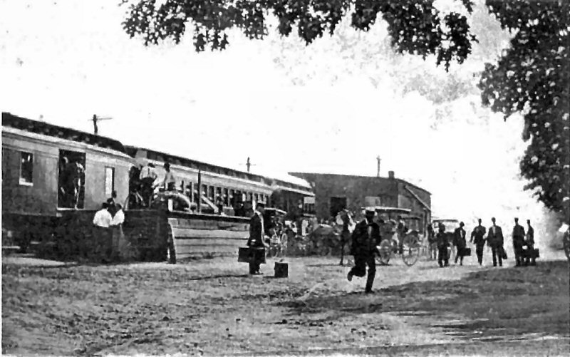
Train #650 LIRR #271 eastbound at Greenlawn team track
8/1987 Photo/Archive: Jay Bendersk
.jpg)
Greenlawn - Third rail test track for newly arrived
DM Locomotives view NW 5/22/1998 Archive: Dave Keller

Greenlawn Station entrance sign
6/12/2019 Photo/Archive: Dave Morrison
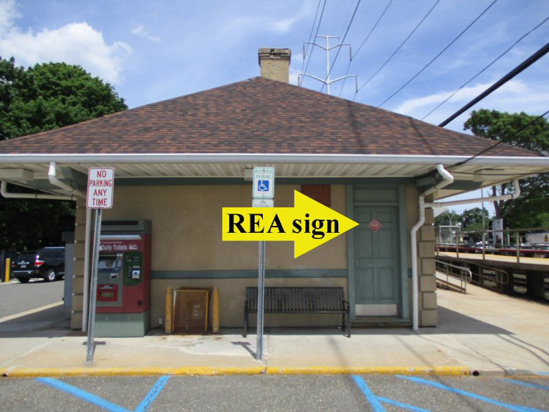
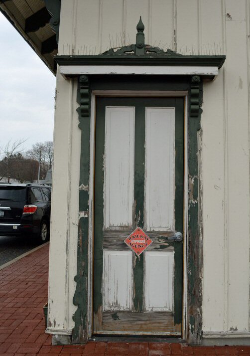
Greenlawn Station - REA sign 6/12/2019
Photo/Archive: Dave Morrison

Greenlawn Station ex-REA door
1/16/2026 Photo/Archive: John Levai
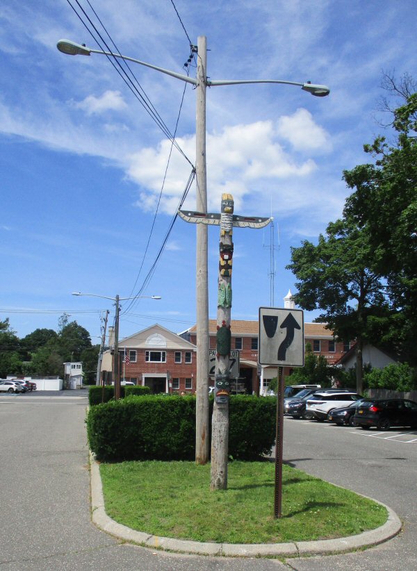
Greenlawn Station - totem pole 6/12/2019
Photo/Archive: Dave Morrison
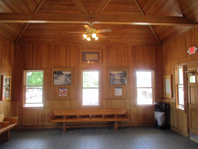
Greenlawn Station interior - 6/12/2019
Photo/Archive: Dave Morrison

Greenlawn Station interior
1/16/2026 Photo/Archive: John Levai
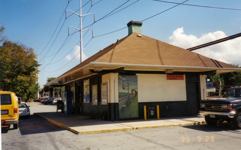
Greenlawn Station- View W 9/29/1995 - mural of old Shinnecock Hills Station Photo/Archive: Dave Morrison
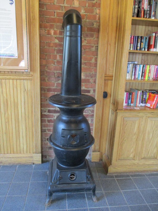
Greenlawn Station - pot belly stove 6/12/2019
Photo/Archive: Dave Morrison
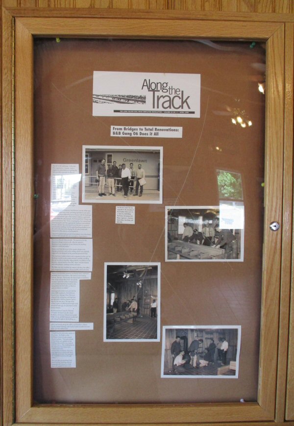
Greenlawn Station interior display 6/12/2019
Photo/Archive: Dave Morrison
Greenlawn Station interior historic photo display 6/12/2019 Photo/Archive: Dave Morrison
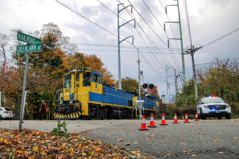
Greenlawn - LIRR #160-150 dropping rail west of the station. MTA PD is seen protecting the crossing, as the train was moving at a walking pace making frequent long stops. 11/13/2021 Photo/Archive: Thomas Farmer
ABANDONED: 10/17/1899. SPUR USED ONLY FOR FREIGHT SERVICE THEREAFTER
Research: Dave Keller
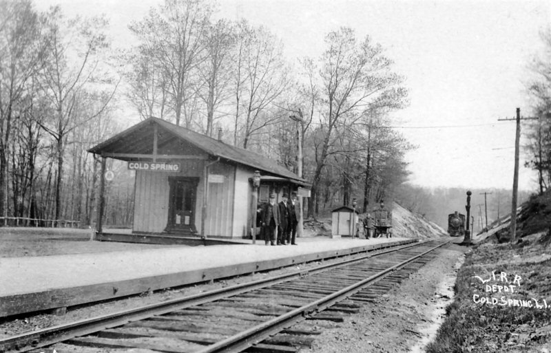
The Hicksville & Cold Spring Branch Railroad was built from Hicksville to Syosset in 1854. It was leased to the Long Island Railroad, and sold to it in 1863. Syosset was at this time an important terminal, and people came from Huntington and Northport in their carriages down to Syosset to take the trains. A few wealthy members of the Jones family of Cold Spring Village, undertook the enterprise of grading the road to their village, which they did in 1862. This road enters Cold Spring along the west side of the stream and mill ponds. But after the line had been graded a dispute arose between the members of the Jones family and the Long Island Railroad as to the exact location of the terminal. As the parties could not agree, the railroad finally abandoned the idea altogether, and when the road was finally extended to Northport the route was a more inland one, leaving Cold Spring to the north.
In 1867 a right-of-way and depot site in Huntington had been granted by the town to the Long Island Railroad, but Oliver Charlick got into a dispute with certain landholders, and with characteristic obstinacy, refused to yield. The road fell through, the more liberal terms of Northport being accepted. The Long Island Railroad extended the branch to Northport Village, leaving Huntington Village to the north, in April, 1868. For quite a few years there was no station opposite Cold Spring, the passengers from that village being obliged to go to either Syosset or Huntington. This aroused the antagonism of the villagers to a great extent. Soon after, however, a station called "Cold Spring Harbor" was established at the small settlement of Woodbury.
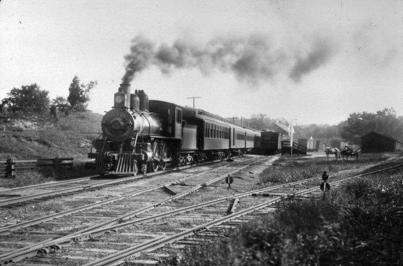
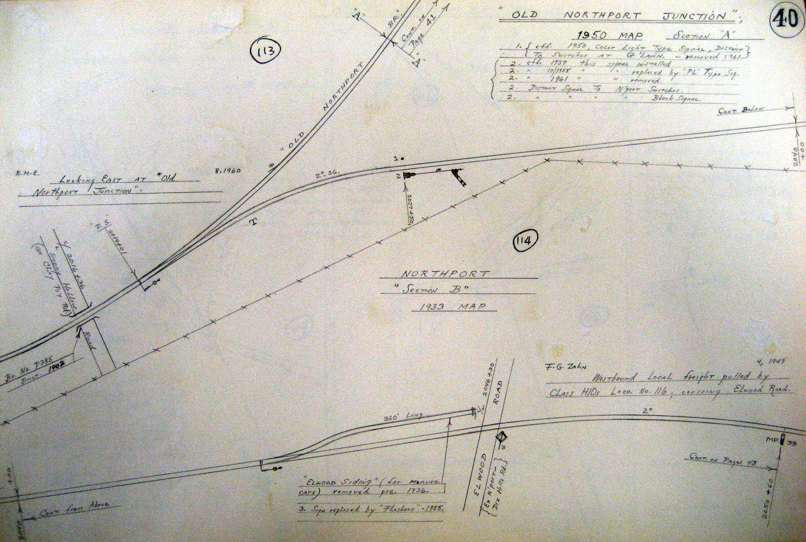
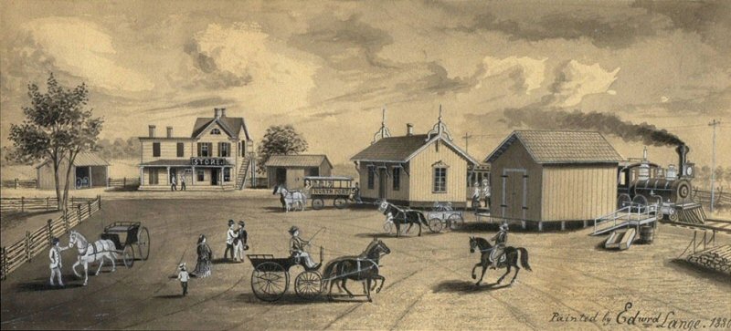
The Long Island Railroad stimulated the building of a further extension by a subsidiary company, the Smithtown & Port Jefferson Railroad Company, in 1870. This extension left the old line at Northport junction, on the highlands back of Northport Village, and continued to Port Jefferson. The first station, known as East Northport, soon became known merely as Northport Station, the line into the village from Northport junction being abandoned. Research: Felix E. Reifschneider
Northport Terminal 1878 Photo: George Brainerd
Archive: Brooklyn Public Library

July 4, 1880 ETT shows "Old Northport" and "New Northport". Train #505
ran as a passenger train to Old Northport then as a mixed train to Port Jefferson.

LIRR timetable from 1890 lists "Northport East Station",
"Northport", and "Northport Junction".
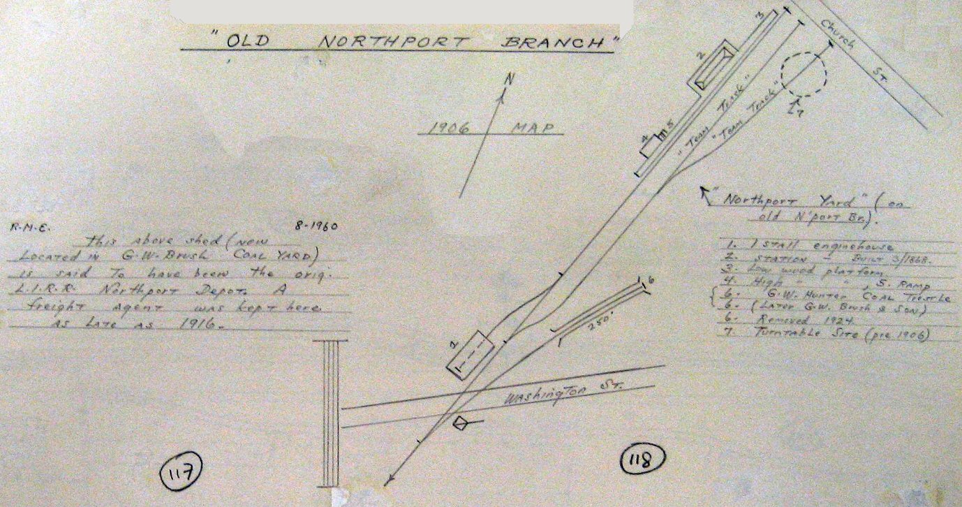
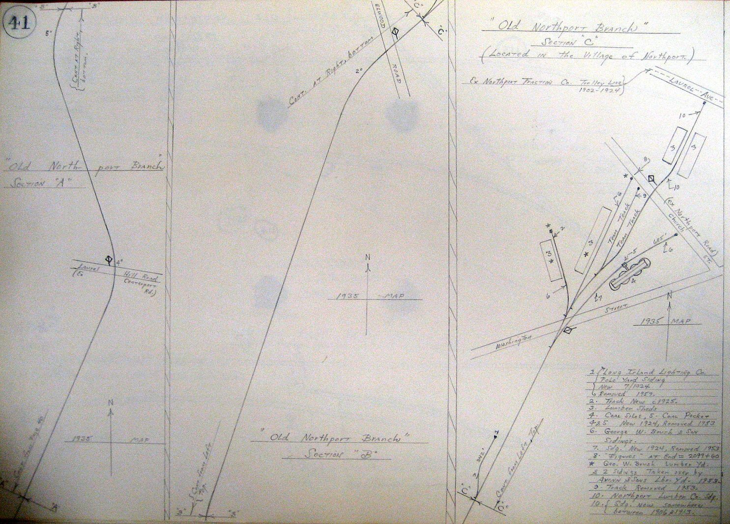
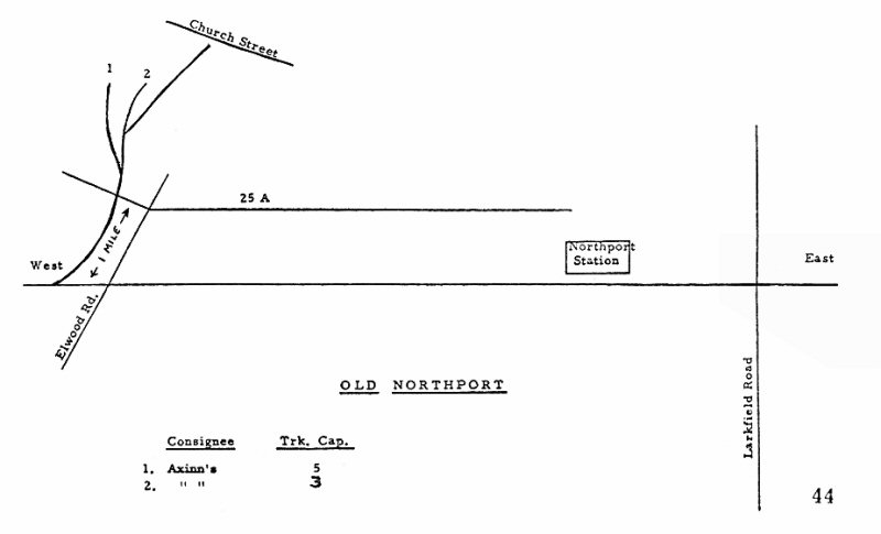
Emery Old Northport Branch 1906 - Redrawn Steve Lynch
Archive: SUNY Stony Brook
Archive: SUNY Stony Brook
Archive: SUNY Stony Brook
1917 Belcher Hyde - Old Northport map
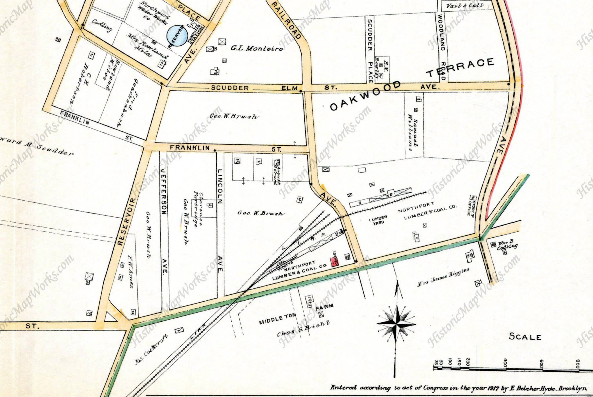
Northport Lumber & Coal Co., Railroad Ave
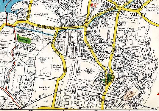
Northport 1941 Hagstrom map
Northport - Kings Park map - Henry Raudenbush
c.1950

Emery map - Old Northport Branch 5/1958
Archive: Dave Keller
Later Axinn & Son's Lumber
Northport Lumber Co. at Church St.-View E c.1960's
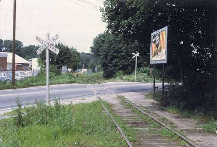
Axinn & Son's Lumber at ex-Washington St. crossing (now Ft. Salonga Rd.- 25A) to the original Old Northport Station location. - View NE
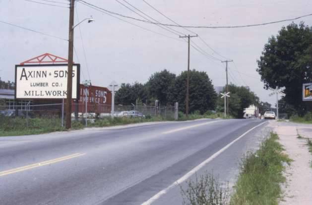
Axinn & Son's Lumber at ex-Washington St. crossing (now Ft. Salonga Rd.- 25A) to the original Old Northport Station location. - View SE c. 1978+ Currently a King Kullen Shopping Center; 2020.
.jpg)
RDC's #3101, #-3121 Old Northport 9/1956 Special (Rugen-Huneke)
BUILT: MAY-JULY/1873. ALSO KNOWN AS "NEW
NORTHPORT". APPEARS ON ETT #10 EFF: 06/28/1899 AS "NORTHPORT (EAST STATION)."
APPEARED ON 1901 TIMETABLE AS "NORTHPORT EAST." MOVED TO PRIVATE LOCATION:
1927. USED AS OFFICE FOR A SIGN COMPANY. RAZED: 1959.
2ND DEPOT BUILT: 1927 FREIGHT STATION MOVED HERE IN PIECES FROM CAMP
UPTON WHEN LIRR ENDED OPERATIONS THERE AFTER 4/1922.
TICKET AGENCY CLOSED: 08/19/2009. STATION "HISTORICALLY REMODELED:" 01/2019 Research: Dave Keller
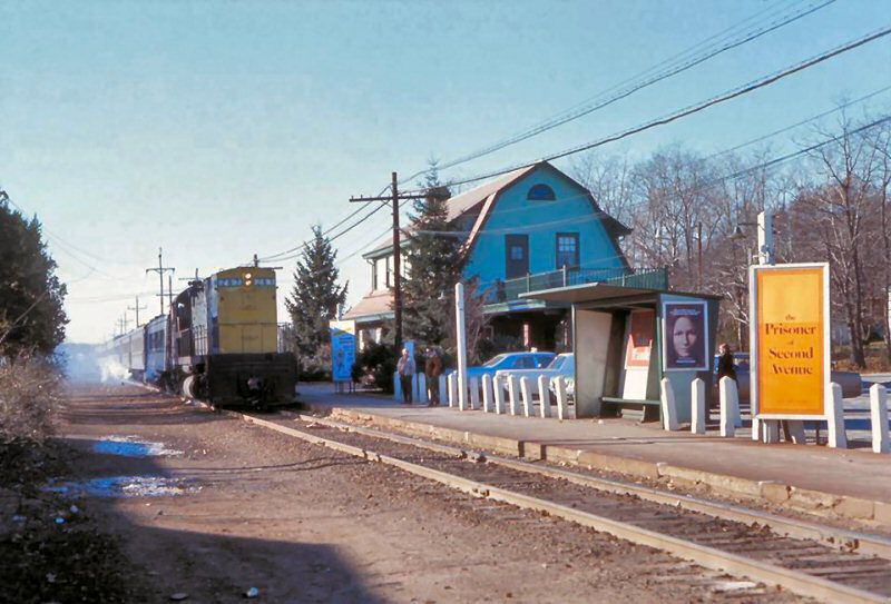
Northport Depot - View E by artist Edward Lange 1880
Northport station as it looked c. 1910 with a
Northport Trolley behind the depot. Archive: Dave Keller
.jpg)
Northport Station - H3 2-8-0 #162 First train from
Penn Station - Northport Traction #601 9/08/1910
Archive: Dave Keller
.jpg)
Northport Station - Traction Car #602 c.1912
Northport Station - View E c. 1927+ Archive: Jim Gillin
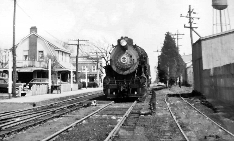
LIRR #111 Northport Station - View W 1952
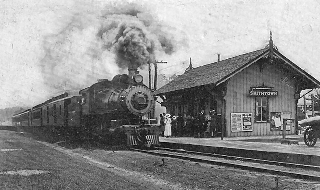
Notes: The low-level
platform (above) between the main track and the passing siding, similar
to what was in place at the time at Smithtown. It was smart because it allowed
passengers to board or get off the train if their train had
to take the passing
siding. "NP" semaphore block
signal relocated behind the photographer to east of the Larkfield Rd. crossing
and converted to position light. Signal and block office out
of service in 1963. Info: Dave Keller
LIRR #113 Northport Station - View E 1952
Photo: John Krause
Northport MP39 - View E c.1950 Archive: Northport Public Library
%20-%201957%20(Keller).jpg)
Northport Station original building in private use 1957
Archive: Dave Keller
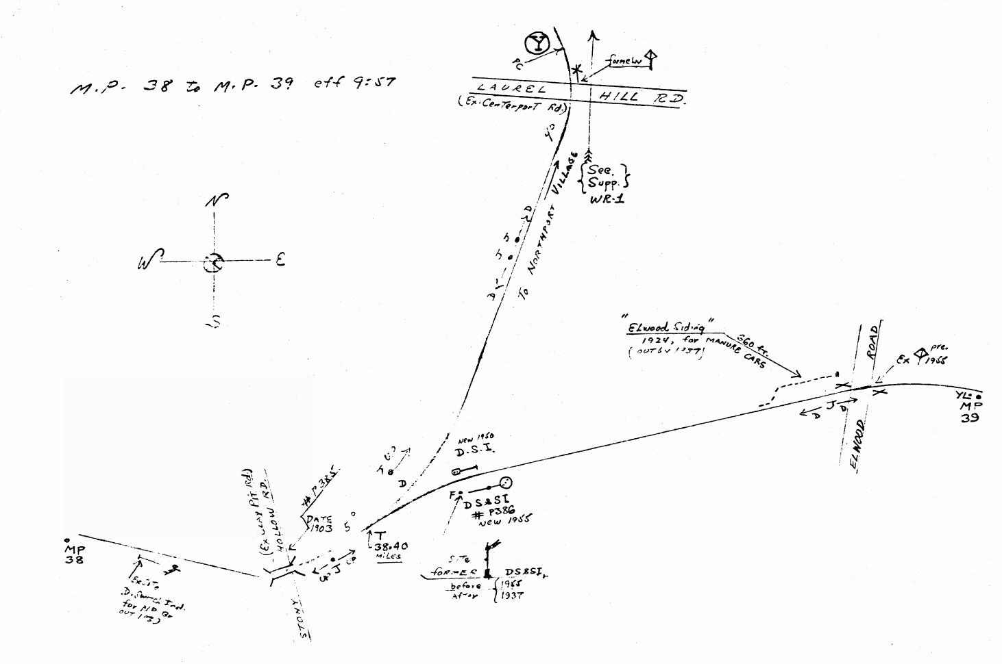
Emery map - Northport MP38-39 9/1957
Archive: Dave Keller
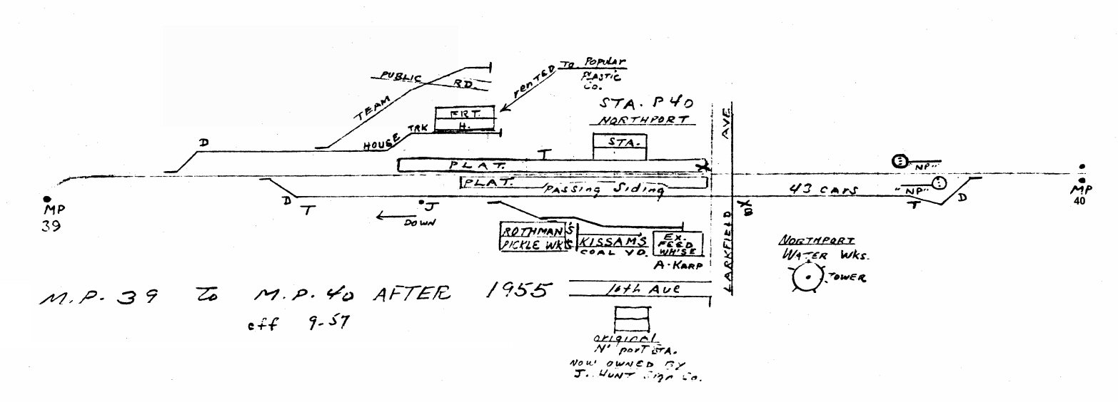
Emery map - Northport MP39-40 after 1955 9/1957
Archive: Dave Keller

East Northport MP40+ - VA Hospital siding new 1934 removed 1950
per Emery map below - 1947 USGS topographic map

Emery map - Northport MP40+ VA Hospital 9/1957
Archive: Dave Keller
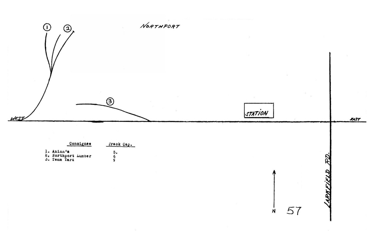
LIRR 1966 map - Northport map #57
.jpg)
FA1 #616 westbound at Old Northport Junction
View E 2/26/1977 (Madden-Keller)

Emery map - Northport MP41-42 - 9/1957
Archive: Dave Keller
.jpg)
H10s #107 freight westbound over Bread and
Cheese Hollow Rd. trestle Northport - c.1952
Photo: John Krause - Archive: Dave Keller
.jpg)
ALCO FA1 #615 - Push-Pull train westbound on Bread and
Cheese Hollow Rd. Trestle 11/1980 (Mazzarone-Keller)
Northport Station - LIRR C-420 #207 - Train #4234
View W - 12/04/1974 Photo: Richard Makse
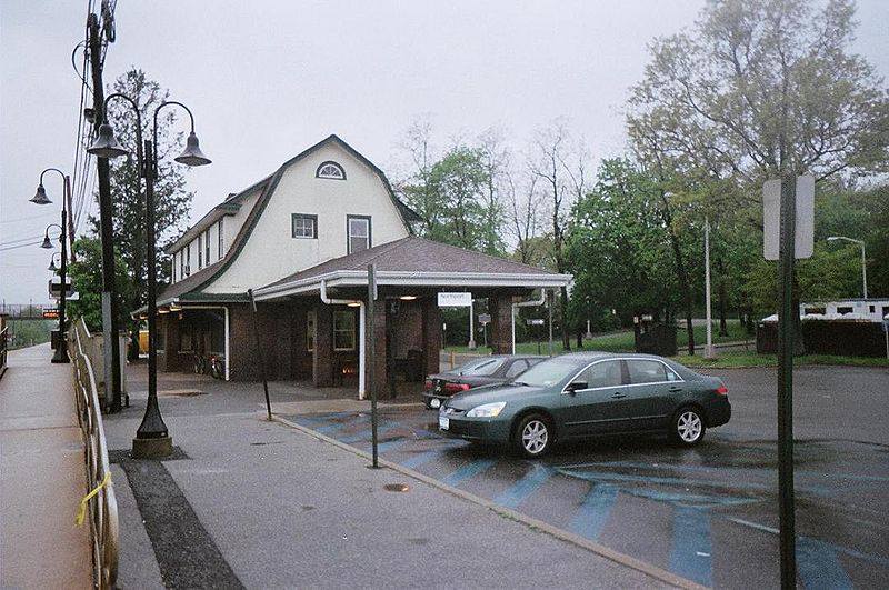
Northport Station - View W 2020

Northport Station - 6/12/2019 Photo/Archive: Dave Morrison
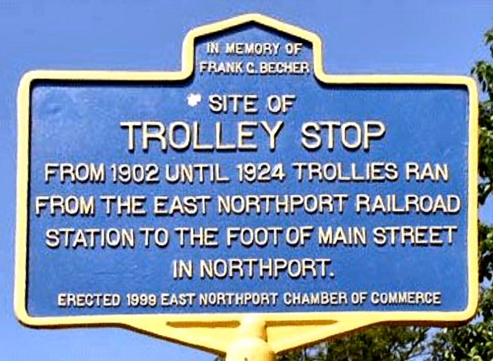
Northport East (LIRR 1901) )Trolley Stop Historical Marker
erected 1999 - East Northport Chamber of Commerce
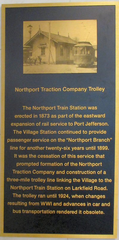
Northport Traction Co. plaque 6/12/2019 Photo/Archive: Dave Morrison
Northport Station interior - 6/12/2019
Photos/Archive: Dave Morrison
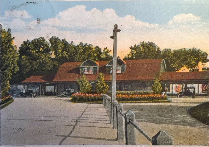
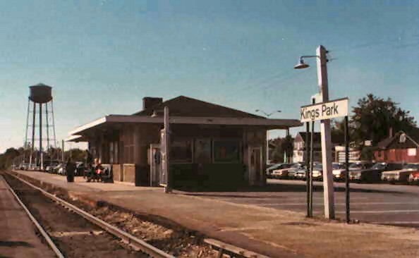
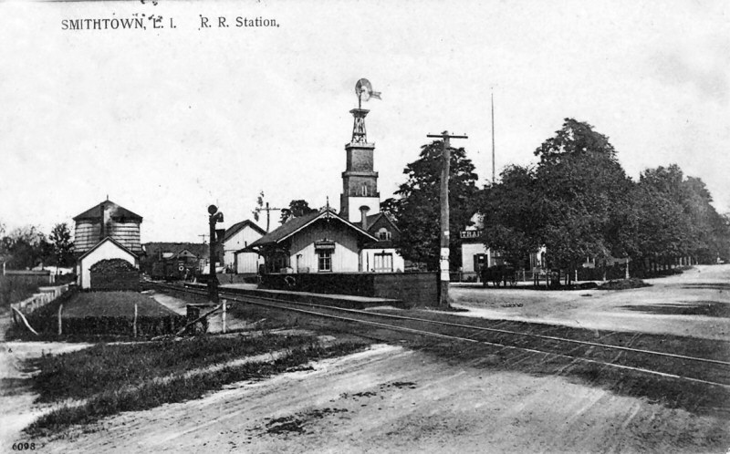
BUILT: NOV-DEC/1872 AS ST. JOHNSLAND. RENAMED “KINGS PARK”: 6/1891 (Per V. F. Seyfried) RAZED: 1948 2nd DEPOT BUILT: 1948. REMODELED: ? AGENCY CLOSED: ?

.jpg)
G5s #50 Train westbound at Kings Park State Hospital
Station 3/1936 (Harrison-Keller)
.jpg)
Kings Park station and "JO" unattended block station signals viewed east - c. 1934 (Jeff Winslow photo, Dave Keller archive)
Looking west at the old Kings Park station (above) on August 30, 1934, notice the station sign identifies the stop as "King's Park" using the possessive apostrophe. As the manned block office closed in June, 1932, the "JO" unattended block station signals visible lower down on the signal mast trackside were used in conjunction with clearance ("K") cards. Semaphore signals were no longer in use and the blades were removed from the mast sometime afterward. This image shows that as of the date of this photo, the semaphore blades had been removed from the mast. The boxcar at the far right was on the spur which once ran behind the depot and eastward to Kings Park State Hospital. The distant water tower was just east of the start of the spur and the sight of the February 16, 1947 wreck of eastbound train #4612 pulled by PRR K4s #5406. (Fred Weber photo / Dave Keller data).

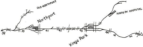
Kings Park Hospital Spur
Emery Map 9/1957 Archive: Dave Keller
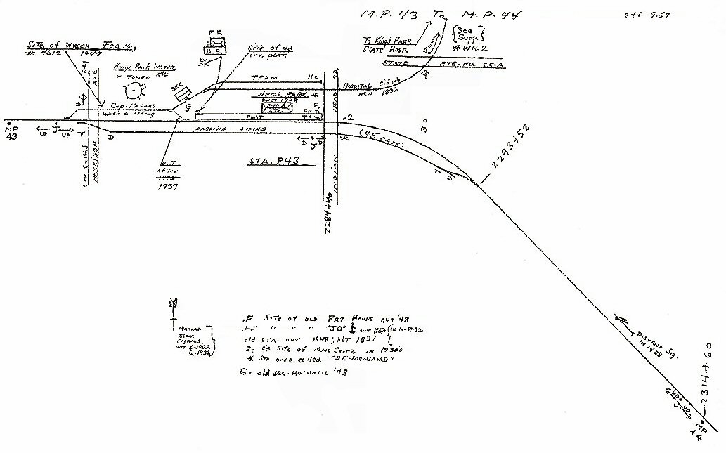
MP43-44 Kings Park Emery Map 9/1957
Archive: Dave Keller
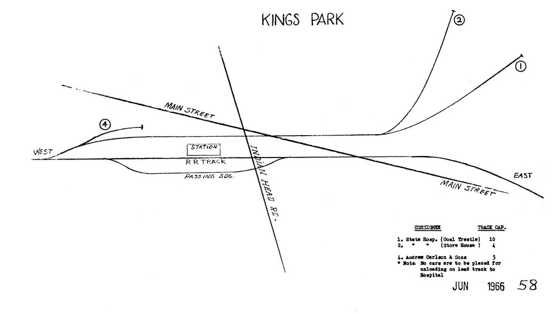
LIRR 1966 Track Map #58
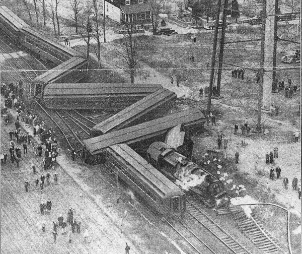
Wreck at Kings Park 2/16/47 Aerial view
shortly after the wreck. Photo: Daily News
%20-%2008-55%20(Higginbotham-Keller).jpg)
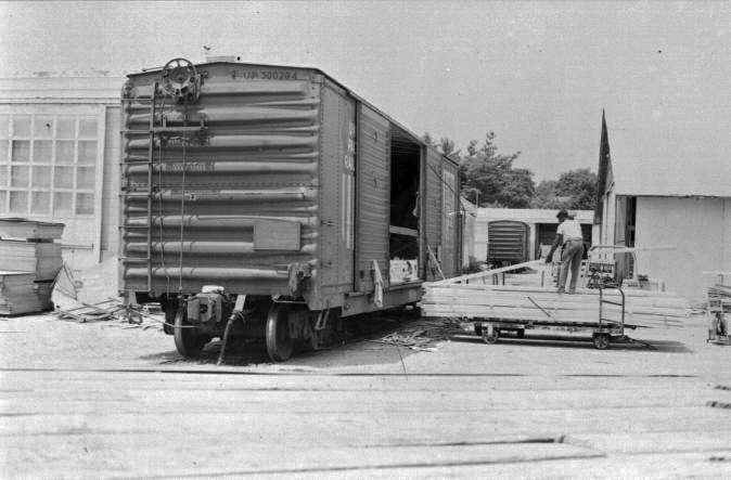
H10s #113 freight backing onto hospital siding behind
Kings Park station 08/25/55 (Higginbotham-Keller)
RS-3 #1558 view E c.1964+
.jpg)
RS3 #1551 Train #4647 westbound at Kings Park
State Hospital Station 1964 (Schneider-Keller)
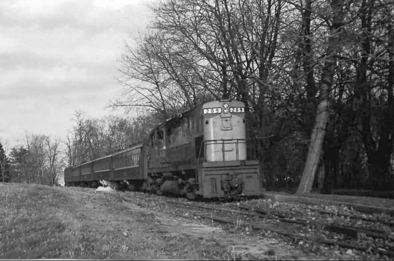
C40 #209 westbound at Kings Park
State Hospital Station (KPHS) 11/1969 (Emery-SUNY-Stony-Brook)
LIRR #214 westbound - Bread & Cheese Hollow Rd., Kings Park 12/1966 (J.Guthrie - Emery SUNY-Stony Brook)
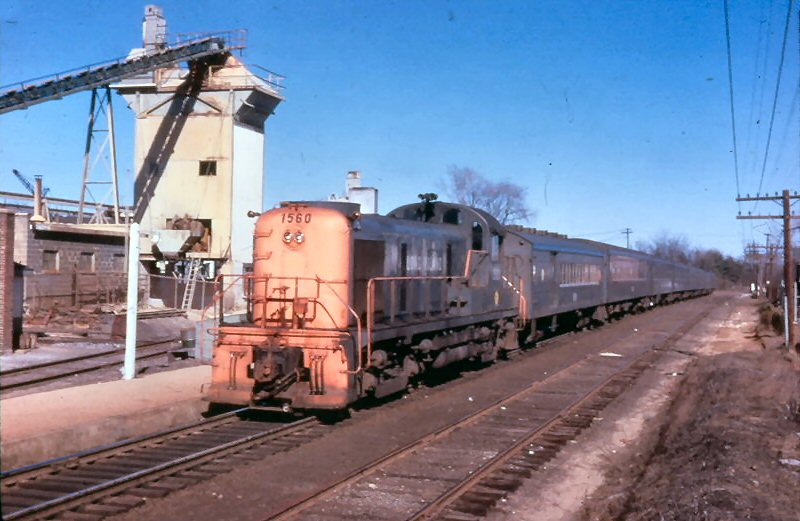
RS-3 #1560 in Goodfellow Gray view E Winter 3/25/1962
Station view NE 1/1966
Notice the LIRR MOW truck in the right background. It looks like an old REA truck, but it's got Dashing Dan in the round yellow circle. Also, look behind the depot at the left. There appears to
be a hospital train laying up back there. Info/Archive: Dave Keller

RS2 #1520 leading an eastbound passenger train approaching King Park station - c.1962
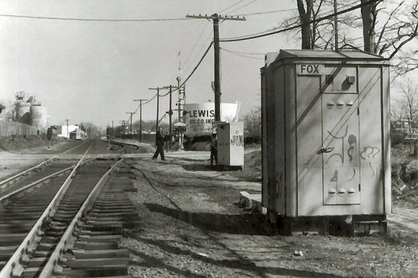
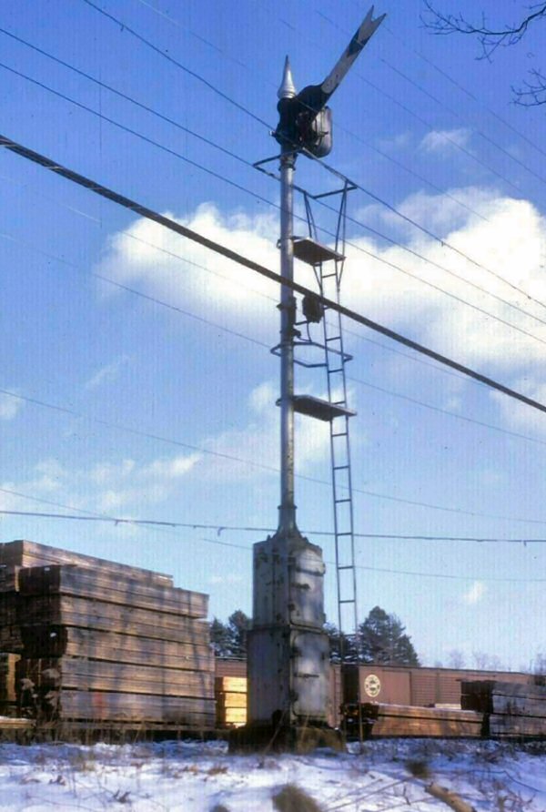
“FOX” CTC Cabin west of Kings Park
Photo: Dave Keller 1969
.jpg)
DOT GTE 4 car train westbound at Kings Park State Hospital Station 11/1977 (Madden-Keller)
Kings Park Station - c.1980's view W
Photo: Fred Lindauer Archive: Steve Lynch
C424 #218 at MP34 westbound

C420 #223 "Smoking It Up" Photo: Mike Koehler c.1983
Photo: Mike Koehler c.1983
Indian Head Road view west C53 on the rear, 223 on
the head end. Photo: Mike Koehler c.1983
LIRR #228 Kings Park State Hospital spur view taken from the hill south of Old Dock Road, looking N toward Patiky Street c. 1985 Photo: Dave Flynn
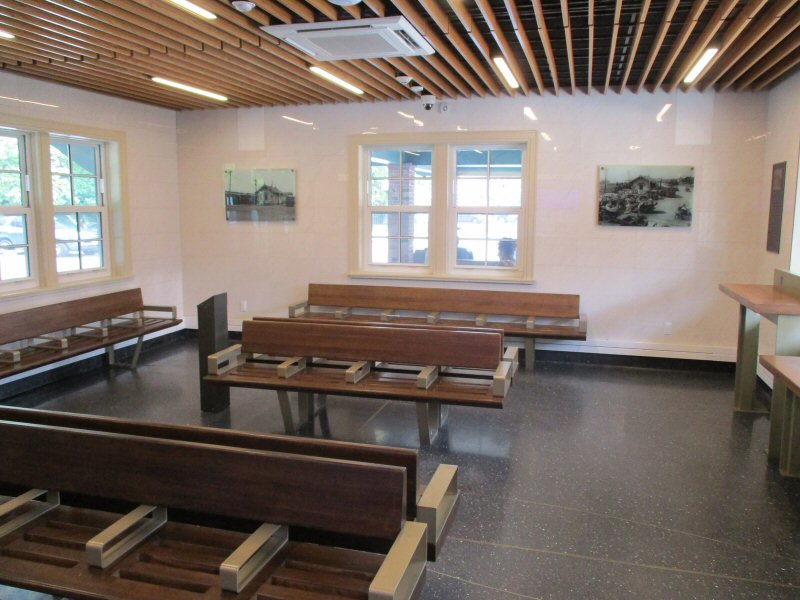
Kings Park Station interior 6/12/2019 Photo/Archive: Dave Morrison
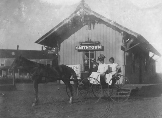
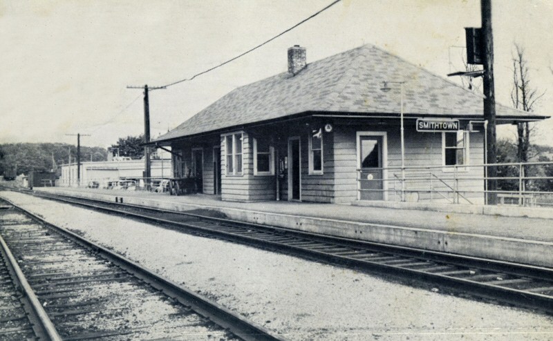
BUILT:
NOV-DEC/1872, CLOSED: 11/6/1936, WITH GRADE CROSSING ELIMINATION OF ROUTES 25 AND
25A.
MOVED TO PRIVATE LOCATION: EARLY IN 1937.
2nd
ELEVATED DEPOT IN SVC: 2/18/1937. REMODELED: 1987 WITH HI-LEVEL PLATFORM INSTALLATION. AGENCY CLOSED: ?
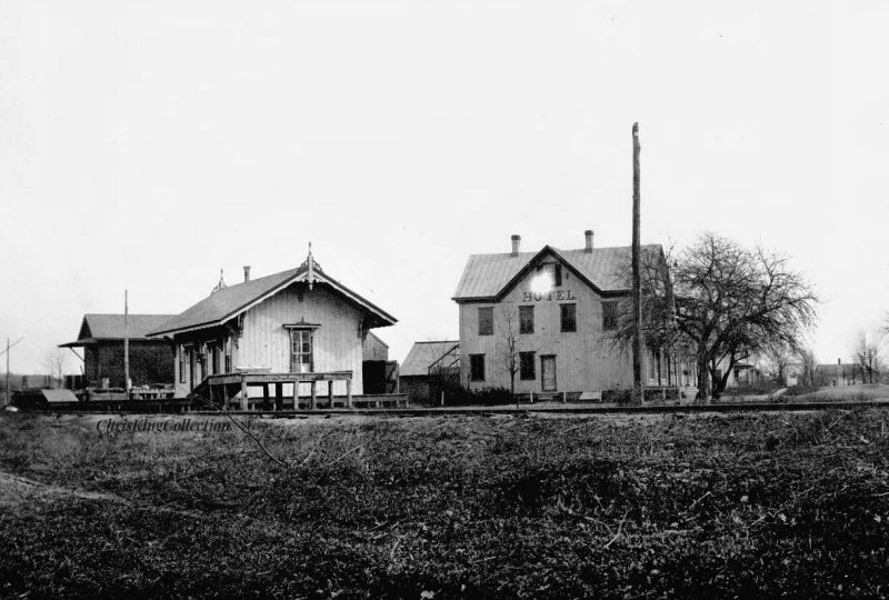
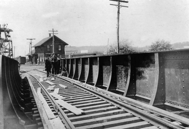
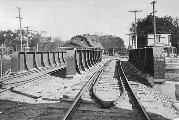
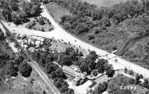
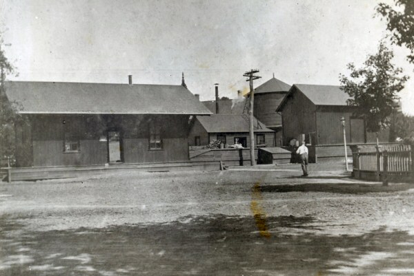
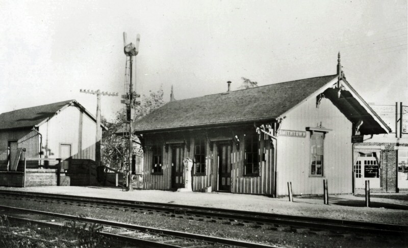
Smithtown Station view SE in 1878. The large structure to the right of the station is the Trainor Hotel, which was a very popular rest spot for travelers coming through on both by train, and by horse and buggy. The hotel unfortunately succumbed to a horrible fire on December 5, 1909 and was never rebuilt.
Photo: George Brainerd Archive: Brooklyn Museum Digital Archive
Smithtown Station, Express House and Freight House at far left. View is SE c. 1910
from the Rte. 25-25A crossing Archive: Carol Mills
Smithtown Station - View N c.1900
Archive: Tommy Farrell
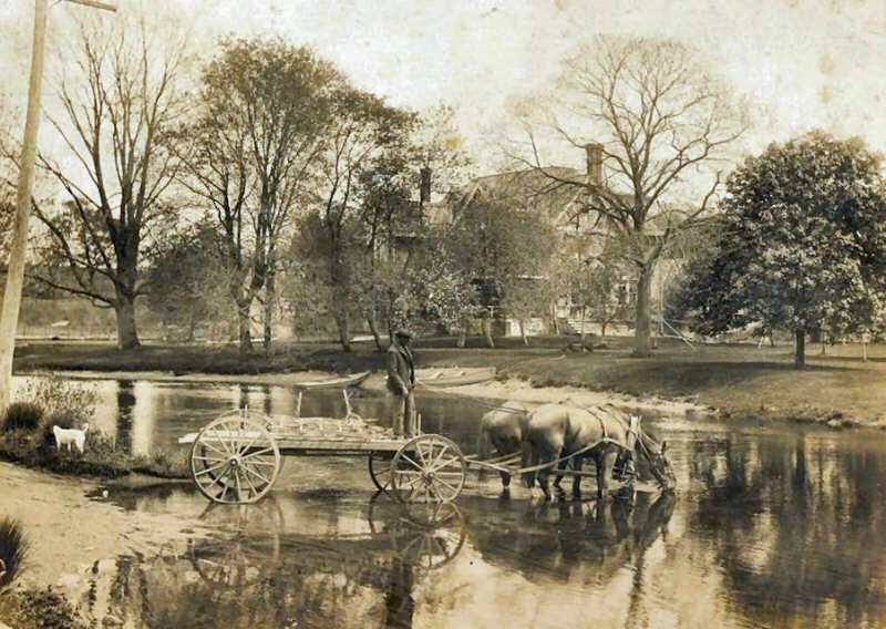
Riverside Inn - Nissequogue River, Smithtown view SW c.1900 Library of Congress
LIRR trestle embankment in left background
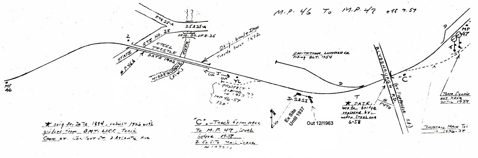
Emery - Smithtown MP46-47 9/1957
Archive: Dave Keller
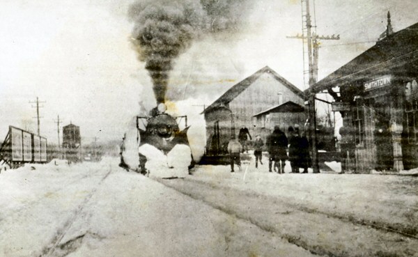
Smithtown - Semaphore D.S. & SI MP46.5 Last month of a semaphore in service 12/1963 View NE
Photo/Archive: Art Huneke
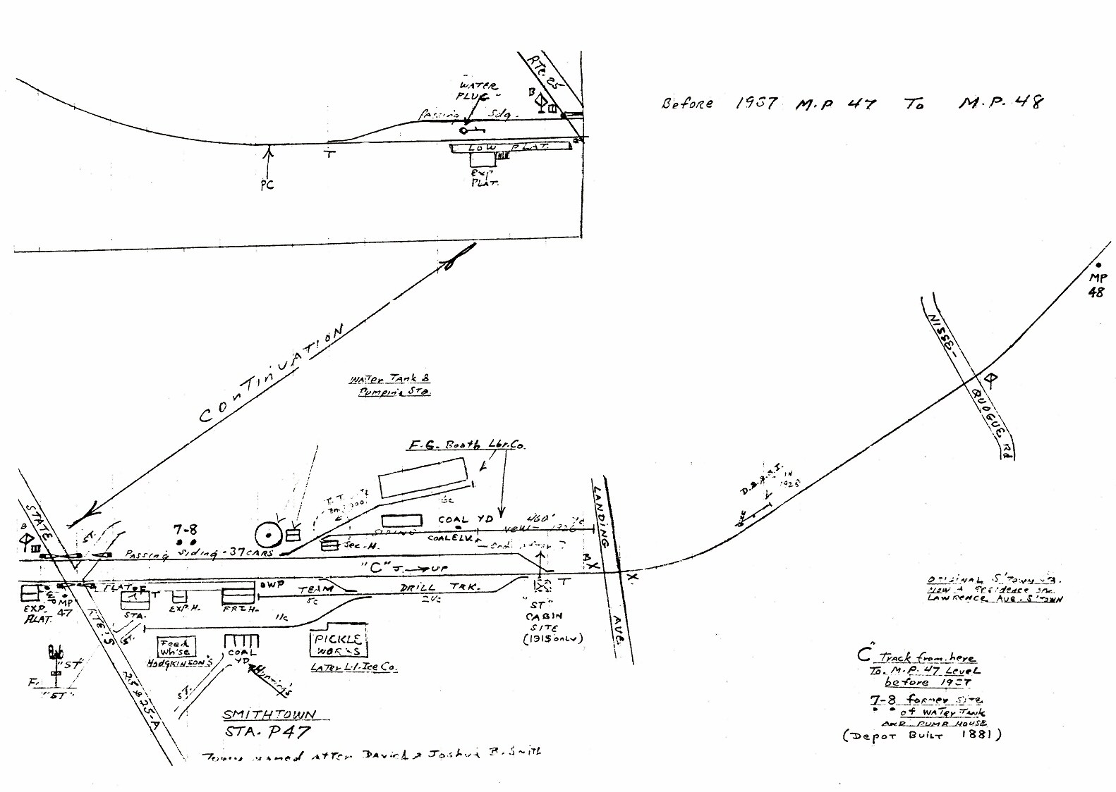
Emery - Smithtown MP47-48 pre-1937 9/1957
Archive: Dave Keller
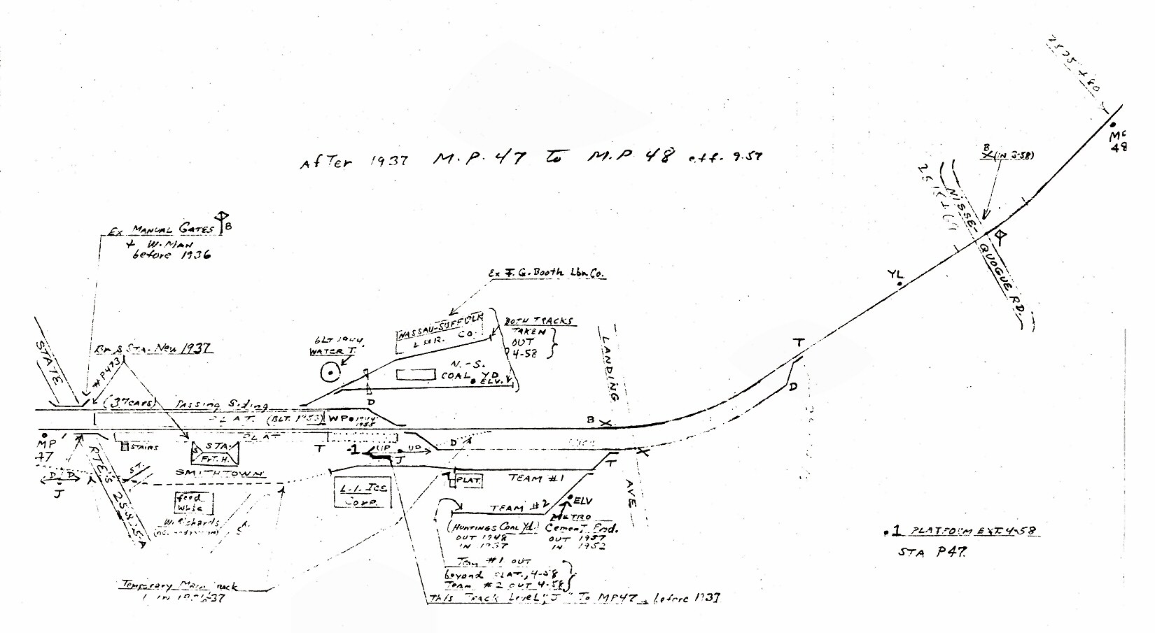
Emery - Smithtown MP47-48 post-1937 9/1957
Emery maps archive: Dave Keller

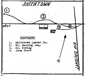
"LIRR Agrees To Find New Smithtown Freight Yard"
10/03/1968 - The Smithtown News

Railroad trestle in Smithtown, 1878

Smithtown wooden trestle location
1878 Emery map
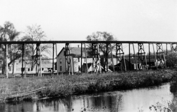
Smithtown wooden trestle view NE c.1890
Archive: Emery SUNY
Research: David Bauer Photo: George B. Brainerd Archive: Brooklyn Museum
Smithtown station 1878 view E Photo: George Brainerd
Smithtown steel trestle LIRR class D56 American 4-4-0
Smithtown - LIRR Trestle at Frank Friede's Riverside Inn post card - View NW
Smithtown station c.1878 Photo: George Brainerd
Archive: Brooklyn Public Library
Smithtown station 1903 view SE
Smithtown station 1905 view N Archive: Tom Muratore
Smithtown station 1906 view S
Smithtown station c. 1905 Archive: Tom Muratore
Smithtown station 4-4-0 class D16b and train westbound
c. 1910 Archive: Tom Muratore
Smithtown station winter 1925 view E
.jpg)
Smithtown Station c. 1928 Archive: Maggie Land Blanck
Smithtown station 1935 view SE
Smithtown station 1942 View SE
Smithtown Station - View E 1979
Once
high-level platforms were installed at the station to handle the new
push-pull service, the overhanging eaves trackside had to be cut back
to allow for passenger clearance overhead, totally ruining the
architectural lines of the depot building.
When
it was decided to eliminate the grade crossing in
Smithtown
and construct a new depot building, the old, original structure was
moved south of the location to
“POST” INTERLOCKING (R.C.) EAST
OF SMITHTOWN (REMOTE FROM “DIVIDE”. IN SVC: 12/20/63. NAMED AFTER
RETIRED SIGNAL DEPARTMENT CIRCUIT
ENGINEER HOWELL B. POST per The Long Island Railroader:
10/11/61. OUT OF SVC: 10/3/77. BECAME “POST 2” LOCATION.
“POST 1” INTERLOCKING (R.C.) WEST OF SMITHTOWN (REMOTE FROM “DIVIDE.”
IN SVC: 10/3/77. FORMERLY “HARE”)
“POST 2” INTERLOCKING (R.C.) EAST OF SMITHTOWN (REMOTE FROM “DIVIDE.”
IN SVC: 10/3/77. FORMERLY “POST”) Research: Dave Keller
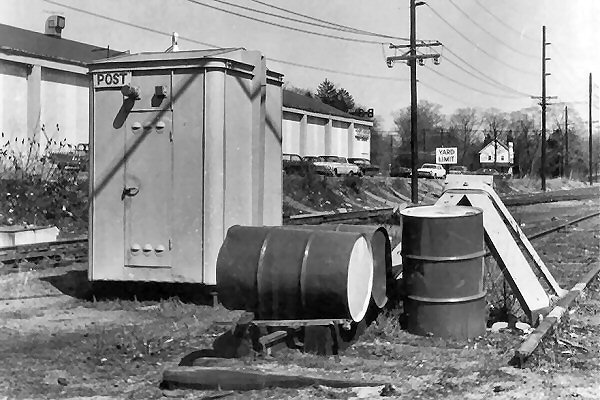
POST CTC Cabin at Smithtown 1969 operated remotely from "DIVIDE." In 1977 it became "POST 2".
Photo/Archive: Dave Keller
HARE CTC Cabin west of Smithtown 1969
In 1977 renamed "POST 1"
Photo/Archive: Dave Keller
LIRR FA2 #602 Smithtown within POST 2 Interlocking View E c.1982 Photo/Archive: David Flynn
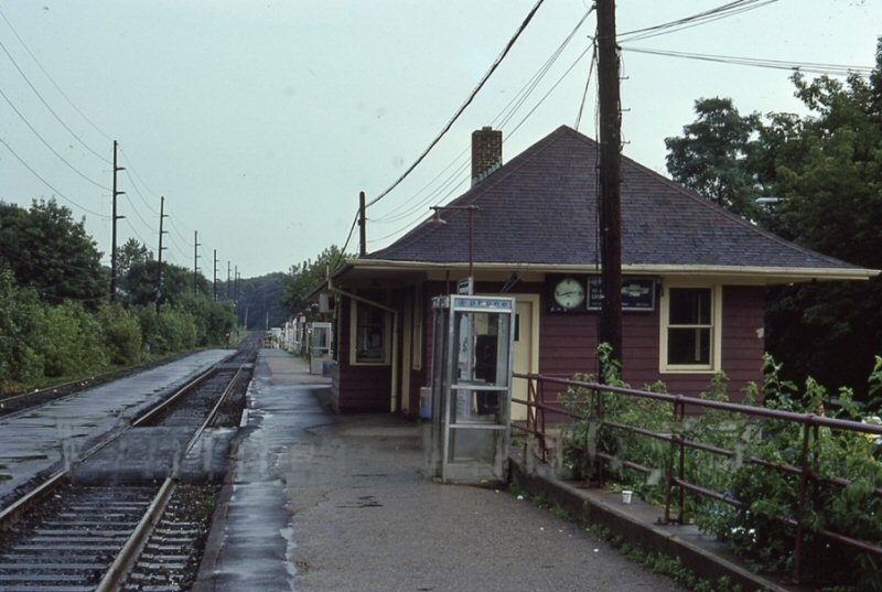
ex-Smithtown Station view N 2014 Archive: Google

ex-Smithtown Station view W 2014 Archive: Google
ex-Smithtown Station view W 1/04/2017
Photo: Mike Tarq
Smithtown Rte.25-25A crossing shanty view E c.1935
According to my LIRR call letters history, "ST" block station had unattended block signals added in 1928. The block office was taken out of service some time after that (I don't have a date, unfortunately), but placed BACK into service on 6/23/35.
It remained in service until it was taken out of service on 11/6/36 and transferred over to a temporary block office south of the tracks for the grade crossing elimination project.
As this image shows the block signals in service AND the unattended block signals are attached to the mast at about mid-height, it's safe to say this image was photographed sometime between June 23, 1935 and November 6, 1936 and while I see NO activity indicating the start of the grade crossing elimination, and I see leaves on all the trees, I'd say Summer, 1935. If it were Summer, 1936, then there would be signs of excavation. Research: Dave Keller
Smithtown wood-framed station
1953 view SE
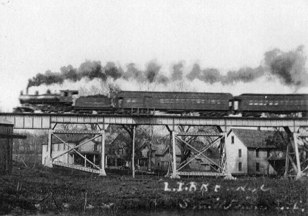
LIRR 2-8-0 H10s crossing Smithtown trestle (P466)
view E from Rte.25 1953
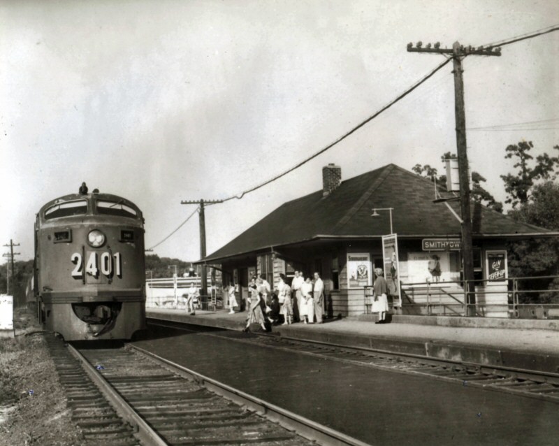
LIRR #2401 FM CPA-24-5 (C liner) Smithtown
view E 1955
Smithtown MP47 view NE 11/23/43 at the turnout for the 37 car passing siding. Photo: Fred Weber
Smithtown bridge over Rte.25-25A view SW 11/23/43
Photo: Fred Weber
Smithtown station view SW Call box at left 10/08/43
Photo: Fred Weber
Smithtown station view SW - whistle post at left and LI Ice Corp. far left 10/08/43 Photo: Fred Weber
LIRR #113 H10s freight meet with superior passenger class LIRR #38 G5s westbound Smithtown view E 1951 Photo: Norman Kohl
LIRR caboose #14 on the Smithtown passing siding view NW 1952
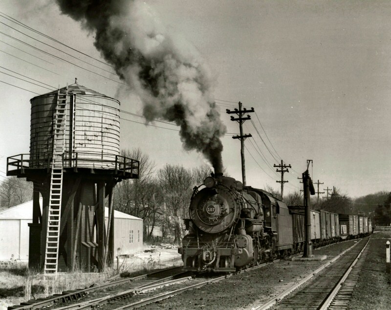
Photo: John Krause - Archive: Dave Keller

LIRR H10s No. 107 view E taking water 2/1953
Photo: John Krause - Archive: eBay
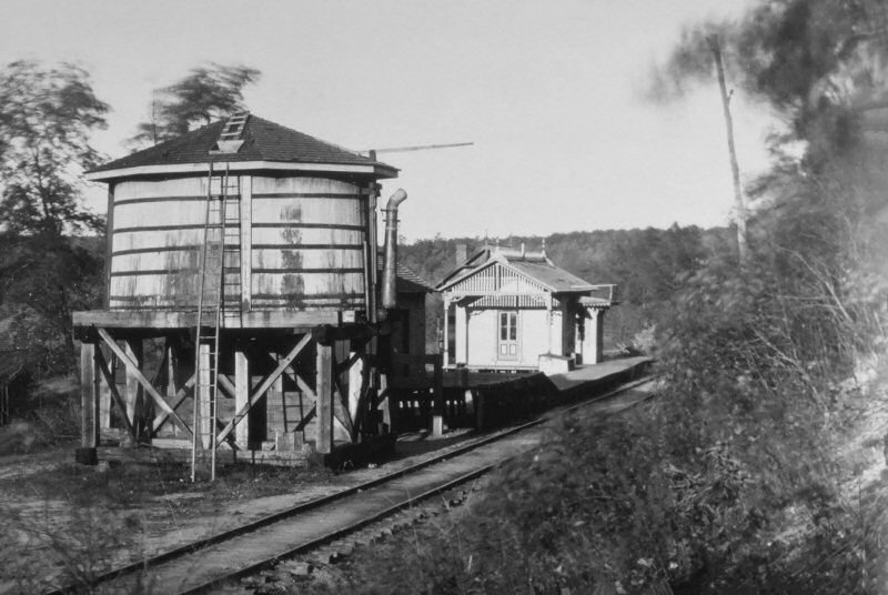
First tank west of the depot in Brainerd's photo c. 1880 view E
Second tank east of the depot in the c. 1890 colorized view SW
Third tank across from the 1903 depot on the north side
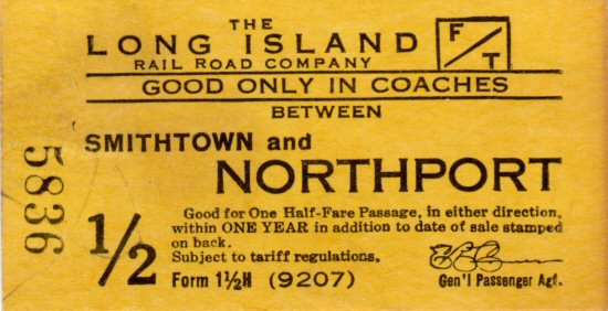
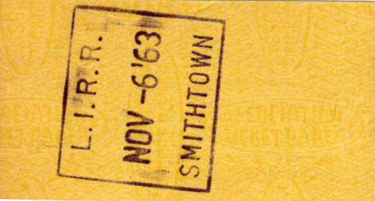
Smithtown - Northport Ticket 11/05/1963
Archive: Brad Phillips

LIRR #35 taking water 10/16/1955
Photo: Walter Broschart Archive: Dave Morrison
Note: LIRR G5s #35 and final "Steam Special" at
Smithtown Station ready to depart
on the very last LIRR steam train
run, October 16, 1955.
LIRR 1966 Smithtown Map #59
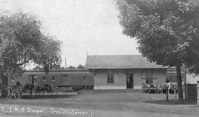
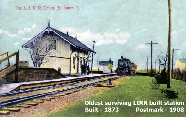
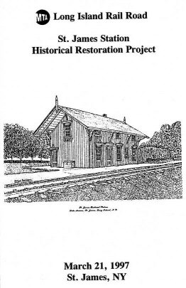
ST. JAMES: OPENED: 10/1873, AGENT'S QUARTERS
LOCATED ON SECOND STORY.
PART TIME AGENCY PER "L.I.R.R.
TICKET OFFICES OPEN FOR SALE
OF TICKETS" OF 9/12/55.
DEPOT
RESTORED: 1964.
CONSTRUCTION
OF 12-CAR-LENGTH HI-LEVEL PLATFORM
WITH SHELTERS BEGUN:
MID-AUG, 1986.
COMPLETED BY
YEAR'S END.
(Derek Stadler date of
installation of latter).
AGENCY
CLOSED: 9/6/96.
EXTERIOR RESTORED
TO ORIGINAL ARCHITECTURE,
INTERIOR REMODELED
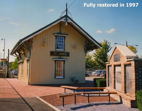
NON-HISTORICALLY: 1997. Research: Dave Keller
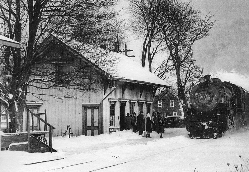
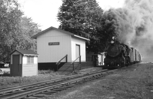
Westbound steam at St. James
March 1953 Photo: John Krauss
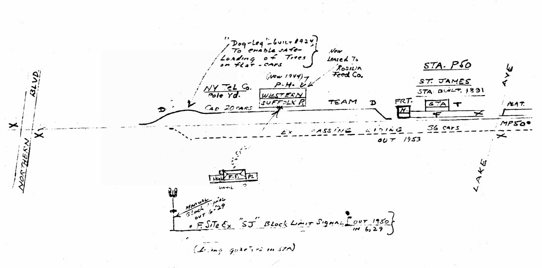
Emery map St. James MP49-50 09/1957
Archive: Dave Keller
Freight-Express House LIRR H10s #113 Freight West St. James 8/25/55
(Higginbotham-Keller)
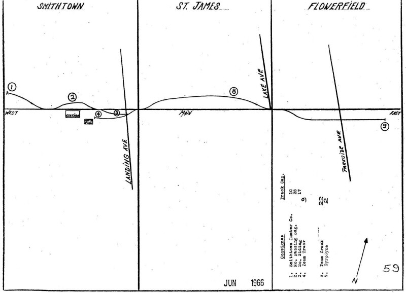
LIRR 1966 map page 59 Smithtown, St. James, Flowerfield Stations
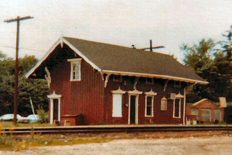
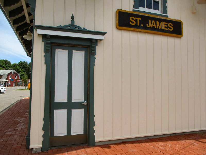
St. James view NE 1978 Photo: Steven Lynch
St. James view N 1993

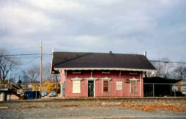
St. James view NW 2010 Source: Wikipedia


Archive: Dave Morrison

St. James Station 3/2017
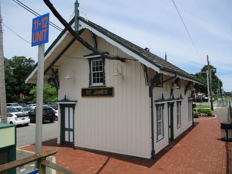
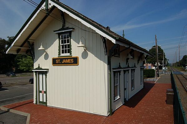
St. James Station 6/12/2019
St. James Station doorway 3/2017, 6/12/2019 below
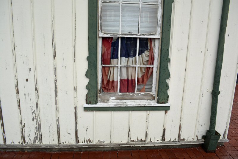
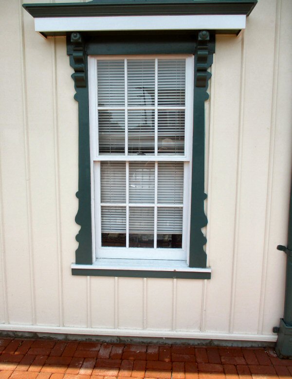
St. James Station window 3/2017, 6/12/2019 below
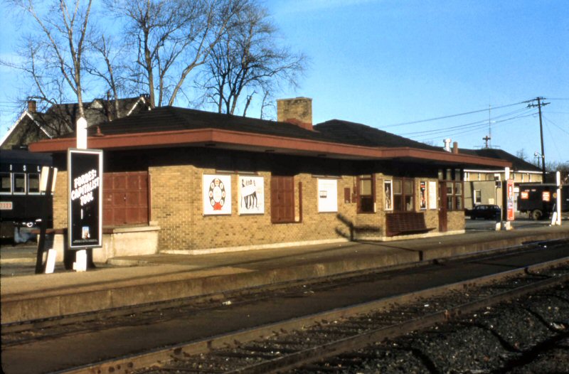
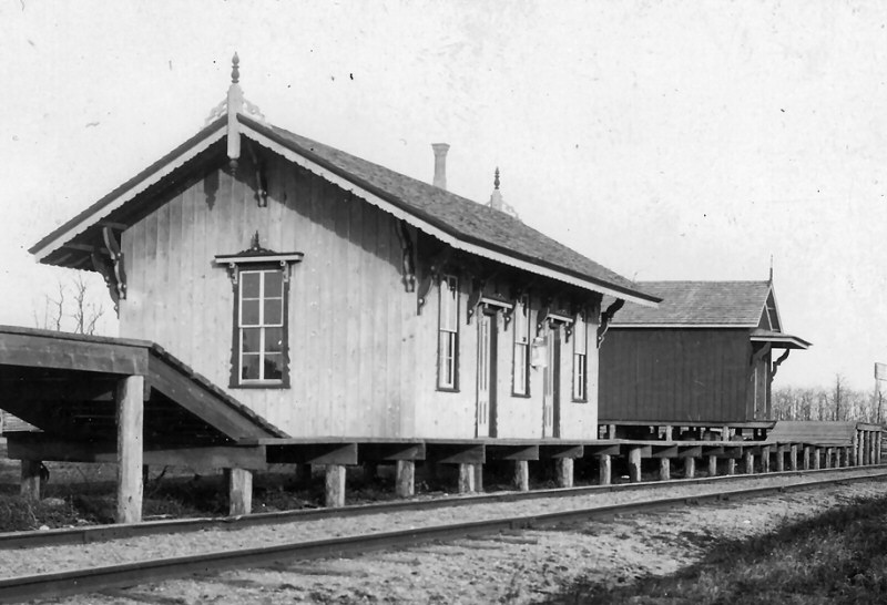
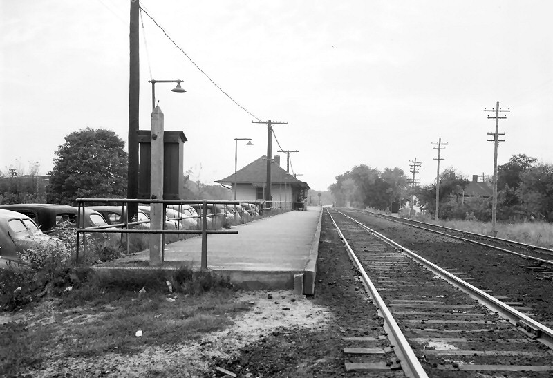
OPENED: 1909-10. AGENCY CLOSED: BETWEEN 10/10/43 (ETT #5) AND 6/11/44
(ETT #6)
DISCONTINUED AS STATION STOP: 1958, RAZED: 7/59
Research: Dave Keller
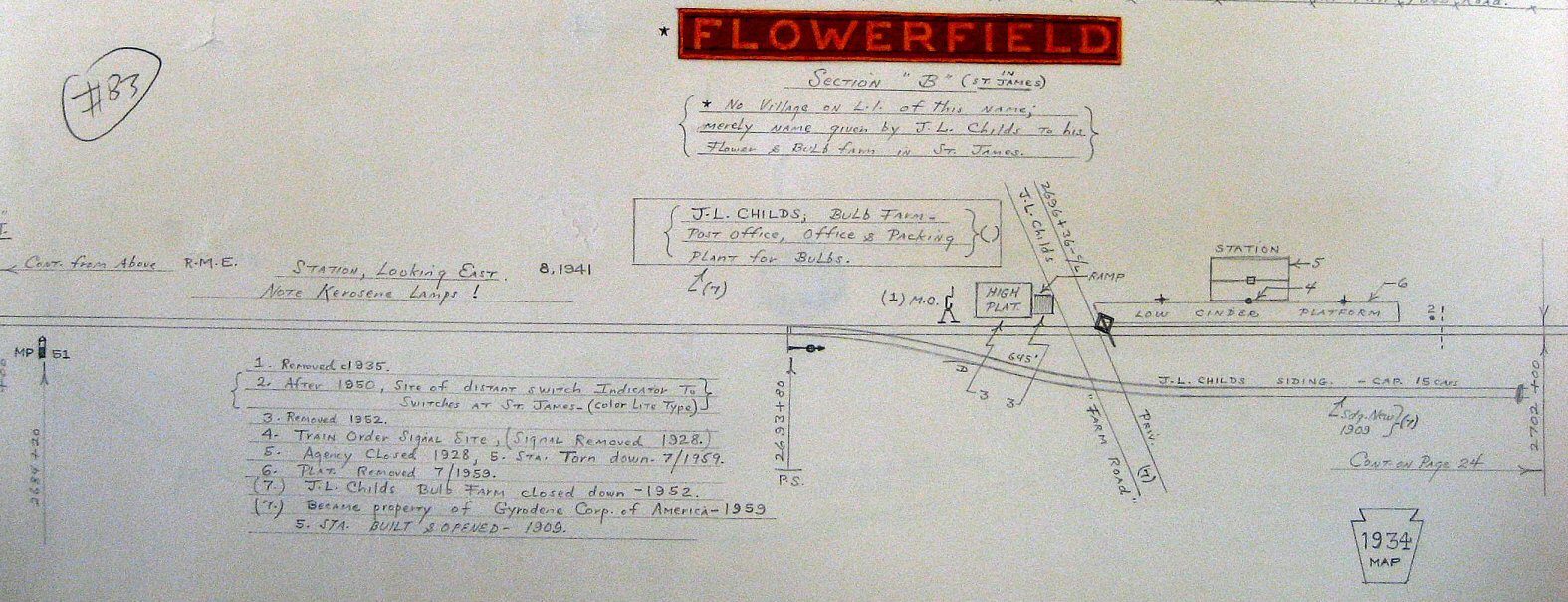
Flowerfield Map 1934 - Emery SUNY-Stony Brook
.jpg)
CPA24-5 #2404 Train #621 westbound past Flowerfield Station
8/26/1955 (Higginbotham-Keller)
%20-%2004-58%20(Keller).jpg)
Flowerfield Station View N 4/1958 Archive: Dave Keller
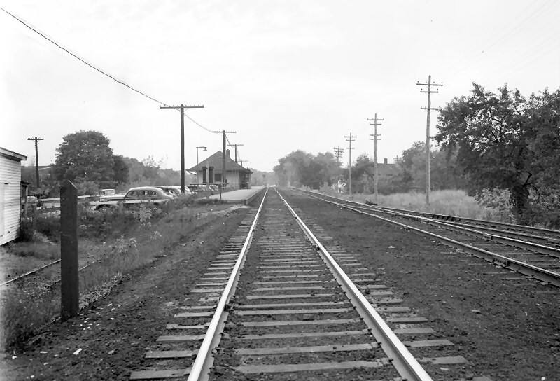
![]() BUILT: 1873, GREATLY
REMODELED: 1917.
CONSTRUCTION OF HI-LEVEL PLATFORMS WITH SHELTERS BEGUN: 3/88. TRACK REALIGNMENT
RESULTED IN RELOCATION OF S. PLATFORM WHICH WAS PLACED IN SVC: 11/14/88. N.
PLATFORM WITH SHELTERS COMPLETED: SPRING/1989. TEMPORARY WAITING ROOM AND
TICKET OFFICE SET UP IN TRAILER DURING RENOVATION OF OLD DEPOT. EXTERIOR
RESTORED TO ORIGINAL ARCHITECTURE, INTERIOR REMODELED NON-HISTORICALLY.
BUILT: 1873, GREATLY
REMODELED: 1917.
CONSTRUCTION OF HI-LEVEL PLATFORMS WITH SHELTERS BEGUN: 3/88. TRACK REALIGNMENT
RESULTED IN RELOCATION OF S. PLATFORM WHICH WAS PLACED IN SVC: 11/14/88. N.
PLATFORM WITH SHELTERS COMPLETED: SPRING/1989. TEMPORARY WAITING ROOM AND
TICKET OFFICE SET UP IN TRAILER DURING RENOVATION OF OLD DEPOT. EXTERIOR
RESTORED TO ORIGINAL ARCHITECTURE, INTERIOR REMODELED NON-HISTORICALLY.
AGENCY
CLOSED: 9/7/96. NEW SHELTERS CONSTRUCTED: 11/2008 TO EARLY 2009.
Research: Dave Keller
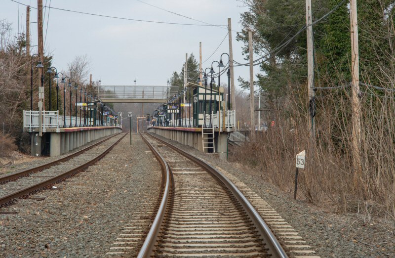
MORE:
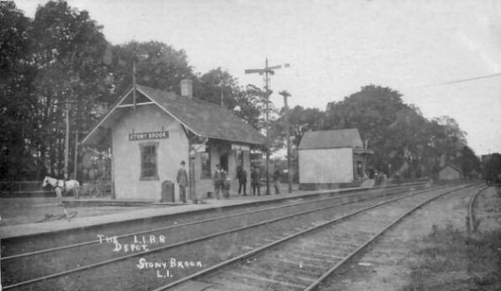
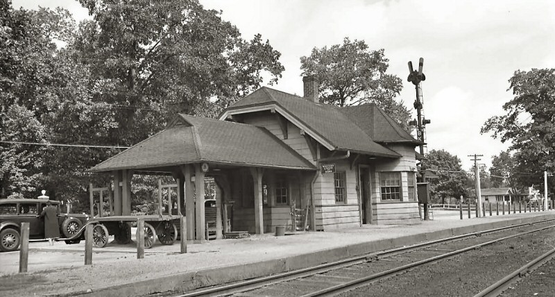
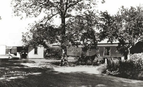
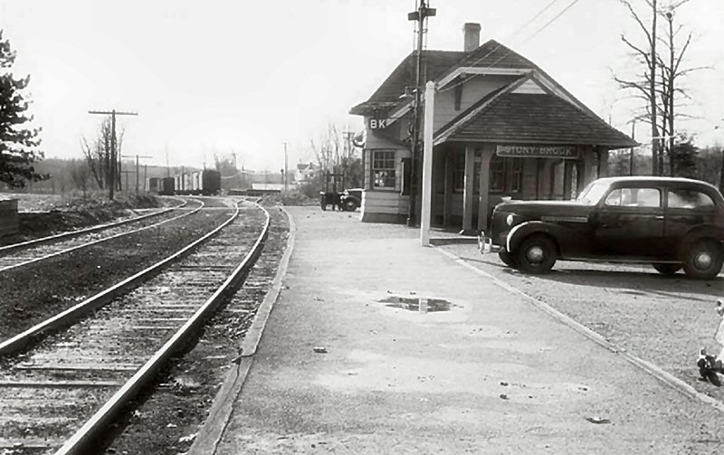
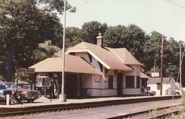
STONY BROOK


.jpg)


.jpg)

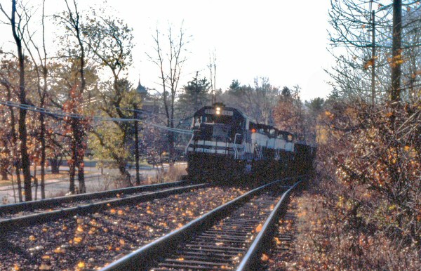
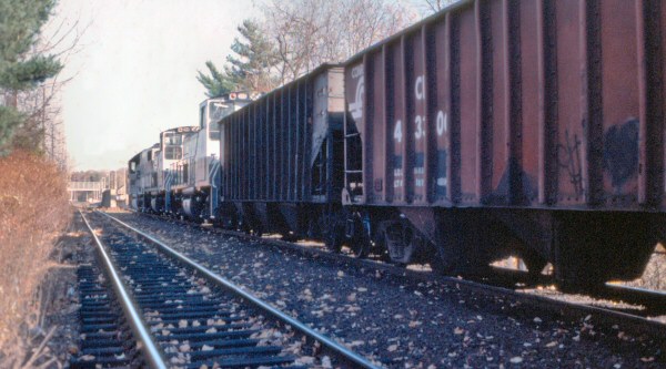

-645-siding-meets-658-7201967-RichardFMakse.jpg)

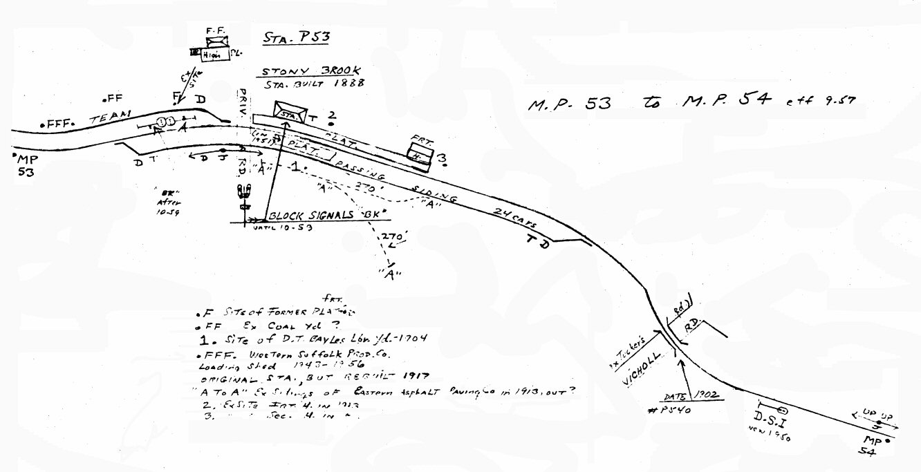
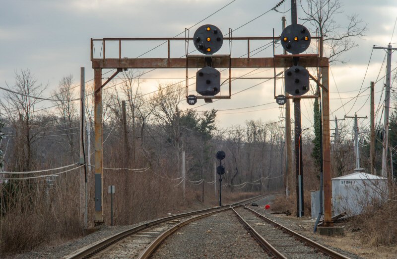
SETAUKET FREIGHT STATION BUILT: 2/1877 AND USED AS DEPOT. ACTUAL
DEPOT BUILT: JAN-FEB/1883 AGENCY CLOSED: ? RAZED: 10/3/60.
DISCONTINUED AS STATION STOP: c. 1980
Research: Dave Keller
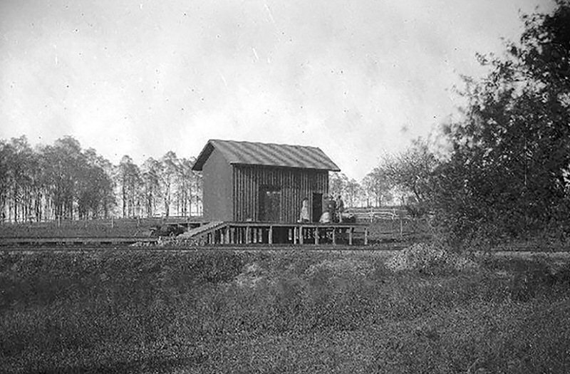
Setauket combination depot freight house. View N/NE
The platform and freight ramp are on the west side. 10/1878
Photo: George Brainerd Archive: John Lisi

Setauket - View NW c.1900 Archive: Dave Morrison
The freight ramp has been relocated to the east side of the freight house and the station platform extended east of the old freight office and former depot, including a Dietz kerosene platform lamp.
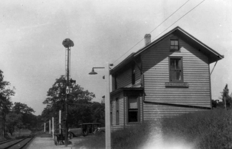
Setauket 1930 Photo: James V. Osborne The freight house has been removed (along with the "AU" block signal semaphore blades) but a short high-level express platform is still in place. Research/Archive: Dave Keller
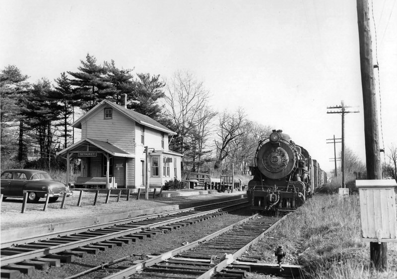
H10s #107 westbound freight at Setauket -Winter 1952 (Krause-Keller)
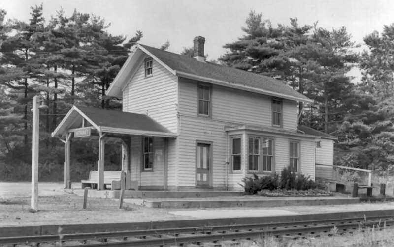
Setauket Station - View 1953 NE
- Photo: John Krause Archive: Dave Keller
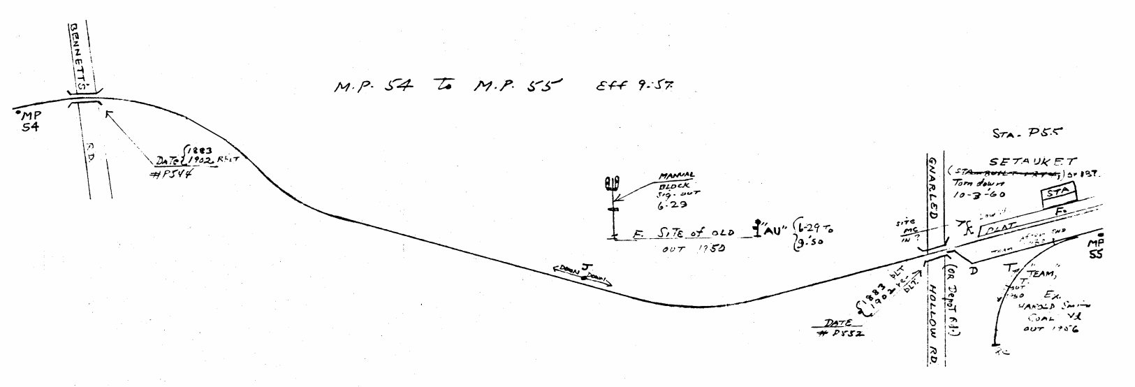
Emery map - Setauket MP54-55 9/1957 - Archive:
Dave Keller
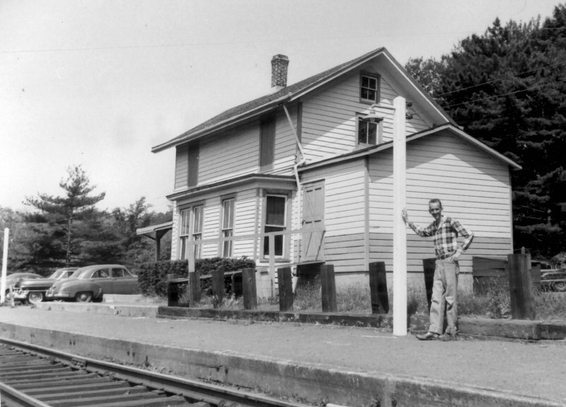
Setauket Station 1958 view NW - Robert Emery holding up lamp post. Photo: Bill Slade Archive: Art Huneke

H10s #107 switching coal hopper for
Harold Smith Coal, Setauket
View NE c.1952 (Krause-Keller)
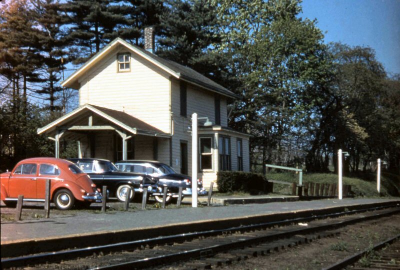
Setauket Station 1959 view E
Photo/Archive: Art Huneke
.jpg)
C420 #202 east on trestle over Old Town Rd, east of
Setauket 12/1971 Photo/Archive: Dave Keller
Emery Map Setauket - 1941
Archive: SUNY-Stony Brook

Port Jefferson Branch - Setauket to Port Jefferson Track profile map 1994
.jpg)
Setauket station shelter shed and platform View E
8/12/1973 - Archive: Dave Keller
OPENED: 1/13/1873, BURNED:
2/1/1874.
2ND DEPOT BUILT: 6/1875, CLOSED: 1903 AND USED AS EXPRESS HOUSE,
RAZED: 4/1963
3RD DEPOT OPENED: 7/25/03, REMODELED: 1968. PLATFORM OUT OF SVC:
4/25/88 AND TEMPORARY PLATFORM 75’ WEST OF MAIN ST. IN SVC. WHILE
HI-LEVEL PLATFORM UNDER CONSTRUCTION.
SOUTH PLATFORM IN SVC: 10/31/88. CONSTRUCTION OF HI-LEVEL PLATFORMS
AND SHELTERS ON N. SIDE OF TRACKS BEGUN: SPRING/1989. PEDESTRIAN
OVERPASS COMPLETED: LATE 1998-JAN, 1999. SHELTERS REPLACED: FALL/2000.
TEMPORARY STATION IN SVC: 12/1999 DURING RENOVATION OF OLD DEPOT.
(Derek Stadler research) EXTERIOR RESTORED TO ORIGINAL
ARCHITECTURE, INTERIOR REMODELED NON-HISTORICALLY. RENOVATION
COMPLETED AND OLD DEPOT REOPENED: 7/10/2001. (Derek Stadler date)
AGENCY CLOSED: 4/2020 Research: Dave Keller

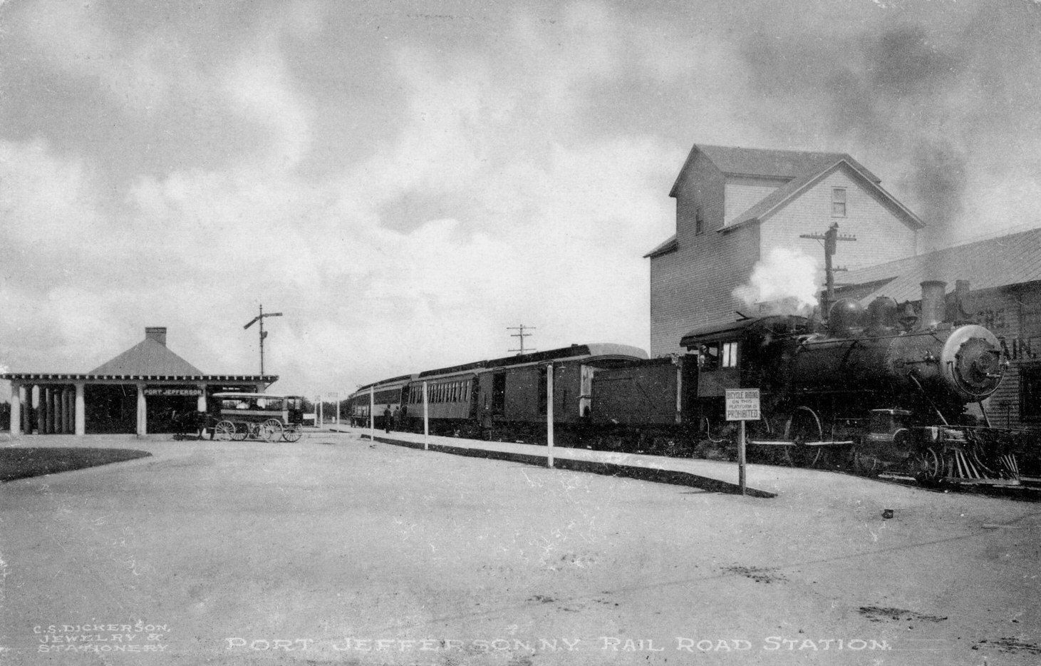
Port Jefferson - LIRR 4-4-0 - View E 1878
Photo: George Brainerd Archive: Dave Keller
Port Jefferson view E c.1903
Note: Hopper on team track for Loper Bros Coal. south of main on team track. Eastbound semaphore behind train.

Port
Jefferson view W c.1903
Note: Semaphore wires and rollers in foreground.
Info: Dave Keller
Loper
Bros Lumber - FA2 #602 C420 #202 view W
12/1971 Photo/Archive: Dave Keller
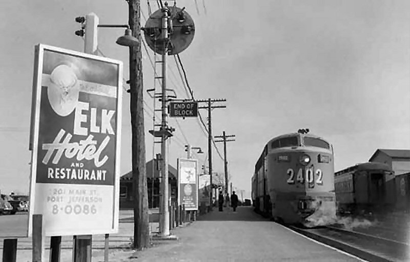
C-Liner #2402 at Port Jefferson station - View E
1958 Archive: Tom Farrell
Port Jefferson LIRR #213 4-4-0
Class D16b view E c.1907
E. H. Rogers Feed & Grain south of main on team track. Note
sign: "BICYCLE RIDING on this platform is PROHIBITED" and
semaphore signals now moved to front of station
.
E. H. Rogers (left) Echo Ave. (also Port Jefferson Road, Coram Road,
Ste. Rte. 112),
Port Jefferson View S 1887 Archive: Tommy Farrell
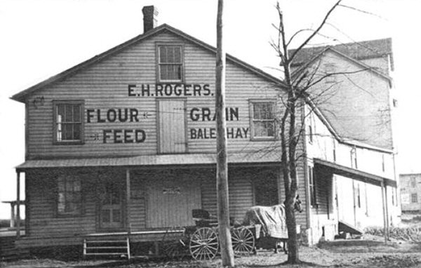
E. H. Rogers - Port Jefferson view E 1897
After 1931 M. Remz Feed - Archive: Tom Farrell
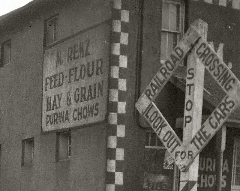
M. REMZ Feed zoom sign
- Port Jefferson View E
4/12/1946 (Weber-Morrison)
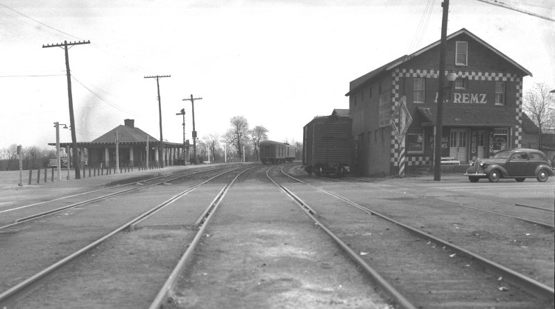
M. REMZ Feed (after
1931, as per
Emery map) Port Jefferson View E
4/12/1946 - (Weber-Morrison)
M. Remz Feed Freight Track at Rte #112
View E - c.1950
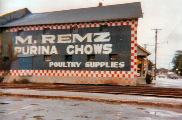
M. Remz Bros. Feed View S 1978
Photo: Steven Lynch
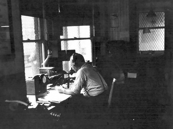
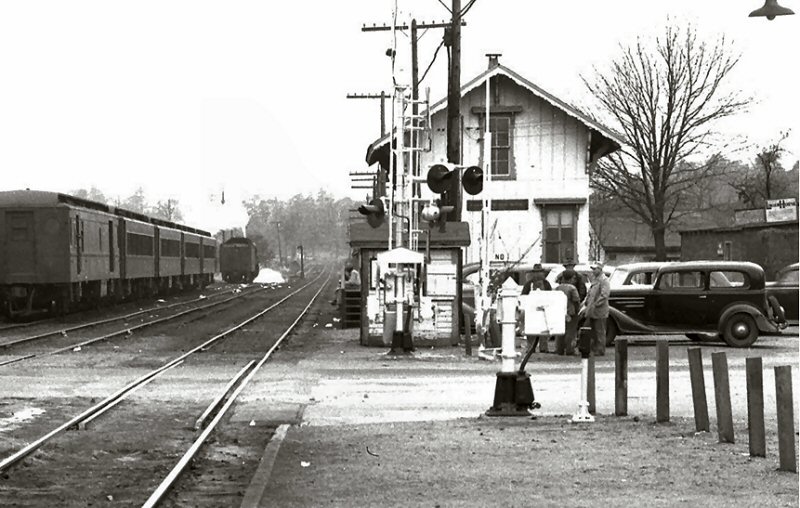
An interior view of the Port Jefferson ticket office and "JF" block station with the block operator talking with the dispatcher on the flexi-phone at the operator's desk which was built into the ticket office bay window to allow visibility in each direction down the track. Note the table machine to operate the block signal and also note that this machine was originally manufactured to control two block signals, eastbound and westbound, but the eastbound one, including large round indicator dial, was removed in 1938 with the end of service east of this station to Wading River. This view is c. 1945. (George Christopher photo, Dave Keller archive)
M. REMZ Feed sign - Port
Jefferson View SW
10/06/1947
(Weber-Morrison)
Emery map - Port Jefferson 1936
Archive: SUNY Stony Brook
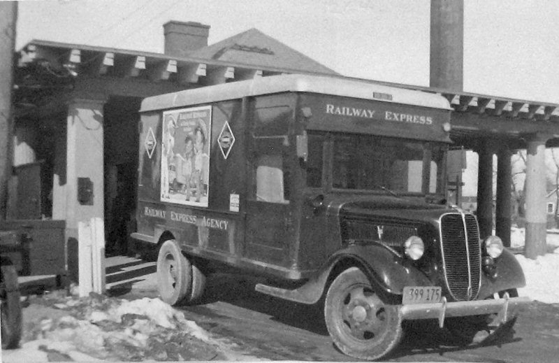
Port Jefferson REA truck 2/1941
Photo: Robert Emery
Archive: SUNY Stony Brook
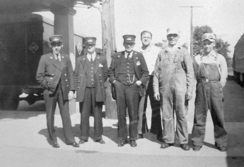
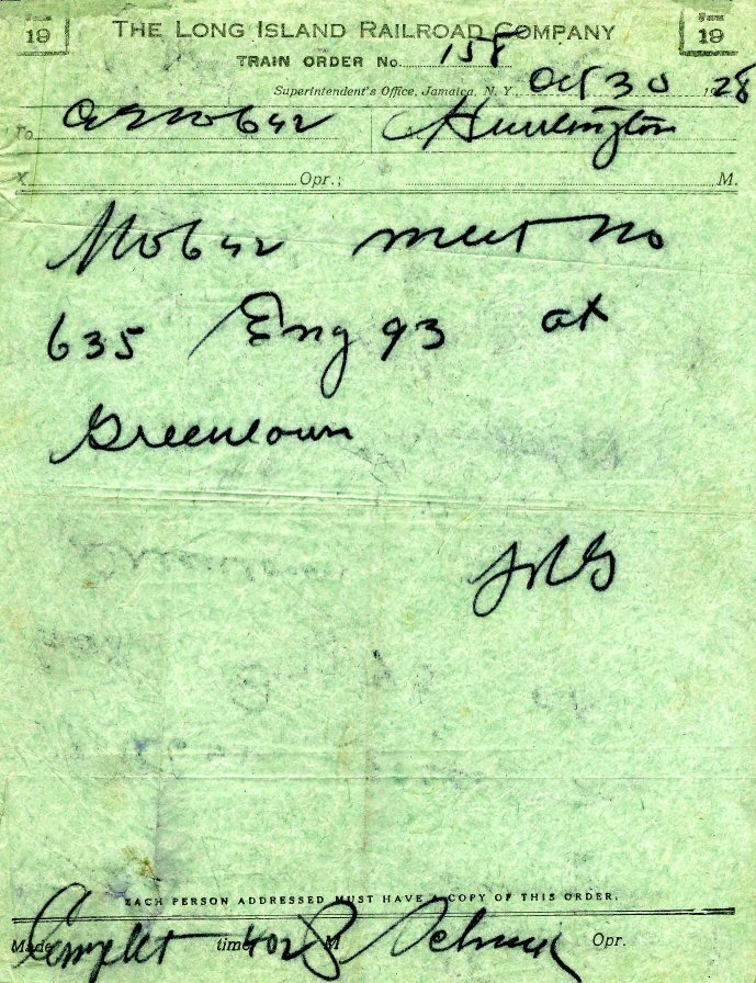
Port Jefferson Crew Train #635 1941
Photo: Robert Emery
Archive: SUNY Stony Brook
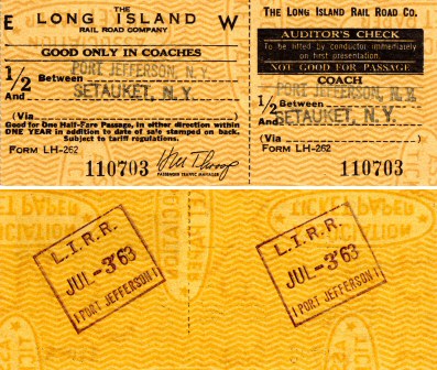
Port Jefferson - Setauket 7/03/1963
Archive: Brad Phillips

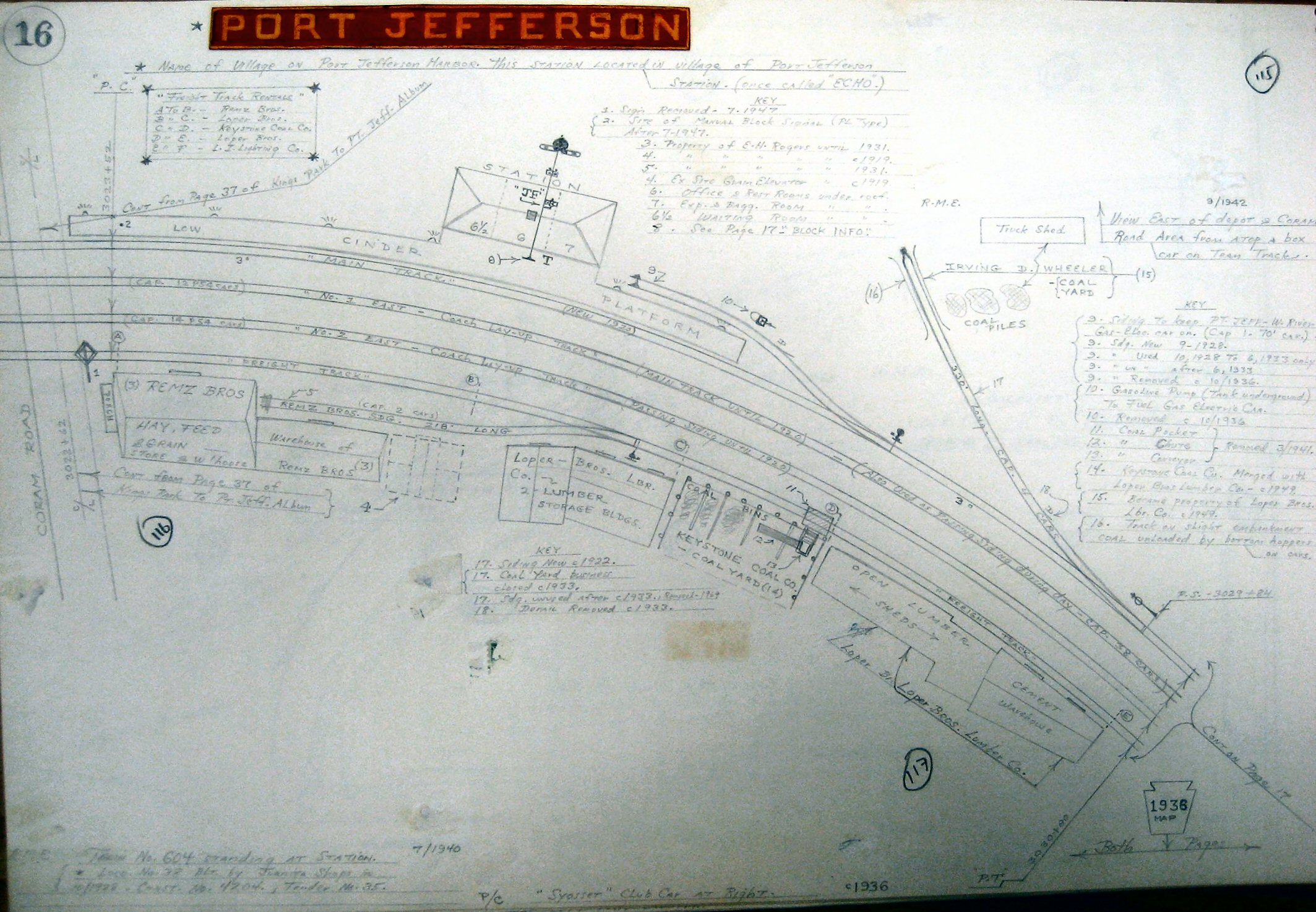
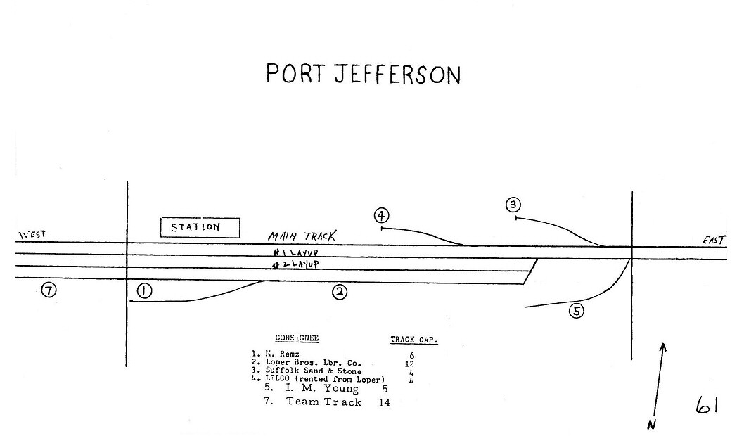
Robert M. Emery map of Port Jefferson pre-1920 MP57-58 (Dave Keller archive)
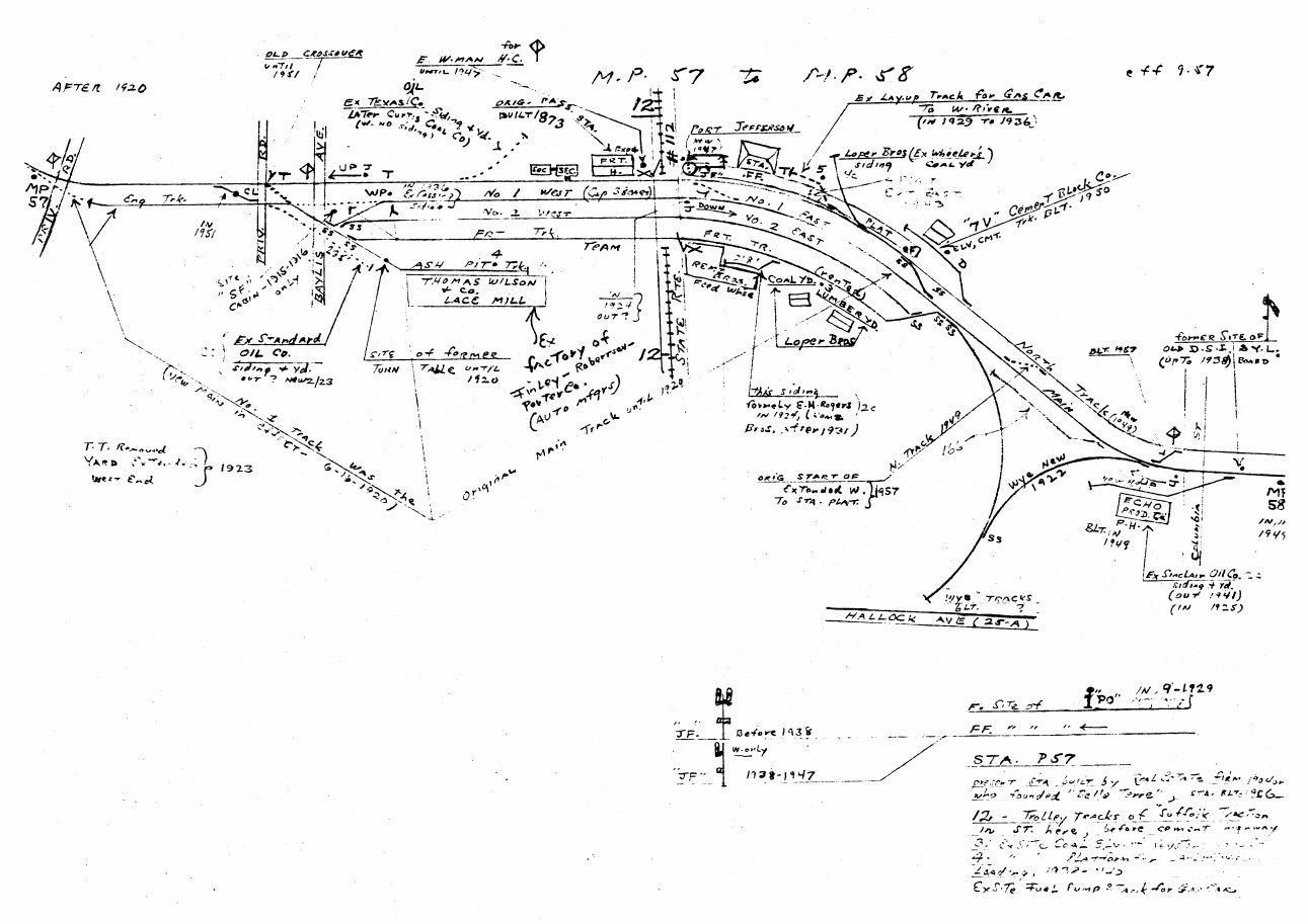
Robert
M. Emery map of Port Jefferson MP57-58 effective 9/1957 showing the
west yard, station facilities, east yard, wye and wye access tracks.
(Dave Keller archive)
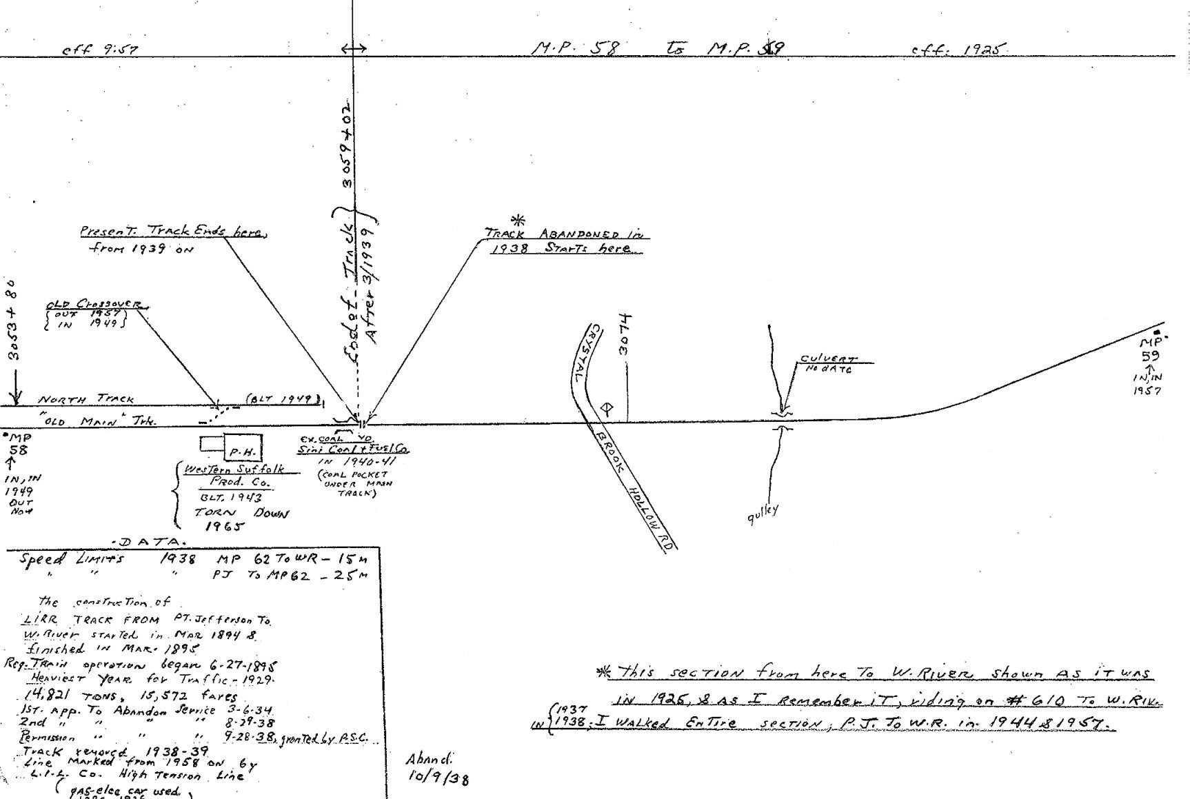
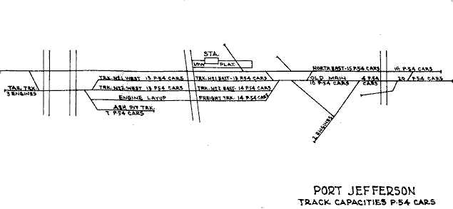
Robert M. Emery map of Port Jefferson MP58-59 effective 9/1957
showing the tracks and end of track east of the station as indicated in
the general order noted in the end-of-track image further down on this
page. The right portion of this map also shows the beginning of the
Wading River extension as it looked in 1925. (Dave Keller archive)
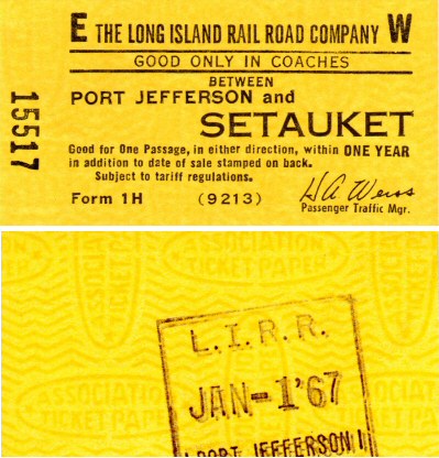
Port Jefferson - Setauket 1/01/1967
Archive: Brad Phillips

Thomas Wilson & Co. Lace Mill - Port Jefferson aerial view W c.1950
Archive: Tom Giarrizzo
The lace mill plant, which manufactured Leavers, Raschel
and Bobbinet lace fabrics, closed in 1987.
Note: Finley Robertson Porter automobile plant until the
1920's.

Port Jefferson West Yard view E from west of Main Street
with the
Wilson & Co. Lace Mill on the right
5/1936
Port Jefferson Freight/Express House/Office
View W zoom Photo: 11/06/1947 (Weber-Morrison)
%20-%2011-06-47%20(Weber-Morrison).jpg)
Loper Bros. Lumber (far left), Wilson Mill (left), 'JF' (right) unattended block station signal mounted lower-down on the block signal mast The two-story structure just west of Rt. 112 is the former 2nd depot on-site, built 6/1875 to replace the original which burned 2/1/1874. After the 1903 depot was built on the east side of what today is Rt. 112, the wooden depot became the express house/office. It was razed in April, 1963. Photo: 11/06/1947 (Weber-Morrison)
LIRR 1966 Port Jefferson map #
61
.jpg)
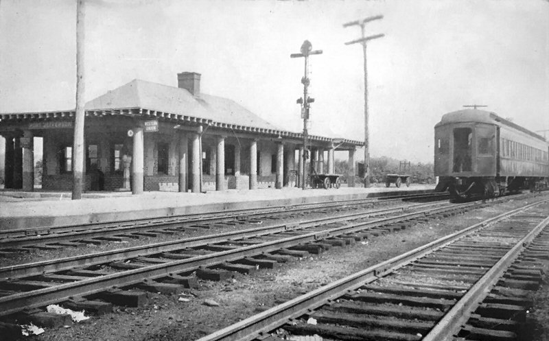
A local professional photographer whose studio was in Port Jefferson for many years was Arthur S. Greene. In 1905 he photographed the 2-year-old station building at Port Jefferson. This depot was built by the developers of nearby Belle Terre, and resembled the architecture of the two pergolas they erected overlooking the Long Island Sound. Built on the northeast quadrant of the crossing of Patchogue-Port Jefferson Road (later route 112) this new brick structure replaced the original wooden one shown previously which was located on the northwest quadrant of that crossing. This view is looking northwest and shows Greene's signature pinto pony and wagon . . . usually found in many of his photographs. Also visible is the block signal out front of the depot building, with two semaphore blades, one eastbound and one westbound as the branch now extended further east to Wading River. (Thomas R. Bayles collection, Dave Keller archive)
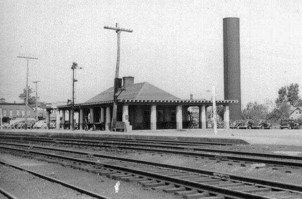
Port Jefferson Station - View NE c.1930's Archive: eBay Info: Dave Keller
Unattended block limit station signals were installed lower down on the
mast effective 5/23/28 until end of service to Wading River 10/09/1938
Looking northwest, we see the Port Jefferson depot as it looked in
1938 after service to Wading River was curtailed. The semaphore
blade for the eastbound block signal has been removed from the mast as
there was no longer any through service past this station stop.
(George Christopher photo, Dave Keller archive)
.jpg)
G5s #22 West Yard Port Jefferson
View E c.1935 Port Jefferson had two yards. One east of the
station and one west. The yard west of the station and west of
Route 112 was known, for some unusual reason as the West Yard.
This c. 1935 view looking east towards Route 112 and the station area,
shows G5s class (4-6-0) locomotive #22 laying up westbound in the West
Yard. (Dave Keller archive)
.jpg)
.jpg)
Also laying up in the West Yard, at the west end near the ashpit tracks is G5s #32. This c. 1935 view, looking northeast, was photographed just a short distance east of where the yard branched off the main, and was, for a number of years, adjacent to a turntable, which was later replaced bye a wye track located east of the station and south of the yard. (Dave Keller archive)
Port Jefferson - East Yard aerial east of Columbia St. 10/2020
Photo/Archive: Jason Zimmermann
.jpg)
Commemorating the last day of steam on Long Island, a railfan extra (fan trip) was held on October 16, 1955, pulled by G5s #35. In this view we see the locomotive, tender and lead car just having been cut from the train preparing to back onto the wye track east of the Port Jefferson station. After being turned on the wye, it will head up the west leg of the wye track, connect to the front of the train it just pulled eastward, and head back west with its complement of railfans of the day. (Dave Keller archive)
.jpg)
Dark Hollow Rd. - arched
concrete tunnel west of
Port Jefferson 01/1972 (Keller-Keller)
.jpg)
Laid up in the Port Jefferson yard in September, 1963 is combination RPO (Railway Post Office) and baggage car #7737. The car still sports modernization number 487 which it's worn since it was renovated in the LIRR's modernization program of cars which began in December of 1954 and lasted several years. Visible across the small door accessing the postal facility is the swing bar that would be rotated perpendicular to the car and catch, while traveling non-stop, leather mailbags hung from a trackside mail crane to be sorted and cancelled en-route. Also note the bars across the windows protecting the mail compartment from burglary. U. S. Railway Mail Service employees carried side arms in the completion of their duties. (Wm. Lichtenstern photo, Dave Keller archive)
.jpg)
Fairbanks-Morse model H16-44 #1507 is seen here laying up in front of the former and original wooden depot building at Port Jefferson on October 24, 1962. Once the new brick depot was constructed in 1903, this old depot was relegated to freight and express use and lasted until the mid-1960s. This view is looking northeast. The station is at the far right, on the other side of the crossing of Route 112. The cars visible are in the station parking lot. (George E. Votava photo, Dave Keller archive)
.jpg)
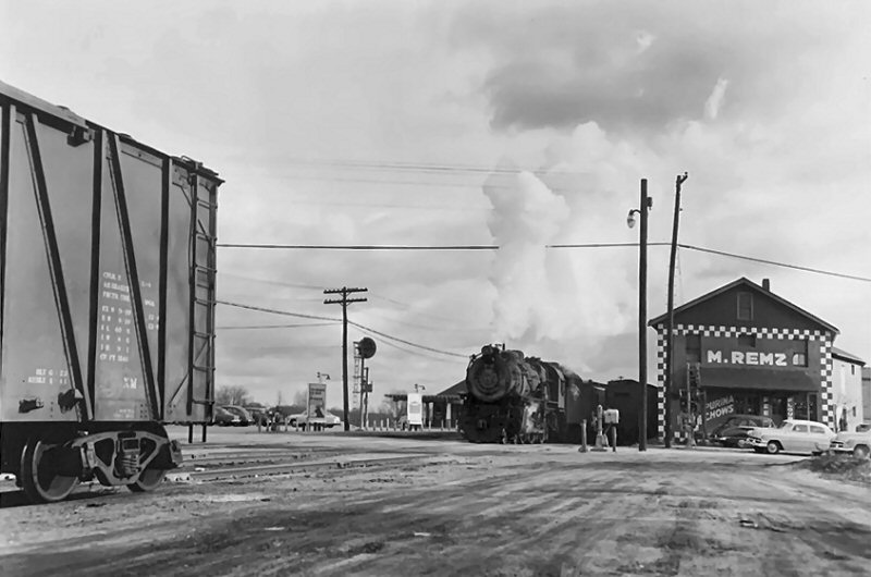
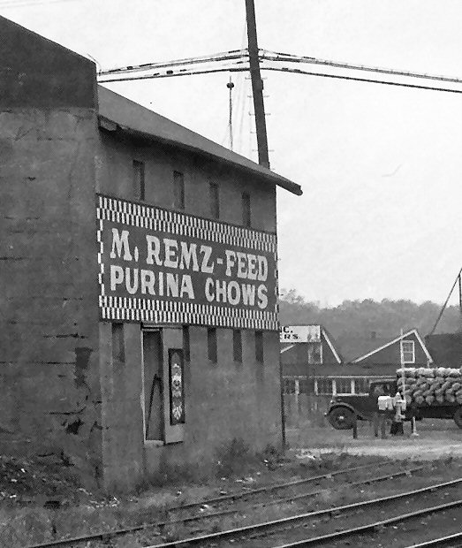
Looking due east in the West Yard in 1957, we see ALCO RS3 #1554 laying up alongside a Fairbanks-Morse C-liner. In the distance at the right is M. Remz's Feed store, many years a landmark, with its notable "Checkerboard Square" pattern, which was Purina Chow's logo. In the left background is visible the original depot in use as a freight / express house and the 1903 depot beyond. For fun, compare this image side-by-side with Brainerd's 1878 image! (Jules P. Krzenski photo, Dave Keller archive)
.jpg)
Fairbanks-Morse C-liner (model CPA24-5) #2401 is backing an RPO-Baggage car onto the wye east of the Port Jefferson station in 1955 so its train can head back west again. View is looking southwest. This area today is all built-up commercially. (W. H. Higginbotham photo, Dave Keller archive)
.jpg)
.jpg)
Fairbanks-Morse C-liner (model CPA20-5) #2008 is laying up in the late afternoon sun in the yard at Port Jefferson
c.1963 (Dave Keller archive)
.JPG)
ALCO C420 #201 and train is laying up westbound in the yard east
of the station on April 5, 1964 (George E. Votava photo, Dave Keller
archive)
September 20, 1999 LIRR GP38-2 #272 is at the platform taking in
passengers as the sun is rising on Port Jefferson Station view E Photo: William J. Skeats.
.jpg)
After non-productive revenue
service to Wading River during the many years of the Great Depression,
when steam trains were replaced by self-propelled gas cars
("Doodlebugs") to cut down on operating expenses, it was
finally decided to cut the 1898 branch extension back to Port
Jefferson. The last revenue train ran on October 9, 1938 and a
little over 5 months later the following general order was issued:
GENERAL
ORDER #1006C, EFFECTIVE 3/29/39:
SINGLE
TRACK FROM A POINT 1,550’ EAST OF EAST LEG OF WYE, PORT JEFFERSON
STATION TO WADING RIVER
STATION OUT OF SERVICE.
WESTWARD
LOWER QUADRANT SEMAPHORE DISTANT SIGNAL LOCATED
EAST OF PORT JEFFERSON STATION OUT OF SERVICE
This view, looking due east, shows that point of single track "1,550' east of east leg of wye" as it looked in 1968, disappearing into nothing . . . . not even a bumper block or crossed railroad ties. With the rebuilding of the yard and installation of modern facilities east of the station, this last vestige of rails to Wading River was torn out. (Dave Keller photo and archive)
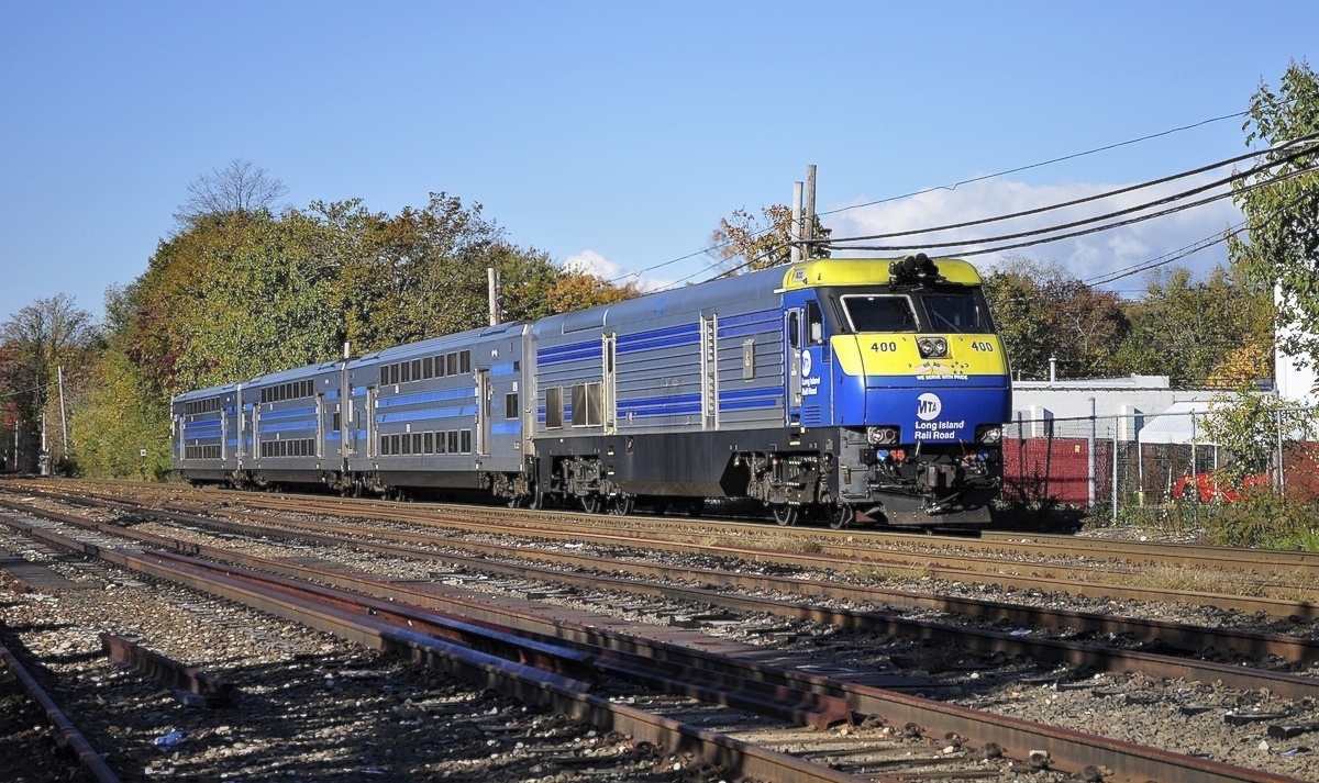
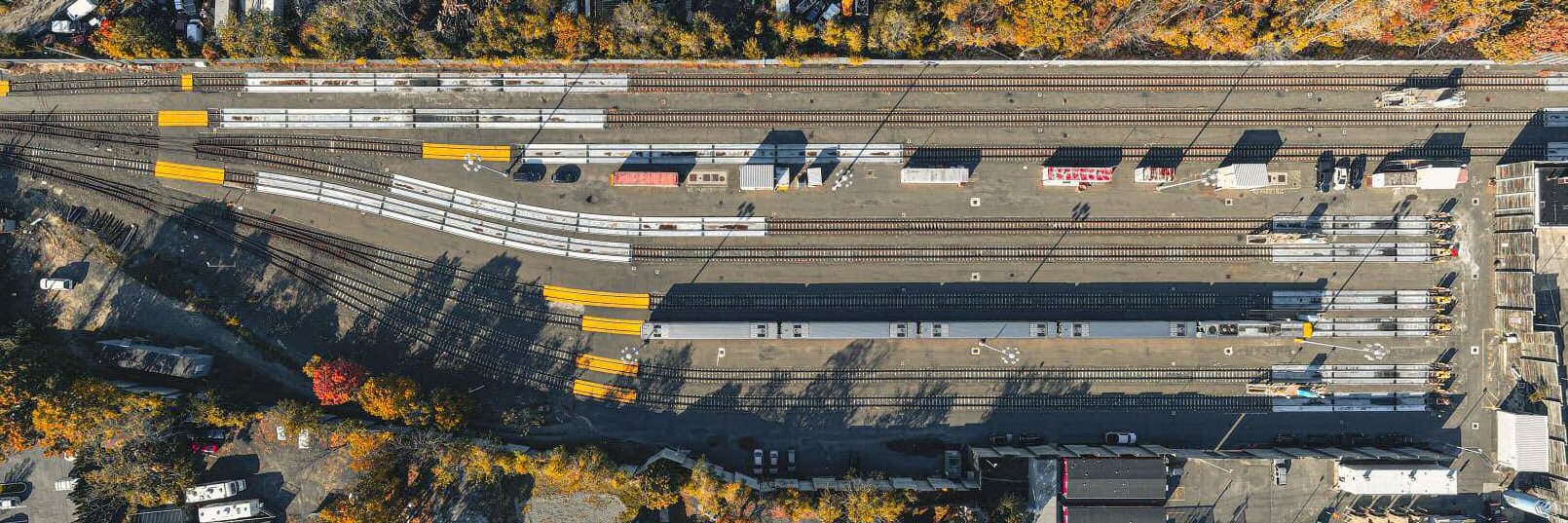
LIRR #400 DE30AC passing the West Yard on 10/03/2010 as the leaves
are changing Photo: William J. Skeats

The Port Jefferson depot midday view NE in the Spring/Summer of 1963. A playbill for "Enter Laughing" starring Alan Arkin, Vivian Blaine, Sylvia Sidney, Michael J. Pollard, and Alan Mowbray is attached to the platform light pole at the left. Archive: Brad Phillips
.jpg)
The Port Jefferson depot is
caught in the late afternoon sun in October, 1964. Long shadows
of the position-light block signal and telephone poles are cast in the
station parking lot in this view looking due east. A playbill
for "What Makes Sammy Run" starring Steve Lawrence, Robert
Alda (Alan's dad) and Sally Ann Howes is attached to the platform
light pole at the right. (Dave Keller
archive)
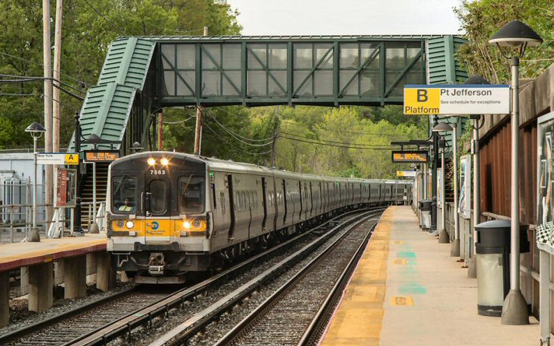
Port Jefferson Station - M7 #7563 - Train #7725
View E 5/18/2020 Photo/Archive: Jeff Erlitz

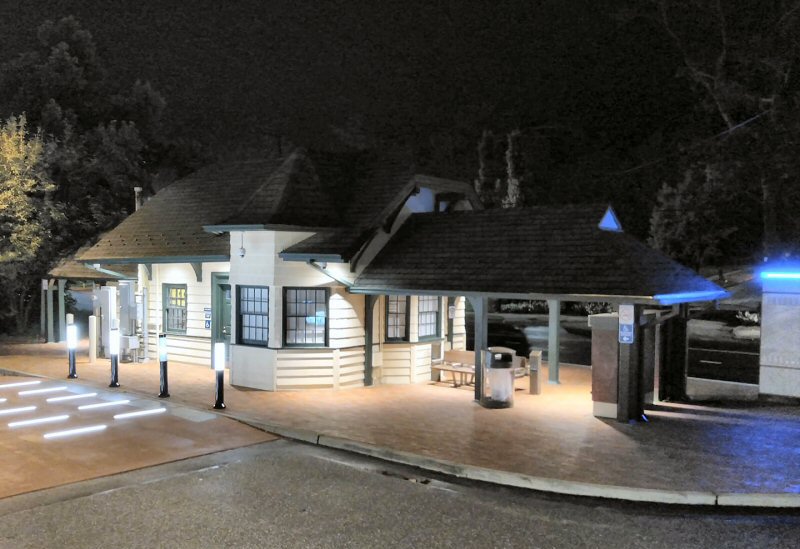
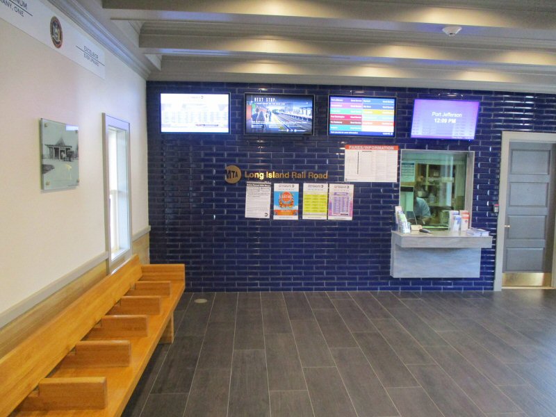
Port Jefferson Station 10/10/2016
Port Jefferson Station 8/17/2017
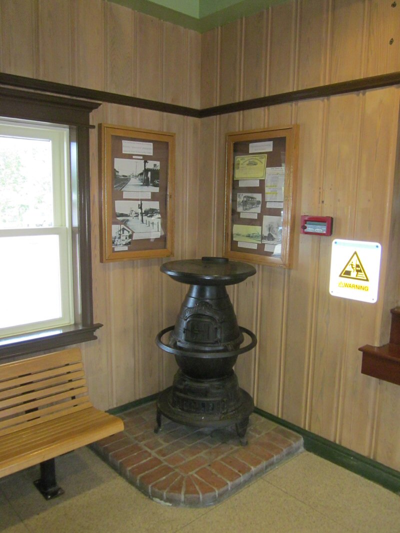
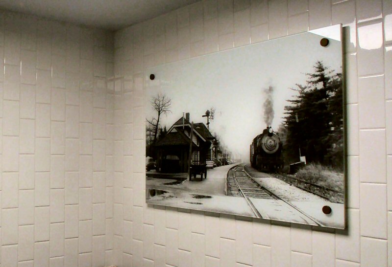
Port Jefferson Station stove 8/17/2017
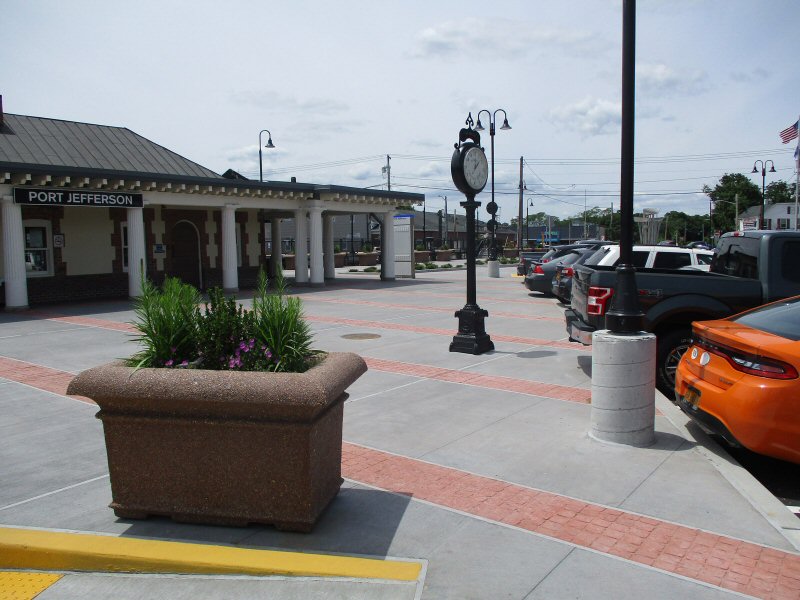
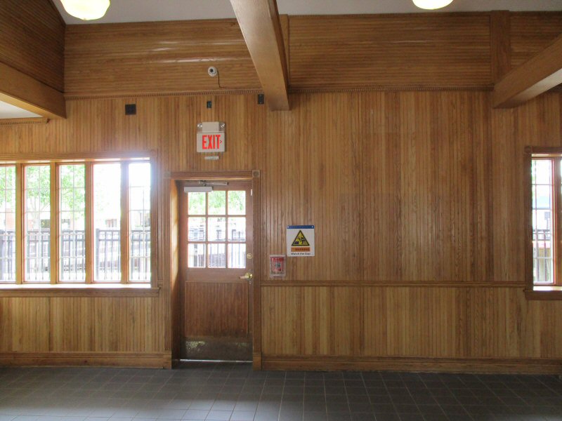
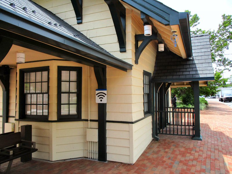
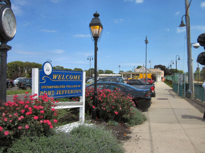
Port Jefferson Station 6/12/2019
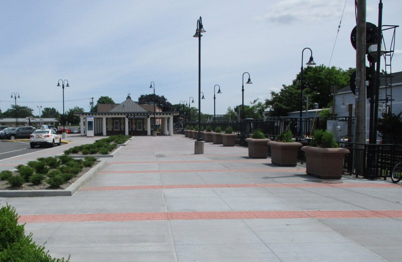
Port Jefferson Station 6/12/2019
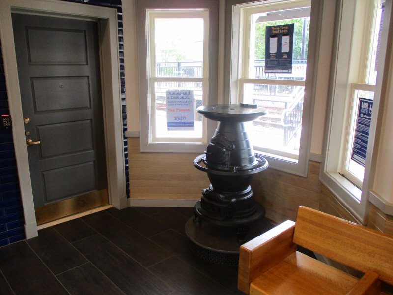
Port Jefferson Station stove 6/12/2019
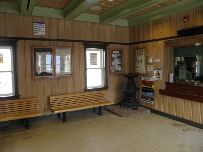
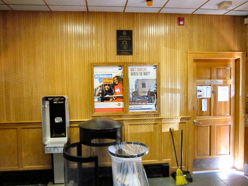
Port Jefferson Station ticket office 8/17/2017
Port Jefferson Station ticket office 6/12/2019