 Montauk
Branch - Babylon to Patchogue
Montauk
Branch - Babylon to Patchogue

|
|
| Early Beginnings - South Side Rail Road | ||
|
|
||
| The Montauk Branch, in Western Suffolk County from Babylon Station to Patchogue Station, comprises MP36 to MP54. | ||
 |
||
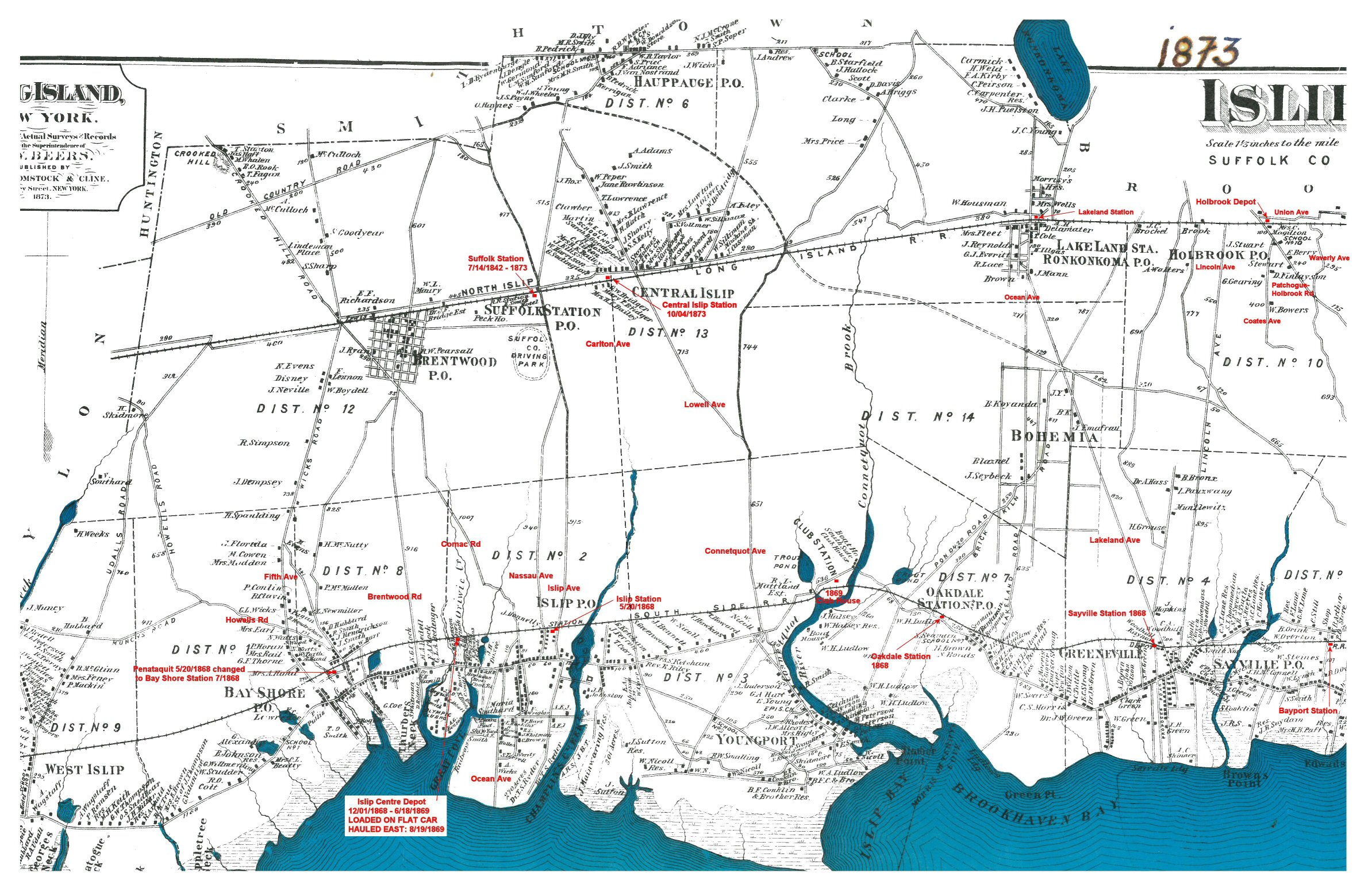
| Islip Town Stations 1873 Beers map with annotations for the LIRR and South Side Rail Road (SSRR) Stations at the time. Archive Islip Public Library Research/Annotations: Steven Lynch | ||
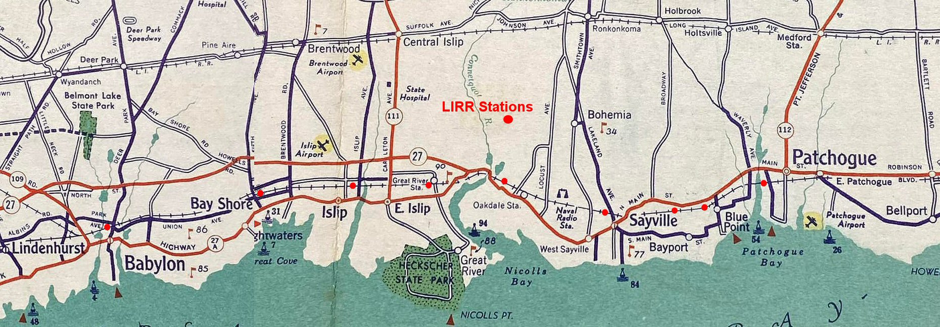 SOCONY map - 1935 Babylon to Patchogue |
||
|
|
||
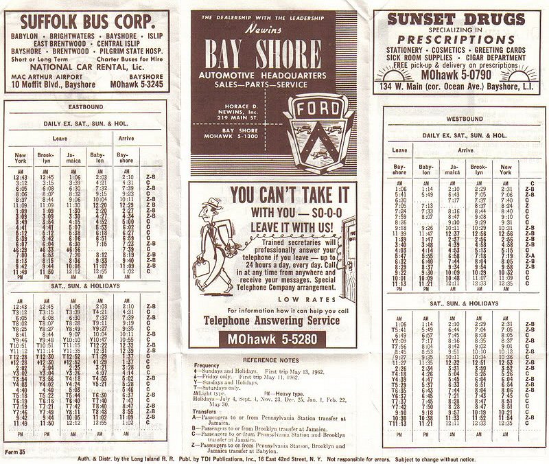
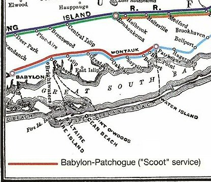
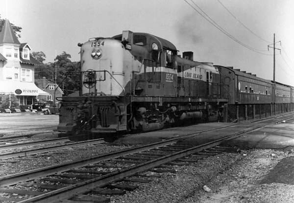
| Babylon-Patchogue - Scoot | ||
|
RDC
Babylon-Patchogue Scoot service: 1957-1967. For the two years
prior, commencing March 31, 1955, the
BUDD RDC's (RDC1
#3101-RDC2 #3121) were utilized serving many locations: Mineola, Hicksville, Ronkonkoma, Riverhead, Greenport, Oyster Bay, Southampton and Patchogue, but not in Scoot service. Dave Keller |
||
 PRR-Keystone Summer 2022 - RDC article by Mike Boland |
 Excerpt from Mike Boland's RDC Keystone article |
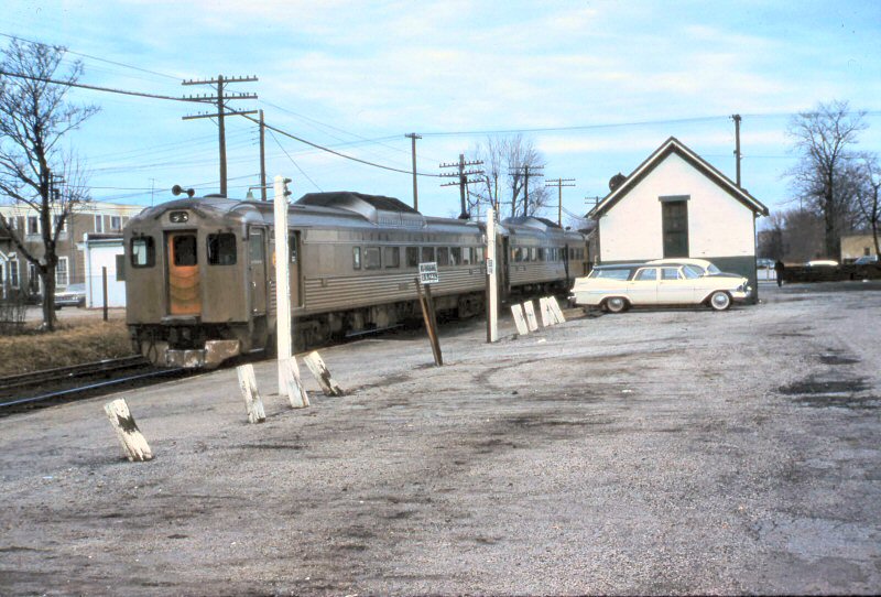
 Babylon-Patchogue Scoot at Babylon Station hi-level wooden platforms c.1957 Archive: Dave Morrison
|
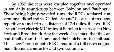
 RS3 #1553 Babylon-Patchogue Scoot westbound crossing Connetquot River west of Oakdale-1968 (J. P. Krzenski-Dave Keller) |
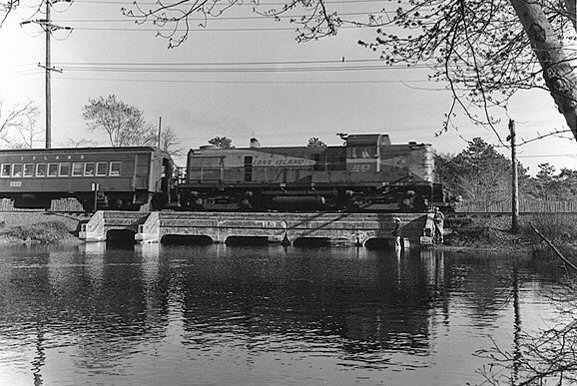
 RS3 #1554 Babylon-Patchogue Scoot crossing Nassau Ave, Islip 1969 passing the ex-Monzet's Hotel Archive: Dave Keller |
 Babylon-Patchogue westbound "Scoot" at PD Tower, Patchogue 4/06/1963 Photo: William Lichtenstern Archive: Dave Keller |
|
|
||
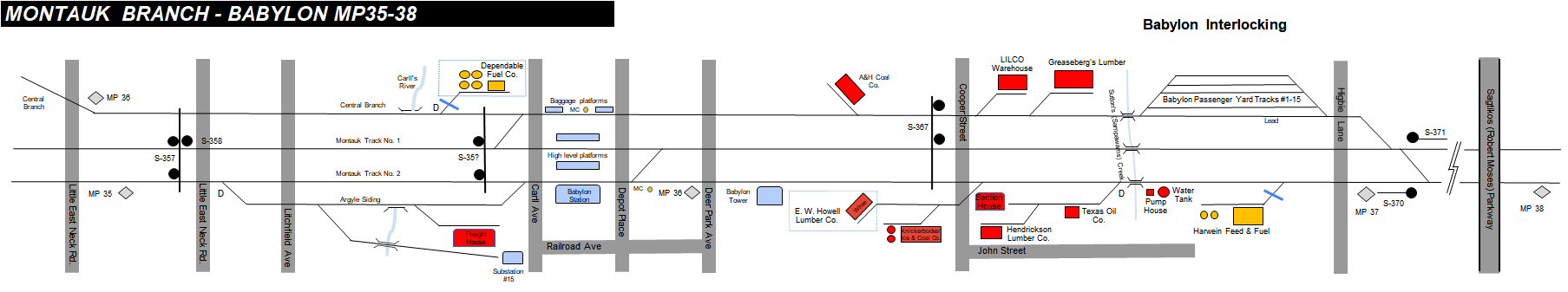
| Babylon to Patchogue Map - c.1960+ | ||
 |
The 1958 Robert Emery maps (Dave Keller
collection) were utilized in conjunction with the 1966 LIRR track maps
and other historical information to develop this series of pictorial diagrams to illustrate the early 1960's Babylon to Patchogue, Montauk Branch Individual maps: Research and drawings: Steven Lynch
|
|
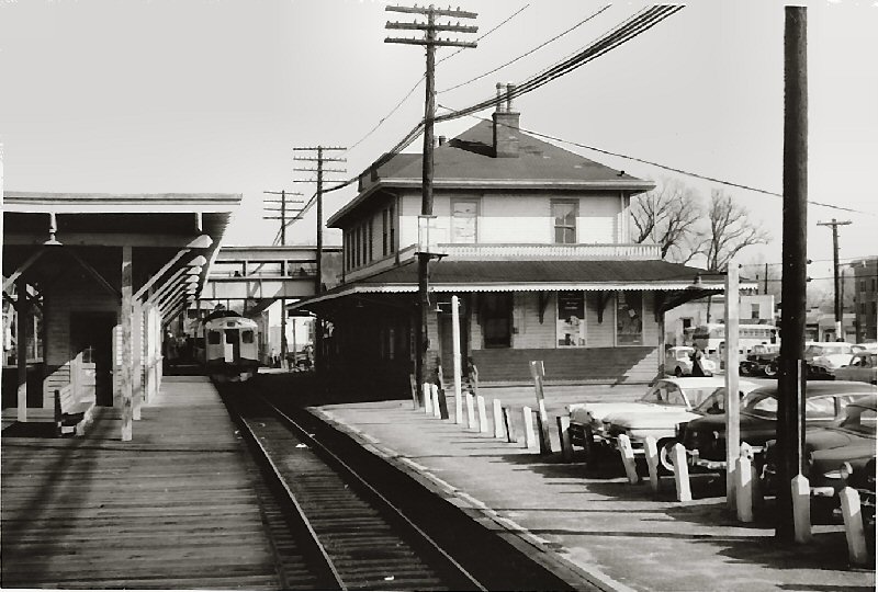
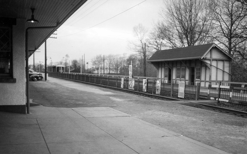
Babylon Station View E Photo/Archive: Jim Gillin |
 |
|
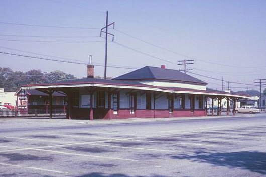
 Bay Shore Station - View W (Sturm-Fehn)
|
 |
|
 Islip Station view NE Archive: Art Huneke |
 |
|
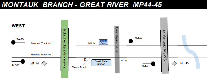
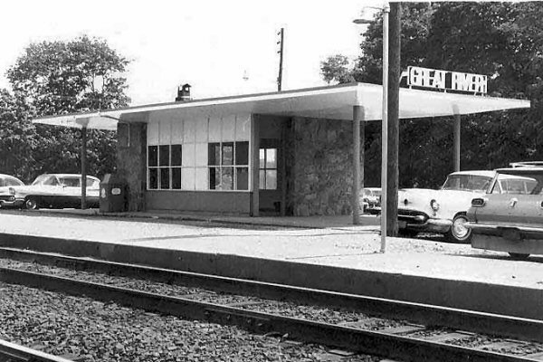 Great River Station - View SE Photo/Archive: Dave Keller |
 |
|
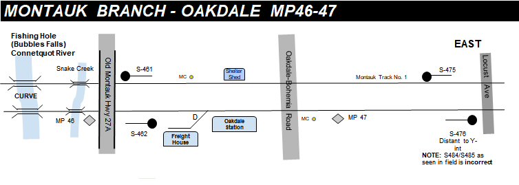
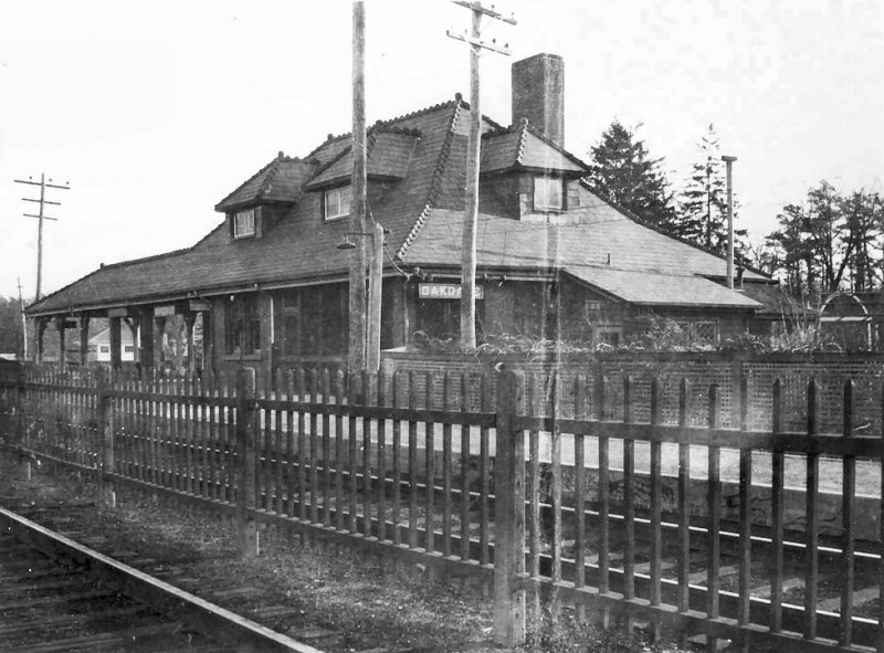 Oakdale Station - View E Archive: Dave Morrison |
 |
|
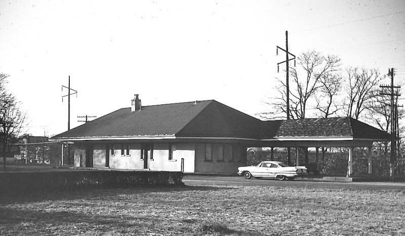
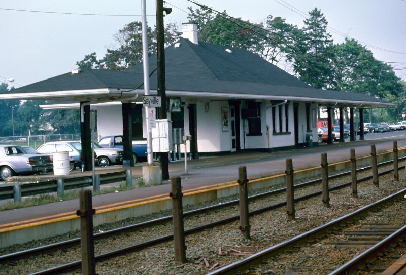 Sayville Station View SW Photo/Archive: Edward Hand
|
 |
|
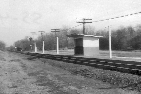
 Bayport Station - view NW Photo/Archive: Brad Phillips |
 |
|
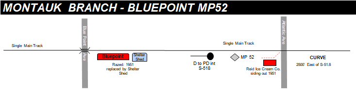
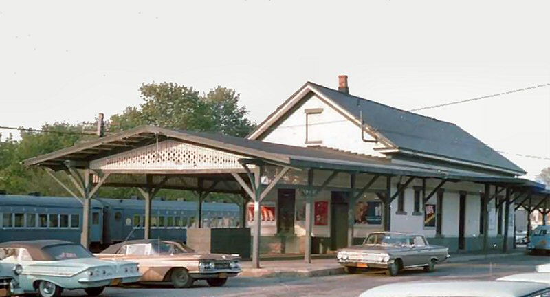
 Blue Point view E Photo/Archive: Brad Phillips |
 |
|
 Patchogue Station view NE Photo/Archive: John Jett
|
 |
|
|
|
||
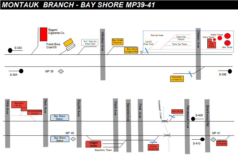
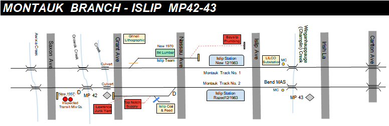
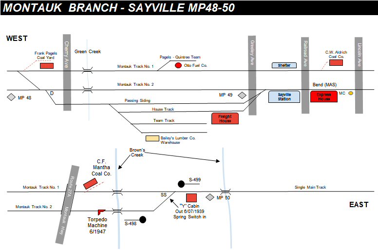
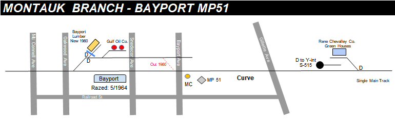
| Babylon to Patchogue Freight Sidings - LIRR 1966 | ||
 LIRR 1966 maps - Drawing: Steven Lynch |
||
|
|
||
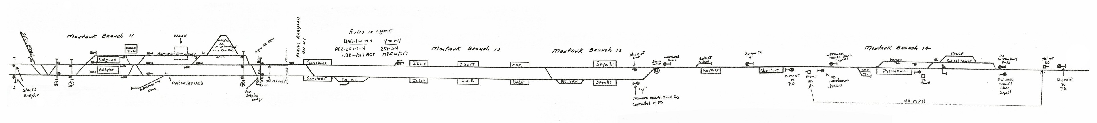
| Babylon to Patchogue Interlockings - 1978 & 1988 | ||
 LIRR 1978 maps - Drawing: R. M. Todaro-LIRR Conductor
|
||
|
|
||
| Babylon to Patchogue Signal Project | ||
|
Note that in the first two
cases, ABS signaling is used in the normal direction only, a term
which here means the system is only in place for trains travelling on
the right-hand side of the track. For trains travelling in the
"reverse" direction (in these cases, on the left-hand side of the
track), a different type of system is in use.
January 6, 2020 The LIRR Today |
||
|
|
||
| Babylon to Patchogue - Native American Named Locations | ||
 NY State DEC Watershed map 2016 Great South Bay West Creek Names |
Take a ride on the
Babylon-Patchogue Scoot and find out what Native American Names abound.
|
Parlor #2018 Close-up Logo Weekend Chief 5/26/1968 |
03/09/2026
 The
The